Herring Run
Baltimore, Maryland
Uploaded by Bivy Team
02 :14 hrs
5.7 mi
195 ft
III
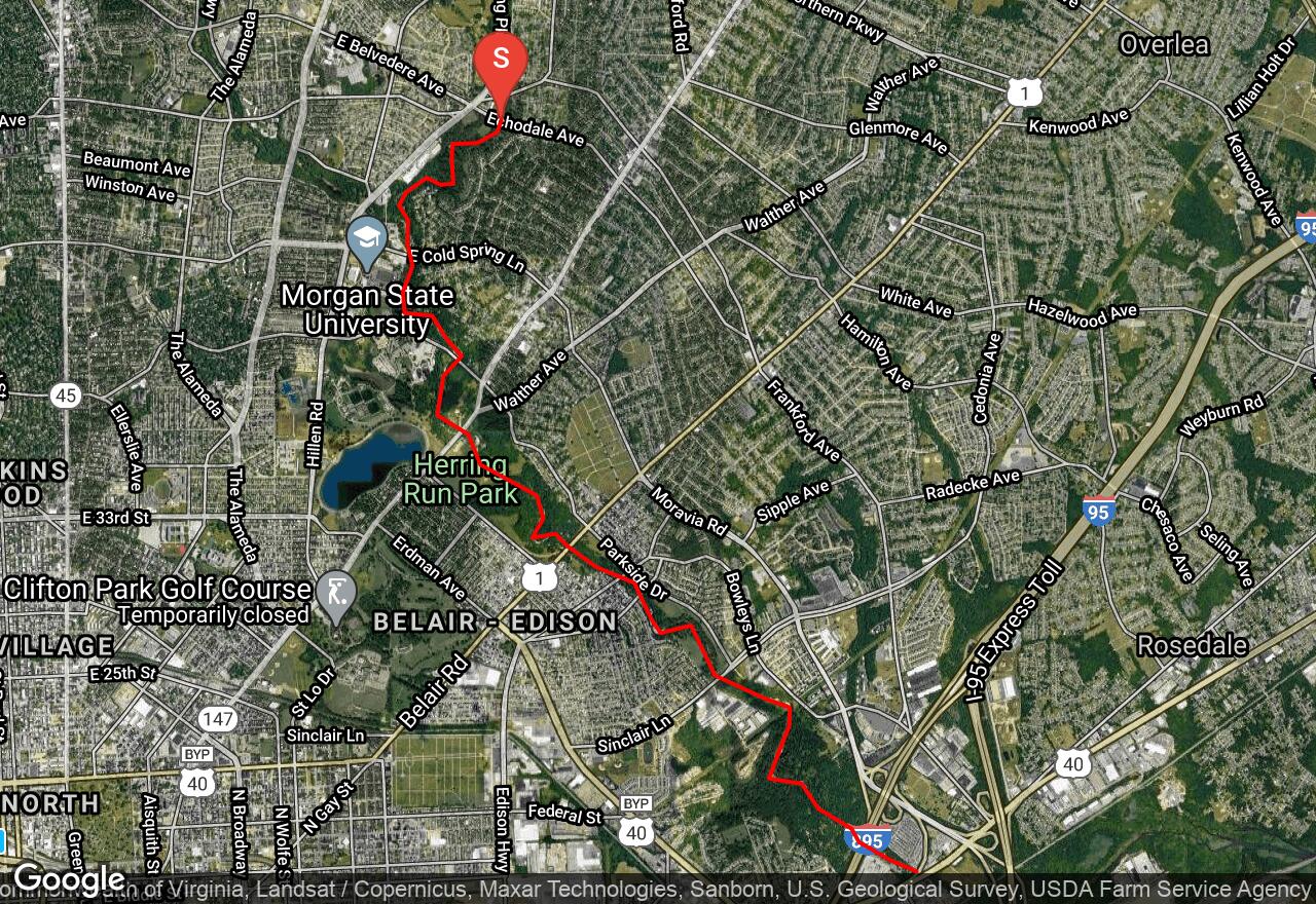
The put-in for this route is in an old residential neighborhood but the creek quickly disappears into a little, densely wooded ravine with steep walls and some attractive rock formations. The scenery changes from this, to city parkland where there is a surprising opportunity for birders. Other than the scenery, the other attraction of Herring Run is its whitewater. It ascends a steep fall line between Echodale Avenue and Route 147, providing a plethora of rock gardens, cobbles, and ledges with little slack water in between. There is a long series of gabion dams with drops of up to three feet. All of these are runnable to the experienced paddler. Other than this, the last half of the run offers mostly gravel-formed rapids and riffles.
2 photos
[{"url":"https://images.bivy.com/lgMap/4618450945179648.jpg"},{"url":"https://images.bivy.com/lgTrailMap/4618450945179648.jpg"}]
Herring Run | Baltimore, Maryland
The put-in for this route is in an old residential neighborhood but the creek quickly disappears into a little, densely wooded ravine with steep walls and some attractive rock formations. The scenery changes from this, to city parkland where there is a surprising opportunity for birders. Other than the scenery, the other attraction of Herring Run is its whitewater. It ascends a steep fall line between Echodale Avenue and Route 147, providing a plethora of rock gardens, cobbles, and ledges with little slack water in between. There is a long series of gabion dams with drops of up to three feet. All of these are runnable to the experienced paddler. Other than this, the last half of the run offers mostly gravel-formed rapids and riffles.