![]()
Potomac River: Great Falls to Washington, D.C.
Travilah, Maryland
Uploaded by Bivy Team
04 :57 hrs
12 mi
165 ft
IV
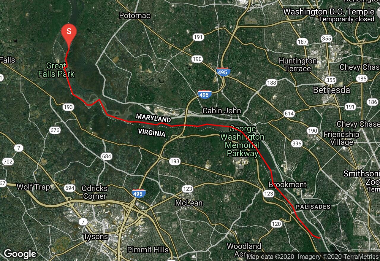
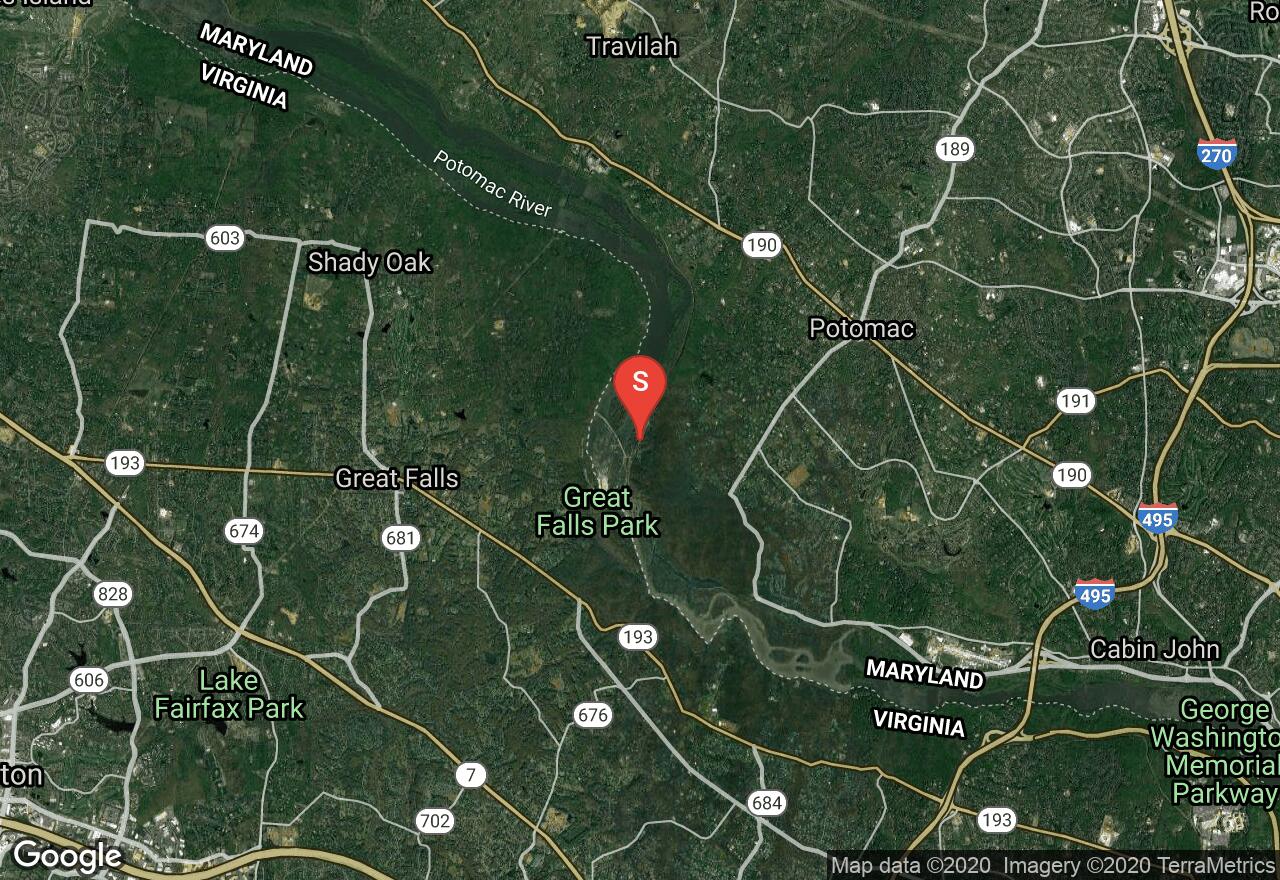
The Potomac is the longest and most diverse river system in Maryland, reaching from the cold, high plateau of the Alleghenys to the broad waters of the Chesapeake Bay and tidewater. This section is the Potomac’s finest. It has the best whitewater and the most dramatic scenery. You will begin below Great Falls and run through Wet Bottom Chute and Mather Gorge, then find a mellow stretch to enjoy the views of 80-foot jagged cliffs. Next you will reach Difficult Run, a rocky, plunging course after which the Potomac gradually calms down to a large, lazy river. Islands begin to split the river and more rapids appear over Yellow Falls, a three-foot double ledge, then a long rock garden brings you to Stubblefield Falls, a short easy, bouncy rapid, and from here on to Brookmont is mostly smooth water gliding through rock gardens and dozens of small islands. At Brookmont, take caution running over Brookmont Dam, then expect more turbulent water and a rocky plunge to tidewater. Approaching the Chain Bridge, Little Falls appears and is very steep and split by jagged, rocky islands. Take out at Fletchers Cove.
2 photos
[{"url":"https://images.bivy.com/lgMap/5865905942691840.jpg"},{"url":"https://images.bivy.com/lgTrailMap/5865905942691840.jpg"}]
Potomac River: Great Falls to Washington, D.C. | Travilah, Maryland
The Potomac is the longest and most diverse river system in Maryland, reaching from the cold, high plateau of the Alleghenys to the broad waters of the Chesapeake Bay and tidewater. This section is the Potomac’s finest. It has the best whitewater and the most dramatic scenery. You will begin below Great Falls and run through Wet Bottom Chute and Mather Gorge, then find a mellow stretch to enjoy the views of 80-foot jagged cliffs. Next you will reach Difficult Run, a rocky, plunging course after which the Potomac gradually calms down to a large, lazy river. Islands begin to split the river and more rapids appear over Yellow Falls, a three-foot double ledge, then a long rock garden brings you to Stubblefield Falls, a short easy, bouncy rapid, and from here on to Brookmont is mostly smooth water gliding through rock gardens and dozens of small islands. At Brookmont, take caution running over Brookmont Dam, then expect more turbulent water and a rocky plunge to tidewater. Approaching the Chain Bridge, Little Falls appears and is very steep and split by jagged, rocky islands. Take out at Fletchers Cove.