![]()
Rock Creek
Rockville, Maryland
Uploaded by Bivy Team
09 :17 hrs
22.4 mi
261 ft
III
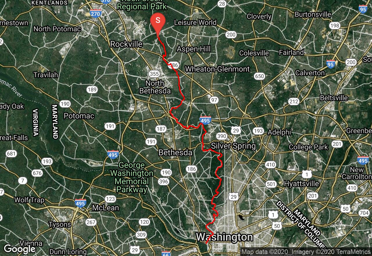
Rock Creek slices down the middle of Montgomery County and Washington, D.C. to join the Potomac at Georgetown. Most of the Montgomery County portion is fast, flat water with some easy gravel bar riffles. There are many fallen trees, logjams, and snags but are easy to navigate around. A short thrill is awarded as you are flushed through a box culvert under the railroad tracks in total darkness. The scenery is mostly woods or open park land with only some highway noise. During summer the thick foliage helps to screen off the outside world. As you enter D.C., a lovely, shallow gorge emerges that extends to the Potomac. Military Road is where the river becomes turbulent and the rapids start. The river speeds up considerably and boulders fill the bed. The gradient eases off after about two miles and returns again to flat water. Pierce Mill Dam, about two miles below Military Road, require a portage carried on the right. This route is runnable within a day of hard rain but ideal water levels last for only a few hours after the rain stops. There are city parks that run almost the whole length of this course if you wish to choose alternative put-ins or take-outs.
2 photos
[{"url":"https://images.bivy.com/lgMap/5909200286777344.jpg"},{"url":"https://images.bivy.com/lgTrailMap/5909200286777344.jpg"}]
Rock Creek | Rockville, Maryland
Rock Creek slices down the middle of Montgomery County and Washington, D.C. to join the Potomac at Georgetown. Most of the Montgomery County portion is fast, flat water with some easy gravel bar riffles. There are many fallen trees, logjams, and snags but are easy to navigate around. A short thrill is awarded as you are flushed through a box culvert under the railroad tracks in total darkness. The scenery is mostly woods or open park land with only some highway noise. During summer the thick foliage helps to screen off the outside world. As you enter D.C., a lovely, shallow gorge emerges that extends to the Potomac. Military Road is where the river becomes turbulent and the rapids start. The river speeds up considerably and boulders fill the bed. The gradient eases off after about two miles and returns again to flat water. Pierce Mill Dam, about two miles below Military Road, require a portage carried on the right. This route is runnable within a day of hard rain but ideal water levels last for only a few hours after the rain stops. There are city parks that run almost the whole length of this course if you wish to choose alternative put-ins or take-outs.