Elliott's Knob and Falls Hollow
Augusta County, Virginia
Uploaded by Bivy Team
03 :56 hrs
8.3 mi
2400 ft
Expert
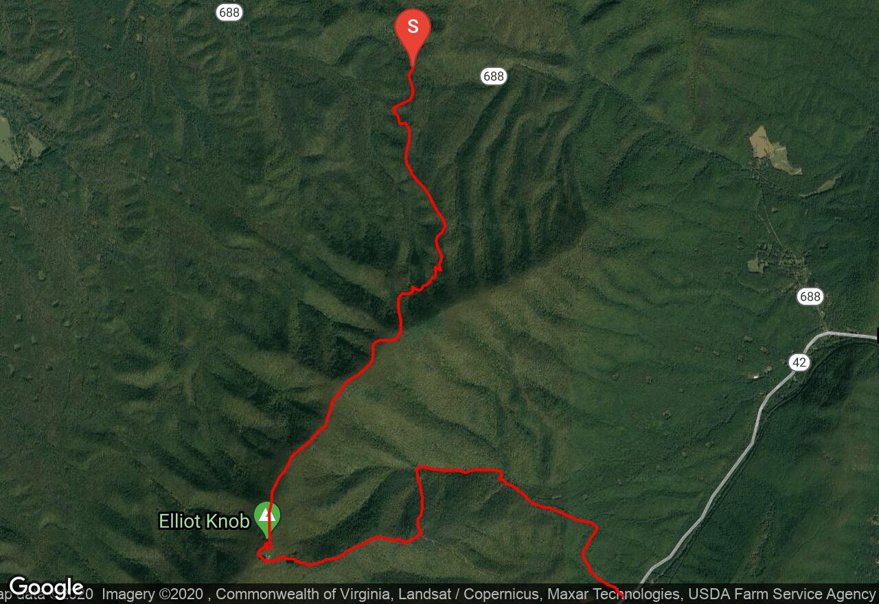
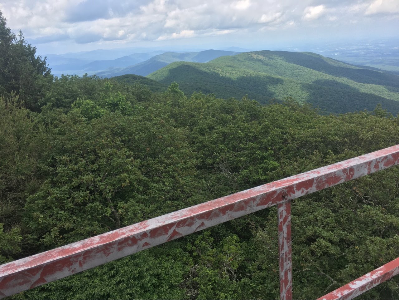
Beginning from VA 688, this route to the summit of Elliott’s Knob follows the North Mountain Trail along the ridges and valleys of the George Washington National Forest. Climb and descend through forests of birch, and even take a brief spur trail to Buffalo Springs along the way. The almost constant ascent will be worthwhile for the views from Elliott’s Knob, the highest point in Augusta County, which allows uninterrupted views of the surrounding Allegheny Mountains. Then the path descends along the paved road until a tiny blazed trail marker shows the way to the Falls Hollow Trail. Veering left off the road, and descending past several waterfalls, the path then becomes an old dirt road as it leads towards the second parking area.
5 photos
[{"url":"https://images.bivy.com/fullsize/Elliotts-Knob-and-Falls-Hollow-6462288656596992.jpg","author":"phudec31aolcom","date":"3 years and 9 months ago"},{"url":"https://images.bivy.com/fullsize/Elliotts-Knob-and-Falls-Hollow-5257036276170752.jpg","author":"phudec31aolcom","date":"3 years and 9 months ago"},{"url":"https://images.bivy.com/fullsize/Elliotts-Knob-and-Falls-Hollow-6442480239116288.jpg","author":"phudec31aolcom","date":"5 years and 9 months ago"},{"url":"https://images.bivy.com/lgMap/5757285548687360.jpg"},{"url":"https://images.bivy.com/lgTrailMap/5757285548687360.jpg"}]
Elliott's Knob and Falls Hollow | Augusta County, Virginia
Beginning from VA 688, this route to the summit of Elliott’s Knob follows the North Mountain Trail along the ridges and valleys of the George Washington National Forest. Climb and descend through forests of birch, and even take a brief spur trail to Buffalo Springs along the way. The almost constant ascent will be worthwhile for the views from Elliott’s Knob, the highest point in Augusta County, which allows uninterrupted views of the surrounding Allegheny Mountains. Then the path descends along the paved road until a tiny blazed trail marker shows the way to the Falls Hollow Trail. Veering left off the road, and descending past several waterfalls, the path then becomes an old dirt road as it leads towards the second parking area.