![]()
Mt Adams: North Ridge Route
Yakima County, Washington
Uploaded by Bivy Team
25 :06 hrs
10.5 mi
7774 ft
II
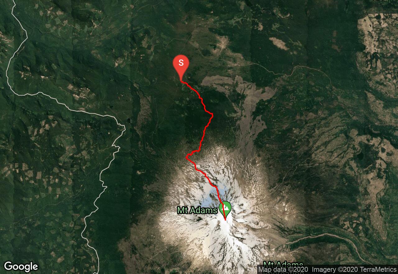
The North Ridge Route is the most popular way to ascend Adams after the South Spur. Like the South Spur, this route avoids glacier travel until the relatively level summit icefield is reached. The ascent is largely non-technical and mostly over broken (and loose) volcanic rock with a maximum slope of about 40 degrees. The route follows the Killen Creek Trail approach to the mountaineering camping area (please camp on scree or snow if possible) then swings southeast past a small glacial lake and up an obvious ridge. The north ridge is gained at about 8800 feet. Simply follow the ridge up, crossing to either side where necessary. In general, the east face is more hazardous than the west. In the late season, crampons might be necessary for the final slog across the icefield. Rock fall is also a hazard in the late season. This route is often used for the descent for parties ascending the Adams Glacier. II Class 3.
2 photos
[{"url":"https://images.bivy.com/lgMap/483011.jpg"},{"url":"https://images.bivy.com/lgTrailMap/483011.jpg"}]
Mt Adams: North Ridge Route | Yakima County, Washington
The North Ridge Route is the most popular way to ascend Adams after the South Spur. Like the South Spur, this route avoids glacier travel until the relatively level summit icefield is reached. The ascent is largely non-technical and mostly over broken (and loose) volcanic rock with a maximum slope of about 40 degrees. The route follows the Killen Creek Trail approach to the mountaineering camping area (please camp on scree or snow if possible) then swings southeast past a small glacial lake and up an obvious ridge. The north ridge is gained at about 8800 feet. Simply follow the ridge up, crossing to either side where necessary. In general, the east face is more hazardous than the west. In the late season, crampons might be necessary for the final slog across the icefield. Rock fall is also a hazard in the late season. This route is often used for the descent for parties ascending the Adams Glacier. II Class 3.