![]()
Mt Index: Southeast Route
Snohomish County, Washington
Uploaded by Bivy Team
13 :44 hrs
5.7 mi
5373 ft
I
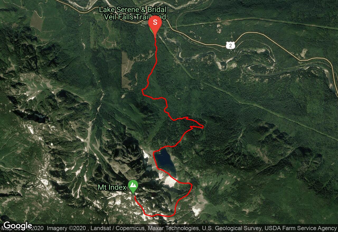
The southeast route up Mt Index makes use of a forested ridge before traversing to a steep gully on the east face of a ridge leading south from the summit. Follow the trail to Lake Serene and swing around its west edge (traversing snow before July) and ascend to a pass southeast of the lake. Ascend the steep ridge through thick forest and traverse left when the forest thins. The route follows a gully all the way to the summit plateau. In the early season or during winter, it may present little more than a long ramp of steep snow, but later in the summer there is a moat and a waterfall at the crux pitch that begins near 5,000 feet. There are several possible ways to ascend, but the easiest is probably to the left near the waterfall. Water ice forms here in cold weather. There are 2-3 pitches of low Class 5 climbing until you top out on the south ridge. On the easy walk to the summit, watch out for cornices. I low 5
2 photos
[{"url":"https://images.bivy.com/lgMap/479040.jpg"},{"url":"https://images.bivy.com/lgTrailMap/479040.jpg"}]
Mt Index: Southeast Route | Snohomish County, Washington
The southeast route up Mt Index makes use of a forested ridge before traversing to a steep gully on the east face of a ridge leading south from the summit. Follow the trail to Lake Serene and swing around its west edge (traversing snow before July) and ascend to a pass southeast of the lake. Ascend the steep ridge through thick forest and traverse left when the forest thins. The route follows a gully all the way to the summit plateau. In the early season or during winter, it may present little more than a long ramp of steep snow, but later in the summer there is a moat and a waterfall at the crux pitch that begins near 5,000 feet. There are several possible ways to ascend, but the easiest is probably to the left near the waterfall. Water ice forms here in cold weather. There are 2-3 pitches of low Class 5 climbing until you top out on the south ridge. On the easy walk to the summit, watch out for cornices. I low 5