Best Climbing in Alaska
Trying to find the best climbing in Alaska? Bivy has great hiking, biking, paddling, climbing, skiing, riding and more, with hand-curated trail maps, as well as detailed driving directions.
Alaska, Valdez
02 :54 hrs
4.4 mi
891.113 ft
S3+
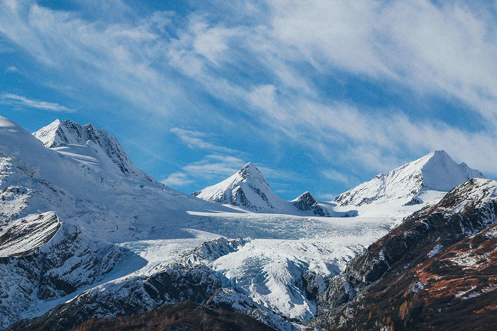
The ascent up Loveland begins from mile marker 27 on Richardson Highway above Thompson Pass. Move up the hill favoring easy ground and cross the pipeline enroute to the base of the ridgeline. From the base of the ridgeline, choose to ascend via the ridgeline, or traverse into the lower basin via “Subway” and then ascend the main drainage system (this is the better option if winds are high on the ridge). Choose either option and move up onto the glacier and navigate across along the left-side where there are no crevasses. Finish to the summit by skiing past two smaller summits to gain the main summit ridge. From the summit, choose from one of the chutes to descend off before following your ascent route across the glacier. Next descend down the drainage and traverse up high at the base of the glacier to meet up with you ascent tracks back to your vehicle. Loveland Basin offers a classic ascent, great views from atop the summit, steep chutes up top and a great natural terrain park mid-mountain. Beginner and intermediate skiers should not travel onto the glacier unless accompanied by advanced skiers with adequate local knowledge of the area
Alaska, Valdez
06 :11 hrs
3.9 mi
1274.949 ft
S3+
Although a strenuous and demanding route, Matthu Pichu offers some of the best and most consistent steep angles in Alaska. Park at the rifle range at the end of Glacier Campground Road and begin your ascent by making your way over to Valdez Glacier Stream via one of the many traveled routes. Use caution when crossing the stream. Freez/thaw cycles can cause various hazards when crossing. After making it across the stream, continue on towards Slater Creek through some, often times, thick brush. Instead of entering the canyon, ascend and traverse up the right side making your way to the upper basin area. From here continue the long journey up the steeps to the high mark of around 4800’. Enjoy great views of Port Valdez, The Valdez Narrows, and of course Matthu Pichu peak on your left before descending down you ascent route.

Alaska, Valdez
03 :14 hrs
4.6 mi
1087.0079 ft
S4
As one of the premiere ski mountaineering routes in the Valdez area, Sapphire Peak offers all the elements of steep rock, ice and snow resulting in some technical ski terrain that expert level skiers are sure to enjoy. The ascent begins from mile marker 27 on Richardson Highway above Thompson Pass. Move up the hill favoring easy ground and cross the pipeline enroute to the base of Loveland Basin ridgeline. From the base of the ridgeline, ski “Subway” to the base of the 27-Mile Glacier. Move up and to the right of the glacier as high as you can before moving onto the glacier and traversing the main icefall. From here you will need to remove the skis and hike the rest of glacier drainage to the basin. After reaching the basin ski across the glacier over towards Sapphire Peak. Ascend up to the col low located on the south ridge and remove your skis to finish to the summit. Bring crampons and an an ice axe as the ridge may require the use of these to reach the summit. Descending off the summit ridge is steep and best to favor your skin track down through to your boot tracks through the icefall. Do not stray from your ascent tracks through the icefall, as this can prove to be a costly mistake. It is wise to bring crampons, an ice axe and crevasse rescue gear.
Alaska, Valdez
03 :01 hrs
4.2 mi
1049.4177 ft
S4
As one of the premiere ski mountaineering routes in the Valdez area, Tones Temple offers all the elements of steep rock, ice and snow resulting in some technical ski terrain that expert level skiers are sure to enjoy. The ascent begins from mile marker 27 on Richardson Highway above Thompson Pass. Move up the hill favoring easy ground and cross the pipeline enroute to the base of Loveland Basin ridgeline. From the base of the ridgeline, ski “Subway” to the base of the 27-Mile Glacier. Move up and to the right of the glacier as high as you can before moving onto the glacier and traversing the main icefall. From here you will need to remove the skis and hike the rest of glacier drainage to the basin. Once in the basin, ski left towards Tones Temple Peak and locate the best spot to gain the ridge leading to the summit. Bring crampons and an an ice axe as the ridge may require the use of these to reach the summit. Once at the peak of Rones Temple choose from several descent options off of the steep summit ridge. Follow your ascent line through the icefall and back down to your vehicle. It is wise to bring crampons, an ice axe and crevasse rescue gear. S4 II
Alaska, Anchorage
01 :22 hrs
2.2 mi
370.4422 ft
S3-
Mellow backcountry ski on a nice face. Quick and fairy safe approach. Go as high as conditions allow you. Wind rips through the area so watch for wind deposits creating bad avy conditions.
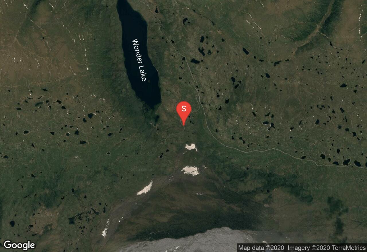
Alaska, Denali County
44 :35 hrs
23.3 mi
2942.9583 ft
IV
Mount Brooks is a prominent peak at the confluence of Muldrow, Traleika and Brooks Glacier. It is known for its beauty and offers remote and true Alaskan expedition crossing over rivers, tundra, glaciers while reaching a stunning summit. Plan on about 10 days for the expedition. Beginning from Wonder Lake plan on 3-6 days to reach Oastler Pass. The climb can be done in one day from Oastler Pass (5,540ft.), but is more enjoyable by breaking it up. Here are some optional places to camp. Shoulder Camp (7,520ft)- offers good camping options. Upper Ridge (9,400 to 11,000ft)-Exposed to weather but good camping along the ridge. Bring standard glacier travel gear and descend your ascent line.
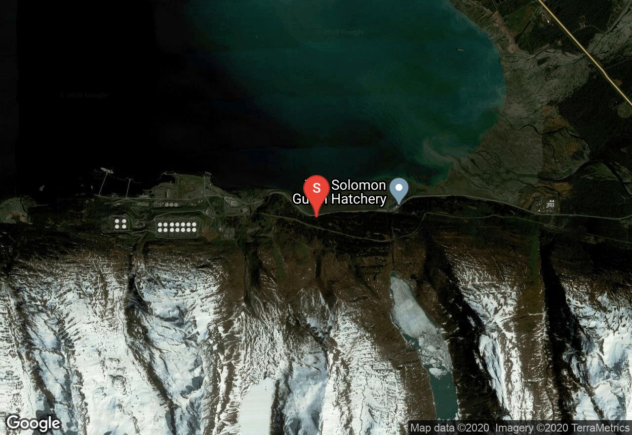
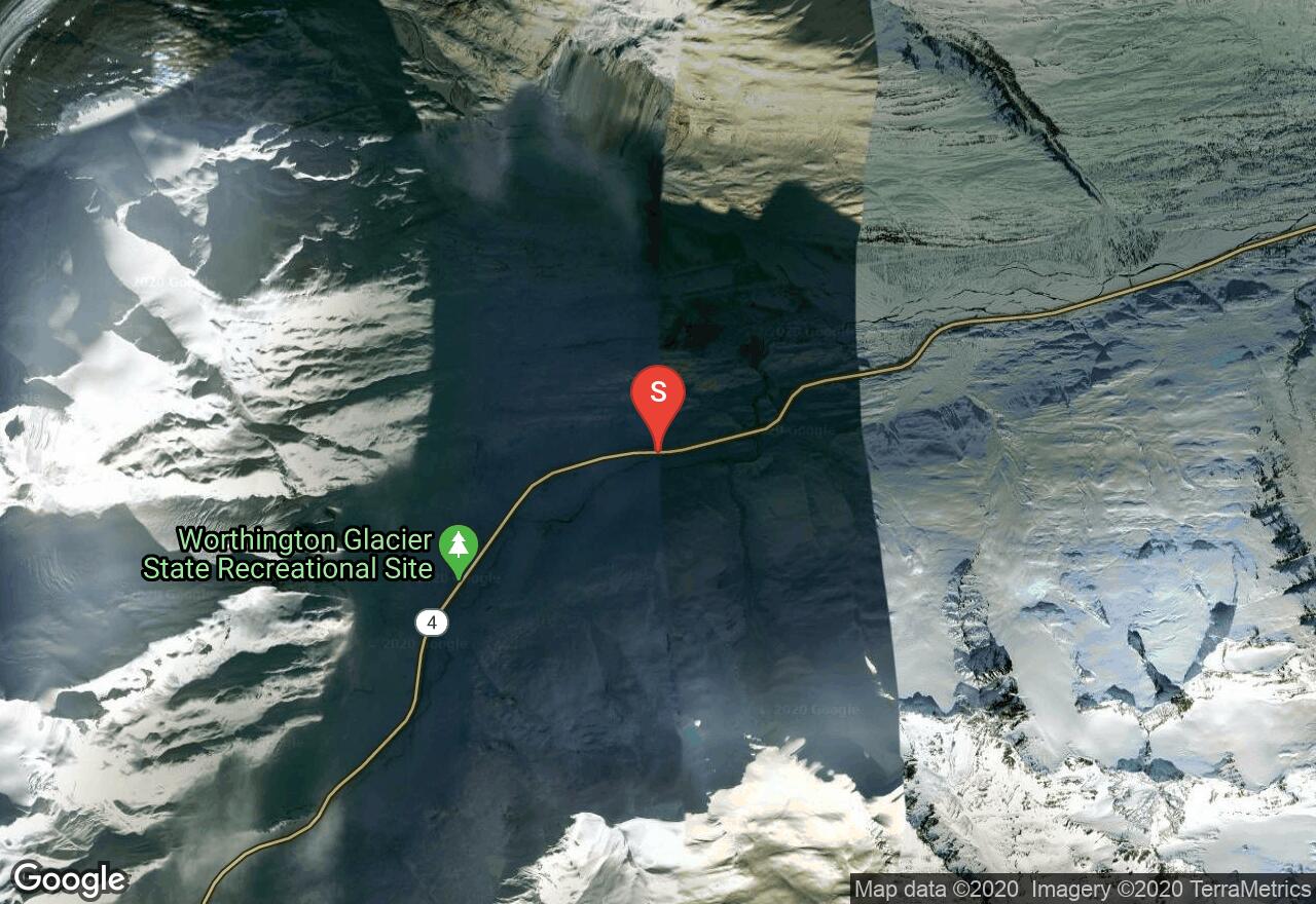
Alaska, Valdez
02 :15 hrs
3.5 mi
729.34454 ft
S4-
Located within the Valdez Arena near the Valdez oil terminal, this north facing route offers some of the best “ski to sea” terrain in the world as you descend down to Port Valdez. Park at Solomon Lake trailhead and and begin up the snowcat trail through the trees. Head west along the pipeline for a short distance before heading south into a clearing beneath Benzene Alley. Ascend up to the first bench through a forested slope and gain the windlip which is usually around 2500’ on “Matts Slope”. Follow the windlip to it’s end which will bring you just below Benzene Peak. Descend to the valley below via the slope adjacent to you ascent route. If desired, the hills above Salomon Lake can be accessed from part of this approach as well. Continue beyond Matts Slope and make your way to a nice series of hill situated above the lake. This offers a great beginners experience with amazing views.
Alaska, Denali County
03 :08 hrs
1 mi
482.3109 ft
VI
Mount Barrill is considerably smaller than its towering neighbors, but has superb rock quality and is sought after by hard-core rock climbers. Beginning from the Ruth Gorge Airstrip, the approach is about 30 minutes. The Cobra Pillar offers a direct line up the central pillar of the East Face making a perfect alpine route. Most parties do the climb in two days if the weather cooperates. It is not necessary to carry bivy gear while climbing. You will be able to climb throughout the night and sleep or rest during the day. But go prepared with proper clothing and equipment to sit out major storms. There is a route bivy at the top of pitch 6 and on top of pitch 13. The route begins with a contrived hand crack on the right side of the pillars base and traverses left to the main dihedral. Be aware the upper pitches are prone to rock or snow fall. Bring 2 sets of cams to 3” and 1 or 2-4” pieces, 1 set of stoppers, 2 bat hooks, ascenders, 1 200ft. rope, one short ice-hammer per person.
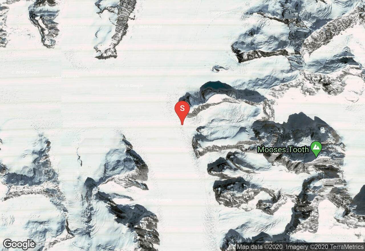
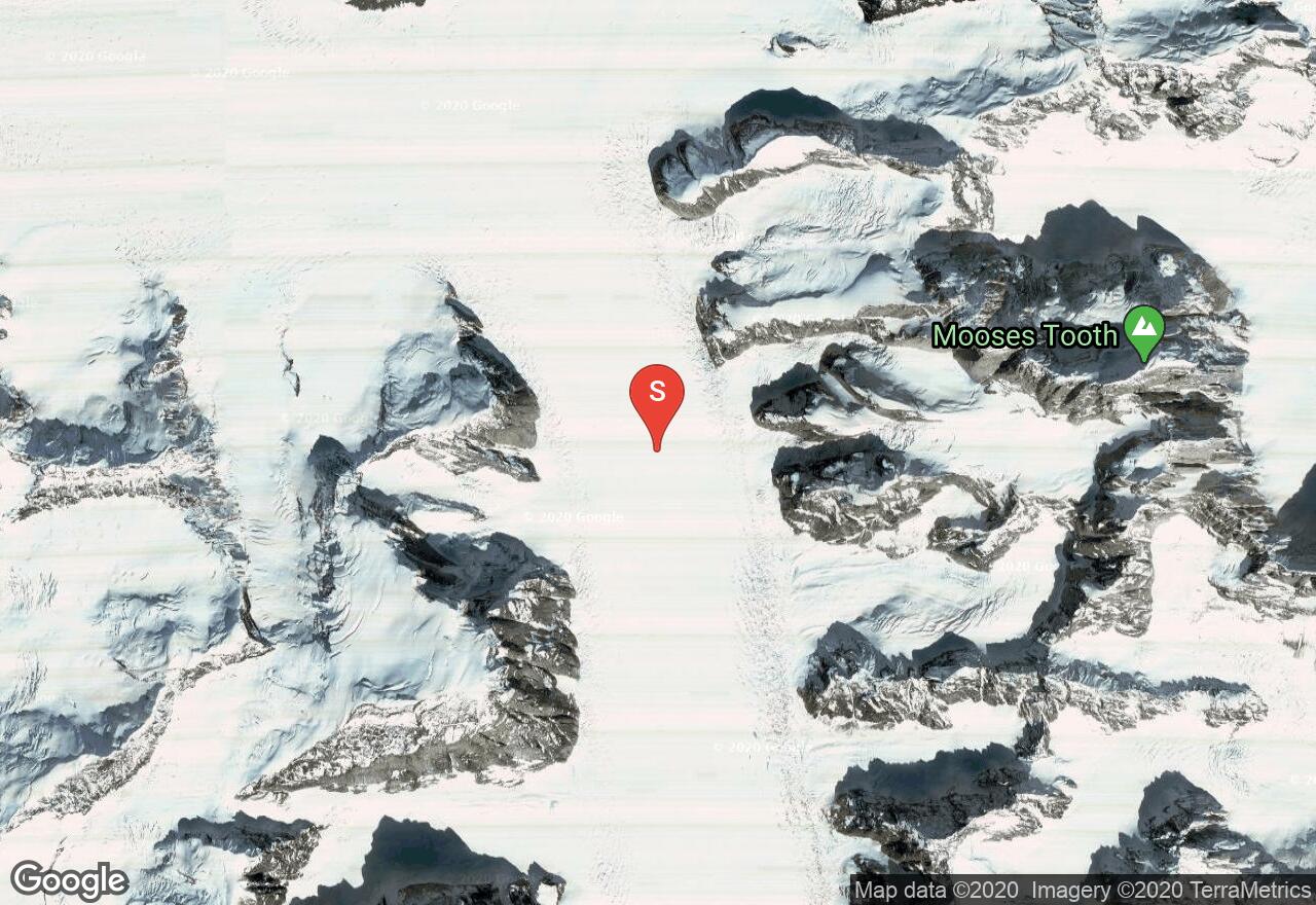
Alaska, Denali County
13 :15 hrs
2.8 mi
1560.5946 ft
V
Rising abruptly in the Alaksan Range, Mooses Tooth is a rugged granite monolith that offers unforgettable views. The West Ridge Route climbs the long and sharp spine of the Mooses Tooth. It involves a difficult and dangerous ridge travers, with steep ice climbing, and dangerous cornices. Most groups that climb the West Ridge Route only reach the lower West Summit. Continuing to the Main (east) Summit becomes complex and extremely dangerous. The climb to the West Summit can be done in one long day from Ruth Glacier, but is more enjoyable with a high camp on Moose’s Back (7,000 to 8,000 feet). To descend from the West Summit rappel and trace your steps along the ridge back to Ruth Glacier. Bring 2 or 3 small cams, 6 to 8 stoppers, 3 or 4 pitons, 6 ice screws and 2 pickets. Take 2 200-ft. ropes and 2 ice tools per person.
Alaska, Valdez-Cordova County
03 :20 hrs
2.5 mi
951.7611 ft
S3-
Begin your ascent from a pullout on the side of Richardson Highway near mile marker 30 above Thompson Pass. Move across Ptarmigan Creek (crossing the creek can be challenging during early and late season) and head south under the treeline towards Happy Valley. Once making it into the valley, make your ascent along the east side up to 5200’ where the ridge will begin to crest and you will begin to see Python Peak to the east. Beginners should start their descent from here unless accompanied by an advanced skier to assist in navigating the glacier. Advanced skiers often choose to ascend onto and above the glacier before making their descent from various starting points.
See more adventures..
Explore complete list
Explore nearby adventures

