Best Cross Country Skiing in California
Trying to find the best cross country skiing in California? Bivy has great hiking, biking, paddling, climbing, skiing, riding and more, with hand-curated trail maps, as well as detailed driving directions.
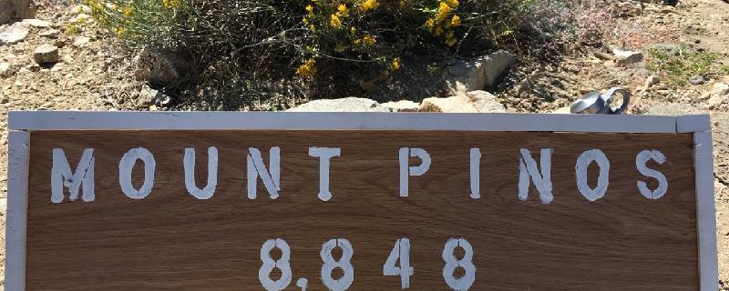
California, Kern County
02 :38 hrs
1.8 mi
141.70532 ft
Moderate
Mount Pinos Trail climbs in and out of white firs and Jefrey Pines and through a meadow before reaching Mount Pinos. The Mount Pinos Nordic Ski Building is located at the trailhead in the parking lot.
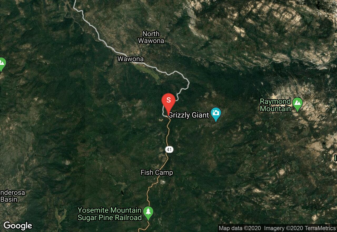
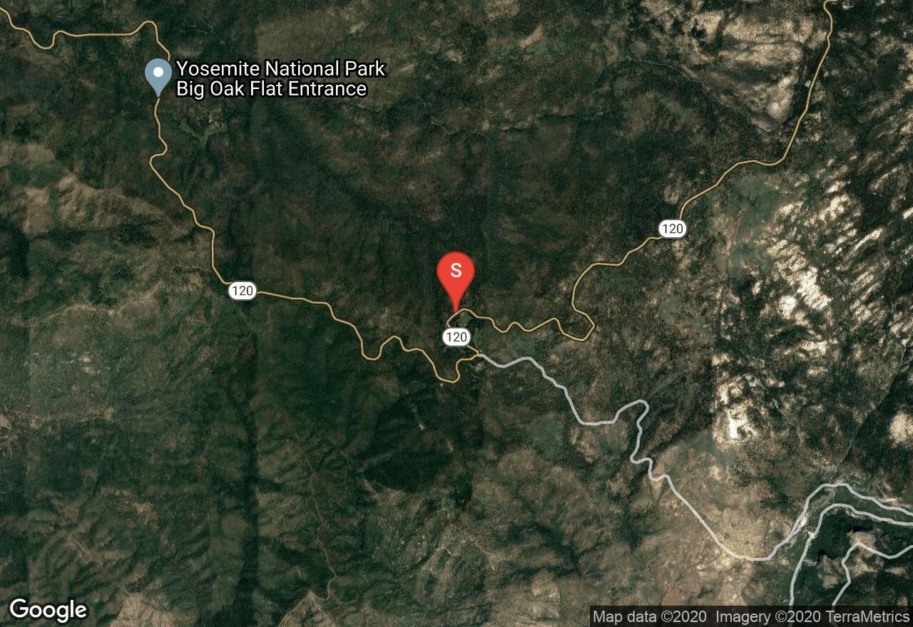
California, Mariposa County
06 :03 hrs
10.6 mi
441.89294 ft
Expert
In winter the Mariposa Grove Road is not plowed and instead its open for skiers and snowshoers to explore the snow covered gigantic sequoias. Mariposa Grove is one of 75 groves that is home to some of the largest living organisms. The road meanders through the forest and makes a lollipop loop past some of the more famous trees of the grove, such as, the Fallen Monarch and the California Tunnel Tree. Check with Yosemite National Park for information on road closures and more specific dates on when this trail is open for winter activities. Restrooms are available at the fee station just before the parking lot for the trailhead.
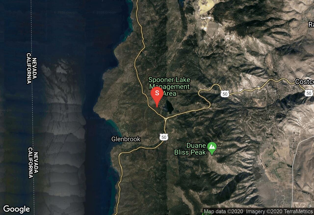
Nevada, Douglas County
00 :56 hrs
1.9 mi
28.992188 ft
Easy
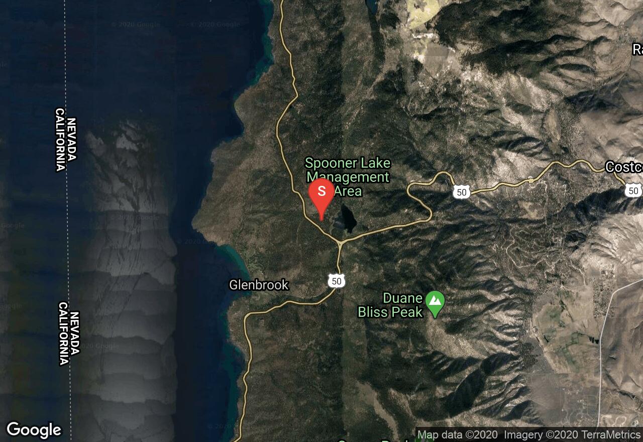
One of the few great places for cross country skiing on the Nevada side of Lake Tahoe, the Spooner Lake area offers a few great looping trails for Nordic Skiers. This loop is a beginner level loop that offers everything that the more advanced courses offer except the difficulty.
Nevada, Carson City
02 :40 hrs
4.2 mi
194.19727 ft
Hard
One of the few great places for cross country skiing on the Nevada side of Lake Tahoe, the Spooner Lake area offers a few great looping trails for skiers. This loop is an intermediate level loop that offers great views, great snow, and a great Nordic workout.
California, Placer County
06 :53 hrs
5.3 mi
328.73315 ft
Moderate
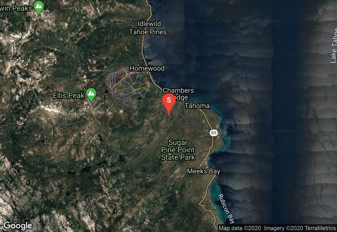
The trail to Richardson Lake and Ludlow Hut begins by following McKinney Creek Trail as it meanders on dirt roads alongside the creek and through forests of Desolation Wilderness. The trail winds past McKinney, Lilly, and Miller lakes before reaching Richardson Lake and Ludlow Hut. You can either park behind the snow stakes at the trailhead parking area or park at Sugar Point State Park which will add some mileage. It's recommended to do this as an overnight multi-day trip and stay at the hut; contact the Sierra Club to make reservations.
California, Big Bear Lake
02 :33 hrs
2.1 mi
42.885986 ft
Moderate
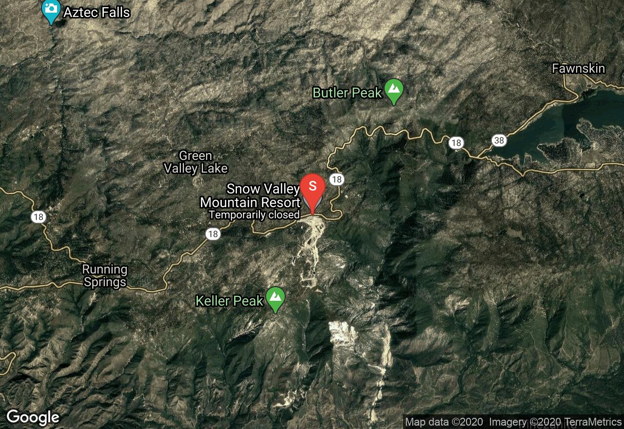
Located in the Rim Nordic Ski Area within the San Bernardino Mountains, Lower Country Road is a groomed cross-country trail for intermediates that gently winds through a thin forest of pines. If you need to rent gear, the park has a rental shop on site. This area is also good terrain for mountain biking and hosts a number of races every year. Call ahead to find out snow conditions.
California, Sierra County
03 :02 hrs
6.5 mi
71.996704 ft
Moderate
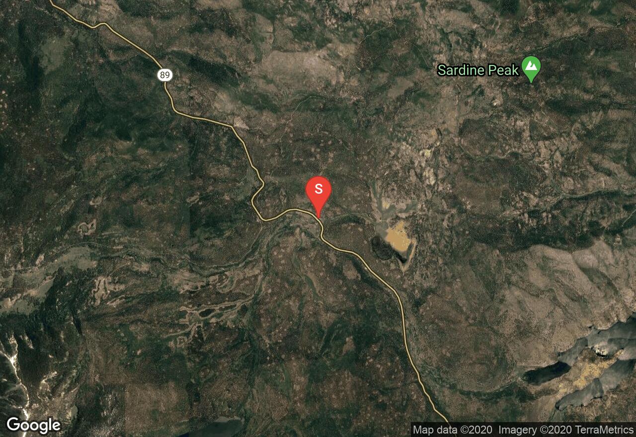
Wheeler Loop Trail Loops through forests, open meadows, and marshes as it follows alongside a creek which drains in the Little Truckee River. It follows dirt roads and Henness Pass Road.
California, Mariposa County
03 :08 hrs
5.3 mi
260.30823 ft
Expert
Gin Flats Loop briefly follows the unplowed Tioga Road that is closed in winters as it skirts the edge of a meadow before reaching a narrow trail. The first half of the loop follows a trail as it climbs through the forest and intersects Tioga Road. The other half of the loop follows Tioga Road back to the trailhead. There are fewer trees along this section and better views. It is much easier to do this trail clockwise than counter-clockwise due to the difference in slope grade. Check with Yosemite National Park for up to date road closures and more specific dates for when this trail is open.
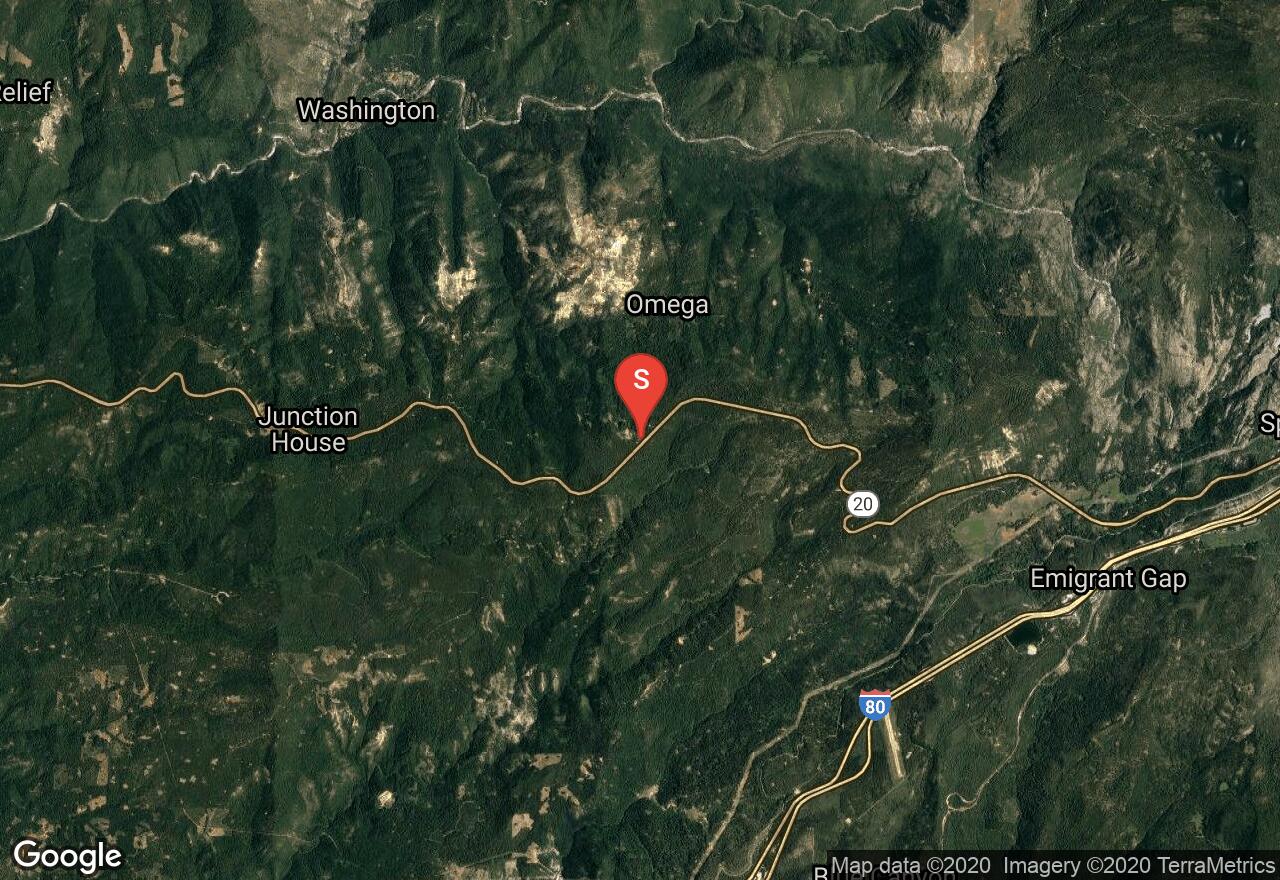
California, Nevada County
04 :44 hrs
9.4 mi
211.03613 ft
Moderate
Conveniently starting from the Alpha Omega Rest Stop off of highway 20, Steephollow Loop winds through a thick forest as it follows interconnected logging roads. Along the ridge, you'll find views of Lake Spaulding and Grouse Ridge towering above the lake. The area has 300 acres of skiable terrain.
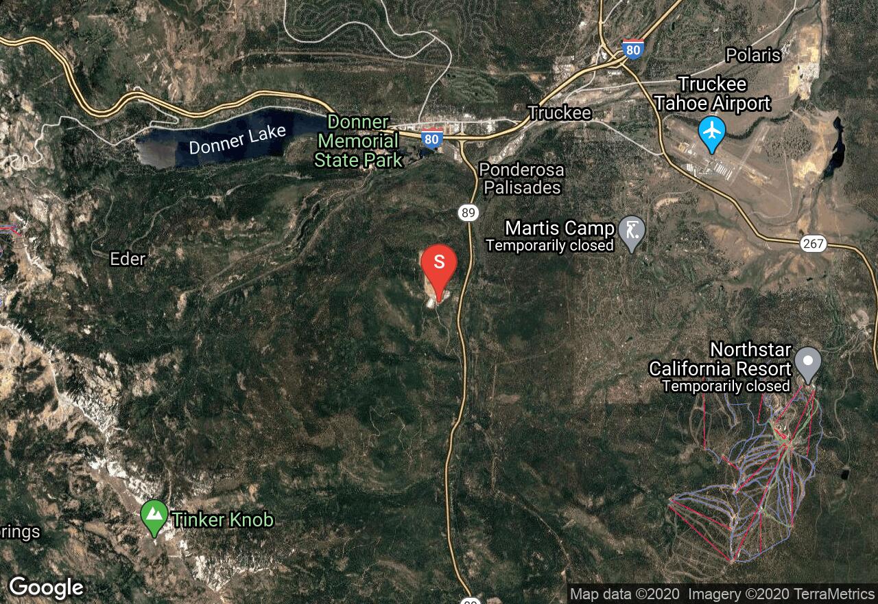
California, Placer County
03 :13 hrs
5.7 mi
195.88855 ft
Moderate
Cabin Creek Loop follows mostly dirt roads, with a short cross-country section, as they meander through a thin forest of pines and firs and alongside Cabin Creek. The 600 acres of skiable terrain is also used by snowmobilers and snowshoers.
See more adventures..
Explore complete list
Explore nearby adventures

