Trail Running in Idaho
Trying to find the best running in Idaho? Bivy has great hiking, biking, paddling, climbing, skiing, riding and more, with hand-curated trail maps, as well as detailed driving directions.
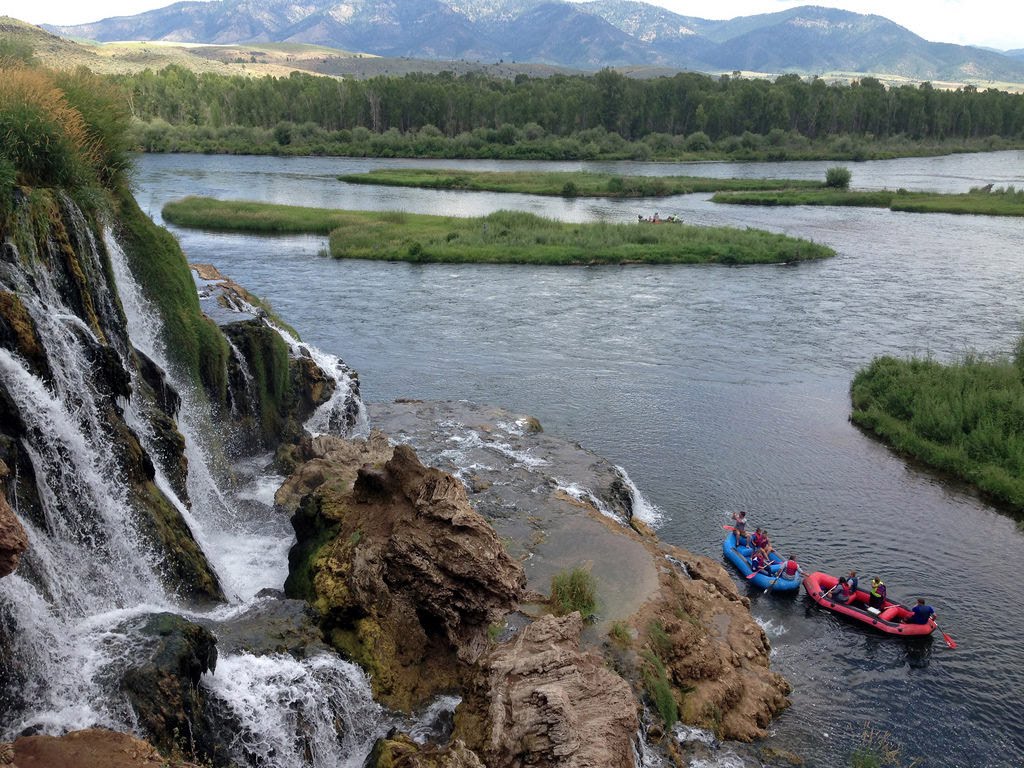
Idaho, Fremont County
01 :41 hrs
4.2 mi
24.875488 ft
II
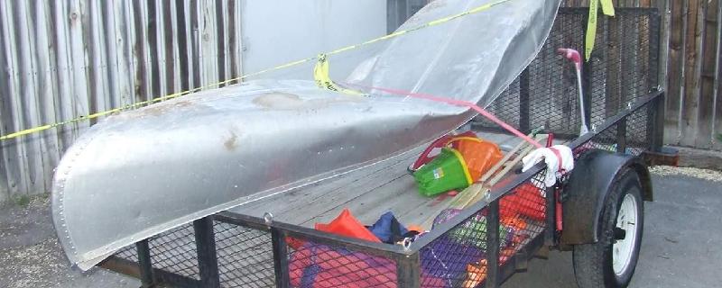
This section of the Henrys Fork starts at Island Park Dam near Box Canyon Campground. The waterway offers continuous class II rapids as it flows through the canyon within the plateau. The river is also great for fishing, and there are excellent views of the surrounding villages and mountains. The take-out is located near Last Chance and Highway 20.
Idaho, Madison County
00 :43 hrs
1.5 mi
126.10657 ft
Easy
A short nature hike on the outskirts of Idaho Falls that climbs through sagebrush-grass, juniper-covered slopes, and along a perennial creek. The trail offers a bit of history, wildlife, and open views of the Snake river, volcanoes, and farmland. The wildlife often sighted here could be rabbits, deer, small lizards, and possibly an eagle or a moose.
Montana, Glacier County
05 :52 hrs
5 mi
700.7062 ft
Expert
This historic tunnel was built in the 1930s by Civilian Conservation Corp for horses and early park tours, it features exceptional architecture. The beginning of this route shares the trail with the popular hike to Iceberg Lake. Just past Ptarmigan Falls, at approximately 3 miles the route forks from the Iceberg trail and begins an aggressive uphill climb through meadows to Ptarmigan Lake. From the lake it is additional 800 feet up a barren slope to the tunnel. After walking through this 250 ft. tunnel (6ft. wide by 9 ft. long) which cuts through Ptarmigan Wall, admire the burst of red rock on the other side, and the stunning views of Natoas Peak, Crosley Ridge, and the Belly Rivers as it flows into Elizabeth Lake. Depending on snowpack, the tunnel doors will open in July and close in early October so be sure to confirm the status at the ranger station before starting your adventure.
Idaho, Lava Hot Springs
00 :33 hrs
1.3 mi
23.296265 ft
II
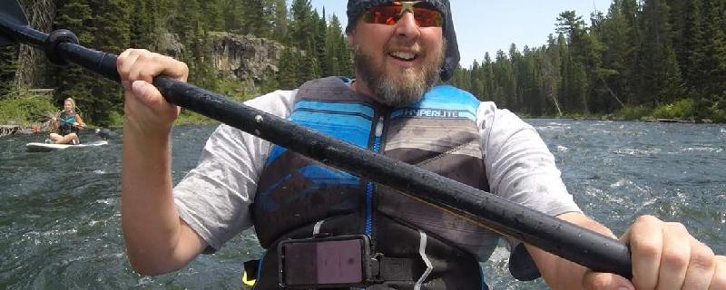
Float or kayak down the Portneuf River through the picturesque, year round community of Lava Hot Springs. Sit on the tube and relax as you go down the river through rapids and shady tree lined river banks. It can really be a lot of fun, especially on a hot summer day. Expect a long walk back as you go up the hill to continue you're outing. It may be a good idea to have a shuttle ride, and be sure to wear a life jacket. Tube rentals are available all throughout town, and the staff in the area is very friendly.

Idaho, Bonneville County
07 :18 hrs
8.5 mi
380.37402 ft
Extreme
Located in the Palisades Ranger District, the hike starts at Big Elk Campground near Palisades Reservoir in Idaho. It eventually leads into Wyoming through aspens, tall Douglas firs, sagebrush, and wildflowers. The route follows alongside Big Elk Creek through a canyon area that resides in the Snake River Mountain Range. Beautiful scenic views are offered along the trail. If you plan on camping, a wilderness permit can be obtained from a Forest Service facility or a registration box.
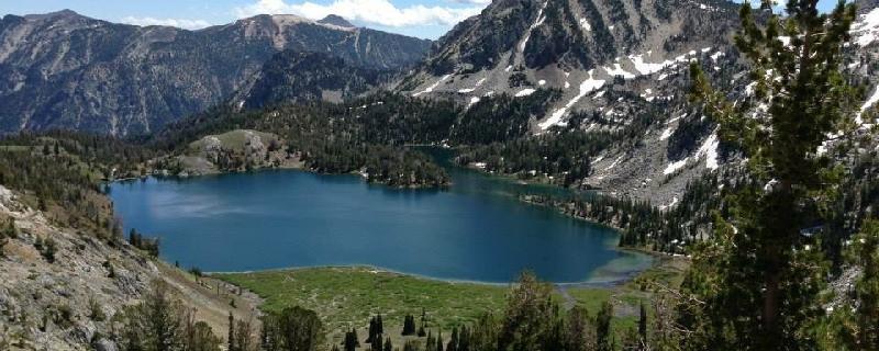
Oregon, Wallowa County
06 :57 hrs
4.9 mi
996.7107 ft
Expert
Nestled in an alpine wonderland, Ice Lake is a perfect mountain lake. This is a strenuous hike, but with a great reward. Ice Lake is filled with brook trout and offers many campgrounds along the shores, while providing a mirror reflection of the nearby Matterhorn. Mountain goats can often be spotted on nearby ridges and many other wildlife also call this refuge home.
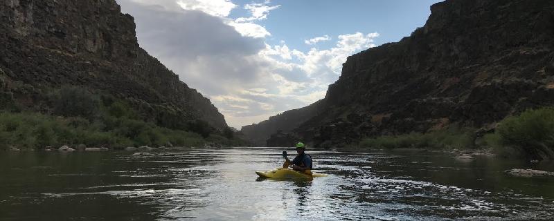
Idaho, Jerome County
05 :17 hrs
13.2 mi
104.85083 ft
IV
The put-in is located near Murtaugh Bridge, off Murtaugh Road and I-84. The river becomes very rocky with technical areas, ledge drops, and moderate to high rapids. Expect big waves, excellent surfing, and wonderful scenic canyon views. Be sure to take out just before the 80 foot drop of Twin Falls downstream. Also, "Pair-A-Dice" can become a class V rapid during high water flow.
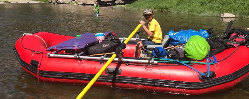
Montana, Meagher County
24 :26 hrs
59.7 mi
286.23877 ft
II
Smith River is a pristine river that offers an excellent river trip. Best to plan on minimum of 3 days and 2 nights. It flows through a colorful canyon with plenty of wildlife, spectacular scenery and good fishing. The river requires a float permit by calling Montana Fish, and Wildlife. You must also declare your boat campsites before leaving. The permits are a first-come, first-served system. The highlight of the trip is a deep limestone canyon with towering rock formations and thick forests. Best float times are May through June before the water gets too low from irrigation. Flows can pick back up in September for a Fall trip where you might find some solitude. Be prepared for cold and rainy weather which is common even in the warm months.
Idaho, Kootenai County
09 :12 hrs
23 mi
4.8639526 ft
SK IV
This outing starts off Coeur d'Alene Lake Drive near Interstate 90 on the northern shore. Adventures await at the magnificent water body of Coeur d'Alene Lake, which is primarily fed by the Saint Joe, Saint Maries, and the Coeur d'Alene Rivers. Once out onto the main part of the lake, be aware of the winds and other boat traffic. High winds can cause large waves, especially when its coming from the south. If the winds are light, paddling and exploring can be done with more ease. The views are unbelievable too, you can really enjoy the scenery of the surrounding Coeur d'Alene Mountains, islands, bays, and the town of Coeur d'Alene. You may also have a chance to spot some wildlife including waterfowl, shorebirds, songbirds, frogs, beavers, and fish.
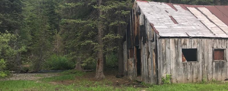
Idaho, Custer County
01 :02 hrs
2.6 mi
50.440186 ft
Moderate
Hike from campground to old mining cabin along Antelope Creek
See more adventures..
Explore complete list
Explore nearby adventures

