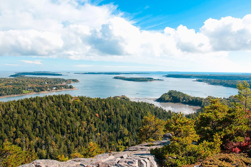
Best Canoeing in Maine
Trying to find the best canoeing in Maine? Bivy has great hiking, biking, paddling, climbing, skiing, riding and more, with hand-curated trail maps, as well as detailed driving directions.
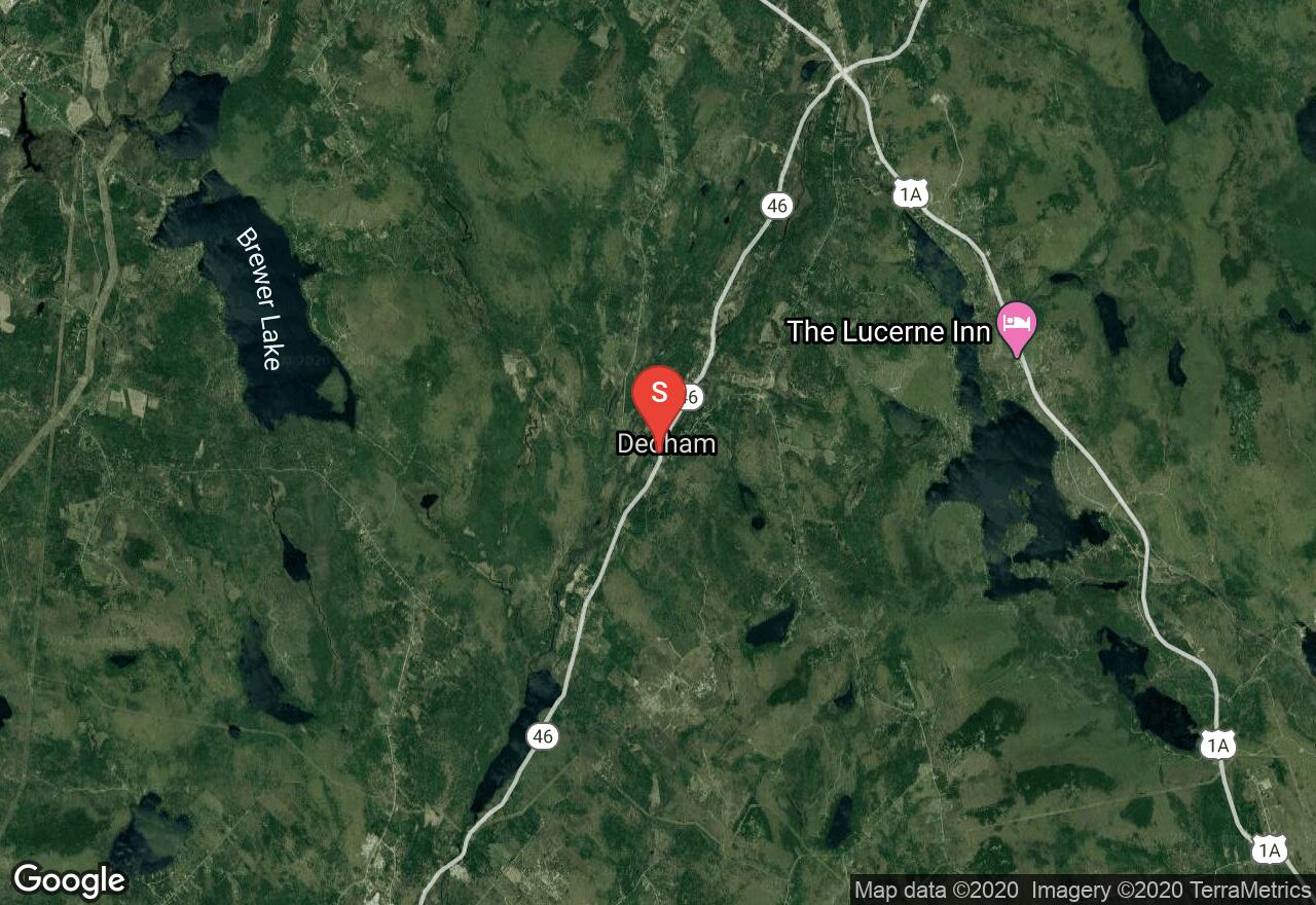
Maine, Hancock County
04 :42 hrs
10.6 mi
25.377392 ft
I
The Narramissic River is a freshwater river that connects a series of lakes in southeastern Maine, eventually turning tidal as it approaches the coast. This section of the Narramissic River starts from the town of Dedham and follows a very rugged forested section of river to the dam and outlet of Alamoosook Lake. The river is can be paddled during medium water but the lakes can be paddled anytime. The river continues on past the dam for a longer trip if desired.
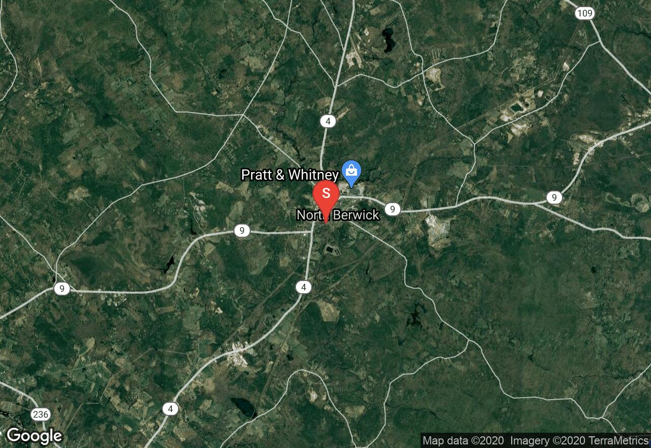
Maine, York County
06 :31 hrs
14.5 mi
10.15143 ft
I
The Great Works River is a historic river that is known for being the first to turn a water-powered mill in the United States. The river is also very scenic though as it runs through heavily wooded rural terrain between North and South Berwick. The river is narrow and winding and consists of mostly class I waters and flatwater. The upper section of the river can be shallow and dry during the summer. Downed trees and other debris can also be an issue, especially during the first part of the run. The last 3 or 4 miles usually have sufficient water for paddling all season long. Be sure to take out at Brattle Street as there is a dam and falls just after the bridge.
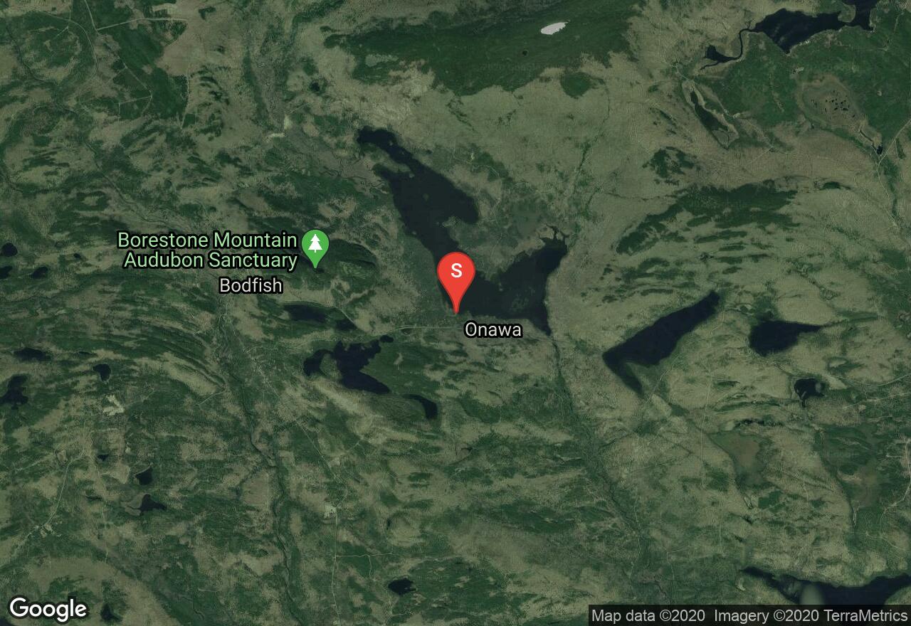
Maine, Piscataquis County
04 :12 hrs
9.3 mi
1.4570618 ft
I
Onawa Lake is located in a beautiful mountain valley where paddlers will enjoy great scenery and lots of opportunity for viewing wildlife. The lake is surrounded by undeveloped forested terrain and vacation homes. There is public access with parking and a ramp located in the southwest corner of the lake.
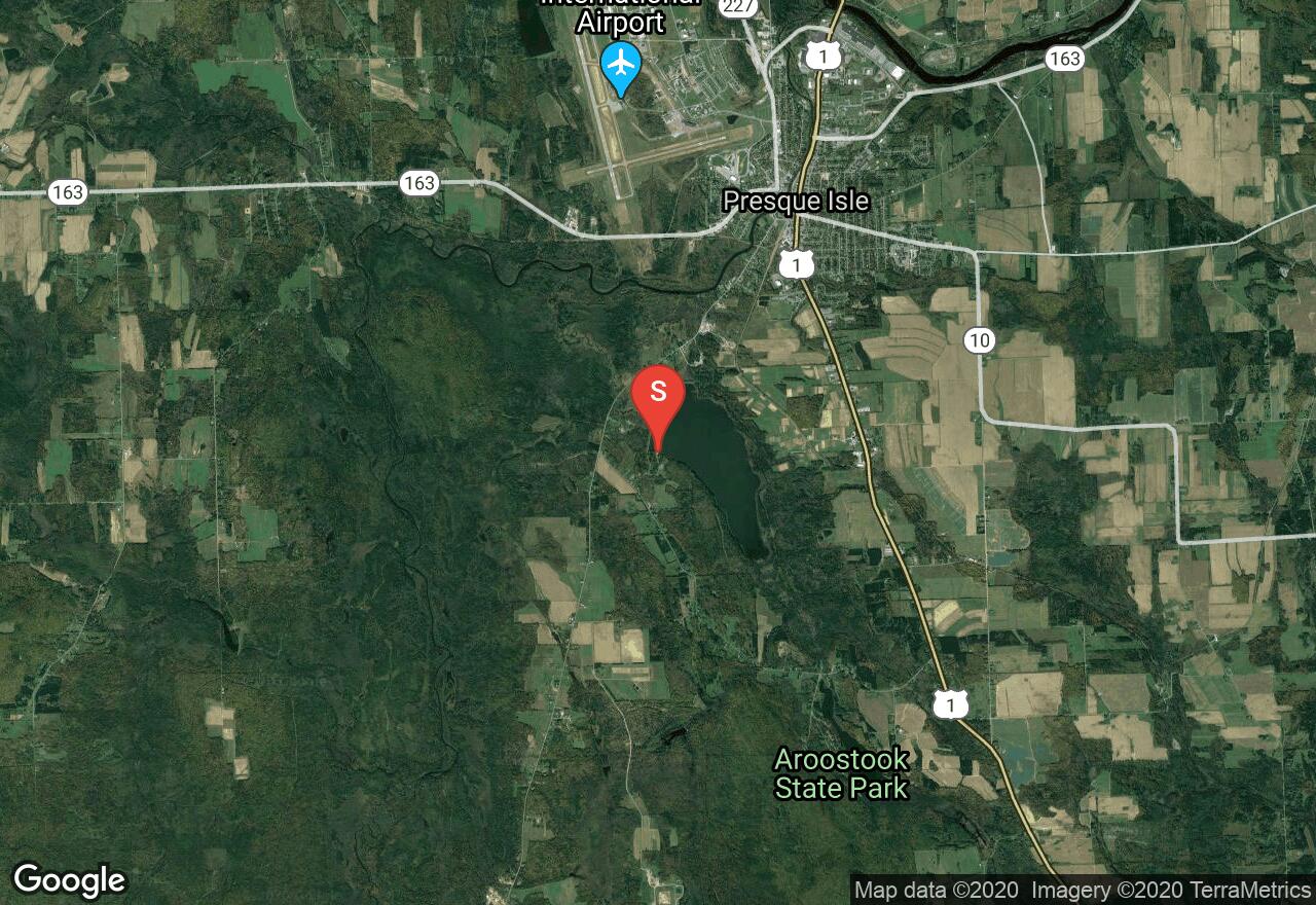
Maine, Presque Isle
01 :30 hrs
3.3 mi
1.2859802 ft
I
Arnold Brook Lake is located in the southern outskirts of Presque Isle and offers a scenic natural setting for paddling, fishing, and wildlife viewing. The lake is completely surrounded by undeveloped wooded terrain. There is a recreation area on the west side of the lake that offers parking and a boat launching area.
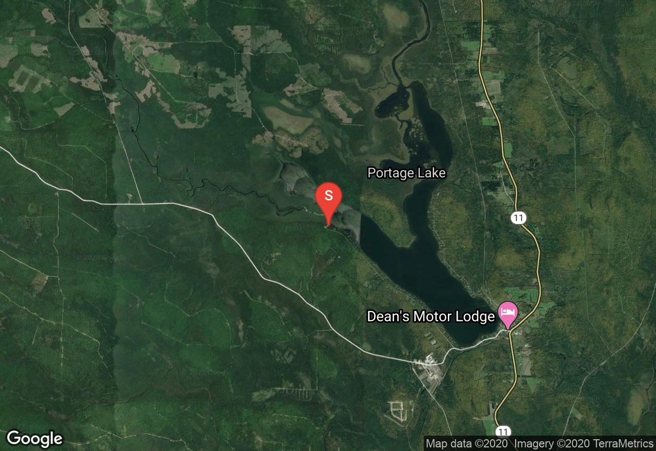
Maine, Aroostook County
09 :22 hrs
20.9 mi
11.090576 ft
I
The Fish River is a tributary of the St. John River that offers some scenic paddling on a slow relaxing river, connecting to multiple lakes along its course. This section starts on Portage Lake and travels through undeveloped woodlands and rural terrain on its way to St. Froid Lake. The put-in and take-out are both public access sites with ramps and parking.
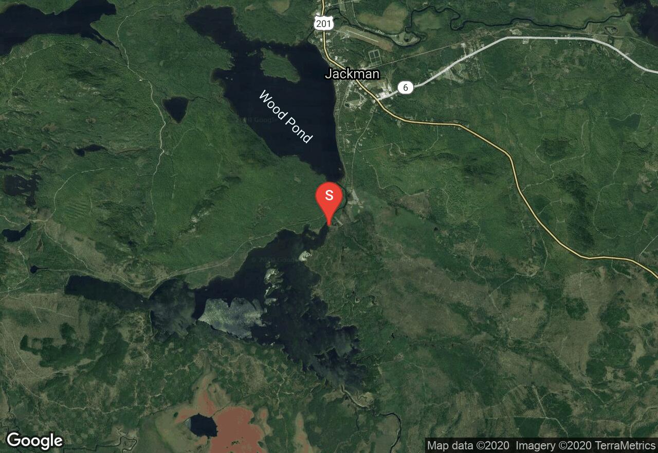
Maine, Somerset County
05 :58 hrs
13.3 mi
0.1239624 ft
I
Attean Pond is 2,745 acres and has dozens of islands that dot its waters. There are multiple bays and interesting shorelines to explore. This is also a popular area because of its connection to the Moose River Bow loop trip which typically begins in this pond. Natural scenery abounds because of its close proximity to Number 5 Bog, a natural landmark. Note that windy weather can cause the waters on the pond to be hazardous.
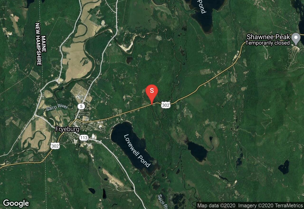
Maine, Oxford County
04 :49 hrs
10.7 mi
7.068344 ft
I
This section of the Saco River is very popular in the summer months, so be prepared for crowds during that time. During the spring, high waters usually force this into a one-way trip, however, at some other times the water is slow enough to allow upstream travel for those with no shuttle options or are novice paddlers. On this route, there should be little-to-no signs of development, but only natural scenery. One can also detour and visit Pleasant Pond while paddling, but be courteous since the pond is located within private property. There are usually fees associated with parking at many of the take-out areas by the Route 160 bridge.
Maine, Somerset County
03 :41 hrs
8.2 mi
1.808197 ft
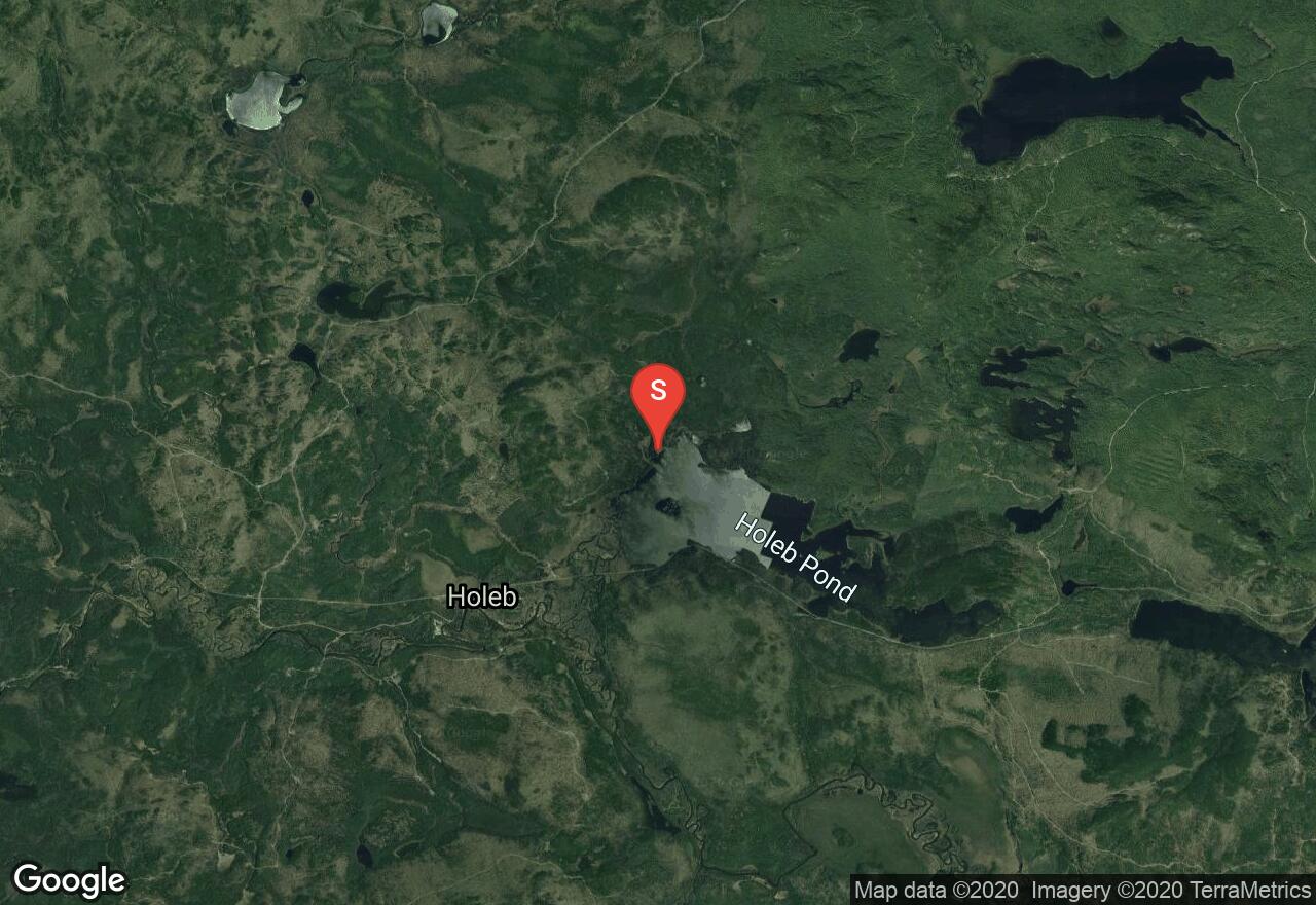
I
Holeb Pond is 1,055 acres and stretches east to west. There are multiple bays, coves, and interesting shorelines to explore. This is also a popular area because of its connection to the Moose River Bow loop trip which typically begins at the neighboring, Attean Pond but access to the river is through this pond. Natural scenery abounds because of its close proximity to Number 5 Bog, a natural landmark. Note that windy weather can cause the waters on the pond to be hazardous.
Maine, Piscataquis County
02 :09 hrs
4.8 mi
6.9068604 ft
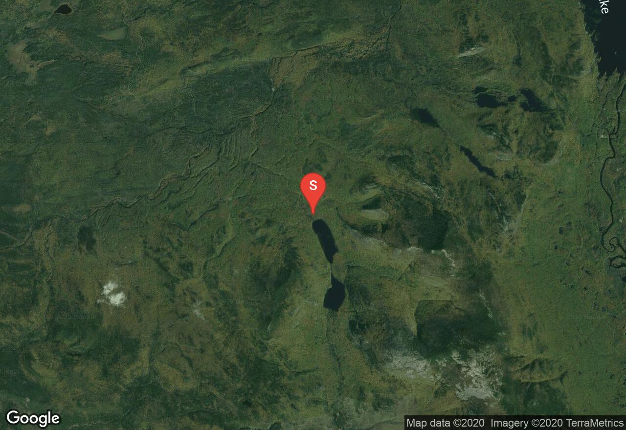
I
These ponds are the epitome of pristine paddling. The area is remote, the surroundings are beautifully mountainous, and the paddling is popular. Old marine fossils have been known to be scattered about - but note that it is illegal to take the fossils from the area. In order to reach Upper South Branch Pond, one will need to portage along a trail about a quarter of a mile. Although the marked portage in this map is triangular in shape, the real trail is actually straight, so simply follow the trail as seen at the ponds. Be prepared to pay a fee at the park gate. Canoe rentals have been known to be available.
Maine, Cumberland County
04 :42 hrs
10.4 mi
0.31497496 ft
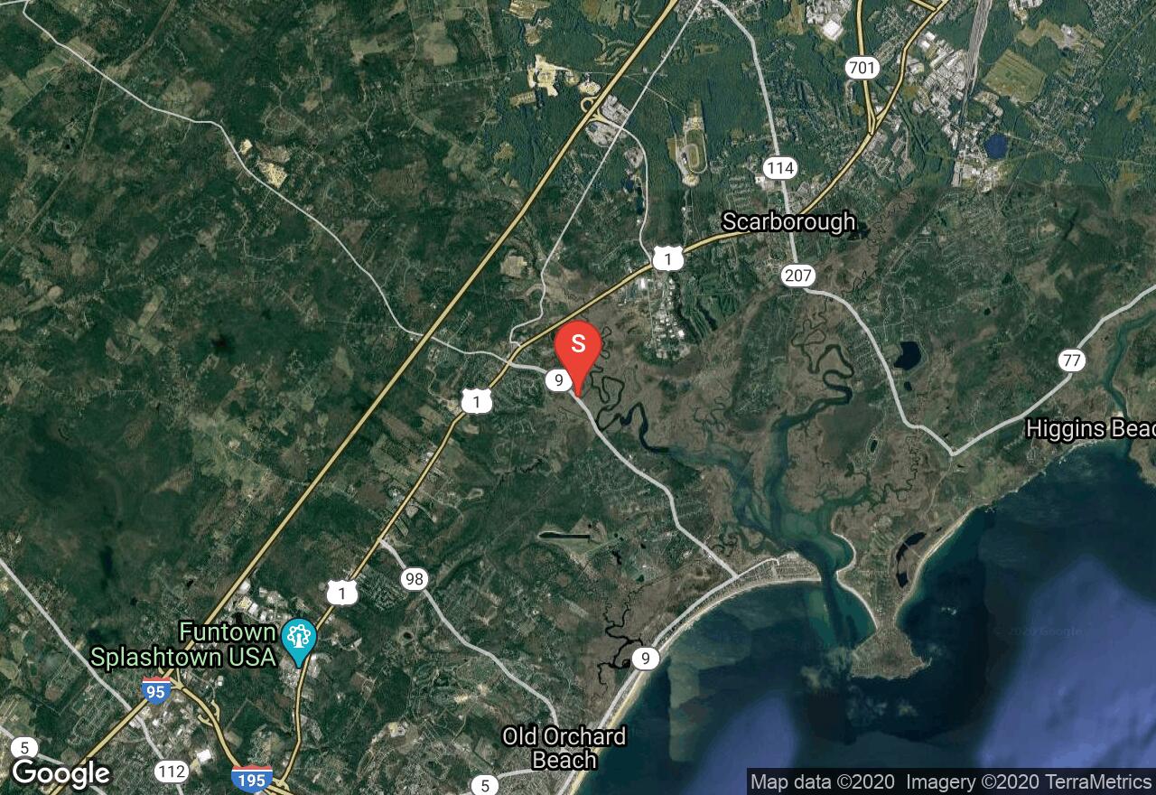
II
Located near the Atlantic coastline, the Scarborough Marsh is a large area of intricate channels that meander about a salt marsh. Since it's by the coast, and there are not many trees or other large objects to block the elements, wind is a constant issue here and can cause choppy water. One will need to plan around the tides and is recommended to paddle against the tide first and then ride it back to the boat launch area. Contact the Scarborough Marsh Nature Center for tidal info - they usually rent canoes as well. The marked route in this journey is not to be followed exactly as it simply shows the main channels; which usually have enough water even at low tide.
See more adventures..
Explore complete list
Explore nearby adventures

