Styles.ec1e20f1fbaef179e0af.css in Great Basin National Park
Trying to find the best in Great Basin National Park ? Bivy has great hiking, biking, paddling, climbing, skiing, riding and more, with hand-curated trail maps, as well as detailed driving directions.
Nevada, White Pine County
02 :01 hrs
4 mi
153.97583 ft
Moderate
Hike to Bristlecone Forest and alpine lakes.
Nevada, White Pine County
06 :49 hrs
3.9 mi
931.04785 ft
Expert
Offering spectacular vistas and distinctive topography, Wheeler is Nevada’s highest independent peak. Your journey to the summit promises pleasant surroundings to begin and a breathtaking finish. This climb, which rises over 3000 feet in just 4 miles, is not for the faint of heart. Pack water and bring a friend for a truly amazing adventure.
Nevada, White Pine County
10 :57 hrs
3.6 mi
928.15576 ft
I
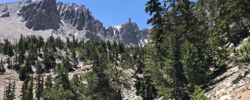
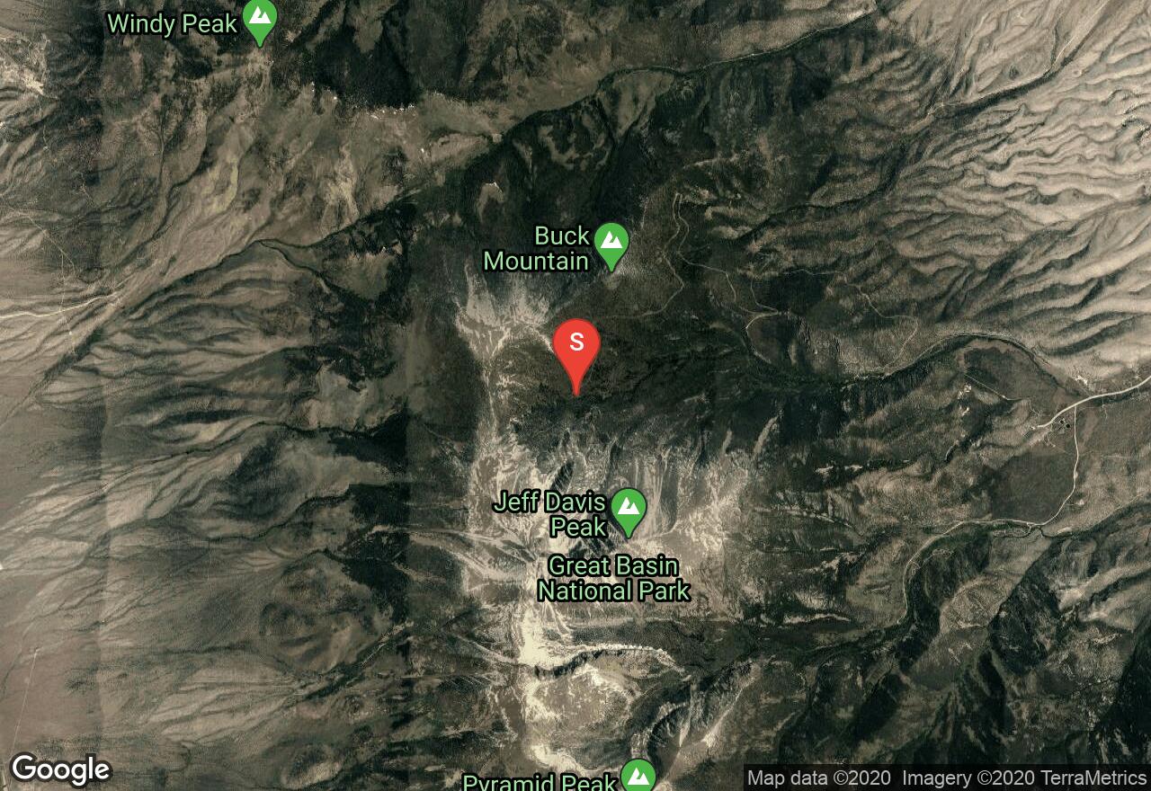
There are a few different routes to summit Wheeler Peak. This route takes you over Jeff Davis peak and then saddles to Wheeler Peak, coming from the east rather than from the north. Of the different routes, this is definitely the most challenging. Many adventurers will then take the easier hiking trail back down the north side of Wheeler, rather than returning along the same route back over Jeff Davis peak. We recommend ski poles and rope for this summit.

Nevada, White Pine County
05 :07 hrs
3.7 mi
658.5205 ft
Expert
In one of the most pristine and beautiful places in Northern Nevada, Lehman Creek Trail runs in the shadow of Wheeler Peak. This 200 foot descent through pine and aspen forest has some of the most spectacular of nature’s wonders. Much less difficult, even round trip, than the nearby peak trail to Wheeler Summit, this is a great hike accessible to all, with the option to access both ends of the trail with vehicles should you prefer not to make the return climb.

Nevada, White Pine County
06 :10 hrs
4.5 mi
595.20654 ft
Expert
Accessible only from the Willard Creek or Cabin Outlook trails, this very worthwhile adventure can only be experienced as an extension off of another trail, so please plan accordingly. This trail extends up along a ridgeline to the Windy Peak. With sweeping views of the northern sections of Great Basin National Park, this is a beautiful if less-popular adventure.

Nevada, White Pine County
06 :04 hrs
4.9 mi
598.9221 ft
Expert
A great destination for National Park lovers who aren’t looking for designated wilderness, in Pole Canyon you can hike one of the nicer trails in the great outdoors. This trail also connects to Timber Creek Trail for other options on getting back out of the back country. No pets or camping are allowed along this trail which is designated for hiking or running.

Nevada, White Pine County
05 :37 hrs
2.5 mi
254.84131 ft
I
Of the high peaks in Nevada, this is one of the easiest to climb, making it great for a first-time mountaineer. One section of about 50 vertical feet near the summit has some loose rock making for a class 2-3 scramble. Otherwise the terrain is fairly easy with a good, easy-to-spot path.

Nevada, White Pine County
05 :09 hrs
4.7 mi
493.46216 ft
Expert
A moderately long trail with some climb to it, this trail is not particularly steep, but the slope is unrelenting as you trend upwards along its entire path into the hills. Designed as an out-and-back trail, yet this path does connect with others to get back out, though none loop back closely to the starting point. This trail passes through a narrow but lush valley in the Great Basin National Park, making it attractive to many who venture out from the park’s central attractions of Lehman Caves and Wheeler Peak.

Nevada, White Pine County
03 :48 hrs
2.2 mi
645.6843 ft
Hard
Rising up into the mountains from the valley west of Great Basin National Park, this is an out-of-the-way trail used less by visitors because it isn’t found behind an official entrance to the park. Those seeking solitude or just something different than the more tourist-friendly Lehman Caves and Wheeler Peek area should consider this option. Still in the National Park, no biking is allowed on the trail.

Nevada, White Pine County
07 :28 hrs
2.5 mi
893.1499 ft
III
Route finding along this path is fairly straightforward, though in the initial forested area, it can be a bit tricky. One stretch of hill rises about 2000 feet, making that particular stretch challenging both travelling up and down due to the steep slope, but otherwise this is a relatively easy hike. Recommended equipment is ski poles, and always be sure to climb in pairs or groups.
See more adventures..
Explore complete list
Explore nearby adventures

