Best Trails in South Dakota
Trying to find the best trails in South Dakota? Bivy has great hiking, biking, paddling, climbing, skiing, riding and more, with hand-curated trail maps, as well as detailed driving directions.
South Dakota, Pennington County
00 :21 hrs
0.9 mi
36.0542 ft
Easy
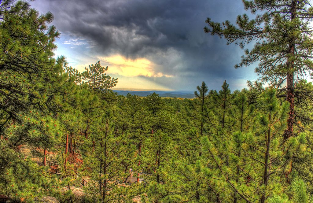
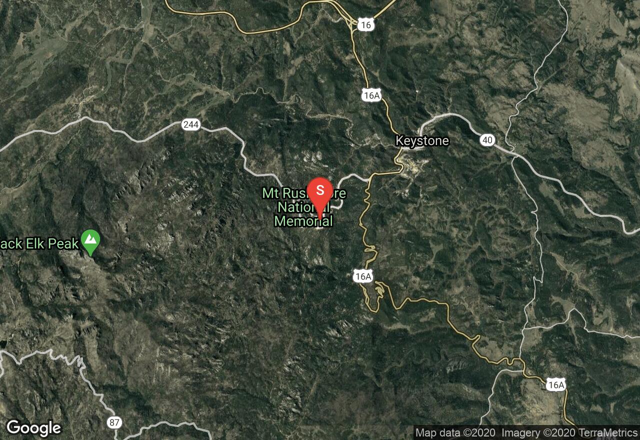
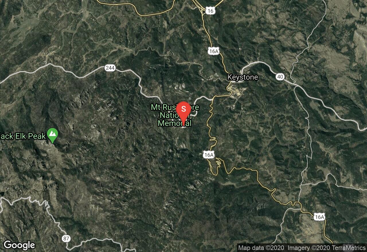
Mount Rushmore National Memorial is one of the most iconic sites in the United States, and is visited by nearly 3 million people each year. The Presidential Trail is a traditional boardwalk that will get you closer to the base of monument, offering spectacular views. You'll definitely enjoy this short hike with family and learn a lot about the history of America's founding fathers. There is an $11 parking fee required for each vehicle.
South Dakota, Pennington County
01 :54 hrs
21.8 mi
245.64111 ft
Hard
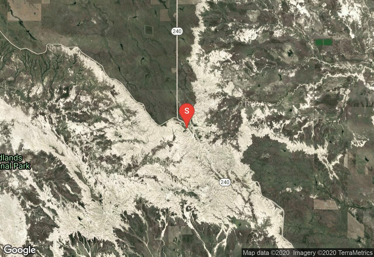
Bicycling through the Badlands provides riders with excellent views of the dramatic and impressive scenery the park has to provide. This ride follows the main park road for almost 22 miles, passing multiple overlooks and points of interest along the way. The downhill route requires a shuttle between the start at the Pinnacle Overlook and end of the ride at the Ben Reifel Visitor Center. The park road does see a lot of traffic during peak season, and is steep and narrow in sections, so extreme caution is required at times. The ride can easily be shortened by starting a shorter distance from the visitor center.
South Dakota, Spearfish
00 :46 hrs
0.9 mi
38.13513 ft
Easy
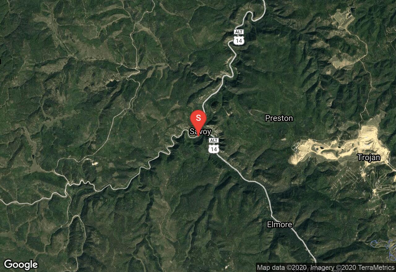
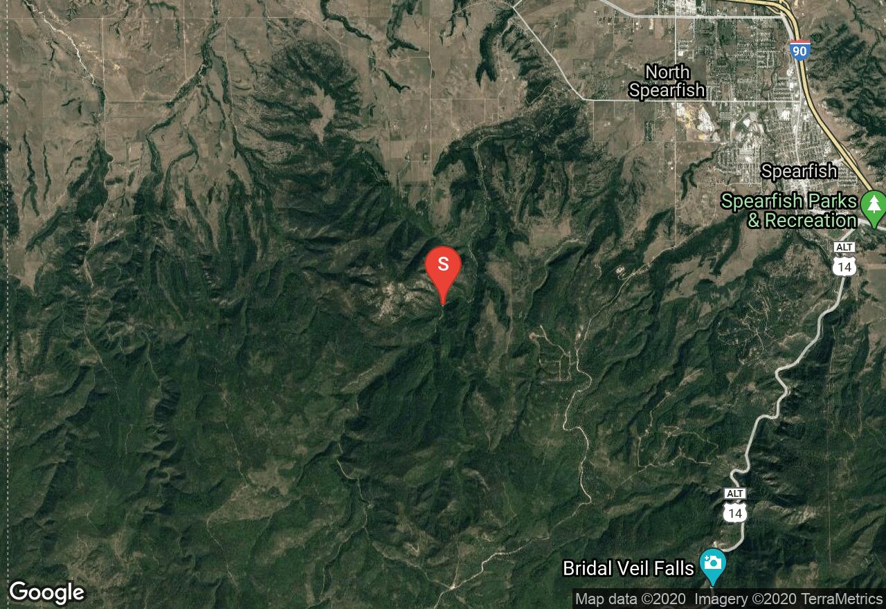
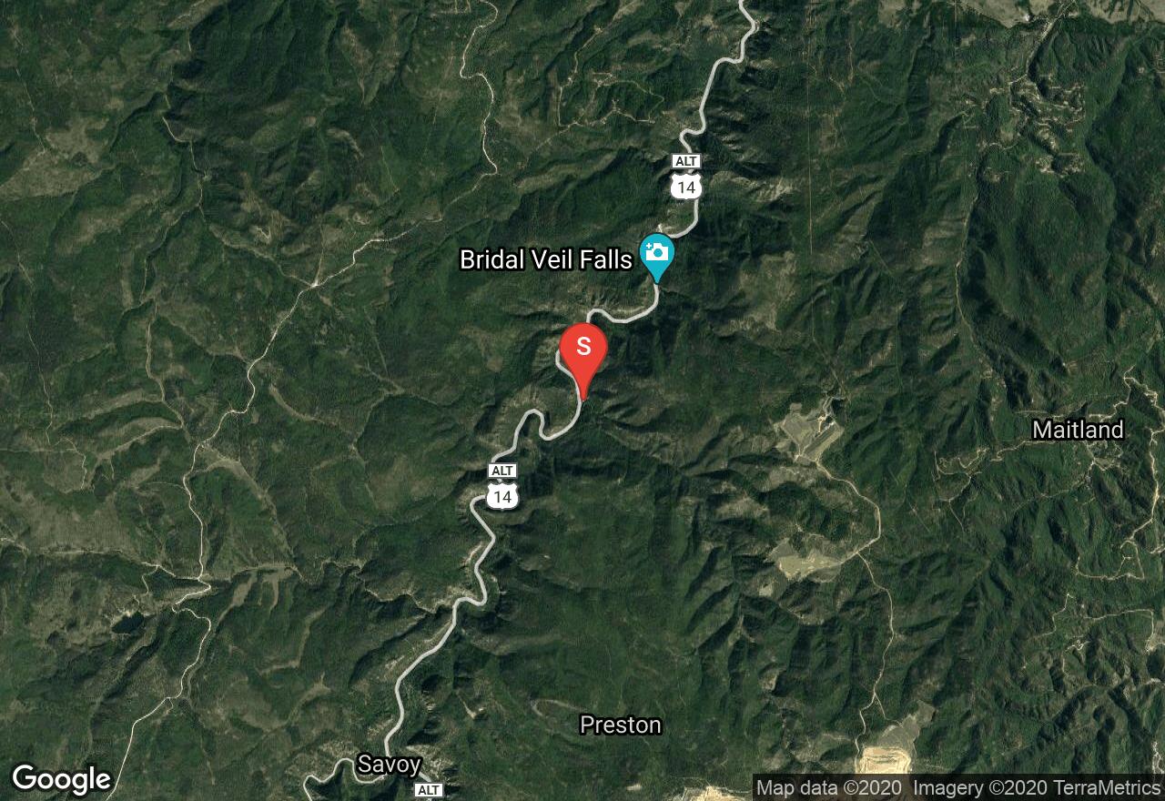
This is a short route that goes along Spearfish Creek on relatively flat terrain. The tree-lined trail is wide and has easy access for all visitors to enjoy the spectacular water fall views. You'll want to park at the parking area on the left side of the road when you're traveling south from Savoy.
South Dakota, Spearfish
03 :46 hrs
3.2 mi
473.2876 ft
Hard
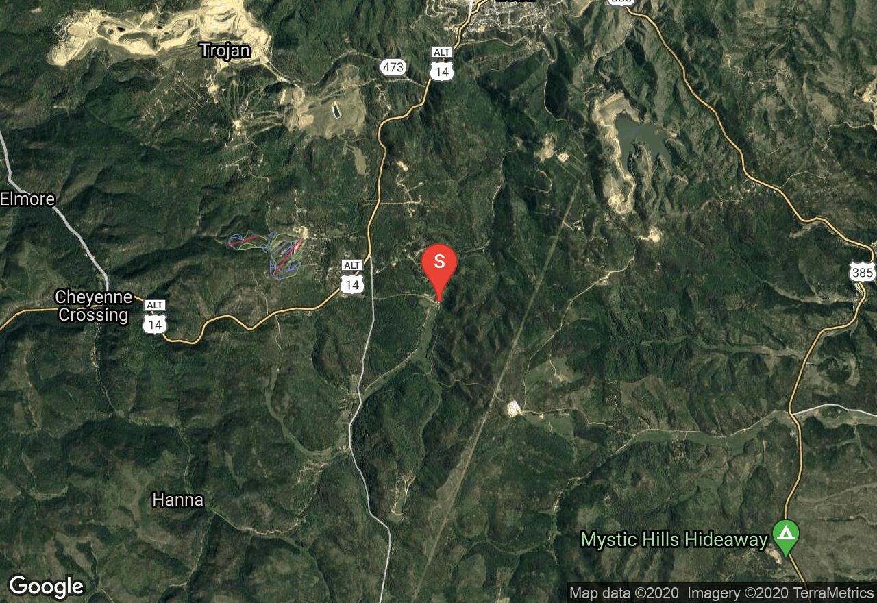
Crow Peak has its name because of a historic battle that involved the Crow and Sioux Indians. The trail is heavily used and it can be accessed off Higgins Gulch Road in the Black Hills National Forest. You'll through ponderosa pine trees and vegetation that comprised of native bushes and bur oak. The route has gradually climbs the southwestern portion of the mountain and reaches the rocky peak, offering amazing views of the surrounding hills. Be cautious of late spring snow and be sure to bring plenty of water and supplies.
South Dakota, Lawrence County
02 :01 hrs
8.5 mi
317.7577 ft
Moderate
This route starts at the Englewood Trailhead at Brownsville Road and travels northward all the way to the end of the Mickelson Trail at Deadwood. You'll start out going alongside Whitewood Creek and traverse downhill through narrow canyons while enjoying views of the Homestake Gold Mine. There are also three other trailheads that are stationed between Englewood and Deadwood. Be sure to purchase a Mickelson Trail pass at a self-service station along the trail or online.
South Dakota, Custer County
03 :45 hrs
3.3 mi
317.33362 ft
Hard
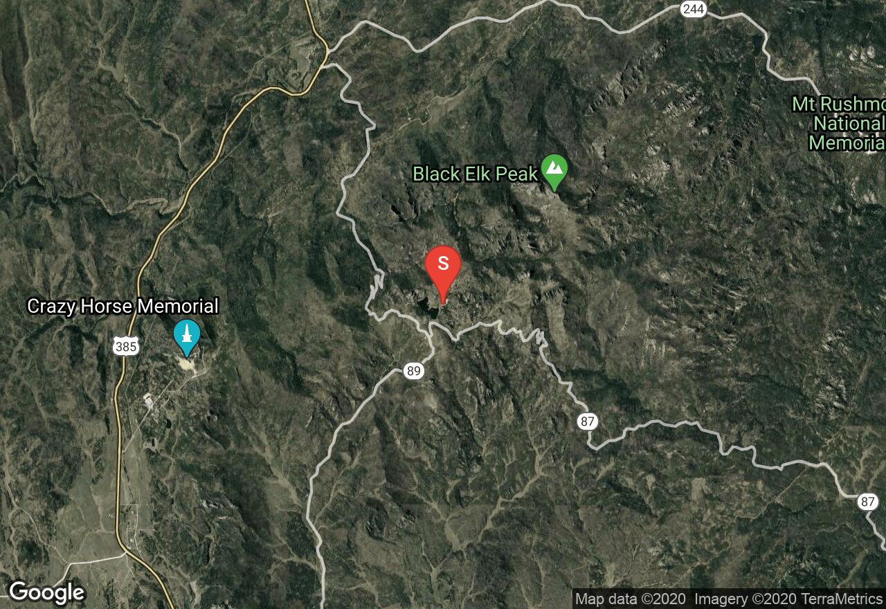
This is a popular hiking trail that is normally approached through the Black Elk Wilderness from Sylvan Lake - Harney Trail Number 9. The trail is generally easy to follow and is heavily used during the warmer months of the year. Be aware that the trail becomes much more strenuous once you get closer to the peak. You'll definitely enjoy passing through ponderosa pine trees and having the opportunity to observe wildlife such as mule deer. A trailhead permit is required to park and/or hike from the trailhead $2.50 - $5 per person or $6 - $12 per vehicle, depending on the time of year.
South Dakota, Pennington County
05 :36 hrs
55.2 mi
780.4823 ft
Expert
This loop ride leads through the scenic Black Hills and past the historic display of Mt. Rushmore. The ride follows the Needle Highway and Iron Mountain Road to complete a loop of just over 50 miles. The route covers some hilly terrain with a few small climbs and descents. There are some tight turns and curvy roadway to navigate. The highways are mostly narrow paved two-lane roads that do see some traffic, especially around the national monument. There are some great rest spots along the way for stopping, resting, and taking in the scenery. There are multiple campgrounds located along the scenic byway.
South Dakota, Lawrence County
00 :32 hrs
0.6 mi
48.428467 ft
Easy
This is a short but very scenic hike that has to be on everybody's bucket list if you live in South Dakota. Be sure to plan ahead and expect to get your feet wet as you travel up along Squaw Creek through the Black Hills National Forest, and then traverse through a limestone corridor. The limestone walls are absolutely stunning once you get to Devil's Bathtub. Also, be cautious of mossy and slippery rocks while hiking through the water.
South Dakota, Pennington County
01 :26 hrs
3.9 mi
53.41919 ft
Moderate
Flume Trail goes from one point to another point with various trailheads and various loops available. It is an historic route that was once a part of a mine in the 1800's. You'll be heading through a dense forest with pine trees, wildflowers, and opportunities to see artifacts from the Rockerville Flume bed that carried water from Spring Creek to Sheridan Lake. This was used to help miners find up to $20 million dollars in gold.

South Dakota, Spearfish
02 :17 hrs
5.4 mi
241.55212 ft
Hard
This route starts at the Little Spearfish Trailhead located off Roughlock Falls Road near Lead, South Dakota. You'll start out traveling uphill along the creek passing by a lot beaver dams to wooded areas above. Berry bushes, mushroom, and other fun plants can be spotted along the way as you make your way through the vegetatively overgrown path. After the first couple of miles, you'll gradually descend back to the road. From the road, you'll need to use caution as you'll be hiking along the roadside back to the trailhead.
See more adventures..
Explore complete list
Explore nearby adventures

