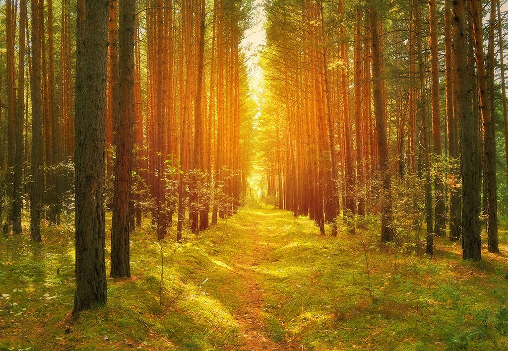
Best Hiking in Texas
Trying to find the best hiking in Texas? Bivy has great hiking, biking, paddling, climbing, skiing, riding and more, with hand-curated trail maps, as well as detailed driving directions.
Oklahoma, Sour John
03 :13 hrs
8.8 mi
72.382034 ft
Hard
Located in Greenleaf State Park, Blue blazes mark the trail which heads east into the woods. Though generally well marked, the trails can be lightly tread and hard to find in places. If desired, an advanced northern loop can be accessed by continuing north past Mary’s Cove. In warm weather the lake is heaven for bugs (including chiggers), so bug repellent and powdered sulfur are a must.
Arkansas, Logan County
03 :03 hrs
9.3 mi
499.44263 ft
Hard
This hike begins near the highest point in Arkansas atop Mount Magazine. You’ll follow the trail down past the bluffs ringing the mountaintop and descend fifteen hundred feet through dense hardwood and evergreen forest in the Ozark National Forest eventual arriving at Cove Lake. Given the length this hike it may be best enjoyed as a one-way adventure with a shuttle vehicle parked at the Cove Lake trailhead. Camping is allowed in the Ozark National Forest so a backpacking adventure is a possibility as well.
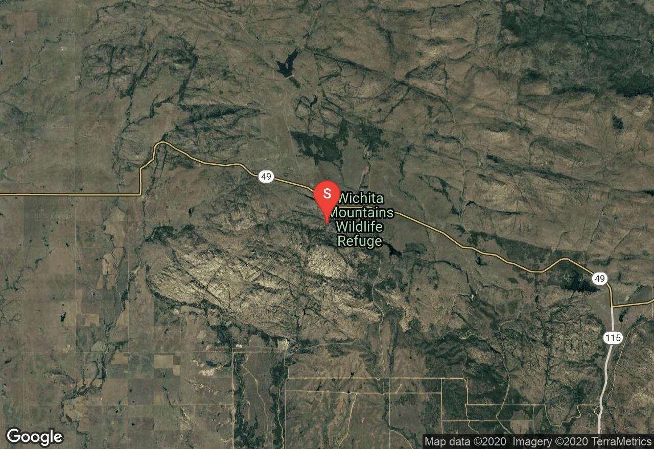
Oklahoma, Lawton
01 :11 hrs
3.2 mi
48.322784 ft
Moderate
Begins as you cross the bridge over the middle of Sunset pool. The trail follows the usually-dry creek bed until turning south up and and out of the creek bed. To complete the loop turn sharp right when the trail converges with the Treasure Lake Trail. This will take you north-west past the boulder field and to the trailhead - the trail is not as well established on this leg of the route.For Post Oak Falls: continue south rather than turning north at the end of the loop. Continue South for approx. .35 miles then turn left into the small canyon. Rattlesnakes and Copperhead Snakes are active during the summer months. Rattlesnakes and Copperhead Snakes are active during the summer months.

New Mexico, Otero County
01 :40 hrs
4.8 mi
13.661621 ft
Moderate
Hike through the beautiful and stark White Sands National Monument along the Alkali Flats Trail, where you will get some stunning views of the giant dunes made of gypsum sand. This is one of the few designated trails in the monument, but you are more than welcome to wander around as long as you are back to the trailhead by sunset. Keep an eye out for white posts with orange tops to keep yourself on the trail. Be sure to pack plenty of water, sunscreen, and sunglasses, as the bright white sand reflects the harsh desert sun and makes it quite toasty. There is a $3 entrance fee per person. No mountain bikes allowed. Dogs allowed on leash.
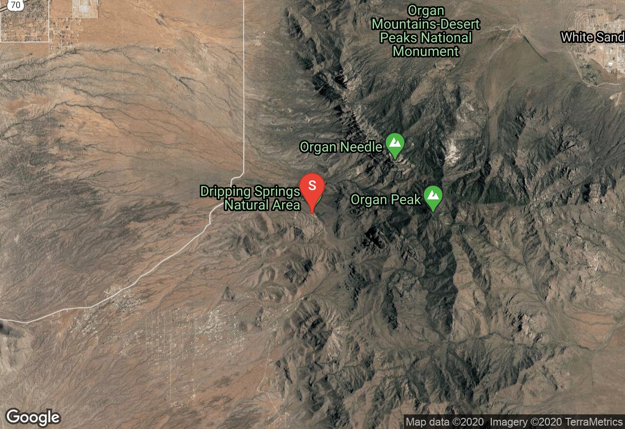
New Mexico, Dona Ana County
02 :03 hrs
4.9 mi
202.3894 ft
Moderate
Dripping Springs was once a bustling resort village, started in the 1870's by Confederate Civil War veteran Eugene Van Patten. Hike around the area on the well maintained trails to see the old, dilapidated buildings of the Van Patten Resort and Boyd Sanatorium and to get a feel for this hidden oasis in the desert. This hike will take you along the base of the Organ Mountains, through arroyos and grasslands filled with abundant wildlife and up into Fillmore Canyon, where you will see a waterfall. Dripping Springs is also known for it's "weeping walls" and lush, oasis-like atmosphere. This trail system is not great for mountain bikes, although they are allowed. There is a $3 day use fee per vehicle at the parking lot.
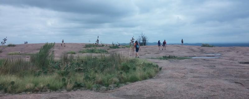
Texas, Llano County
02 :23 hrs
6.4 mi
68.76248 ft
Hard
One of the best-known outdoor venture sites in western Texas, Enchanted Rock State Natural Area is an amazing place to spend the day. This trail loops around the rock itself, and also passes between two of the larger features. This is desert climate so be sure bring water for this fairly long trail. Many side paths and trail options explore different amazing sections of this natural wonder, so don't be afraid to wander off the path.
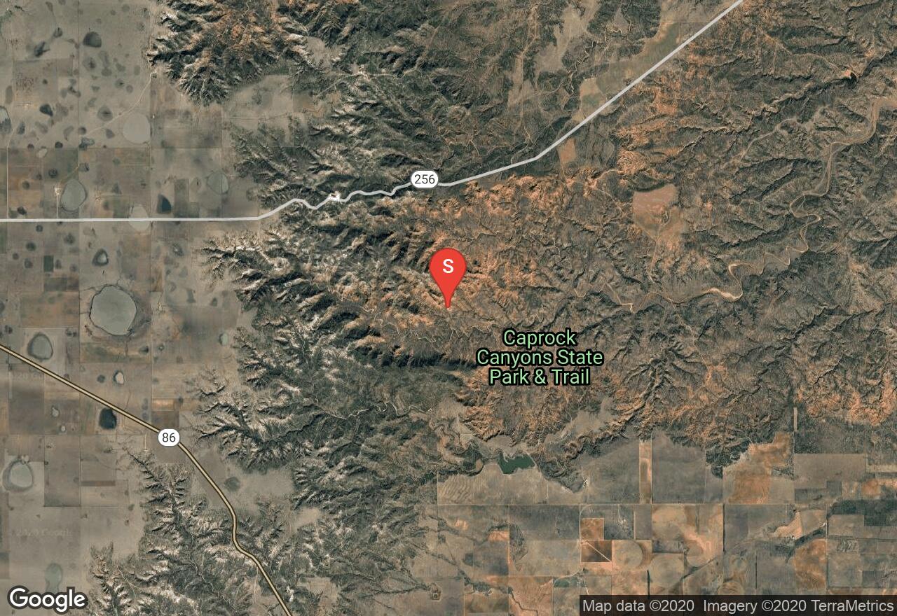
Texas, Briscoe County
03 :06 hrs
3.4 mi
215.84326 ft
Hard
Running along the ridgeline separating the two canyons formed by the Little Red River in the Caprock Canyons State Park, this is a beautiful hike offering stunning views of both canyons. Users recommend taking a camera and binoculars to enrich this adventure, and be on the lookout for the official Texas State Bison Herd.
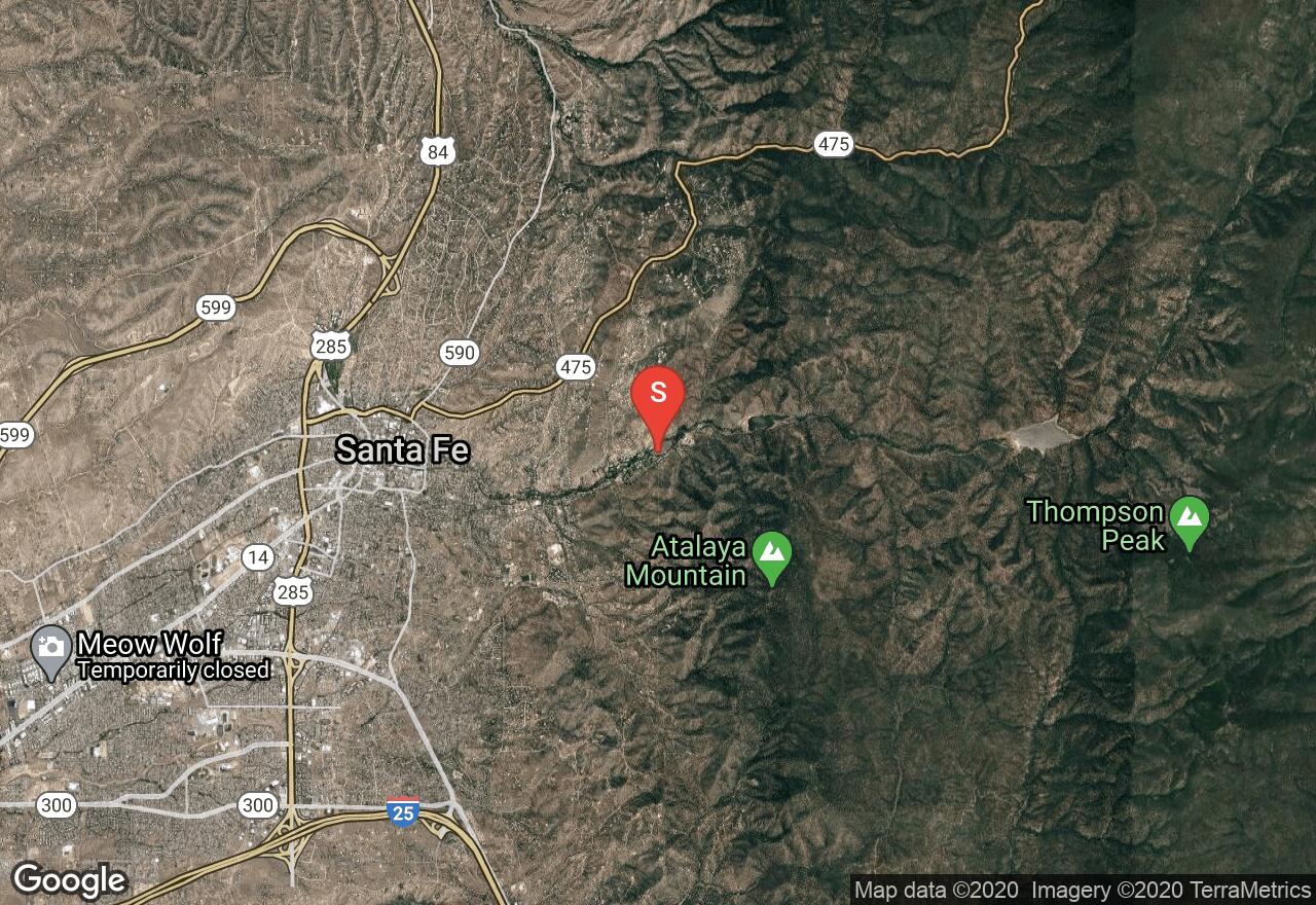
New Mexico, Santa Fe
00 :36 hrs
1.5 mi
31.716064 ft
Easy
Take an easy hike through the Santa Fe Canyon Preserve and enjoy one of the last bits of unspoiled riparian habitat in Santa Fe. This is an excellent hike for birders, over 140 species have been noted in the area. This habitat is known as a bosque, or riverside forest, and is very rare. There are interpretive signs all along the hike, explaining what you are seeing. No bikes or pets allowed.
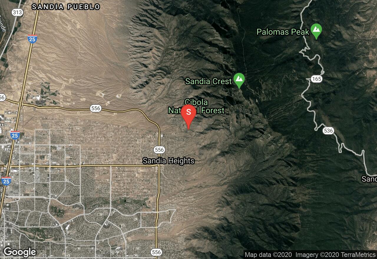
New Mexico, Bernalillo County
06 :04 hrs
8.4 mi
1171.1565 ft
Expert
The La Luz Trail climbs from the base of the Sandia mountains all the way up to the peak, so be prepared for a challenging trek. That is why this loop ends with a nice, 15 minute scenic tram ride back down to your starting point. If you wish, however, you can go back the way you came, or make it a shuttle - leaving a parked car at either end. This trail will lead you to spectacular views amid an immense amount of switchbacks used to ease the rapid elevation gain. Enjoy the giant granite slabs and boulders that are the Sandia Mountains while hiking over talus slopes and above lush, vegetated valleys. One-way tram tickets can be purchased at either end for $12/person, and it usually runs from 9 am - 5 pm. There is a parking fee of $1 to park at the Sandia Peak Tramway grounds. Because this is in the wilderness, mountain bikes are not allowed. This trail is listed as no dogs, due to the fact that they are not allowed on the tram down.
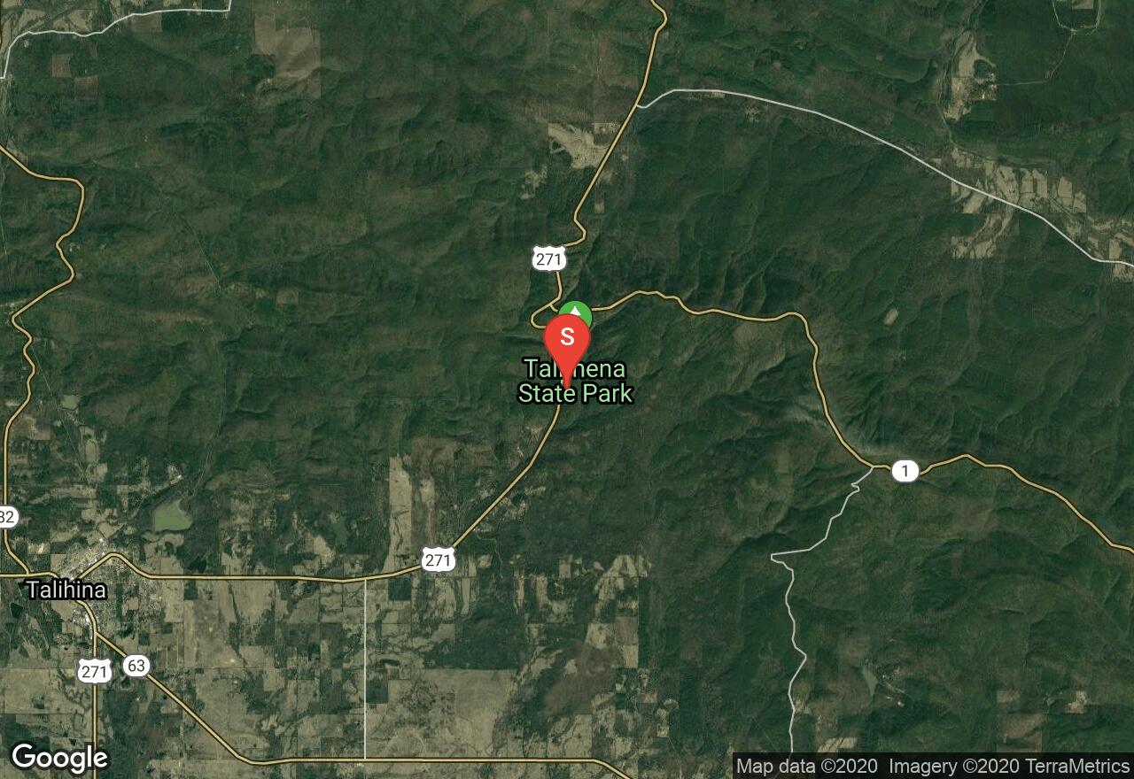
Oklahoma, Le Flore County
18 :17 hrs
44.3 mi
479.9718 ft
Extreme
This leg of the Ouachita trail begins at Talimena State Park and terminates at the Arkansas State Line. Because it is lightly travelled, this trail offers solitude as well as beautiful views. The whole of the trail is marked by blue blazes which are in varying states of repair, so it is important to keep an eye out for them. Water is scarce and poison ivy is common, so prepare accordingly. Be sure to wear orange during hunting season and to leave a note on your vehicle to inform authorities that your vehicle isn't abandoned.
See more adventures..
Explore complete list
Explore nearby adventures

