Best Cross Country Skiing in Iowa
Trying to find the best cross country skiing in Iowa? Bivy has great hiking, biking, paddling, climbing, skiing, riding and more, with hand-curated trail maps, as well as detailed driving directions.
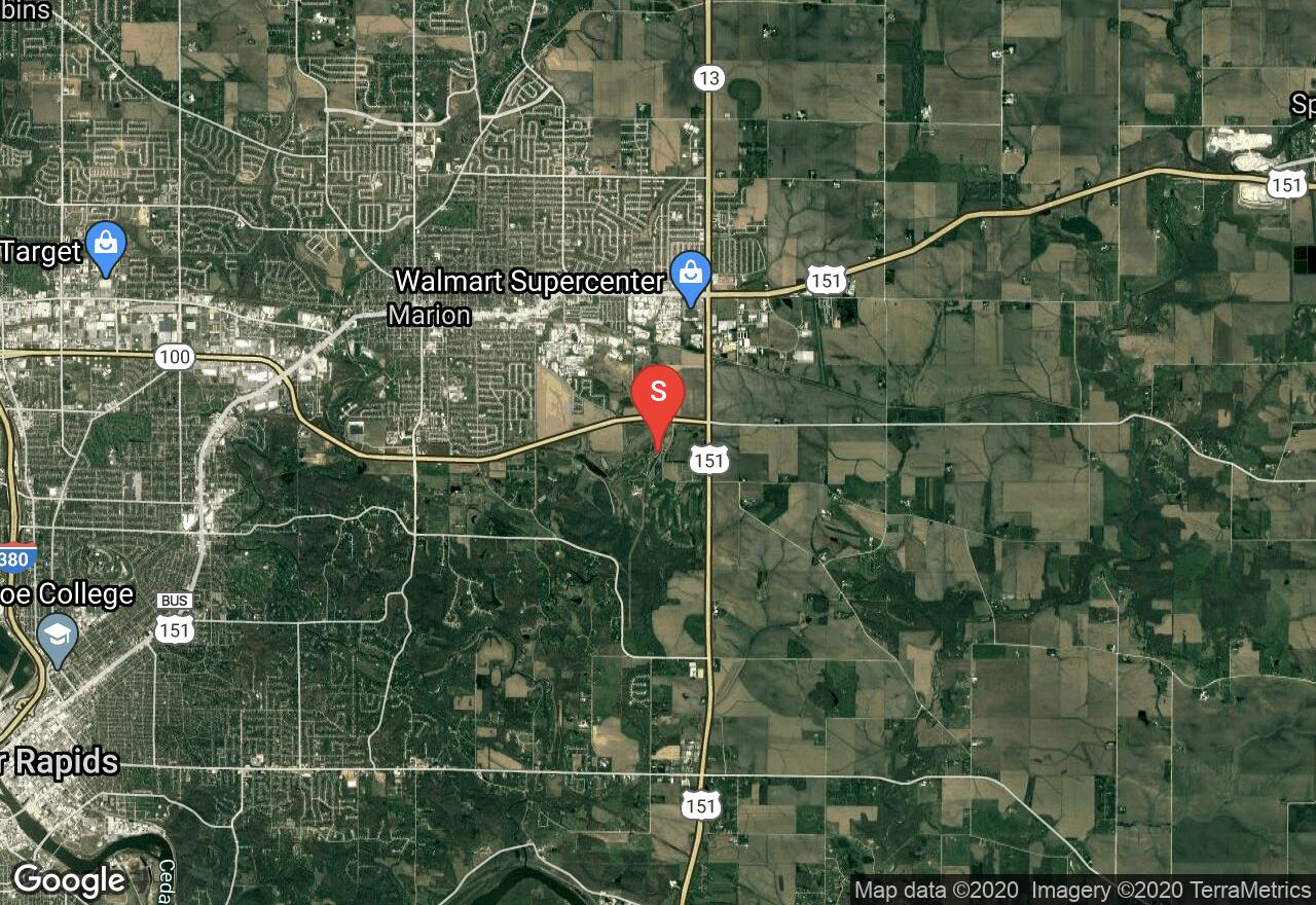
Iowa, Linn County
02 :05 hrs
4.9 mi
29.301529 ft
Easy
The park is open year round for trail use. Part of the trail is groomed for classical and skate cross-country skiing. And other parts are tailored for mountain biking and equestrians. You will also find a lighted downhill sledding facility.
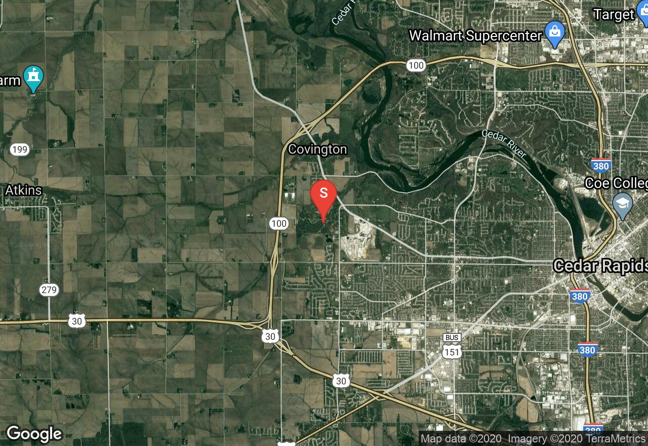
Iowa, Linn County
01 :11 hrs
2.8 mi
16.284073 ft
Easy
The park has several smaller trails to go on besides this one. The trails are groomed for cross-country skiing. You may extend this adventure by connecting to the other trails. Please check in when weather conditions are extreme to see if the park is open.
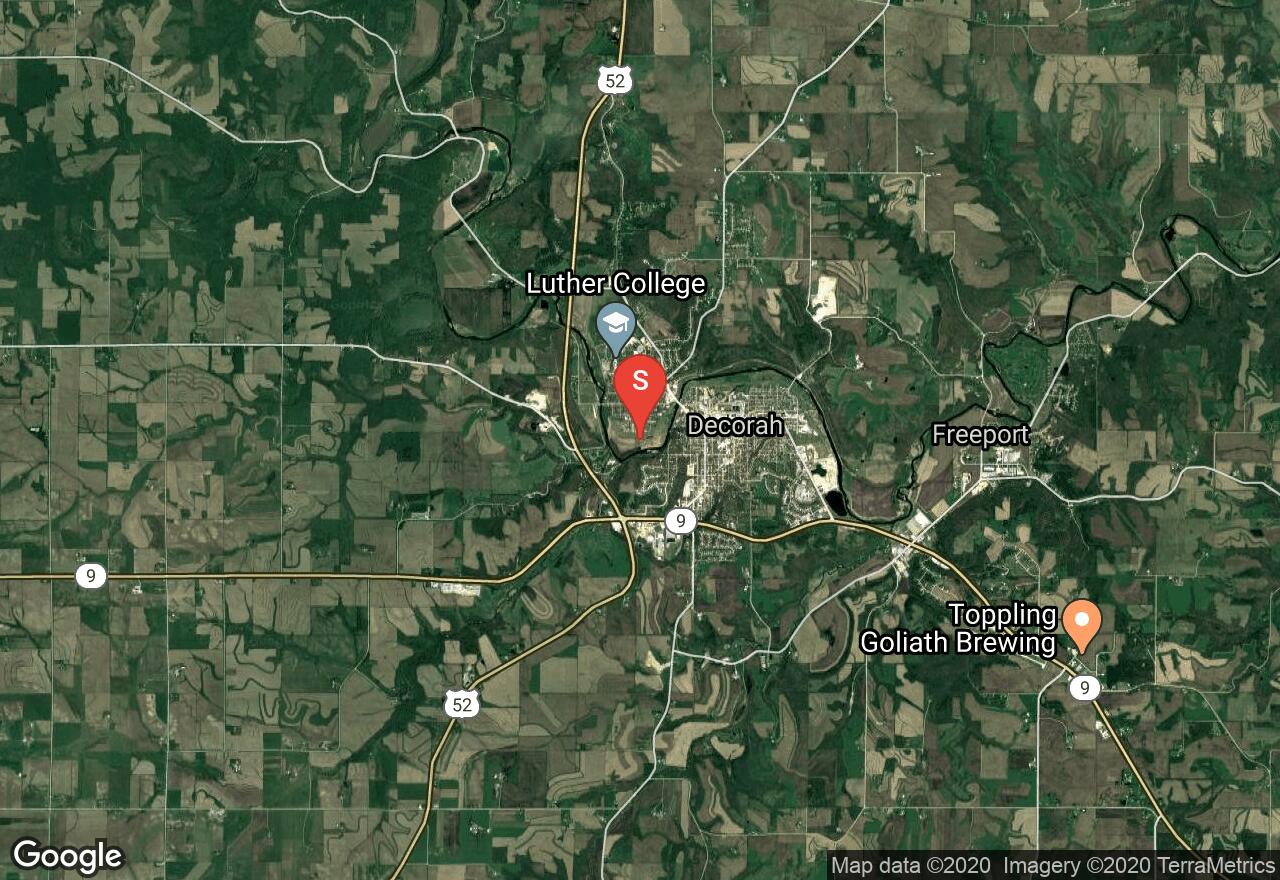
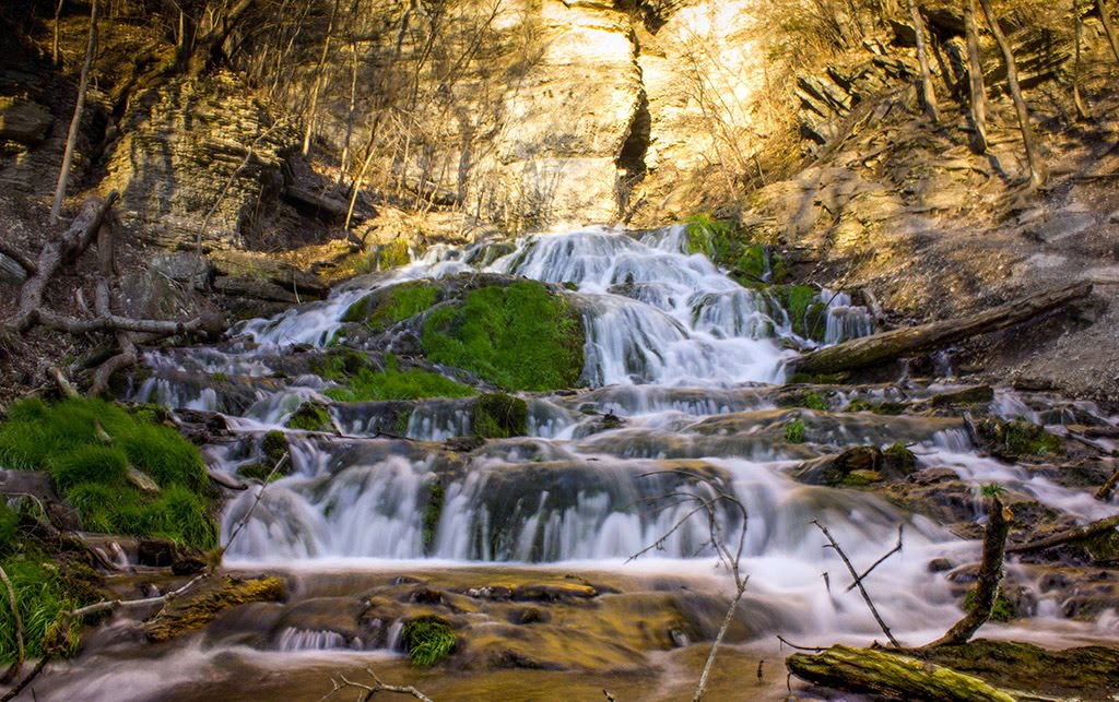
Iowa, Decorah
00 :28 hrs
1.2 mi
0.19256592 ft
Easy
A double track groomed trail, in an open prairie, near the river. Beginners and intermediate skiers will benefit most from this trail. This is one of many ski trails in the neighboring parks.
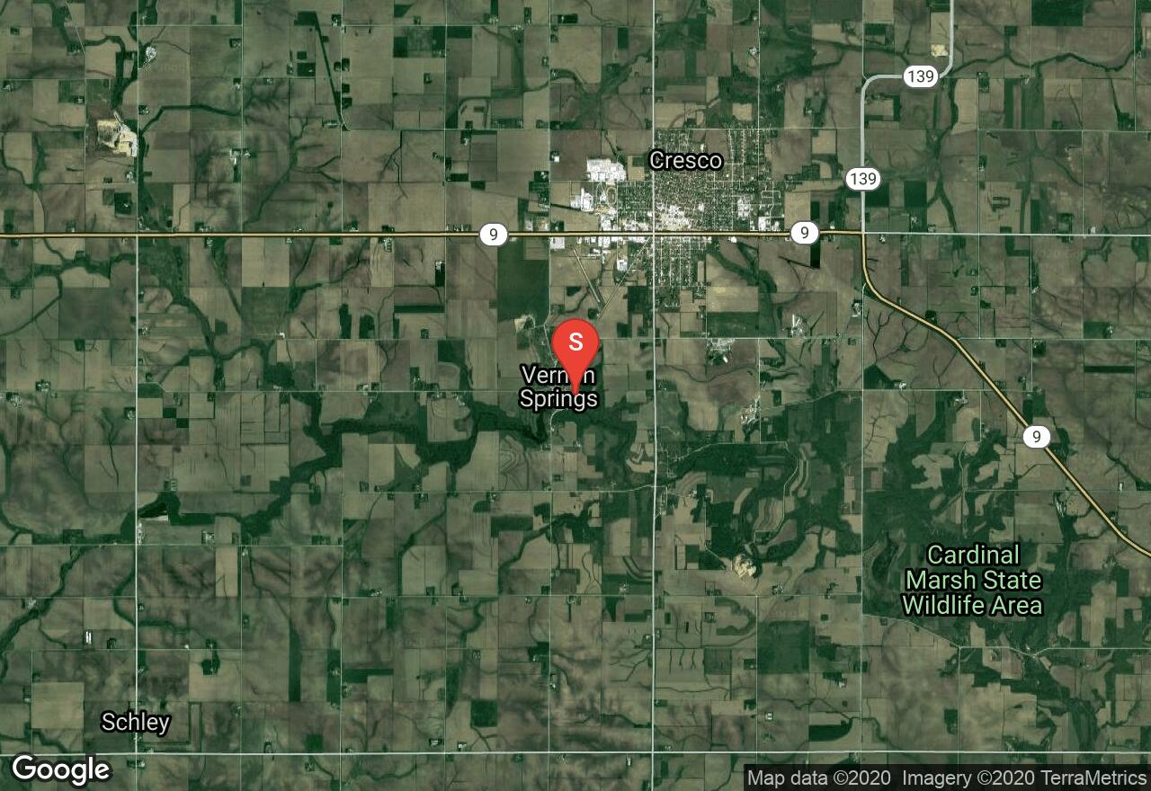
Iowa, Howard County
00 :56 hrs
2 mi
29.95874 ft
Easy
This is a popular spot year round. It is a groomed trail for cross-country skiing and you may see an occasional deer, turkey or other birds and animals that use the park as a habitat.
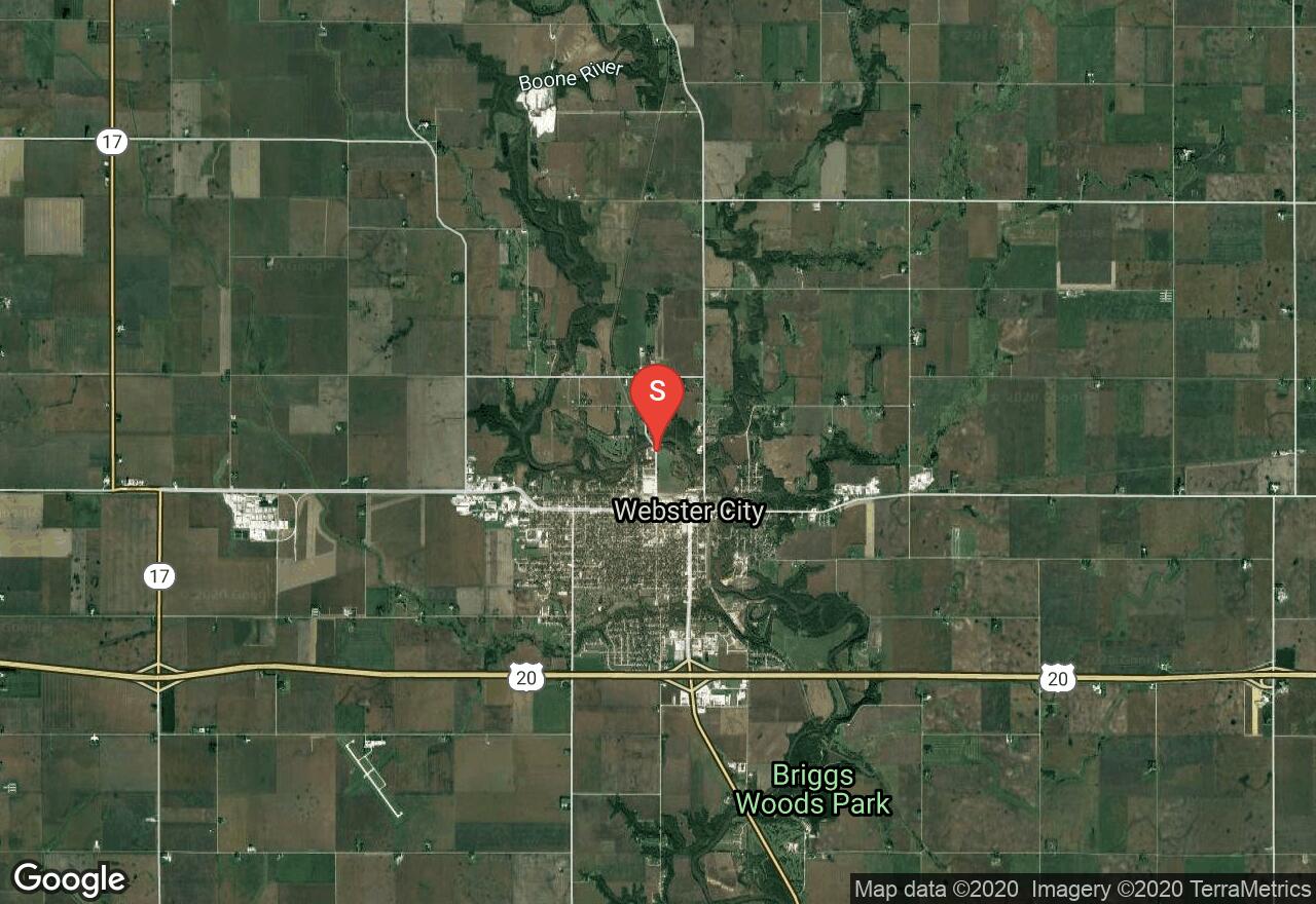
Iowa, Webster City
02 :18 hrs
5.3 mi
20.955688 ft
Easy
Beginning at Nokomi’s Park and ending at Briggs Woods Co Park, this trail goes through woods, has river views, passes by open fields and a business district. Mostly flat, you can ski it one way as it is mapped here or do it out and back. There are several different parking spots throughout the trail if you wish to make it shorter.
Iowa, Forest City
01 :43 hrs
4.1 mi
9.422699 ft
Easy
The trail is groomed for both diagonal stride and skate style skiing. Just north of it, you will find a flat packed trail for skiing and snowshoeing.
Iowa, Polk County
00 :41 hrs
1.6 mi
6.0995483 ft
Easy
In the winter months, you can cross-country ski, go snowmobiling and snow shoeing at the Big Creek State Park. This particular trail is for cross-country skiing only. It is groomed and with a few gentle turns. The elevation doesn’t vary much. This is one of two trails that are used for cross-country skiing, this being the longest one in the park.
Iowa, Polk County
02 :32 hrs
5.8 mi
26.339462 ft
Moderate
This is a year round trail, used for hiking, mountain biking, cross-country skiing, snow shoeing and when there is enough snow, snowmobiling. The views of the lake are beautiful. Please call the park ranger for trail conditions before you head out there.
Iowa, Linn County
00 :28 hrs
1.1 mi
9.551056 ft
Easy
This is one of the smaller trails of the Morgan Creek Park. It is mostly flat and groomed for cross-country skiing. It connects to other trails that can make the adventure longer than what is mapped in here. Please check in when weather conditions are extreme to see if the park is open.
Iowa, Winneshiek County
02 :03 hrs
1.7 mi
25.743134 ft
Hard
You will ski around the lake through open areas and small forests of hardwood trees. There are a couple of good climbs and descents. With views of the lake, it is beautiful year round.
Iowa, Winneshiek County
00 :56 hrs
2.4 mi
11.470581 ft
Easy
Something unique about this trail is that ¾-mile is lighted for night skiing until 11:00 p.m. It has a skating lane. A beautiful trail that is groomed double track. It is a good place for beginners. You can make it a one way as it is mapped here, choose to make it an out and back or beginning at either end.
Iowa, Polk County
00 :29 hrs
0.6 mi
4.5080566 ft
Easy
In the winter months, you can cross-country ski, go snowmobiling and snow shoeing at the Big Creek State Park. This a multi use trail, shared by hikers, bikers, cross country skiers and snow shoers. The trail is groomed. The elevation doesn’t vary much. It is the shortest trail for cross country skiing in the park.
Illinois, Henry County
06 :46 hrs
34 mi
23.065475 ft
Extreme
The Hennepin Canal Trail is a trail that spans multiple counties in Illinois as it follows a canal that makes its way from the Mississippi River east to the Illinois River with a connecting feeder canal trail that also connects from the north. This section starts in the western portion of the trail at Lock 29 and travels through the remote rural areas on its way to the turnaround point at the feeder basin where the feeder canal comes to a convergence with the main canal. There are limited pit stops and access areas located right along the canal trail for water, bathrooms, or food so be sure to come prepared beforehand. The trail provides scenery of the canal all along the path with sections through wooded terrain and lots of open rural scenery. From the feeder basin the trail can be continued for many miles to the east or the north giving riders the option of customizing a longer trip. The trail is mixed asphalt and crushed limestone and is very level making it a good option for riders of all skill levels.
Iowa, Johnson County
01 :37 hrs
4.8 mi
21.71228 ft
Moderate
Birdwatchers can see almost every bird native to the region. There are multi-use trails in the park and single use. This in the only trail where mountain biking is allowed; and in the winter, this is one of two trails where snowmobiling is allowed. Bikers, yield to hikers. And, there is parking available at both ends. Great lake views during the whole hike.
Iowa, Decorah
09 :06 hrs
33.9 mi
125.360535 ft
Moderate
A ride that will take on you on roads shared with cars and on the Prairie Farmer Trail. The surface is made of paved roads and crushed limestone. The climb is steep and long. The scenery changes from farm fields, city neighborhoods and business district. There are restroom facilities and drinking water at the trailhead.
South Dakota, Lincoln County
00 :57 hrs
3.7 mi
82.97064 ft
Hard
A network of multi-use trails travel over rolling hill terrain in Newton Hills State Park offering some fun and challenging ride option for mountain bikers. The marked singletrack trails travel through forested areas and open meadows with lots of short but steep climbs and descents. Trail conditions may be muddy at times with small obstacles along the way. The trails can be used to customize multiple shorter loops or one long loop. The trails are The state park also offers camping and picnic areas. The trails are also open for hiking and horseback riding so watch out for other users along the way. There are some other connecting trails to the south but some allow hiking only.
Iowa, Burlington
00 :30 hrs
2 mi
39.595657 ft
Easy
Starr's Cave Preserve Trail is beautiful with limestone bluffs shadowing Flint Creek. During the winter you can cross country ski to explore the trails.
Iowa, Maxwell
01 :42 hrs
4.9 mi
38.16284 ft
Moderate
The surface is crushed limestone. This is a stretch of the trail, which is mapped as one way, there is parking at both ends. You will pass rolling hills of farmland, thick wooded forest and prairies. Hikers, cross-country skiers and cyclists use this rail to trail path. On the side there is a trail of mowed turf that is used by equestrians and snowmobilers.
Iowa, Cedar Falls
04 :34 hrs
17 mi
11.959808 ft
Easy
A ride for spring, summer or fall, the scenery is beautiful at any time. It connects several parks riding through prairie, thick wooded areas, and neighborhoods, going by the Cedar River and going around the Big Woods Lake. This might be the very best ride in Iowa. Because of the parks, it goes through, you have facilities and drinking water throughout the ride.
Iowa, Cedar Falls
01 :22 hrs
4.1 mi
4.054596 ft
Moderate
The park is known for it’s fishing and camping. The trail goes around and over the lakes. Surrounded by hardwood forest, this is a quick get away from the city with wildlife viewing opportunities in their natural habitat. Camping is popular, first come first serve. There are two boat ramps with day parking next to it.
Iowa, Tama County
00 :28 hrs
1.4 mi
3.098999 ft
Easy
Hikers, cross-country skiers and hunters are welcome. Be aware of ticks and poison ivy. Going around the lake, with thick woods surrounding it for most of the hike, you have great views the whole time. If you choose to stay overnight, there is camping available and cabins for rent. The lake provides good fishing and in the winter months you can also do sledding and ice skating.
Iowa, Waterloo
01 :21 hrs
2 mi
2.9075928 ft
Moderate
Rich in fauna and vegetation, this is a beautiful path to hike. A floodplain forest, with red cedar trees, with a large deer population; you can find over 180 species of birds and during spring, there are a lot of wildflowers. In the winter months, you can also cross-country ski and snowmobile. This trail can be as long a hike as you want it to be, this map only shows part of it.
Iowa, Waterloo
01 :04 hrs
1.6 mi
0.6439514 ft
Moderate
Rich in fauna and vegetation, this is a beautiful path to hike. A floodplain forest, with red cedar trees, with a large deer population; you can find over 180 species of birds and during spring, there are a lot of wildflowers. In the winter months, you can also cross-country ski and snowmobile.
Iowa, Waterloo
00 :42 hrs
2.6 mi
1.5331726 ft
Easy
The park has several trails that are short and multi-use. This mapping illustrates those trails. You can also connect to the Cedar Valley Lakes Trail, which is several miles long. While biking, enjoy the views of lakes, wooded forest and wildlife. These trails are shared with hikers, cross-country skiers, snowmobilers and snowshoers.
Iowa, Delaware County
01 :53 hrs
5.4 mi
29.200256 ft
Moderate
You will share this trail with equestrians, mountain bikers, snowmobilers, cross country skiers and snowshoers. During spring, part of the trail will be very muddy and wet. During winter, the park closes its roads, being open only for cross country skiers, snowshoers and snowmobilers. You may encounter poison ivy, ticks and very steep rock faces.
Iowa, Warren County
01 :04 hrs
3 mi
40.95706 ft
Moderate
A rugged trail made of dirt. Hunters are allowed during hunting season. With thick lush vegetation, you will see different hardwood trees and different types of flora. Be prepared to go uphill, cross bridges and see wildlife. If you pay attention, you will hear birdcalls.
Iowa, Warren County
04 :32 hrs
6.8 mi
8.979248 ft
Hard
As you hike through the countryside, you will enjoy wildflowers and herons swooping over the open fields. Cyclists and cross-country skiers share the trail. It is a long hike. No restroom facilities or drinking water along the way.
Iowa, Winnebago County
00 :51 hrs
2.4 mi
31.37851 ft
Easy
The park has many trails and some are multi use. The lake is great for fishing. This is a multi-use trail, hiking, equestrian and cross-country skiing. In the winter months, ice fishing, ice-skating, cross-country skiing, sledding and snowmobiling are allowed, with a place to warm up afterwards. The whole park has a thick forest of hardwood. Come during spring when wildflowers are in bloom. Also, be mindful that during hunting season, the north side of the park is open to public hunting.
Iowa, Mason City
01 :18 hrs
1.9 mi
3.1403198 ft
Moderate
With trails that intertwine, this park is a good spot in the city for a walk about in nature. With wooded patches, and adjacent to the Winnebago River, this mapping shows you the perimeter of the park’s trails. With river views and heavily wooded areas, your hike is a great getaway from the busy city life.
Iowa, Clear Lake
01 :58 hrs
5.9 mi
8.606049 ft
Hard
Going through farmland, this adventure has no shade throughout. Mostly flat and paved, the hikers, cyclists, in-line skating and cross-country skiers share the path. There is parking at both ends, which allows you to choose to make it a one-way hike (this is how it is mapped) or an out and back trail, if you are looking for distance.
Iowa, Tama County
00 :49 hrs
1 mi
23.000366 ft
Easy
There is something for everyone to do year-round. Hikers, snowmobilers and cross-country skiers share this trail. During spring, the wildflowers are abundant. Through the path, you will find plenty of wildlife to observe. A great trail for Birdwatching also. Camping is available near this trail.
Iowa, Winnebago County
00 :36 hrs
1.7 mi
11.957306 ft
Easy
The park has a mixture of wetlands and uplands vegetation, which provides a great habitat for wildlife. Hikers, in-line skaters, cycling and cross-country skiers share the trail. It is a short hike, paved and with lake views for the duration of the adventure.
Iowa, Johnson County
00 :17 hrs
0.7 mi
35.279587 ft
Easy
You will hike on uneven ground, with steep hills and sometimes muddy. There is something for everyone throughout the year. In the spring, look for the woodland wildflowers and migrating birds; plenty of wildlife to observe through the summer months, great colors during fall and cross country skiing and snow shoeing during winter.
Iowa, Jackson County
00 :45 hrs
1.9 mi
64.52574 ft
Easy
With caves to explore, a winding river and a crude narrow trail. You will share this adventure with cross country skiers, birders, climbers, snowshoers and equestrians. During spring, there are wildflowers, during summer you have prairie flowers, beautiful fall colors and during the winter cross-country skiing and snowshoeing.
Iowa, Des Moines
00 :59 hrs
2.8 mi
23.362915 ft
Moderate
Also known as the East River Trail, at its northern end, it connects to the Neal Smith Trail. The path goes through the heart of Des Moines. At this trail’s midpoint, you can cross the river on the Union Railroad Bridge, which is for pedestrian use. You will pass several points of attraction in Des Moines and enjoy river views throughout the hike. Hikers and bikers share the trail.
Iowa, Humeston
08 :29 hrs
15.7 mi
- ft
Easy
The surface of this path is cinder. The views are prairies, farmlands, wooded patches and wildlife to be seen. A rail to trail adventure, you will find hikers and cross-country skiers. There are no facilities or drinking water at either end. It can be done out and back or one-way. There is parking at both ends.
Iowa, Jackson County
00 :43 hrs
1.9 mi
56.225906 ft
Easy
One of the trails of Bellevue State Park, you will share it with snowmobilers and cross-country skiers. The park has a butterfly garden, which is best to visit during May through September. From this trail you will have views of the Mississippi River.
Iowa, Des Moines
00 :36 hrs
3 mi
6.0098267 ft
Easy
You will ride through the woods, bridge crossing over Raccoon River, by neighborhoods, commercial area and a lake. The surface of the trail is asphalt. Riding by the river for most of the trail gives you great views with rich vegetation and wildlife.
Iowa, Davenport
03 :60 hrs
7.5 mi
26.863876 ft
Hard
The Duck Creek Trail can be an out and back or one way trail. On this mapping, it is an out and back. You will cross the river, go through wooded patches; ride by neighborhoods, commercial areas and by parks. The path is paved, mostly flat and free of obstacles.
Iowa, Harrison County
02 :31 hrs
4.8 mi
31.079803 ft
Easy
The surface of this path is composed of ballast, mowed grass and dirt. For biking, please use fat tires. Be prepared to share the trail with hikers, cross-country skiers and snowmobilers. The ride takes you through farmland, wooded patches and open prairies. Some of the trail is on shared road.
Iowa, Carroll County
01 :20 hrs
3.9 mi
11.652771 ft
Moderate
This park has a couple of different things to offer. Equipped with a farmstead museum, which displays farming equipment that dates back to 1880s; and wildlife exhibits where you can see 35 species of exotic and native animals and birds. You can also do some sledding, cross-country skiing, snowshoeing and ice fishing during the winter months. During the summer months, you may enjoy the fishing, swimming, hiking, biking and camping.
Iowa, Davis County
02 :04 hrs
6.1 mi
17.144531 ft
Hard
There is an abundance of wildlife to observe. The park has very dense woods. Boats are allowed on the lake at no wake speeds. If you don’t have a boat, you are welcome to rent one. There are cabins available for overnight stay. During the winter months there is cross country skiing and snowmobiling.
Iowa, Mitchell County
01 :40 hrs
3.3 mi
21.533173 ft
Easy
You will enjoy a ride next to the river with lush vegetation and thick woods to ride through. Equestrians, hikers and cross-country skiers also use the trail. No motorized vehicles allowed. The path is made from limestone. Another activity to enjoy on this trail is Birdwatching.
Iowa, Winnebago County
00 :32 hrs
0.7 mi
8.971069 ft
Easy
The park has many trails and some are multi use. The lake is great for fishing. This is a single use trail. In the winter months, ice fishing, ice-skating, cross-country skiing, sledding and snowmobiling are allowed, with a place to warm up afterwards. The whole park has a thick forest of hardwood. Come during spring when wildflowers are in bloom. Also, be mindful that during hunting season, the north side of the park is open to public hunting.
Iowa, Sibley
02 :19 hrs
4.3 mi
39.071777 ft
Easy
The surface is natural-groomed. To ride on this trail, use fat tires. The path is shared with hikers, cross-country skiers and equestrians. As far as vegetation goes, you will leave the city and see lots of farmland. There are a few trees on the path. During the hot weather months, bring plenty of water and wear sunscreen.
Iowa, Fremont County
01 :32 hrs
5.9 mi
60.588776 ft
Easy
Waubonise State Park biking trail explores the gorges and valleys riding on a natural surface trail. Fat tires are required and you will share the trail with hikers, equestrians and snowmobilers during the winter. The scenery is beautiful; at the visitor center, you can collect information on the park’s plants and trees.
Wisconsin, Grant County
01 :42 hrs
2.5 mi
5.1427155 ft
Moderate
Berghum Bottoms is a remote stretch of river front land at the base of wooded bluffs and is truly a gem. This hike follows a narrow, unmarked path but is basic in direction and very simple to follow. Walk east, with the bluffs rising to your right and the river and its floodplain forest to the left. Keep close to the base of the bluff but do not ascend and do not venture into the flood plain. The path splits after about a mile and you will take the right branch down to a landing on the river, a great place to pause and soak in the Wisconsin River views and watch the raptors and waterfowl cruise the river corridor. Next, find a narrow path leading into the woods that will bring you to an old road, leading east along the base of the bluff. A good turn-around spot is a notable washout at the mouth of a ravine.
Iowa, Emmet County
00 :21 hrs
1.1 mi
2.8527222 ft
Easy
Fort Defiance has camping sites. There are several trails around the park, some are for hikers only and some are for hikers and equestrians. In the winter, cross-country skiing is allowed. The trails have a lush cover of vegetation and trees. During spring, enjoy the wild flowers, and the endangered prairie bush clover. This is a great place to relax. On this path you will find hikers and equestrians.
Wisconsin, Grant County
02 :29 hrs
6.3 mi
128.31358 ft
Hard
This hike features broad views of the confluence of the Wisconsin and Mississippi Rivers from tall bluffs, Native American mounds, notable bird-watching, wildflowers, and hardwood forests. Every stretch of this hike possesses something special. Throughout the hike there are two 500-foot climbs, beautiful descents into wooded ravines, caves, and hotspots for bird-watching, especially the colorful warblers during spring migration. Take time to really notice the beautiful scene that is ever-changing and always surrounding you.
South Dakota, North Sioux City
01 :59 hrs
6 mi
4.821533 ft
Hard
Adams Homestead and Nature Preserve covers 1500 acres along the Missouri River and offers a network of trails that explore an area of diverse natural terrain. The River Loop follows a gravel trail on the south side of Mud Lake that travels through both prairie and forest terrain down to the Missouri River. The trail has lots of small ups and downs but no major hills making it a good choice for hikers of all skill levels. The trail continues to the north up past the lake making it easy to customize a much longer hike if desired.
Iowa, Henry County
02 :02 hrs
5.9 mi
27.353912 ft
Moderate
Hikers and mountain bikers share this trail. In the winter, you also find great cross-country skiing. You will go up and down ravines as you hike. During spring, the wild flowers cover the ground and birds find their home in the forest. You will find a rich variety of rocks and vegetation as you hike. Fees only required for camping.
Iowa, Emmet County
00 :27 hrs
1.3 mi
10.794067 ft
Easy
Fort Defiance has camping sites. There are several trails around the park, some are for hikers only and some are for hikers and equestrians. In the winter, cross-country skiing is allowed. The trails have a lush cover of vegetation and trees. During spring, enjoy the wild flowers, and the endangered prairie bush clover. This is a great place to relax. On this path you will find hikers and equestrians.
Iowa, Des Moines
00 :44 hrs
1.1 mi
3.298355 ft
Easy
Completely paved and wide, this is an easy hike/ride, adjacent to the Four Mile Creek. It has patches of thick wooded forest, where the trees form a canopy overhead and a small open field to hike, ride through. Hikers, in-line skating, cross-country skiers and cyclists use the trail.
Iowa, Fort Dodge
01 :38 hrs
4.7 mi
41.08203 ft
Moderate
A rail to trail, with cinder surface and parking at both ends. You will go by parks, golf course, wooded areas so thick that the trees will canopy overhead. You will also find the Fort Dodge Museum with a pioneer village and collections of pioneer, military and Native American Exhibits.
Iowa, Cedar Rapids
00 :55 hrs
2.8 mi
6.164688 ft
Easy
You will share the trail with mountain bikers, equestrians and cross-country skiers. During the summer, the shady parts of the trail are cool and the trails are dry. Wear DEET because of the mosquitoes, long pants and long sleeve shirts are recommended.
Iowa, Des Moines
05 :43 hrs
16.7 mi
54.905228 ft
Expert
Here we mapped the south portion of the Neil Smith Trail. There are several parking spots throughout for those that want to do a smaller portion of the hike. You can get connected to the Inter-Urban Trail and the Trestle to Trestle Trail. Many use this path to commute daily. There is an abundance of wildlife to observe, the vegetation is plenteous and provide great scenery. Hikers, bikers and joggers share this path. Because of its proximity to the river and lake, floods are common on this path, it is advised to check on the Des Moines Trails website for information on closed stretches.
Iowa, West Des Moines
00 :51 hrs
2.6 mi
3.739914 ft
Easy
A black walnut forest, this trail is located next to the Raccoon River. With a boat ramp on the west side of the park, it allows fishermen to put in their boats or fish from the riverbanks. Birdwatching is excellent with more than 90 species of birds having been identified in the park. Cross-country skiing is particularly good here. During springtime, enjoy the wild flowers.
Iowa, Clarksville
05 :25 hrs
8.1 mi
9.75882 ft
Expert
With some climbing, this trail offers views of farmland, some hardwood trees along the way and going through town as you start and as you finish it, if you choose to make it out and back as it is mapped. A rail to trail, the surface is crushed limestone. This is one of the segments of a very long path. You can make your hike/ride as long or as short as you would like. There is parking at both ends of the trail.
Iowa, Des Moines
03 :48 hrs
5.5 mi
46.3217 ft
Expert
A long paved path. Spring through fall is the best time to hike this trail. Watch out for cyclists. During winter, cross-country skiing is very good. There are no fees to hike. No facilities or drinking water.
Iowa, Davenport
03 :10 hrs
5.9 mi
6.882492 ft
Moderate
On the Riverfront Trail you will cross railroad, go by neighborhoods, go over a bridge to cross part of the Mississippi River, ride through parks, and have a pleasant ride. Paved or concrete throughout, without climbs and with great scenery to observe, this is not a very long path to bike. In this mapping, it is shown as an out and back, if you choose, you can make it one way, parking available at both ends.
Iowa, Coulter
12 :28 hrs
37.6 mi
99.06424 ft
Extreme
A rail to trail, this mapping has the part of the trail that is developed. It connects several small communities and it goes through lots of prairies of farmland. Very little shade along the day, bring plenty of drinking water and in the summer months wear sunscreen.
Iowa, Jasper County
03 :24 hrs
9.9 mi
17.64096 ft
Hard
Hikers will share this trail with equestrians and cross-country skiers. There are poison ivy and ticks on the path. Cross-country skiing is excellent in the winter months. Great spot to hear birds singing. No fees or permits required to hike.
Iowa, Webster County
02 :32 hrs
7.4 mi
48.067017 ft
Hard
Hikers, equestrians, hunters, mountain bikers, cross-country skiers and snowmobilers share the trail year-round. Be aware, during early spring, trails are muddy. Also, be mindful that ticks and poison ivy are present. During hunting season watch out for hunters, wear bright orange clothing and avoid white. This park has something different, two shooting ranges. This trail connects to the swamp trail. Wetlands ahead!
Iowa, Des Moines
00 :40 hrs
2 mi
5.395935 ft
Easy
This is a very popular park due to the number of activities it offers, because of that this is location is crowded most of the time. The bridge on this hike offers great views of the lake of downtown Des Moines. The trail is paved and it provides benches to stop and rest.
Iowa, Webster County
04 :08 hrs
12.1 mi
23.329834 ft
Expert
Hikers, equestrians, hunters, mountain bikers, cross-country skiers and snowmobilers share the trail year-round. Be aware, during early spring, trails are muddy. Also, be mindful that ticks and poison ivy are present. During hunting season watch out for hunters, wear bright orange clothing and avoid white. This park has something different, two shooting ranges. This is the longest trail of the park, with constant views of the lake and Birdwatching opportunities.
Iowa, Van Buren County
00 :25 hrs
1.2 mi
9.366989 ft
Easy
Hikers and cross-country skiers share this trail. Be on the lookout for ticks and poison ivy. Throughout the trail you have views of the lake.
Iowa, Des Moines
00 :30 hrs
1.4 mi
22.779724 ft
Easy
Be prepared to do some wood climbing. The trail is well marked. During winter, cross-country skiing is good. Dogs are permitted on a leash. It can get muddy, be mindful of that, and wear good shoes. There are facilities and drinking water in the park, but nowhere near the trail or trailhead.
Iowa, Plymouth County
02 :03 hrs
5.3 mi
84.08032 ft
Hard
The path consists of old gravel roads and mowed firebreaks. It is open year-round. There will be hikers, hunters and cross-country skiers. Watch out for poison ivy, ticks and sunburn on exposed ridges. No fees or permits required.
Nebraska, Cass County
01 :22 hrs
5.3 mi
48.4505 ft
Expert
In a heavily wooded and fairly mountainous region of Nebraska, the Platte River State Park is situated along the Platte River and nearby both cities of Lincoln and Omaha. The trail begins by traveling along the ridge and then spending the majority of the time climbing and descending through technical areas of dense woodland. Be cautious while on the adventure as it can host bikers, hikers, and other types of users simultaneously. Note that a state park permit is required for entry, and bikers are not allowed from Memorial Day - October before 4:00 PM due to horseback riders.
Iowa, Fayette County
01 :31 hrs
5.8 mi
61.707855 ft
Easy
Only fat tire cycling is allowed. You will encounter hikers, cross-country skiers, equestrians and snowmobilers. The surface of the trail is natural. The park has over 20-foot high limestone bluffs and a white pine plantation. You will ride through wooded areas and prairies. A campground is available for those that would like to stay overnight.
Iowa, Howard County
03 :44 hrs
7 mi
12.108704 ft
Easy
Most of the trail is part of an abandoned rail. A small stretch of it is on shared road. As far as flora goes, you will ride through prairie, wetland, farmland, marsh and woodlands. You also may encounter wildlife. The surface consists of crushed limestone throughout and of mowed grass surrounding Lake Hendricks.
Wisconsin, Grant County
01 :03 hrs
2.7 mi
78.80267 ft
Moderate
Nelson Dewey State Park is a delightful mix of history and scenery dedicated to Nelson Dewey, Wisconsin’s first elected governor. The land was once part of Dewey’s 2,000-acre estate and went through a succession of owner’s before the land was purchased for a state park. Today the main park area, with its campgrounds, overlooks, and hiking trails, is across County Highway VV atop the bluff overlooking the Mississippi and Dewey’s Stonefield. This is a comprehensive hike that visits all of the main attractions of the park and traverses the gorgeous wooded ridge. The views over the river are spectacular.
Iowa, Spirit Lake
04 :38 hrs
8.7 mi
16.207794 ft
Easy
The surface of the trail is paved. Some of the time you will be on a road shared with cars going through neighborhoods. Many trails connect to the Iowa Great Lakes Spinal Trail. There are hikers, bikers, rollerbladers, runners and cross-country skiers. Riding by city, farmland and lakes, your views will be beautiful.
South Dakota, Lincoln County
00 :39 hrs
1.6 mi
51.147736 ft
Moderate
This short trail is located in Newton Hills State Park and offers a scenic hike through forested prairie and rolling hill terrain. The interpretive trail is open for hiking only but does connect to a larger network of multi-use trails to the north. Although the hike is short, it does have some fairly substantial steep climbs and descents and can be strenuous at times. The state park also offers picnicing, hiking, and good wildlife viewing.
Wisconsin, Lone Rock
03 :47 hrs
14 mi
13.656082 ft
Moderate
The Pine River Trail travels the course of the Pine River as it flows south to meet the Wisconsin River. On this trail you will be in the midst of some of the loveliest scenery in the state. You will ride past farm fields, the pretty river, and have views of marshes. The trail surface is crushed-limestone and the grades are gentle. You will get a chance to enjoy the beauty of 250-foot river bluffs without having to ride over them.
Iowa, Clive
03 :03 hrs
4.5 mi
15.365555 ft
Hard
Adjacent to the Walnut Creek, the trail goes through a forest of hardwood trees. This path connects to the Des Moines Trail system. Hikers and bikers share the trail. The forest is dense and it forms a canopy overhead. Bring plenty of water, there are no facilities on the trail.
South Dakota, North Sioux City
01 :34 hrs
4.7 mi
3.9335327 ft
Moderate
Adams Homestead and Nature Preserve covers 1500 acres along the Missouri River and offers a network of trails that explore an area of diverse natural terrain. The Lake Loop follows a gravel trail on the west side of Mud Lake that travels through both prairie and forest terrain. The trail has lots of small ups and downs but no major hills making it a good choice for hikers of all skill levels. The trail continues to the south down towards the river for a much longer hike if desired.
Iowa, Guthrie County
00 :29 hrs
1.4 mi
6.5971985 ft
Moderate
Being heavily wooded, the park has a variety of vegetation and wildlife you can observe on your hike. You can almost plan on seeing deer if you take an early morning or evening walk. There is camping available for those that desire to stay overnight. During the summer you can experience GASP (Great Annual Spring Park bicycle ride). If you are a nature lover, the education center offers weekend workshops.
Wisconsin, Mineral Point
12 :37 hrs
46.7 mi
75.01257 ft
Easy
Also known as the Tri-County Trail, this ride is on a former railroad corridor that meanders through the heart of southwest Wisconsin’s Driftless Area, a massive tract of land noted for the rolling hills and rocky outcroppings left untouched by glaciers. On this trail you will cross a total of 57 bridges and overpasses including the 440-foot bridge at Brownstown. Monroe, the trail’s southern end, is known as the “Swiss Cheese Capital” of the United States. You will pass through several other communities, one of which is Mineral Point, one of the state’s oldest communities. It is a historic mining village rich with artist’s studios and galleries and many old homes with have been restored.
Iowa, Minburn
02 :39 hrs
8.1 mi
28.798767 ft
Expert
This is only part of the Raccoon Trail. The total length is over 30 miles. You must obtain a permit to use the trail if you are 18 years old or older. Yearly passes are also available; you may purchase them at businesses or offices along the trail (there are signs displayed to show you where). The surface is asphalt. You will share this path with in-line skating, cyclists and cross-country skiing.
Iowa, Benton County
05 :54 hrs
21.9 mi
25.287994 ft
Easy
Part of this ride is on the Cedar Valley Nature Trail. You may choose to ride it as an out and back on the trail or ride through the rich farmland of Iowa. Enjoy the tree tunnel on the trail and listen to the birds singing. The view of prairies and thick wood forest are beautiful year round. The surface is composed of paved roads and crushed limestone.
Iowa, Monona County
01 :17 hrs
3.3 mi
57.56595 ft
Moderate
Hikers and cross-country skiers share the path. Watch out for ticks and poison ivy. There is camping available. No fees or permits, except for camping or cabin rental. It is recommended that this be an overnight hike.
Iowa, Hardin County
01 :29 hrs
1.9 mi
31.525848 ft
Moderate
You will see lots of white pine trees. Some are over 200 years old. Also, some rare ferns and white birch are on the trail. Adjacent to the park you will find a nine-hole golf course, the Pine Lake Country Club. This is one of the most popular parks in Iowa. There are camping sites for a fee.
Iowa, Lyon County
01 :11 hrs
3.5 mi
9.56604 ft
Moderate
The park has a lot of aquatic activities to explore. Cross-country skiers share the hiking trail, no bikes allowed. Camping is available for those looking for an overnight stay. The path is paved and goes around the lake. A very small part of the trail intertwines with the bicycle trail.
Iowa, Pottawattamie County
05 :16 hrs
10 mi
77.683075 ft
Easy
This is the beginning stretch of this trail. The path is made of limestone screenings. Also, the first 5 miles of this part of the trail, is shared on an adjacent trail for equestrians. On a rail to trail, that is over 60 miles long; you determine how much of it you want to ride. Hikers and cross-country skiers use this trail.
Iowa, Grundy County
02 :40 hrs
8.1 mi
22.164154 ft
Hard
A rail to trail filled with native vegetation and wild life. The trail itself is surfaced with crushed limestone, the sides of it, are mowed grass for equestrian use. It goes through small communities; passes rolling hills prairies of farmland and some stretches are wooded. Hikers, Cross-country skiers, cyclists and equestrians share the path. There is parking available at both ends of the trail. If you choose to do just part of the hike, you may look for parking along the way.
Iowa, Winneshiek County
02 :46 hrs
10.2 mi
23.93393 ft
Easy
The name of the trail tells you the views will be fantastic with rolling farm prairies. This is a rail to trail project, access to it is available throughout it. It connects Calmar to Cresco. The surface is crushed limestone. You will encounter biking, hiking, jogging, skating and cross-country skiing. Dogs are allowed on a leash.
Iowa, Marion County
02 :35 hrs
3.5 mi
12.309143 ft
Hard
This is a multi use trail, which allows hikers, cross-country skiers and runners. There are other paths in the park for equestrians and mountain biking. Occasionally the trails will be closed due to wet conditions. In the park you may do some fishing, camping, boating and Birdwatching.
Iowa, Dubuque County
01 :07 hrs
3.2 mi
40.792755 ft
Moderate
You will hike on dirt trails, mowed footpaths and paved areas. During hunting season watch out for hunters and wear bright orange, avoid white clothing. Be mindful of ticks and poison ivy.
Iowa, Waverly
04 :23 hrs
13 mi
35.51236 ft
Expert
A rail to trail, this mapping has the part of the trail that is developed. It connects several small communities and it goes through lots of prairies of farmland. Very little shade along the day, bring plenty of drinking water and in the summer months wear sunscreen.
Iowa, Blanchard
05 :20 hrs
10.1 mi
57.40332 ft
Easy
The surface is made of limestone screenings. This is the south end of the path. On the North end, the trail is shared with equestrians for the first 5 miles. This cuts through farmlands and some hardwood trees patches. Bring plenty of water and snacks. You will not see towns for long stretches.
Iowa, Mason City
00 :26 hrs
1.3 mi
7.7227783 ft
Easy
The park is a skaters and BMX biking park. However it does have a nice trail that goes around the two bodies of water that can be hiked, cross-country skied or used for snow shoeing. To use the park with BMX bikes or skateboarding, there is no supervision and one must wear the gear required and follow the rules.
Iowa, Dickinson County
00 :34 hrs
1.6 mi
7.1263733 ft
Easy
Hikers, bikers, cross-country skiers, snowshoers, joggers/runners and snowmobilers share the trails. Birdwatchers will be there too. The trails are flat and paved. For some of the path, you will have lake view. There is a patch of woods in the park, which the trail will touch.
Iowa, Franklin County
00 :35 hrs
1.8 mi
4.8097534 ft
Easy
The park has a little something for everyone year round. Cyclists, birdwatchers, youth groups, cross-country skiing share the trail, and there is wildlife to be observed and wildflowers in its season. Going on the dam you will experience a cool mist. Restrooms are closed during the winter months.
Iowa, Bondurant
05 :20 hrs
19.9 mi
60.68492 ft
Easy
The trail is paved from beginning to end. You will share it with rollerbladers, hikers, and cross-country skiers; in the Jasper County snowmobilers. This rail-trail goes through the forested banks and timbered bluff. The scenery of farmland, open spaces and wooded areas, will keep changing as you ride. It is wheel chair accessible.
Iowa, Osage
02 :11 hrs
3 mi
27.725494 ft
Hard
With wooded areas, where the trees are so thick they form a canopy overhead, this trail is located by the Cedar River. For part of the hike, you will have views of the river. Fishing is great in this area. A rail to trail, hikers, bikers and cross-country skiers share the path.
Iowa, Winnebago County
00 :32 hrs
0.7 mi
8.269653 ft
Easy
The park has many trails and some are multi use. The lake is great for fishing. This is a single use trail. In the winter months, ice fishing, ice-skating, cross-country skiing, sledding and snowmobiling are allowed, with a place to warm up afterwards. The whole park has a thick forest of hardwood. Come during spring when wildflowers are in bloom. Also, be mindful that during hunting season, the north side of the park is open to public hunting.
Iowa, Conrad
05 :04 hrs
9.4 mi
- ft
Easy
As you ride, you will enjoy farmland, prairie, open areas and small communities. The path is a rail to trail made of crushed limestone and wide. Hiking and cross-country skiing are present in their seasons. The parking is a little ways away from the trailhead. No facilities or drinking water throughout.
Iowa, Cass County
00 :26 hrs
1.2 mi
24.35437 ft
Easy
There is a campground on the South end of the lake. The northwestern end there is a marsh and an old floodplain forest. Only wakeless speed for the boats on this lake, abundant wildlife to be observed and great fishing.
Iowa, Montgomery County
02 :12 hrs
6.1 mi
32.18741 ft
Hard
A variety of activities for everyone year-round is found at Viking Lake State Park. On the trail, you will see many plants, shrubs and trees. The lake has a boat rental facility; you can swim, camp, fish, kayak and picnic. You can almost plan on seeing ducks, beavers, turkeys, white-tailed deer, shore birds and muskrats. During winter, snowmobiling, cross-country skiing and snowshoeing is available
Iowa, Linn County
03 :06 hrs
8.8 mi
46.909775 ft
Hard
The park has something for everyone year-round. On this multi-use trail, you can hike; do some snowmobiling and cross-country skiing. There is a separate trail for equestrians. The trails may be closed due to being too wet. During hunting season, there are hunters present. Wear bright orange clothing.
Iowa, West Chester
03 :45 hrs
13.9 mi
30.84555 ft
Easy
Most of this rail to trail is made of crushed limestone and some paved asphalt. Fauna and flora are rich and everywhere. You will enjoy wooded forest with your occasional prairie, which will provide you with views of the rolling hills of countryside. There are restroom facilities along the way in the parks throughout the trail.
Iowa, Shelby County
01 :01 hrs
1.4 mi
18.64804 ft
Moderate
A year round park where there is something for everyone. During summer, you can enjoy water activities, hiking, biking and camping. During the winter, ice-skating, snowmobiling, cross-country skiing, snowshoeing and ice boating are available. All trails are open to hikers, mountain biking, cross-country skiing, snowshoeing and snowmobiling.
Iowa, Iowa County
00 :55 hrs
2.7 mi
4.9094696 ft
Easy
Going around the pond, you will find moms with strollers, cyclists, cross-country skiers and in-line skaters. The best time to go on this adventure is July/August; the lilies are in full bloom then. Dogs must be on a leash at all times.
Iowa, Decatur County
00 :57 hrs
2.7 mi
17.402588 ft
Moderate
This part of the trail is for hikers and cross-country skiers. Equestrians use an additional path that can be hiked also. Around the lake, you will have the opportunity of bird watching during spring and fall. Fishing is popular also. Hiking is free, camping a fee is required.
Iowa, Marion County
05 :49 hrs
11.4 mi
52.04019 ft
Easy
Bikers, hikers, in-line skating, cross-country skiers and joggers use the wide and paved path of this trail. Because of its location next to Lake Red Rock and Des Moines River, it is common for this trail to get flooded. Please check on the website for the Lake Red Rock for temporary closures. You will ride through heavily wooded areas; the colors in the fall are beautiful.
Wisconsin, Crawford County
01 :17 hrs
1.3 mi
125.66809 ft
Moderate
This is a great hike up a tall bluff, through some bushes, on a faint foot path to a very rewarding, broad river view and solitude. From the Rush Creek Road, walk east, uphill, on a grassy lane through old fields and then climb a wooded slope. As you walk uphill, keep the drainage to your right and the slope broadens and the top of the bluff nears. Turn right on a rutted jeep road, stay straight at the fork and continue walking on the faint path until you see the woods ending in front of you. The broad open space of the river valley is an abrupt transition from the woods you emerge from and hawks perch in the trees on the edge of the prairie. A slow approach may be worthwhile.
Iowa, Wahpeton
00 :24 hrs
1.1 mi
7.6660156 ft
Easy
The trail is at the opposite side of the lake. It is a self-guided adventure; you can obtain a brochure to help you with the several natural features of the hike. It is a great place to observe wildlife. In the summer months, it provides a shaded setting. During the winter months cross-country skiing is allowed. Over 100,000 boats and fishermen annually visit the lake.
Iowa, Webster County
02 :51 hrs
8.4 mi
46.395264 ft
Hard
Hikers, equestrians, hunters, mountain bikers, cross-country skiers and snowmobilers share the trail year-round. Be aware, during early spring, trails are muddy. Also, be mindful that ticks and poison ivy are present. During hunting season watch out for hunters, wear bright orange clothing and avoid white. This park has something different, two shooting ranges. On this adventure you will walk along the river.
Iowa, Dubuque County
01 :46 hrs
4.7 mi
75.71039 ft
Moderate
The trail takes you by the Dubuque Arboretum and Botanical Gardens. You will walk through dense wooded patches, where there is a canopy overhead. You will go through a prairie grassy area, a neighborhood and back to where you started. Be prepared for a climb.
Iowa, Benton County
06 :01 hrs
22.4 mi
47.90193 ft
Easy
A very long trail with different sections that you can bike, hike, cross-country ski, and jog or run. You will ride by parks, neighborhoods, river, farmlands and woods. The scenery is beautiful, the trail is easy, no obstacles, and there is crushed limestone on the path. Make the ride as long or as short as you want. This mapped section has parking at both ends.
Iowa, Woodbury County
01 :54 hrs
2.8 mi
3.1575928 ft
Hard
With a natural beach, this park is popular during the warmer months. A ramp for boats (you may rent one if desired), there is no limit on horsepower for boat motors). You may hike, have picnics swim and during winter months snowmobiling is allowed. With a concession stand near the beach, food is readily available for purchase. A very popular attraction is Birdwatching.
Iowa, Waterloo
04 :13 hrs
7.9 mi
8.211594 ft
Easy
You will encounter concrete, asphalt, limestone screenings and unimproved surfaces on this path. The trail is longer; this is just a section of it. You will ride by lakes, river, commercial areas, through city parks and neighborhood. The change in climbing is minimal and the scenery is constantly changing as you ride.
Wisconsin, Crawford County
02 :30 hrs
7 mi
104.58707 ft
Hard
The setting of this hike is in a quiet, C-shaped valley and offers a pleasant sense of isolation due to the tall bluffs surrounding it. This route rotates around the base of this headland on two of its sides, past river bottom sloughs, steep forested slopes, and sandstone cliffs before crossing the top of the ridge on its return. You will reach some beautiful vantage points atop the bluffs with great views of the forested ravines and river below. In addition, this is a notable bird-watching area, especially for waterfowl, warblers, great blue herons, gray catbirds, indigo bunting, and American restart warblers.
Iowa, Ringgold County
01 :60 hrs
3 mi
4.617096 ft
Hard
A rail to trail path, made of crushed rock. Hikers, cyclists, cross-country skiers, equestrians and snowmobiling share this path. With the patches of hardwood trees, you will have the opportunity for Birdwatching, In the middle of farmland; you will see prairies and enjoy little elevation change.
Iowa, Boone County
00 :33 hrs
1.5 mi
32.9599 ft
Easy
The park has a lot to offer for everyone year-round. From Birdwatching, camping, running, kayaking, cross-country skiing, hiking, wildlife and wildflowers, you certainly can find something to do in all seasons. The trails are easy mostly flat. With interesting vegetation to observe and it is recommended to bring a magnifying glass x5 or x10 to see the lichens found along the trail.
Iowa, Iowa City
00 :31 hrs
1.4 mi
25.866318 ft
Easy
Hikers and cross-country skiers are welcome on the trail. Be mindful of poison ivy and ticks. Mountain biking, camping, fishing and boating are available at the Park. During hunting season, be mindful of hunters and wear bright colors, avoid white.
Iowa, Linn County
01 :02 hrs
2.9 mi
34.72101 ft
Easy
On the eastern Iowa River, you will have views of it throughout the hike. Be on the lookout for ticks, poison ivy and steep rock faces over the fast flowing river. Be ready to climb steps, rock climbers are welcome and need to get a permit with the rangers. To hike there are no fees.
Iowa, Roland
03 :37 hrs
10.8 mi
15.441223 ft
Expert
The path is made of crushed limestone and mowed grass. As you hike, you will run into mountain bikers (fat tire biking), equestrians, cross-country skiers and snowmobiling. The grass is not mowed regularly, making it very difficult for road bikes. On your path, you will see some native prairie habitat and farmlands.
Iowa, Fort Dodge
00 :41 hrs
0.9 mi
11.52536 ft
Easy
A short trail that runs along the Des Moines River. Going through wooded areas, with little openings and paved, this rail to trail connects to other paths that can make your hike as long as you want. No facilities or drinking water at the trailhead.
Iowa, Orange City
01 :04 hrs
2 mi
31.366547 ft
Easy
On this trail, you will see some prairie vegetation, farmland, and ride on crushed rock. Hikers, cross-country skiers, snowmobilers and an adjacent equestrian trail share the path. It connects Orange City to Alton. There is an open air shelter where you can picnic or rest at the picnic tables. Parking is available at both ends of the trail.
Iowa, Martensdale
02 :22 hrs
8.7 mi
42.942734 ft
Easy
The trail’s surface varies from asphalt to limestone. The elevation has some climbing. Parking is available at both ends. You will ride through some thick wooded areas and some open farm rolling hills. Beautiful countryside. The trail is used for hiking, cross-country skiing and some cycling. This mapping is only a part of the trail. You may continue to ride northbound.
Nebraska, Sarpy County
02 :08 hrs
6.1 mi
21.704132 ft
Hard
This paved trail travels around Wehrspann Lake, an approximate 250 acre lake on the outskirts of Omaha, Nebraska. It's a park-like area that offers other recreation like picnicking, fishing, and no-wake boating. One will experience great lakeside views traveling through open grassy areas along a curvy path. This journey is suitable for all skill levels due to easy accessibility and moderately flat elevation.
Iowa, Taylor County
03 :34 hrs
10.2 mi
27.599243 ft
Hard
This park provides habitat for wildlife and wetland plants. The trail tends to get muddy during spring or after a good storm. Hikers share this trail with equestrian, snowmobilers and cross-country skiers. Watch out for ticks and poison ivy. Fees required for camping.
Iowa, Marshalltown
03 :28 hrs
5.2 mi
7.787903 ft
Hard
The trail is located along the Linn Creek and the Iowa River. It links several parks in the area. Snowmobiles are allowed adjacent to the trail, at the bottom of the dike. The surface is paved. You will hike through prairie grassy areas where you can observe wild flowers. With views of the river and creek throughout, some wooded patches and a little variation on the elevation, this is a good trail to hike, bike, cross-country skiing, in-line skating and snowmobiling.
Iowa, Warren County
01 :29 hrs
4.2 mi
26.928436 ft
Moderate
A birdwatcher’s delight, during spring, birds come in for a break on their trek north and during summer, several species stay behind raising their young. Watch out for ticks and poison ivy. You will cross a bridge, enjoy a constant view of the lake throughout the hike and the rich vegetation. Fees required for camping only.
Nebraska, Omaha
05 :01 hrs
7.4 mi
17.364227 ft
Expert
The Keystone Trail was one of many first modern trails established in Omaha as it treks by a mix of farmland, industrial, and park areas. It is a paved path that travels over and under several bridges. It also winds alongside Little Papillion Creek and provides a surprisingly peaceful journey. There is a shuttle option if one has two vehicles.
Iowa, Humboldt County
04 :39 hrs
17.3 mi
20.082977 ft
Easy
This rail to trail is wide and the surface is crushed limestone. Here we mapped only part of the trail. Throughout it, there are shelter houses, picnic areas, access parking lots and restrooms. With woodlands, wetlands, farmlands and going through small communities, your scenery will be rich and beautiful. The trail crosses 3 rivers on its path.
Iowa, Dubuque County
06 :44 hrs
24.8 mi
143.3919 ft
Easy
A long trail made of crushed limestone. This path was laid on a segment of the Old Chicago Great Western railbed. You will ride through rugged woodlands; enjoy views of the river, limestone bluffs and untouched prairies. Snowmobilers will be found on this trail in the winter season. Be mindful of other users of the trail. Bikers always yield to hikers and runners.
Iowa, Van Buren County
02 :18 hrs
6.7 mi
39.790817 ft
Hard
Hikers and cross-country skiers share this trail. Be on the lookout for ticks and poison ivy. The hike provides you with river views throughout. If you are looking for an easy walk, do this hike.
Iowa, Jackson County
00 :28 hrs
1.3 mi
14.196915 ft
Easy
One of the trails of Bellevue State Park, you will share it with snowmobilers and cross-country skiers. The park has a butterfly garden, which is best to visit during May through September. You will go through meadows and wetlands. No fees required to hike, fees are required for camping.
Iowa, Shelby County
00 :33 hrs
0.8 mi
2.1489258 ft
Easy
A year round park where there is something for everyone. During summer, you can enjoy water activities, hiking, biking and camping. During the winter, ice-skating, snowmobiling, cross-country skiing, snowshoeing and ice boating are available. All trails are open to hikers, mountain biking, cross-country skiing, snowshoeing and snowmobiling.
Iowa, Lyon County
00 :15 hrs
0.9 mi
8.814697 ft
Easy
Hikers, in-line skating and cross-country skiers share this cycling trail. With constant views of the lake, you will ride by wooded areas, open fields and a mix of both. Farmland and prairies surround the park; the lake has many water activities available. If you choose to stay overnight the park has campsites.
Nebraska, Washington County
00 :36 hrs
1.8 mi
19.549927 ft
Easy
Fort Atkinson was the first fort built west of the Missouri River and a reconstruction rests in its place. There are occasional military reenactments around the fort during the spring through fall months. Towards the beginning of the journey, one can see a sculpture representing Lewis and Clark's meeting with the Native Americans. This trail includes dense vegetation; following a dirt/grass path throughout trees and grassland with a few inclines. Note that a State Park Permit and day fee is required.
Iowa, Dubuque
00 :37 hrs
1.2 mi
0.8795166 ft
Easy
Paved all the way through, this is a ride with many different things to see. With views of the Mississippi River throughout, a marina at the end of the path, enjoy the boat traffic; you may see waterfowl and you will ride by a commercial area. Mostly flat and without hills to climb or obstacles to overcome, this is an easy ride.
Iowa, Shelby County
00 :46 hrs
2.2 mi
13.982819 ft
Easy
A year round park where there is something for everyone. During summer, you can enjoy water activities, hiking, biking and camping. During the winter, ice-skating, snowmobiling, cross-country skiing, snowshoeing and ice boating are available. All trails are open to hikers, mountain biking, cross-country skiing, snowshoeing and snowmobiling. This trail will take you by the lakeshore.
Wisconsin, Lafayette County
00 :19 hrs
0.8 mi
38.292877 ft
Easy
Belmont Mound is part of the vast Niagara dolomite escarpment, a rock formation primarily running from Niagara Falls to eastern Wisconsin. The name means beautiful mountain and is covered with oak, maple, walnut, and basswood with white-tailed deer, raccoons, rabbits, wild turkeys, squirrels, and owls calling the woods their home. This hike loops around the mound and reaches a 40-foot observation tower with sweeping vistas of the valley below.
Wisconsin, Grant County
01 :13 hrs
4.5 mi
26.30008 ft
Hard
Wyalusing State Park is one of Wisconsin’s oldest state parks and has magnificent views overlooking the river valley where the Wisconsin and Mississippi Rivers converge. Leave from the Park Office parking area and follow a section of the Walnut Springs Trail to the parking area for the Whitetail Meadow Trail. The Whitetail Meadow Trail rolls gently and usually has a hardpack track on its otherwise grassy surface as it circuits the edge of a field and its mown grassy surface is rough, but otherwise a very easy ride.
Iowa, Pottawattamie County
00 :33 hrs
0.8 mi
2.5028076 ft
Easy
The trails are all multi use, hiking, snowmobiling, cross country skiing and mountain biking are allowed. Camping is available and very popular. If you are planning on fishing at the Missouri River and Wilson Island, you must have an Iowa or Nebraska fishing license. A boat ramp provides access to the river on this trail. North of the Wilson Island is the DeSoto National Wildlife Refuge, where you can enjoy the artifacts of the sunken steamboat Bertrand and educational presentations on the Missouri River and wildlife conservation history.
Iowa, Jefferson County
00 :20 hrs
1.3 mi
17.753052 ft
Easy
On this trail, only fat tires are allowed. Be mindful of hikers and yield to them. You will ride a variety of landscapes. There is plenty of wildlife in the park. Flora and fauna are all around, pay attention and you will hear different birds singing. The trails are well marked and color-coded. You will experience a variety of terrain as you ride on hills, make sharp turns and enjoy the ease of flat ground.
Nebraska, Omaha
02 :34 hrs
3.7 mi
17.933441 ft
Hard
The Keystone Trail was one of many first modern trails established in Omaha as it treks by a mix of industrial and park areas. It is a paved path that also winds alongside Little Papillion Creek and provides a surprisingly peaceful journey. There is a shuttle option if one has two vehicles.
Iowa, Polk County
00 :35 hrs
1.5 mi
13.986282 ft
Easy
An easy trail that passes through a woodland area, follows the Skunk River, and along on open field. Wildflowers and thistles bring a variety of butterflies and birds. The hike begins crossing the Warren truss bridge.
Iowa, Clayton County
01 :16 hrs
4.8 mi
54.839127 ft
Easy
The trail is partially crushed stone and paved road. Fat tire bicycling, hikers, cross-country skiers, equestrians and snowmobilers use the part that is crushed stone. With very small variation on the elevation, it is a good trail to take kids on. Because of its proximity to the river, the trail occasionally floods, check before you go in early spring or after rain.
Iowa, Union County
03 :05 hrs
9.1 mi
5.5620117 ft
Moderate
You will find something for everyone year-round in this park. In the spring, enjoy wild flowers and the wildlife throughout the seasons. At the lake, there is an area that is wakeless and an area for water skiing. The trail is shared with cyclists, runners, cross-country skiers and snowmobilers. Great variety of plants are found on the path.
Iowa, Allamakee County
00 :57 hrs
3.5 mi
102.44478 ft
Easy
The Yellow River Forest is rich in the wildlife and flora. Birdwatchers can see a variety of waterfowl and upland game birds. Bald eagles and the endangered red-shouldered hawk are found in the park. A hardwood forest with prairie sites will give you beautiful views.
Nebraska, Douglas County
00 :57 hrs
1.4 mi
6.964081 ft
Moderate
Winding alongside West Papillion Creek, one will encounter plenty of tree line and city parks along this journey. Located on the edge of a suburban development, this gentle, paved path is used by locals for outdoor enjoyment and exercise. There are also pockets of open area if one chooses to recreate off the path.
Nebraska, Washington County
01 :27 hrs
5.3 mi
1.1960754 ft
Moderate
Made for an easy ride, the Boyer Chute Trail is mainly flat with some possible rough terrain along the way. It's recommended for beginners, provides nice prairie views, and passes through some small woodlands aside the Missouri River. The trail loops around the Boyer Chute National Wildlife Refuge which opens its gates a half hour before sunrise and closes a half hour past sunset.
Nebraska, Douglas County
01 :06 hrs
1.6 mi
6.0942993 ft
Moderate
The Big Papio Trial is paved and built on top of a levee overlooking the Big Papillion River as it follows alongside. It runs through one of Omaha's suburban and industrial areas, but also passes by a park and golf course most of the way. Gentle, smooth, and mostly flat are a few words to describe this journey.
Iowa, Clayton County
01 :16 hrs
4.8 mi
54.839127 ft
Easy
The trail is partially crushed stone and paved road. Fat tire bicycling, hikers, cross-country skiers, equestrians and snowmobilers use the part that is crushed stone. With very small variation on the elevation, it is a good trail to take kids on. Because of its proximity to the river, the trail occasionally floods, check before you go in early spring or after rain.
Nebraska, Sarpy County
00 :38 hrs
1.6 mi
41.877686 ft
Easy
A mix of dirt and crushed limestone, the Schramm Park Trail is fit for those wanting to explore a dense woodland area. There are a fair amount of steep inclines along the journey and a respectable decline towards the end. A State Park Permit and fee is required if parking at the trailhead, however, free parking is available at the old fish hatchery aquarium down the street.
Explore nearby adventures

