Best Crosscountry Skiing in South Dakota
Trying to find the best crosscountry skiing in South Dakota? Bivy has great hiking, biking, paddling, climbing, skiing, riding and more, with hand-curated trail maps, as well as detailed driving directions.
South Dakota, Lawrence County
02 :01 hrs
8.5 mi
317.7577 ft
Moderate
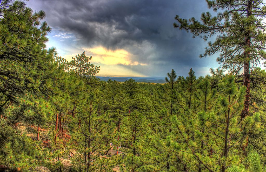
This route starts at the Englewood Trailhead at Brownsville Road and travels northward all the way to the end of the Mickelson Trail at Deadwood. You'll start out going alongside Whitewood Creek and traverse downhill through narrow canyons while enjoying views of the Homestake Gold Mine. There are also three other trailheads that are stationed between Englewood and Deadwood. Be sure to purchase a Mickelson Trail pass at a self-service station along the trail or online.
South Dakota, Pennington County
01 :26 hrs
3.9 mi
53.41919 ft
Moderate
Flume Trail goes from one point to another point with various trailheads and various loops available. It is an historic route that was once a part of a mine in the 1800's. You'll be heading through a dense forest with pine trees, wildflowers, and opportunities to see artifacts from the Rockerville Flume bed that carried water from Spring Creek to Sheridan Lake. This was used to help miners find up to $20 million dollars in gold.
South Dakota, Pennington County
02 :44 hrs
6.7 mi
362.9237 ft
Hard
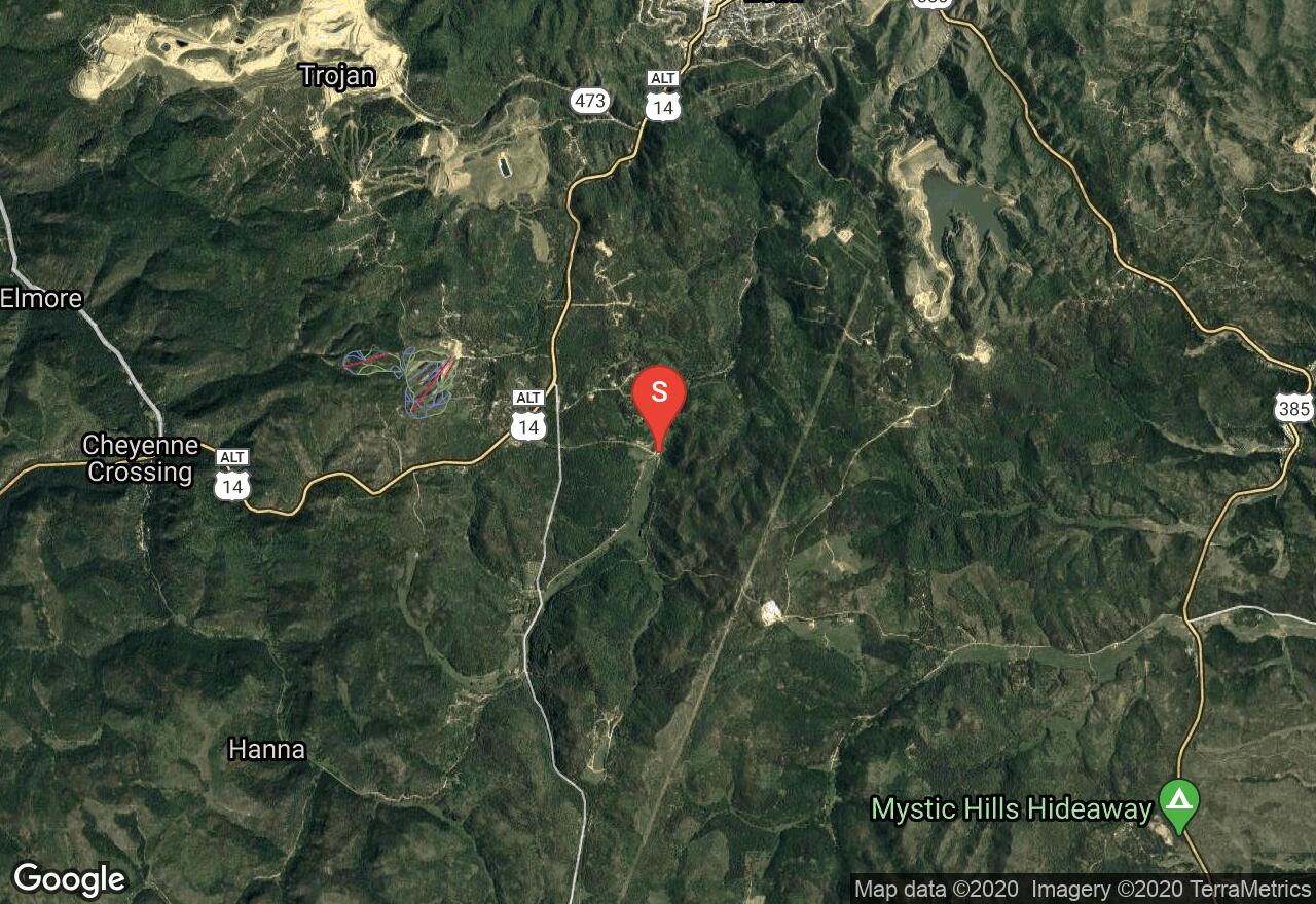
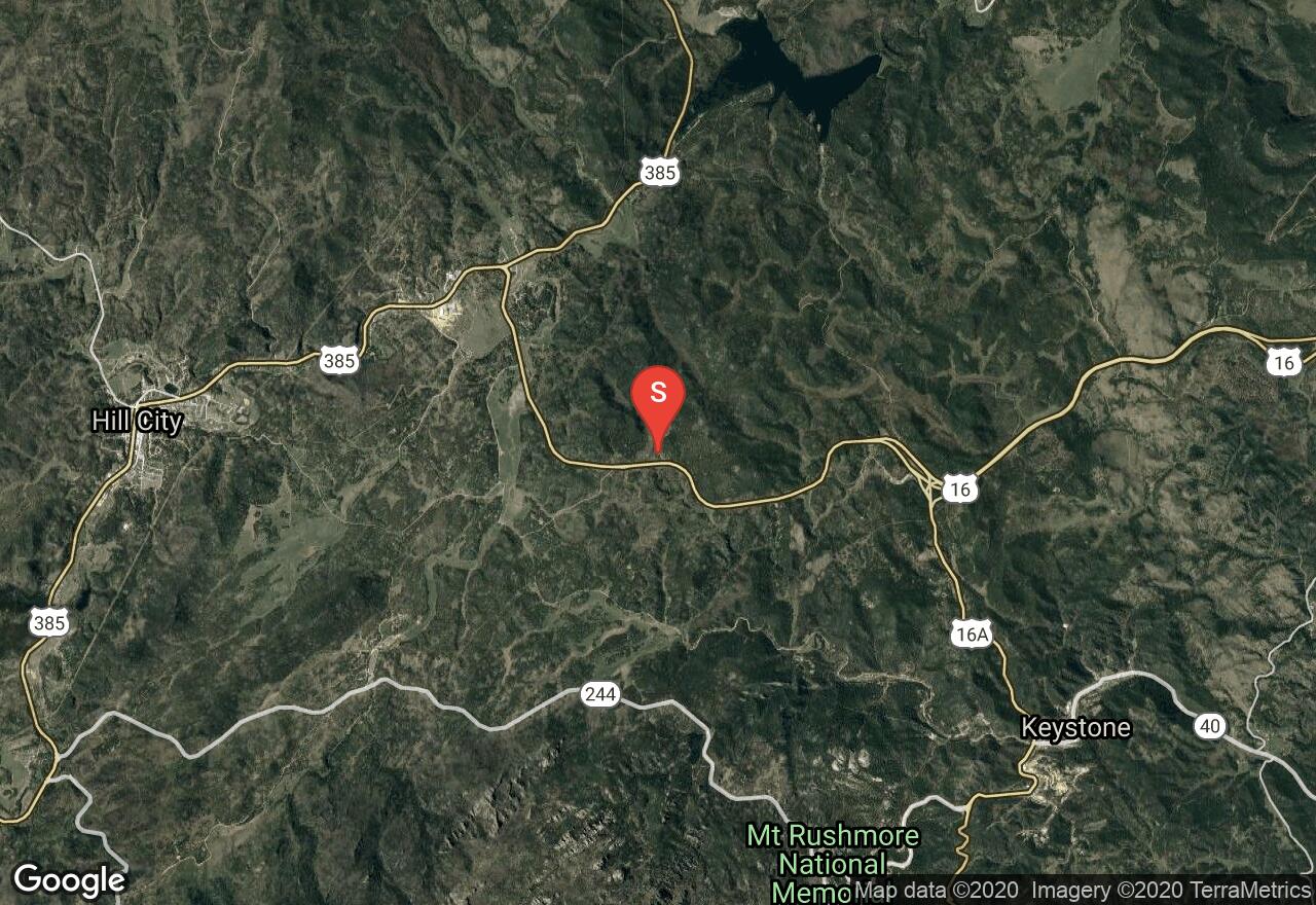
The Centennial Trail is over 100 miles long and was built in 1989 to represent the 100th anniversary of South Dakota's statehood. This part of the trail begins at the Samelius Trailhead located east of Hill City on Highway 16. The route travels through the Black Hills National Forest and climbs halfway through the hike to offer amazing views of Sheridan Lake. Most people will do this route as a one-way day trip with necessary vehicle arrangements, but it can also be done as an out and back.
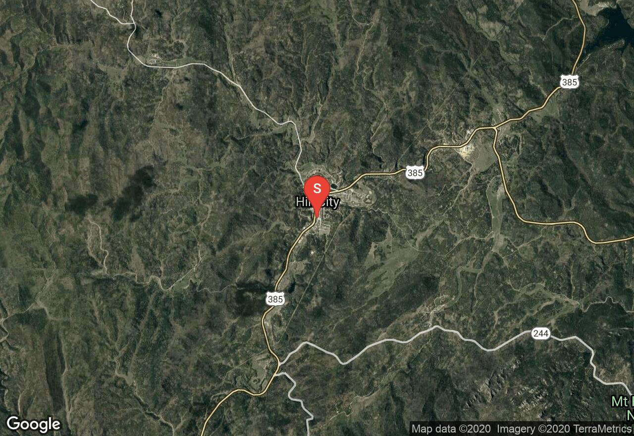
South Dakota, Hill City
07 :46 hrs
14.6 mi
235.04553 ft
Moderate
The entire Mickelson Trail is 109 miles long and has a total of 15 trailheads, 4 rock tunnels, and several railroad bridges. The surface of the route is mostly crushed limestone and packed gravel, along with some sections of dirt road. This route starts in Hill City and travels northward through the Black Hills National Forest to the Mystic Road Trailhead. You'll enjoy the scenery while going alongside a section of Crooked Creek and while coming into the historic mining town of Mystic. You can make this a half-day one way trip or a full-day out and back trip. Be sure to purchase a Mickelson Trail pass at a self-service station along the trail or online.
South Dakota, Pennington County
03 :08 hrs
6 mi
136.71033 ft
Hard
If you are looking for a long and scenic trip in the Badlands, then Sheep Mountain Table will be a great destination for you. The route follows along the old Sheep Mountain Road and is located south of the town Scenic, and off of Bombing Range Road. You'll travel through several different landscapes and gradually climb to a large mesa with a grass-topped summit. There are also great views of surrounding pinnacles and spires.
South Dakota, Hughes County
01 :16 hrs
4.7 mi
1.97229 ft
Easy
LaFramboise Island is a scenic island located on the Missouri River that offers undeveloped natural area for visitors to enjoy. The historic island was mentioned in the journals of Lewis and Clark and is a great destination for hiking, biking, and wildlife viewing. A small network of singletrack trails on the island can be used to customize trips of varying distances. This ride follows multiple trails through dense forest to complete one long loop that covers a good portion of the island. The terrain is very flat with practically no elevation change and no technical sections making it a great choice for beginner riders.
South Dakota, Custer County
03 :39 hrs
8.8 mi
204.70935 ft
Hard
The Centennial Trail is over 100 miles long and was built in 1989 to represent the 100th anniversary of South Dakota's statehood. This part of the trail begins at the Highland Creek Trailhead near the Custer State Park boundary fence. You'll travel through the dense ponderosa pine forest in the rolling Black Hills, along with meadows that are near the creeks. Most people will do this route as a one-way day trip with necessary vehicle arrangements, but it can also be done as an out and back. Custer State Park requires a park entrance license for each vehicle.
South Dakota, Hughes County
00 :29 hrs
1.4 mi
1.1794739 ft
Easy
LaFramboise Island is a scenic natural island located on the Missouri River that offers undeveloped natural area for visitors to enjoy. The historic island was mentioned in the journals of Lewis and Clark and is a great destination for hiking, biking, and wildlife viewing. A small network of trails on the island can be used to customize trips of varying distances. This short loop follows an interpretive nature trail on the northwest side of the island and is a great option for a short introduction to the island.
South Dakota, Edgemont
09 :23 hrs
32.6 mi
462.81213 ft
Easy
The entire Mickelson Trail is 109 miles long and has a total of 15 trailheads, 4 rock tunnels, and several railroad bridges. The surface of the trail is mostly crushed limestone and packed gravel, along with some partial dirt roads. It begins at the town of Edgemont and journeys northward through the Black Hills National Forest along abandoned rail lines, wooden bridges, and then passes by a gravel pit before getting to the town of Pringle. Most people make this a one way day trip with extra vehicles or accommodations at each trailhead. Be sure to purchase a Mickelson Trail pass at a self-service station along the trail or online.
South Dakota, Lincoln County
00 :57 hrs
3.7 mi
82.97064 ft
Hard
A network of multi-use trails travel over rolling hill terrain in Newton Hills State Park offering some fun and challenging ride option for mountain bikers. The marked singletrack trails travel through forested areas and open meadows with lots of short but steep climbs and descents. Trail conditions may be muddy at times with small obstacles along the way. The trails can be used to customize multiple shorter loops or one long loop. The trails are The state park also offers camping and picnic areas. The trails are also open for hiking and horseback riding so watch out for other users along the way. There are some other connecting trails to the south but some allow hiking only.
South Dakota, Pennington County
05 :24 hrs
18.1 mi
377.1609 ft
Moderate
This section of the Mickelson trail begins12 miles north of Hill City on Mystic Road and is within the Black HIlls National Forest. You'll travel alongside Castle Creek and Rapid Creek as you make your way to the historic mining town of Rochford, and then you'll pass by Swede Gulch before getting to the Dumont Trailhead. You can make this a half-day one way trip with a vehicle at each trailhead, or you can make it a full-day out and back trip. Be sure to purchase a Mickelson Trail pass at a self-service station along the trail or online.
South Dakota, Meade County
02 :06 hrs
4.1 mi
58.533203 ft
Hard
This part of the Centennial trail begins at the Alkali Creek Trailhead located south of Sturgis and near Interstate 90. The route traverses through the Dakota Hogback while traveling along Old Stone Road. You may get a glance of some outstanding views of Bear Butte and the surrounding Black Hills as you go through less vegetated areas.
South Dakota, Custer
08 :28 hrs
15.6 mi
257.7777 ft
Moderate
The entire Mickelson Trail is 109 miles long and has a total of 15 trailheads, 4 rock tunnels, and several railroad bridges. This part of the trail is accessed at Harbach Centennial Park in Custer, where you'll then journey northward along Laughing Water Creek and near the Black Elk Wilderness. There are great views of Crazy Horse Mountain and also the granite spires around Buckhorn Mountain. You can make this a half-day one way trip with necessary vehicle arrangements, or it can be done as a full-day out and back trip. Be sure to purchase a Mickelson Trail pass at a self-service station along the trail or online.
South Dakota, Lawrence County
01 :31 hrs
6 mi
181.32764 ft
Moderate
The entire Mickelson Trail is 109 miles long and has a total of 15 trailheads, 4 rock tunnels, and several railroad bridges. The surface of the trail is mostly crushed limestone and packed gravel, along with some sections of dirt road. This route starts at the old lumber town of Dumont and travels fast downhill through the Black Hills National Forest to the Englewood Trailhead at Brownsville Road. Be sure to purchase a Mickelson Trail pass at a self-service station along the trail or online.
South Dakota, Lawrence County
01 :51 hrs
6.9 mi
96.82544 ft
Hard
This loop ride in the Black Hills leads through heavily forested terrain up to the Old Baldy Mountain summit where riders can enjoy some scenic panoramic views of the surrounding area. The trail is very narrow with lots of rocks and vegetation close to the trail resulting in some obstacles and challenging riding surface at times. The trail has some steep descents and climbs as well as it climbs up to the summit and along some smaller ridges. The trail also connects to the Rimrock Trail just across from FS 134 for a longer ride if desired.
South Dakota, Roberts County
01 :34 hrs
6.1 mi
120.63092 ft
Hard
Sica Hollows State Park covers an area of rugged terrain consisting of thickly forested ravines and hillsides and lots of trails that provide some fun and challenging rides. An extensive network of horse trails in the park can be used to customize trips of varying distances and difficulties for biking and hiking. The singletrack dirt and grass trails can be muddy, especially in the shady areas, and possible obstructions and obstacles may also be present on sections of trail. This ride follows multiple trails to complete one long loop around the park and is a good option for experienced riders. The trails are also popular for hiking and horseback riding so watch out for others along the way.
South Dakota, Pennington County
00 :37 hrs
2.4 mi
111.35718 ft
Moderate
Buzzard's Roost is located just a few miles west of Rapid City and offers an extensive trail system for mountain bikers of all skill levels to enjoy. The trails are well-marked and easy to follow. The majority of the trails are singletrack with lots of rocks so be sure to carry along a spare tube or two just to be safe. This ride follows mostly easy to moderate sections of trail in the park but riders looking for a little more challenge can branch off on some of the difficult sections of trail if desired.
South Dakota, Edgemont
08 :43 hrs
16.2 mi
223.98853 ft
Easy
The entire Mickelson Trail is 109 miles long and has a total of 15 trailheads, 4 rock tunnels, and several railroad bridges. The surface of the trail is mostly crushed limestone and packed gravel, along with some partial dirt roads. It begins at the town of Edgemont and journeys northward through the heart of the amazing Black Hills. The easiest way to get onto the trail is to park on the side of 2nd Avenue at the city park and head north toward the railroad tracks. You'll make your trip along abandoned rail lines and cross wooden bridges, and then also pass by the Elk Mountains before getting the Minnekahta Trailhead. You can purchase a Mickelson Trail pass at a self-service station along the trail or online.
South Dakota, Lawrence County
01 :23 hrs
5 mi
161.85986 ft
Hard
The Eagle Cliff Trails is an extensive network of marked trails in the Black Hills National Forest that are popular for biking, hiking and cross-country skiing. Totaling more than 20 miles, the trail system can be used to customize trips of varying distances and difficulties. The terrain covers lots of rolling hills that can provide some challenging rides. There are multiple trailheads and access points so the trip options are abundant. The trail surfaces and conditions will also vary with some possible muddy sections and obstructions along the way. This loop ride covers an intermediate 5-mile loop but for riders exploring a lot more of the area, pay attention to signs and distance covered to ensure you can get back to where you started before wearing yourself out too much.
South Dakota, North Sioux City
01 :59 hrs
6 mi
4.821533 ft
Hard
Adams Homestead and Nature Preserve covers 1500 acres along the Missouri River and offers a network of trails that explore an area of diverse natural terrain. The River Loop follows a gravel trail on the south side of Mud Lake that travels through both prairie and forest terrain down to the Missouri River. The trail has lots of small ups and downs but no major hills making it a good choice for hikers of all skill levels. The trail continues to the north up past the lake making it easy to customize a much longer hike if desired.
South Dakota, Sioux Falls
00 :26 hrs
1.3 mi
2.3900452 ft
Easy
Sertoma Park is located along the Big Sioux River and offers some scenic nature trails for hiking in an otherwise suburban area. The park offers multiple shorter loop trails that can be hiked individually or combined for a longer hike. This hike follows the Woodland Trail and a segment of the Prairie Trail to complete one longer loop in the area. The dirt/gravel trails are fairly flat, wide, and easy to follow making the hike a great choice for beginner hikers.
South Dakota, Hughes County
01 :34 hrs
4.7 mi
0.4800415 ft
Moderate
Farm Island Recreation Area is located just east of Pierre and provides a wide array of recreational opportunities including some nice hiking options. The hiking trails explore the peaceful and scenic nature island. The trails can be used for hiking, biking, and cross-country skiing and are very flat and easy to follow. The recreation area also offers camping, picnic areas, a visitor center, and water recreation.
Iowa, Plymouth County
02 :03 hrs
5.3 mi
84.08032 ft
Hard
The path consists of old gravel roads and mowed firebreaks. It is open year-round. There will be hikers, hunters and cross-country skiers. Watch out for poison ivy, ticks and sunburn on exposed ridges. No fees or permits required.
South Dakota, Pennington County
00 :51 hrs
2.3 mi
22.5896 ft
Easy
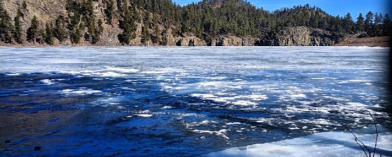
Located at Pactola Lake, the Osprey Trail loops around the area twice and also has a spur trail that leads to an overlook. The route was appropriately named because ospreys can be observed in the area, especially when they are hunting for fish out on the water. The route travels through ponderosa pine trees and leads to the shoreline at a few spots, offering great views of the lake. Be sure to purchase a day-use parking pass during the summer season.
South Dakota, Custer County
01 :52 hrs
3.5 mi
69.209595 ft
Hard
The entire Mickelson Trail is 109 miles long and has a total of 15 trailheads, 4 rock tunnels, and several railroad bridges. The surface of the trail is mostly crushed limestone and packed gravel, along with some partial dirt roads. The trail is conveniently accessed behind the Pringle fire station and where you'll then journey northward through the Black Hills passing by old barns and granite formations before getting to the White Elephant Trailhead. Be sure to purchase a Mickelson Trail pass at a self-service station along the trail or online.
South Dakota, Lincoln County
00 :39 hrs
1.6 mi
51.147736 ft
Moderate
This short trail is located in Newton Hills State Park and offers a scenic hike through forested prairie and rolling hill terrain. The interpretive trail is open for hiking only but does connect to a larger network of multi-use trails to the north. Although the hike is short, it does have some fairly substantial steep climbs and descents and can be strenuous at times. The state park also offers picnicing, hiking, and good wildlife viewing.
South Dakota, North Sioux City
01 :34 hrs
4.7 mi
3.9335327 ft
Moderate
Adams Homestead and Nature Preserve covers 1500 acres along the Missouri River and offers a network of trails that explore an area of diverse natural terrain. The Lake Loop follows a gravel trail on the west side of Mud Lake that travels through both prairie and forest terrain. The trail has lots of small ups and downs but no major hills making it a good choice for hikers of all skill levels. The trail continues to the south down towards the river for a much longer hike if desired.
South Dakota, Union County
01 :01 hrs
3.9 mi
39.062805 ft
Moderate
Union Grove State Park offers a small trail system of multi-use trails that provide some fun easy-to-moderate riding for mountain bikers. The trails travel through mostly open prairie terrain with some small ups and downs. The trails are mostly dirt and stone but can be overgrown by tall vegetation in spots. There may also be occasional mud in lower segments of the trail. The multi-use trails are also open for horseback riding and hikers so watch out for other users on the trail.
South Dakota, Brookings County
00 :59 hrs
3.7 mi
6.6138916 ft
Moderate
Oakwood Lakes State Park offers a small network of multi-use trails for biking and hiking. The trails consists of multiple loops or segments that can be combined for an easy ride. The trail system is surrounded by multiple lakes resulting in some great scenery. The trails are mostly flat dirt singletrack but there are some sections that may be overgrown with obstacles, grass, or mud adding a little challenge. The trails are also open for hiking and horseback riding so watch out for other users along the way.
Iowa, Lyon County
01 :11 hrs
3.5 mi
9.56604 ft
Moderate
The park has a lot of aquatic activities to explore. Cross-country skiers share the hiking trail, no bikes allowed. Camping is available for those looking for an overnight stay. The path is paved and goes around the lake. A very small part of the trail intertwines with the bicycle trail.
South Dakota, Walworth County
00 :32 hrs
1.4 mi
25.673645 ft
Easy
Located in rolling hill terrain just north of the banks of the Missouri River, Indian Creek offers some nice hiking trails and opportunity for viewing wildlife. The Prairie Falcon Trail is mowed grass trail that can be used for hiking and biking. The trail is short but does cover some somewhat hilly terrain. The recreation area also offers a boat ramp, picnic areas, and campgrounds.
South Dakota, Custer County
00 :57 hrs
1.3 mi
32.07837 ft
Easy
The Creekside Trail has a few access points scattered along Highway 16A, offering a splendid stroll on a well maintained path with a hard surface. You'll travel along the Grace Coolidge Creek and make your way to the historic State Game Lodge. Please be sure to purchase a Custer State Park license for each vehicle.
South Dakota, Yankton County
00 :56 hrs
4.8 mi
11.093109 ft
Easy
Lewis and Clark Recreation Area is situated on the north side of the lake, on the South Dakota side, and offers excellent opportunity for recreation including miles of hiking and biking trails. This paved pathway travels from the west end of the Gavins Point Section of the park all the way to the east side near the marina and dam. The trail is fairly flat and easy to follow making it a good choice for riders of all skill levels.
South Dakota, Sioux Falls
00 :16 hrs
0.8 mi
1.8398438 ft
Easy
Sertoma Park is located along the Big Sioux River and offers some scenic nature trails for hiking and wildlife viewing in an otherwise suburban area. The park offers multiple shorter loop trails that can be hiked individually or combined for a longer hike. This hike follows the Riparian Trail which is an inside loop that travels along the oxbow lake and around a small pond. The dirt and gravel trails in the park are fairly wide, flat, and easy to follow making them a great choice for young hikers.
South Dakota, Sioux Falls
00 :19 hrs
0.9 mi
1.3118896 ft
Easy
Sertoma Park is located along the Big Sioux River and offers some scenic nature trails for hiking in an otherwise suburban area. The park offers multiple shorter loop trails that can be hiked individually or combined for a longer hike. The Prairie Trail loop hike explores the open prairie terrain on the east side of the park between the oxbow lake and the river. The gravel trail is fairly flat, wide, and easy to follow.
South Dakota, Pennington County
02 :08 hrs
5.4 mi
144.58801 ft
Hard
Flume Trail goes from one point to another point with various trailheads and various loops available. It is an historic route that was once a part of a mine in the 1800's. The Coon Hollow Trailhead is located on Silver Mountain Road and offers a hike through the Storm Mountain area. You'll be heading through a dense forest with pine trees, wildflowers, and plenty of wildlife. The trail is primarily maintained for hiking and trail running.
South Dakota, Brandon
00 :32 hrs
2.1 mi
45.082367 ft
Moderate
The Prairie Vista Trail is one of two loop trails in Big Sioux Recreation Area that offers some fun and scenic riding. This loop covers fairly flat terrain west of the river with only one small climb. The trail is narrow in places and consists of mainly dirt and grass but there may be sections that are uneven or muddy. This loop trail can be combined with a loop on the other side of the river for a longer ride if desired.
South Dakota, Lake County
00 :21 hrs
1 mi
8.370728 ft
Easy
This scenic state park is located on a peninsula that juts out into the 1350-acre glacially-fed Herman Lake. The park offers multiple hiking trails that explore the natural terrain along the eastern shores of the lake. The Abbott trail is a grass trail that leads through wooded terrain and tall grass prairie, offering some nice views of the lake. The trail is short with just a few small climbs, and is shaded much of the way, making it a good choice for hikers of all skill levels. The trail can also connect to other trails in the park for a longer trip if desired. The state park offers camping, picnicing, lake access, and snowshoe rentals in the winter.
South Dakota, Brandon
00 :41 hrs
2.5 mi
13.708527 ft
Moderate
This trail is one of two loops in Big Sioux Recreation Area that offers some fun and scenic riding. This loop covers rolling terrain east of the river with a few small climbs. The trail is narrow in places and consists of mainly dirt and grass. There may be sections that are may be overgrown, uneven, or muddy. This loop trail can be combined with a loop on the other side of the river for a longer ride if desired.
South Dakota, Roberts County
00 :23 hrs
1 mi
29.739777 ft
Easy
Hartford Beach is located on the southern shoreline of Big Stone Lake and offers a small network of trails for hikers and bikers to enjoy when visiting the park. The Robar trail is located north of the campground and connects to the Aspen Spring trail. There are interpretive signs along the trail providing history about the natural terrain and history of the area. There is a gradual descent as the trail leads down towards the lake but the hike is otherwise short and easy to follow making it a good choice for all skill levels.
South Dakota, Meade County
02 :42 hrs
5.2 mi
90.34918 ft
Moderate
This part of the Centennial trail begins at Ft. Meade Trailhead, which is located just outside of Sturgis and on Cemetery Road. The route travels away from Dakota Hogback and goes down through the prairie grass on a double-track road. You'll definitely enjoy some amazing views of Bear Butte and Bear Butte Lake. Be sure to use caution when crossing over Highway 34.
South Dakota, Lake County
00 :31 hrs
1.5 mi
13.361908 ft
Easy
This scenic state park is located on a peninsula that juts out into the 1350-acre glacially-fed Herman Lake. The park offers multiple hiking trails that explore the natural terrain along the eastern shores of the lake. The Luce Adventure trail is a grass trail that circles around Herman Slough, leading through a diverse group of ecosystems. There are interpretive signs all along the trail that provide information about the vegetation and wildlife of the area. The trail is short with just a few small climbs, and is shaded much of the way, making it a good choice for hikers of all skill levels. The trail can also connect to other trails in the park for a longer trip if desired. The state park offers camping, picnicing, lake access, and snowshoe rentals in the winter.
South Dakota, Brookings County
00 :18 hrs
0.9 mi
2.218689 ft
Easy
This short loop hike in Oakwood Lakes State Park travels out onto Scout Island and is a great option for a short interpretive hike in the park. The dirt trail is only open for hikers and cross-country skiers and is fairly flat with only some small hills. There are additional hiking and biking trails in very close proximity that can be used for a longer hike if desired. The area also offers multiple lakes that provide great opportunity for fishing and water recreation.
South Dakota, Spink County
00 :31 hrs
0.7 mi
5.6717834 ft
Easy
This short out-and-back trail in Fisher Grove State Park travels along the James River and provides hikers with excellent scenery and wildlife viewing. Numbered Interpretive signs located along the trail provide information about the terrain, wildlife, and history of the area. The trail is flat and easy to follow making it a good choice for hikers of all skill levels. The state park also offers camping, picnicing, and access to the James River.
South Dakota, Lake County
00 :38 hrs
1.9 mi
12.514191 ft
Easy
This state park is located on a peninsula that juts out into the 1350-acre glacially-fed Herman Lake. The state park offers multiple hiking trails that explore the natural terrain along the shores of the lake. The Pioneer Adventure trail is a grass trail that leads through tall grass prairie and near some wetland areas. The trail is short, flat, and shaded in sections making it a good choice for hikers of all skill levels. The trail can also connect to other trails in the park for a longer trip if desired. The state park offers camping, picnicing, lake access, and snowshoe rentals in the winter.
South Dakota, Custer County
02 :00 hrs
4.3 mi
254.34033 ft
Hard
The Centennial Trail is over 100 miles long and was built in 1989 to represent the 100th anniversary of South Dakota's statehood. This part of the trail begins at the French Creek Horse Camp Trailhead in Custer State Park and travels through a dense ponderosa pine forest in the rolling Black Hills. The route starts out on fairly level terrain for the first 1.5 miles, and then becomes a strenuous climb for the next mile. Most people will do this route as a one-way day trip with necessary vehicle arrangements, but it can also be done as an out and back. Custer State Park requires a park entrance license for each vehicle.
South Dakota, Custer County
00 :15 hrs
0.7 mi
9.303955 ft
Easy
This is a short and very scenic hike that is located in Custer State Park and off Highway 87A. It is quite amazing to be able to travel along the shoreline and see the still water reflections of ponderosa pines and large rock walls. Campsites, fishing docks, cabins, a gift shop, and a restaurant lodge facilitate the area. Also, keep in mind that a $15 Custer State Park entrance fee is required for each vehicle.
South Dakota, Roberts County
00 :19 hrs
0.8 mi
31.964233 ft
Easy
Hartford Beach is located on the southern shoreline of Big Stone Lake and offers a small network of trails for hikers and bikers to enjoy when visiting the park. The Aspen Spring trail is located between the two campgrounds and connects to the Robar trail. There is a gradual descent down towards the lake but is otherwise short and easy to follow making it a good choice for all skill levels.
South Dakota, Watertown
00 :34 hrs
1.6 mi
7.8065186 ft
Easy
This short trail in Pelican Lake State Recreation Area leads through wetlands and prairies to an observation tower on Pelican Lake. The area is a popular stopover for migrating waterfowl and is great for viewing wildlife including pelicans. The grass trail travels over some mild rolling hill terrain but is easy to follow and is a good option for hikers of all ages. The state recreation area also offers camping, picnic areas, a boat ramp, and additional hiking and biking trails.
South Dakota, Pennington County
01 :19 hrs
3.5 mi
150.87988 ft
Moderate
Flume Trail goes from one point to another point with various trailheads and various loops available. It is an historic route that was once a part of a mine in the 1800's. The Boulder Hill Trailhead is located between section 2 and section 3 of the Flume Trail, and the Coon Hollow Trailhead is located at the very end of the Flume Trail on Silver Mountain Road. You'll be heading through a dense forest with pine trees, wildflowers, and plenty of wildlife. Most people will want to have an extra vehicle parked at the Coon Hollow TH to make it a one way hiking trip.
South Dakota, Custer County
00 :15 hrs
0.6 mi
18.159546 ft
Easy
This is a simple nature walk that goes around the Elk Mountain Campground in Wind Cave National Park. The route goes through prairie grass, thick trees, and riparian areas as well. Take your time and visit some of the interpretive stops that display information about the area. Be on the lookout for bison and rattlesnakes, and also be sure to put a leash on your pets.
Iowa, Lyon County
00 :15 hrs
0.9 mi
8.814697 ft
Easy
Hikers, in-line skating and cross-country skiers share this cycling trail. With constant views of the lake, you will ride by wooded areas, open fields and a mix of both. Farmland and prairies surround the park; the lake has many water activities available. If you choose to stay overnight the park has campsites.
Nebraska, Dixon County
00 :31 hrs
2 mi
30.294891 ft
Hard
Named after an area with significant deposits of bison bones, this trail offers multiple climbs and downhill runs of moderate size. The path travels through dense tree cover, and (around the halfway point) traverses along a ridge- line of the Missouri River. Finally, after passing through open grassland and one last thicket of trees, the trail ends back at the starting point. Note that a state parking pass is required.
South Dakota, Pennington County
02 :23 hrs
3 mi
53.413696 ft
Hard
This trail begins at the Sheridan North GP Campground and travels along the northern shoreline of Sheridan Lake. When you get near the dam, you'll bypass the Centennial Trail and traverse down a rocky cliff with slabs of slate for stair usage. You'll then skirt along the edge of the dam before climbing up to the Upper Spring Creek Trailhead. You'll definitely enjoy the vistas across the lake, along with the cool fresh air of the forest.
Nebraska, Dixon County
00 :27 hrs
1 mi
42.579376 ft
Hard
This trail runs through a highly dense wooded area of Ponca State Park. Once a horse path, Bigley's Ravine Trail tests users with a steep climb up the hill side and a nice descent back down. Be cautious of highly rugged and bumpy sections of track. Instead of an out and back journey, there is an option to travel back to the start by roadway. To do this, after the trail ends, go right and then take another right; following the road back to the vehicle. Note that a state parking pass is required.
Explore nearby adventures

