Best Kayaking in Massachusetts
Trying to find the best kayaking in Massachusetts? Bivy has great hiking, biking, paddling, climbing, skiing, riding and more, with hand-curated trail maps, as well as detailed driving directions.
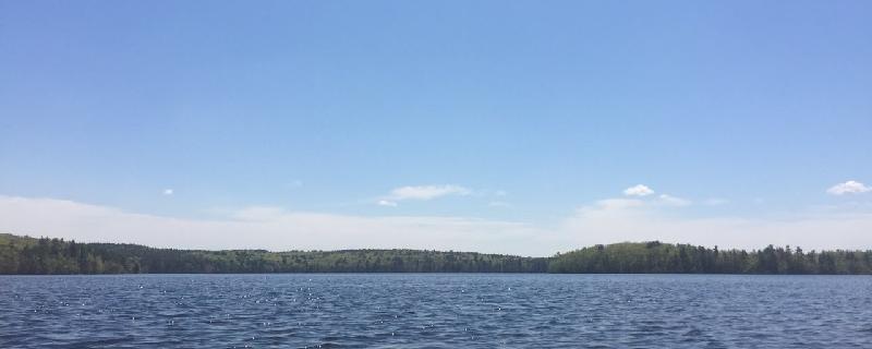
Massachusetts, Middlesex County
01 :13 hrs
2.9 mi
2.959999 ft
I
Beautiful scenery, easy but can get get a little rough with waves when windy. Can be short trip but exploring every nook and cranny along with the islands could be an all day event. Some of the islands have small charcoal grills for picnics and swimming is allowed, good family day activity. Motor boats are allowed under 15 mph for fishing, and no jet skis, so beginner friendly.
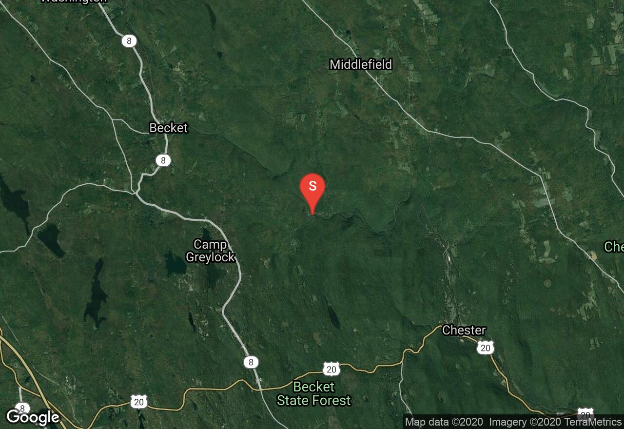
Massachusetts, Becket
02 :13 hrs
6 mi
100.61963 ft
IV
The West Branch of the Westfield River is one of the best early-spring Class IV runs in New England. The valley from Becket to Chester is isolated, marked only with beautiful stone-arch railroad bridges and the bridge at Bancroft. This route features three stunning granite railroad bridges which span the river high above as you challenge the rapids below. There are a few tricky waves to maneuver including a double ledge in the gorge. Take-out is a mile below Chester Center at a roadside pullout on MA 20.
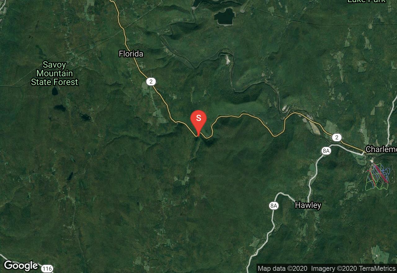
Massachusetts, Savoy
01 :16 hrs
3.9 mi
119.9171 ft
V
This is a great section that has been called one of the best whitewater runs in the East. The upper and lower sections have a gradient of 130 feet per mile and the middle section has a gradient of 100 feet per mile. It is technical in nature and demands good boat control. There is a 10-foot waterfall at mile 3.1 that is runnable in the center at most water levels, or portage on the right. Take out at the confluence of the Deerfield River on MA 2.
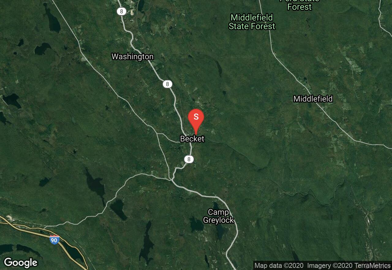
Massachusetts, Becket
01 :10 hrs
3.4 mi
81.58707 ft
IV
The West Branch of the Westfield River is one of the best early-spring Class IV runs in New England. The valley from Becket to Chester is isolated, marked only with beautiful stone-arch railroad bridges and the bridge at Bancroft. This section of the river is continuous Class IV which demands tight maneuvering in heavy waves. Shortly below a ledge beneath a railroad bridge comes the double ledge that can be run to the left or portaged on the right. When you reach the Bancroft Dam portage on the left and take-out is just below.

Massachusetts, Lenox
02 :05 hrs
4.9 mi
6.8878784 ft
I
This run covers a very scenic stretch of the Housatonic River as it flows through beautiful marshes and wetlands as well as some thick tree lined sections. Forest covered mountains rise to the east in October Mountain State Forest. There are many twists and turns in the river with two possible log jams that can be easily maneuvered around. Due to the expansive wetland area, wildlife is prevalent, especially shoreline birds and migratory birds in fall. The Housatonic River is contaminated with PCBs and is not safe to drink, even with a water purifier, and fish and other animals caught in the river are not safe to eat.
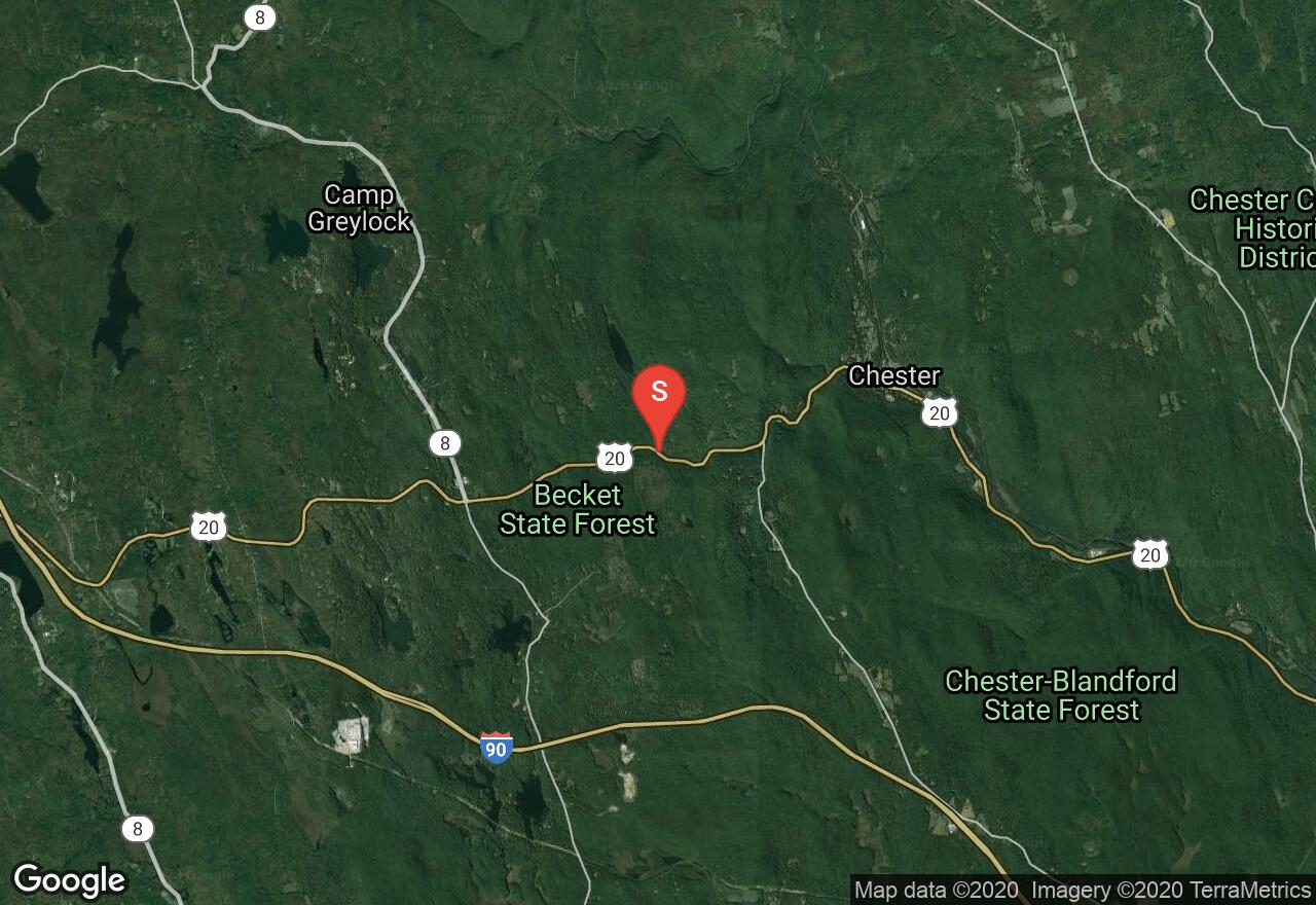
Massachusetts, Becket
00 :33 hrs
2.1 mi
100.727356 ft
V
Walker Brook is a small tributary to the West Branch of the Westfield River. This is an extremely steep, narrow, and technical whitewater river. You may put in anywhere on US 20 as it follows the river. The entire route is continuous Class IV and Class V rapids. Take out in Chester on the right at Hampden Street Park.
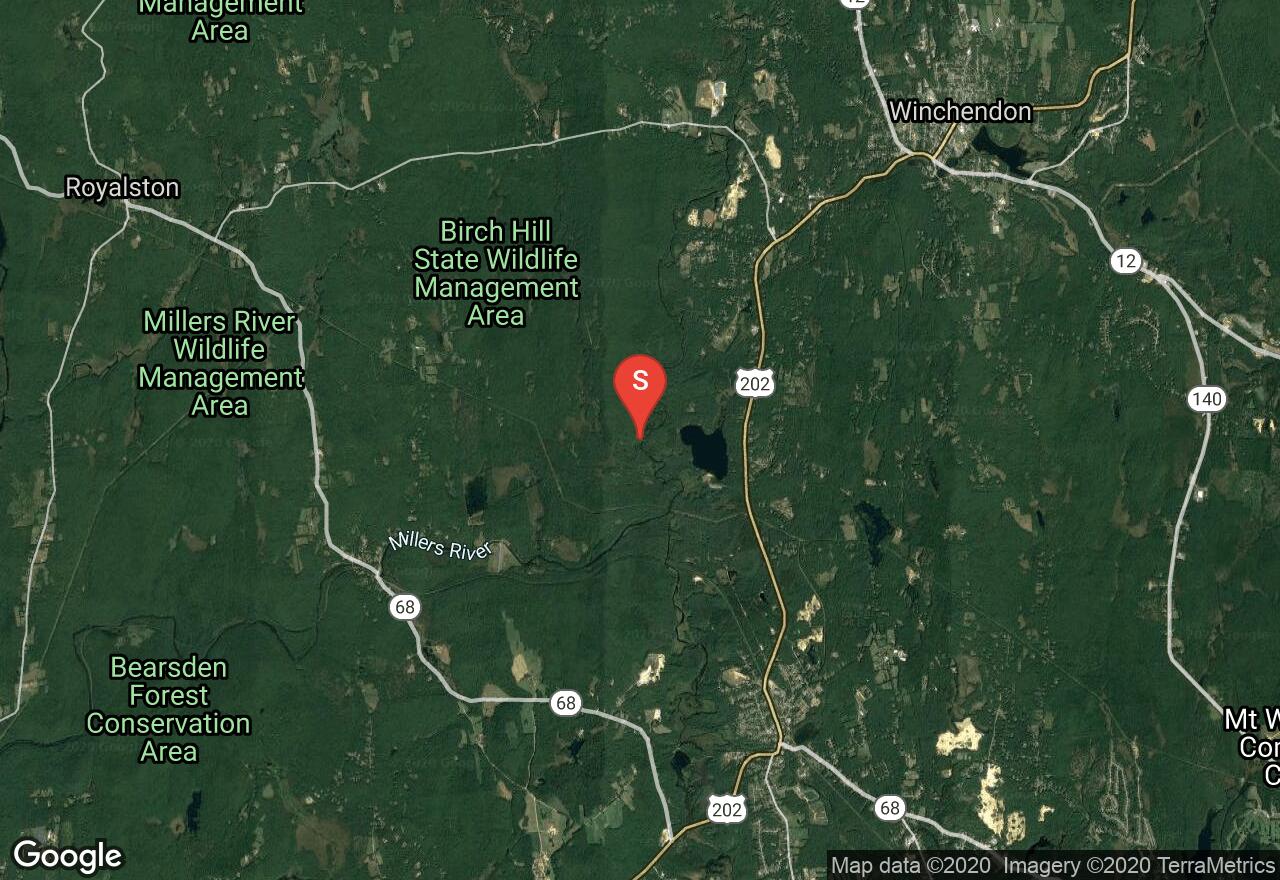
Massachusetts, Winchendon
03 :37 hrs
4.3 mi
3.2120514 ft
I
These two rivers are bounded by the Birch Hill Wildlife Management Area and the Otter River State Forest and offer an unspoiled paddle through red maple, alder, red-willow dogwood, and buttonbush swamps. In spring the current flows more swiftly, making paddling upstream difficult is some places. Beaver activity is prevalent and you will notice signs of beaver lodges everywhere. In fact, it is a large beaver lodge that marks a great turn around point. Wildlife is abundant and the scenery and views are beautiful.
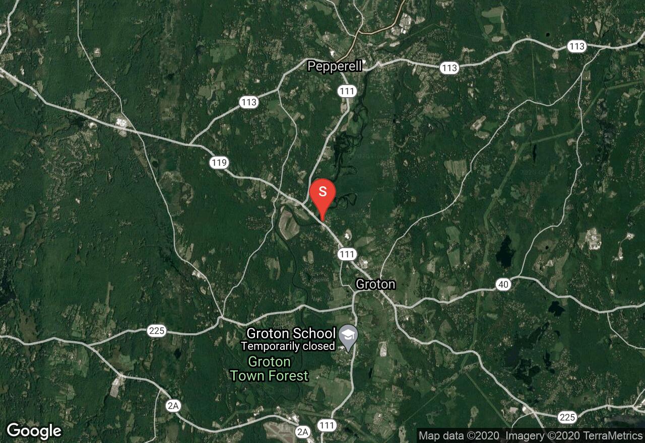
Massachusetts, Groton
05 :15 hrs
12.4 mi
4.2999725 ft
I
This dammed up section of the Nashua River would take an entire day to explore fully. Twists and turns among the many islands as well as oxbows and side channels have created a giant maze with which to paddle. If you have all day, it is fun to get lost and explore but if you have limited time, be sure to have a compass and a map. The river banks are thick with shrubs and marsh plants and lots of wildlife have made this their home.
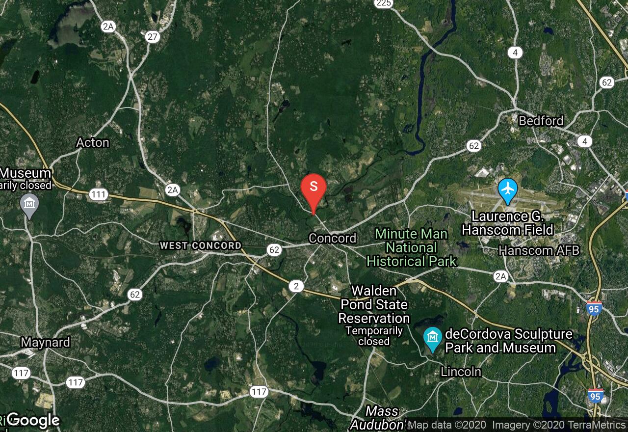
Massachusetts, Concord
02 :03 hrs
4.8 mi
0.87060547 ft
I
This section of the Concord River is very slow-flowing and is surrounded by beautiful, shrubby marshlands that provide homes for lots of waterfowl and marsh birds. High plant diversity characterizes this area, including American lotus, with its enormous yellow flowers. The river runs through the Great Meadows National Wildlife Refuge and was traveled by Thoreau who wrote about his travels here in 1839 and is recorded in his book, A Week on the Concord and Merrimack Rivers. This route is one-way but the current is slow and lazy, allowing you to paddle both directions if you wish.
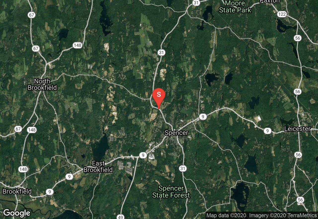
Massachusetts, Spencer
03 :06 hrs
7.4 mi
13.557373 ft
I
In the early spring, this trip in the headwaters of the Quaboag provides a nice, easy run for 2 to 3 hours. At the beginning many houses are visible from the river, but the father downstream you travel the less you see of any development. As the river passes a shopping center next to the MA 9 bridge the current picks up, and for the next couple miles there is a mixture of quickwater and occasional Class I rapids. The remainder of the trip is on flat water. The Seven Mile River becomes the Brookfield River about three quarters of the way through the route.
See more adventures..
Explore complete list
Explore nearby adventures

