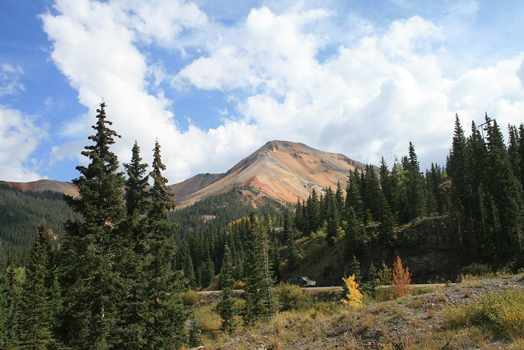
Trail Running in Wyoming
Trying to find the best running in Wyoming? Bivy has great hiking, biking, paddling, climbing, skiing, riding and more, with hand-curated trail maps, as well as detailed driving directions.
Wyoming, Lincoln County
03 :53 hrs
7.9 mi
32.522217 ft
III
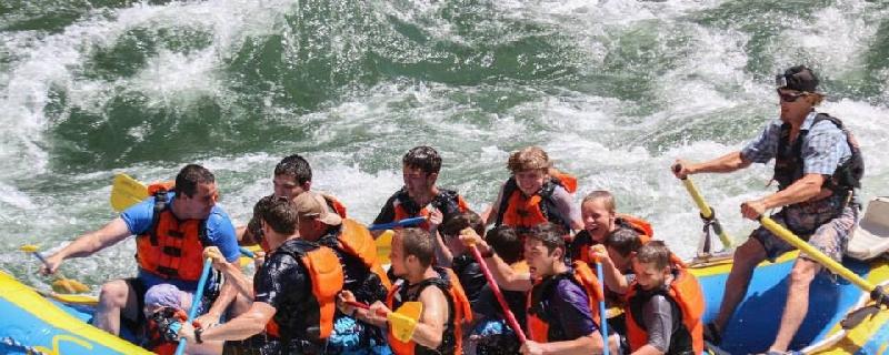
The most exciting whitewater on the Snake River is found along this section of known as Alpine Canyon. Paddlers travel through a scenic canyon setting while navigating some substantial and well-known rapids that include Cottonwood, Big Kahuna, Lunch Counter and more. The route is very popular resulting in large crowds during peak season. There are many commercial outfitters that run trips along the route so the boat ramps can become very congested. Permits are only required for large groups and commercial companies.
Wyoming, Carbon County
03 :56 hrs
7.1 mi
464.7505 ft
Hard
This 7.2 mile Loop leads you to the top of Medicine Bow Peak, which is the highest peak in the snowy range.
Wyoming, Jackson Hole
18 :50 hrs
6 mi
2079.233 ft
III
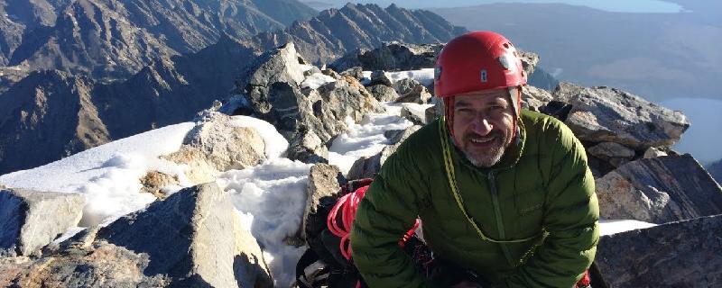
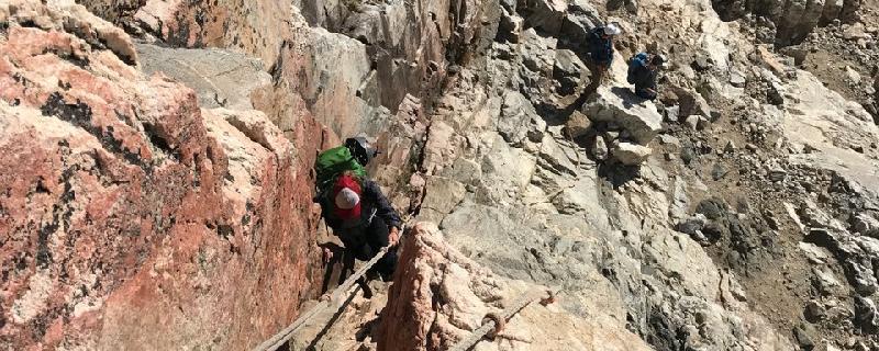
Climbing up the south side of the majestic Grand Teton, this route follows the Lower Exum and the Upper Exum on the Full Exum Route. The Lower Exum Ridge is steeper and more difficult than the upper and is a great course for climbers seeking good difficult rock on the Grand Teton. The first pitch of the Lower Exum ridge is a straightforward chimney. Chimney up for a while, tunnel through a chockstone and then you can bypass the second crux where the chimney closes up. The second pitch ascends some ramps and corners up to another large ledge. Pitch 3 ascends a nice jam crack to some black rock. With a 60 meter rope this easily links with pitch 4, which ascends an interesting 5.7 chimney. Pitch 4 chimney is in two parts, starting with the crux of the lower part to get into the chimney, after which it was straightforward and this leads into a wider chimney that is capped with a large chockstone. Next is the famous Black Face pitch that leads to Upper Exum Ridge, one of the most popular routes to the summit. With the combination of ready access, southern exposure and exciting climbing with excellent rock, the Upper Exum route will continue to be popular.
Wyoming, Jackson Hole
18 :54 hrs
6.7 mi
1950.6953 ft
II
Grand Teton is the highest mountain in Grand Teton National Park and a classic destination in American mountaineering. The Owen-Spalding route begins at the Lower Saddle between the Grand and Middle Teton peaks. Scrambling and sections of modest difficulty climbing lead to the Upper Saddle between The Enclosure to the west and the west wall of Grand Teton to the east. From the Upper Saddle ropes can be used to traverse exposed 2,000 ft cliffs along the west flank, but the section is generally considered non-technical. Features such as the "Belly Roll" and "The Crawl", where climbers usually straddle a rock fin for several yards, lead to the Double Chimney. The chimneys are the most complex section of the climb and may be icy. This section leads to a steep scramble to the summit. The descent may be down-climbed or rappeled using several fixed anchors.
Wyoming, Albany County
02 :47 hrs
1.7 mi
381.30273 ft
Hard
There are three major routes leading to Medicine Bow Peak. This one begins at the Lewis Lake Trailhead and it is the most aggressive but also the shortest route of the three. It is a relatively short and beautiful hike, but also has some the exposure and dangers of alpine mountain exploring. Thunderstorms, lightning, and even snow can occur at any time of year.

Wyoming, Teton County
00 :15 hrs
0.6 mi
18.522217 ft
Easy
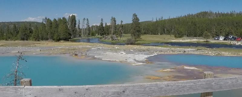
Loop featuring the Turquoise Pool, Opal Pool, Grand Prismatic Spring, and Excelsior Geyser. Each season offers a unique experience.
Wyoming, Teton County
00 :14 hrs
0.6 mi
10.789551 ft
Easy
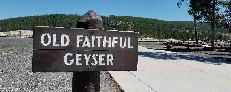
Old Faithful Geyser Loop offers views of the geyser from all directions. The attraction is popular all year and allows a different experience with each season.
Wyoming, Teton County
00 :14 hrs
0.6 mi
8.702148 ft
Unknown
Located north of Old Faithful, this is named for the unusual biscuit-like deposits that surround Sapphire Pool. It is an interpretive trail with geysers, mud pots, hot springs, and wildlife. It also connects to Mystic Falls, Fairy Creek, and Summit Lake.
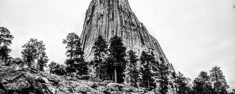
Wyoming, Crook County
01 :05 hrs
2.8 mi
89.46289 ft
Moderate
This is the longer of two loops which includes the Southside Trail and the Red Beds trail. You can also include the Valley View section which would add almost a mile. The Devils Tower is a one-of-a-kind monolithic feature that was the first to become a national monument. There is a fee charged upon entering the monument area.
Wyoming, Jackson Hole
05 :44 hrs
5 mi
374.55322 ft
Expert
This route will take you past the beautiful Phelps Lake and into a portion of Death Canyon. It is an option to continue in the canyon as a multi day adventure but the route is plotted as a day hike out and back. Use necessary precaution in winter for avalanche safety and awareness.
See more adventures..
Explore complete list
Explore nearby adventures

