Best Road Biking in Nebraska
Trying to find the best road biking in Nebraska? Bivy has great hiking, biking, paddling, climbing, skiing, riding and more, with hand-curated trail maps, as well as detailed driving directions.
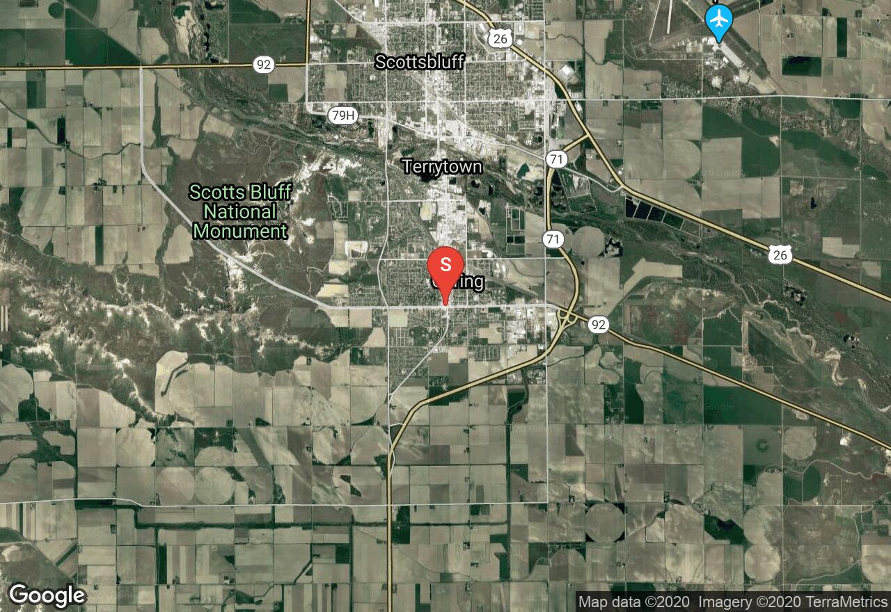
Nebraska, Gering
00 :47 hrs
4.2 mi
207.94934 ft
Moderate
Beginning in the city of Gering, one will head west along the two lane, Old Highway 92. While riding, the bluffs will begin to appear in the distance as one travels closer to the entrance of the uphill climb to the monument. Once passed the Visitors Center, the paved road becomes a bit narrower, curvier, and steeper. As the elevation increases, the road's steep edge becomes more exposed. While traveling to the top, one will pass through several rock tunnels and finally come to a spectacular view of the Nebraskan landscape and surrounding bluffs. Note that bikes are only allowed on the monument road in the early morning and late evenings after the park closes the road to vehicles - contact the park for specific dates and times. A fee is also required to bike along the roadway.
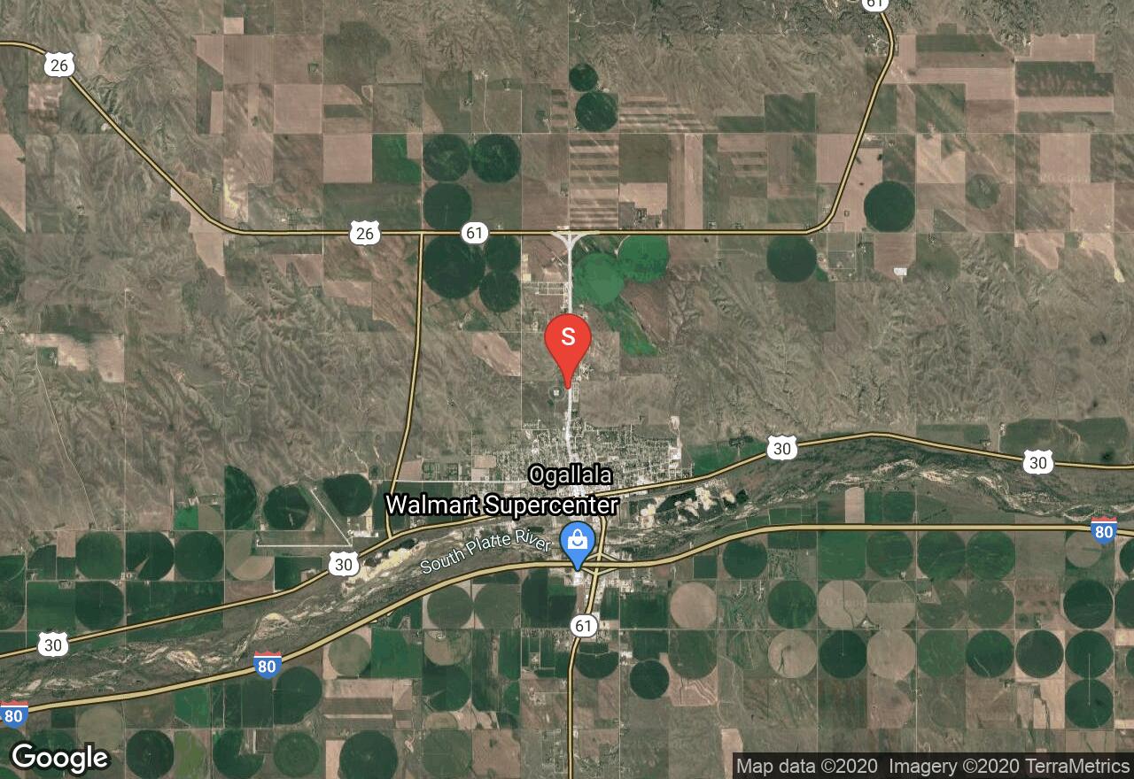
Nebraska, Ogallala
06 :31 hrs
64.2 mi
167.16931 ft
Extreme
This reservoir, created by the Kingsley Dam, is the largest in the state. The mapped route travels along Highway 26 as well as roads 92 and 61. It is mostly two lane narrow roadways that occasionally split into three or even four lanes. Although there are not many close views of the lake, one will experience the vast openness of the Nebraskan landscape and feel a sense of accomplishment once completing this long course. The nearby state recreation area offers boating, swimming, fishing, and camping.
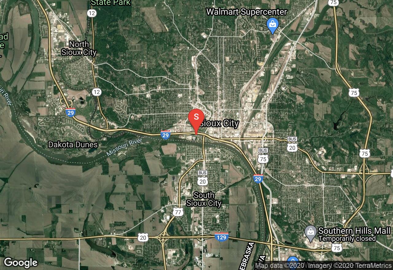
Iowa, Sioux City
00 :42 hrs
3.5 mi
10.824646 ft
Easy
The whole ride is by the Big Sioux River. Because of history, there is a statue of Lewis, Clark, and Seaman (Lewis’ dog) at the beginning of the ride. This is a great path for families, it is flat and easy; it goes from Chris Larson Park to Riverside Park.
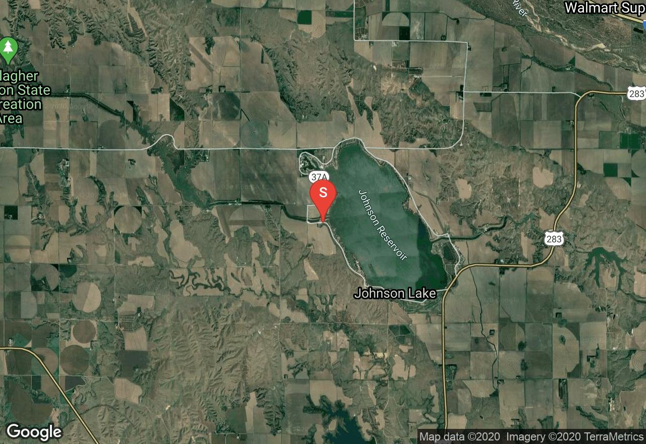
Nebraska, Gosper County
01 :02 hrs
10.3 mi
11.988403 ft
Moderate
Circling the large, Johnson Lake, this journey begins along Johnson Lake Drive and Recreation Roads that stretch around the entire lake's perimeter. Be cautious on these roads as there is not much of a shoulder. Off and on throughout, in order to offer variety of views and technicality, the mapped course will divert from the main roadway and onto the lake's paved trail. Expansion and construction on the lake's trail could offer more route options in the future.
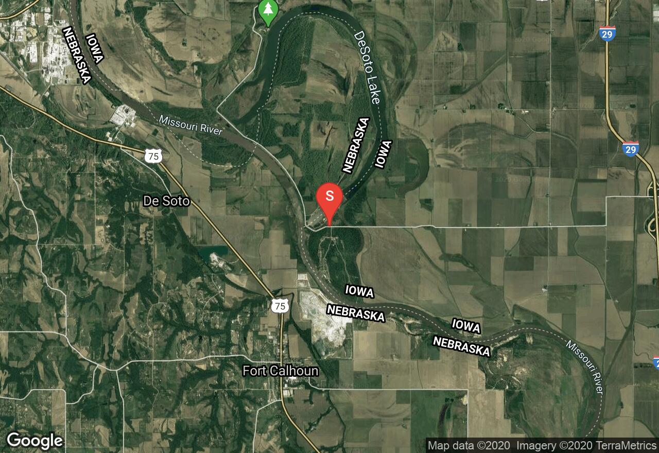
Iowa, Pottawattamie County
00 :57 hrs
9.4 mi
2.463684 ft
Easy
Please take under consideration that part of this ride is on gravel. Your road tires can handle it. You will ride by the Missouri River and as you enter the park, there is a lake, which used to be a part of the river. The best time to see the birds is in the fall, when hundreds of thousands are a part of the fall waterfowl migration. On an interesting note, the middle of the lake is the state line for Nebraska.
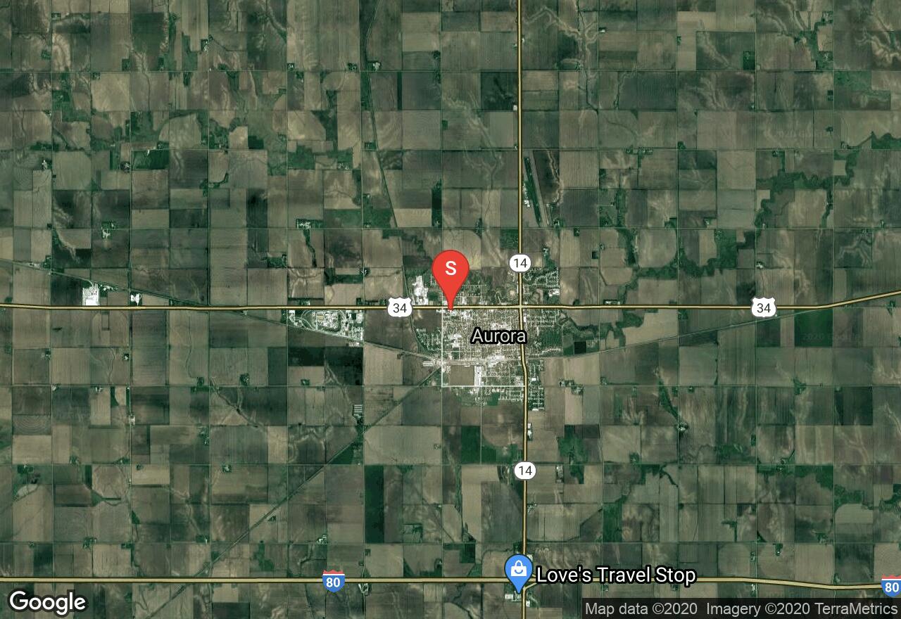
Nebraska, Aurora
02 :37 hrs
13.1 mi
28.280884 ft
Hard
This is a route for those wanting a long, straight stretch of road to simply cruise along. Though not being completely flat, the route does have a slight incline (sometimes unnoticeable) that steadily increases in elevation until the turn-around point. Then, it's an easier return trip because of the slender downhill slope. Located west of Lincoln, this trip begins in the city of Aurora and runs west along the two lane, Highway 34. One will experience the openness of Nebraska while traveling beside agricultural landscape. There is a shuttle option if one has two vehicles.
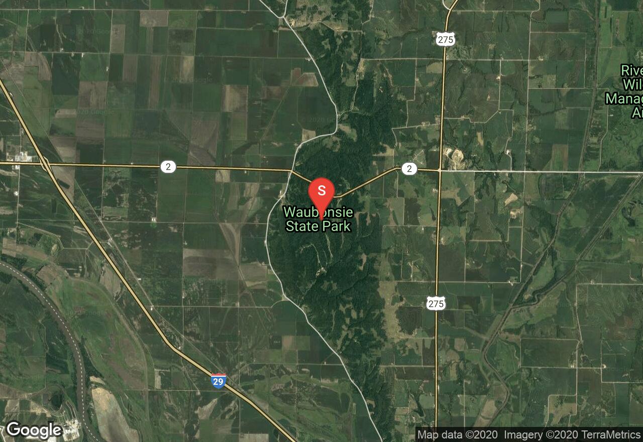
Iowa, Fremont County
02 :30 hrs
25.2 mi
89.231445 ft
Hard
Be prepared to climb short steep hills on this ride. Be aware of the rumble strips at the intersection as you leave the park with HWY 275, they are very deep and can bounce you right off your bike. You will ride from Waubonsie State Park, through Riverton and Sidney then back to the park, passing great views of farmlands and trees. Enjoy the Riverton Marsh and the Riverton Wildlife Management Area. During migration season, you can see thousands of snow geese coming to the marsh.
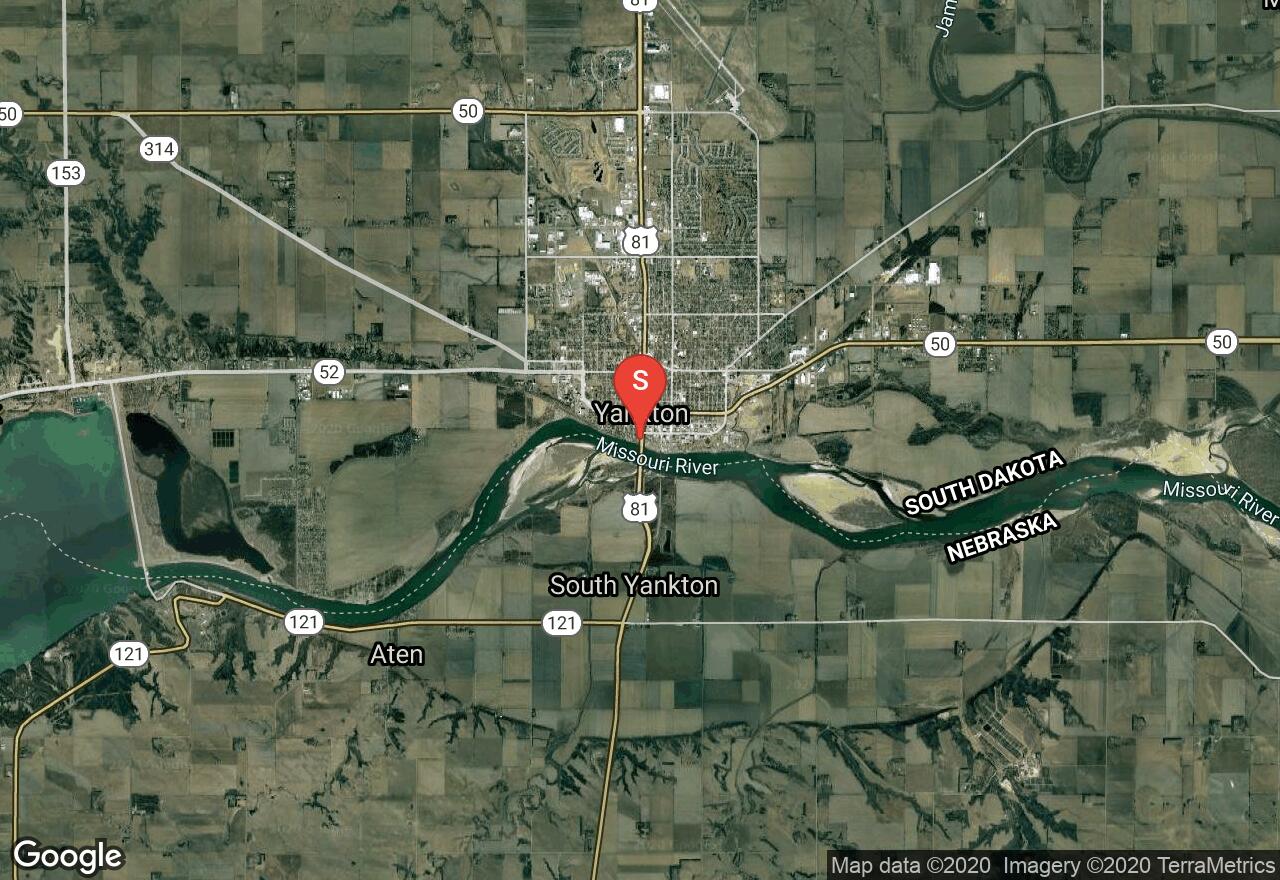
South Dakota, Yankton
00 :49 hrs
4.2 mi
15.871429 ft
Easy
The Auld-Brokow Trail is a wide multi-use pathway that follows Mame Creek through the suburban community of Yankerton. The trail connect multiple points of interest and parks in the area providing some good resting and stopping spots. There are some very mild rolling hills but no major climbs or descents making it an easy ride for all skill levels.
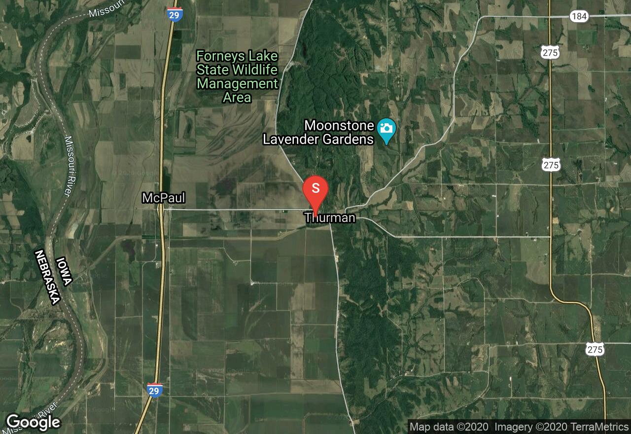
Iowa, Thurman
01 :49 hrs
18.2 mi
79.41498 ft
Moderate
The roads are paved. You will find a little of everything, as you ride through the rolling hills of farmlands, you will find short steep climbs, flats and small hills. You will start and finish in Thurman and go through Tabor. Passing a lake and wildlife management on the way. Tabor has quite the interesting history of abolitionist activity in its early years. Look for facilities in Thurman and Tabor.
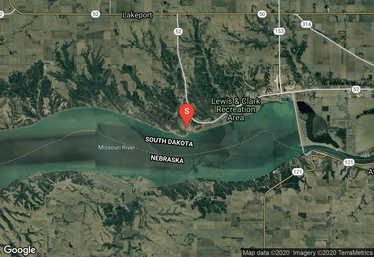
South Dakota, Yankton County
00 :56 hrs
4.8 mi
11.093109 ft
Easy
Lewis and Clark Recreation Area is situated on the north side of the lake, on the South Dakota side, and offers excellent opportunity for recreation including miles of hiking and biking trails. This paved pathway travels from the west end of the Gavins Point Section of the park all the way to the east side near the marina and dam. The trail is fairly flat and easy to follow making it a good choice for riders of all skill levels.
See more adventures..
Explore complete list
Explore nearby adventures

