Best Rafting in Tennessee
Trying to find the best rafting in Tennessee? Bivy has great hiking, biking, paddling, climbing, skiing, riding and more, with hand-curated trail maps, as well as detailed driving directions.
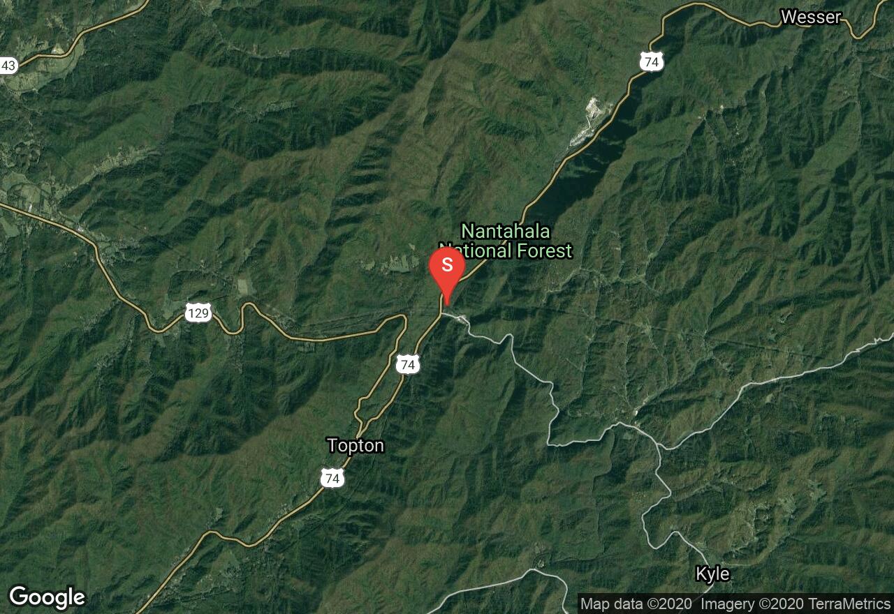
North Carolina, Graham County
03 :02 hrs
7.8 mi
82.634766 ft
III
The Nantahala River is located in western North Carolina and travels through national forest before entering Nantahala Lake and offers multiple sections of runnable river for paddlers of all skill levels. This section of the Nantahala River is a consistent, thrilling run of class I-III rapids. The roadway follows the river closely through this section so scouting the river before is easy to do and is strongly advised. Some of the rapids are upgraded in difficulty depending on water flow so it is important to know what the river is doing before running it. Nantahala Falls, as well as a few other rapids, can be easily portaged giving paddlers that are not as skilled the opportunity to run the river. The river can only be run when the power plant is operating so verify this information and current water gauges before attempting the run.
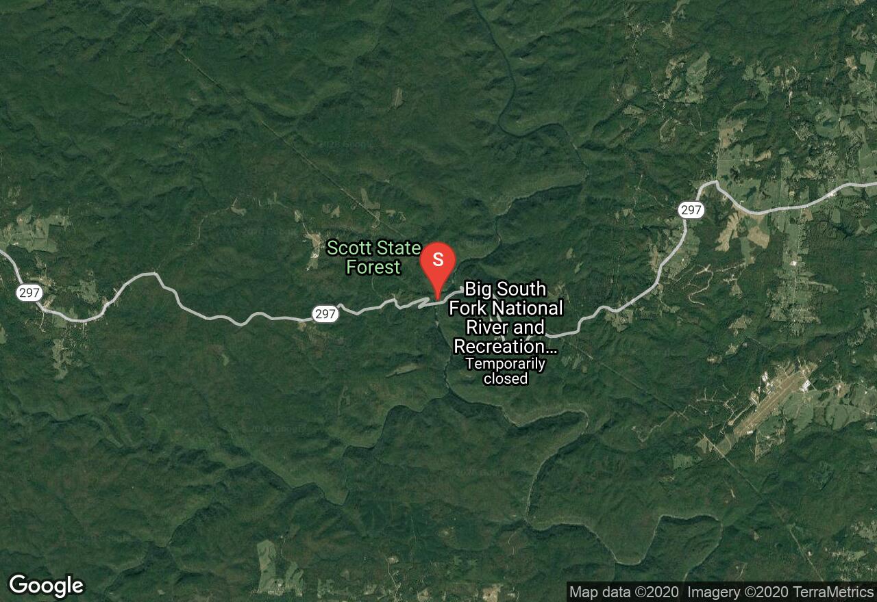
Tennessee, Scott County
03 :17 hrs
7.8 mi
16.080582 ft
II
Big South Fork National River flows through a protected river in a deep scenic gorge with sandstone bluffs. The put-in begins at TN 297 bridge. Large rocks protrude along the shoreline and the banks are lined with sycamore and river birch trees. You will encounter some small rapids. Angel Falls is located 1.9 miles and is a mandatory portage on river right. Below the falls the river narrows into a boulder field creating some whitewater rapids. Take-out is at Station Camp Road.
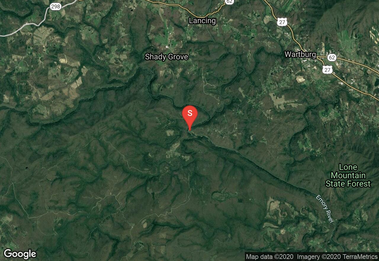
Tennessee, Morgan County
03 :53 hrs
9.3 mi
29.614899 ft
III
Emory River is a big Cumberland Plateau river that offers some exciting whitewater. The put-in is located at Nemo Bridge where you will start off with the most difficult rapids of the entire adventure. Nemo Rapids are class III and found around the corner after floating under the bridge. You can portage on river right if you want to avoid them. The rest of the river cuts through a mountain-rimmed valley with Class II rapids found throughout the paddle. Norfolk Southern Railroad parallels the entire section. Takeout at the TN 299 bridge on river right.
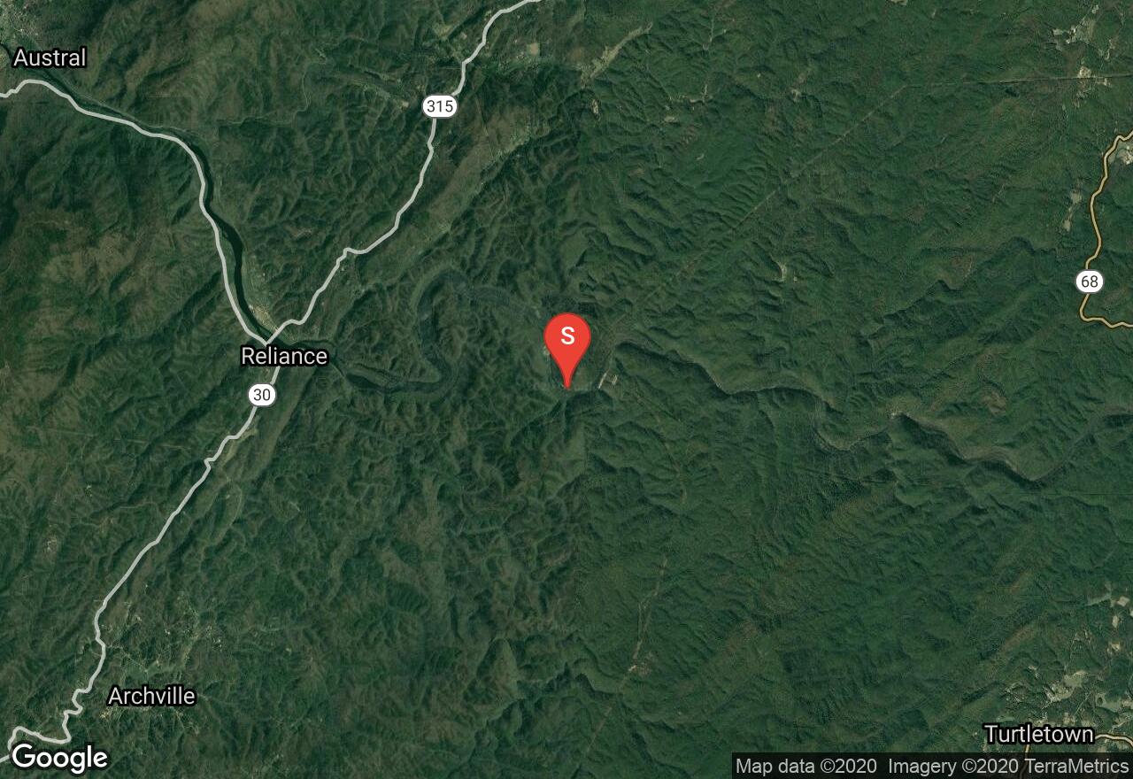
Tennessee, Polk County
02 :19 hrs
5.6 mi
31.600662 ft
III
Located in the Cherokee National Forest, this popular dam-controlled whitewater river has a swift current that cuts through a beautiful mountainous setting. Just below the put-in you will quickly encounter a series of Class II+ rapids. The adventure is short and many will do it twice in one day. Take-out is on river left near Webb Brothers Country Store. Releases start at 10 or 11am and it is best to launch by 12. For release info call 805-632-2264.
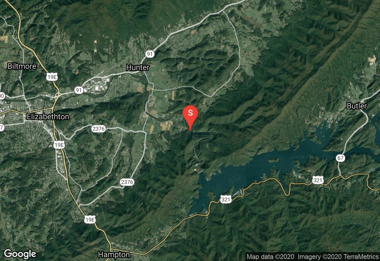
Tennessee, Carter County
03 :30 hrs
8.5 mi
39.284912 ft
III
This section of the Watagua River begins just below Wilbur Dam and flows cold and clear. The flow is dam-controlled and offers a lively float through a mountainous valley. Bee Cliff Rapid, which is also, known as Anaconda is a Class III rapid but can be avoided. There are a few more rapids and islands that split the river. Stay off the river if TVA is not generating, as the current will be none. Take-out is at Riverside Park in Elizabethton.
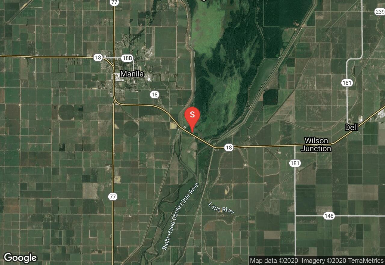
Arkansas, Mississippi County
04 :57 hrs
11 mi
2.6999207 ft
I
Big Lake National Wildlife Refuge offers a beautiful wetland existing in a pristine state to explore. The lake is located in the Mississippi Delta region of Arkansas near Manila and surrounded by farmlands. Powerboats are prohibited on the lake making for a quiet and safe experience for paddlers. Wildlife viewing opportunities are assured while visiting this area.
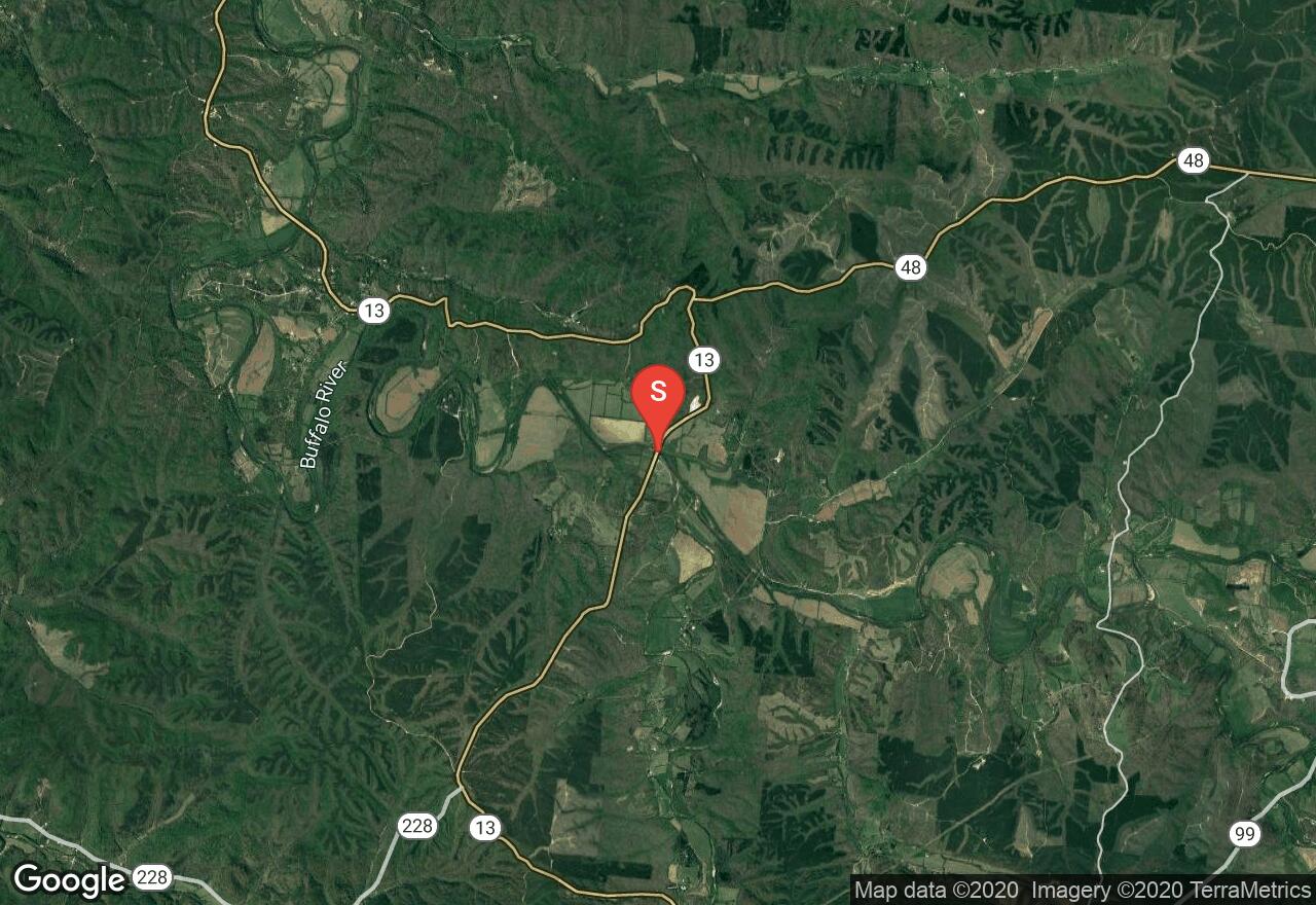
Tennessee, Wayne County
04 :24 hrs
10.4 mi
14.507568 ft
I
The Buffalo River is the longest free flowing river in middle Tennessee along with being one of the state’s finest river fisheries. This middle section is popular for outfitters, making it busy on summer weekends. You’ll pass by a riverside waterfall and a bluff used for swimming. The river divides into channels so watch for strainers and islands. You’ll be treated to a wooded shoreline along with several gravel bars. Put-in is Bell Bridge and takeout is at the end of Horseshoe Bend Road.
See more adventures..
Explore complete list
Explore nearby adventures

