Best Hiking in Virginia
Trying to find the best hiking in Virginia? Bivy has great hiking, biking, paddling, climbing, skiing, riding and more, with hand-curated trail maps, as well as detailed driving directions.

Virginia, Madison County
03 :08 hrs
6.3 mi
664.1326 ft
Hard
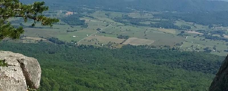
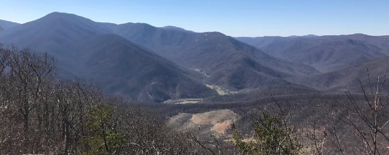
The Old Rag is a popular summit among the Shenandoah peaks because climbing it feels like an actual mountain, perhaps due to its rocky mount, unique among mountains in the Blue Ridge. This particular route begins from the parking area on VA 600 and follows the Ridge Trail up the spine of Old Rag. Continue following this trail along the rocky summit of Old Rag, soak in the views, and then descend along the easterly side of the mountain. When the trail rejoins Weakly Hollow Road, make a hard right along the Weakley Hollow Fire Road that parallels the main road. This will eventually return to the parking area.

Virginia, Accomack County
06 :14 hrs
17.5 mi
19.410809 ft
Hard
This is my all time favorite hike. This was the first time I went all the way up the beach to the top of the service trail. If you're into beach combing this is the way to do it, lots of great shells and many other finds. There is a chance of seeing ponies. If you go on top of the dunes once you're above the northern fence line you can see ponies. Once you meet up with the service trail at the northern tip it's really buggy so bathe in Off or Repel. Lots of ponies through here, make sure to look out on all the marshes, they can be anywhere. It's a flat and easy walk, it's just very long so I wouldn't recommend for beginners or anyone wanting a leisurely stroll. This took me 12 hours, including pony spotting time, and it cut me off early at the end. Ended up being 21.8 miles.
Virginia, Smyth County
05 :20 hrs
12.4 mi
490.73206 ft
Expert
Yet another forgotten gem of Virginia’s mysterious southlands, this loop follows old fire roads into the backwoods of Jefferson National Forest. Beginning along the orange-blazed Rowlands Creek Trail (which may be unsigned), progress through stunning forests of hemlock and rhododendron and watch for cascades and mini-falls along the edge of Rowlands Creek. After several fords of the river itself, veer right along Old FDR 84 along the edges of the twin mountains: Double Top and Round Top. Keep a close eye out for the orange-blazed Jerrys Creek Trail, which veers right off the fire road and descends back into the mountains around Chestnut Ridge. In June and July, millions of white blossoms populate this gorge from the rhododendron that make their homes along its shady slopes. Take in stunning views of the sloping valleys as the trail widens into FDR 845 and wends its way back towards the parking area.

Virginia, Rockbridge County
02 :19 hrs
6.9 mi
19.334412 ft
Hard
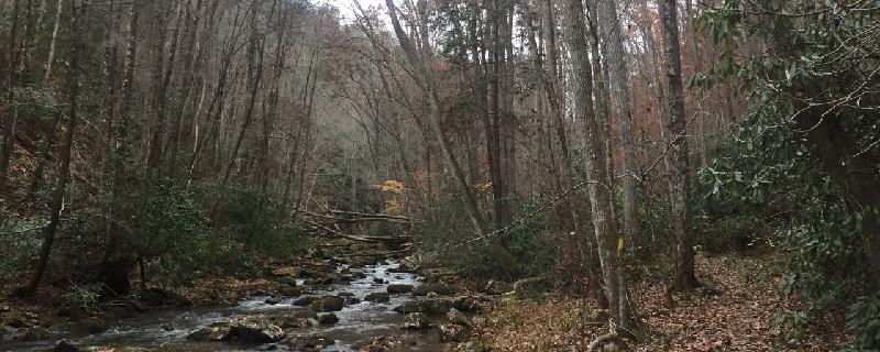
This beautiful day hike follows the Chessie Nature Trail as it parallels the course of the Maury River from Lexington to Buena Vista. Popular with kayakers and canoeists, this section of the river is full of tumbling rapids and whitewater gorges, with cliffs of limestone and beautiful ruins of old stone buildings hugging the edges of the water. In essence, this trail is a beautiful way to spend an afternoon. For bicyclists: The Chessie Nature Trail has recently been opened to bike traffic, much to the joy of local cyclers – it is a fantastic bike ride out and back. For road bikes, make sure to have multi-purpose tread as some sections of the trail are somewhat rough.

Virginia, Bath County
03 :38 hrs
7.3 mi
373.77426 ft
Expert
Beginning from the same parking area as the Tuscarora Overlook Loop, this rigorous loop trail begins along the Beards Gap Trail that snakes its way through the valley and switchbacks up to Beards Gap. After a brief detour to the overlook, return down to the ridgeline for a scenic hike along the aptly-named Mountain Top Trail that snakes along the ridge of Beards Mountain. Coming to the height of the ascent, veer left onto the (also aptly-named) Mountain Side Trail that wends its way along the face of the mountain, offering views of Douthat Lake sparkling below. Arriving back at the intersection of the Beards Gap and Mountain Top Trails, veer right this time along the Buck Hollow Trail which will trace the edge of the Buck Lick Creek, the Wilson Creek, and then lead back to the parking area.
Virginia, Scott County
03 :41 hrs
3.8 mi
283.1486 ft
Hard
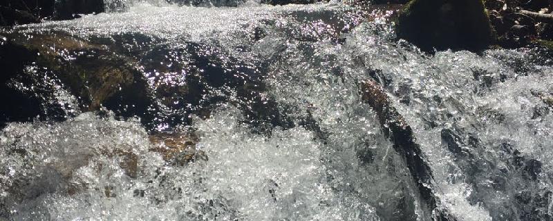
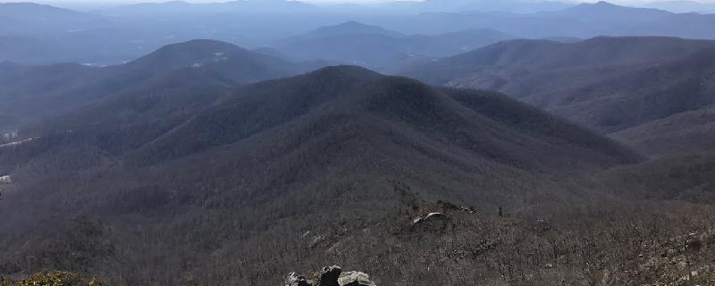
This gentle ascend up the gorge carved by Little Stony Creek follows the Little Stony National Recreation Trail up from the parking area. Passing by numerous falling cascades and beautiful vistas of the surrounding southern Appalachians, the trail wends its way up towards Big Bear Lookout. Along the way, pass by stunning waterfalls that flow copious and wide in the spring, creating glistening pools that are perfect for a quick swim. Upon reaching the road, continue along the edge of VA 701 to reach Big Bear Lookout and soak in the views before returning along the edge of the creek. This hike is an easy and utterly beautiful experience of southern Virginia.
Ohio, Hocking County
00 :48 hrs
2 mi
76.64276 ft
Easy
Located in Conkles Hollow State Nature Preserve, this hike begins with a steep climb to the top of the gorge where the views are excellent. It follows the rim along rock outcroppings making a loop around the interesting sandstone gorge. Birdwatching and spring wildflowers are popular.
Virginia, Nelson County
03 :41 hrs
7.8 mi
562.1217 ft
Hard
Swinging bridge over the river. Great views from Chimney Rock.
Virginia, Nelson County
04 :55 hrs
10.5 mi
743.527 ft
Hard
Crabtree Falls is a series of five cascades and several smaller ones. It is a popular place to visit so expect to see some crowds. The trail follows along a steep path with some rocky terrain through a thick oak-hickory forest mixed with many types of ferns and wildflowers. The rocks at the waterfall can be slippery so do not climb on them.
Virginia, Amherst County
02 :21 hrs
5.3 mi
233.50336 ft
Hard
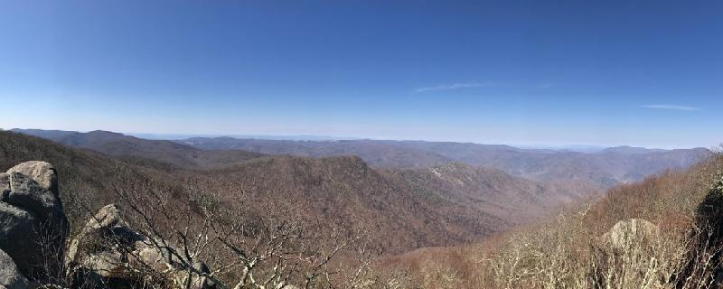
Perhaps one of the most pristine and remote sections of the Blue Ridge Mountains (thanks to a 1994 Congressional Bill protecting the area from commercial use), the Mount Pleasant Special Management Area offers an array of beautiful hikes and summit vistas for the adventurous hiker. Though short in distance, the hike to the summit of Mount Pleasant (some say one of the most beautiful summit vistas in Virginia), begins hugging the edges of the mountains through this misty-sloped wilderness. At the trail intersection, bear left along the Mount Pleasant Summit Spur and come to the peak. After gazing across a seemingly endless sea of green mountains, take the spur back to the Mount Pleasant Trail and veer left along the second half of the loop to return to the parking area.
See more adventures..
Explore complete list
Explore nearby adventures

