Runtime.80ab492fe3d778817936.js in New River Gorge
Trying to find the best in New River Gorge ? Bivy has great hiking, biking, paddling, climbing, skiing, riding and more, with hand-curated trail maps, as well as detailed driving directions.
West Virginia, Fayette County
02 :03 hrs
2.2 mi
58.67108 ft
Hard
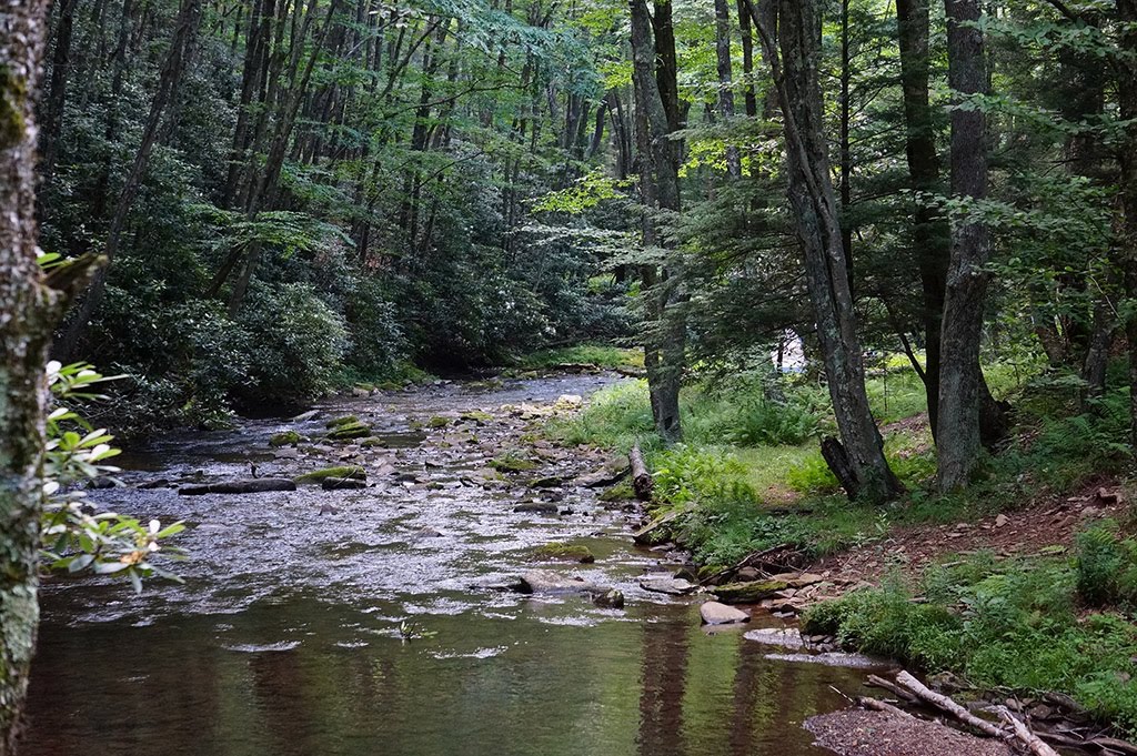
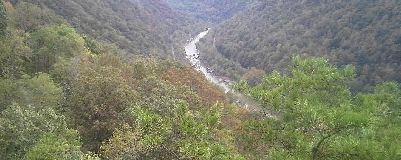
This popular trail tours the best of the New River Gorge, along unbroken cliff line known as the Endless Wall. Breathtaking panoramas await hikers as the trail zigzags along the top of the cliffs edge. the dirt trail crosses Fern Creek and travels through rich forest of gnarled pines and rhododendron thickets. The overlook at Diamond Point provides a good turnaround spot. The trail has no guardrails so take caution with the Numerous steep cliffs.

West Virginia, Fayette County
01 :24 hrs
1.5 mi
89.00223 ft
Easy
Located at the New River Gorge National River, the trail is the best starting point for hikes in the area. The mostly flat dirt and rock trail travels through a mixed hardwood forest with sites of mushrooms throughout the under-story. Among the wonders of the New River Gorge, the rock outcrop known as Long Point provides a 360-degree panorama that includes one of the best views of the New River Gorge Bridge. Bring your camera and binoculars to capture the view. There are no guardrails along the cliff ledges so use caution.
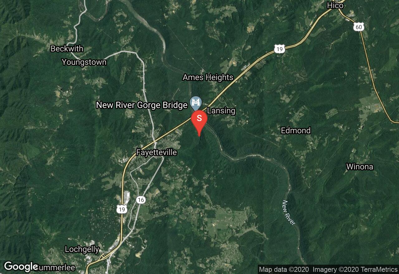
West Virginia, Fayette County
03 :53 hrs
3.8 mi
240.56433 ft
Hard
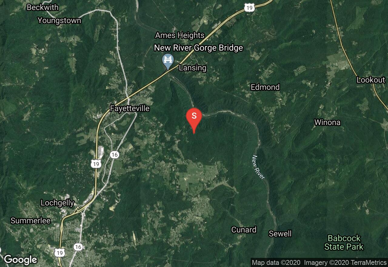
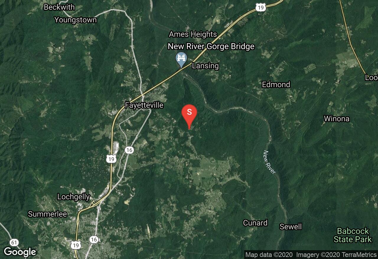
The Fayetteville Trail is one of many trails located in Fayetteville. This trail travels along the southern wall of the New River Gorge, ascending and descending through the ravines of streams and crossing ridges. The trail travels through thick forests of maple, sycamore, and chestnut oak trees. there are amazing views of the New River Gorge Bridge as the trail travels over ridge lines. There is the opportunity for a shuttle plan, the trail has two access points one of Fayette station road and the other on Kaymoor road.
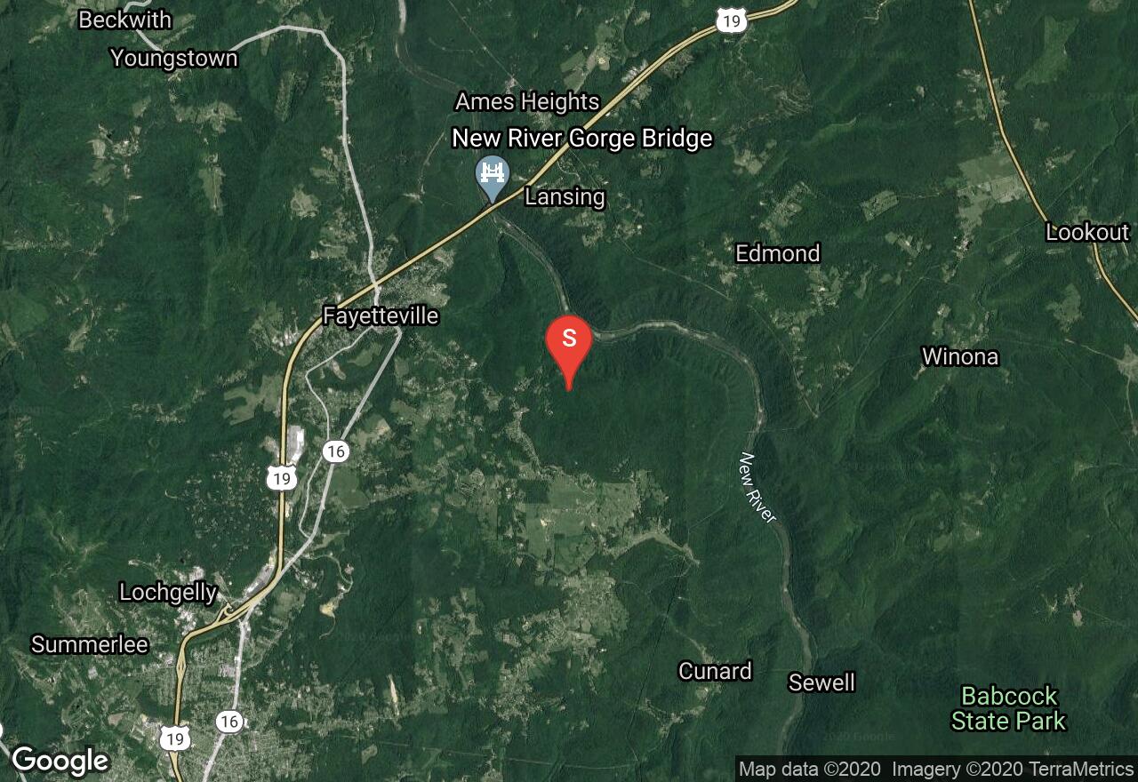
West Virginia, Fayette County
00 :59 hrs
3.8 mi
31.746094 ft
Hard
The Clovis Trail and Adena Trail are part of the many trails in the Arrowhead Trail System of the New River Gorge National River. The Clovis trail is the shortest loop of the system and is relatively flat with minimal elevation changes. This trail is excellent for all skill types, it has no obstacles and has the option to loop around instead of connecting to the Adena Trail. The Adena Trail is the middle loop of the Arrowhead Trails. This trail loops through the forest on low-grade swooping dips with slight uphill and downhill sections. It has a few rock surfaces with wide turns and switchbacks. This trail loop can be traveled in either direction.
West Virginia, Fayette County
01 :49 hrs
7 mi
36.493652 ft
Hard
The Dolton Trail is part of the Arrowhead Trail System of the New River Gorge National River. This is a narrow trail with some moderate elevation changes. Expect to encounter small obstacles along the trail including rocky sections and tight turns. There are sections where the trail travels along a ridge line as well as through tunnels of rhododendrons and thick forest. This trail’s design has a nice flow and is also used by runners.

West Virginia, Fayette County
01 :27 hrs
0.8 mi
314.04095 ft
Moderate
This New River Gorge forest hiking trail, descends steeply from the top of the gorge with stairs and switchbacks to the Kaymoor coal mine site. At the mine site, a set of 821 steps continues down towards the remains of the old mine buildings near the river. Remember to not climb, sit, or walk on walls and other constructed features of this historic site. The Kaymoor coal mine was in operation for almost 60 years, but has been abandoned since 1963. The highlight of this trail includes spectacular views of the gorge and the ruins of the town of Kaymoor and its mine.

West Virginia, Fayette County
02 :04 hrs
1.9 mi
113.23303 ft
Hard
The longest hiking trail established in the New River Gorge, the trail runs parallel along the walls of the Gorge. The Kaymoor Trail follows along old roads and rail beds that leads hikers to the abandoned mining sites. Hikers have the opportunity to travel down a set of 821 steps towards the remains of the old mine buildings near the river. Do not climb, sit, or walk on walls and other constructed features of this historic site. The Kaymoor coal mine was in operation for almost 60 years, but has been abandoned since 1963. Enjoy the lush greenery from the hemlock trees, with spectacular views that this trail has to offer.

West Virginia, Fayette County
00 :14 hrs
0.6 mi
21.452026 ft
Unknown
Chestnut Creek Campground is located in Lansing and has a peaceful and quiet atmosphere. A variety of sites are available including tent sites, parking for RVs/trailers, group sites and 1 cabin. Sites are spacious, level and the campground provides restrooms, hot showers and a hiking trail.
West Virginia, Fayette County
01 :03 hrs
2.1 mi
19.247314 ft
Hard
The Lacoy Trail is part of the Arrowhead Trail System of the New River Gorge National River. This is a narrow trail with some moderate elevation changes. This trail has some minor rocky areas and sweeping corners, as well as a challenging rock bridge over a small drain. There are sections where the trail travels through tunnels of rhododendrons and thick forest. The trail’s design has a nice flow and is also used by runners. The Lacoy Trail connects to Dolton Trail, there is the option to continue on Dolton Trail to create a loop.

West Virginia, Fayette County
01 :28 hrs
1.6 mi
77.27008 ft
Moderate
is one of many trails located in Fayetteville. This trail travels along a wooded ridge following along the route of old roadbeds. The Timber Ridge Trail is easily traversed and wanders through a young woodland forest. The trail has the option to connect to the Fayetteville Trail and Long Point Trail l to loop back to the parking lot.
See more adventures..
Explore complete list
Explore nearby adventures

