Main.726e0f2c599ca549d020.js in Mississippi
Trying to find the best in Mississippi? Bivy has great hiking, biking, paddling, climbing, skiing, riding and more, with hand-curated trail maps, as well as detailed driving directions.
Mississippi, Grenada County
02 :45 hrs
6.5 mi
1.7613754 ft
I
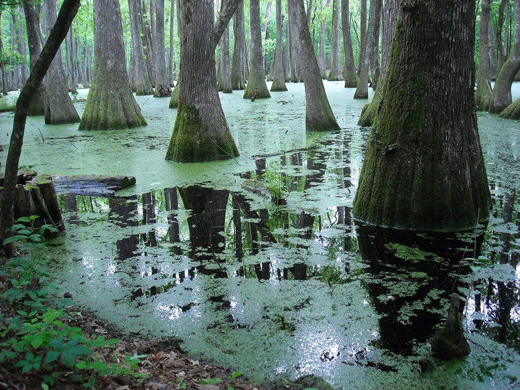
The Yalobusha River is full of pleasant surprises and meanderings and is a paddler’s paradise from the dam in Grenada to its end. Claimed to be “one of Mississippi’s treasures,” it flows through the Malmaison Wildlife Management Area, displays sycamore, birch, maple, and willow forests along its banks, hosts and abundance of wildlife from beaver to red-tailed hawks and blue herons, and possesses some fine sandbars and clear water. It is floatable at virtually any level; even in flood the river is fairly docile. There are many opportunities for camping and other outdoor recreational opportunities along its path. This route flows through the gorgeous Malmaison Wildlife Management Area for about half its distance.
Mississippi, Biloxi
01 :28 hrs
3.5 mi
7.593504 ft
III
Launched at Kuhn Street boat ramp and kayaked down the north side of Deer Island.
Mississippi, Pike County
02 :53 hrs
6.8 mi
7.4956665 ft
I
The Bogue Chitto River is tiny and logjammed in its upper reaches but as it extends into Pike County, it widens into one of the prettiest and most popular paddling rivers in Mississippi. It is not too small that you are constantly fighting logjams yet not too big that you are forever fighting headwinds. It has a swift current with sharp bends and submerged logs that will keep your attention. The river abounds in wildlife, the water is clear and the scenery is gorgeous, alternating with woods and sandbars. This stretch offers a very pleasant float with gorgeous forested scenery. It can become very busy on weekends and in the summer, especially as you approach the water park. There are canoe rental companies available near the park as well.
Mississippi, Lincoln County
00 :51 hrs
3.2 mi
14.484787 ft
Expert
The Mt. Zion Bike Trails are in a great, relatively remote area. This loop trail has great flow, the climbs are always rewarded with fun descents, and lots of intentional obstacles are placed to test your skill and provide a great playground for mountain bikers. You will encounter wooden berms, walls, and tabletops, a 14-foot see-saw, innumerable wooded bridges, and fun jumps. Although this route has many obstacles and challenges, there are always warning signs and turn-offs to avoid them. Alternate loops for beginners and a 1-mile loop for kids are available here with a pavilion stocked with popsicles for the kids. This is a great spot for riders of all abilities.
Mississippi, Tishomingo County
12 :20 hrs
29 mi
4.399925 ft
I
The Tennessee Tombigbee Waterway links the Tennessee and Tombigbee Rivers in northeast Mississippi. It has no current, is frequented by barges and motorboats, and often presents nothing more than a rock-lined canal. But it is one of the major waterways in the South and it passes through some superb wildlife areas. It is quite popular with many types of watercraft. Wildlife abounds along the waterway, beautiful hardwood forests and brushy areas fill the banks, and many campgrounds are nearby. With so many boat ramps and access points, paddling options are limitless. Bay Springs Lake is one of the most beautiful spots on the waterway. The beach-rimmed, piney-woods lake contains countless coves big and small. It is heavily used on summer weekends, but at off times the lake may be virtually deserted. The lock drops you 84 feet where you can have a whole new experience and new vistas.
Mississippi, Tishomingo County
05 :56 hrs
14 mi
6.799988 ft
I
The Tennessee Tombigbee Waterway links the Tennessee and Tombigbee Rivers in northeast Mississippi. It has no current, is frequented by barges and motorboats, and often presents nothing more than a rock-lined canal. But it is one of the major waterways in the South and it passes through some superb wildlife areas. It is quite popular with many types of watercraft. Wildlife abounds along the waterway, beautiful hardwood forests and brushy areas fill the banks, and many campgrounds are nearby. With so many boat ramps and access points, paddling options are limitless. This area is actually a lake and is well-worth exploring. It contains rocky bluffs draped with forests that display phenomenal foliage in the fall.
Mississippi, Grenada County
11 :12 hrs
24.9 mi
12.799995 ft
I
Grenada Lake is the largest body of water in Mississippi with nearly 64,000 acres of water, 148 miles of shoreline, 16 boat ramps, boundless opportunities for camping, and many other great outdoor recreation opportunities. This is the perfect spot for family fun and is a popular destination for visitors year-round. In addition to the many water-base and other outdoor recreational activities, Grenada Lake hosts several fishing tournaments annually as well. It is home to Hugh White State Park and several other public use areas around its shores. The scenery is beautiful and there are lots of things to do and see.
Mississippi, Tishomingo County
03 :24 hrs
33.6 mi
110.632126 ft
Hard
This section of the Natchez Trace Parkway travels through northwest Alabama crossing over the Tennessee River near its halfway point. The trail provides great view points and scenic vistas along the way through the rolling hills of Alabama’s countryside. Begin along the Alabama/Mississippi state line, at the parking area just off of the parkway and travel to the Alabama/Tennessee state line (shown here), or vise versa. This trail can be done as an out out-and-back day trip, or one way which is shown here. If desired, the entire route of the Natchez Trace Parkway can be linked with this portion beginning from Natchez, Mississippi traveling to Nashville, Tennessee.
Mississippi, Biloxi
01 :39 hrs
16.5 mi
6.348848 ft
Moderate
This is a great urban ride through the city centers of Biloxi and Ocean Springs. You will ride along the beach in Biloxi with spectacular vistas over the long beach and large open waters. Crossing the bridge to Ocean Springs also offers many views of the water as well as of the cities. Another great beach ride is waiting after you cross the bridge and you will cut through some of the city streets in Ocean Springs and Biloxi before finishing. The cities are busy and there is lots of traffic but bicycle lanes and paths are available.
Louisiana, Covington
05 :29 hrs
27.5 mi
7.1697607 ft
Expert
This scenic recreational pathway is the first in Louisiana to be part of the National Rail-Trail Network and is a popular destination for bikers looking for high mileage and good scenery. The paved corridor passes through lots of undeveloped forested terrain and green space as well as multiple historic communities. The trail has lots of convenient access spots and parking areas giving visitors the option of customizing trips of varying distances. The trail is very flat and very well-maintained so riders of all skill levels will enjoy visiting the trail.
Mississippi, Pike County
02 :08 hrs
5.1 mi
9.762527 ft
I
The Bogue Chitto River is tiny and logjammed in its upper reaches but as it extends into Pike County, it widens into one of the prettiest and most popular paddling rivers in Mississippi. It is not too small that you are constantly fighting logjams yet not too big that you are forever fighting headwinds. It has a swift current with sharp bends and submerged logs that will keep your attention. The river abounds in wildlife, the water is clear and the scenery is gorgeous, alternating with woods and sandbars. This section includes perhaps the finest stretch on the river from Bogue Chitto Water Park to just below Highway 48 in Walthall. The river is narrow enough to provide shade, tricky enough not to be dull, and has little sign of human presence. Wildlife is abundant and ospreys are frequently spotted.
Mississippi, Wilkinson County
01 :45 hrs
4.6 mi
87.794464 ft
Hard
Clark Creek Natural Area is a 700 acre park and is home to over 50 waterfalls. On this hike you will travel to some of these waterfalls and have some spectacular views atop the ridges. The trail starts off improved, but turns into a single track primitive trail with steep inclines. The deep woodland is very scenic and peaceful and is also home to a beautiful range of foliage and wildlife. Because of the steep and rugged terrain, this is possibly some of the toughest hiking in Mississippi.
Mississippi, Gulfport
13 :26 hrs
33.6 mi
0.42277518 ft
SK V
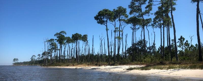
The Gulf Islands National Seashore is one of the prime places to paddle along the Mississippi Coast and is headquartered in Ocean Springs. Ship Island is the collective name for two barrier islands, East Ship Island and West Ship Island. Hurricane Camille split the once single island into two separate islands in 1969. Fort Massachusetts is found on the western end and pine, cedar, and live-oak dominate the wooded areas. Evidence of Hurricane Katrina is easily found as well.
Mississippi, Newton County
01 :29 hrs
3.3 mi
9.574905 ft
I
Turkey Creek Water Park features a 250-acre lake located just five miles southwest of Decatur. This is one of the most popular lakes around, attracting skiers, paddlers, fishermen, campers, and other outdoor enthusiasts. It is known for its conservation program and natural beauty. The shorelines are filled with wildflowers, thick forest, deer, squirrels, ducks, turkeys, and other wildlife. There is also a white sand beach for swimmers, wooded picnic areas, and nature trails.
Mississippi, Gulfport
10 :15 hrs
12.8 mi
0.3679123 ft
SK V
The Gulf Islands National Seashore is one of the prime places to paddle along the Mississippi Coast and is headquartered in Ocean Springs. Cat Island is the westernmost island and is a perfect playground for paddlers. Its unique T-shape was created by colliding Gulf currents. The beautiful sandy beaches are backed by dense forests of slash pines and live oaks. Bayous and marshes on Cat Island are home to alligators as well as refuge to migratory birds. The scenery is spectacular and there are many places to explore.
Mississippi, Tate County
11 :19 hrs
25.1 mi
2.899994 ft
I
Arkabutla Lake is a reservoir on the Coldwater River in both Tate and DeSoto counties in north Mississippi. It is a beautiful and popular lake with an annual visitation exceeding 2 million people. To accommodate all of its visitors, there are many recreational opportunities and facilities available. The lake offers a fishing pier, swimming beach, accessible campgrounds, sailing, waterskiing, and paddling. Sailing is very popular because of the dependable winds. For paddlers, this is something of caution but there are small coves to escape the wind. Wind warning lights are visible from most areas on the lake. No alcohol is permitted and lifejacket wearing is strictly required. The scenery and natural beauty is wonderful while paddling Arkabutla Lake.
Mississippi, Covington County
04 :02 hrs
9.5 mi
11.642513 ft
II
Mississippi is not a state that has a lot of whitewater. Several streams have occasional chutes and drop-offs, but only the Okatoma is renowned for its whitewater. The Okatoma Creek is just a regular Mississippi creek that happens to have four notable rapids on a popular stretch between Seminary and Sanford. Drawing huge crowds and making the Okatoma one of the most popular floats in the state, these rapids provide quite a thrill. The first rapid contains a fairly easy passage to the left of some rock shoals blocking most of the river. The Chute is a narrow channel on the left that requires paddlers to make a hard right to negotiate the second drop at fast speeds. Okatoma Falls comes 2 miles below the Chute and consists of a straightforward plunge of about 2.5 feet. The last rapids comes right after the falls as the river narrows into a tree-lined gorge and provides some excitement but poses no threat.
Mississippi, Perry County
04 :09 hrs
9.8 mi
10.117439 ft
I
Black Creek is Mississippi’s premier paddling stream. For most of its length it is ideal paddling size, avoiding logjams and strainers of a small creek and motorboats and headwinds of a large river. The current is strong and steady with no whitewater and no stagnant pools and it is located largely in the De Soto National Forest and contains wilderness surroundings and gorgeous scenery. Its name comes from the dark, tannin-stained waters. The dark water is highlighted with white sandbars beneath green forest walls. Many wildflowers and wild berries can be found along the river banks as well. This wonderful stretch of river is a designated national Wild and Scenic River and the Black Creek Wilderness Area fills the surrounding land.
Mississippi, Lauderdale County
08 :34 hrs
19.1 mi
6.4999924 ft
I
Okatibbee Lake is an 11,000-acre project maintained by the Corps of Engineers that was developed for flood control and also offers many recreational opportunities. Surrounding the lake there is one campground, four day-use parks with boat ramps, and three designated swimming areas. The scenery is very natural and beautiful and wildlife is abundant and commonly seen from the water and along the shorelines. On the north side of the lake is the Okatibbee Wildlife Management Area that can be partially explored by canoe.
Mississippi, Wiggins
04 :16 hrs
9.5 mi
1.1998672 ft
I
Flint Creek Reservoir is a 600-acre lake located in the Flint Creek Water Park in Wiggins. The lake is stocked with bass, bream, crappie, and catfish. Boating, waterskiing, swimming, jet skiing, and paddling are other popular activities on the water. Also available is the parks waterslides. Many other family recreational opportunities are available. The scenery is wonderful and wildlife is abundant with thick, beautiful forest filling the shorelines. Wild turkey, deer, squirrels, ducks, and other waterfowl can often be found along the lakeside.
Mississippi, Lowndes County
01 :46 hrs
5.1 mi
26.038895 ft
Hard
This trail circles the scenic Lake Lowndes as you traverse hilly countryside. You will cross several streams that make their way to the lake, adding to the attractive water views. The trail surface consists of grass and dirt on the narrow footpath and pavement for the on-road section. The scenery is spectacular with great views of the lake and wonderful woods with holly trees adding year-round greenery in addition to the thick woodland foliage. Other trails are available and may be combined for longer excursions.
Mississippi, Brandon
00 :09 hrs
0.4 mi
7.5794373 ft
Easy
Easy walk with optional mild climbing
Mississippi, Warren County
01 :04 hrs
11 mi
58.04346 ft
Easy
Vicksburg National Military Park preserves the site of the American Civil War Battle of Vicksburg, waged from May 18 to July 4, 1863. This ride follows the park roads and offers a great tour of most of the sites at the park. The park includes 1,325 historic monuments and markers, 20 miles of historic trenches and earthworks, two antebellum homes, 144 emplaced cannons, the Grant’s Canal site, and the 117-acre cemetery. There is also a 12-mile hiking trail available for those who wish to experience more than what can be seen from the touring road.
Louisiana, St. Tammany County
03 :16 hrs
7.3 mi
2.999998 ft
I
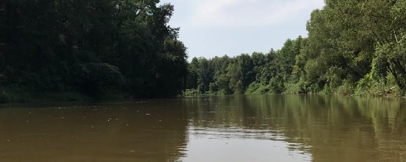
The Pearl River forms the border between Louisiana and Mississippi and offers some scenic paddling, especially the section that runs through the Pearl River Wildlife Management Area. The river widens as it enters Louisiana and splits into multiple channels. This section of river starts at Davis Landing on the most western river channel and follows the river south through swamp and marsh terrain to the take-out at Indian Village. The area is very rugged and full of wildlife, including gators.
Mississippi, Wilkinson County
01 :45 hrs
4.6 mi
87.794464 ft
Hard
Clark Creek Natural Area is a 700 acre park, home to over 50 waterfalls. Hike the area loop to travel across some of these waterfalls and see some of the views atop the ridges. The trail starts off as an improved trail but turns into a single track primitive trail with steep inclines.
Mississippi, Quitman
02 :57 hrs
6.6 mi
3.5999908 ft
I
Archusa Creek Reservoir is a 450-acre lake located on the east side of Quitman and is the centerpiece for the Archusa Creek Water Park. It has large fishing populations, especially for bass, catfish, perch, and bream. Swimming, boating, and waterskiing are among some of the most popular activities on the lake. Archusa Creek Water Park also offers other outdoor recreational opportunities. On the west side of the reservoir there is some residential development but most of the shoreline scenery is natural and very beautiful with thick forest all around. There are also a few forested islands on the water that are very pretty.
Alabama, Dauphin Island
01 :52 hrs
2.3 mi
4.8 ft
SK II
A great intro into Sea Kayaking, Sand Island off of Dauphin Island along Pelican Bay provides beginners and veterans with abundant marine wildlife, white sand beaches and green and gold sea oats for viewing pleasure. Begin from Dauphin Island beach near Isle Dauphin Golf Club as you make your way through the waters of the gulf of Mexico. Depending on your time commitment, you can choose to paddle around the island or paddle along one side. Harsh southerly winds and hurricanes continue to push the sands northward, ever changing the landscape of this island. Always get a weather report before paddling upon open water.
Alabama, Mobile County
01 :51 hrs
4.6 mi
1.6 ft
SK I
Located along the western edge of Alabama’s Mobile Bay, this trip begins from Fowl River Marina ($5 use fee), and travels north to Goat Island by way of East Fowl River. There are many possible routes throughout the area. This particular trip travels in a counter clockwise direction around the island, while also exploring the various side sloughs and inlets the area has to offer. End this trip by traveling back to Fowl River Marina. This trip has a small portion of open water paddling located at the entrance of Fowl River. Choppy waters may be present in this area along Mobile Bay.
Mississippi, Tishomingo County
02 :32 hrs
25.9 mi
86.10857 ft
Hard
The Natchez Trace is a historical path that extends about from Natchez, Mississippi to Nashville, Tennessee and links the Cumberland, Tennessee, and Mississippi Rivers. It was created and used for centuries by Native Americans and was later used by early European and American explorers, traders, and emigrants. Today, the trail is commemorated by the Natchez Trace Parkway and the Natchez Trace National Scenic Trail. This route extends from the Alabama-Mississippi border to a parking area just before Kirkville. You will pass through the Tishomingo State Park and along the Trace are many points of interest. Some of these include Bear Creek Mound, Cave Spring, Tennessee-Tombigbee Waterway, Pharr Mounds, and Donivan Slough. The scenery is beautiful.
Mississippi, Perry County
02 :28 hrs
5.8 mi
10.996948 ft
I
Black Creek is Mississippi’s premier paddling stream. For most of its length it is ideal paddling size, avoiding logjams and strainers of a small creek and motorboats and headwinds of a large river. The current is strong and steady with no whitewater and no stagnant pools and it is located largely in the De Soto National Forest and contains wilderness surroundings and gorgeous scenery. Its name comes from the dark, tannin-stained waters. The dark water is highlighted with white sandbars beneath green forest walls. Many wildflowers and wild berries can be found along the river banks as well. Beaverdam Creek enters just below the put-in and is an impressive little brook worth exploring on foot, either by wading or following the segment of Black Creek Trail that loops around it.
Mississippi, Harrison County
08 :41 hrs
12.6 mi
36.23214 ft
Expert
One of the most ecologically diverse and versatile hikes in the state, the Tuxachanie Trail is a 13 mile out and back, with a green and a yellow loop that branch off of the main trial about half way through. Located in beautiful De Soto National Forest, you will travel through wetlands, forests of holly and magnolia trees, and a section of the Tuxachanie Creek system.
Mississippi, Hinds County
03 :43 hrs
37 mi
65.72505 ft
Hard
The Natchez Trace is a historical path that extends about from Natchez, Mississippi to Nashville, Tennessee and links the Cumberland, Tennessee, and Mississippi Rivers. It was created and used for centuries by Native Americans and was later used by early European and American explorers, traders, and emigrants. Today, the trail is commemorated by the Natchez Trace Parkway and the Natchez Trace National Scenic Trail. This section of the Trace flows through mostly remote areas with thick, gorgeous forests lining the road. The scenery is wonderful and there are also many historic sites to see. Some of these are the town of Rocky Springs, Grindstone Ford, Mangum Mound, and Sunken Trace. Informational signs provide information on these sites. Owens Creek Waterfall adds to the scenery.
Alabama, Mobile County
09 :29 hrs
23.7 mi
2.1 ft
SK II
Located along the western edge of Alabama’s Mobile Bay, this trip begins from Memories Fish Camp boat launch ($3 use fee). Travel south down Muddy Creek and Dykes Creek as it then turns into Fowl River. At the split continue to head south down West Fowl River into the Mississippi Sound and Fowl River Bay. This particular trip continues into the bay and around Turtleback Island before ending in Heron Bay at Jemison’s Launch. If you would like a shorter distance trip,or are traveling in a canoe, you have the option of ending at Delta Port Marina before heading into open waters of the bay area.
Mississippi, Pontotoc County
04 :29 hrs
9.9 mi
2.3916245 ft
I
Trace Lake offers 565 acres of freshwater for fishing, paddling, and water sports. The lake is stocked with largemouth bass, channel catfish, redear sunfish, bluegill, and crappie. A fee is charged for use of the boat ramps but carry-in access is free. Water skiing is popular on the lake year-round. Trace Lake offers a quiet, natural retreat located just minutes from the excitement of Tupelo. A thick forest with lush foliage surrounds the lake and provides great scenery.
Louisiana, East Feliciana County
01 :09 hrs
3.3 mi
15.684812 ft
Moderate
Port Hudson is the site of a historic Civil War siege and battle that now serves as a stage for yearly re-enactments as well as a recreational area that offers a museum and hiking trails. The trails lead to impressive overlooks and points of interest that provide visitors to the area a glimpse of the history and happenings that occurred at Port Hudson. The trails consists of dirt trails and boardwalks that lead through the forested area along the river and over small bluffs. The historic site is closed Mondays and major holidays and is open from 9 a.m. to 5 p.m.
Louisiana, East Baton Rouge County
01 :14 hrs
4.6 mi
4.597804 ft
Moderate
Located in the northeast outskirts of Baton Rouge, Comite River Park offers mountain bikers a fun and challenging race course that runs along the scenic Comite River and Cypress Bayou. The singletrack trail travels over some hilly terrain with some short but steep ascents and descents and lots of twists and turns. The trail network here is extensive with lots of shortcut trails so you may want to refer to a trail map when exploring the area. The trails are also popular for hiking so pay close attention to other users on the trail.
Louisiana, Jackson
02 :21 hrs
23.8 mi
51.711746 ft
Hard
This scenic ride through East Feliciana Parish follows some peaceful roads that travel through beautiful undeveloped wooded terrain. Along the way there are multiple creek crossings that are great for resting, picnicing, and playing in the water. Highway 421 is fairly smooth and has some small ups and downs over rolling hills but no major climbs. Jones Creek Road has a few more curves and hills but is still not too physically demanding. There are no food or water stops outside of Jackson so be sure to pack plenty for the ride. Jackson has some interesting historic sites and good eating establishments to visit at the beginning or end of the ride.
Mississippi, Noxubee County
01 :26 hrs
3.2 mi
3.9990845 ft
I
Bluff Lake is a 1200-acre lake that is located in the Sam D. Hamilton Noxubee National Wildlife Refuge. The refuge consists of 48,000 acres of bottomland and upland forest that is occupied by a variety of game species, including quail, deer, and turkey. In addition, many other bird species inhabit the forests and a few notable ones are the wood stork and bald eagle. The Loakfoma and Bluff Lakes are perfect for quietly exploring and observing the gorgeous scenery and timid wildlife.
Mississippi, Hattiesburg
02 :15 hrs
5.4 mi
7.9778214 ft
I
Black Creek is Mississippi’s premier paddling stream. For most of its length it is ideal paddling size, avoiding logjams and strainers of a small creek and motorboats and headwinds of a large river. The current is strong and steady with no whitewater and no stagnant pools and it is located largely in the De Soto National Forest and contains wilderness surroundings and gorgeous scenery. Its name comes from the dark, tannin-stained waters. The dark water is highlighted with white sandbars beneath green forest walls. Many wildflowers and wild berries can be found along the river banks as well. On this stretch you will float down several lovely, meandering miles with quiet, peaceful scenery. On busy weekends and holidays you are likely to meet many others also enjoying this segment of the river.
Mississippi, Port Gibson
03 :09 hrs
31.8 mi
75.35263 ft
Hard
The Windosr Ruiins are about 10 miles southwest of Port Gibson. The ruins are those of the largest antebellum Greek Revival mansion built in the state and have been used in various motion pictures. Leaving from Port Gibson, you will tour country roads through beautiful forested scenery. The area is mostly remote except for the short distances through the small towns of Port Gibson and Alcorn.
Mississippi, Lee County
02 :57 hrs
6.6 mi
6.999962 ft
I
Elvis Presley Lake is a 322 acre lake located in Tupelo. Here you can find some of the best water-related recreation opportunities around. Some of the amenities include a handicapped access fishing pier, shady shorelines great for bank fishing, a boat ramp, several camping pads, a pavilion, and picnic areas. The scenery is beautiful with thick forest surrounding the lake. The shoreline is irregular with many coves and long, finger-like projections from the lake body which give great opportunities to find a quiet place to enjoy nature.
Mississippi, Pascagoula
06 :02 hrs
15.1 mi
0.4726448 ft
SK V
The Gulf Islands National Seashore is one of the prime places to paddle along the Mississippi Coast and is headquartered in Ocean Springs. Petit Bois Island is the easternmost island located south of Pascagoula. The island originally extended about 7 miles east of the Alabama-Mississippi state line and was effectively located in both states but between 1933 and 1968 the eastern end of the island eroded due to the effects of hurricanes and natural shoreline movement. The island is now approximately 6 miles long and serves as a habitat for gulls, terns, plovers, alligators, and other wildlife. Petit Bois in French means “little woods” and was so named by the early French explorers due to a small wooded section on the eastern end that is mostly non-existent since Hurricane Katrina. The island consists mostly of sand and scrub.
Mississippi, Itawamba County
04 :44 hrs
11.1 mi
2.6906586 ft
I
The Tennessee Tombigbee Waterway links the Tennessee and Tombigbee Rivers in northeast Mississippi. It has no current, is frequented by barges and motorboats, and often presents nothing more than a rock-lined canal. But it is one of the major waterways in the South and it passes through some superb wildlife areas. It is quite popular with many types of watercraft. Wildlife abounds along the waterway, beautiful hardwood forests and brushy areas fill the banks, and many campgrounds are nearby. With so many boat ramps and access points, paddling options are limitless. The surrounding land on this route contains numerous creeks and rivers that are tributaries to the waterway. Wildlife is abundant, waterfowl are ever-present, and the surrounding forest provides stunning scenery.
Louisiana, St. Francisville
01 :42 hrs
17.1 mi
50.510727 ft
Moderate
This short loop ride through the Feliciana Hills offers excellent scenery as well as a taste of Louisiana history by visiting the site of Rosedown Gardens and Plantation. Some of the best scenery along the route is near the very beginning of the ride on Tunica Road. The highlight of the trip, however, is the site of the plantation which is known for its beautiful gardens and historic home. The area is slightly hilly with just a few small ups and downs but overall is not too physically strenuous.
Mississippi, Clarke County
00 :51 hrs
1.9 mi
6.8677673 ft
I
Ivy Lake is a beautiful 65- acre lake located in the middle of Clarkco State Park. There are several features that make this a great destination for paddling. Some of these include the 815 acres of gently rolling woodlands that surround that lake and provide a gorgeous background to the lake, the clear blue water, and the peace and tranquility found in this unspoiled natural setting. The lake is stocked with largemouth bass, bluegill, and channel catfish and offers good fishing year-round.
Mississippi, Wayne County
02 :53 hrs
6.4 mi
7.7999344 ft
I
Maynor Creek Water Park offers a 450-acre lake for fishing, boating, swimming, and waterskiing and is located just six miles west of Waynesboro. Fishing is great for bream, catfish, crappie, and Florida bass. The views are stunning with dogwoods and magnolias blooming in the spring and glorious autumn colors paint the scenery in the fall. Also available in the park are great campgrounds and picnic pavilions and some hiking opportunities.
Mississippi, Itawamba County
03 :27 hrs
8.2 mi
10.996155 ft
I
The Tennessee Tombigbee Waterway links the Tennessee and Tombigbee Rivers in northeast Mississippi. It has no current, is frequented by barges and motorboats, and often presents nothing more than a rock-lined canal. But it is one of the major waterways in the South and it passes through some superb wildlife areas. It is quite popular with many types of watercraft. Wildlife abounds along the waterway, beautiful hardwood forests and brushy areas fill the banks, and many campgrounds are nearby. With so many boat ramps and access points, paddling options are limitless. This section follows the channel through a very scenic, lush forest and ends at a great public use area. Beaver Lake Recreation Area is has a lot of wildlife and has a small lake that is great for a quiet paddle.
Mississippi, Greenwood
06 :09 hrs
61.5 mi
4.988125 ft
Extreme
The Bikes, Blues, and Bayous bicycle tour is held annually in Greenwood and Leflore counties. There is a 20-mile, 46-mile, and 62-mile course available. You can either enter to join this race or choose to do it on your own time. It is a beautiful ride with fantastic scenery and many great views. You will cross through forested areas, vast agricultural lands, cross rivers, pass through quaint towns, as well as the historic downtown of Greenwood. Parking is available on the street and is free throughout all of the downtown area. The ride is almost completely flat with very minor and gentle elevation changes.
Mississippi, Pike County
02 :00 hrs
4.5 mi
3.7999954 ft
I
Lake Tangipahoa is a 700-acre lake and is the focal point in the Percy Quinn State Park. Loblolly pines and stately magnolia trees, rolling hills, spectacular wildlife, and seasonal flowers surround the lake and fill the park, creating wonderful scenery and views from the water. Boating, swimming, and fishing are generally permitted on the lake, however fishing is closed until 2017. Many camping opportunities and other recreational activities are available in the park.
Mississippi, Lincoln County
02 :34 hrs
5.7 mi
4.976654 ft
I
Lake Lincoln is nestled in the shade of towering hardwood trees and is the center piece for the gorgeous Lake Lincoln State Park. This beautiful lake provides many recreational opportunities including boating, swimming, skiing, fishing, and paddling. Fish are stocked annually and the fishing is good. The scenery and clear blue water make a lovely paddling experience. The thick forest fills the shorelines and surrounding area and the park offers many other activities as well.
Mississippi, Port Gibson
04 :15 hrs
42.8 mi
77.030304 ft
Expert
This route has some great scenery as it follow a section of the Natchez Trace Parkway and some meandering country roads through thick hardwood forests. One major point of interest is a wonderful vista of the Mississippi River at Grand Gulf. Grand Gulf is rich in history with many historic buildings and churches as well as the site of the Battle of Grand Gulf. You will have other great water views as you pass Lake Mille as well.
Mississippi, Forrest County
03 :05 hrs
7.3 mi
7.2615013 ft
I
Black Creek is Mississippi’s premier paddling stream. For most of its length it is ideal paddling size, avoiding logjams and strainers of a small creek and motorboats and headwinds of a large river. The current is strong and steady with no whitewater and no stagnant pools and it is located largely in the De Soto National Forest and contains wilderness surroundings and gorgeous scenery. Its name comes from the dark, tannin-stained waters. The dark water is highlighted with white sandbars beneath green forest walls. Many wildflowers and wild berries can be found along the river banks as well. This stretch runs between broadening sandbars and high bluffs. The stream is narrow and shallow enough in some places to require tricky maneuvering but not hard enough to make you question the worth of the trip. The scenery is very beautiful and intimate.
Mississippi, Stone County
08 :33 hrs
20.2 mi
12.618445 ft
I
Black Creek is Mississippi’s premier paddling stream. For most of its length it is ideal paddling size, avoiding logjams and strainers of a small creek and motorboats and headwinds of a large river. The current is strong and steady with no whitewater and no stagnant pools and it is located largely in the De Soto National Forest and contains wilderness surroundings and gorgeous scenery. Its name comes from the dark, tannin-stained waters. The dark water is highlighted with white sandbars beneath green forest walls. Many wildflowers and wild berries can be found along the river banks as well. The creek exits the national forest on this section but the change is not dramatic. More noticeable is the creek’s gradual evolution toward swampy-ness.
Alabama, Mobile
02 :44 hrs
10.3 mi
15.800007 ft
Hard
Considered to be one of the best trails in Mobile Alabama and surrounding areas, this trail is located right on campus of University of Southern Alabama. Although the trail is on campus, you are traveling through heavily wooded areas making you unaware how close you are to the University. This combination of trails create a fast and flowy singletrack route with a few slight up hill sections. This trail can be traveled in either direction, White Trail (shown here) travels clockwise, while Yellow Trail travels counter clockwise. The trail is well marked and shows you what direction to take for easier or more advanced features, as well as marking which way to go for the quickest exit of the trail system if you need to exit before finishing the full loop. This loop is made up of multiple trails which can be accomplished by themselves if you desire a shorter ride.
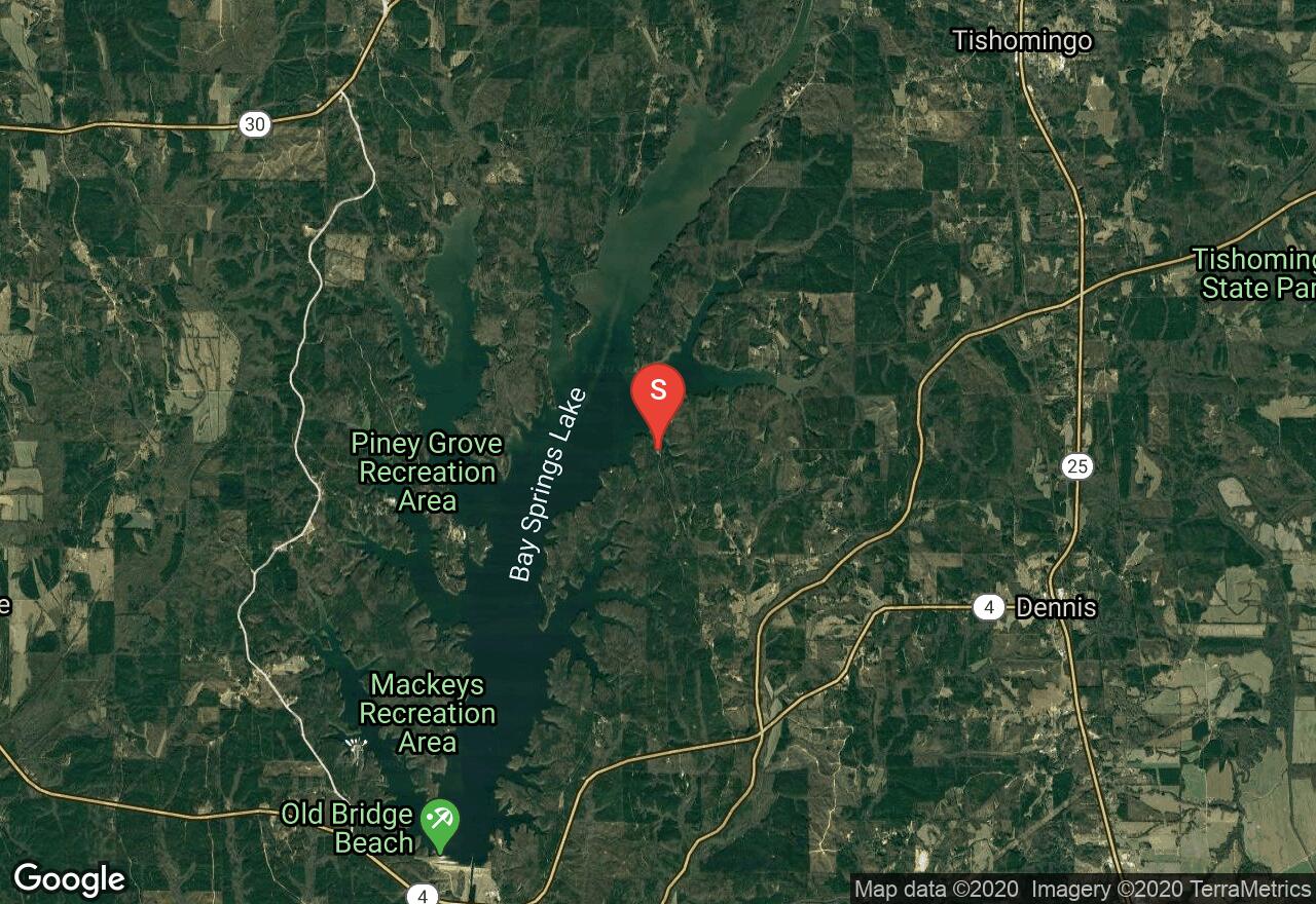
Mississippi, Tishomingo County
01 :58 hrs
4.6 mi
5.6238556 ft
I
Bear Creek is an exceptionally beautiful small stream that runs through the heart of the Tishomingo State Park, the only state park with canoe rental and shuttle services. The landscape is rocky and hilly, and portions of the creek scoot over rocks for some exciting swifts. Other stretches are long, straight, and without current. While in the park’s boundaries the scenery includes towering stands of forest, tall canyon walls, and foliage that is lush green in the summer and stunningly colorful in the fall. This section begins at the swinging foot bridge in Tishomingo State Park and flows through its thick, lush forest. Once you leave the park, the forest thins a bit and large agricultural fields back the thin line of trees as you continue to the take-out.
Mississippi, Clarke County
07 :04 hrs
16.7 mi
7.694504 ft
I
The Chickasawhay River flows for 159 miles at the fringe of the Appalachians and contains a variety of beautiful scenery. You will see pretty stone, encounter some muck, pass an intriguing region of waterfalls and alligators, as well as cliffs and swamps. Except for the lower reaches of the river where it becomes wide and deep, the Chickasawhay provides pleasant floating, with good fishing, and relatively little human contact. Because of its remoteness, wildlife thrives here and sightings are common. This section is particularly scenic, with high clay-rock walls and deep woods that range from pine plantations to tropical-type jungle. The sheer bluffs are natural sources of spring water and in springtime, water pours from the mossy clay walls like faucets.
Louisiana, West Ferriday
01 :56 hrs
4.3 mi
1.8462095 ft
I
Bayou Cocodrie offers paddlers the opportunity to explore an area of some of some of the last remaining bottomland hardwoods in all of Louisiana. The designated scenic river offers lots of untouched wilderness scenery as well as birdwatching opportunity. This trip starts from the launch at the northern end of the wildlife management area and travels south on the bayou. The trip can easily be shortened or lengthened by paddling the bayou varying distances if desired.
Mississippi, Ocean Springs
03 :24 hrs
8.5 mi
1.1764591 ft
SK II
The Gulf Islands National Seashore is one of the prime places to paddle along the Mississippi Coast and is headquartered in Ocean Springs. There are four bayous within the park. Halstead Bayou winds west past the campground, Stark Bayou runs north to a park road, a smaller bayou meanders east beside the William M. Colmer Visitor Center, and Davis Bayou opens out to Biloxi Bay. All of these areas offer a beautiful sample of marsh, an abundance of wildlife, and bird-crowded sand pits. All four of these bayous are easy paddling except Davis Bayou which is wide and subject to strong winds. When the breeze is light you can paddle inland several miles.
Mississippi, Tishomingo County
00 :30 hrs
1.1 mi
0.21250916 ft
I
Haynes Lake is a small, 45 acre lake located in the Tishomingo State Park. The lake is well-stocked with largemouth bass, bluegill, redear sunfish, and channel catfish and gasoline engines up to 10 horsepower are allowed. The lake and park are located in the foothills of the Appalachian Mountains and the scenery and views are absolutely stunning. Steep forested hills surround the lake and offer a very quiet, secluded atmosphere. Tishomingo State Park has many other opportunities for recreation and enjoying the beauty of nature.
Mississippi, Walthall County
02 :38 hrs
6.3 mi
11.078846 ft
I
Magee’s Creek is a sparking jewel of a stream with crystal clear water and deep, shady woods. There are only about twelve miles on this creek that are floatable but it’s as pretty a place you’re likely to see anywhere. It is a tributary to the Bogue Chitto River and it becomes floatable at Homes Water Park on Highway 198. This stretch is twisty and narrow and may pose problems in extreme low water contains adequate water most of the time. The smaller and more maneuverable the boat, the better. The scenery consists of spring-dampened clay banks and massive, overarching hardwood trees. Because of previous issues with paddlers and landowners, there are strict regulations prohibiting alcohol, firearms, trespassing, and glass or Styrofoam containers.
Mississippi, Lamar County
01 :48 hrs
4 mi
6.847458 ft
I
This water park offers a 600-acre lake for swimming, fishing, hiking, and boating. The park also has many scenic campsites and a variety of outdoor activities. The location is relatively remote and the scenery is very natural and beautiful. Thick forest surrounds the lake and wildlife is abundant. The lake has a great fishing population and is stocked regularly.
Mississippi, Madison County
01 :38 hrs
6.4 mi
40.154335 ft
Expert
The Ridgeland Trails is an excellent trail system through a beautiful forest. The scenery is beautiful with plenty of large rock formations. Different trails are available for riders of different skill levels. This route combines them all and provides more variety and mileage. There is an awesome tree bridge for more advanced riders, some short, challenging climbs, fun obstacles, and a wooden banked turn. A membership is required to use this track but 2-day memberships are available at a kiosk.
Mississippi, Clarke County
01 :29 hrs
3.5 mi
3.2065659 ft
I
The Chickasawhay River flows for 159 miles at the fringe of the Appalachians and contains a variety of beautiful scenery. You will see pretty stone, encounter some muck, pass an intriguing region of waterfalls and alligators, as well as cliffs and swamps. Except for the lower reaches of the river where it becomes wide and deep, the Chickasawhay provides pleasant floating, with good fishing, and relatively little human contact. Because of its remoteness, wildlife thrives here and sightings are common. This section is particularly scenic, with high clay-rock walls and deep woods that range from pine plantations to tropical-type jungle. The sheer bluffs are natural sources of spring water and in springtime, water pours from the mossy clay walls like faucets.
Mississippi, New Albany
04 :31 hrs
45.3 mi
43.16388 ft
Expert
The Tanglefoot Trail follows an historic railroad corridor and has lots to offer for both the nature enthusiast and the recreational opportunist. The asphalt trail winds through six communities and three counties that are rich in history. You will be surrounded by mature hardwood forests, agricultural fields of cotton and soybeans, pastures, and wetlands with great views of creeks, flora, and fauna. There are many road crossings but most are private farm crossings and the traffic is minimal. There are also several bridge crossings but they are wooden and may be quite bumpy and the elevation changes are mild.
Mississippi, Jackson County
13 :49 hrs
32.5 mi
3.8 ft
I
The Pascagoula River is the grand waterway of southeast Mississippi and is already sizeable when it officially begins at the juncture of the Leaf and Chickasawhay Rivers. It is a remarkably wild river, bordered for most of its length by the Pascagoula River Wildlife Management Area and the Ward Bayou Wildlife Management Area with several other wildlife areas flanking these and filling the area for miles. This section enters the Ward Bayou Wildlife Management Area and does a considerable amount of meandering before it splits into two branches. Continue on the west branch to the take-out at Shepard State Park.
Mississippi, Hancock County
05 :33 hrs
6.5 mi
2.3471842 ft
I
The Jourdan River is scarcely a river at all, more of an estuary of St. Louis Bay with virtually no current. McLeod Water Park is the highest public access point on the river, yet even here the Jourdan is wide and deep enough for large motorboats. By paddling and exploring upstream you can escape the motorboat traffic, find the best scenery on the river, and have the opportunity to explore many narrow side passages and oxbow lakes. You will find quiet, lonely waters ringed by gorgeous thick forest, an abundance of birdlife from ospreys to blue herons, and lots of other wildlife and woodland creatures. The river rises and falls with the tide.
Alabama, Mobile County
06 :09 hrs
13.8 mi
13.630838 ft
I
Located in Mobile County Alabama, near the border of Mississippi, this trip begins off of Mason Ferry Road and travel alongs the swift flowing Escatawpa River ending at Escatawpa River Campground off of Moffett Road. Because of the deepness of the water in combination with the numerous sandbars located along the entire route, the Escatawpa River is known as a great “play river”. The sandbars are great areas to pull off for a lunch break or for camping if desired and the deep pools of water off the sandbars allow for swimming holes during breaks along the route. Various wildlife such as; deer, turtles, turkey, and hawks can be seen along the route. Bring insect repellent as mosquitoes may be present during sections of slower water flow. A $3 parking fee is required if you desire to park at Escatawpa River Campground.
Mississippi, Marshall County
00 :42 hrs
1.5 mi
5.5960083 ft
I
Spring Lake is the centerpiece of the gorgeous Wall Doxey State Park. The park offers an abundance of outdoor recreation opportunities in a setting that is rich in natural beauty. The lake is spring-fed and surrounded by a beautiful and thick forest. Fishing is great and bird watching is also enjoyed here. No swimming is permitted in the lake and boats must not exceed trolling speed.
Louisiana, Franklin County
06 :44 hrs
14.9 mi
5.0031147 ft
I
This section of the Tensas River is a good option for paddling as it runs right through a national wildlife refuge that offers a very remote setting and lots of opportunity for viewing wildlife, including bears. The river is surrounded by hardwood forests and undeveloped wilderness area. The trip starts at a primitive launch on Fool Lake and heads northwest to the convergence with the Tensas. From here paddlers will turn south and follow the river around a large bend to a take-out at Ben Lilly Launch.
Louisiana, St. Tammany Parish County
01 :29 hrs
4.4 mi
3.5520535 ft
Moderate
This scenic hiking trail located in Fontainebleau State Park is a great option for hikers and visitors to the area who want to really get out and explore the area of forest and marsh terrain. The dirt trail leads through the diverse terrain that is home to lots of plantlife and wildlife. The hike is very flat and easy to follow and can easily be shortened by hiking just part of the trail or lengthened by adding the connecting interpretive nature trail. The state park also offers picnic areas, camping, and access to Lake Pontchartrain.
Mississippi, Noxubee County
01 :50 hrs
4.1 mi
2.7999268 ft
I
Loakfoma Lake is a 600-acre lake that is located in the Sam D. Hamilton Noxubee National Wildlife Refuge. The refuge consists of 48,000 acres of bottomland and upland forest that is occupied by a variety of game species, including quail, deer, and turkey. In addition, many other bird species inhabit the forests and a few notable ones are the wood stork and bald eagle. The Loakfoma and Bluff Lakes are perfect for quietly exploring and observing the gorgeous scenery and timid wildlife.
Mississippi, Jefferson Davis County
00 :45 hrs
2.1 mi
14.274391 ft
Easy
The Golden Eagle Trail Complex, sometimes known as Tuffburg, is a multi-use trail system made up of 10 miles of single track with a large range of trail difficulty. There are arrows on the trails that point in a suggest direction of flow. The trails were built and are maintained by volunteers so please respect the land and other trail users. The Turtle Loop is a beginner trail with an easy flow, some bridges, and beautiful forest scenery.
Mississippi, George County
05 :26 hrs
12.8 mi
3.396203 ft
I
The Pascagoula River is the grand waterway of southeast Mississippi and is already sizeable when it officially begins at the juncture of the Leaf and Chickasawhay Rivers. It is a remarkably wild river, bordered for most of its length by the Pascagoula River Wildlife Management Area and the Ward Bayou Wildlife Management Area with several other wildlife areas flanking these and filling the area for miles. On this stretch the Pascagoula retains elements of hill country, with high bluffs, pine trees, and only intermittent swamps and bayous among the big, beautiful sandbars.
Mississippi, Clarke County
05 :47 hrs
13.6 mi
12.596203 ft
II
The Chickasawhay River flows for 159 miles at the fringe of the Appalachians and contains a variety of beautiful scenery. You will see pretty stone, encounter some muck, pass an intriguing region of waterfalls and alligators, as well as cliffs and swamps. Except for the lower reaches of the river where it becomes wide and deep, the Chickasawhay provides pleasant floating, with good fishing, and relatively little human contact. Because of its remoteness, wildlife thrives here and sightings are common. This section is particularly scenic, with high clay-rock walls and deep woods that range from pine plantations to tropical-type jungle. The sheer bluffs are natural sources of spring water and in springtime, water pours from the mossy clay walls like faucets. Sandbars increase and there are about 10 small sets of easy rapids, including a 2-3 foot drop and a roaring 200-yard-long stretch at the mouth of Shubuta Creek, called Old Shubuta Races.
Mississippi, Tishomingo County
02 :38 hrs
6.3 mi
6.259918 ft
I
Bear Creek is an exceptionally beautiful small stream that runs through the heart of the Tishomingo State Park, the only state park with canoe rental and shuttle services. The landscape is rocky and hilly, and portions of the creek scoot over rocks for some exciting swifts. Other stretches are long, straight, and without current. While in the park’s boundaries the scenery includes towering stands of forest, tall canyon walls, and foliage that is lush green in the summer and stunningly colorful in the fall. This section of river meanders through thick, lush forest of the Toshomingo State Park and ends next to the swinging foot bridge. The park also has a 45-acre lake for paddling, many nature trails, and many camping opportunities.
Mississippi, Adams County
01 :41 hrs
3.7 mi
7.084198 ft
I
Natchez Lake is a very pretty, 230-acre lake located in Natchez State Park just 10 miles north of historic Natchez. The lake is well-stocked with largemouth bass, bluegill, crappie, redear sunfish, and channel catfish and it holds the record for the largest bass in Mississippi history. The scenery consists of gorgeous, densely wooded rolling hills and it is very quiet and secluded.
Mississippi, Walthall County
02 :15 hrs
5.4 mi
10.366829 ft
I
Magee’s Creek is a sparking jewel of a stream with crystal clear water and deep, shady woods. There are only about twelve miles on this creek that are floatable but it’s as pretty a place you’re likely to see anywhere. It is a tributary to the Bogue Chitto River and it becomes floatable at Homes Water Park on Highway 198. This stretch is twisty and narrow and may pose problems in extreme low water contains adequate water most of the time. The smaller and more maneuverable the boat, the better. The scenery consists of spring-dampened clay banks and massive, overarching hardwood trees. Because of previous issues with paddlers and landowners, there are strict regulations prohibiting alcohol, firearms, trespassing, and glass or Styrofoam containers.
Mississippi, Adams County
02 :08 hrs
4.8 mi
2.799943 ft
I
Butler Lake is a lake located just nine miles from Natchez, in the St. Catherine Creek National Wildlife Refuge. The refuge contains a diverse array of habitat types consisting of bottomland hardwoods, cypress swamps, upland hardwoods on the Loess Bluffs, and small cliffs made from a specific type of wind-blown sediment. It was established in 1990 to preserve, improve, and create habitat for waterfowl. In addition to waterfowl, other wildlife that can be found at the refuge is wood storks, the alligators, songbirds, and many more. The alligator gar is one of the unique species found here. They are large prehistoric fish that have been found as long as 10 feet and weighing up to 300 pounds. They live in lakes, bayous, slow-moving rivers, and some brackish coastal waters.
Mississippi, George County
13 :47 hrs
32.5 mi
6.966447 ft
I
The Pascagoula River is the grand waterway of southeast Mississippi and is already sizeable when it officially begins at the juncture of the Leaf and Chickasawhay Rivers. It is a remarkably wild river, bordered for most of its length by the Pascagoula River Wildlife Management Area and the Ward Bayou Wildlife Management Area with several other wildlife areas flanking these and filling the area for miles. On this stretch, Big Black Creek enters from the west and the forested scenery is thick and provides a respectable level of solitude and tranquility.
Louisiana, St. Tammany County
00 :49 hrs
1.4 mi
0.54567516 ft
Easy
This paved pathway follows the Pontchartrain Lakefront in Mandeville and is a popular jogging/walking trail. The paved trail offers excellent views of the water as well as quaint residential development along the way. The paved pathway is wide and flat, and has lots of good access areas and resting spots.
Mississippi, Harrison County
05 :39 hrs
13.4 mi
16.090622 ft
I
The Wolf River offers near-pristine paddling for more than half its length. The stream begins west of Lumberton but doesn’t become navigable until the Silver Run community southeast of Poplarville and it eventually empties into St. Louis Bay. Its character changes several times making it fascinating to explore. On this stretch, small sandbars grow bigger and the thick forested background provides a quiet getaway. A privately owned primitive campsite on Cemetery Road is available on this route.
Mississippi, Walthall County
03 :02 hrs
7.2 mi
7.934883 ft
I
The Bogue Chitto River is tiny and logjammed in its upper reaches but as it extends into Pike County, it widens into one of the prettiest and most popular paddling rivers in Mississippi. It is not too small that you are constantly fighting logjams yet not too big that you are forever fighting headwinds. It has a swift current with sharp bends and submerged logs that will keep your attention. The river abounds in wildlife, the water is clear and the scenery is gorgeous, alternating with woods and sandbars. On this stretch, black and turkey vultures are plentiful and have established the area for roosting and resting. Offsetting the relative homeliness of the buzzards are wildflowers growing along the river, which has widened enough now to receive full sun. The spider flower is especially pretty and it blooms from June through November.
Mississippi, Prentiss County
02 :07 hrs
5.2 mi
26.457962 ft
I
The Tennessee Tombigbee Waterway links the Tennessee and Tombigbee Rivers in northeast Mississippi. It has no current, is frequented by barges and motorboats, and often presents nothing more than a rock-lined canal. But it is one of the major waterways in the South and it passes through some superb wildlife areas. It is quite popular with many types of watercraft. Wildlife abounds along the waterway, beautiful hardwood forests and brushy areas fill the banks, and many campgrounds are nearby. With so many boat ramps and access points, paddling options are limitless. Bay Springs Lake is one of the most beautiful spots on the waterway. The beach-rimmed, piney-woods lake contains countless coves big and small. It is heavily used on summer weekends, but at off times the lake may be virtually deserted. The lock drops you 84 feet where you can have a whole new experience and new vistas.
Mississippi, Gulfport
08 :02 hrs
19 mi
9.168479 ft
I
The Wolf River offers near-pristine paddling for more than half its length. The stream begins west of Lumberton but doesn’t become navigable until the Silver Run community southeast of Poplarville and it eventually empties into St. Louis Bay. Its character changes several times making it fascinating to explore. The river widens and deepens on this stretch and as a result the current slows. The paddling now feels more coastal, as you pass large sandbars, and beautiful woodland and marsh scenery. Wolf River Canoe and Kayak headquarters offers guided paddle trips through the marshes in and around St. Louis Bay. Two take-out options are passed before reaching Hampton Road, the last access point on the river.
Mississippi, Jefferson County
03 :05 hrs
31.6 mi
78.63635 ft
Hard
The Natchez Trace is a historical path that extends about from Natchez, Mississippi to Nashville, Tennessee and links the Cumberland, Tennessee, and Mississippi Rivers. It was created and used for centuries by Native Americans and was later used by early European and American explorers, traders, and emigrants. Today, the trail is commemorated by the Natchez Trace Parkway and the Natchez Trace National Scenic Trail. This section of the Trace extends to its southern terminus in the city of Natchez. The scenery is very beautiful as you ride through the country and thick forests. There are many great views over the rivers and you will pass other points of interest such as Loess Bluff, Turpin Creek, and Emerald Mound.
Mississippi, Rankin County
17 :39 hrs
39.2 mi
3.0999832 ft
I
The Ross R. Barnett Reservoir, sometimes referred to as “The Rez”, is an impoundment of the Pearl River. The 33,000-acre lake serves as the state’s largest drinking water resource. It features 105 miles of shoreline that are quite diverse and wonderful for exploring, especially Pelahatchie Bay and the northern end of the lake. There are numerous small islands and coves, great scenery, and many secluded areas for paddlers to enjoy.
Mississippi, Pike County
02 :28 hrs
5.8 mi
7.4749756 ft
I
The Bogue Chitto River is tiny and logjammed in its upper reaches but as it extends into Pike County, it widens into one of the prettiest and most popular paddling rivers in Mississippi. It is not too small that you are constantly fighting logjams yet not too big that you are forever fighting headwinds. It has a swift current with sharp bends and submerged logs that will keep your attention. The river abounds in wildlife, the water is clear and the scenery is gorgeous, alternating with woods and sandbars. This is the farthest upstream that is paddleable and still has plenty of logjams, yet it is a very sweet stretch. It has beautiful green scenery that provides wonderful shade. Birch and sycamore trees reach across the river in places to form a canopy.
Mississippi, Pascagoula
03 :25 hrs
8.5 mi
0.29415828 ft
SK III
Round Island is a small, uninhabited island located in the Mississippi Sound just a few miles off shore from Pascagoula. It has beautiful, long sand beaches and sparse forests of slash pine, and some interior marshes. The island provides feeding, resting, and wintering habitat for migratory birds, including the brown and white pelicans and cormorants. A number of rare or endangered species, including the American alligator are found there. Hurricane Katrina did lots of damage that included destruction of the lighthouse and cutting channels partly pr completely through it. Round Island provides a great opportunity to explore an offshore island in much less distance than one of the Gulf National Seashore Barrier Islands.
Mississippi, Jackson County
08 :03 hrs
10.1 mi
0.9750935 ft
SK V
The Gulf Islands National Seashore is one of the prime places to paddle along the Mississippi Coast and is headquartered in Ocean Springs. This route leaves from Ocean Springs Beach off of South Belle Fontaine Drive and crosses a gap of over six feet to reach Horn Island. The island is 13 miles long and up to ¾ of a mile wide and is home to a variety of wildlife. In addition to the wild hogs, ospreys, bald eagles, deer, rabbits, raccoons, and alligators there are fierce biting insects. The sandy beaches are long and beautiful, views out into the open sea are endless, and footpaths cross the island, allowing you to explore its lagoons, marshes, and thickets. Take caution as waves can build quickly and unexpectedly and other dangers of the open sea are prevalent.
Louisiana, Livingston County
01 :41 hrs
1.9 mi
1.1832402 ft
I
Tickfaw State Park provides visitors easy access to the Tickfaw River, a nice spot for a relaxing, scenic paddle through an area of diverse habitats. The flatwater river offers paddlers of all skill levels the opportunity to view wildlife, fish, and enjoy nature. The state park has boat rentals, camping, picnicing, and hiking trails.
Mississippi, Meridian
02 :06 hrs
8 mi
50.3975 ft
Hard
This is a great singletrack trail located on the west side of Bonita Lakes. It contains some rolling hill sections, some steep climbs and descents, a few sharp turns and switchbacks, and only minor obstacles such as small rocks. As you ride through the scenic forest, great vistas over the lake are also presented. The trail is very well-maintained as well. Hiking trails and horse trails run parallel to this trail as well as intersecting it often. Take caution, and stay on the blue-blazed path that is dedicated to mountain biking.
Alabama, Mobile County
05 :28 hrs
13.7 mi
1.0000001 ft
SK II
Located along the edges of the Mobile Bay and the Mississippi Sound, this trip begins from Heron Bay/ Jemison’s Launch. From here you will travel in a counter clockwise direction exploring the many creeks, bayous and sloughs that border the entire Heron Bay area. Your trip will end back at Jemison’s Launch. With many options in this area to paddle, you can have a different trip route with each visit. Along this route you will view a wide variety of wildlife and also have the option of some great fishing. This area is a semi-protected region of water unless the winds are coming from the southwest direction which will then cause choppy waves. The current is noticeable heading either north or south. This trip can easily be turned into a multi-day route, if the proper gear and equipment is at hand.
Mississippi, George County
09 :57 hrs
23.5 mi
9.2303505 ft
I
Black Creek is Mississippi’s premier paddling stream. For most of its length it is ideal paddling size, avoiding logjams and strainers of a small creek and motorboats and headwinds of a large river. The current is strong and steady with no whitewater and no stagnant pools and it is located largely in the De Soto National Forest and contains wilderness surroundings and gorgeous scenery. Its name comes from the dark, tannin-stained waters. The dark water is highlighted with white sandbars beneath green forest walls. Many wildflowers and wild berries can be found along the river banks as well. On this section the forest changes and you will begin to see more cypress than pine, with Spanish moss dangling over the water. Springs refresh the river, leaking from low slipper-clay shelves.
Mississippi, Yalobusha County
08 :37 hrs
19.1 mi
8.799995 ft
I
Enid Lake is a 28,000-acre reservoir with parts that extend into three counties. It is surrounded by several state park areas, including Cossar State Park situated on a large peninsula on its southern shore. Fishing is very good and very popular. Common fish species include crappie, largemouth bass, catfish, and bream. The lake holds the world records for white crappie. The scenery is wonderfully diverse with white sandy beaches, marshy areas, many streams that are great for exploring, and thick forests that provide a great background for it all.
Alabama, Livingston
00 :14 hrs
0.7 mi
8.548531 ft
Easy
Forest Trail is a quick hike/trail run through the hills next to Lake Livingston, located on the campus of University of West Alabama. The trail begins from the small parking lot next to the wooden bridge that crosses a narrow portion of the lake. The trail makes a loop through the trees leading back to the same trailhead. Signs along the trail provide educational information about the areas plant and animal life.
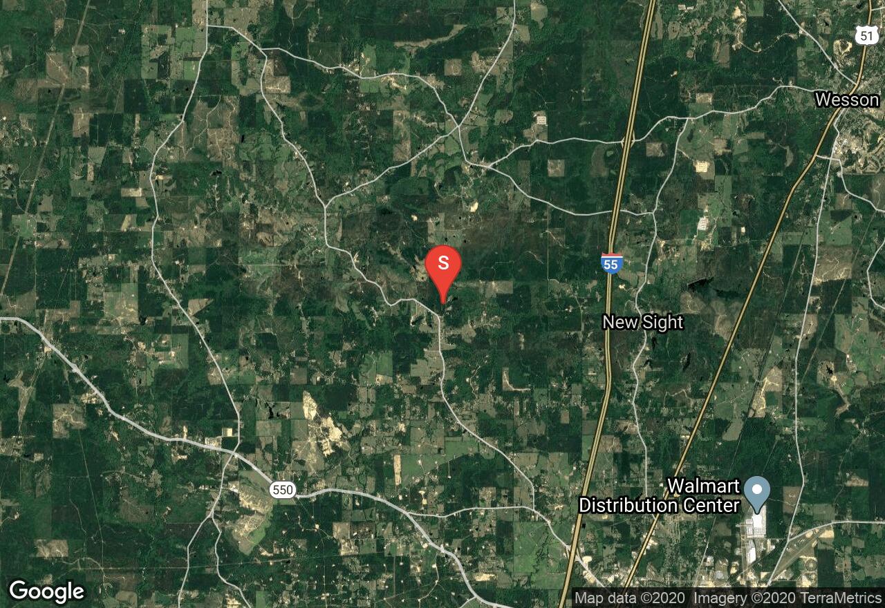
Mississippi, Grenada County
05 :00 hrs
11.8 mi
4.888088 ft
I
The Yalobusha River is full of pleasant surprises and meanderings and is a paddler’s paradise from the dam in Grenada to its end. Claimed to be “one of Mississippi’s treasures,” it flows through the Malmaison Wildlife Management Area, displays sycamore, birch, maple, and willow forests along its banks, hosts and abundance of wildlife from beaver to red-tailed hawks and blue herons, and possesses some fine sandbars and clear water. It is floatable at virtually any level; even in flood the river is fairly docile. There are many opportunities for camping and other outdoor recreational opportunities along its path.
Louisiana, St. Tammany Parish County
00 :32 hrs
1.6 mi
1.5891373 ft
Easy
This interpretive nature trail located in Fontainebleau State Park is a great option for beginner hikers and visitors to the area who want to get a see what the area has to offer without hiking for a long time. The loop consists of wide dirt trail and boardwalk pathway that leads through the area of forest and marsh that is home to lots of diverse plantlife and wildlife. The hike is very flat and easy to follow and can be shortened by hiking part of it as an out-and-back or lengthened by adding a connecting hiking trail in the park that heads further east. The state park also offers picnic areas, camping, and access to Lake Pontchartrain.
Alabama, Mobile County
04 :13 hrs
10.5 mi
0.8 ft
SK II
Located along the Mississippi Sound, this trip begins from the local boat launch site across the street from Coden Bayou Bait and Tackle Shop on Tom Johnson Road. From here travel south through Coden Bayou and then onto Portersville Bay. Once in Portersville Bay you can spot Terrapin Island in the distance. You have the option of traveling around the Island in either direction. Along your way around the Island, you have plenty of options to stop along the beaches or explore the various sloughs. To end this trip, travel back to the local boat launch site along Tom Johnson Road. Always use caution when paddling open waters as conditions can change quickly.
Mississippi, Stone County
02 :24 hrs
9.1 mi
22.280087 ft
Hard
The Bethel Bike Trails are a network of 7 different trails in the De Soto National Forest. They are primarily single track with occasional doubletrack sections. The trails are mostly flat with only slight changes in elevation. This route combines three trails, the Badlands, the Briar Patch, and then the Couch. The scenery consists of mostly piney woods but the Couch Trail parallels the Tuxachanie Creek with great views. Several roots pose small challenges on the Couch Trail as well. This is a common hunting area and caution is advised during hunting season.
Mississippi, Perry County
04 :30 hrs
10.7 mi
11.254448 ft
I
Black Creek is Mississippi’s premier paddling stream. For most of its length it is ideal paddling size, avoiding logjams and strainers of a small creek and motorboats and headwinds of a large river. The current is strong and steady with no whitewater and no stagnant pools and it is located largely in the De Soto National Forest and contains wilderness surroundings and gorgeous scenery. Its name comes from the dark, tannin-stained waters. The dark water is highlighted with white sandbars beneath green forest walls. Many wildflowers and wild berries can be found along the river banks as well. The river widens a bit on this section as four more creeks flow into it. The natural scenery that fills the creek’s banks is worth every moment spent on the river.
Louisiana, Livingston County
00 :59 hrs
3 mi
3.0902262 ft
Moderate
Tickfaw State Park consists of varying ecosystems including bottomland hardwood forest, wetland, cypress swamp, and the Tickfaw River. A network of trails explore the area of diverse vegetation and wildlife, providing hikers with multiple hiking options. This hike follows multiple boardwalk and dirt trails to complete a loop through the area. The trails are very flat and easy to follow, great for hikers of all skill levels, including a trail that is ADA accessible. The state park also offers camping, picnicing, and canoeing.
Mississippi, Grenada County
08 :05 hrs
19.1 mi
7.711437 ft
I
The Yalobusha River is full of pleasant surprises and meanderings and is a paddler’s paradise from the dam in Grenada to its end. Claimed to be “one of Mississippi’s treasures,” it flows through the Malmaison Wildlife Management Area, displays sycamore, birch, maple, and willow forests along its banks, hosts and abundance of wildlife from beaver to red-tailed hawks and blue herons, and possesses some fine sandbars and clear water. It is floatable at virtually any level; even in flood the river is fairly docile. There are many opportunities for camping and other outdoor recreational opportunities along its path.
Mississippi, Jackson County
11 :31 hrs
27.1 mi
3.8 ft
I
The Pascagoula River is the grand waterway of southeast Mississippi and is already sizeable when it officially begins at the juncture of the Leaf and Chickasawhay Rivers. It is a remarkably wild river, bordered for most of its length by the Pascagoula River Wildlife Management Area and the Ward Bayou Wildlife Management Area with several other wildlife areas flanking these and filling the area for miles. This section enters the Ward Bayou Wildlife Management Area and does a considerable amount of meandering before it splits into two branches. Continue on the east branch to a ramp below the Interstate-10 bridge.
Mississippi, Jones County
05 :31 hrs
13.1 mi
17.259323 ft
III
The Leaf River, like the Chickasawhay River, flows for more than 150 miles through southeast Mississippi before merging to for the Pascagoula. For most of its length it tends to be a bit small for many motor boaters and a bit big for many paddlers, making it an ideal spot for a quiet getaway. Many other rivers and creeks join the Leaf River along its course and it grows significantly before its terminus. Towering, 70-foot bluffs and dense forest create a secure, closed-in feeling on this section. The river bottom swamps resemble tropical jungles, while high piney bluffs suggest the Rocky Mountains. There are numerous riffles and easy rapids on this route, including a 3-4-foot runnable waterfall called Gordon’s Rock.
Louisiana, West Carroll County
00 :49 hrs
2.4 mi
9.831963 ft
Easy
Situated in the northeast corner of Louisiana, Poverty Point State Historic Site provides visitors with both a scenic and historic hike through the area. The trail was constructed by boy scouts and travels through upland hardwood forest terrain to multiple sites of archeological significance. The area is known best for a series of manmade mounds that were built by inhabitants of the area. The exact reason for the mounds is unknown but there are theories that state they were foundations of dwellings. The hike is not too long and is mostly flat with the exception of one short climb to the top of a mound. There is a small fee to visit the historic site.
Alabama, Mobile County
05 :04 hrs
6.3 mi
- ft
SK III
Located along the Mississippi Sound, this trip begins from the West Fowl River Delta Port Marina ($5 use fee). From the put-in travel south into the Fowl River Bay before paddling through open waters passing Murder Point and Raccoon Island. After passing Raccoon Island you will approach Cat Island from the north east. Use the Sand bars to pull up on and rest as you enjoy the seclusion of the Island. Continue around the southern end of the Island before heading west to Marsh Island. Once again, enjoy the seclusion of the Islands before backtracking to West Fowl River Delta Port Marina to end the trip. This route makes for a great day trip which can be turned into a multi-day route if the proper gear and equipment is at hand. Always use caution when paddling open waters, as conditions can change quickly.
Louisiana, Lacombe
01 :41 hrs
2.5 mi
1.4901444 ft
Moderate
Located on the north shore of Lake Pontchartrain, this large wildlife refuge offers an array of natural habitats that provide great birdwatching and wildlife viewing opportunity. The hike follows both boardwalk trail and a dirt road that travels through the area of marshes, hardwood and pine forests, and sandy beaches. The out-and-back hike is just over 5 miles total but hikers looking for a short trip through the area can just hike the short boardwalk nature trail located near the trailhead.
Arkansas, Phillips County
02 :41 hrs
6 mi
1.2362976 ft
I
Located very near the Mississippi River within the St. Francis National Forest Storm Creek Lake is surrounded by dense and pristine hardwood forest. Actually a small reservoir, this body of water has a long and irregular shoreline that creates plenty of small private coves to explore. Camping facilities are available adjacent to the lake.
Louisiana, Washington County
01 :46 hrs
5 mi
31.142689 ft
Moderate
Hiking the trails in Bogue Chitto State Park provides visitors the experience of exploring an area of diverse natural habitats including cypress swamps, hardwood forest, upland forests, small streams and ponds, and rolling hill terrain. This 5-mile pathway loops around the area with multiple access points and resting stops making it a good option for hikers of varying skill levels. The state park also offers picnicing, camping, fishing, equestrian trails, boating, and wildlife viewing.
Mississippi, Lauderdale County
00 :34 hrs
1.6 mi
19.748734 ft
Easy
Dunn’s Falls splashes over a rock face on a big bend of the Chunky River. This is a beautiful natural setting where steep wooded bluffs drop down to the water’s edge offering a great vantage point for scenic vistas. This hike is a double loop that traverses very hilly, wooded terrain. The trail surface is mostly a dirt footpath through the forest but there is a long staircase that leads down to the base of the falls.
Mississippi, Scott County
07 :11 hrs
21.5 mi
32.76996 ft
Extreme
This popular trail makes the longest single-loop trail in the state, running about 23 miles. It is commonly hiked in two days, making camp at one of two base camps. One camp is at the trailhead and the other is about 10 miles in. On this hike you will wind through remote woodlands with attractive scenery. The trail is shared with but it is mostly level and well taken care of.
Mississippi, Tishomingo County
00 :58 hrs
2.6 mi
44.859604 ft
Moderate
Take a hike through scenic Tishomingo State Park and discover fascinating stone features. Along the path you will hike across stony creek beds and come across rocky sandstone gorges. Other recreational activities such as rock climbing are also welcomed along the trail.
Mississippi, Bolivar County
04 :37 hrs
10.3 mi
0.898571 ft
I
Lake Bolivar is a 1200-acre lake that averages a depth of only 5 feet. It contains a good population of a wide variety of fish and some aquatic vegetation includes duckweed and coontail. The lake is an ancient remnant of the Mississippi River created centuries ago by a natural cutoff at Bolivar Bend. There are dozens of pilings from an old bridge that extends across the lake which hold large numbers of bass. The scenery consists of lines of large cypress trees backed by vast agricultural fields.
Mississippi, Perry County
00 :13 hrs
0.6 mi
3.9239998 ft
Unknown
Moody’s Landing Campground is just downstream from Brooklyn. Visitors enjoy aquatic activities as well as hiking on nearby trails. Amenities include a boat ramp, picnic tables, toilets, drinking water, and more. The maximum stay limit is 14 days and no alcoholic beverages are allowed within the campground. No overnight fee is required.
Louisiana, Tangipahoa Parish County
04 :40 hrs
5.2 mi
0.13040048 ft
I
Manchac is a large lake swamp located northwest of New Orleans that provides lots of paddling destinations on its multiple lakes, rivers, and bayous. North Pass is a calm and easily accessible waterway located just south of the Joyce Wildlife Management Area that offers some nice scenery and wildlife viewing opportunity. Paddlers can explore the main waterway or venture off on the many sloughs and channels that spread through the area.
Mississippi, Marion County
00 :13 hrs
0.6 mi
5.262001 ft
Unknown
Mimosa Landing Campground is a private campground that consists of 67 sites which can accommodate both tents and trailers. Full hookups can be found at almost all sites and there are plenty of pull thrus. Other amenities include water, toilets, showers, propane, laundry facilities, internet, a pool, and a playground for children. Pricing ranges from $21-30 per night.
Mississippi, Scott County
02 :05 hrs
5.7 mi
27.071 ft
Unknown
Roosevelt State Park Campground consists of very spread out sites that surround the lake within the state park. There is a variety of sites here including cabins, standard sites, and more. Electric hookups are offered here and pets are welcome. Amenities include a boat launch, cable tv, laundry facilities, showers, drinking water, and more.
Mississippi, Tate County
01 :30 hrs
4.4 mi
25.527279 ft
Moderate
The Coldwater Nature Trail is situated below the dam of Arkabutla Lake. The path is well marked, and has different routes that can create shorter loops around the lake. The last bit of the trail follows the Big Oak Nature Trail near Coldwater River. You will traverse through dense bottomland forest with many signs of wildlife habitation all around.
Mississippi, Lauderdale County
00 :20 hrs
0.8 mi
13.9229965 ft
Unknown
Meridian East/Toomsuba KOA Campground is a very luxurious and well shaded campground. Visitors here have access to propane, wifi, a swimming pool, and a pavilion. Maximum RV length is 73 feet. Pets are welcome here and there is even a dog park within the campground.
Mississippi, Franklin County
00 :23 hrs
1 mi
26.71 ft
Unknown
Clear Springs Campground is located within the thick pine trees of Homochitto National Forest. Visitors here enjoy swimming and fishing in the nearby lake. Amenities include extra parking, a pavilion, an amphitheater, restrooms, and bathhouses. A day pass costs $5 per day and an overnight pass costs $7-20 per night depending on the site.
Mississippi, Oktibbeha County
01 :06 hrs
3.3 mi
2.7765884 ft
Moderate
The Noxubee Wildlife Refuge is an area that used to be intensively farmed and over-grazed and has been transformed into an excellent example of forest and wildlife management. This change has caused a return of bountiful wildlife populations and a restoration of the pine and hardwood forest types that were native to the area. The endangered red-cockaded woodpecker, wood stork, alligator, bald eagle, and wintering fowl live in the refuge. This hike begins on a trailhead on Keaton Tower Road and explores a great wilderness area of the refuge through the extensive bottomland hardwood forest where wildlife abounds and small creeks and rivers wind through the forest.
Alabama, Chickasaw
00 :37 hrs
1.2 mi
8.674491 ft
Moderate
Beginning from the Chickasabouge Park parking lot, travel along the access road under Interstate Highway 65 before connecting to Hemp Trail. Travel through rolling hills of thick forested sections, covered with hardwoods,pines, swamps, a few wooden bridges and sand sections to top it off. This trail links up with Coaster Trail and is done as a out and back. Great for mountain biking, but can also be used for hiking and trail running as well. Chickasabouge Park is a Outdoor Recreational Facility and Wildlife Refuge providing plenty of other activities to enjoy while at the park. An admission fee of $1 is required before entering the park. Camping is allowed with fee required.
Mississippi, Forrest County
02 :04 hrs
4.6 mi
4.7990494 ft
I
Lake Geiger is a 225-acre lake located in the Paul B. Johnson State Park and offers great freshwater fishing, water sports, paddling, and swimming. The lake is well-stocked with largemouth bass, crappie, bluegill, redear sunfish, and channel catfish. Surrounding the lake is a gorgeous hardwood forest, campgrounds, and hiking trails. Views from the water are stunning.
Mississippi, Chickasaw County
00 :09 hrs
0.4 mi
12.167 ft
Unknown
Stinkin Jims Horse Campground is a private campground located within the city of Houston. Both tents and trailers are welcome here and sites have access to electric/water hookups, water, toilets, showers, and more. Horses and other pets are welcome and visitors enjoy horseback riding as well as other activities on the nearby trails.
Mississippi, Jackson County
00 :16 hrs
0.8 mi
3.5737147 ft
Easy
The Sandhill Crane National Wildlife Refuge stands to provide protection for sandhill cranes, one of the rarest bird populations on earth. The diverse habitats found at the refuge make it an ideal resting place for migrating birds. It protects one of the last expanses of wet pine savanna habitats. Other things to look for at the refuge are the diverse plants that range from beautiful to bizarre and a long list of bird species. This trail begins beside the Ocean Springs Middle School and explores the pine forest, wetlands, and river in the area.
Mississippi, Oktibbeha County
00 :13 hrs
0.6 mi
1.5110016 ft
Unknown
Starkville KOA Campground sits along the shores of Okitibbeha County Lake. Sites have a great view of the water and also enjoy aquatic activities such as kayaking, fishing, and more. Amenities include firewood, cable tv, a pavilion, and electricity. Maximum RV length is 75 feet.
Mississippi, Perry County
00 :06 hrs
0.3 mi
3.0559998 ft
Unknown
Janice Landing Campground is located near Black Creek hiking trail within De Soto National Forest. Sites here have access to a boat ramp, picnic tables, toilets, and drinking water. There is a 14 day stay limit and there are no alcoholic beverages allowed within the campground. Black creek provides great aquatic activities.
Mississippi, Lafayette County
00 :24 hrs
1 mi
24.052002 ft
Unknown
Puskus Lake Campground is located within Holly Springs National Forest. This is a pretty quiet area that sits near the lake. Visitors enjoy fishing for crappie, catfish, bass, and bluegill. Amenities include picnic tables, a boat ramp, and more. This campground is open all year. Sites cost $3 for day use and $7 per night.
Louisiana, St. Francisville
03 :12 hrs
16.1 mi
24.483 ft
Hard
The out-and-back trip between St. Francisville and Morganza follows the the levee along the Mississippi River, providing riders with good views of the massive river while passing multiple historic sites including some impressive plantations and old churches. The ride requires crossing the ferry from St. Francisville to the south side of the river. The terrain is almost completely flat along this route and the traffic is very mild, making this a great choice for riders of all skill levels.
Mississippi, Yalobusha County
00 :13 hrs
0.6 mi
8.431999 ft
Unknown
Jones Creek Campground is located within George P Cossar State Park near Enid Lake. Sites here are more shaded and secluded than the other campground within the state park. Sites here have access to laundry facilities, a bathhouse, restrooms, and more. Maximum RV length is 40 feet. Visitors enjoy many aquatic activities as well as volleyball and other activities within the campground.
Mississippi, Gautier
00 :14 hrs
0.7 mi
5.134 ft
Unknown
Camp Journeys End Campground is a private campground that is located within the city of Ocean Springs. The 65 sites here can accommodate both tents and trailers up to 90 feet in length. Full hookups are offered at all sites and other amenities include tables, water, toilets, showers, RV storage, propane, laundry facilities, internet, a bat launch, and more. Pricing begins around $51 per night.
Mississippi, Holmes County
00 :32 hrs
1.5 mi
7.124962 ft
Easy
Holmes County State Park is home to beautiful hardwood forests, an abundance of wildlife, rolling nature trails, and English Lake. The trail winds through a small section of the park, providing a close look at native plants, birds, and wildlife. You will cross a dike over the lake as well as a bridge over another section of the lake. There are great views of the water.
Mississippi, Coahoma County
06 :27 hrs
14.3 mi
3.0999908 ft
I
Moon Lake is a 2300-acre lake located twenty miles south of Tunica’s casinos, just west of US-61 and is one of Mississippi River’s oxbow lakes. It is a shallow lake with the deepest points never reaching more than 35 feet and here is a great fishing population. It is well known for its crappie, catfish, and seasonal duck hunting. The lake is near the Mississippi River and provides many opportunities to view migratory birds. The water is still and this is a great destination for a quiet afternoon paddling and enjoying the tranquil beauty and solitude.
Mississippi, Pike County
00 :43 hrs
2 mi
27.147835 ft
Easy
This hike travels through the woods and wetlands along the Bogue Chitto River with waterfalls, swamps, and great views all packed into this short trek. It consists of two loops, one travelling on bluffs overlooking the river and the other crossing wetlands over numerous boardwalks. There are several cross trails which provide additional hiking opportunities. The trail surface is mainly hard-packed dirt with roots and leaves with several boardwalks to cross the swamps.
Mississippi, Tippah County
01 :39 hrs
3.7 mi
5.9999847 ft
I
Tippah County Lake is a 145 acre lake and is located just north of Ripley. There are great camping spots available and fishermen are likely to find a variety of fish, especially bass and crappie. The scenery is very green and beautiful with a thick, lush forest filling the shorelines. Some views over open meadows are also available. There are several coves around the lake where quiet and solitude can be found.
Mississippi, Perry County
00 :07 hrs
0.3 mi
1.5170002 ft
Unknown
Cypress Creek Landing Campground is located near Black Creek within De Soto National Forest. The 14 sites have access to a boat ramp, picnic tables, toilets, fire rings, and drinking water. There is a 14 day stay limit and alcoholic beverages are not permitted. Sites cost $7 per night.
Mississippi, Neshoba County
00 :14 hrs
0.7 mi
2.2320023 ft
Unknown
Burnside Lake Campground consists of 22 private sites that can accommodate both tents and RVs up to 40 feet in length. Electric/water hookups can be found and other amenities include water, toilets, showers, dump, and more. Pets are welcome here. Sites are open all year and pricing ranges from $21-30 per night.
Mississippi, Biloxi
00 :14 hrs
0.7 mi
3.1880002 ft
Unknown
Parkers Landing Campground consists of 130 private sites located within Biloxi. Sites can accommodate both tents and trailers. Full hookups are offered at almost every site. Other amenities include tables, water, toilets, showers, RV storage, propane, laundry facilities, cable tv, and a pool. Sites cost $41-50 per night.
Mississippi, George County
07 :25 hrs
17.5 mi
5.681611 ft
I
Red Creek heads up around Lumberton and flows southeast, roughly paralleling the Black Creek when later the two creeks merge to form Big Black Creek. Red Creek is a paddling gem and is shallow and sandy as it flows through beautiful forest with much wildlife and peace and quiet. On this stretch, you will float a few miles on the Red Creek before it’s juncture with the Black Creek and later, a few miles on the Pascagoula River. Red Creek lies within the realm of the Pascagoula swamp and this area offers some great backwater exploration. The final mile or so before the juncture with Black Creek flows within the Pascagoula River Wildlife Management Area. This route certainly provides unique scenery and great exploration opportunities.
Mississippi, Ocean Springs
00 :34 hrs
1.7 mi
4.2067394 ft
Easy
The Sandhill Crane National Wildlife Refuge stands to provide protection for sandhill cranes, one of the rarest bird populations on earth. The diverse habitats found at the refuge make it an ideal resting place for migrating birds. It protects one of the last expanses of wet pine savanna habitats. Other things to look for at the refuge are the diverse plants that range from beautiful to bizarre and a long list of bird species. This trail starts at the Visitor Center and winds through the gorgeous pine savanna and near the river with great views.
Louisiana, Baton Rouge
00 :34 hrs
2.8 mi
4.4526196 ft
Easy
This multi-use recreational trail follows the banks of the Mississippi River, past multiple points of interest in the city of Baton Rouge. The trip starts near the LSU campus and continues to downtown Baton Rouge passing museums, historic sites, and the state capitol along the way. The trail is flat, paved, and wide with separate lanes for biking and jogging.
Mississippi, Perry County
06 :60 hrs
16.5 mi
12.884357 ft
I
The Tallahala Creek runs down a narrow corridor of land, bounded on the west by the Okatoma Creek valley and on the east by Bogue Homa Creek. As a result, Tallahala has few notable tributaries and never gets a chance to grow. It is a very attractive stream with good fishing that is very rarely used by other paddlers or boaters. It is characterized by big woods, big cutovers, medium-sized sandbars, and lots of peace and quiet. It is too narrow and shallow to paddle until it reaches Highway 29 east of Ellisville and even then, logjams and shallows are quite burdensome. This stretch is quiet and pleasant and offers great scenery. Some unfortunate cutovers leave the banks empty for long stretches. However, when the cutovers end, the creek coasts between walls of big trees and high banks and in spring, flowering mountain laurels glow and a bounty of other gorgeous wildflowers bloom.
Mississippi, Tate County
00 :09 hrs
0.4 mi
2.437996 ft
Unknown
Memphis South RV Park and Campground is a private campground located within the city of Coldwater. The 82 sites here can accommodate both tents and trailers up to 60 feet in length. Full hookups are offered at all sites and other amenities include laundry facilities, RV storage, firewood, internet, a pool, and a playground. Pricing ranges from $31-40 per night.
Mississippi, Jones County
04 :15 hrs
10 mi
8.671078 ft
I
The Leaf River, like the Chickasawhay River, flows for more than 150 miles through southeast Mississippi before merging to for the Pascagoula. For most of its length it tends to be a bit small for many motor boaters and a bit big for many paddlers, making it an ideal spot for a quiet getaway. Many other rivers and creeks join the Leaf River along its course and it grows significantly before its terminus. The river widens considerably on this stretch and sandbars become vast. These sandbars are frequented by great blue herons that are often spotted snatching up fish from the river.
Arkansas, Lee County
04 :09 hrs
9.2 mi
1.0999908 ft
I
Bear Creek Lake is a medium size reservoir in the St. Francis National Forest near the Mississippi River. The lake is surrounded by dense hardwood forest and is particularly beautiful in the fall when colors are vibrant. Paddling here is made interesting by the lake’s long irregular shoreline that offers several branches and many coves to explore.
Mississippi, Clarke County
00 :14 hrs
0.7 mi
9.584999 ft
Unknown
Clarkco State Park Campground surrounds the lake within the state park and offers plenty of primitive sites and cabins. Visitors here enjoy fishing, hiking, swimming, and other aquatic activities. Amenities include a boat launch, fire rings, laundry facilities, picnic tables, showers, and more. Pets are welcome here.
Mississippi, Lee County
03 :20 hrs
7.4 mi
2.5012436 ft
I
Lake Lamar Bruce is a 300 acre lake located in Saltillo in Lee County. The lake is stocked with a variety of fish and you can expect to find largemouth bass, carp, redear sunfish, bluegill, crappie, and channel catfish. A very thick, beautiful forest surrounds the lake and provides great views and scenery. Several homes are found around the shorelines but it is overall a very quiet and peaceful lake.
Mississippi, Perry County
04 :11 hrs
6.1 mi
22.05613 ft
Expert
Hike another portion of Black Creek Trail from Janice Landing to get another set of views of the waterway, swamps, and pine forests. Boardwalks and footbridges span the trail, as you enjoy the variety of ecosystems along the way.
Mississippi, Lowndes County
00 :28 hrs
1.3 mi
9.113998 ft
Unknown
Lake Lowndes Campground is located along the shores of the lake. Visitors enjoy access to plenty of activities within the campground such as football, soccer, tennis, basketball, and volleyball. Fishing and other aquatic activities are also popular here. Sites have electric hookups and pets are welcome here.
Mississippi, Holmes County
05 :39 hrs
13.3 mi
7.6185646 ft
I
The Big Black River slices diagonally across the state from northeast to southwest. It contains elements of both the Mississippi Delta and the piney hills and it includes sandbars and a few red clay bluffs. Some of the highlights found on this river include lush forest, plenty of sloughs for exploring, and great catfishing, but it is very muddy and the current is slow. The woods and wildlife make it worth it and paddlers return in spite of the mud. This section of the river offers many sloughs to explore where you can find a splendid array of trees and plants. Wildlife is abundant in these parts and is often spotted by quiet paddlers. Tracks of different animals and creatures can be seen in the wet ground and a variety of birds can be heard and seen in the trees and overhead.
Mississippi, Wilkinson County
08 :56 hrs
19.8 mi
10.348099 ft
I
Lake Mary is located in Wilkinson County and is an oxbow lake of the Mississippi River. It has a large fishing population, especially in April and May. The scenery is exceptionally beautiful with thick forests all around and several large islands on the lake. At low water levels, nice sandy beaches are available and are great for swimmers. All of the property along Lake Mary Road is privately owned and should be respected.
Mississippi, Coahoma County
17 :48 hrs
41.9 mi
8.083706 ft
I
The Mississippi River is large, has a lot of power, and carries lots of tugboat traffic and for these reasons it demands extra caution. For long trips, paddling down the center of the river in as straight a line as possible and pulling aside for barge traffic is the best strategy. For short trips, paddling close to the shore to avoid traffic may be easiest. Hazards on this big river include strong upstream eddies and dangerous whirlpools. Although the difficulty rating of this river is Class I with no rapids, this river should not be attempted unless you are competent with a paddle. The woods and wildlife are phenomenal surrounding the 400 miles of river through Mississippi. On this section there are several really large islands and twists in the river. A large, thick forest surrounds the river and offers gorgeous scenery. You will find many sandy banks and sand bars and enjoy a very quiet paddle with great views.
Mississippi, Chickasaw County
00 :09 hrs
0.4 mi
9.795998 ft
Unknown
Davis Lake Campground is located within Tombigee National Forest. Visitors enjoy endless recreation here such as swimming, skiing, fishing, and boating. Amenities include water and electric hookups, tables, grills, a boat ramp, toilets, showers, and even more. Sites cost $5 for day use and $20 for overnight use.
Mississippi, Ocean Springs
00 :40 hrs
2 mi
2.9266381 ft
Easy
Davis Bayou is an oasis of green natural coastal woodlands located only a few miles from Biloxi. It is part of the Gulf Islands National Seashore and offers a lot of recreational opportunities to visitors. This hike traverses a maritime forest and along tidal creeks with views extending toward the Gulf. Boardwalks take you across a saltwater bayou bordered with marsh grass and alligator sightings are possible as well.
Alabama, Prichard
00 :40 hrs
1.9 mi
9.957289 ft
Easy
The Indian Loop Trail inside Chickasabouge Park is a multi-use trail used by hikers, trail runners and mountain bikers. Hikers and runners are advised to run the trails in one direction while bikers are advised to ride the trails in the opposite direction to avoid accidents. Begin from the parking lot and cross the park road before entering into dense woods of magnolia oaks, and trail brush. Stay left at the junction of Cemetery Trail before meeting with the two ends of the Indian Loop trail. Again stay left as you begin the loop. At the halfway point, you will see a trailhead leading to campsites. Take this trail to lead you down to the beaches of Chickasaw Creek. After enjoying the creek, backtrack to the Indian Loop trail to finish the loop back to the parking lot. Be sure to grab the trail park map to avoid confusion of the trail system within the park. A $1 fee is required to enter the park, children under 6 and seniors enter for free.
Alabama, Dauphin Island
11 :29 hrs
14.4 mi
0.2 ft
SK II
Beginning from Aloe Park Landing, this trip travels the west end of Dauphin Island passing various small bays and long stretches of white sand beaches for which Alabama’s Gulf Coast is known for. Once reaching West Point, pull up on shore and relax before heading back to Aloe Park Landing. If desired, you can continue your paddle around West Point and around Dauphin Island. Always use caution when paddling open waters as conditions can change quickly.
Mississippi, Oktibbeha County
01 :57 hrs
4.3 mi
4.96994 ft
I
Oktibbeha County Lake is a 480-acre lake just 9 miles west of Starkville off of Highway 82. It has boat rental, camping, and other facilities available. Skiing is permitted on the lake from noon to sunset. It is in a relatively remote area with beautiful, thick forest surrounding the lake and providing wonderful scenery. A couple small creeks enter the lake and can be explored upstream for a quieter, more intimate setting to enjoy the scenery.
Mississippi, Franklin County
03 :45 hrs
10.6 mi
46.26554 ft
Expert
Get your hiking boots on for this 11 mile loop within Homochitto National Forest. Tally's Creek loops away from the Clear Springs Lake recreation area, and ventures through wooded glens, and hilly terrain. If you wish to backpack you can make this an overnight loop, or combine with other trails within the Clear Springs Trail system for a multi-night loop.
Mississippi, Tate County
00 :48 hrs
3 mi
13.420639 ft
Extreme
Developed exclusively for mountain bikers, this trail has a series of obstacles that make for a sought-after adventure for all mountain bikers. The trail contains obstacles that include jumps, black diamond drops, tight paths between trees, and bridges. It is meant to test your technical skills and provide variety and excitement.
Louisiana, Covington
02 :46 hrs
3.1 mi
0.9630248 ft
I
This paddling trip starts from the Water Street launch on Bogue Falaya and travels south to the convergence with the Tchefuncte River. From this point paddlers can head up the Tchefuncte River and explore the scenic waterway for a few miles. The scenery includes some residential development mixed with lots of wooded shoreline.
Mississippi, Hancock County
01 :29 hrs
4.3 mi
34.69894 ft
Moderate
The De Soto National Forest is characterized by gently rolling terrain covered by southern pine ridges and hardwood bottomland with clear, tea-colored streams meandering through the forest. Year-round recreation opportunities abound for many types of outdoor enthusiasts. This hike explores a beautiful wilderness area with very pretty, piney forest. It is a multi-use trail and bicyclists or ATVs may be seen on parts of the trail.
Mississippi, Amite County
01 :18 hrs
3.8 mi
20.520859 ft
Moderate
The Ethel Vance Natural Area is a system of convoluted trails developed and laid out by mountain bikers. The trail winds back and forth through the forest and along the bluff above the river. There is another system of single track paths that make for a longer hike.
Alabama, Chickasaw
01 :34 hrs
6 mi
9.35062 ft
Hard
Beginning from the Chickasabouge Park parking lot, travel under Interstate Highway 65 from the access road, before connecting to Misery Trail trailhead. Make your way through Misery Trail then connect to Black Forest Trail via the connector trail. Once you have completed Black Forest Trail the trail will connect directly to South Trail. Travel through rolling hills of thick forested sections, covered with hardwoods,pines, swamps, a few wooden bridges and sand sections to top it off. Return to the parking lot via the access roads. This trail can also be accessed directly through the access roads if you do not want to link your route with Misery and Black Forest. Great for mountain biking, but can also be used for hiking and trail running as well. Chickasabouge Park is a Outdoor Recreational Facility and Wildlife Refuge providing plenty of other activities to enjoy while at the park. An admission fee of $1 is required before entering the park. Camping is allowed with fee required.
Mississippi, Lowndes County
01 :55 hrs
5.5 mi
15.965424 ft
Hard
On this hike you will traverse wonderfully wooded and hilly terrain as you make a series of loops on the east side of the lake. The trail dips into valleys, over hilltops, and crosses small streams. The scenery is spectacular with thick woods accented by holly trees which add year-round greenery. Wildflowers and many woodland creatures are also seen. Although this trail is shared with equestrians and mountain bikers, it is underutilized by them and mostly used by hikers. Other trails are available and may be combined for longer excursions.
Mississippi, Jackson County
00 :10 hrs
0.5 mi
0.80999947 ft
Unknown
Martin Lake Resort and Campground is a private campground located within Biloxi. The 150 sites here can accommodate tents and trailers up to 45 feet in length. Amenities include full hookups, water, toilets, showers, laundry facilities, internet, cable tv, a pool, and a playground for children. Pricing ranges from $41-50 per night.
Louisiana, Jackson
02 :56 hrs
29.6 mi
51.95675 ft
Moderate
This scenic ride through East Feliciana Parish follows peaceful roads that travel through beautiful undeveloped wooded terrain and rural farmlands to the Audubon State Historic Site. Along the way there are multiple creek crossings that are great for resting, picnicing, and playing in the water. The Audubon State Historic Site and Oakley Plantation are located towards the end of the ride and offer tours that give lots of insight regarding the history of the area. There are no food or water stops outside of Jackson so be sure to pack plenty for the ride. Jackson also has some interesting historic sites and eating establishments that make it a worthwhile place to spend some time at the beginning or end of the ride.
Mississippi, Washington County
07 :45 hrs
17.2 mi
4.199999 ft
I
Lake Washington is a 5000-acre lake that was anciently part of the Mississippi River and is located just 13 miles from Hollandale. It has a very large fishing population and contains a wide variety of fish species. Lake vegetation includes duckweed and cypress trees and the scenery is very attractive. Behind a thin line of trees that surrounds the lake is a vast expanse of agricultural fields. It is one of the largest natural lakes in Mississippi and is also one of the oldest.
Mississippi, Greene County
00 :11 hrs
0.5 mi
9.454994 ft
Unknown
Turkey Fork Campground is located within the thick pine trees of Chickasaw National Forest. Turkey Fork Lake is nearby and provides great opportunity for boating, swimming, and fishing for catfish, bass, and bluegill. Visitors also enjoy hiking and picnicking. Toilets and water are available as well. Tent sites are $7 per night and other standard sites are $20 per night. There is also a $5 entrance fee per vehicle.
Mississippi, George County
01 :49 hrs
4.3 mi
6.6331034 ft
I
Red Creek heads up around Lumberton and flows southeast, roughly paralleling the Black Creek when later the two creeks merge to form Big Black Creek. Red Creek is a paddling gem and is shallow and sandy as it flows through beautiful forest with much wildlife and peace and quiet. The river widens significantly on this stretch and the water deepens and darkens. Bayous appear and exploring them will reward you with great views of giant cypress trees.
Mississippi, Wiggins
02 :41 hrs
6.4 mi
9.027241 ft
I
Red Creek heads up around Lumberton and flows southeast, roughly paralleling the Black Creek when later the two creeks merge to form Big Black Creek. Red Creek is a paddling gem and is shallow and sandy as it flows through beautiful forest with much wildlife and peace and quiet. On this stretch, the creek is pretty open and requires portaging only rarely. It is studded with exquisite sandbars and other great scenery. The Creek’s only outfitter, Red Creek Camp and Canoe Rental, is located near the put-in.
Mississippi, Perry County
06 :27 hrs
15.2 mi
8.707474 ft
I
The Leaf River, like the Chickasawhay River, flows for more than 150 miles through southeast Mississippi before merging to for the Pascagoula. For most of its length it tends to be a bit small for many motor boaters and a bit big for many paddlers, making it an ideal spot for a quiet getaway. Many other rivers and creeks join the Leaf River along its course and it grows significantly before its terminus. On this section, the river is characterized by a wide channel, high clay banks, numerous large sandbars, and little sign of people except for occasional clusters of fishing camps. The route is usually wide open, though in places the river narrows and you must weave among fallen logs. The current is fairly strong but lacks shoals or rapids.
Louisiana, St. Tammany County
00 :06 hrs
0.3 mi
0.5460316 ft
Easy
This short ADA accessible nature trail follows a boardwalk path through Fairview-Riverside State Park situated right near the Tchefuncte River. The state park is known for the large oak trees that create a canopy over the area providing lots of shade and a peaceful setting for enjoying nature. The state park also provides picnic areas, campgrounds, easy access to the river, and good fishing.
Mississippi, Scott County
00 :20 hrs
0.7 mi
2.495224 ft
I
Golden Lake is a very small, 15-acre spring-fed lake and is located in Golden Memorial State Park. The lake is the focal point of the park with camping, hiking, fishing, and other recreational opportunities surrounding it. It is in a tranquil, secluded setting that is perfect for a getaway on the water. The lake is stocked with largemouth bass, bluegill, redear sunfish, and channel catfish. The scenery is gorgeous and consists of a thick hardwood forest.
Mississippi, Yalobusha County
00 :13 hrs
0.6 mi
7.822998 ft
Unknown
Yacona Ridge Campground is located within George P Cossar State Park near Enid Lake. There are standard sites that can accommodate tents or trailers as well as cabins. Sites here have access to laundry facilities, a bathhouse, and a playground for children. Visitors here enjoy aquatic activities in the nearby lake as well as volleyball and other activities.
Mississippi, Lauderdale County
01 :05 hrs
2.5 mi
2.995369 ft
II
The Chunky River feeds the Chickasawhay River which later joins the Leaf River to form the Pascagoula. This is the northernmost tributary in the vast Pascagoula River system that is floatable. Some major characteristics of the Chunky River are long, still stretches alternating with gentle, rocky rapids. It flows through an area that lies at the fringe of the Appalachians and the scenery consists of rocks, cliffs, ferns, and hardwoods. This section flows through a very remote area, passing only one house and briefly approaching a railroad track.
Louisiana, Washington County
04 :14 hrs
9.5 mi
10.604332 ft
I
The Bogue Chitto is a calm and scenic river that starts in Mississippi and flows south into Louisiana providing paddlers plenty of river miles for exploration. The Bogue Chitto travels through heavily wooded terrain and is lined with lots of white sand and gravel bars. The river is popular for floating and is serviced by multiple rental companies. This section of the river starts at Highway 38 and travels south to the take-out at Highway 10 in Franklinton. The river does continue on and is good for floating after Highway 10 but public access sites are limited and use of rental companies may be needed.
Mississippi, Harrison County
07 :13 hrs
18 mi
1.2999969 ft
SK I
Bay St. Louis is located adjacent to the City of Bay St. Louis in Hancock County. This bay offers a wonderful diversity of scenery. There are many small rivers that are easily paddled upstream to explore the beautiful marshes. The marshes host a gorgeous array of wetland plants and provide homes to lots of wildlife. You also paddle along the shore next to the city where there are many attractive homes.
Mississippi, Covington County
01 :02 hrs
2.3 mi
1.9991684 ft
I
Lake Mike Connor is a small, 79-acre fishing lake located in Covington County just five miles west of Collins. There are over a dozen camping pads with hookups available at the lake. The fishing is great and is stocked with largemouth bass, crappie, bluegill, redear sunfish, channel catfish, and magnolia crappie. Beautiful forest surrounds the lake and provides stunning scenery and several fishing piers are available.
Mississippi, Forrest County
02 :21 hrs
3.5 mi
8.395584 ft
Hard
The Black Creek Trail is Mississippi’s longest trail, stretching for 41 miles from Big Creek Landing to Fairley Bridge Landing. This portion of the trail only covers about four miles from Brooklyn to Moody’s Landing. It is located in the De Soto National Forest and is within a federally designated wild and scenic area. You will have many views of Black Creek and hike amid cypress swamps, by sugar white sandbars, and through hardwood forests. There are several boardwalks and footbridges over small creeks and swampy areas. High bluffs offer spectacular vatages to enjoy Black Creek.
Mississippi, Franklin County
03 :09 hrs
8.7 mi
49.248413 ft
Expert
This hike rolls and winds through the hills, and forest scenery of Clear Springs Recreation Area. The trail is combined with a portion of the Mills Branch Trail, and the Tallys Creek Trail, to make an excellent adventure. For someone looking to hike along beautiful scenery, and make an overnight venture, consider combining all three trails. There is a campground at Clear Springs Lake.
Mississippi, Gautier
00 :56 hrs
3.5 mi
2.6466002 ft
Moderate
Located near Mississippi's Gulf Coast, Shepard State Park offers explorers something special. The route presented within the park is relatively short and flat, but the singletrack pathway brings a special experience to the travelers of this State Park.
Louisiana, St. Tammany County
03 :41 hrs
8.2 mi
1.0354614 ft
I
The Pearl River forms the border between Louisiana and Mississippi and offers some scenic paddling, especially the section that runs through the Pearl River Wildlife Management Area. The river widens as it enters Louisiana and splits into multiple channels. This section of river starts at Lock 1 on the northwestern side of the wildlife management area and follows a river channel south past lots of white sandbars and wooded terrain. The area is very rugged and full of wildlife, including gators. There are additional take-out spots locate downriver that can be used to lengthen the trip and explore more of the area if desired.
Mississippi, Pontotoc County
00 :12 hrs
0.5 mi
10.215996 ft
Unknown
Warrior Trails Campground is one of many small campgrounds within Trace Run State Park. Sites here are standard and can accommodate trailers up to 40 feet in length. Electric hookups are offered here as well as other amenities such as a boat launch, fire rings, laundry facilities, and a playground for children. Visitors enjoy many aquatic activities here. Pets are welcome.
Mississippi, Copiah County
04 :44 hrs
11.2 mi
19.56075 ft
I
The Bayou Pierre River was named for its rocks. Pierre is French for stone, and bayou comes from a Choctaw term for stream. It is well-named as it contains gravel bars, colorful clays, and rock ledges. The river is shallow and meandering and has fascinating geology and wildlife. But the waterway suffers from considerable erosion and is difficult to paddle. Most of the good floating sections will most likely require occasional wading and towing.
Mississippi, Adams County
01 :11 hrs
3.3 mi
25.134995 ft
Unknown
Natchez Campground is located within Natchez State Park. Sites are standard and have access to electric hookups. Pets are welcome here. Maximum RV length is 36 feet. Visitors have access to a boat launch, fire rings, laundry facilities, picnic tables, and showers. Aquatic activities are popular here as well as hiking on the nearby trails.
Mississippi, Madison County
01 :27 hrs
4.3 mi
12.237061 ft
Moderate
The Natchez Trace National Scenic Trail lies entirely within the boundaries of the Natchez Trace Parkway. This hike combines a short section of the Trace with a scenic loop trail around Cypress Swamp. The trail circles and crosses boardwalks within the swamp, offering close-up views of the watery ecosystem. There is a plethora of beautiful wildflowers and wetland plants as well as evidences of wildlife habitats. The Natchez Trace portion of this hike traverses hilly woodlands and open fields.
Mississippi, Marshall County
00 :21 hrs
1 mi
12.977005 ft
Unknown
Chewalla Lake Campground is located next to the lake within Holly Springs National Forest. Visitors enjoy swimming and fishing. Sites include access to a dock, swimming beach, picnic tables, restrooms, showers, drinking water, and more. Sites cost $5 for day use and $7-20 per night depending on if visitors would like electric hookups or not.
Mississippi, Ridgeland
03 :34 hrs
36.3 mi
63.83665 ft
Hard
The Natchez Trace is a historical path that extends about from Natchez, Mississippi to Nashville, Tennessee and links the Cumberland, Tennessee, and Mississippi Rivers. It was created and used for centuries by Native Americans and was later used by early European and American explorers, traders, and emigrants. Today, the trail is commemorated by the Natchez Trace Parkway and the Natchez Trace National Scenic Trail. There are many points of interest on this route and lots of views, history, and other things to see. Some of these are Brashear’s Stand, Osburn Stand, Cowles Mead Cemetery, the Battle of Raymond Site, and the Lower Choctaw Boundary. The area is rich in history.
Mississippi, Stone County
07 :02 hrs
16.6 mi
7.678855 ft
I
Red Creek heads up around Lumberton and flows southeast, roughly paralleling the Black Creek when later the two creeks merge to form Big Black Creek. Red Creek is a paddling gem and is shallow and sandy as it flows through beautiful forest with much wildlife and peace and quiet. The first three miles of this section flow through the beautiful De Soto National Forest. It then continues several more miles, part of it through the Red Creek Wildlife Management Area, to the community of Vestry.
Mississippi, Stone County
05 :54 hrs
14 mi
12.395649 ft
I
Red Creek heads up around Lumberton and flows southeast, roughly paralleling the Black Creek when later the two creeks merge to form Big Black Creek. Red Creek is a paddling gem and is shallow and sandy as it flows through beautiful forest with much wildlife and peace and quiet. On this stretch gorgeous sandbars and pretty trees grace the scenery and just a few miles before the take-out, it enters the De Soto National Forest.
Louisiana, West Feliciana County
00 :38 hrs
1.8 mi
11.371487 ft
Easy
Located along the eastern edges of the Tunica Hills, Mary Ann Brown Preserve is an area of mixed pine-hardwood forest terrain that provides lots of nice scenery, solitude, and wildlife viewing opportunity. This loop hike follows almost 2 miles of well-marked, maintained trails that travel through the preserve. The hike is fairly short and easy and can even be shortened more by hiking only certain sections of trail.
Mississippi, Pike County
02 :18 hrs
6.5 mi
15.959 ft
Unknown
Percy Quin Campground surrounds Lake Tangipahoa. Sites are well spread out and offer plenty of opportunity for fishing and other aquatic activities. Amenities include a boat launch, picnic tables, showers, and more. A variety of cabins and standard/premium sites are offered.
Mississippi, Claiborne County
04 :57 hrs
11.7 mi
13.822878 ft
I
The Bayou Pierre River was named for its rocks. Pierre is French for stone, and bayou comes from a Choctaw term for stream. It is well-named as it contains gravel bars, colorful clays, and rock ledges. The river is shallow and meandering and has fascinating geology and wildlife. But the waterway suffers from considerable erosion and is difficult to paddle. Most of the good floating sections will most likely require occasional wading and towing. On this stretch the river passes some of those namesake rocky ledges. It also makes the transition from sandy hills to muddy floodplain before the take-out. Alligators up to 15 feet long are said to live in this area.
Mississippi, Simpson County
01 :06 hrs
2.5 mi
3.7541351 ft
I
Simpson County Lake is a 76 acre lake located just north of Magee. There is great fishing for largemouth bass, crappie, bluegill, redear sunfish, and channel catfish. Other recreational opportunities are available including camping. The scenery is gorgeous as the shorelines are filled with a thick and lush forest. The lake is very secluded and quiet except for exposure to US highway 49 for a small section on the south end.
Mississippi, Choctaw County
00 :23 hrs
1 mi
16.159012 ft
Unknown
Choctaw Lake Campground offers a variety of activities such as swimming and fishing. This campground is located within Tombigee National Forest. Amenities here include picnic tables and pavilions, a swimming area, showers, flush toilets, boat ramps, a fishing pier, and a hiking trail. Sites cost $5 for day use and $20 for overnight use.
Mississippi, Adams County
00 :18 hrs
0.8 mi
18.067001 ft
Unknown
Plantation RV Park and Campground is a private campground that consists of about 40 sites. These sites can accommodate both tents and trailers up to 60 feet in length. Full hookups are offered at all sites and other amenities include tables, water, toilets, showers, dump, laundry facilities, and more. Pets are welcome here. Pricing ranges from $41-50 per night.
Mississippi, Pontotoc County
00 :14 hrs
0.6 mi
19.909004 ft
Unknown
Deer Run Campground is a small loop within Trace Run State Park. There are standard sites here that have access to electric hookups and pets are welcome. Maximum RV length is 40 feet. Visitors here have access to a boat launch, fire rings, laundry facilities, and a playground for children. Visitors enjoy many aquatic activities as well as exploring the beautiful scenery in the area.
Mississippi, Harrison County
00 :14 hrs
0.7 mi
2.4060001 ft
Unknown
Big Biloxi Recreation Area Campground is located along the banks of Big Biloxi River within De Soto National Forest. The 25 sites include hookups, showers, picnic tables, a pavilion, toilets, drinking water, and a dump station. Visitors enjoy fishing for bream, bass, and catfish. The pavilion can be rented for $40 per day and overnight sites cost $20 per night.
Mississippi, Scott County
00 :05 hrs
0.2 mi
12.363998 ft
Unknown
Golden Memorial State Park Campground is a nicely shaded campground that is located near the shores of the lake. Visitors here enjoy fishing and other aquatic activities thanks to this lake. Sites include access to picnic tables and other amenities for trailers.
Mississippi, Simpson County
02 :09 hrs
5 mi
4.706581 ft
I
The Pearl River is one of the state’s most significant waterways and is not a typical paddling river, but it is both interesting and challenging. Challenges include logjams on the upper reaches followed by dwindling current as the river approaches Ross Barnett Reservoir. As the river nears the coast, some of the most impressive swamps in the state appear with a real sense of isolation and an abundance of wildlife. On the lower section of the Pearl, the river gradually widens as it courses through increasingly remote farm, pasture, and timberland. The paddling is fairly simple, with few obstacles and a good current. Wildlife is especially plentiful along these stretches
Mississippi, Lauderdale County
04 :12 hrs
10 mi
15.144485 ft
II
The Chunky River feeds the Chickasawhay River which joins the Leaf River to form the Pascagoula. This is the northernmost tributary in the vast Pascagoula River system that is floatable. Some major characteristics of the Chunky River are long, still stretches alternating with gentle, rocky rapids. It flows through an area that lies at the fringe of the Appalachians and the scenery consists of rocks, cliffs, ferns, and hardwoods. This section is particularly scenic, with rocky cliffs and lush vegetation. It is a good bass-fishing area too. Another highlight is the creaky iron Stucky Bridge that was first built in 1847.
Mississippi, Biloxi
10 :35 hrs
26.5 mi
0.2 ft
SK I
The City of Biloxi is lies directly on the Mississippi Sound, with barrier islands scattered off the coast and into the Gulf of Mexico. This route explores the Back Bay of Biloxi on the opposite side of the city from the Sound. This is a bustling metropolitan area with many beautiful homes and buildings to see. There are also a countless number of islands, marshes, and rivers to explore. This area could easily be made into a multi-day paddling adventure.
Mississippi, Choctaw County
02 :60 hrs
30 mi
31.08738 ft
Hard
The Natchez Trace is a historical path that extends about from Natchez, Mississippi to Nashville, Tennessee and links the Cumberland, Tennessee, and Mississippi Rivers. It was created and used for centuries by Native Americans and was later used by early European and American explorers, traders, and emigrants. Today, the trail is commemorated by the Natchez Trace Parkway and the Natchez Trace National Scenic Trail. This route passes through Jeff Busby Park, French Camp, Bethel Mission, and Cole Creek. It is very scenic and beautiful and it abounds in history.
Mississippi, Tishomingo County
01 :56 hrs
4.6 mi
7.8703003 ft
I
Bear Creek is an exceptionally beautiful small stream that runs through the heart of the Tishomingo State Park, the only state park with canoe rental and shuttle services. The landscape is rocky and hilly, and portions of the creek scoot over rocks for some exciting swifts. Other stretches are long, straight, and without current. While in the park’s boundaries the scenery includes towering stands of forest, tall canyon walls, and foliage that is lush green in the summer and stunningly colorful in the fall. On this section, log jams and strainers are a possibility as the creek twists and turns through a lush forest with often-overhanging trees.
Mississippi, Scott County
01 :05 hrs
3.1 mi
29.903046 ft
Moderate
Roosevelt State Park is a site for many recreational opportunities including hiking, boating, camping, and fishing. The trail system rolls through the hills and hollows and offers a mix of both human and natural history. On this particular hike you will traverse hill country in the midst of a very attractive forest. Some of the foliage includes pines, dogwood, oak, hickory, cherry, and sweetgum all draped with wonderful vines.
Alabama, Mobile County
09 :36 hrs
21.3 mi
1.2041321 ft
I
This section of Big Creek Lake begins from Fox Landing boat launch. From here travel the entire northern section of the lake exploring the various inlets, coves and sloughs, with beautiful scenery all around. This lake is a popular area for fishing as well. End this trip by paddling back to Fox Landing Boat Launch. There is $5 fee for for using the boat launch. Multiple possible routes are available at this lake.
Mississippi, Sharkey County
06 :39 hrs
15.7 mi
9.568686 ft
I
The Sunflower River is a tributary of the Yazoo River, starting in the Delta at Long Lake and absorbs many other waterways on its journey through the Delta National Forest to its confluence with the Yazoo. Some trees are more than three hundred years old in the Green Ash Research Natural Area and beautiful, vine-draped trees and lush greenery fill the scenery on the rest of the river. Wildlife is abundant and signs of habitation are easily found. There is no shortage of natural beauty and serene atmosphere on the Sunflower River but mud and little to no current prove be its downfall. On this route there is no current and the scenery is not exactly charming for the first seven miles or so until you reach the boundaries of the national forest, but quiet paddlers may spot a black bear or alligators. Stay right at the fork as you approach the forest and here is where the peaceful solace of the Sunflower abounds. Because of the little-to-no current, shuttles can be avoided by paddling out-and-back and trips can be customized by length as well.
Mississippi, George County
03 :51 hrs
9.1 mi
9.5169935 ft
I
Escatawpa River is a blackwater stream, its waters being stained by natural tannic acids leached from vegetation. It is a small stream that is floatable for about half of its length along the Mississippi-Alabama state line. The dark water is accented by porcelain-white sandbars and beautiful cypress trees and roots. This river contains unique beauty with a variety of scenic rewards. Many swift bends and occasional fallen logs demand precise maneuvering. On this stretch, the Escatawpa flows through lovely wooded surroundings. Pleasant sandbars appear sporadically and shady red-maple arbors at the edge of the river provide great resting stops.
Mississippi, Greene County
10 :06 hrs
23.8 mi
9.130009 ft
I
The Chickasawhay River flows for 159 miles at the fringe of the Appalachians and contains a variety of beautiful scenery. You will see pretty stone, encounter some muck, pass an intriguing region of waterfalls and alligators, as well as cliffs and swamps. Except for the lower reaches of the river where it becomes wide and deep, the Chickasawhay provides pleasant floating, with good fishing, and relatively little human contact. Because of its remoteness, wildlife thrives here and sightings are common. This section is wonderfully remote. There are long, lonely stretches of woods that are blissful to paddlers. But with the river deeper and wider, motorboats become more common as you near Leakesville.
Mississippi, Lee County
00 :20 hrs
0.9 mi
5.4609985 ft
Unknown
Tombigbee Campground is located within Tombigbee State Park. Visitors here enjoy plenty of activities including aquatic as well as hiking on the nearby trails. Amenities include showers, a boat launch, showers, picnic tables, and laundry facilities. Sites have access to electric hookups and pets are welcome here.
Mississippi, Covington County
00 :31 hrs
1.1 mi
1.5377045 ft
I
Dry Creek Lake is a 150-acre lake located in the Dry Creek Water Park near Mount Olive. There is a great fishing population and some species include Florida bass, catfish, and crappie. Boating, camping, canoeing, and picnicking are some of the popular activities on the lake with aluminum boat rentals available. The scenery is spectacular with thick forest filling the shorelines and no signs of human habitation to be seen. This is a small, quiet destination for paddling.
Mississippi, Tishomingo County
01 :23 hrs
4 mi
40.863678 ft
Moderate
This hike is located in the Toshomingo State Park. The path travels along Bear Creek where geological wonders, including stunning rock outcroppings, can be found all along the trail. The scenery is spectacular and there are many things to see. The trail also passes a few pioneer cabins.
Mississippi, Marshall County
01 :16 hrs
1.8 mi
10.360306 ft
Moderate
This hike offers a pleasant, scenic walk along the shoreline and dam of Chewalla Lake. There is an old Indian mound, offering a bit of history and a great place to explore and later on there is a perfect spot to picnic and take a swim.
Mississippi, Winston County
01 :55 hrs
7.3 mi
76.2428 ft
Hard
This trail at Noxubee Crest is located in the Tombigbee National Forest and utilizes singletrack, doubletrack, and forest roads to complete the loop. As you ride, there are very few technical obstacles and you will traverse through hardwood forests following ridges and hills. Some fun climbs and descents are not too challenging but keep the ride exciting. The scenery is very pretty through the forest and as a bonus it keeps the trail pretty well-shaded. Occasionally you will go into low places where there are bridges to cross. The trail is well-marked with signs and maps.
Mississippi, Madison County
09 :13 hrs
21.8 mi
9.585133 ft
I
The Big Black River slices diagonally across the state from northeast to southwest. It contains elements of both the Mississippi Delta and the piney hills and it includes sandbars and a few red clay bluffs. Some of the highlights found on this river include lush forest, plenty of sloughs for exploring, and great catfishing, but it is very muddy and the current is slow. The woods and wildlife make it worth it and paddlers return in spite of the mud. Plenty of sloughs and oxbow lakes provide great detours on this section of the river. Views of wildlife, including abundant waterfowl, and gorgeous scenery in the lush forest are found on these detours. The presence of alligators, some reportedly as long as 16 feet, adds to the wildness of the river.
Mississippi, Meridian
01 :38 hrs
4.6 mi
30.372551 ft
Moderate
The 3,300 acre Bonita Lakes park is full of different nature trails to explore. The main loop around the lake is mapped; however, there are many other single track paths that break from the main trail and make loops themselves. Along the trail the scenery is very beautiful and there are great vantage points for vistas of the lake. At the park, there is something for everyone, whether it's hiking, biking, or running.
Mississippi, Hancock County
04 :30 hrs
10 mi
1.979567 ft
I
The Pearl River forms the border between Louisiana and Mississippi and offers some scenic paddling, especially the section that runs through the Pearl River Wildlife Management Area. The river widens as it enters Louisiana and splits into multiple channels. This trips launches from the bridge at Highway 90 on the main channel and explores both swamp and marshland area to the north and south. The multiple channels and waterways in this area provide paddlers with many different paddling options. The area is very rugged and full of wildlife, including gators and turtles.
Mississippi, Perry County
00 :05 hrs
0.2 mi
2.9729996 ft
Unknown
Fairley Bridge Landing Campground is located near Black Creek within De Soto National Forest. Sites have access to a boat ramp, picnic tables, toilets, and more. There is a 14 day stay limit that is enforced. No alcoholic beverages are allowed within the campground. No overnight fee is required. Visitors enjoy hiking on the nearby trails.
Mississippi, Pontotoc County
00 :15 hrs
0.7 mi
12.406998 ft
Unknown
Eagle Ridge Campground is one of many loops within Trace Run State Park. Both standard and premium sites are offered here that can accommodate trailers up to 40 feet in length. Amenities include a boat launch, fire rings, laundry facilities, and a playground for children. Aquatic activities are very popular here. Pets are welcome.
Mississippi, Simpson County
04 :10 hrs
9.8 mi
10.859074 ft
I
The Pearl River is one of the state’s most significant waterways and is not a typical paddling river, but it is both interesting and challenging. Challenges include logjams on the upper reaches followed by dwindling current as the river approaches Ross Barnett Reservoir. As the river nears the coast, some of the most impressive swamps in the state appear with a real sense of isolation and an abundance of wildlife. On the lower section of the Pearl, the river gradually widens as it courses through increasingly remote farm, pasture, and timberland. The paddling is fairly simple, with few obstacles and a good current. Wildlife is especially plentiful along these stretches.
Mississippi, Pearl River County
00 :11 hrs
0.5 mi
7.019005 ft
Unknown
Haas Cienda Ranch and RV Park is a private campground that consists of about 65 sites. Sites can accommodate both tents and trailers up to 65 feet in length. Amenities include full hookups, tables, grills, water, toilets, showers, laundry facilities, and a swimming pool. Pricing ranges from $21-30 per night.
Alabama, Mobile County
03 :35 hrs
8 mi
2.1 ft
I
Located along the western edge of Alabama’s Mobile Bay, this trip begins from Memories Fish Camp boat launch ($3 use fee). Travel south down Muddy Creek and Dykes Creek as it then turns into Fowl River. At the split, head up East Fowl RIver before ending at Fowl River Marina ($5 use fee). Taking time to explore the many side sloughs and bayous through this region will add more enjoyment to this trip.
Mississippi, Harrison County
03 :20 hrs
12.6 mi
32.674553 ft
Hard
If you're looking for a remote trail with little traffic, look no further. Located in De Soto National Forest, The Big Foot Horse Trail covers terrain that is sure to inspire the inner explorer. You will find a number of roots that have stretched across the pathway, and potholes along the trail that require creative crossing at times.
Mississippi, Greene County
06 :54 hrs
16.3 mi
8.023687 ft
I
The Leaf River, like the Chickasawhay River, flows for more than 150 miles through southeast Mississippi before merging to for the Pascagoula. For most of its length it tends to be a bit small for many motor boaters and a bit big for many paddlers, making it an ideal spot for a quiet getaway. Many other rivers and creeks join the Leaf River along its course and it grows significantly before its terminus. On this section, the river is characterized by a wide channel, high clay banks, numerous large sandbars, and little sign of people except for occasional clusters of fishing camps. The route is usually wide open, though in places the river narrows and you must weave among fallen logs. The current is fairly strong but lacks shoals or rapids.
Mississippi, Warren County
05 :60 hrs
14.1 mi
7.0079975 ft
I
The Big Black River slices diagonally across the state from northeast to southwest. It contains elements of both the Mississippi Delta and the piney hills and it includes sandbars and a few red clay bluffs. Some of the highlights found on this river include lush forest, plenty of sloughs for exploring, and great catfishing, but it is very muddy and the current is slow. The woods and wildlife make it worth it and paddlers return in spite of the mud. On this stretch of river, Campbell Swamp extends to the right several miles below the take-out and impressive stands of cypress and tupelo gum can be seen from the water. A rustic fallen-in bridge gives a bit of antiquity to the scenery.
Louisiana, Washington County
02 :36 hrs
5.8 mi
4.686966 ft
I
The Bogue Chitto is a calm and scenic river that starts in Mississippi and flows south into Louisiana providing paddlers lots of river miles for exploration. The Bogue Chitto runs through heavily wooded terrain and is lined with lots of white sand and gravel bars. The river is popular for floating and is serviced by multiple rental companies. This section of the river starts at Highway 438 just south of the Mississippi/Louisiana border and flows south to the take-out at Highway 38. The river does continue on and is good for floating after Highway 38 for paddlers looking to add more distance.
Mississippi, Winston County
00 :44 hrs
2 mi
20.194 ft
Unknown
Legion State Park Campground is located within the state park and all sites are offered on a first come first serve basis. Visitors here enjoy boating, fishing, hiking, picnicking, and more. Amenities include showers, fire rings, picnic tables, and extra parking. Pets are welcome here.
Mississippi, Oxford
02 :14 hrs
8.4 mi
31.903076 ft
Hard
This trail leaves from the Thacker Mountain Rail-Trail in Oxford and winds through a beautiful hardwood forest. There is a complex trail system that winds tirelessly back and forth and all around this beautiful natural setting. Some small ups and downs and possible small rocks or roots are the only real challenges on these tracks. You may choose to make the ride as short or as long as you prefer. To visit the graveyard, a short section is ridden along forest roads.
Mississippi, Franklin County
02 :35 hrs
6.1 mi
8.633167 ft
I
The Homochitto River meanders through sparsely populated Franklin, Wilson, and south Adams and the Homochitto National Forest before emptying into the Mississippi River. It is quite shallow with a sandy bottom and it is notorious for its flash floods and shifting sands. The quick sands are very dangerous, taking the lives of many in the past, and huge amounts of riverside acreage cave into the river each year. Planning and foresight can subdue these challenges. Although there are endless shallows and broiling sands, many return to the Homochitto for its sweeping vistas and wildlife, ranging from bears to alligators. This section is the prettiest on the river. The water very clear and gorgeous trees line the river.
Louisiana, St. Tammany County
01 :42 hrs
5.1 mi
4.136278 ft
Moderate
Situated along Bayou Castine, across from Fontainbleau State Park, the Northlake Museaum and Nature Center offers a scenic and enjoyable trail system for hiking. The natural area is located just out of the suburban area of Mandeville and is a good option for an easy hike just out of the city. This hike combines multiple smaller loop trails to complete a longer hike through the area of diverse terrain. The hike can easily be split up into the shorter loop hikes if desired. There is also a nature center and interpretive trails that provide a lot more information about the different ecosystems of the area.
Mississippi, Hinds County
00 :30 hrs
1.1 mi
1.8958969 ft
I
Mayes Lake is located in LeFleur’s Bluff State Park and is a small, 50-acre lake. It offers great fishing and is stocked with largemouth bass, crappie, bluegill, redear sunfish, and channel catfish. Only electric trolling motors are allowed. The lake is surrounded by lush greenery that protects it from the heart of urban Jackson. It is a great destination because of its convenience due to proximity to the city and the thick forest that offers beautiful scenery and isolation.
Alabama, Mobile County
12 :18 hrs
27.3 mi
1.6707268 ft
I
This section of Big Creek Lake begins from Fox Landing boat launch. From here travel the entire southern section of the lake exploring the various inlets, coves and sloughs with beautiful scenery all around. This lake is a popular area for fishing as well. End this trip by paddling back to Fox Landing Boat Launch. There is $5 fee for for using the boat launch. Multiple possible routes are available at this lake.
Mississippi, Pearl River County
05 :49 hrs
13.8 mi
17.909756 ft
I
The Wolf River offers near-pristine paddling for more than half its length. The stream begins west of Lumberton but doesn’t become navigable until the Silver Run community southeast of Poplarville and it eventually empties into St. Louis Bay. Its character changes several times making it fascinating to explore. This stretch is challenging with its swift, crooked, and narrow passage that requires a great deal of maneuvering. It offers great fishing for bream, bass, and some catfish. Small sandbars backed are backed by a thick forest of water oak, pine, and magnolia trees and provide beautiful, secluded scenery.
Mississippi, Forrest County
00 :19 hrs
0.9 mi
4.7068253 ft
Easy
Paul B. Johnson State Park is located in the heart of Mississippi’s pine belt region. Majestic long-leaf and loblolly pines, delicate dogwoods, and ancient oaks predominate in the deep forests of the park and provide beautiful scenery. This trail is located on the southeast end of the lake where views over the water can be had as well. An observation tower is also available for optimal views of the forest and lake.
Mississippi, Lafayette County
00 :43 hrs
2.8 mi
31.772728 ft
Hard
Located in the Clear Creek Recreation Area at Sardis Lake, the Intermediate Loop is one of three singletrack paths designed for mountain bikers. All three loops are at a different level of difficulty, allowing riders of all skill levels an opportunity in the same area. You will ride through a beautiful, thick hardwood forest on a mostly stable trail surface. Leaves and needles and possible small rocks or tree roots will be the only obstacles. There are great views over the lake and wonderful scenery.
Mississippi, New Albany
04 :31 hrs
45.3 mi
41.949104 ft
Easy
Located just north of Oxford, this is a short and sweet ride down some country roads with great scenery. Leaving from a corner gas station, you will make a simple loop past the Township of Twelve Oaks, a large ball park, and some other residential homes. Hardwood forests line the roads and provide pretty scenery. The roads are relatively quiet as they are outside of the city and residential traffic is all you will encounter. There are some gentle rolling hills and caution is advised as there is no paved shoulder on the roads.
Louisiana, St. Tammany County
00 :21 hrs
1 mi
1.36794 ft
Easy
Lake Ramsay Preserve is known for having the highest quality of longleaf pine flatwood savanna in all of Louisiana that is home to a large variety of diverse plantlife and wildlife. This hike follows an interpretive boardwalk trail that explores a portion of the preserve where visitors can view and learn more about the ecosystems within the preserve and wildlife management area. There are additional hiking trails located north of the preserve in the wildlife management area for hikers who want to hike a few more miles.
Mississippi, Walthall County
01 :31 hrs
3.6 mi
7.302723 ft
I
The Bogue Chitto River is tiny and logjammed in its upper reaches but as it extends into Pike County, it widens into one of the prettiest and most popular paddling rivers in Mississippi. It is not too small that you are constantly fighting logjams yet not too big that you are forever fighting headwinds. It has a swift current with sharp bends and submerged logs that will keep your attention. The river abounds in wildlife, the water is clear and the scenery is gorgeous, alternating with woods and sandbars. River roads roughly parallel the river on this stretch with many attractive houses. Large water oak and beech trees line the river as well as other pretty greenery adding to the scenery. Dillon Bridge is the last take-out before the river enters Louisiana for a distance.
Mississippi, Choctaw County
01 :09 hrs
1.3 mi
48.209267 ft
Easy
Jeff Busby Campground is a beautiful and well-maintained campground. You can choose from a few scenic hikes, or stay a night or two under the night sky. The nature trail starts at the end of Summit Road and finishes atop a bluff overlooking majestic forests. During the hike you will encounter varied hiking terrains, a waterfall, and multiple sightseeing viewpoints.
Louisiana, Sun
01 :42 hrs
3.8 mi
1.796526 ft
I
The Bogue Chitto is a calm and scenic river that starts in Mississippi and flows south into Louisiana providing paddlers miles of river for exploration. The Bogue Chitto runs through mostly wooded terrain that offers nice scenery and wildlife viewing opportunity. The river is popular for floating and is serviced by multiple rental companies. This section of the river starts at Highway 21 north of Bush and runs northeast to the take-out at Lock 3 where there is an easily accessible launch site.
Mississippi, Oktibbeha County
00 :04 hrs
0.2 mi
2.2080002 ft
Unknown
John W Starr Forest RV Park Campground is a private campground that is located within the city of Starkville. The 13 sites here all have full hookups as well as tables, grills, water, and toilets. Sites are well shaded and can accommodate large RVs. Pricing ranges from $11-20 per night.
Mississippi, Choctaw County
01 :36 hrs
4.5 mi
33.21747 ft
Moderate
This trail is a double loop that mostly travels away from Choctaw Lake, on the Headwaters Trail. Hikers will be able to explore a variety of environments, as they hike over the ribbed hills on the west side of Choctaw Lake. The trail is marked by plastic blazes nailed to the trees.
Mississippi, Lafayette County
01 :06 hrs
3.2 mi
25.797447 ft
Moderate
North Cypress Trail is located within Holly Springs National Forest. The trail loops around North Cypress Lake, where watery views and beaver dams can be spotted from the trail. The trail is easy going as it winds through the trees of the national forest. This trail is also shared with bikers and horses.
Alabama, Livingston
00 :49 hrs
2.3 mi
9.287266 ft
Easy
Lake Trail is a secluded hike/trail run through the forested areas surrounding Lake Livingston, located on the University of West Alabama campus. The trail begins from the small parking lot next to the wooden bridge crossing a narrow portion of the lake. The trail makes a loop cutting through the trees before wrapping around the lake leading back to the same trailhead. Signs along the trail provide educational information about the areas plant and animal life.
Mississippi, Aberdeen
00 :14 hrs
0.7 mi
1.0569992 ft
Unknown
Morgans Landing Park Campground is a private campground located in the city of Aberdeen. There are 14 sites here that can accommodate tents and trailers. Full hookups as well as electric/water hookups can be found. Water and dump are accessible as well. Sites cost up to $11 per night.
Mississippi, Lauderdale County
04 :12 hrs
10 mi
15.144485 ft
II
The Chunky River feeds the Chickasawhay River which joins the Leaf River to form the Pascagoula. This is the northernmost tributary in the vast Pascagoula River system that is floatable. Some major characteristics of the Chunky River are long, still stretches alternating with gentle, rocky rapids. It flows through an area that lies at the fringe of the Appalachians and the scenery consists of rocks, cliffs, ferns, and hardwoods. This stretch is shallow and rocky as it flows past Dunn’s Falls Water Park that is known for its 65-foot waterfall that pours from a millpond dam down a rocky cliff into the Chunky River.
Mississippi, Ocean Springs
06 :15 hrs
15.6 mi
0.1 ft
SK III
Deer Island is on Biloxi Bay and is easily accessed from Davis Bayou of the Gulf Islands National Seashore. The island is five miles long and a quarter mile wide. A long sandy beach backed by pine forest and palmetto is very scenic and privately owned. As you circumnavigate the island, the water right off the shore is very shallow, allowing a closer, more peaceful look at the island and some distance from motor boats. At low tide sand flats arise. Dolphins are often seen around the offshore side. On the return trip the views are dominated by the urbanized coast as casino hotels line the shore.
Mississippi, Pontotoc County
04 :17 hrs
42.9 mi
47.999725 ft
Expert
The Natchez Trace is a historical path that extends about from Natchez, Mississippi to Nashville, Tennessee and links the Cumberland, Tennessee, and Mississippi Rivers. It was created and used for centuries by Native Americans and was later used by early European and American explorers, traders, and emigrants. Today, the trail is commemorated by the Natchez Trace Parkway and the Natchez Trace National Scenic Trail. This section passes by several historic landmarks that are indicated by informational signs. One of these is the Bynum Mounds which can be seen from the road. The scenery and views throughout this route are beautiful.
Mississippi, Marion County
01 :32 hrs
3.4 mi
3.016777 ft
I
Lake Bill Waller is a 168 acre lake just a few miles southeast of Columbia. It has great fishing and is stocked with largemouth bass, bluegill, redear sunfish, and channel catfish. Lots of aquatic vegetation and several coves around the shorelines provide good cover for fish and an abundance of nature for paddlers to enjoy. Thick forest surrounding the lake is very pretty as well.
Mississippi, Forrest County
02 :39 hrs
6.3 mi
4.953312 ft
I
The Tallahala Creek runs down a narrow corridor of land, bounded on the west by the Okatoma Creek valley and on the east by Bogue Homa Creek. As a result, Tallahala has few notable tributaries and never gets a chance to grow. It is a very attractive stream with good fishing that is very rarely used by other paddlers or boaters. It is characterized by big woods, big cutovers, medium-sized sandbars, and lots of peace and quiet. It is too narrow and shallow to paddle until it reaches Highway 29 east of Ellisville and even then, logjams and shallows are quite burdensome. This stretch makes an admirable, and easy, day trip. A few springs feed the Tallahala and are pleasant to explore and in them are found pleasant gems of hidden nature.
Mississippi, Hancock County
00 :05 hrs
0.3 mi
0.41400003 ft
Unknown
Sunrise RV Park and Campground is a private campground that consists of about 25 sites. These sites can accommodate both tents or trailers up to 45 feet in length. Full hookups can be found at about half of the sites and other amenities include tables, water, toilets, laundry facilities, internet, and more. Visitors enjoy hiking on the nearby trails. Pets are welcome. Pricing ranges from $21-30 per night.
Mississippi, Adams County
11 :41 hrs
27.5 mi
10.722595 ft
I
The Mississippi River is large, has a lot of power, and carries lots of tugboat traffic and for these reasons it demands extra caution. For long trips, paddling down the center of the river in as straight a line as possible and pulling aside for barge traffic is the best strategy. For short trips, paddling close to the shore to avoid traffic may be easiest. Hazards on this big river include strong upstream eddies and dangerous whirlpools. Although the difficulty rating of this river is Class I with no rapids, this river should not be attempted unless you are competent with a paddle. The woods and wildlife are phenomenal surrounding the 400 miles of river through Mississippi. This section runs through some of the most wild and beautiful scenery. St. Catherine Creek National Wildlife Refuge borders the river to the east and offers great natural views and lots of wildlife.
Mississippi, Lincoln County
00 :46 hrs
2.2 mi
12.344002 ft
Unknown
Lake Lincoln State Park Campground is located along the shores of a lake and is well shaded. Sites here can accommodate tents or trailers and have access to a boat launch, fire rings, trails, picnic tables, and more. Visitors enjoy hiking on the nearby trails as well as aquatic activities.
Mississippi, Choctaw County
01 :34 hrs
4.5 mi
32.50647 ft
Moderate
This trail is located on the southeast side of Choctaw Lake in the Tombigbee National Forest. You will traverse hilly terrain through a densely wooded and very scenic area. Wildlife is abundant and the flora is diverse. Before the establishment of this forest, much of the land was abandoned farmland with rapidly eroding soils. Now, the scenery consists of pine and hardwood forests and lots of bushes and wildflowers. You will have spectacular vistas over Choctaw Lake as well as visiting another very small lake along the trail.
Mississippi, Tishomingo County
00 :34 hrs
1.6 mi
8.77301 ft
Unknown
Tishomingo State Park Campground surrounds Haynes Lake. Scenery here is beautiful and visitors enjoy endless activities. Some of which include swimming or fishing in the nearby lake as well as hiking on the nearby trails. Amenities include a boat launch, fire rings, picnic tables, and a playground for children.
Louisiana, Abita Springs
02 :18 hrs
23.1 mi
28.275797 ft
Moderate
Situated in the rolling hill countryside of southeast Louisiana, this route takes riders to Louisiana's premier Pontchartrain Vineyards and Winery. The winery has a visitor center and tasting room and also offers some nice overlooks of the surrounding vineyards. The route starts in Abita Springs where there is some traffic but this lessens as you travel further north through rural development towards the vineyards. The terrain is very flat and the ride is not too long making this a good choice for beginners or just an easy half-day ride.
Louisiana, Pearl River
02 :38 hrs
5.9 mi
2.0999959 ft
I
The Pearl River forms the border between Louisiana and Mississippi and offers some scenic paddling, especially the section that runs through the Pearl River Wildlife Management Area. The river widens as it enters Louisiana and splits into multiple channels. This section of river starts at the launch site at Highway 59 and follows the river south through areas of swamp and marsh terrain to the take-out at Davis Landing. The area is very rugged and natural, and is full of lots of wildlife, including gators. There are also other smaller channels that branch off to the west that can be explored.
Mississippi, Pontotoc County
01 :06 hrs
3.1 mi
25.276535 ft
Moderate
Trace State Park offers a quiet, natural retreat located just minutes from the bustle of Tupelo. There are a variety of outdoor activities ranging from fishing and water sports to exploring miles of secluded nature trails. This trail offers a unique landscape of upland pine, hardwoods, and wetland forest. You will begin by hiking parallel to the lake’s shore with opportunities for great vistas over the water and then continue on multi-use trails through the park. The terrain is hilly, the scenery is beautiful, and wildlife is abundant.
Mississippi, Ridgeland
01 :12 hrs
3.6 mi
23.888039 ft
Moderate
The Natchez Trace National Scenic Trail lies entirely within the boundaries of the Natchez Trace Parkway. This portion of the trail parallels closely to the parkway and it is the very end of the trail. The trail passes by a residential area but the beautiful forested greenway blocks the residential views. A spectacular vista over the Ross R. Barnett Reservoir is found at the end of the trail and great scenery is all along the path.
Mississippi, Holmes County
00 :32 hrs
1.2 mi
5.605957 ft
I
English Lake is located in the beautiful Holmes County State Park and is surrounded by beautiful hardwood forests. The park is abundant with wildlife and the forest provides a very scenic backdrop for this picturesque lake. Fishing is good and the lake is stocked with largemouth bass, bluegill, and redear sunfish. A narrow land bridge separates English Lake from Odom Lake. Both are very pretty and fun to paddle.
Mississippi, Vicksburg
13 :15 hrs
31.2 mi
7.7589884 ft
I
The Mississippi River is large, has a lot of power, and carries lots of tugboat traffic and for these reasons it demands extra caution. For long trips, paddling down the center of the river in as straight a line as possible and pulling aside for barge traffic is the best strategy. For short trips, paddling close to the shore to avoid traffic may be easiest. Hazards on this big river include strong upstream eddies and dangerous whirlpools. Although the difficulty rating of this river is Class I with no rapids, this river should not be attempted unless you are competent with a paddle. The woods and wildlife are phenomenal surrounding the 400 miles of river through Mississippi. On this section, you will experience lots of barge traffic just as you are starting. Views and scenery include beautiful forests, large sandy beaches, and some agricultural fields.
Mississippi, Jackson County
04 :04 hrs
4.8 mi
0.999272 ft
I
This is a gorgeous trip through a wonderful, marshy area with great scenery and views all around. Leaving from the Paige Bayou Marina, there are numerous paddling options that allow you to explore the marshes. There are great opportunities for viewing wildlife and observing a variety of marsh plants. There is virtually no current and no waves.
Mississippi, Jones County
04 :59 hrs
11.8 mi
9.529446 ft
I
The Leaf River, like the Chickasawhay River, flows for more than 150 miles through southeast Mississippi before merging to for the Pascagoula. For most of its length it tends to be a bit small for many motor boaters and a bit big for many paddlers, making it an ideal spot for a quiet getaway. Many other rivers and creeks join the Leaf River along its course and it grows significantly before its terminus. This section is the first on the Leaf that is easily passable without too many log jams and shoals. There may be a few still on this stretch but a significant tributary, the Oakohay Creek, enters from the west and makes this a great place for paddling.
Mississippi, Holmes County
00 :14 hrs
0.6 mi
11.645996 ft
Unknown
Holmes County State Park Campground consists of 28 sites located within the city of Durant. Maximum RV length is 40 feet. Sites here have access to tables, grills, water, toilets, showers, dump, and a playground for children. Visitors enjoy hiking on the nearby trails as well as boating and fishing. Sites cost $11-20 per night.
Mississippi, Issaquena County
00 :20 hrs
0.9 mi
7.1259975 ft
Unknown
Little Sunflower River Campground is located right along the shores of the river within Delta National Forest. Visitors here enjoy boating as there is a boat ramp within the campground. Sites also include access to picnic tables, grills, potable water, and restrooms. Sites must be reserved and cost $7 per night. Extra parking is offered as well.
Mississippi, Jefferson Davis County
02 :20 hrs
6.7 mi
57.651863 ft
Hard
The Longleaf Trace scenic trail stretches 40 miles from Prentiss to Hattiesburg. This section of the trail to Carson has been claimed as the most scenic section. Most hikers use this as a one way from Prentiss to Carson, and take a shuttle back to the trailhead.
Mississippi, Oxford
01 :47 hrs
17.9 mi
55.6046 ft
Moderate
This loop leaves from City Hall Square in Oxford and makes a loop on scenic country roads to the village of Taylor and back to Oxford city center. Oxford has a lot of history which can be seen on this ride. As you leave the city, the scenery changes and you will ride through hardwood forests and pass some agricultural fields. There are some fun, easy rolling hills too. Although there is not a paved shoulder on these roads, the traffic is light once you get out of the city.
Mississippi, Washington County
05 :28 hrs
12.1 mi
7.9325523 ft
I
Lake Lee is an oxbow lake off of the Mississippi River located several miles south of Greenville and adjacent to the small community of Wayside. The lake is well-known for its large fish population but has little visible cover. In the spring most of the fishing cover is in a willow field across the lake from Deerfield Landing. The scenery is very beautiful with marsh and forest filling the shorelines. It is very quiet and peaceful.
Mississippi, Franklin County
03 :52 hrs
10.7 mi
53.636467 ft
Expert
Located within the Clear Springs Recreation Area, this trail follows the Richardson Creek Trail closely, until it makes its own loop towards the end of the hike. This hike can be combined with the Richardson Creek Trail to make a longer, more scenic hike through the Clear Springs Area. Beautiful forested hills make great scenery and provide a very natural setting.
Alabama, Livingston
00 :25 hrs
1.2 mi
13.607319 ft
Easy
Prairie Trail is a secluded hike/trail run through the forested areas next to Lake Livingston, located on the University of West Alabama campus. The trail begins from the small parking lot next to the wooden bridge crossing a narrow portion of the lake. The trail makes a loop around a heavily wooded area next to Lake LU before returning to the trailhead from the opposite direction. A shorter distance and a longer distance trail are other options from this same trailhead.
Mississippi, Franklin County
02 :02 hrs
7.8 mi
46.52018 ft
Expert
The Clear Springs Recreation Area is location in the Homochitto National Forest and is a beautiful spot that is centered around a clear, spring-fed lake. There are several challenges on this trail that are sure to give you a fair workout. There are hours of great, flowing singletrack through the big woods with fun, smooth downhills, some steep, challenging uphills, small roots, and some overgrown areas. The scenery is tremendous and although the trail does not pass right by the lake, there is access to it.
Mississippi, Lawrence County
05 :54 hrs
13.9 mi
10.810364 ft
I
The Pearl River is one of the state’s most significant waterways and is not a typical paddling river, but it is both interesting and challenging. Challenges include logjams on the upper reaches followed by dwindling current as the river approaches Ross Barnett Reservoir. As the river nears the coast, some of the most impressive swamps in the state appear with a real sense of isolation and an abundance of wildlife. On the lower section of the Pearl, the river gradually widens as it courses through increasingly remote farm, pasture, and timberland. The paddling is fairly simple, with few obstacles and a good current. Wildlife is especially plentiful along these stretches.
Louisiana, St. Tammany County
00 :56 hrs
2.8 mi
2.058773 ft
Easy
This wildlife management area is known for its high-quality longleaf pine flatwood savannah habitat that is home to lots of diverse plantlife and wildlife. The wildlife management area provides a network of trails that are open to the public that travel through the important conservation area. There are additional connecting trails that can be used to customize a shorter or longer trip through the area. The terrain is very flat and the trail is easy to follow, a good choice for all skill levels.
Mississippi, Adams County
00 :31 hrs
0.7 mi
5.019104 ft
Easy
Natchez State Park is located just 10 miles north of historic Natchez, the oldest settlement on the Mississippi River. The park features boating and fishing on Natchez Lake, primitive and developed campsites, cabins, and many more recreational opportunities. This short trail travels near the shore of the lake and has great views. The forest provides wonderful, natural scenery and a peaceful environment.
Mississippi, Attala County
05 :43 hrs
13.5 mi
7.40757 ft
I
The Big Black River slices diagonally across the state from northeast to southwest. It contains elements of both the Mississippi Delta and the piney hills and it includes sandbars and a few red clay bluffs. Some of the highlights found on this river include lush forest, plenty of sloughs for exploring, and great catfishing, but it is very muddy and the current is slow. The woods and wildlife make it worth it and paddlers return in spite of the mud. This segment makes a good day trip with good access points and plenty of sandbars. There are a few camping options and great fishing. Plenty of smaller sloughs offer access to the swampy environs flanking the river. Paddling up a quiet, shady channel may provide the opportunity to view unsuspecting wildlife and the rich diversity of plants make for stunning scenery.
Mississippi, Grenada County
01 :02 hrs
3 mi
34.718773 ft
Moderate
The Leflore Trail is located in the Malmaison National Wildlife Management Area. There is a lot of history found along this trail with a combination of both human and natural history. You will hike through the Loess Hills on the edge of the Delta as well as visit a history cemetery and the homesite of Jackson Leflore, an early settler. The scenery is quite attractive with wooded hills all around you and a pecan grove near the end of the loop.
Mississippi, Jones County
03 :04 hrs
7.2 mi
6.120247 ft
I
The Leaf River, like the Chickasawhay River, flows for more than 150 miles through southeast Mississippi before merging to for the Pascagoula. For most of its length it tends to be a bit small for many motor boaters and a bit big for many paddlers, making it an ideal spot for a quiet getaway. Many other rivers and creeks join the Leaf River along its course and it grows significantly before its terminus. The woods along this section of the river range from swampy cypress to dense canebrakes to tall pines. It is a good habitat for snakes as well as a variety of other wildlife.
Mississippi, Washington County
01 :03 hrs
3.2 mi
1.8766155 ft
Moderate
This trail is comprised of two different loops that travel around the park and Black Bayou. The first, is the Lake Trail that circles Alligator Lake. You will walk over boardwalks to view the watery scenery. The second, is the Black Bayou Trail. While on this trail, you will have the opportunity to explore different swamp features around the edge of Black Bayou.
Mississippi, Adams County
01 :20 hrs
3.8 mi
29.553827 ft
Moderate
At Saint Catherine Creek National Wildlife Refuge there is a great emphasis on providing opportunities for wildlife oriented recreation to enhance environmental learning. Here you can hike level gravel surfaces to explore different environments. At one point, you experience a wonderful photography area to observe waterfowl.
Mississippi, Jackson County
04 :36 hrs
10.8 mi
5.4999995 ft
I
Escatawpa River is a blackwater stream, its waters being stained by natural tannic acids leached from vegetation. It is a small stream that is floatable for about half of its length along the Mississippi-Alabama state line. The dark water is accented by porcelain-white sandbars and beautiful cypress trees and roots. This river contains unique beauty with a variety of scenic rewards. Many swift bends and occasional fallen logs demand precise maneuvering. This section grows noticeably swampy with several bayous and oxbow lakes providing great side trips. Gorgeous white spider lilies and titi bushes bloom in lake spring and early summer. These and other pretty plants flourish in the lower, swampy areas.
Mississippi, Leflore County
02 :15 hrs
5 mi
1.9999962 ft
I
Matthews Brake National Wildlife Refuge encompasses nearly 2500 acres in west-central Mississippi. The major natural feature of the refuge is Matthews Brake, a shallow oxbow lake. The lake’s vegetation consists of bald cypress and water tupelo trees in the deeper portions, with buttonbush, American lotus, and swamp privet thickets in more shallow water. The population of migratory birds is very large and supports about 200 species of birds throughout the year. This is a beautiful, quiet place to paddle and enjoy nature.
Mississippi, Clinton
01 :25 hrs
5.3 mi
15.778053 ft
Moderate
Butts Park is located just west of Jackson and south of Clinton. It is a great spot for a good paced ride. This route is the race loop, marked by black arrows on the trees and there are numerous other trails that connect this larger outer trail. It is a great beginner track with some intermediate features such as a few drops, some short hard climbs, very small roots, and some light, long inclines. The trails usually require several sunny days to recover after a rain. Orange sings mark the path for the main trail and yellow signs are to go back to the parking lot.
Mississippi, Jefferson Davis County
00 :53 hrs
2 mi
3.2862244 ft
I
Lake Jeff Davis is a 100 acre lake located in Prentiss and offers good camping and fishing. There are several camping pads near the lake and it is stocked with largemouth bass, bluegill, redear sunfish, crappie, and channel catfish. The scenery is wooded and the lake contains lots of aquatic vegetation. It is very quiet and peaceful.
Mississippi, Claiborne County
03 :07 hrs
7.4 mi
11.450537 ft
I
The Bayou Pierre River was named for its rocks. Pierre is French for stone, and bayou comes from a Choctaw term for stream. It is well-named as it contains gravel bars, colorful clays, and rock ledges. The river is shallow and meandering and has fascinating geology and wildlife. But the waterway suffers from considerable erosion and is difficult to paddle. Most of the good floating sections will most likely require occasional wading and towing. On this section, the river passes under the Natchez Trace and just 2 miles downstream is the take-out. From the Trace down, the river is subject to high water with slow current and deep pools.
Mississippi, DeSoto County
09 :48 hrs
23.1 mi
11.239479 ft
I
The Mississippi River is large, has a lot of power, and carries lots of tugboat traffic and for these reasons it demands extra caution. For long trips, paddling down the center of the river in as straight a line as possible and pulling aside for barge traffic is the best strategy. For short trips, paddling close to the shore to avoid traffic may be easiest. Hazards on this big river include strong upstream eddies and dangerous whirlpools. Although the difficulty rating of this river is Class I with no rapids, this river should not be attempted unless you are competent with a paddle. The woods and wildlife are phenomenal surrounding the 400 miles of river through Mississippi. This section runs through a rural area with vast agricultural fields lying just beyond the forested area that lines the river. The scenery is beautiful as you pass many large sandbars, thick forest, and several large islands.
Mississippi, Scott County
01 :23 hrs
3.1 mi
1.5828552 ft
I
Located in Roosevelt State Park in Scott County, Shadow Lake is a beautiful, 150-acre lake that is great for paddling. It is conveniently located between Meridian and Jackson and is in the Bienville National Forest with great scenery and panoramic views. Within this natural oasis, wonderful peace and tranquility can be found while paddling this lake. As the lake is well-stocked with a variety of fish, the fishing is great and other recreational opportunities are available in the park as well.
Mississippi, Tupelo
01 :33 hrs
15.2 mi
36.7668 ft
Moderate
The Natchez Trace is a historical path that extends about from Natchez, Mississippi to Nashville, Tennessee and links the Cumberland, Tennessee, and Mississippi Rivers. It was created and used for centuries by Native Americans and was later used by early European and American explorers, traders, and emigrants. Today, the trail is commemorated by the Natchez Trace Parkway and the Natchez Trace National Scenic Trail. This section leaves from Tupelo at the Chickasaw Village Site and travels through a mix of thick forest scenery and open fields. Along this section of the Trace you will also pass the Black Belt Overlook and the Chickasaw Council House.
Mississippi, Clarke County
09 :29 hrs
22.4 mi
15.230202 ft
I
The Chickasawhay River flows for 159 miles at the fringe of the Appalachians and contains a variety of beautiful scenery. You will see pretty stone, encounter some muck, pass an intriguing region of waterfalls and alligators, as well as cliffs and swamps. Except for the lower reaches of the river where it becomes wide and deep, the Chickasawhay provides pleasant floating, with good fishing, and relatively little human contact. Because of its remoteness, wildlife thrives here and sightings are common. On this section, the river grows gradually wider and slower with many large sandbars. The banks get muddier and catfishing is popular.
Mississippi, Covington County
05 :43 hrs
13.5 mi
8.699856 ft
I
The Leaf River, like the Chickasawhay River, flows for more than 150 miles through southeast Mississippi before merging to for the Pascagoula. For most of its length it tends to be a bit small for many motor boaters and a bit big for many paddlers, making it an ideal spot for a quiet getaway. Many other rivers and creeks join the Leaf River along its course and it grows significantly before its terminus. On this stretch, big woods and occasional high, powdery sandbars line the banks. Springs pour through moss from undercut clay banks like open faucets and add to the beautiful scenery and views.
Mississippi, Pike County
02 :16 hrs
6.7 mi
17.987045 ft
Hard
Percy Quin State Park is filled with Loblolly pines, stately magnolia trees, rolling hills, spectacular seasonal flowers, and is centered around Lake Tangipahoa. On this trail you will enjoy natural sights and sounds, have opportunities to see wildlife, traverse the pine forest over rolling hills, and have fabulous vistas over the lake. There are many other recreational opportunities provided in the park.
Louisiana, Covington
01 :52 hrs
2.1 mi
0.4717513 ft
I
Bogue Falaya is a tributary of the Tchefuncte River and is a fun paddling destination located in the heart of suburban development in southeastern Louisiana. This trip starts at Bogue Falaya Wayside Park in Covington and flows south towards the convergence with Tchefuncte River. The park is only open from 8 a.m. to 5 p.m. so use an alternate put-in if launching before or after this timeframe. The trip can be done as an out-and-back trip or paddlers can continue downstream to one of the multiple access sites on the Tchefuncte.
Mississippi, Rosedale
00 :37 hrs
0.9 mi
8.182446 ft
Moderate
Located within the Great River Road State Park, the Sandbar Trail takes you from the Mississippi River shoreline, over a waterside sandbar, and to the edge of the massive river. It is quite an unusual hike as it is almost completely along a large sandbar on the river bank. The loose terrain makes it somewhat difficult to hike on. The hike is open all year, but the sandbar is the most exposed during fall.
Mississippi, Choctaw County
03 :13 hrs
9.2 mi
43.218384 ft
Expert
This trail system is a destination for avid hikers who love views of hilly terrain and wildflower artistry. The hike can be challenging due to the steep inclines as it winds through the greater North Noxubee River Valley.
Mississippi, Winston County
03 :25 hrs
9.4 mi
91.84494 ft
Expert
This trail offers picture-worthy views and trail variation at the cost of length and rugged terrain. However, the 9 mile loop does offer connecting trails allowing you to customize your hike to make the loop shorter. The first connecting trail is the Log Jump Trail at about 1.4 miles in. And at 4 miles the Powerline Trail joins with the main trail. With the inclines and declines, the rugged technical terrain of Sheepranch Loop makes for a fun mountain bike trail as well.
Alabama, Chickasaw
01 :13 hrs
4.6 mi
9.35062 ft
Hard
Beginning from the Chickasabouge Park parking lot, travel under Interstate Highway 65 from the access road, before connecting to Misery Trail trailhead. Make your way through Misery Trail then connect to Black Forest Trail via the connector trail then access road. Travel through rolling hills of thick forested sections, covered with hardwoods,pines, swamps, a few wooden bridges and sand sections to top it off. Return to the parking lot via the access roads. This trail can also be accessed directly through the access roads if you do not want to link your route with Misery Trail. Chickasabouge Park is a Outdoor Recreational Facility and Wildlife Refuge providing plenty of other activities to enjoy while at the park. An admission fee of $1 is required before entering the park. Camping is allowed with fee required.
Mississippi, Winston County
00 :21 hrs
0.8 mi
11.179092 ft
I
Lake Toppasha is a small, 12-acre lake located in Legion State Park in Louisville. The lake offers great fishing and gorgeous scenery. Densely wooded hills surround the lake and provide great views. Largemouth bass, bluegill, and redear sunfish are stocked annually. Camping, hiking, and swimming are other popular activities in Legion State Park.
Mississippi, Copiah County
02 :25 hrs
5.4 mi
7.7891083 ft
I
Calling Panther Lake is a 512 acre lake located just 5 miles west of Crystal Springs. A thick and beautiful forest fills the shorelines and surrounds the lake, offering gorgeous scenery and views all around. The water is very clear and pretty and the dense foliage of the forest provides a very quiet and serene atmosphere. Camping is available and fishing is good for largemouth bass, crappie, bluegill, redear sunfish, and channel catfish.
Mississippi, Lafayette County
00 :38 hrs
1.8 mi
20.97979 ft
Easy
Wander alongside Puskus Lake and enjoy views of the lake and informational signs to learn more about the lakeside environment. The trail starts at the boat ramp and makes a double loop to bring you back to the start. You will hike through the lakeside woodlands on a dirt footpath where you can enjoy nature and wildlife as well as find stunning views over the lake.
Louisiana, Covington
05 :21 hrs
11.9 mi
1.9398831 ft
I
This one-way downriver paddling trip follows the Bogue Falaya and Tchefuncte Rivers south of Covington to the mouth of Lake Pontchartrain. The scenery along the way is a mix of both residential development and undeveloped wooded terrain. The river is easy to paddle with minimal current and multiple access points. As the rivers nears the lake the terrain becomes much more swampy, providing paddlers with some additional waters that can be explored.
Mississippi, Lee County
01 :04 hrs
2.4 mi
6.3225555 ft
I
Located in Tombighee State Park just outside of Tupelo, Lake Lee is a small, 55-acre lake. It is very quiet, peaceful, and it offers stunning scenery. Boat ramps are available but are limited to trolling speeds only. The lake is well-stocked with largemouth bass, bluegill, redear sunfish, and channel catfish. The dense forest surrounding the lake maintains a calming and serene atmosphere on the beautiful, blue water.
Louisiana, St. Helena County
02 :46 hrs
6.2 mi
6.3673973 ft
I
The Amite River is a designated Natural Scenic River that offers paddlers lots of pristine scenery and wildlife viewing opportunity in southeast Louisiana. The section between Highway 432 and Highway 10 is the most scenic stretch of river that is easily accessible. The access from Highway 432 is not the most convenient but is possible by using a dirt path on the northeast side of the bridge. The only parking available at the put-in is on the shoulder of the road. The scenery along the way includes lots of undeveloped wooded terrain and large sandbars that contrast the green vegetation along the banks.
Mississippi, Sharkey County
00 :09 hrs
0.4 mi
2.2229996 ft
Unknown
Blue Lake Recreation Area Campground is located right near the lake within Delta National Forest. Amenities here include a boat launch, picnic tables, grills, potable water, and restrooms. Visitors enjoy aquatic activities as well as hiking on the nearby trails. Sites cost $7 per night.
Alabama, Chickasaw
00 :48 hrs
1.6 mi
9.35062 ft
Moderate
Beginning from the Chickasabouge Park parking lot, travel under Interstate Highway 65 from the access road, before connecting to Misery Trail trailhead. Travel through rolling hills of thick forested sections, covered with hardwoods,pines, swamps, a few wooden bridges and sand sections to top it off. This trail can be linked to Black Forest Trail via the connector trail at the end of the Misery Trail, or can simply be done as an out and back (Shown here). Great for mountain biking, but can also be used for hiking and trail running as well. Chickasabouge Park is a Outdoor Recreational Facility and Wildlife Refuge providing plenty of other activities to enjoy while at the park. An admission fee of $1 is required before entering the park. Camping is allowed with fee required.
Mississippi, Pike County
00 :22 hrs
1.1 mi
11.272003 ft
Unknown
Paradise Ranch RV Resort and Campground is a private campground in Tylertown that consists of 53 sites. These sites can accommodate both tents and trailers. Amenities include full hookups, grills, water, and even a boat launch. There are also cabins that can be rented. Pricing begins around $51 per night.
Alabama, Mobile County
02 :22 hrs
5.9 mi
- ft
SK I
Launch from the boat access along the end of Bayou La Batre and travel west until reaching Little Bay. Enter into the bay and enjoy exploring it’s many swamps and sloughs before heading back to the same boat access to end your trip. Enjoy the diverse plant and animal life along this trip as it borders Grand Bay National Wildlife Refuge. Always use caution when paddling open waters as conditions can change quickly.
Mississippi, Rosedale
00 :35 hrs
1.3 mi
1.6956482 ft
I
Perry Martin Lake is a very small, 25-acre oxbow lake located in the Great River Road State Park. The park offers many opportunities for outdoor recreation but this picturesque lake is one of the main highlights. It is well-stocked with largemouth bass, bluegill, crappie, and channel catfish. This lake offers a very quiet, very intimate paddling experience with gorgeous scenery. The surrounding forest is thick with lush foliage that has much to offer for nature enthusiasts. A 75-foot observation tower is located in the park near the lake and is well-worth the effort for the panoramic views it presents.
Mississippi, Claiborne County
04 :04 hrs
9.6 mi
13.976006 ft
I
The Bayou Pierre River was named for its rocks. Pierre is French for stone, and bayou comes from a Choctaw term for stream. It is well-named as it contains gravel bars, colorful clays, and rock ledges. The river is shallow and meandering and has fascinating geology and wildlife. But the waterway suffers from considerable erosion and is difficult to paddle. Most of the good floating sections will most likely require occasional wading and towing. In this stretch the river cascades over clay shelves that are quite enjoyable to slide over.
Alabama, Lamar County
01 :06 hrs
2.4 mi
6.059616 ft
I
Located west Vernon, Alabama, the Lamar County Lake provides a great destination for paddlers and anglers. This 68 acre lake is nicely located within a heavily forested area with easy access. A fishing license is required to fish at the lake and a $3 launch permit is required for small personal boat users to access the lake. The lake also offers camping, cabin rentals and picnick areas.
Mississippi, Tate County
01 :11 hrs
4.5 mi
27.564056 ft
Hard
This trail is on the west side of Arkabutla Lake near the dam. It is a well-maintained loop trail with a combination of both single- and doubletrack. It is mostly flat with some slow climbs. The trail surface is pretty stable with occasional small obstacles such as roots or rocks. One technical section includes stepping logs, imbedded to accommodate hikers, on an incline. There is not a lot of traffic on this trail but you may run into other bikers, joggers, or hikers. The scenery is great and includes open views over the lake and heavily forested surroundings.
Louisiana, Tangipahoa County
02 :43 hrs
6.1 mi
4.744422 ft
I
The Tangipahoa River is a long clear river that runs through southeast Louisiana and provides over 30 miles of enjoyable paddling in a scenic wilderness area. This river has some flow to it and is lined with lots of gravel and sandbars, both of which are rare in Louisiana. This section of the river starts at the Highway 40 bridge west of Independence and travels south to a take-out on Highway 442. The river in this segment is easy to paddle with a nice flow and few obstructions. The river can be paddled for more miles before the put-in and after the take-out for visitors who want to paddle longer distances.
Louisiana, Plaquemine
06 :41 hrs
33.5 mi
3.6556797 ft
Extreme
This ride follows the path of the Mississippi River and takes visitors past some of the most historic and beautiful plantations along the river. The ride requires taking the Sunshine Ferry across the Mississippi to the east side of the river. The ride also leads to the scenic Sunshine Bridge that crosses back over the Mississippi. Riders can turn around here and head back the way they came or there is also the option of crossing the bridge and returning on the other side of the river. Riding the bridge is tricky though and a little dangerous so this should only be attempted by advanced riders up for the challenge. The ride is very flat though and the traffic is not too busy making it a nice ride with lots of interesting things to see along the way.
Mississippi, Smith County
00 :18 hrs
0.9 mi
7.927994 ft
Unknown
Marathon Lake Campground is located within Delta National Forest. The lake provides great fishing opportunities for catfish, bass, and crappie. Amenities include electric hookups, a boat ramp, a swimming area, showers, picnic tables, and more. Visitors also enjoy hiking on the nearby trails. Overnight camping is $20 and day use is $5. Maximum stay limit is 14 days.
Mississippi, Yazoo County
11 :03 hrs
26 mi
7.6729794 ft
I
The Sunflower River is a tributary of the Yazoo River, starting in the Delta at Long Lake and absorbs many other waterways on its journey through the Delta National Forest to its confluence with the Yazoo. Some trees are more than three hundred years old in the Green Ash Research Natural Area and beautiful, vine-draped trees and lush greenery fill the scenery on the rest of the river. Wildlife is abundant and signs of habitation are easily found. There is no shortage of natural beauty and serene atmosphere on the Sunflower River but mud and little to no current prove be its downfall. On this section, the first few miles wind through gorgeous scenery of the national forest before emerging into farmland. From here, the river is flanked by vast agricultural fields and passes the quaint town of Holly Bluff and then alternates between open land and the national forest. Because of the little-to-no current, shuttles can be avoided by paddling out-and-back and trips can be customized by length as well.
Louisiana, Richland County
03 :17 hrs
8.2 mi
1.8957558 ft
SK I
Poverty Point Reservoir is a 2700-acre man-made lake that offers paddlers excellent birdwatching and wildlife viewing opportunity. The lake is part of a state park complex that provides easy access to the lake as well as lodging, camping, hiking, and swimming. The state park offers boat ramps on the north and south ends of the lake. The water can get rough when windy so stay close to the shoreline if the water is choppy.
Mississippi, Harrison County
00 :19 hrs
1 mi
0.9029999 ft
Unknown
TLC Wolf River Resort Campground is a private campground that consists of 140 sites. These sites can accommodate both tents and trailers up to 50 feet in length. Amenities include full hookups, tables, grills, water, toilets, showers, propane, laundry, internet, a pool, and a playground. Pricing ranges from $41-50 per night.
Mississippi, Rankin County
00 :29 hrs
1.4 mi
8.016998 ft
Unknown
Timberlake Campground is a private campground that has a total of 272 sites that can accommodate both tents and trailers. Full hookups are plentiful here and amenities include tables, water, dump, laundry facilities, a pool, and a playground for children. Pets are welcome. Pricing is around $21-30 per night.
Mississippi, Hinds County
01 :00 hrs
3 mi
16.658371 ft
Moderate
Lefleur's Bluff State Park is home to a series of swamps and natural wonders. Within the state park there are several nature trails that lead from one end of the park to the other. On this trail you will trek along the greater Pearl River floodplain and bluffs above it.
Louisiana, Abita Springs
05 :49 hrs
58.4 mi
51.191216 ft
Expert
This loop ride travels over very mild rolling hills through peaceful rural farmlands and residential areas in southeast Louisiana. The route starts in the town of Abita Springs and heads northwest up to the town of Folsom where visitors can see the large ranches and mansions that are common to the area. There is some traffic around both Folsom and Abita Springs but the majority of the roads have very light traffic. There are also good resting and eating spots in both towns.
Mississippi, Monroe County
00 :02 hrs
0.1 mi
0.90800476 ft
Unknown
Smithville Marina Campground consists of 4 private sites that can accommodate tents and trailers. Full hookups are available here as well as other amenities including water, toilets, showers, dump, laundry facilities, internet, and more. Visitors here enjoy access to a boat launch as well as hiking trails. Sites cost $21-30 per night.
Mississippi, Grenada County
00 :53 hrs
2.3 mi
41.281273 ft
Hard
This trail is located on the southwest corner of Grenada Lake and is deemed one of the best hikes in all of Mississippi. It is well-marked and maintained and contains some of the steepest terrain around. In addition to the rugged and exploratory terrain, you will also visit a Civil War site for a bit of cultural history. The scenery and views are wonderful throughout the hike and the wooded setting provides thick and attractive foliage.
Mississippi, Rankin County
01 :12 hrs
12.1 mi
5.951927 ft
Moderate
This is a beautiful ride in Ridgeland that circles Pellahatchie Bay on the Ross R. Barnett Reservoir. A paved bikeway follows the highways for most of the route, making it easy for cyclists who prefer to avoid traffic. The views over the lake are spectacular, particularly on the bridge as you cross the bay. Beautiful forest dominates the rest of the scenery even as you pass residential areas.
Mississippi, Crystal Springs
00 :25 hrs
1.1 mi
17.097977 ft
Easy
The Tree Tops Trail offers a unique experience and view as you walk along 1,500 feet of elevated boardwalk around Chautauqua State Park. While enjoying high rise views of the trees and lake, consider exploring other trails around the park as well.
Mississippi, Lafayette County
01 :40 hrs
6.4 mi
32.26905 ft
Expert
Located in the Clear Creek Recreation Area at Sardis Lake, the Expert Loop is one of three singletrack paths designed for mountain bikers. All three loops are at a different level of difficulty, allowing riders of all skill levels an opportunity in the same area. You will ride through a beautiful, thick hardwood forest on a mostly stable trail surface. Leaves and needles and possible small rocks or tree roots will be the only obstacles. There are great views over the lake and wonderful scenery.
Mississippi, Grenada County
00 :27 hrs
1.4 mi
1.6879997 ft
Unknown
Hugh White State park Campground sits near Grenada Lake and has access to plenty of outdoor activities. Both standard sites and cabins are available. Visitors enjoy fishing for bass, bream, and catfish. Amenities include a boat launch, fire rings, picnic tables, and a playground for children.
Mississippi, Lowndes County
01 :27 hrs
3.2 mi
12.491699 ft
I
Lake Lowndes is a 150-acre lake and is the centerpiece for Lake Lowndes State Park just a few miles southeast of Columbus. The lake is popular for freshwater fishing and water sports and is well-stocked with largemouth bass, bluegill, crappie, redear sunfish, and channel catfish. Water skiing and other water sports are popular but are only permitted on weekends and holidays. To avoid a busy day on the lake and the wakes from the skiers, weekdays are best for paddling. The scenery consists of a thick, beautiful forest.
Louisiana, Plaquemine
04 :27 hrs
22.3 mi
6.658809 ft
Hard
This route provides riders with classic Louisiana scenery as it travels through rural terrain along both the Bayou Plaquemine and Bayou Grosse Tete waterways. The ride starts and ends at the historic town of Plaquemine which is an interesting place to explore on its own with lots of historic architecture. The ride follows rural paved roads that are almost completely level and have very mild traffic. There is a gas station and a few food stops in Grosse Tete, the turnaround point for this ride.
Mississippi, Panola County
14 :21 hrs
31.9 mi
1.7684402 ft
I
Sardis Lake is 58,000-acre reservoir located a few miles west of Tupelo. The John W. Kyle State Park is located on its shore and offers a wide array of recreational opportunities. Skiing, swimming, and fishing are just a few of the outdoor activities available. The scenery is wonderful with thick forests and an abundance of natural beauty. The lake levels are controlled by the US Army Corp of Engineers and the lake is generally lowered for flood control starting on July 1 to January 1 however, there are always low water ramps on the lake that are useable.
Mississippi, Washington County
00 :30 hrs
1.1 mi
0.59999657 ft
I
Alligator Lake, sometimes called Brushy Lake, is a small, 60 acre spring-fed lake that is located in the Leroy Percy State Park. The scenery is stunning as the lake is surrounded by a thick hardwood forest with cypress trees and ancient oaks with an abundance of beautiful moss. The park is well-known for its alligator population and the lake is stocked with largemouth bass, bluegill, redear, and channel catfish. Other recreational opportunities are available including hunting and camping.
Mississippi, Clarke County
00 :58 hrs
2.8 mi
19.831398 ft
Moderate
Ivy Lake stands as a beautiful centerpiece to Clarkco State Park. This hike circles the lake and explores some of the surrounding forest on a trail that consists of dirt footpaths and some pavement. On the northeastern shore of the lake there is an observation tower an observation tower that offers spectacular views. The State Park also offers great amenities such as cabins, camping, and swimming.
Mississippi, Claiborne County
00 :09 hrs
0.3 mi
15.287998 ft
Unknown
Grand Gulf Military Monument Park Campground is a private campground located in Port Gibson. The 42 sites here can accommodate both tents and trailers. Full hookups are offered at all sites and other amenities include water, toilets, showers, dump, laundry facilities, and more. Visitors enjoy hiking on the nearby trails. Pricing is around $21-30 per night.
Mississippi, Hinds County
01 :01 hrs
2.7 mi
32.94536 ft
Moderate
Located in Lefleur’s Bluff State Park, this trail travels through a thick, lush green forest with a variety of plants and wildlife to see.
Mississippi, Monroe County
01 :35 hrs
3.5 mi
1.3579178 ft
I
Lake Monroe is a 99 acre lake located several miles southwest of Amory. It is a beautiful lake with clear water and gorgeous scenery. Fishing is good largemouth bass, redear sunfish, crappie, bluegill, and channel catfish. There are several camping spots available at the lake. This is a very peaceful place to enjoy the water.
Mississippi, Tishomingo County
01 :23 hrs
3.2 mi
2.8729095 ft
I
Bear Creek is an exceptionally beautiful small stream that runs through the heart of the Tishomingo State Park, the only state park with canoe rental and shuttle services. The landscape is rocky and hilly, and portions of the creek scoot over rocks for some exciting swifts. Other stretches are long, straight, and without current. While in the park’s boundaries the scenery includes towering stands of forest, tall canyon walls, and foliage that is lush green in the summer and stunningly colorful in the fall. This section is short and contains many twists and turns through a gorgeous forest and past some large, open fields.
Mississippi, Marshall County
00 :37 hrs
1.7 mi
19.277 ft
Unknown
Wall Doxey State Park Campground is a great destination for outdoor activities. Amenities here include a bath house, boat launch, fire rings, laundry facilities, picnic tables, and more. Visitors enjoy lots of aquatic activities as well as hiking on the nearby trails. Pets are welcome here.
Mississippi, Rankin County
00 :05 hrs
0.2 mi
8.151268 ft
Easy
Short Trail through Brandon Park
Alabama, Millry
00 :51 hrs
2 mi
5.882805 ft
I
Washington County Lake, also known as Emmit Wood Lake, is a popular bass and bream fishing destination for locals, but also offers a beautiful relaxing paddling experience. Begin and end your trip on this 84 acre lake from a small boating dock located near the entrance on state lake road. A $3 day use fee is required.
Louisiana, St. Tammany County
05 :59 hrs
6.7 mi
0.39999938 ft
I
This access site to Lake Pontchartrain is located at the end of Bayou Lacombe and is a good starting point for exploring the lakeshore along the St. Tammany Wildlife Refuge. The turnaround point for this trip is at the mouth of Cane Bayou but turning around sooner or paddling further are also options. There is also another option of padding in the opposite direction from the put-in and exploring the shoreline towards Big Branch Marsh WMA.
Mississippi, Panola County
00 :29 hrs
1.4 mi
2.9449997 ft
Unknown
John W. Kyle State Park Campground is located around the shores of the lower lake. Visitors enjoy fishing and other aquatic activities on the lake as well as volleyball and other activities that are within the campground. Amenities include a boat launch, fire rings, laundry facilities, picnic tables, and a playground for children.
Mississippi, Scott County
00 :37 hrs
1.7 mi
7.8930054 ft
Unknown
Shockaloe Trail Campground is a beautiful campground that is nationally recognized for its trails. Located within Delta National Forest, this campground has access to plenty of trails as well as drinking water, pavilions, and other amenities. No alcoholic beverages are allowed within the campground and no ATVs are allowed on the trails. A 14 day stay limit is enforced. Sites cost $7 per day/night and that includes use of the trail.
Mississippi, Covington County
02 :26 hrs
5.8 mi
13.278679 ft
II
Mississippi is not a state that has a lot of whitewater. Several streams have occasional chutes and drop-offs, but only the Okatoma is renowned for its whitewater. The Okatoma Creek is just a regular Mississippi creek that happens to have four notable rapids on a popular stretch between Seminary and Sanford and minimal riffles and rapids elsewhere. This stretch from Sanford to Lux offers fewer thrills than the upstream section but still has some challenges.
Mississippi, Madison County
00 :13 hrs
0.6 mi
19.186996 ft
Unknown
Mississippi Petrified Forest Campground is a private campground that is located within the city of Flora. The 15 sites here can accommodate both tents and trailers. Full hookups can be found at some sites and other amenities include tables, grills, showers, toilets, and more. Pets are welcome. Visitors enjoy hiking on the nearby trails. Pricing ranges from $21-30 per night.
Mississippi, Lauderdale County
00 :07 hrs
0.4 mi
1.8880005 ft
Unknown
Nanabe Creek Campground is a private campground located within the city of Meridian. This campground consists of 75 sites that can accommodate both tents and trailers. There are 55 sites with full hookups and 30 pull thrus. Amenities include tables, grills, water, RV storage, laundry facilities, internet, a pool, and a playground. Pricing ranges from $21-30 per night.
Mississippi, Scott County
00 :21 hrs
1 mi
8.91069 ft
Easy
Golden Memorial State Park provides a tranquil, secluded getaway nestled in a vale surrounded by tree covered hills. Golden Lake is the focal point of the park. The trail features the second largest loblolly pine tree in the state of Mississippi, a peaceful, unspoiled environment, a one-room schoolhouse that served the area over a century ago, and a close view of native birds, plants, and wildlife. Great vantage points and vistas of the lake are available as well.
Mississippi, Kemper County
04 :20 hrs
9.6 mi
16.315125 ft
I
Kemper County Lake is a 595 acre lake in a relatively isolated area just outside of the town of De Kalb. Surrounding the lake is a thick forest with some marshy areas. The scenery is beautiful and very peaceful. There is good camping and great fishing available. Fish include largemouth bass, bluegill, redear sunfish, and channel catfish.
Mississippi, Hancock County
03 :38 hrs
9.1 mi
0.7040514 ft
SK II
Heron Bay is a bay located just nine miles from Pearlington, in Hancock County. This is a prime fishing spot and it is very pretty. Leaving from La France Marina, you will navigate through Campbell’s Inside Bayou, Peter’s Ditch, and Redfish Bayou before entering Heron Bay. The scenery on this route is very marshy. Vast and beautiful marshes extend for miles and provide habitat for many shorebirds and waterfowl. Very pretty marsh plants and other wildlife also add to the scenery. On the return trip through the canal, take caution for motor boats and large watercraft.
Mississippi, Tishomingo County
01 :01 hrs
2.6 mi
23.728004 ft
Unknown
Jp Coleman State Park Campground surrounds Pickwick Lake. This campground is a very popular destination for aquatic activities such as sailing, swimming, skiing, and fishing for smallmouth bass. Amenities include a boat launch, showers, a swimming pool, and a picnic shelter. Pets are welcome here.
Mississippi, Pass Christian
00 :06 hrs
0.3 mi
0.64400005 ft
Unknown
Pass Christian RV Park and Campground is a private campground that consists of 28 sites. These sites can accommodate both tents and trailers up to 70 feet in length. Plenty of pull thrus are offered as well as full hookups. Other amenities include grills, toilets, showers, RV storage, laundry facilities, and more.
Mississippi, Marion County
01 :03 hrs
2.3 mi
1.7563667 ft
I
Lake Columbia is an 86 acre lake located just a few miles southeast of Columbia. It has a dozen camping pads with hookups and great fishing. The lake is stocked with largemouth bass, bluegill, redear sunfish, and channel catfish. Lots of aquatic vegetation and several coves around the shorelines provide good cover for fish and an abundance of nature for paddlers to enjoy. Thick forest surrounding the lake is very pretty as well.
Mississippi, Jones County
02 :35 hrs
5.7 mi
1.4000778 ft
I
Lake Bogue Homa is an 882 acre lake and is located in Jones County just a few miles east of Laurel. There are a few camping spots at the lake and it is stocked with largemouth bass, crappie, bluegill, and channel catfish. The scenery is very pretty and forested with some marshy area on the north side. It is very pretty and very peaceful.
Mississippi, Washington County
00 :25 hrs
1.3 mi
0.9030018 ft
Unknown
Leroy Percy Campground is located next to the lake and sites are very well spread out. Plenty of trees are here and provide great shade. Visitors enjoy hunting for deer, squirrel, turkey, and duck. Amenities include a boat launch, laundry facilities, picnic tables, showers, and a playground for children.
Mississippi, Pontotoc County
01 :19 hrs
3.6 mi
30.123001 ft
Unknown
Trace Run State Park Campground consists of a primitive loop as well as other standard sites located within the campground. Amenities here include a boat launch, fire rings, laundry facilities, and a playground for children. Visitors enjoy many aquatic activities here such as swimming and boating. Pets are welcome.
Mississippi, Waveland
00 :41 hrs
2 mi
1.9530001 ft
Unknown
Buccaneer State Park Campground is a very large campground that offers anything from primitive sites to premium sites with plenty of amenities. Bathhouses, pavilions, restrooms, and tables are all available. Visitors here enjoy hiking, golfing, biking, and there is even a waterslide within the area.
Mississippi, Lawrence County
01 :07 hrs
2.5 mi
6.1963882 ft
I
Lake Mary Crawford is a 130 acre lake located just a few miles west of Monticello. It is known for excellent bluegill and has a good population of largemouth bass, redear sunfish, crappie, and channel catfish. There are two fishing piers and two boat ramps to accommodate boats of all sizes. However, the lake is restricted to trolling speed only. The shorelines are forested and very scenic with some marshy areas as well. The clear water and secluded area make it very peaceful and beautiful.
Mississippi, Claiborne County
01 :57 hrs
2.6 mi
29.343117 ft
Hard
The trails follows the Natchez Trace National Scenic Trail as it rolls over hills to end at a pair of waterfalls. The first is a smaller, tributary waterfall, and the second is the actual Owens Creek Falls. The flow of the waterfall tends to be the most fulfilling during the winter and spring months, or after heavy rainfall. Camping can be combined with the hike, as there are nice facilities with water and restrooms.
Mississippi, Lafayette County
00 :31 hrs
2 mi
14.067932 ft
Hard
Located in the Clear Creek Recreation Area at Sardis Lake, the Beginner Loop is the shortest of three singletrack paths designed for mountain bikers. All three loops are at a different level of difficulty, allowing riders of all skill levels an opportunity in the same area. You will ride through a beautiful, thick hardwood forest on a mostly stable trail surface. Leaves and needles and possible small rocks or tree roots will be the only obstacles. There are great views over the lake and wonderful scenery.
Louisiana, Tangipahoa County
03 :45 hrs
8.4 mi
9.541107 ft
I
The Tangipahoa River is a long clear river that runs through southeast Louisiana and provides over 30 miles of enjoyable paddling through a wilderness setting. This river has some flow to it and is lined with lots of gravel and sandbars which is not as common in Louisiana. This section starts at the Highway 16 bridge just west of Amite and flows south through undeveloped wooded terrain to the take-out at Highway 40 bridge west of Independence.
Mississippi, Biloxi
00 :06 hrs
0.3 mi
0.73200035 ft
Unknown
Southern Comfort Camping Resort is a private campground that can accommodate both tents and trailers. Full hookups are offered at about half of the sites. Other amenities include tables, water, dump, RV storage, laundry facilities, internet, cable tv, and a swimming pool. Pets are welcome. Pricing ranges from $21-30 per night.
Mississippi, Lowndes County
01 :06 hrs
3.1 mi
20.64154 ft
Moderate
Hike along this double loop trail near Columbus Lake to see some of the most spectacular views from the high standing bluff along the shore. The lower loop travels along Tombigbee River, where other views are available from a lower shoreline.
Louisiana, West Baton Rouge County
05 :60 hrs
30 mi
3.7663584 ft
Expert
This scenic ride tours Louisiana's Plantation Country on the west side of the Mississippi between the communities of Port Allen and New Roads. Scenery along the way includes constant water views of the river as well as several large historic plantation homes from the 1700's and 1800's. The plantation homes are surrounded by large estates and fields of sugar cane. The town of New Roads, the turnaround point for this ride, also has some interesting historic buildings and sites that are worthwhile to visit as well as some good eating establishments. The traffic is very light most of the way but it does increase as you enter New Roads and Port Allen.
Louisiana, Livingston County
03 :19 hrs
7.4 mi
1.9562583 ft
I
The Tickfaw River is a rugged and remote waterway that travels through heavily forested, undeveloped terrain in southeastern Louisiana. The river, unlike many of the nearby streams, has a minimal current, no sand or gravel bars, and consists of mostly muddy waters, making it a good option for paddlers seeking some variety. The river can be accessed at J&W Campground for a small launch fee and the take-out is at the state park which is easily accessible.
Mississippi, Pearl River County
00 :36 hrs
1.8 mi
3.914651 ft
Easy
The Crosby Arboretum is dedicated to preserving, protecting, and displaying plants native to the Pearl River Drainage Basin ecosystem as well as providing environmental and botanical research opportunities. The Arboretum displays three basic habitats. They are a Savanna exhibit, a Woodland exhibit, and an Aquatic exhibit. This hike explores almost all of the trails at the arboretum, allowing you to visit each of these exhibits and learn more about the area’s natural history. The scenery is wonderful and the trail is flat and easy.
Mississippi, Rankin County
00 :38 hrs
1.7 mi
10.1729965 ft
Unknown
Yogi Bears Jellystone Park Camp Resort is a private campground that consists of 150 sites that can accommodate both tents and trailers. All sites have full hookups and maximum RV length is 60 feet. Amenities include tables, grills, water, toilets, showers, RV storage, laundry facilities, a pool, and a playground for children. Pricing ranges from $41-50 per night.
Louisiana, St. Tammany County
01 :35 hrs
1.8 mi
2.1678946 ft
I
Paddling Cane Bayou between U.S. 190 and Lake Pontchartrain is a short but scenic paddle located between Fontainebleau State Park and Big Branch Marsh Wildlife Refuge. The bayou offers a lot of rugged scenery and wildlife viewing opportunity. The trip can easily be lengthened by exploring some of the connecting sloughs and marshes along the way as well as exploring the Lake Pontchartrain lakeshore.
Mississippi, Louisville
00 :11 hrs
0.4 mi
3.296875 ft
I
Lakelet Palila is a very small, 4-acre lake located in Legion State Park in Louisville. The lake offers great fishing and gorgeous scenery. Densely wooded hills surround the lake and provide great views. Camping, hiking, and swimming are other popular activities in Legion State Park.
Mississippi, Hattiesburg
01 :32 hrs
15.1 mi
51.88228 ft
Moderate
This section of the Longleaf Trace starts in an urban area of Hattiesburg near the University of Mississippi. It travels through mostly suburban areas, crossing some roads and highways before reaching the quiet scenic part of the trail. Enjoy the accommodations, such as benches and rest areas along the trail.There are other trailheads and stopping points along this route making it easy to accommodate a shorter ride.
Mississippi, Tate County
00 :36 hrs
1.8 mi
4.657799 ft
Easy
This hike incorporates sections of other park trails as it traverses the Appalachian foothills in Tishomingo State Park. The trail surface is mostly dirt with some rocky sections and a quick walk along the rocky bank of the Coldwater River on the return trip. The wooded scenery is attractive and the views are great.
Alabama, Pickensville
04 :05 hrs
4.5 mi
0.0662117 ft
I
Located just west of Pickensville, Alabama, this particular region of Aliceville Lake can be accessed from the Pickensville Recreation Area boat ramp. From here travel through various side streams and sloughs exploring the lake and fishing. Return to the boat ramp to end this trip. The Pickensville Recreation area is great for the whole family offering multiple recreational activities such as; canoeing, kayaking, fishing, a swim area, ball court, hiking and a amphitheater. Camping and RV spots are available as well.
Mississippi, Neshoba County
01 :03 hrs
2.4 mi
2.341339 ft
I
Neshoba County Lake is a 138 acre lake located a few miles southeast of Philadelphia. The lake surface contains a lot of floating vegetation and the water clarity is very low. There is great fishing for largemouth bass, bluegill, redear sunfish, crappie, and channel catfish. Camping is also available. The swampy vegetation provides great cover for fish and can be interesting to explore for nature lovers. Thick forest fills the surrounding area.
Mississippi, Simpson County
05 :34 hrs
13.2 mi
12.074844 ft
II
Strong River begins in the Bienville National Forest near Morton and flows southwest past Pucket and Mendenhall before joining the Pearl River. Only about a third of its length is floatable from D’Lo Water Park down to the Pearl, and even some of the upper parts are too shallow at times. Most of the time the river is placid and very enjoyable but in extreme water conditions it may be unpredictably raging and dangerous. This stretch beings with a long rapid, then subsides into more quiet, leisurely water for the rest of the trip. Scenic bluffs tower over the south bank about five miles from the start and hundreds of vultures roost around a big old tree nearby. The put-in and take-out are steep and difficult.
Mississippi, Franklin County
03 :18 hrs
7.8 mi
11.665997 ft
I
Good paddle with lots of wildlife and slow steady current on the Ouchita River. Begin off Hwy 84 in Eddiceton and take out at 98
Mississippi, Leake County
05 :26 hrs
12.8 mi
7.167679 ft
I
The Pearl River is one of the state’s most significant waterways and is not a typical paddling river, but it is both interesting and challenging. Challenges include logjams on the upper reaches followed by dwindling current as the river approaches Ross Barnett Reservoir. As the river nears the coast, some of the most impressive swamps in the state appear with a real sense of isolation and an abundance of wildlife. This stretch may pose obstacles of sandy shoals and fallen trees during time of low water. However, the Pearl widens and slows near the end of the route and these obstacles cease to be a problem.
Mississippi, Madison County
01 :40 hrs
2.4 mi
7.763794 ft
Moderate
The Natchez Trace National Scenic Trail lies entirely within the boundaries of the Natchez Trace Parkway. This section of the Natchez Trace has a variety of views and settings. You will see wooded bottomlands, open fields, and creek bed ecosystems on the journey to the Choctaw Boundaries. At the Boundaries, you will meet a short nature trail that offers historic information on the Choctaw lands.
Louisiana, East Baton Rouge County
00 :18 hrs
0.9 mi
6.916604 ft
Easy
This short loop trail explores the forested area located in the southeast corner of Highland Road Park near the observatory. The trail provides opportunity to get out and enjoy some natural scenery within close proximity to the busy metropolis of Baton Rouge. The park also has an astronomy observatory, ball fields, archery range, disc golf, and fishing.
Mississippi, Clinton
00 :32 hrs
1.5 mi
6.9098053 ft
Easy
This is a short hike located right in the heart of Clinton and is easy and suitable for hikers of all abilities. The trail is mostly flat with only very minor elevation changes and the surface is hard and stable. This is a great opportunity to get outdoors and enjoy nature without traveling outside the city. The Clinton Community Nature Center preserves a precious tract of woods in an effort to conserve the land and historic features. The scenery is wonderful and natural. The Nature Center provides educational opportunities for children as well.
Mississippi, Jones County
02 :32 hrs
6 mi
4.991493 ft
I
The Tallahala Creek runs down a narrow corridor of land, bounded on the west by the Okatoma Creek valley and on the east by Bogue Homa Creek. As a result, Tallahala has few notable tributaries and never gets a chance to grow. It is a very attractive stream with good fishing that is very rarely used by other paddlers or boaters. It is characterized by big woods, big cutovers, medium-sized sandbars, and lots of peace and quiet. It is too narrow and shallow to paddle until it reaches Highway 29 east of Ellisville and even then, logjams and shallows are quite burdensome. On this stretch the creek widens but shallows may still require some wading.
Mississippi, Franklin County
09 :02 hrs
21.4 mi
19.708427 ft
I
The Homochitto River meanders through sparsely populated Franklin, Wilson, and south Adams and the Homochitto National Forest before emptying into the Mississippi River. It is quite shallow with a sandy bottom and it is notorious for its flash floods and shifting sands. The quick sands are very dangerous, taking the lives of many in the past, and huge amounts of riverside acreage cave into the river each year. Planning and foresight can subdue these challenges. Although there are endless shallows and broiling sands, many return to the Homochitto for its sweeping vistas and wildlife, ranging from bears to alligators. This section has many large sandbars that often hold tracks of animals. Prints of alligator or black bears are not uncommon.
Mississippi, Franklin County
01 :48 hrs
4.2 mi
6.6840935 ft
I
The Homochitto River meanders through sparsely populated Franklin, Wilson, and south Adams and the Homochitto National Forest before emptying into the Mississippi River. It is quite shallow with a sandy bottom and it is notorious for its flash floods and shifting sands. The quick sands are very dangerous, taking the lives of many in the past, and huge amounts of riverside acreage cave into the river each year. Planning and foresight can subdue these challenges. Although there are endless shallows and broiling sands, many return to the Homochitto for its sweeping vistas and wildlife, ranging from bears to alligators. This section is very beautiful with great scenery and is one of the more accessible routes for a day trip.
Arkansas, Chicot County
14 :32 hrs
32.3 mi
2.599945 ft
I
Lake Chicot located in southwestern Arkansas offers paddlers the unique experience of exploring a former main channel of the Mississippi River that is now a natural lake. The shoreline here is largely developed by the town of Lake Village and is hemmed by agricultural lands.
Mississippi, Winston County
02 :09 hrs
6 mi
60.47133 ft
Hard
The Noxubee Wildlife Refuge is a wonderful source of recreation and trail exploration. Within the refuge, there are several activities to choose from. Hike the Scattertown trail as it takes off and travels within a natural watershed. Or take a short drive up the road to visit the nearby lake and the views it has to offer. Be sure to stop in and see the visitors center while you are there.
Mississippi, Petal
00 :31 hrs
1 mi
4.5754204 ft
Moderate
This is a short and pleasant singletrack trail along the Leaf River. The flow of the trail is very nice and there is minimal elevation change or obstacles, making it very beginner friendly. There are a few gentle rollers and twists and turns that are easy for novice riders to navigate.
Mississippi, Choctaw County
00 :42 hrs
0.8 mi
57.017418 ft
Easy
The Little Mountain Trail moves along a segment of the Appalachian Mountains in Choctaw County. Get your camera ready, because the best views are found from the trailhead and towards the beginning of the hike. The trail then works its way to Jeff Busby Campground. Camping can also be combined with the hike to make for a nice weekend getaway.
Mississippi, Harrison County
03 :34 hrs
8.4 mi
10.347893 ft
I
The Biloxi River is a typical coastal stream as it begins very narrow and within a few miles expands to become a wide estuary. This route begins and Highway 49 where it is a small, tumbling, woodland stream and it ends at Three Rivers Road just a few miles before it expands dramatically and meets the brackish backwater from Back Bay. The first half of this stretch runs through national forest and contains shoals and log jams and is not floatable at low water levels. Piney woods continue outside the national forest boundaries. The scenery is pleasant despite its proximity to the urban sprawl. Forest is still prominent and woodland creatures and songbirds can be seen and heard.
Mississippi, Choctaw County
00 :49 hrs
2.4 mi
7.200897 ft
Easy
The Lakeside Trail travels in loop around Choctaw Lake where there are benches available for enjoying the natural surroundings. Fishing piers around placed around the lake which hosts a good fishing population. This path can provide access to other trails around the lake that branch off.
Mississippi, Gautier
00 :19 hrs
0.9 mi
1.9965674 ft
Easy
This trail is located in the Indian Point Unit of the Pascagoula River Coastal Preserve. The preserve was created to provide long-term benefits to natural resource and economic values of the coastal region and to preserve, conserve, restore, and manage Mississippi’s coastal ecosystems. This is a short trail that loops through beautiful pine savannas and displays a beautiful diversity of native plants. There are great views over the river as well. The trail surface is hard-packed dirt with an array of scattered grass, leaves, needles, and twigs.
Mississippi, Sharkey County
00 :19 hrs
0.9 mi
0.1952362 ft
Easy
Blue Lake Recreation Area is located in Delta National Forest. The nature trail, located on the west side of Blue Lake, is the National Forest's only hiking trail. Signs are placed along the trail to learn about the swampy region and its foliage. Camping and boating can be combined with the trail to make a good getaway.
Mississippi, Walthall County
00 :51 hrs
1.9 mi
4.511162 ft
I
Lake Walthall is a small, 55-acre fishing lake located near the small community, Tylertown. Densely forested hills surround the lake and provide great scenery and a very quiet and peaceful atmosphere. The lake is stocked with largemouth bass, bluegill, redear sunfish, and channel catfish. There is not a boat ramp so carry-in access is required on the south end of the lake near the fishing pier.
Mississippi, Marshall County
00 :41 hrs
2 mi
18.260033 ft
Easy
At Wall Doxey State Park you can visit some of the cleanest, most pristine spring-fed water sources. The trail way works its way along park facilities and roughly follows the shoreline of Spring Lake as you circle it. The terrain is contains many gentle hills and you will pass some of the 200 springs that flow into the lake. Thick, attractive surrounding forest provides and very peaceful and natural setting for your hike.
Mississippi, Scott County
00 :15 hrs
0.7 mi
5.222336 ft
Easy
Welcome to the Bienville National Forest. Located in the heart of Mississippi, the forest includes 178,000 acres of public land managed by the Forest Service, U.S. Department of Agriculture. Management allows both the use and protection of natural resources so that timber, wildlife, recreational opportunities and water are available for Americans today and in future generations. This hike is short and begins at the Ranger District Office off of Highway 35. You will make a loop through forest covered hills and past a small pond.
Arkansas, Crittenden County
05 :30 hrs
12.2 mi
2.899929 ft
I
Horseshoe Lake is a small natural body of water at the edge of the Mississippi surrounded by wetlands and agricultural land. True to its name it is shaped much like a horseshoe the outer edge of which is occupied by many houseboats. At the lake are large old growth cypress trees to paddle through and the fishing is decent.
Mississippi, Franklin County
10 :10 hrs
24.1 mi
24.718983 ft
I
The Homochitto River meanders through sparsely populated Franklin, Wilson, and south Adams and the Homochitto National Forest before emptying into the Mississippi River. It is quite shallow with a sandy bottom and it is notorious for its flash floods and shifting sands. The quick sands are very dangerous, taking the lives of many in the past, and huge amounts of riverside acreage cave into the river each year. Planning and foresight can subdue these challenges. Although there are endless shallows and broiling sands, many return to the Homochitto for its sweeping vistas and wildlife, ranging from bears to alligators. This section is long and lonely. The scenery alternates from woods to pastures and though more tributaries come in, it is still shallow.
Louisiana, Tensas County
07 :27 hrs
18.6 mi
0.11536789 ft
SK III
Lake Bruin is a 3000-acre lake located on the western edge of Louisiana that is popular for water recreation including paddling along its miles of shoreline. The water can be easily accessed from a state park launch located on the southeast side of the lake. The state park also has a swimming beach, water playground, campgrounds, picnic areas, fishing pier, and canoe rentals.
Mississippi, Yalobusha County
01 :22 hrs
3.8 mi
19.603302 ft
Moderate
This trail cruises hills above the shoreline of Enid Lake. It offers pleasant scenery in its wooded setting and sweeping vistas of the lake below. The trail surface is mostly a dirt footpath but has some gravel sections. The surrounding woodland is quite scenic with its steep terrain forested with oaks, dogwood, and hickory. The swim beach is nearby and may offer a cool reprieve on a hot day.
Louisiana, Richland County
00 :14 hrs
0.3 mi
3.1052608 ft
Easy
This short nature trail is located at the south end of Poverty Point Reservoir and is a fun, short walk for visitors to the state park. The state park is home to a 2700-acre lake that offers lots of recreational activities including camping, fishing, boating and swimming. The trail is short and flat, making it a great choice for young hikers.
Mississippi, Claiborne County
02 :23 hrs
3.2 mi
39.785538 ft
Hard
The Natchez Trace National Scenic Trail lies entirely within the boundaries of the Natchez Trace Parkway. This section of the trail begins at the Rocky Springs Campground and heads in a northeastern direction through forest wetlands and creek bed environments. It does not provide a “back country” experience but it does contain beautiful scenery, rocks, and hills.
Mississippi, Winston County
00 :37 hrs
1.7 mi
15.581757 ft
Easy
Don't be deceived by the hike around Legion Lake. The inclines set upon the shores can be real thigh burners. Though classified as an easy hike by distance, there is alot of climbing and descending packed into it. Be sure to wear shoes suitable with support for hiking.
Louisiana, Pointe Coupee County
05 :32 hrs
27.7 mi
7.614977 ft
Expert
Starting from New Roads, this ride offers quiet roads and nice scenery as it follows the False River and Poydras Bayou south to Gross Tete. The ride is almost completely flat as it travels quiet roads through mostly rural terrain. The turnaround point for this ride is the small village of Gross Tete which offers restrooms and some food stops.
Mississippi, Hinds County
00 :59 hrs
2.2 mi
0.52010345 ft
I
Lake Dockery is a 55-acre lake in Hinds County. It is located west off of Interstate-55 at Byram. No skiing is permitted and there are no facilities except a ramp. Fishing is great and there are several fishing piers located around the shores. It is located in a residential area and some homes are seen from the water but the scenery is dominated by greenery and beautiful trees.
Mississippi, Warren County
02 :26 hrs
6.6 mi
45.45423 ft
Hard
Designed to test your endurance and orientation skills, this trail can present a challenge to even the most experienced hiker. The scout trail winds and twists through ravines, open fields, and the most primitive wooded areas of Vicksburg. The trail can continue further than what is mapped to complete a 12 mile loop, if you wish for the full Al Scheller experience.The trail also follows a series of historical sites that you can learn more about on your way through.
Louisiana, Tangipahoa County
09 :07 hrs
20.3 mi
9.961584 ft
I
The Tangipahoa River is a long clear river that runs through southeast Louisiana and provides miles of enjoyable paddling in a scenic wilderness area. This river has some flow to it and is lined with lots of gravel and sandbars, both of which are rare in Louisiana. This section of the river starts at the Highway 443 and travels south to a take-out Lee's Landing. There is no good access to the river between the put-in and the take-out so paddlers should only run this section if they are prepared for a long day trip on the river.
Louisiana, Tangipahoa County
00 :09 hrs
0.2 mi
- ft
Easy
This short hike follows a boardwalk trail into the swampland terrain of Joyce Wildlife Management Area located in Southern Louisiana. The trail provides visitors a glimpse of the vegetation and wildlife that inhabit the area and is a great choice for young kids.
Mississippi, Hattiesburg
04 :56 hrs
11.7 mi
10.032219 ft
I
The Leaf River, like the Chickasawhay River, flows for more than 150 miles through southeast Mississippi before merging to for the Pascagoula. For most of its length it tends to be a bit small for many motor boaters and a bit big for many paddlers, making it an ideal spot for a quiet getaway. Many other rivers and creeks join the Leaf River along its course and it grows significantly before its terminus. On this section, the river has acquired a couple more major tributaries and holds enough water and deep holes for motorboats. The beautiful, forested scenery remains and there is a lot for paddlers to explore and see.
Mississippi, Smith County
00 :40 hrs
2 mi
3.5008316 ft
Easy
This trail begins near the boat ramp and heads north alongside the lake. As you reach the northern tip of the lake, a scenic 200-foot boardwalk crosses this swamp-like section of the lake. A grassy area runs parallel to the lake’s east shore before the trail enters the woods. The forest is relatively thin with sporadic tall pines and oaks. Pretty wildflowers and grassy clearings round out the vegetation. Along the way there are great views of the lake, especially at an open area atop the dam.
Mississippi, Oxford
02 :02 hrs
3 mi
14.644112 ft
Hard
The Thacker Mountain Trail follows an old railroad grade with numerous singletrack paths sprouting off from it. Located in Oxford, the rail trail is popular with walkers, hikers, runners, and bikers. The dirt singletrack that spur off it are quite popular with mountain bikers. The trail surface is a mix of gravel and cinder on the old railroad grade and it is mostly flat with gentle inclines.
Mississippi, Lee County
03 :30 hrs
5 mi
21.000298 ft
Expert
The Natchez Trace National Scenic Trail lies entirely within the boundaries of the Natchez Trace Parkway. This portion of the trail closely parallels the Natchez Trace Parkway as it travels through suburban Tupelo and along the Old Town Overlook. The scenery is wooded and very attractive.
Mississippi, Simpson County
04 :41 hrs
11.1 mi
15.157883 ft
II
Strong River begins in the Bienville National Forest near Morton and flows southwest past Pucket and Mendenhall before joining the Pearl River. Only about a third of its length is floatable from D’Lo Water Park down to the Pearl, and even some of the upper parts are too shallow at times. Most of the time the river is placid and very enjoyable but in extreme water conditions it may be unpredictably raging and dangerous. This stretch begins at D’Lo Water Park, locally known as “the rock”, where there is a campground and canoe rental and shuttle services. About five miles below the park, Merit Bridge crosses the river. It is a very beautiful historic iron bridge. Immense walls of hardwood forest with few sandbars provide stunning scenery and host a variety of wildlife. Just before the take-out there is a river-wide rapid that can be exciting and fun, provided there’s enough water to get over it. It can easily be avoided if desired.
Mississippi, Leake County
05 :40 hrs
13.3 mi
5.0250015 ft
I
The Pearl River is one of the state’s most significant waterways and is not a typical paddling river, but it is both interesting and challenging. Challenges include logjams on the upper reaches followed by dwindling current as the river approaches Ross Barnett Reservoir. As the river nears the coast, some of the most impressive swamps in the state appear with a real sense of isolation and an abundance of wildlife. This stretch is likely to be rife with logjams, however the beautiful sandbars and thick surrounding forest provide great scenery and the seclusion is very peaceful.
Arkansas, Desha County
03 :27 hrs
34.6 mi
5.665783 ft
Hard
This Arkansas delta country tour begins near Pendleton at a riverside campground. Shortly after crossing the Arkansas River a side road takes you to a National Memorial at Arkansas Post. The tour continues out on the highway north taking you past open farmlands. The Ride reaches its terminus at a lock on a canal of the Arkansas River Navigation system. To return you’ll reverse your route.
Louisiana, East Feliciana County
06 :36 hrs
14.8 mi
17.084827 ft
I
The Amite River is a designated Natural Scenic River that offers paddlers lots of pristine scenery and wildlife viewing opportunity in southeast Louisiana. The section between Highway 10 and Highway and Highway 37 is probably the most accessible but much of the scenery along this stretch includes mining machinery, gravel pits, and sandbars that are evidence of the gravel mining industry in the area. The mining activity along this stretch of river can also result in silt making its way into the river which results in rougher paddling conditions.
Mississippi, Lauderdale County
01 :14 hrs
2.8 mi
5.9781036 ft
I
Lake Tom Bailey is a 182 acre lake located in Lauderdale County just 8 miles east of Meridian. There are 22 camping pads with hookups and great fishing. Stocked fish species include largemouth bass, crappie, bluegill, and channel catfish. Beautiful forest surrounds the lake with some marshy areas as well. This is a fishing lake with a few good fishing piers. Some grassy park areas and a few homes also surround the lake.
Mississippi, Clarke County
01 :57 hrs
5.2 mi
34.783157 ft
Easy
Big loop around outer border of Clarkco State Park. Trail is dirt and sandy bottom. There is a low spot with bridges to cross creek. Trail extends through the old CCC camp area. There are a couple of hills. Overall this is a very well maintained trail with great forest views.
Mississippi, Clarke County
04 :29 hrs
10.6 mi
15.852913 ft
III
This is a nice float on the Chickasawhay River with beautiful scenery. Takeout is in Stonewall.
Mississippi, Ridgeland
00 :42 hrs
1.9 mi
16.969048 ft
Easy
This is a short section of the the Natchez Trace Parkway. It is a nice paved trail.
Mississippi, Hinds County
00 :20 hrs
0.9 mi
18.175 ft
Unknown
Askews Landing Campground is a private campground within the city of Edwards. The 97 sites here can accommodate both tents and trailers. Full hookups can be found at about half the sites and there are also electric/water hookups. Conveniently located just a stone's throw away from Interstate 20, our RV park is a favorite amongst families, couples, and solo travelers seeking an enjoyable and tranquil escape. Our expansive RV spaces provide ample opportunity for relaxation and solitude, while our facilities, including a swimming pool, fishing lake, rentable pavilion, and more, guarantee a comfortable and entertaining stay.Here at Askew's Landing RV, we put a strong emphasis on delivering top-notch customer service. Our welcoming and well-informed staff members are always on hand to assist you. We're devoted to ensuring every guest leaves with fond memories of their time with us. To reserve a spot for RV or tent camping, please don't hesitate to call us or check out our website today.Website address: https://www.askewslandingrv.comPhone: 601-852-2331Email: [email protected]: Camp Store, Saltwater pool, Rental Pavilion, Rental Cabin, Stocked Fishing lake, Rental kayaks, Outdoor games and activities, Bathhouse, Dog park, community gathering area, 30 and 50-amp RV sites, tent camping sites both primitive and with water/electric.
Mississippi, Lauderdale County
03 :60 hrs
9.4 mi
16.30449 ft
II
The Chunky River is a short river, formed by the merging of Chunky Creek and Okahatta Creek just west of the town of Chunky, Mississippi. This section goes from Fish camp to Stuckey's Bridge. 7.5 ft water
Alabama, Chickasaw
01 :07 hrs
3.2 mi
8.999984 ft
Moderate
The Cemetery Loop inside Chickasabouge Park is a multi-use trail used by hikers, trail runners and mountain bikers. Hikers and runners are advised to run the trails in one direction while bikers are advised to ride the trails in the opposite direction to avoid accidents. Wooden bridges will be crossed at various sections of the trail as you wind through hardwood hills and sandy pine flats. A $1 fee is required to enter the park, children under 6 and seniors enter for free.
Explore nearby adventures

