Main.726e0f2c599ca549d020.js in South Dakota
Trying to find the best in South Dakota? Bivy has great hiking, biking, paddling, climbing, skiing, riding and more, with hand-curated trail maps, as well as detailed driving directions.
South Dakota, Pennington County
03 :02 hrs
6.7 mi
5.199829 ft
I
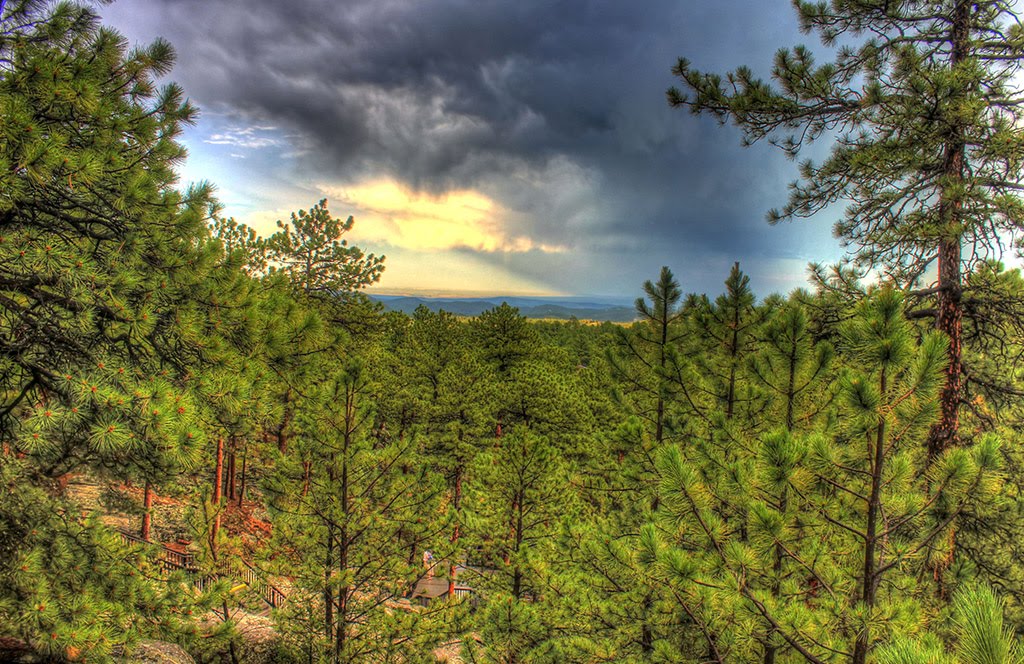
This 780 acre lake is the largest and deepest water body in the Black Hills area at about 150 feet in depth. The southern access begins starts at the Pactola Campground off Custer Gulch Road. Brown and Rainbow trout, along with largemouth bass are primary found while fishing here. There is a $5 vehicle day use fee, and rentals are available at the full service marina store on the northern side of the reservoir.
South Dakota, Pennington County
00 :21 hrs
0.9 mi
36.0542 ft
Easy
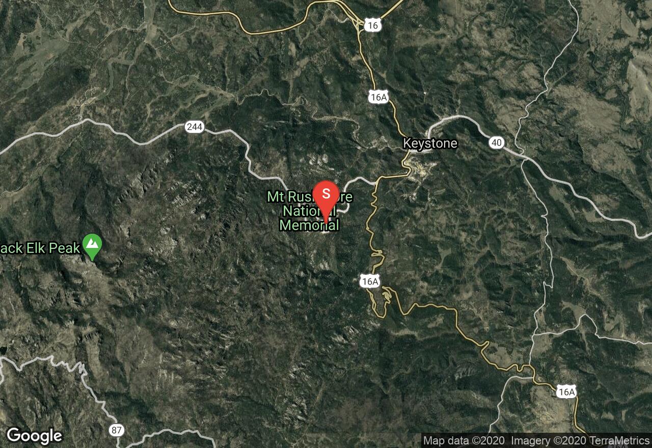
Mount Rushmore National Memorial is one of the most iconic sites in the United States, and is visited by nearly 3 million people each year. The Presidential Trail is a traditional boardwalk that will get you closer to the base of monument, offering spectacular views. You'll definitely enjoy this short hike with family and learn a lot about the history of America's founding fathers. There is an $11 parking fee required for each vehicle.
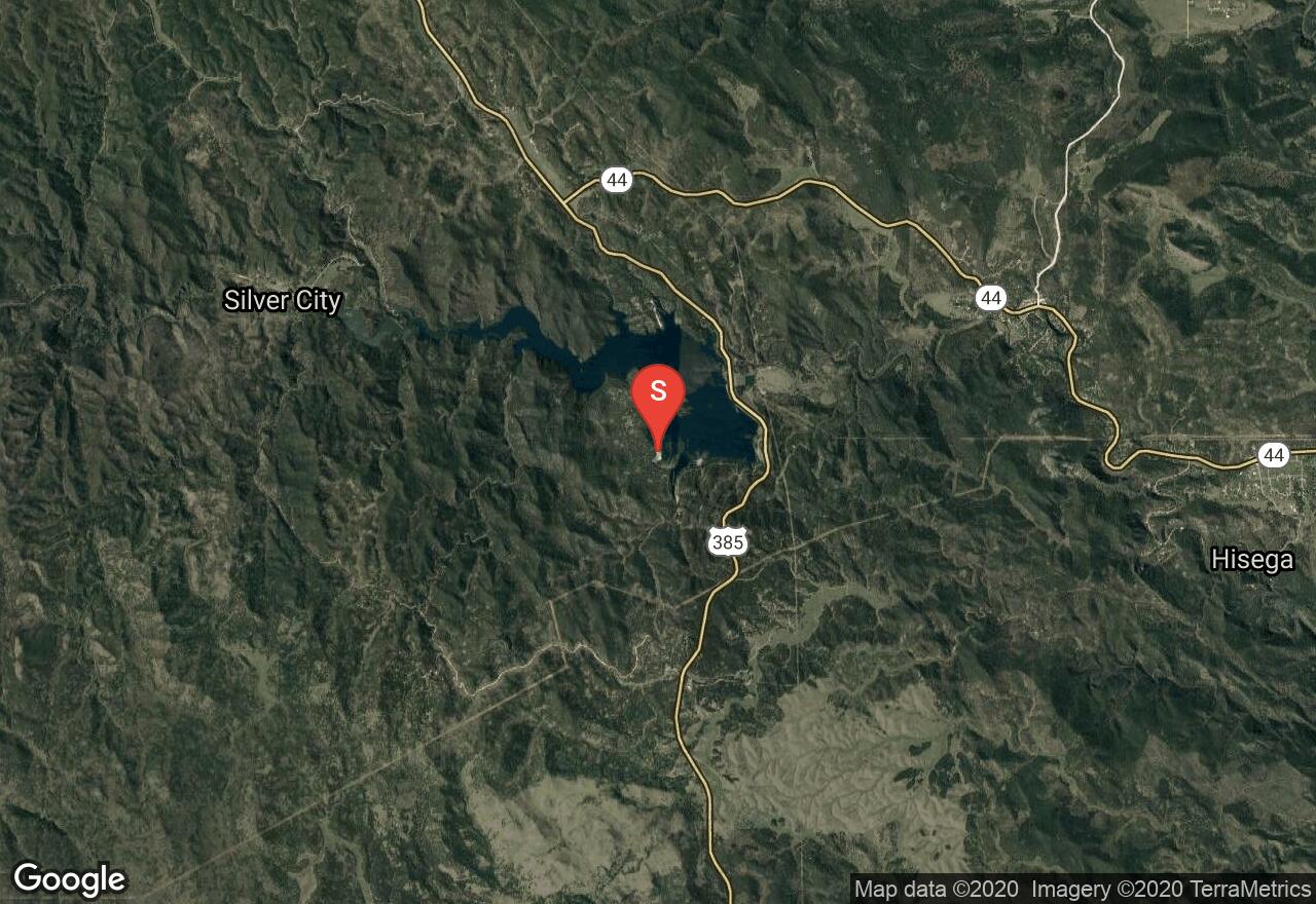
South Dakota, Marshall County
03 :16 hrs
7.3 mi
2.9365234 ft
I
Located in Marshall County, this 2,000 acre waterbody has about 4 miles of shoreline and an average depth of 10 feet. Large burial mounds were once a part of the lake's history, and then the Roy family built a settlement and planted crops along the lakeshore. Roy Lake State Park is now a popular fishing spot where visitors will be able to enjoy sandy beaches, picnic areas, boat ramps, shoreline trails, and camping. The resort also offers cabins and condos, along with fising trips and rentals. There is a $6 day use fee required for each vehicle.
South Dakota, Pennington County
01 :54 hrs
21.8 mi
245.64111 ft
Hard
Bicycling through the Badlands provides riders with excellent views of the dramatic and impressive scenery the park has to provide. This ride follows the main park road for almost 22 miles, passing multiple overlooks and points of interest along the way. The downhill route requires a shuttle between the start at the Pinnacle Overlook and end of the ride at the Ben Reifel Visitor Center. The park road does see a lot of traffic during peak season, and is steep and narrow in sections, so extreme caution is required at times. The ride can easily be shortened by starting a shorter distance from the visitor center.
South Dakota, Pennington County
03 :18 hrs
7.3 mi
10.0998535 ft
I
Pactola Reservoir is the largest and deepest water body in the Black Hills area. This route starts at the Pactola North boat launch area, which is located off highway 385 and about 15 miles west of Rapid City. The marina is considered a heavily used area, especially on the weekends. There is a $5 vehicle day use fee, and rentals are available at the full service marina store.
South Dakota, Spearfish
00 :46 hrs
0.9 mi
38.13513 ft
Easy
This is a short route that goes along Spearfish Creek on relatively flat terrain. The tree-lined trail is wide and has easy access for all visitors to enjoy the spectacular water fall views. You'll want to park at the parking area on the left side of the road when you're traveling south from Savoy.
South Dakota, Spearfish
03 :46 hrs
3.2 mi
473.2876 ft
Hard
Crow Peak has its name because of a historic battle that involved the Crow and Sioux Indians. The trail is heavily used and it can be accessed off Higgins Gulch Road in the Black Hills National Forest. You'll through ponderosa pine trees and vegetation that comprised of native bushes and bur oak. The route has gradually climbs the southwestern portion of the mountain and reaches the rocky peak, offering amazing views of the surrounding hills. Be cautious of late spring snow and be sure to bring plenty of water and supplies.
South Dakota, Sully County
02 :42 hrs
6 mi
10.929962 ft
I
Okobojo point is located northwest of Pierre, and is accessed off SD 1804 to 194th Street. Visitors are offered some of the best views of the Missouri River and its surroundings. The shoreline has one of the longest sandy beaches on Lake Oahe, giving plenty of land and water activities for the whole family. Not only is there a beach, but there are also campsites, a picnic shelter, a boat ramp, drinking water, and toilets. There is a $6 day use fee required for each vehicle.
South Dakota, Sully County
01 :59 hrs
4.4 mi
5.502716 ft
I
The Oahe Dam on the Missouri River results in a large reservoir that begins in central South Dakota and continues north into North Dakota. West Bend Recreation Area offers a protected marina with easy boat launching for all watercrafts. There are also a lot services and facilities that accommodate for several land and water activities. Walleye, northern pike, catfish and chinook salmon are primarily stocked in the lake. There is also a $6 day use fee required for each vehicle.
South Dakota, Lawrence County
02 :01 hrs
8.5 mi
317.7577 ft
Moderate
This route starts at the Englewood Trailhead at Brownsville Road and travels northward all the way to the end of the Mickelson Trail at Deadwood. You'll start out going alongside Whitewood Creek and traverse downhill through narrow canyons while enjoying views of the Homestake Gold Mine. There are also three other trailheads that are stationed between Englewood and Deadwood. Be sure to purchase a Mickelson Trail pass at a self-service station along the trail or online.
South Dakota, Custer County
03 :45 hrs
3.3 mi
317.33362 ft
Hard
This is a popular hiking trail that is normally approached through the Black Elk Wilderness from Sylvan Lake - Harney Trail Number 9. The trail is generally easy to follow and is heavily used during the warmer months of the year. Be aware that the trail becomes much more strenuous once you get closer to the peak. You'll definitely enjoy passing through ponderosa pine trees and having the opportunity to observe wildlife such as mule deer. A trailhead permit is required to park and/or hike from the trailhead $2.50 - $5 per person or $6 - $12 per vehicle, depending on the time of year.
South Dakota, Pennington County
05 :36 hrs
55.2 mi
780.4823 ft
Expert
This loop ride leads through the scenic Black Hills and past the historic display of Mt. Rushmore. The ride follows the Needle Highway and Iron Mountain Road to complete a loop of just over 50 miles. The route covers some hilly terrain with a few small climbs and descents. There are some tight turns and curvy roadway to navigate. The highways are mostly narrow paved two-lane roads that do see some traffic, especially around the national monument. There are some great rest spots along the way for stopping, resting, and taking in the scenery. There are multiple campgrounds located along the scenic byway.
South Dakota, Custer County
00 :14 hrs
0.5 mi
4.2608643 ft
I
Located in Custer State Park, Legion Lake is quite a gem for only having a water surface of 9 acres and a 1/2 mile shoreline. It is absolutely astonishing to be able to glide through the still water and to be able to see the reflections of ponderosa pines and large rock walls. Campsites, fishing docks, cabins, a gift shop, and a restaurant lodge facilitate the area. A $15 Custer State Park entrance fee is required for each vehicle.
South Dakota, Lawrence County
00 :32 hrs
0.6 mi
48.428467 ft
Easy
This is a short but very scenic hike that has to be on everybody's bucket list if you live in South Dakota. Be sure to plan ahead and expect to get your feet wet as you travel up along Squaw Creek through the Black Hills National Forest, and then traverse through a limestone corridor. The limestone walls are absolutely stunning once you get to Devil's Bathtub. Also, be cautious of mossy and slippery rocks while hiking through the water.
South Dakota, Custer County
00 :26 hrs
1 mi
8.02002 ft
I
Sylvan Lake is located 7 miles up on Sylvan Lake road Custer, and is within the Custer State Park boundary. In 1881, a dam was built across Sunday Gulch to create the body of water. The scenery is absolutely amazing with evergreens and granite formations surrounding the shoreline. You'll also be entertained to have a chance to see bison, pronghorn, big horn sheep, mountain goats, deer, eagles, and other wildlife. A $15 park entrance fee is required for each vehicle, and a campground is located down the road.
South Dakota, Brookings County
01 :57 hrs
4.3 mi
3.696289 ft
I
Oakwood Lakes State Park has eight combined glacial lakes and offers almost every kind of land and water activity for the whole family. The park used to be a summer camp gathering place for American Indians, but was later developed after 1869. A variety of trails and shaded trees cover much of the shoreline, and there are a lot of waterfowl, turtles and other wildlife sightings near Scout Island. A $6 day use fee is required for each vehicle, and there are canoe and kayak rentals available.
South Dakota, Pennington County
01 :26 hrs
3.9 mi
53.41919 ft
Moderate
Flume Trail goes from one point to another point with various trailheads and various loops available. It is an historic route that was once a part of a mine in the 1800's. You'll be heading through a dense forest with pine trees, wildflowers, and opportunities to see artifacts from the Rockerville Flume bed that carried water from Spring Creek to Sheridan Lake. This was used to help miners find up to $20 million dollars in gold.
South Dakota, Spearfish
02 :17 hrs
5.4 mi
241.55212 ft
Hard
This route starts at the Little Spearfish Trailhead located off Roughlock Falls Road near Lead, South Dakota. You'll start out traveling uphill along the creek passing by a lot beaver dams to wooded areas above. Berry bushes, mushroom, and other fun plants can be spotted along the way as you make your way through the vegetatively overgrown path. After the first couple of miles, you'll gradually descend back to the road. From the road, you'll need to use caution as you'll be hiking along the roadside back to the trailhead.
South Dakota, Mitchell
00 :54 hrs
2 mi
0.8779297 ft
I
Lake Mitchell is a fairly large 870 acre waterbody with about 10 miles of shoreline and an average depth of 12 feet. There are multiple launching areas around the lake, along with residential development and thick forests along the shoreline. The southwest access point is near the campground and has probably the best boat launch at the lake. The lake is popular for fishing and has a lot of wildlife viewing opportunities. Also, be aware of possible algae outbreaks on the water during hot and dry weather conditions.
Nebraska, Cherry County
00 :35 hrs
1.3 mi
4.930542 ft
I
This wildlife refuge is home to multiple species of bird and other indigenous creatures. Approximately 30 water bodies dot the area and allow man-powered paddling vessels only. Sport fishing is available on lakes Watts, Rice, Duck, West Long, Hackberry, Dewey, Pelican, Clear, and Willow - also granting access to water crafts with outboard electric motors. Hunting is allowed as well. The landscape is vast and isolated, exhibiting the rolling hills of Nebraskan prairie. Access to and within the refuge can prove difficult since many of the lakes can only be accessed by foot or 4WD vehicles, so plan accordingly.
South Dakota, Spearfish
00 :58 hrs
4.9 mi
115.71179 ft
Easy
The Spearfish Recreation Trail travels over 5 miles through the heart of Spearfish providing access to multiple parks, green spaces, and town attractions. The City of Spearfish is located just north of the Black Hills National Forest and much of the trail is lined with trees and follows a small creek. The concrete multi-use pathway does climb if riding from the south but is gradual and makes for a fun return ride. The trail is accessed from multiple spots making it easy to customize shorter outings on the trail as well.
South Dakota, Marshall County
01 :19 hrs
2.9 mi
1.7154541 ft
I
Large burial mounds were once a part of the lake's history, and then the Roy family built a settlement and planted crops along the lakeshore. Roy Lake State Park is now a popular fishing spot where visitors will be able to enjoy sandy beaches, picnic areas, boat ramps, shoreline trails, and camping. You'll definitely enjoy the panoramic views across the water with patches of dense trees and wildlife viewing opportunities as well. There is also a $6 day use fee required for each vehicle.
South Dakota, Pennington County
02 :44 hrs
6.7 mi
362.9237 ft
Hard
The Centennial Trail is over 100 miles long and was built in 1989 to represent the 100th anniversary of South Dakota's statehood. This part of the trail begins at the Samelius Trailhead located east of Hill City on Highway 16. The route travels through the Black Hills National Forest and climbs halfway through the hike to offer amazing views of Sheridan Lake. Most people will do this route as a one-way day trip with necessary vehicle arrangements, but it can also be done as an out and back.
South Dakota, Hill City
07 :46 hrs
14.6 mi
235.04553 ft
Moderate
The entire Mickelson Trail is 109 miles long and has a total of 15 trailheads, 4 rock tunnels, and several railroad bridges. The surface of the route is mostly crushed limestone and packed gravel, along with some sections of dirt road. This route starts in Hill City and travels northward through the Black Hills National Forest to the Mystic Road Trailhead. You'll enjoy the scenery while going alongside a section of Crooked Creek and while coming into the historic mining town of Mystic. You can make this a half-day one way trip or a full-day out and back trip. Be sure to purchase a Mickelson Trail pass at a self-service station along the trail or online.
South Dakota, Pennington County
03 :08 hrs
6 mi
136.71033 ft
Hard
If you are looking for a long and scenic trip in the Badlands, then Sheep Mountain Table will be a great destination for you. The route follows along the old Sheep Mountain Road and is located south of the town Scenic, and off of Bombing Range Road. You'll travel through several different landscapes and gradually climb to a large mesa with a grass-topped summit. There are also great views of surrounding pinnacles and spires.
South Dakota, Pennington County
01 :44 hrs
3.9 mi
9.59729 ft
I
This popular fishing spot is located 20 miles west of Hill City, SD. Castle Creek is the water source, allowing a complex that has 3 campgrounds, 2 picnic areas, trails, and several boat launches. The north access is off Rochford Rd and near Custer Trail. Wakeboarding is not allowed, so the paddling is easy and the trip is very peaceful. There is a $5 vehicle day use fee.
Nebraska, Cherry County
01 :59 hrs
4.4 mi
0.4998169 ft
I
This wildlife refuge is home to multiple species of bird and other indigenous creatures. Approximately 30 water bodies dot the area and allow man-powered paddling vessels only. Sport fishing is available on lakes Watts, Rice, Duck, West Long, Hackberry, Dewey, Pelican, Clear, and Willow - also granting access to water crafts with outboard electric motors. Hunting is allowed as well. The landscape is vast and isolated, exhibiting the rolling hills of Nebraskan prairie. Access to and within the refuge can prove difficult since many of the lakes can only be accessed by foot or 4WD vehicles, so plan accordingly.
South Dakota, Stanley County
01 :16 hrs
2.8 mi
6.7103577 ft
I
The Oahe Dam on the Missouri River results in a large reservoir that begins in central South Dakota and continues north into North Dakota. It is the fourth largest reservoir in the United States and has a total area of 370,000 acres. There is a large parking lot area off SD 1806 at the dam, along with a double wide boat launch, a boat dock, and toilets. Walleye, northern pike, catfish and chinook salmon are primarily stocked in the lake.
Nebraska, Cherry County
00 :37 hrs
1.4 mi
5.1777344 ft
I
This wildlife refuge is home to multiple species of bird and other indigenous creatures. Approximately 30 water bodies dot the area and allow man-powered paddling vessels only. Sport fishing is available on lakes Watts, Rice, Duck, West Long, Hackberry, Dewey, Pelican, Clear, and Willow - also granting access to water crafts with outboard electric motors. Hunting is allowed as well. The landscape is vast and isolated, exhibiting the rolling hills of Nebraskan prairie. Access to and within the refuge can prove difficult since many of the lakes can only be accessed by foot or 4WD vehicles, so plan accordingly.
South Dakota, North Sioux City
01 :26 hrs
3.2 mi
5.7765503 ft
I
This is an irregularly shaped 270 acre lake located in North Sioux City, and it is easily accessed off Interstate 29. The east access has a boat ramp and a parking lot for vehicles with trailers. Development of residential homes surrounds most of the shoreline, and there are also several small islands and inlets with vegetation. Geese, herons, turtles, and other wildlife can be easily spotted while out on the lake.
South Dakota, Meade County
01 :02 hrs
2.3 mi
4.6325684 ft
I
This is a very popular 215 acre lake located off Highway 79 in Bear Butte State Park. You'll absolutely love the spectacular view of the butte nearby, along with excellent fishing opportunities and good quality water. Bear Butte is known to be a sacred mountain for American Indians, as you may notice religious ceremonies and worshiping out in the distance. With more than 3 miles of shoreline, you'll also be sure to have plenty of space to enjoy your outdoor trip. There is a $6 daily use fee for each vehicle.
South Dakota, Custer County
03 :46 hrs
8.9 mi
188.55847 ft
Expert
This part of the Centennial Trail begins at the Iron Creek Horse Camp Trailhead in Custer State Park and travels through a dense ponderosa pine forest in the rolling Black Hills. You'll definitely enjoy the many creek crossings that this trail has to offer, along with the cliffs, canyons and bends . Be cautious of a few strenuous climbing spots, and be sure to pack plenty of water and supplies. Most people will do this route as a one-way day trip with necessary vehicle arrangements, but it can also be done as an out and back. Custer State Park requires a park entrance license for each vehicle, and the Black Elk Wilderness requires free registration.
South Dakota, Custer County
00 :30 hrs
1.1 mi
8.806885 ft
I
Center Lake is another beautiful small acreage water source located in Custer State Park, 11 miles away from Custer. There is only about 1 mile of shoreline, but the reflection of ponderosa pines on the water is well worth the trip. Campsites, cabins, showers, and a boat dock facilitate the area. A $15 Custer State Park entrance fee is required for each vehicle.
South Dakota, Brookings County
02 :01 hrs
4.5 mi
5.8793335 ft
I
Oakwood Lakes State Park is a combination of eight glacial lakes, campsites, picnic areas, and boating facilities. The park used to be a summer camp gathering place for American Indians, but was later developed after 1869. Lake Oakwood's western access has a large parking lot near the main campground. A variety of trails and shaded trees cover much of the shoreline at this lake. A $6 day use fee is required for each vehicle, and there are canoe and kayak rentals available.
South Dakota, Hughes County
01 :16 hrs
4.7 mi
1.97229 ft
Easy
LaFramboise Island is a scenic island located on the Missouri River that offers undeveloped natural area for visitors to enjoy. The historic island was mentioned in the journals of Lewis and Clark and is a great destination for hiking, biking, and wildlife viewing. A small network of singletrack trails on the island can be used to customize trips of varying distances. This ride follows multiple trails through dense forest to complete one long loop that covers a good portion of the island. The terrain is very flat with practically no elevation change and no technical sections making it a great choice for beginner riders.
South Dakota, Mitchell
00 :44 hrs
2.8 mi
7.104645 ft
Moderate
The Kiwanis trail is a short but fun singletrack trail located on the southwest side of Lake Mitchell. The trail is well-established and easy to follow and is a good choice for beginner and intermediate riders. The trail has lots of small ups and and downs but no major climbs or descents. There are a few tight stretches as well as some fast flowing sections of trail.
South Dakota, Custer County
03 :39 hrs
8.8 mi
204.70935 ft
Hard
The Centennial Trail is over 100 miles long and was built in 1989 to represent the 100th anniversary of South Dakota's statehood. This part of the trail begins at the Highland Creek Trailhead near the Custer State Park boundary fence. You'll travel through the dense ponderosa pine forest in the rolling Black Hills, along with meadows that are near the creeks. Most people will do this route as a one-way day trip with necessary vehicle arrangements, but it can also be done as an out and back. Custer State Park requires a park entrance license for each vehicle.
South Dakota, Custer County
01 :44 hrs
3.8 mi
215.13025 ft
Moderate
This route is located in Custer State Park and goes along the shoreline of Sylvan Lake, and then traverses over rocks and dives into Sunday Gulch. The trail is so popular that it has become a well maintained National Recreation Trail, offering a scenery of plants, trees, and mosses. As you dive into the gulch, there are granite walls on both sides of the trail. Be sure to use the side rails at the necessary spots, and also use caution when icy conditions are present. A park entrance fee is required for each vehicle.
South Dakota, Lake County
02 :52 hrs
6.4 mi
2.998352 ft
I
This is a very popular and well developed 2,700 acre located outside of Madison, SD. The Walkers Point Recreation Area is accessed from SD Hwy 19 and offers a large parking area, a double wide boat ramp, boat dock, fish cleaning station, toilets, and camping facilities. The lake offers a variety of land and water activities, and is also stocked with bullhead, crappie, northern pike, perch and walleye. The shoreline mostly has housing development and wooded areas. Be sure to check the weather conditions for wind, as the lake is very susceptible to choppy conditions. There is also a $6 daily use fee for each vehicle at some spots around the lake.
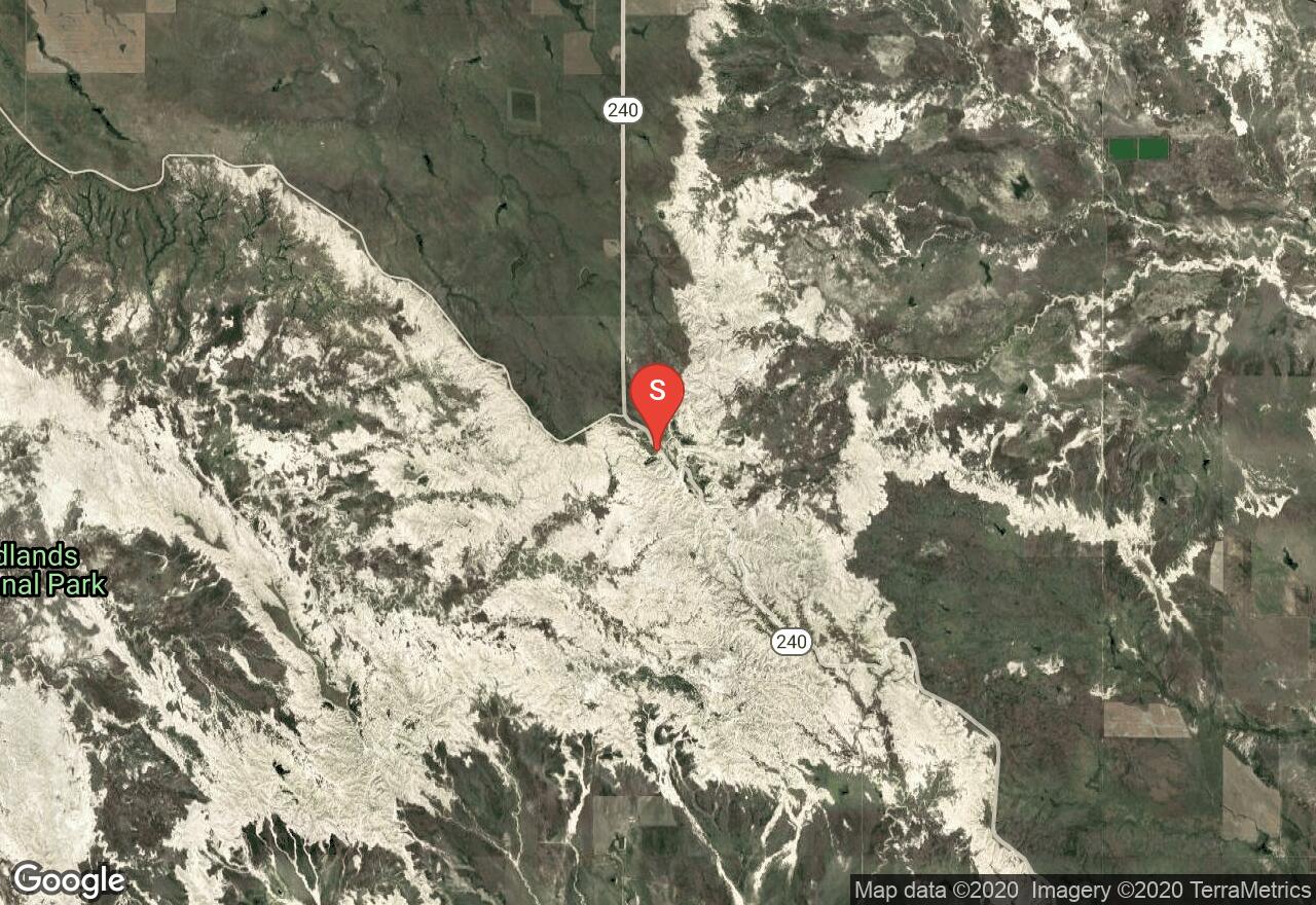
South Dakota, Jackson County
01 :50 hrs
5.2 mi
21.238586 ft
Hard
This is the longest trail in the Badlands National Park, and it starts at the Door and Window parking area. The route travels east one way to the Fossil Exhibit Trail parking area. Most of the hiking will be on relatively level terrain, along with some short climbs when you get to the north edge of the Badland Wall. Be cautious of loose rocks and soil when you are passing through the badland formations. You'll have to plan ahead and have another vehicle parked at the Fossil Exhibit Trail parking area to get back to the starting point. A park entrance fee is required for each vehicle.
Nebraska, Cherry County
01 :06 hrs
2.4 mi
0.15539551 ft
I
This wildlife refuge is home to multiple species of bird and other indigenous creatures. Approximately 30 water bodies dot the area and allow man-powered paddling vessels only. Sport fishing is available on lakes Watts, Rice, Duck, West Long, Hackberry, Dewey, Pelican, Clear, and Willow - also granting access to water crafts with outboard electric motors. Hunting is allowed as well. The landscape is vast and isolated, exhibiting the rolling hills of Nebraskan prairie. Access to and within the refuge can prove difficult since many of the lakes can only be accessed by foot or 4WD vehicles, so plan accordingly.
South Dakota, Hughes County
00 :29 hrs
1.4 mi
1.1794739 ft
Easy
LaFramboise Island is a scenic natural island located on the Missouri River that offers undeveloped natural area for visitors to enjoy. The historic island was mentioned in the journals of Lewis and Clark and is a great destination for hiking, biking, and wildlife viewing. A small network of trails on the island can be used to customize trips of varying distances. This short loop follows an interpretive nature trail on the northwest side of the island and is a great option for a short introduction to the island.
South Dakota, Walworth County
02 :16 hrs
5 mi
4.3897095 ft
I
Indian Creek Recreation area is located southeast on Highway 12 from Mobridge, offering land and water activities along Lake Oahe (Missouri River). The eastern access point will launch you into a bay area and offer beautiful river views with rolling hills in the background. There are a variety of trails that go along the shoreline, and you'll also be able to spot deer, raccoon, beavers, and birds. There are also plenty of campsites and other facilities at the recreation area. Walleye, northern pike, catfish and chinook salmon are primarily stocked in the lake.
South Dakota, Jackson County
00 :36 hrs
0.6 mi
43.904907 ft
Easy
Located in Badlands National Park, the Notch Trail climbs to an opening at the top of the Badland Wall, offering amazing views of surrounding spires, colorful rock formations, large walls, and the prairie afar. The hike begins with a gradual climb before reaching an enjoyable climbing ladder. Be sure to space out evenly on the ladder if you are in a group, because too many people on it at once can cause imbalance. Once you get past the ladder, you'll squeeze past a steep wall before reaching the overlook.
South Dakota, Stanley County
01 :05 hrs
2.4 mi
12.268677 ft
I
The Oahe Dam on the Missouri River results in a large reservoir that begins in central South Dakota and continues north into North Dakota. Spring Creek Recreation Area is a day use park that offers several land and water activities for the whole family. There is a resort, a marina, a boat ramp and a fish cleaning station near the launching point. Walleye, northern pike, catfish and chinook salmon are primarily stocked in the lake. There is also a $6 day use fee required for each vehicle.
South Dakota, Custer County
00 :51 hrs
1.1 mi
8.370483 ft
Easy
This route is located in Custer State Park and goes along the shoreline of Sylvan Lake. The trail is well maintained and offers a great walk for the whole family to get out and stretch while traveling through the area. You'll also enjoy hiking along gigantic granite rock formations that rise above the lake. Most of the route is level, except for when you pass over the rocky terrain in a few spots.
South Dakota, Pennington County
02 :54 hrs
2.7 mi
222.35559 ft
Hard
This trail begins at a trailhead located just south of Horse Thief Lake near Highway 244. It is known to be one of the most scenic trails in the Black Elk Wilderness, and it also connects to a variety of different trails in the area. The route will lead you through areas of towering granite spires, small streams and thick vegetation. You'll also be able to enjoy some great views while making your way across two saddles.
South Dakota, Edgemont
09 :23 hrs
32.6 mi
462.81213 ft
Easy
The entire Mickelson Trail is 109 miles long and has a total of 15 trailheads, 4 rock tunnels, and several railroad bridges. The surface of the trail is mostly crushed limestone and packed gravel, along with some partial dirt roads. It begins at the town of Edgemont and journeys northward through the Black Hills National Forest along abandoned rail lines, wooden bridges, and then passes by a gravel pit before getting to the town of Pringle. Most people make this a one way day trip with extra vehicles or accommodations at each trailhead. Be sure to purchase a Mickelson Trail pass at a self-service station along the trail or online.
South Dakota, Walworth County
02 :32 hrs
5.6 mi
2.7009583 ft
I
Swan Creek Recreation Area is located west of Akaska and off Sloan Creek Road. The eastern access area has campsites nearby, along with drinking water, toilets, and other facilities/services. You'll get launched into a bay area and be able to pass by swan creek as you make your way around the shoreline. You'll definitely enjoy viewing the large reservoir with rolling prairie hills in the background and observations of birds as well. There is also a $6 day use fee for each vehicle.
South Dakota, Lake County
01 :18 hrs
2.9 mi
2.86557 ft
I
Lake Herman State Park is located on a peninsula and offers visitors a good variety of land and water activities. The lake has 1,350 acres of surface water and was formed from melted glacial ice. In 1870, Herman Luce and his family settled the timberland on the east side of the lake. Along the shoreline you'll notice several trails, historic sites, grasses, wetlands, and wooded areas. You'll also be able to spot a lot of birds and animals in the area. Canoe and kayak rentals are available here, and there is a $6 day use fee for each vehicle.
South Dakota, Lincoln County
00 :57 hrs
3.7 mi
82.97064 ft
Hard
A network of multi-use trails travel over rolling hill terrain in Newton Hills State Park offering some fun and challenging ride option for mountain bikers. The marked singletrack trails travel through forested areas and open meadows with lots of short but steep climbs and descents. Trail conditions may be muddy at times with small obstacles along the way. The trails can be used to customize multiple shorter loops or one long loop. The trails are The state park also offers camping and picnic areas. The trails are also open for hiking and horseback riding so watch out for other users along the way. There are some other connecting trails to the south but some allow hiking only.
South Dakota, Hamlin County
03 :46 hrs
8.4 mi
2.589508 ft
I
Lake Poinsett was named after former U.S. Secretary of War Joel Poinsett, and it's one of the larger water bodies in the state. It is a popular destination for a variety of land and water activities, with services and development around the shoreline, including a museum. The northern launching point is on Northwest Lake Dr at Poinsett Beach. The fishing at the lake is superb, with walleye, northern pike, bass, and perch. Don't be surprised if you spot a lot of birds here as well.
South Dakota, Hamlin County
03 :31 hrs
7.8 mi
5.3430786 ft
I
Lake Poinsett was named after former U.S. Secretary of War Joel Poinsett, and it's one of the larger water bodies in the state. It is a popular destination for a variety of land and water activities, with services and development around the shoreline, including a museum. The western launching point is on Highway 81 near the golf course. The fishing at the lake is superb, with walleye, northern pike, bass, and perch. Don't be surprised if you spot a lot of birds here as well.
South Dakota, Pennington County
01 :23 hrs
3.1 mi
2.559204 ft
I
This is a 435 acre popular fishing spot that is located 20 miles west of Hill City, SD. Castle Creek is the water source, allowing a complex that has 3 campgrounds, 2 picnic areas, trails, and several boat launches. Wakeboarding is not allowed, so the paddling is easy and the trip is very peaceful. There is a $5 vehicle day use fee.
South Dakota, Pennington County
05 :24 hrs
18.1 mi
377.1609 ft
Moderate
This section of the Mickelson trail begins12 miles north of Hill City on Mystic Road and is within the Black HIlls National Forest. You'll travel alongside Castle Creek and Rapid Creek as you make your way to the historic mining town of Rochford, and then you'll pass by Swede Gulch before getting to the Dumont Trailhead. You can make this a half-day one way trip with a vehicle at each trailhead, or you can make it a full-day out and back trip. Be sure to purchase a Mickelson Trail pass at a self-service station along the trail or online.
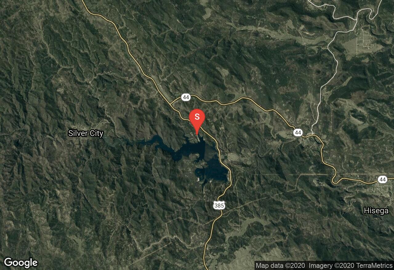
South Dakota, Pennington County
00 :55 hrs
2 mi
5.8183594 ft
I
The Sheridan Lake Marina is located about 6 miles northeast of Hill City, SD on Highway 385. This is a 380 acre lake that is surrounded by a heavily forested shoreline in the Black Hills. There is a full service facility at the marina that will offer food, rentals, and equipment. Hours of operation run from 8AM to 7PM.
South Dakota, Campbell County
03 :28 hrs
7.7 mi
2.4248657 ft
I
Located near the town of Pollock, this recreation area offers a great location to get out on the waters of the Missouri River and Lake Oahe. There are boat ramps, campsites, and toilets near the access point, along with drinking water. Walleye, bass, northern pike, and perch are primarily stocked in this area. Pheasants, grouse and waterfowl are commonly observed here as well. Keep in mind that there is a $6 day use fee for each vehicle.
South Dakota, Pennington County
01 :55 hrs
5.4 mi
122.82117 ft
V
This run down Battle Creek leads through scenic Black Hills terrain offering some thrilling class III-IV (V) rapids along the way. At high water there is a potential 17-foot class V falls located about halfway down the run to be aware of. During the summer It is a fun swimming hole for cliff jumping and playing around.
South Dakota, Pennington County
01 :53 hrs
4.9 mi
202.5791 ft
Hard
The Centennial Trail is over 100 miles long and was built in 1989 to represent the 100th anniversary of South Dakota's statehood. This route starts at the Brush Creek Trailhead and travels northward through the Black Hills National Forest with a few creek crossings and offers plenty of wildlife spotting opportunities as well. You'll be able to enjoy excellent views of Pactola Lake as you quickly descend towards it for the last couple of miles. This route can be done as a half day one-way trip with necessary vehicle arrangements, or it can be done as a full-day out and back trip.
South Dakota, Lake County
01 :42 hrs
3.8 mi
5.4901123 ft
I
Lake Herman has 1,350 acres of surface water and was formed from melted glacial ice. In 1870, Herman Luce and his family settled the timberland on the east side of the lake. Along the shoreline you'll notice several trails, historic sites, grasses, wetlands, and wooded areas. You'll also be able to spot a lot of birds and animals in the area. Canoe and kayak rentals are available here, and there is a $6 day use fee for each vehicle.
South Dakota, Minnehaha County
03 :29 hrs
34.8 mi
75.8934 ft
Hard
This route is named the Three Waters Ride because it takes bikers to three different recreational areas located on rivers and creeks. The ride goes to Big Sioux Recreation Area, Palisades State Park, and Beaver Creek Nature Area. The ride follows mostly paved county highways that are flat but there is some traffic. There are camping facilities at Big Sioux Recreation Area and Palisades State Park.
South Dakota, Meade County
03 :59 hrs
10.6 mi
490.62122 ft
Expert
This part of the Centennial trail begins at the Elk Creek Trailhead located on Rinkle Road near Vanocker Canyon. The route travels northward through the Black Hills National Forest with a few ups and downs before its major descent towards Alakali Creek. Be on the lookout for antelope, bighorn sheep, mule deer, elk, and mountain goats. The route is usually done as a one-way trip with necessary vehicle arrangements, or it can be done as an out-and-back if you plan accordingly.
South Dakota, Custer County
02 :02 hrs
2.5 mi
105.615845 ft
Hard
This route begins at Center Lake in Custer State Park and the trail is primarily an old abandoned logging road that travels along Grace Coolidge Creek with several water crossings. A lot of fishermen go out this area to enjoy the deep pools that are stationed below granite formations along the creek. This is a great place to enjoy the scenery of summer wildflowers and fall leave colors. Keep in mind that a park entrance fee is required for each vehicle.
South Dakota, Meade County
02 :06 hrs
4.1 mi
58.533203 ft
Hard
This part of the Centennial trail begins at the Alkali Creek Trailhead located south of Sturgis and near Interstate 90. The route traverses through the Dakota Hogback while traveling along Old Stone Road. You may get a glance of some outstanding views of Bear Butte and the surrounding Black Hills as you go through less vegetated areas.
South Dakota, Roberts County
06 :11 hrs
13.7 mi
1.8999329 ft
I
With the Minnesota River as the water source, Big Stone Lake runs 26 miles along the Minnesota and South Dakota border. There are a variety of parks, campgrounds, and access points located all around the lake in both states. Northern pike, bluegills, walleye, and yellow perch attract a lot of boaters and fishermen. It's also a great place to do some birdwatching and lakeside camping, especially when the wildflowers are blooming in late spring.
South Dakota, Minnehaha County
01 :12 hrs
2.7 mi
0.742218 ft
I
This is a very popular and heavily used recreation area located 10 miles west of Sioux Falls. The lake has a surface area of about 225 acres, a 3 mile shoreline, and a maximum depth of 30 feet. You'll notice that most of the shoreline is developed and there is a lot of traffic on the water. Be sure to follow the rules and make your way around the lake in a counter clockwise direction. The lake is stocked with primarily northern pike, walleye, yellow perch, crappie, and bullhead.
South Dakota, Meade County
04 :18 hrs
4.3 mi
369.51404 ft
Hard
This route starts at the Bear Butte Lake Trailhead located in Bear Butte State Park and on South Dakota 79. The Butte was formed by a molten magma intrusion that stands above the surrounding prairie lands. You'll definitely enjoy this amazing climb that takes you to the summit, offering views of the lake and the prairie. A park entrance fee is required to enter the park.
South Dakota, Lake County
02 :28 hrs
5.5 mi
0.5491638 ft
I
This is a very popular and well developed 2,700 acre located outside of Madison, SD. The lake offers a variety of land and water activities, and is also stocked with bullhead, crappie, northern pike, perch and walleye. The shoreline mostly has housing development and wooded areas. Be sure to check the weather conditions for wind, as the lake is very susceptible to choppy conditions. There is also a $6 daily use fee for each vehicle at some spots around the lake.
South Dakota, Roberts County
03 :17 hrs
33 mi
44.64612 ft
Hard
This 30-mile loop ride starts from Hartford Beach and follows the shoreline of Big Stone Lake south to Big Stone City. The ride travels through an area of historic significance and offers excellent scenery along the way. The majority of roadway along this trip is paved roadway with minimal traffic. The terrain is mostly flat with very small rolling hills. There are multiple parks and communities along the route that offers amenities, lodging, and supplies.
South Dakota, Custer
08 :28 hrs
15.6 mi
257.7777 ft
Moderate
The entire Mickelson Trail is 109 miles long and has a total of 15 trailheads, 4 rock tunnels, and several railroad bridges. This part of the trail is accessed at Harbach Centennial Park in Custer, where you'll then journey northward along Laughing Water Creek and near the Black Elk Wilderness. There are great views of Crazy Horse Mountain and also the granite spires around Buckhorn Mountain. You can make this a half-day one way trip with necessary vehicle arrangements, or it can be done as a full-day out and back trip. Be sure to purchase a Mickelson Trail pass at a self-service station along the trail or online.
South Dakota, Lawrence County
01 :31 hrs
6 mi
181.32764 ft
Moderate
The entire Mickelson Trail is 109 miles long and has a total of 15 trailheads, 4 rock tunnels, and several railroad bridges. The surface of the trail is mostly crushed limestone and packed gravel, along with some sections of dirt road. This route starts at the old lumber town of Dumont and travels fast downhill through the Black Hills National Forest to the Englewood Trailhead at Brownsville Road. Be sure to purchase a Mickelson Trail pass at a self-service station along the trail or online.
South Dakota, Fall River County
07 :57 hrs
17.7 mi
2.706787 ft
I
Angostura Reservior is located on the Cheyenne River and offers scenic views with over 35 miles of shoreline for paddlers to enjoy. The large lake is also home to a wide variety of migratory birds and other wildlife. The lake is also known for its great sandy beaches and good fishing. A recreation area on the lake offers boat launching facilities, canoe and kayak rentals, campgrounds, picnic areas, hiking trails, and a visitor center.
South Dakota, Sully County
01 :31 hrs
3.4 mi
7.8563843 ft
I
The Oahe Dam on the Missouri River results in a large reservoir that begins in central South Dakota and continues north into North Dakota. It is the fourth largest reservoir in the United States and has a total area of 370,000 acres. Pike Haven is popular resort that is often visited by Pheasant and Geese hunters, along with fishermen. Walleye, northern pike, catfish and chinook salmon are primarily stocked in the lake.
South Dakota, Garretson
02 :21 hrs
5.8 mi
35.8497 ft
II
Split Rock Creek offers some of the best white water paddling in all of South Dakota when water levels are sufficient in the spring and after heavy rainfall. The scenic river offers some class I-II rapids and is easily accessible. This stretch of the river starts from the put-in at Rock Creek Park in the north end of Garretson and covers almost 6 miles to the take-out at the Rd. 257 bridge.
South Dakota, Pennington County
02 :16 hrs
22.6 mi
138.75677 ft
Hard
This loop ride travels through rolling grasslands along the northern edges of Badlands National Park offering some nice scenery and great opportunity for wildlife viewing. Sage Creek Rim Road and some other stretches of road along this route are gravel road so mountain bikes or fat tire cycles are recommended. The ride does go through the national park so if you paid for a car to enter, make sure to grab your pass or be prepared to pay an entrance fee.
Nebraska, Cherry County
00 :41 hrs
1.5 mi
0.9411621 ft
I
This wildlife refuge is home to multiple species of bird and other indigenous creatures. Approximately 30 water bodies dot the area and allow man-powered paddling vessels only. Sport fishing is available on lakes Watts, Rice, Duck, West Long, Hackberry, Dewey, Pelican, Clear, and Willow - also granting access to water crafts with outboard electric motors. Hunting is allowed as well. The landscape is vast and isolated, exhibiting the rolling hills of Nebraskan prairie. Access to and within the refuge can prove difficult since many of the lakes can only be accessed by foot or 4WD vehicles, so plan accordingly.
South Dakota, Custer County
06 :45 hrs
12.4 mi
192.34253 ft
Hard
The entire Mickelson Trail is 109 miles long and has a total of 15 trailheads, 4 rock tunnels, and several railroad bridges. The surface of the route is mostly crushed limestone and packed gravel, along with some partial dirt roads. This part of the trail is accessed behind the Pringle fire station, where you'll then journey northward through the Black Hills, passing by old barns, pegmatite mines, and near granite formations. You can make this a half-day one way trip or a full-day out and back trip. Be sure to purchase a Mickelson Trail pass at a self-service station along the trail or online.
South Dakota, Lake County
01 :45 hrs
3.9 mi
2.5493774 ft
I
Lake Herman State Park is located on a peninsula and offers visitors a good variety of land and water activities. The lake has 1,350 acres of surface water and was formed from melted glacial ice. In 1870, Herman Luce and his family settled the timberland on the east side of the lake. Along the shoreline you'll notice several trails, historic sites, grasses, wetlands, and wooded areas. You'll also be able to spot a lot of birds and animals in the area. Canoe and kayak rentals are available here, and there is a $6 day use fee for each vehicle.
South Dakota, Custer County
01 :22 hrs
3 mi
3.4989014 ft
I
Located off Highway 16A in Custer State Park, this 121 acre reservoir is surrounded by scenic forests and granite formations. Buffalo herd, elk, pronghorn, and bighorn sheep can be spotted near the shores. Lookout for buoys that prevent canoes from interfering with swimmers on the eastern edge of the lake. There are a few good quality campgrounds along the shoreline.
Minnesota, Ortonville
03 :30 hrs
7.8 mi
0.50994873 ft
I
With the Minnesota River as the water source, Big Stone Lake runs 26 miles along the Minnesota and South Dakota border. There are a variety of parks, campgrounds, and access points located all around the lake in both states. Northern pike, bluegills, walleye, and yellow perch attract a lot of boaters and fishermen. It's also a great place to do some birdwatching and lakeside camping, especially when the wildflowers are blooming in late spring.
South Dakota, Jackson County
01 :41 hrs
4.6 mi
71.91821 ft
Moderate
This route is located in the Badlands National Park and begins on the Saddle Pass Trail before connecting with the Castle Trail and the Medicine Root Trail. The long hike is well worth the trip as you loop around the prairie and the amazing badland formations along the Badland Wall. The Castle Trail will take you through large pinnacles, spires, sod tables and fins, and the Medicine Root Trail will take you through the open grassland prairie. Be on the lookout for bighorn sheep, rattlesnakes, and a variety of birds. A park entrance fee is required for each vehicle.
Nebraska, Keya Paha County
00 :16 hrs
0.4 mi
4.374939 ft
Easy
The Smith Falls Trail will lead hikers right up to the base of Nebraska's 70 foot waterfall, making it the tallest in the state. The partly dirt and boardwalk path allows easy access to the landmark with minimum elevation or effort. Note that a state park permit is required for entry.
South Dakota, Potter County
01 :32 hrs
3.4 mi
5.451355 ft
I
The Oahe Dam on the Missouri River results in a large reservoir that begins in central South Dakota and continues north into North Dakota. Bob's Resort is located west of Gettysburg, off Highway 212, and offers plenty of lodging accommodations. The resort area also has other facilities and services, such as campsites, boat launches, fish cleaning stations, toilets, and more. Walleye, northern pike, catfish and chinook salmon are primarily stocked in the lake.
South Dakota, Custer County
00 :32 hrs
1.2 mi
3.1931152 ft
I
You'll definitely enjoy the views of the surrounding aspen groves and ponderosa pine while on the water in the Black Hills National Forest. There are plenty of campground sites and picnic sites available here. Plus, the lake is stocked with trout, sunfish, smallmouth bass, northern pike, and catfish. There is a $5 vehicle day use fee.
South Dakota, Hughes County
02 :40 hrs
26.7 mi
120.60852 ft
Hard
Riders will enjoy this tour of the capitol city of Pierre, traveling past multiple points of interest including the State Capitol, Framboise Island, and Lake Oahe Dam to name a few. The ride follows sections of the Lewis and Clark Bicentennial Trail which is both paved and crushed gravel, and paved roadway with narrow shoulders. There is some traffic on 1806 and 1804. The ride is mostly flat with the exception of one small climb up towards Oahe Dam.
South Dakota, Campbell County
02 :36 hrs
5.8 mi
3.4413452 ft
I
Located near the town of Pollock, this recreation area offers a great location to get out on the waters of the Missouri River and Lake Oahe. There are boat ramps, campsites, and toilets at the recreation area, along with drinking water. Walleye, bass, northern pike, and perch are primarily stocked in this area. Pheasants, grouse and waterfowl are commonly observed here as well. Keep in mind that there is a $6 day use fee for each vehicle.
South Dakota, Brookings County
04 :17 hrs
9.5 mi
3.1938477 ft
I
Lake Poinsett was named after former U.S. Secretary of War Joel Poinsett, and it's one of the more larger water bodies in the state. It is a popular destination for a variety of land and water activities, with services and development around the shoreline, including a museum. The fishing here is superb, with walleye, northern pike, bass, and perch. Don't be surprised if you spot a lot of birds here as well.
South Dakota, Charles Mix County
12 :12 hrs
121.8 mi
250.04092 ft
Extreme
This multi-day loop ride loops through rolling prairie terrain of southern South Dakota, offering wide open vistas of the "burning bluffs" area and Missouri River. The ride follows mostly rural paved roads with minor traffic but there are a few sections of highway that may be a little busier. The terrain is mostly flat with a few small hills but no major climbs or descents. The loop trip passes through multiple small communities and recreation areas that offer amenities, lodging, and supplies.
South Dakota, Lake County
02 :24 hrs
5.3 mi
2.993103 ft
I
This is a very popular and well developed 2,700 acre located outside of Madison, SD. The Johnson's Point Recreation Area is accessed from SD Hwy 34 and offers a couple of parking areas and a double wide boat ramp. The lake offers a variety of land and water activities, and is also stocked with bullhead, crappie, northern pike, perch and walleye. The shoreline mostly has housing development and wooded areas. Be sure to check the weather conditions for wind, as the lake is very susceptible to choppy conditions. There is also a $6 daily use fee for each vehicle at some spots around the lake.
Nebraska, Cherry County
02 :26 hrs
5.4 mi
5.8691406 ft
I
This wildlife refuge is home to multiple species of bird and other indigenous creatures. Approximately 30 water bodies dot the area and allow man-powered paddling vessels only. Sport fishing is available on lakes Watts, Rice, Duck, West Long, Hackberry, Dewey, Pelican, Clear, and Willow - also granting access to water crafts with outboard electric motors. Hunting is allowed as well. The landscape is vast and isolated, exhibiting the rolling hills of Nebraskan prairie. Access to and within the refuge can prove difficult since many of the lakes can only be accessed by foot or 4WD vehicles, so plan accordingly.
South Dakota, Sully County
02 :01 hrs
4.5 mi
5.7340393 ft
I
The Oahe Dam on the Missouri River results in a large reservoir that begins in central South Dakota and continues north into North Dakota. Cow Creek Recreation Area is located north of Pierre and off SD 1804. There are also a lot services and facilities that accommodate for several land and water activities here. Walleye, northern pike, catfish and chinook salmon are primarily stocked in the lake. There is also a $6 day use fee required for each vehicle.
South Dakota, Roberts County
06 :47 hrs
15.1 mi
3.9999695 ft
I
With the Minnesota River as the water source, Big Stone Lake runs 26 miles along the Minnesota and South Dakota border. The Shady Beach area has a large parking lot and a nice bar and restaurant with elegant dining. Northern pike, bluegills, walleye, and yellow perch attract a lot of boaters and fishermen. It's also a great place to do some birdwatching and lakeside camping, especially when the wildflowers are blooming in late spring.
South Dakota, Spearfish
03 :27 hrs
17.3 mi
473.07385 ft
Hard
Spearfish Canyon is a scenic byway that offers some excellent riding through a dramatic canyon with towering rock cliffs and beautiful waterfalls. The ride can be done as a challenging out-and-back by starting from Spearfish and riding up and back down, or as a faster one-way trip by shuttling to the top and just riding down the canyon. The canyon sees only mild-to-moderate traffic and has a small shoulder for riding.
South Dakota, Potter County
03 :19 hrs
7.4 mi
4.042206 ft
I
The Oahe Dam on the Missouri River results in a large reservoir that begins in central South Dakota and continues north into North Dakota. West Whitlock Recreation Area is a popular camping and fishing spot located west of Gettysburg and off Highway 212. The site is named after Mrs. J.F Whitlock, who once owned the land here with her pioneering family. There are several facilities and services available, including canoe and kayak rentals. There is a $6 day use fee required for each vehicle.
Nebraska, Cherry County
03 :03 hrs
6.8 mi
2.4953003 ft
I
This wildlife refuge is home to multiple species of bird and other indigenous creatures. Approximately 30 water bodies dot the area and allow man-powered paddling vessels only. Sport fishing is available on lakes Watts, Rice, Duck, West Long, Hackberry, Dewey, Pelican, Clear, and Willow - also granting access to water crafts with outboard electric motors. Hunting is allowed as well. The landscape is vast and isolated, exhibiting the rolling hills of Nebraskan prairie. Access to and within the refuge can prove difficult since many of the lakes can only be accessed by foot or 4WD vehicles, so plan accordingly.
South Dakota, McCook County
01 :28 hrs
3.3 mi
2.5956116 ft
I
This beautiful recreation area is popular for all sorts of land and water activities. The 500 acre Lake Vermillion is known for its clear, good quality water and abundance in fish. Be cautious of boaters, swimmers, and anglers as you go out for your water adventure. Waterfowl, beavers, and much more of wildlife can be spotted around here.
South Dakota, Lawrence County
01 :51 hrs
6.9 mi
96.82544 ft
Hard
This loop ride in the Black Hills leads through heavily forested terrain up to the Old Baldy Mountain summit where riders can enjoy some scenic panoramic views of the surrounding area. The trail is very narrow with lots of rocks and vegetation close to the trail resulting in some obstacles and challenging riding surface at times. The trail has some steep descents and climbs as well as it climbs up to the summit and along some smaller ridges. The trail also connects to the Rimrock Trail just across from FS 134 for a longer ride if desired.
South Dakota, Walworth County
02 :22 hrs
5.2 mi
4.424011 ft
I
Swan Creek Recreation Area is located west of Akaska and off Sloan Creek Road. The western launching area has campsites nearby, along with drinking water, toilets, and other facilities/services. You'll enjoy viewing the large reservoir with rolling prairie hills in the background and observations of birds as well. Walleye, northern pike, catfish and chinook salmon are primarily stocked in the lake. There is also a $6 day use fee for each vehicle.
South Dakota, Mitchell
01 :17 hrs
2.9 mi
7.490631 ft
I
Lake Mitchell is a fairly large 870 acre waterbody with about 10 miles of shoreline and an average depth of 12 feet. There are multiple launching areas around the lake, along with residential development and thick forests along the shoreline. The western access point is located off West Harmon Drive and offers a double wide boat launch, a boat dock and plenty of parking. The lake is popular for fishing and has a lot of wildlife viewing opportunities. Also, be aware of possible algae outbreaks on the water during hot and dry weather conditions.
South Dakota, Walworth County
01 :29 hrs
3.3 mi
4.7814026 ft
I
Indian Creek Recreation area is located southeast on Highway 12 from Mobridge, offering land and water activities along Lake Oahe (Missouri River). The western access point will launch you into the Revheim Bay area and lead you into a few inlets and past a railroad bridge. There are also plenty of campsites and other facilities at the recreation area. Walleye, northern pike, catfish and chinook salmon are primarily stocked in the lake.
Nebraska, Cherry County
01 :30 hrs
3.4 mi
5.7956543 ft
I
This wildlife refuge is home to multiple species of bird and other indigenous creatures. Approximately 30 water bodies dot the area and allow man-powered paddling vessels only. Sport fishing is available on lakes Watts, Rice, Duck, West Long, Hackberry, Dewey, Pelican, Clear, and Willow - also granting access to water crafts with outboard electric motors. Hunting is allowed as well. The landscape is vast and isolated, exhibiting the rolling hills of Nebraskan prairie. Access to and within the refuge can prove difficult since many of the lakes can only be accessed by foot or 4WD vehicles, so plan accordingly.
South Dakota, Yankton County
00 :55 hrs
3.7 mi
47.9328 ft
Hard
This network of trails is located in the wooded bluffs on the north side of Lewis and Clark Lake and provides a fun and challenging ride for intermediate riders. The trails consist of mostly technical singletrack with lots of possible obstacles, rocky terrain, muddy sections, and some small climbs and steep descents. There are some offshoot trails along the main loop that can be used to add some challenge and some additional riding terrain if desired.
South Dakota, Marshall County
02 :05 hrs
4.7 mi
6.4993896 ft
I
Located in Marshall County, this 2,000 acre waterbody has about 4 miles of shoreline and an average depth of 10 feet. Large burial mounds were once a part of the lake's history, and then the Roy family built a settlement and planted crops along the lakeshore. Roy Lake State Park is now a popular fishing spot where visitors will be able to enjoy sandy beaches, picnic areas, boat ramps, shoreline trails, and camping. There is also a $6 day use fee required for each vehicle.
South Dakota, Custer County
01 :26 hrs
3.5 mi
115.2572 ft
Moderate
The Canyons Trail begins at the Jewel Cave National Monument Visitors Center parking lot, which is located off Mount Rushmore Road. The route has its name because it loops around the area while traversing through Hell Canyon and Lithograph Canyon. You'll also enjoy plenty of exciting views, along with plenty of wildlife viewing opportunities.
South Dakota, Pennington County
01 :60 hrs
2.3 mi
113.47888 ft
Moderate
This part of the Centennial Trail begins at the Upper Spring Creek Trailhead, which is located about a half mile away from Sheridan Lake. The route bypasses the Flume Trail and skirts along the dam on the eastern edge of the lake with a rocky cliff in view. Once you get to the rocky cliff, you'll climb up a stairway that is made of slabs of slate. The rest of the trail will travel through the rolling Black Hills National Forest, and then stops at the Dakota Point Trailhead on Dakota Point Rd.
South Dakota, Pennington County
00 :21 hrs
0.8 mi
0.89404297 ft
I
This small but beautiful lake is easily accessed off Highway 244, about two miles northwest of Mount Rushmore. The area has an excellent campground with great amenities, along with peaceful views of the surrounding Black Hills National Forest. Toilets and fishing docks are also available. The lake area is heavily used and there is also a day use parking fee.
South Dakota, Custer County
02 :23 hrs
5.6 mi
153.50195 ft
Hard
The trailhead is located off Mount Rushmore Road in the Black Hills country, and it offers a fairly small parking area. The route loops around the canyon and also offers a small spur trail to an overlook. You'll immediately begin with a strenuous climb that switchbacks up the hillside and goes past boulders, rock walls, and cliffs. After you reach the limestone crest, the rest of the route becomes easier as you gradually travel down through Hell Canyon. The trail is maintained for hikers, horseback riders, and mountain bikers. Plus, the area is great for observing birds, especially during breeding season in late Spring.
Nebraska, Cherry County
13 :05 hrs
31.4 mi
76.79431 ft
III
Split into an overnight adventure, the Niobrara River is considered one, if not the most extreme river in the state. It is not very deep throughout, but flows quite fast. There are three marked portages: the first being a campground at Smith Falls (the largest waterfall in the state), and the remaining two mainly for canoes to get around dangerous rapids. The first day of paddling is fairly calm and allows for scenic views of springs and waterfalls along the river's edge. The second day is more challenging; involving larger rapids and obstacles to maneuver. It's highly recommended to study the course ahead of time to make note of all hazards. One hazard in particular is about six miles downstream from Smith Falls; go left around Fritz Island to avoid risk of capsizing over a rock ledge on the right. Finally, be sure to exit the river at least 100 yards before the final bridge, as just in front lies a large hole and dangerous rapids. Note that the launch site charges a daily access fee.
South Dakota, Roberts County
01 :34 hrs
6.1 mi
120.63092 ft
Hard
Sica Hollows State Park covers an area of rugged terrain consisting of thickly forested ravines and hillsides and lots of trails that provide some fun and challenging rides. An extensive network of horse trails in the park can be used to customize trips of varying distances and difficulties for biking and hiking. The singletrack dirt and grass trails can be muddy, especially in the shady areas, and possible obstructions and obstacles may also be present on sections of trail. This ride follows multiple trails to complete one long loop around the park and is a good option for experienced riders. The trails are also popular for hiking and horseback riding so watch out for others along the way.
South Dakota, Rapid City
01 :33 hrs
6.1 mi
137.27332 ft
Hard
Hanson-Larsen Memorial Park is located in the heart of Rapid City and offers an extensive network of biking and hiking trails for all skill levels to enjoy. The trail system consists of multiple connecting trails that range between easy and extreme and can be combined for a wide array of trip options. This loop trips follows a series of intermediate trails in the park to complete a 6-mile loop. The trails are also popular for hiking and running so pay close attention to other users of the trail when visiting. Park the is open year-round but trails may be closed when they are too wet or muddy.
South Dakota, Pennington County
01 :08 hrs
2.5 mi
2.1523438 ft
I
Sheridan Lake is located about 6 miles northeast of Hill City, SD on Highway 385. This is a 380 acre lake that is surrounded by a heavy ponderosa pine forest shoreline, offering plenty of room for water activities and plenty of beautiful vistas. The southwest access is on Calumet Rd near the South Shore Campground. Hours of operation run from 8AM to 7PM.
South Dakota, Spearfish
04 :57 hrs
12 mi
253.30896 ft
Expert
This part of the Centennial Trail starts at the Dalton Lake Trailhead located south of Sturgis and next to Dalton Lake Campground. The route travels through an isolated area of the Black Hills National Forest with a large amount of ponderosa pine trees and plenty of rock formations. You'll definitely be able to experience some of most rugged and wildest hiking that South Dakota has to offer here. You can make this a full day or multi-day one way trip with necessary vehicle accommodations, or as a multi-day out and back. Also, be sure to bring plenty of water and supplies.
South Dakota, Spearfish
02 :17 hrs
5.4 mi
241.55212 ft
Hard
This route starts at the Little Spearfish Trailhead located off Roughlock Falls Road near Lead, South Dakota. You'll start out traveling uphill along the creek passing by a lot beaver dams and eventually lead into a wooded area above. Berry bushes, mushroom, and other fun plants can be spotted along the way as you make your way through the vegetatively overgrown path. After the first couple of miles, you'll gradually descend back to the road. From the road, you'll need to use caution as you'll be hiking along the roadside back to the trailhead.
South Dakota, North Sioux City
01 :25 hrs
3.1 mi
4.9676514 ft
I
This is an irregularly shaped 270 acre lake located in North Sioux City, and it is easily accessed off Interstate 29. The west access is located at the Game Fish & Parks Department on Suncoast Drive. Development of residential homes surrounds most of the shoreline, and there are also several small islands and inlets with vegetation. Geese, herons, turtles, and other wildlife can be easily spotted while out on the lake.
South Dakota, McCook County
02 :01 hrs
4.5 mi
5.915802 ft
I
This beautiful recreation area is popular for all sorts of land and water activities. The 500 acre Lake Vermillion is known for its clear, good quality water and abundance in fish. Waterfowl, beavers, and much more of wildlife will be spotted here. Be cautious of boaters, swimmers, and anglers as you go out for your water adventure. Numerous boat launches, campsites, and services surround the dog legged lake for wondrous opportunities. Canoe rentals are also available, and there is a $6 day use fee for each vehicle.
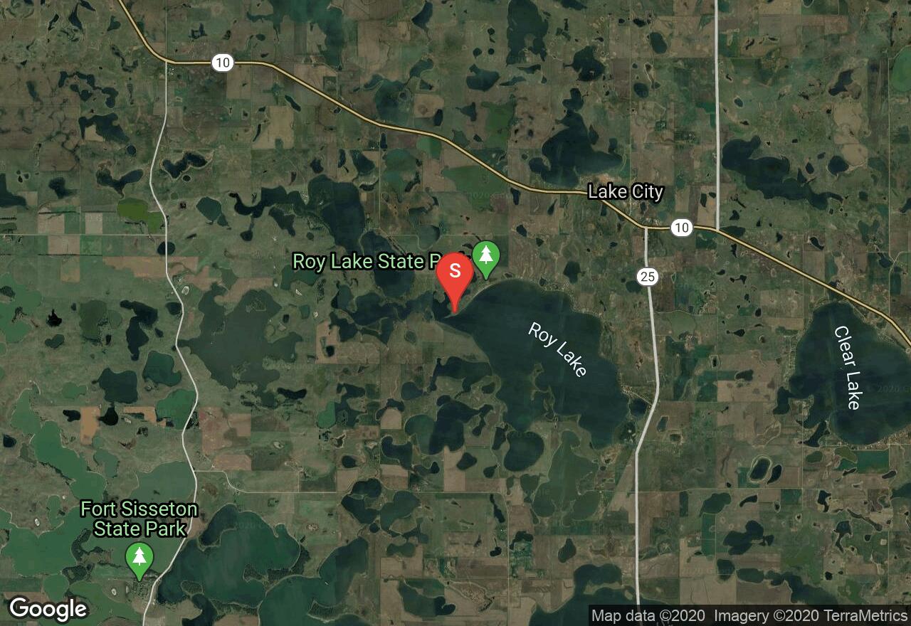
South Dakota, Day County
02 :14 hrs
5 mi
2.0962524 ft
I
Picker Lake State Park is a popular spot for outdoor activities when the weather is hot. The water is fed by refreshing cold spring water, and the lake is considered to be one of the deepest natural lakes in the state at 41 feet in depth. Canoe and kayak rentals are available here, along with many other facilities and services. The beach area offers a great place to set up and get ready for your adventure. There is also a $6 day use fee for each vehicle.
South Dakota, Custer County
01 :37 hrs
1.4 mi
177.5321 ft
Moderate
This trail begins at the Little Devils Tower Trailhead, located off SD Hwy 87 (Needles Hwy). The hike is fairly short and has a rather gradual climb, except for when you get to the steep granite terrain at the tower. You'll definitely enjoy passing through ponderosa pine trees and having the opportunity to observe wildlife such as mule deer. A trailhead permit is required to park and/or hike from the trailhead, costing $2.50 - $5 per person or $6 - $12 per vehicle, depending on the time of year.
South Dakota, Marshall County
07 :32 hrs
75.1 mi
46.087524 ft
Extreme
This ride passes through a landscape of small rolling hills, wetlands, and abundant pothole lakes in northeastern South Dakota. The area is rich with cultural history and also offers excellent opportunity for wildlife viewing, especially birds and waterfowl. The majority of the route follows rural roads that are paved with very minor traffic. There are some small rolling hills but no major climbs or descents. Riders who want to add a little mileage can also take a side trip to Sica Hollow but this does require riding along gravel roads.
South Dakota, Pennington County
00 :37 hrs
2.4 mi
111.35718 ft
Moderate
Buzzard's Roost is located just a few miles west of Rapid City and offers an extensive trail system for mountain bikers of all skill levels to enjoy. The trails are well-marked and easy to follow. The majority of the trails are singletrack with lots of rocks so be sure to carry along a spare tube or two just to be safe. This ride follows mostly easy to moderate sections of trail in the park but riders looking for a little more challenge can branch off on some of the difficult sections of trail if desired.
South Dakota, Brown County
03 :50 hrs
38.3 mi
24.198761 ft
Hard
This double loop ride travels scenic and rural roads between Richmond and Mina Lakes. The ride is a great option for a short day trip in the Aberdeen area and recreation sites at both lakes make good resting spots. The ride is very flat but there is a section on gravel road. The traffic is fairly minimal but there is not much shoulder room so do pay attention to traffic.
South Dakota, Edgemont
08 :43 hrs
16.2 mi
223.98853 ft
Easy
The entire Mickelson Trail is 109 miles long and has a total of 15 trailheads, 4 rock tunnels, and several railroad bridges. The surface of the trail is mostly crushed limestone and packed gravel, along with some partial dirt roads. It begins at the town of Edgemont and journeys northward through the heart of the amazing Black Hills. The easiest way to get onto the trail is to park on the side of 2nd Avenue at the city park and head north toward the railroad tracks. You'll make your trip along abandoned rail lines and cross wooden bridges, and then also pass by the Elk Mountains before getting the Minnekahta Trailhead. You can purchase a Mickelson Trail pass at a self-service station along the trail or online.
South Dakota, Pennington County
01 :21 hrs
3 mi
3.467163 ft
I
This is a 435 acre popular fishing spot that is located 20 miles west of Hill City, SD. Castle Creek is the water source, allowing a complex that has 3 campgrounds, 2 picnic areas, trails, and several boat launches. The south access is on Deerfield Cove Rd and near Dutchman Campground. Wakeboarding is not allowed, so the paddling is easy and the trip is very peaceful. There is a $5 vehicle day use fee.
Nebraska, Cherry County
01 :20 hrs
3 mi
3.0980835 ft
I
This wildlife refuge is home to multiple species of bird and other indigenous creatures. Approximately 30 water bodies dot the area and allow man-powered paddling vessels only. Sport fishing is available on lakes Watts, Rice, Duck, West Long, Hackberry, Dewey, Pelican, Clear, and Willow - also granting access to water crafts with outboard electric motors. Hunting is allowed as well. The landscape is vast and isolated, exhibiting the rolling hills of Nebraskan prairie. Access to and within the refuge can prove difficult since many of the lakes can only be accessed by foot or 4WD vehicles, so plan accordingly.
South Dakota, Sioux Falls
01 :55 hrs
19.2 mi
35.70642 ft
Moderate
This paved bike trail loops through the city of Big Sioux Falls providing access to multiple parks, green spaces, and points of interest. The multi-use trail also connects to other shorter trails in the area providing lots of great riding options. The trail is very flat, well-maintained, and easy to access making it a good choice for riders of all skill levels. The pathway is also used by walkers and joggers so watch out for other trail users.
South Dakota, Pennington County
01 :28 hrs
3.3 mi
0.8865967 ft
I
Sheridan Lake is located about 6 miles northeast of Hill City, SD on Highway 385. This is a 380 acre lake that is surrounded by a heavily forested shoreline in the Central Hills. The southeast access is on Rustle Loop Rd near the Flume trail and South Shore Campground. Hours of operation run from 8AM to 7PM.
Nebraska, Cherry County
02 :46 hrs
6.2 mi
4.091736 ft
I
This wildlife refuge is home to multiple species of bird and other indigenous creatures. Approximately 30 water bodies dot the area and allow man-powered paddling vessels only. Sport fishing is available on lakes Watts, Rice, Duck, West Long, Hackberry, Dewey, Pelican, Clear, and Willow - also granting access to water crafts with outboard electric motors. Hunting is allowed as well. The landscape is vast and isolated, exhibiting the rolling hills of Nebraskan prairie. Access to and within the refuge can prove difficult since many of the lakes can only be accessed by foot or 4WD vehicles, so plan accordingly.
South Dakota, Day County
01 :38 hrs
3.6 mi
2.9440918 ft
I
Picker Lake State Park is a popular spot for outdoor activities, especially when the weather is hot. The water is fed by refreshing cold spring water, and the lake is considered to be one of the deepest natural lakes in the state at 41 feet in depth. The southern access launching area is at the East Pickerel Lake Recreation Area. There is a $6 day use fee for each vehicle.
South Dakota, Lawrence County
01 :23 hrs
5 mi
161.85986 ft
Hard
The Eagle Cliff Trails is an extensive network of marked trails in the Black Hills National Forest that are popular for biking, hiking and cross-country skiing. Totaling more than 20 miles, the trail system can be used to customize trips of varying distances and difficulties. The terrain covers lots of rolling hills that can provide some challenging rides. There are multiple trailheads and access points so the trip options are abundant. The trail surfaces and conditions will also vary with some possible muddy sections and obstructions along the way. This loop ride covers an intermediate 5-mile loop but for riders exploring a lot more of the area, pay attention to signs and distance covered to ensure you can get back to where you started before wearing yourself out too much.
South Dakota, Lawrence County
00 :26 hrs
0.5 mi
17.497192 ft
Easy
This route begins off Highway 14A and travels quickly to top and bottom part of Little Spearfish Falls. There are a few different spots to enter the paved trail, especially from the parking lot at the Latchstring Restaurant. The scenery here is spectacular as you are surrounded by the riparian habitat of lush green meadows, wildflowers, berry bushes, aspen trees, and pine trees.
South Dakota, Lawrence County
01 :02 hrs
2.1 mi
105.75293 ft
Hard
This route starts in Spearfish Canyon and follows along Iron Creek towards the Rod and Gun Campground. You'll enjoy the sounds of birds, running water and whistling pines as you climb gradually up into the Black Hills National Forest. The route comes to stop at an intersection where you can also connect to a singletrack, or you can continue instead along a dirt road.
South Dakota, Turner County
01 :34 hrs
3.5 mi
0.86621094 ft
I
Swan Lake has a public access point on 455th avenue and has a 200 acre waterbody with about a 4 mile shoreline. The water is fairly shallow in a lot of places, so be sure to watch out for debris, plants, and rocks below. The shoreline is pretty well developed with residential cabins and wooded areas. There are also some interesting islands to cruise by, but the wildlife is a bit limited around the lake with some possibility of spotting fish, muskrats and waterfowl.
South Dakota, Custer County
00 :09 hrs
0.4 mi
7.6539307 ft
Unknown
Oreville Campground is 4 miles south of Hill City. It is a very relaxing destination and is located on a hillside and campsites offer guests plenty of privacy from other campers. Lots of wildlife can be seen in the area including bighorn sheep, elk, pronghorn, bald eagles, hawks, osprey, peregrine falcon, and many other species. Tons of recreational activities are available including fishing, horseback riding, mountain biking, and riding OHVs. It costs about $20 per night.
South Dakota, Meade County
00 :47 hrs
2.1 mi
26.153198 ft
Unknown
Suzies Camp is a great campground located off of exit 34, I-90 in the city of Sturgis. There are 60 total campsites with full hookups and 30/50 amp electricity as well as tent sites. Other amenities include cabins, hot showers, laundry facilities, and more. Plenty of activities are available here for all ages such as biking, hiking, 4-wheeling, horseback riding, and much more.
South Dakota, Walworth County
02 :13 hrs
4.9 mi
1.96521 ft
I
The Oahe Dam on the Missouri River results in a large reservoir that begins in central South Dakota and continues north into North Dakota. It is the fourth largest reservoir in the United States and has a total area of 370,000 acres. The Lebeau Recreation Area has a lot of interesting inlets and bays to explore, and can be accessed on 146th street. Walleye, northern pike, catfish and chinook salmon are primarily stocked in the lake. Services and facilities are limited, so be sure to bring plenty of water and supplies.
South Dakota, Pennington County
00 :35 hrs
1.6 mi
12.56665 ft
Unknown
Sheridan North Cove Group Campground is situated right along the north shore of Sheridan Lake. The lake provides beautiful scenery as well as wonderful recreational activities such as fishing, swimming, boating, and water skiing. Wildlife in the area will not disappoint as there are elk, deer, bighorn sheep, pronghorn, bald eagles, hawks, and much more. In the winter anglers enjoy ice fishing in the lake. is situated right along the north shore of Sheridan Lake. The lake provides beautiful scenery as well as wonderful recreational activities such as fishing, swimming, boating, and waterskiing. Wildlife in the area will not disappoint as there are elk, deer, bighorn sheep, pronghorn, bald eagles, hawks, and much more. In the winter anglers enjoy ice fishing in the lake.
South Dakota, Lawrence County
02 :44 hrs
6.9 mi
250.19995 ft
Hard
The Centennial Trail is over 100 miles long and was built in 1989 to represent the 100th anniversary of South Dakota's statehood. This part of the trail starts at Boxelder Creek and travels northward through a plethora of ponderosa pine trees in the Black Hills National Forest, offering plenty of wildlife spotting opportunities. You'll also be able to enjoy excellent views into Little Elk Creek Canyon as you get closer to the Dalton Lake Trailhead. This route can be done as a half day one-way trip with necessary vehicle arrangements, or it can be done as a full-day out and back trip.
South Dakota, Spearfish
00 :05 hrs
0.2 mi
1.6514893 ft
Unknown
Rod & Gun Campground is a very unique campground. It actually features one of the Dances with Wolves fim sites nearby. There are seven sites available, and restroom facilities are available. It is actually located right next to Little Spearfish Creek which offers great recreation. Pricing is around $18 per night, and extra vehicles are $2 per night. Sites are not reservable, and all sites are single.
South Dakota, Potter County
03 :01 hrs
7.6 mi
3.9891052 ft
SK II
Lake Oahe is a 370,000-acre lake located on the Missouri River in Emmons County. By volume, it is the fourth-largest reservoir in the United States. There are 51 recreation areas located along the shoreline and over 1.5 million people visit each year. Species of fish in the reservoir include walleye, northern pike, channel catfish, and smallmouth bass. Gorgeous rolling hills covered in very pretty native prairie grasses provide wonderful scenery.
South Dakota, Day County
08 :45 hrs
19.4 mi
5.6884155 ft
I
Part of the Waubay National Wildlife Refuge, this 33,000 acre lake is located in the Glacial Lakes region of South Dakota. The vegetation in this area is filled with grasslands and woodlands, so expect to see a lot of wildlife here, especially birds and deer. The area is also popular for fishing and hunting trips, so please be aware of your surroundings.
South Dakota, North Sioux City
01 :59 hrs
6 mi
4.821533 ft
Hard
Adams Homestead and Nature Preserve covers 1500 acres along the Missouri River and offers a network of trails that explore an area of diverse natural terrain. The River Loop follows a gravel trail on the south side of Mud Lake that travels through both prairie and forest terrain down to the Missouri River. The trail has lots of small ups and downs but no major hills making it a good choice for hikers of all skill levels. The trail continues to the north up past the lake making it easy to customize a much longer hike if desired.
South Dakota, Fall River County
00 :37 hrs
3.1 mi
16.21045 ft
Easy
This paved pathway travels along the eastern side of Angostura Reservoir and offers a short easy ride in the recreation area. The trail does travel over some mild rolling hill terrain but is fairly short and easy to follow. The recreation area also offers campgrounds, picnic areas, swimming, boat launching facilities, and a frisbee golf trail.
South Dakota, Custer County
01 :37 hrs
3.9 mi
150.47217 ft
Moderate
This is a loop hike that starts at a trailhead located behind the State Park School near Peter Norbeck Visitors Center. Expect a lot of ups and downs as you quickly climb up to the summit of Lover's Leap and then descend the western ridge to Galena Creek. There are also a lot of water crossings on your way back, so be sure to be prepared if waters are high. Keep in mind that a state park entrance fee is required for each vehicle.
South Dakota, Turner County
01 :34 hrs
3.5 mi
0.9505005 ft
I
Swan Lake has a public access point on 455th avenue and has a 200 acre waterbody with about a 4 mile shoreline. The water is fairly shallow in a lot of places, so be sure to watch out for debris, plants, and rocks below. The shoreline is pretty well developed with residential cabins and wooded areas. There are also some interesting islands to cruise by, but the wildlife is a bit limited around the lake with some possibility of spotting fish, muskrats and waterfowl.
Nebraska, Cedar County
23 :51 hrs
53.1 mi
22.607788 ft
I
This river adventure is mapped to be a three night trip, however, if one has the stamina for long hours of paddling, it is possible to complete the course with just one overnight stay. Marked as the only portages, there's three camping areas, but one could skip the first and third campgrounds to shorten the trip to the one overnight stay as mentioned. Also, if desired, each campground is a potential finishing point if one doesn't want to paddle the entire length of the course. The river is large and the current is steady, but note that southern winds can cause difficulty. Only sometimes do sandbars form, forcing simple maneuvering. Parking is available at the launch and final takeout point, but fees may apply.
South Dakota, Davison County
00 :07 hrs
0.3 mi
0.5191345 ft
Unknown
Dakota Campground is a great little campground located in the city of Mitchell. It has tons of large trees that provide plenty of shade. There is 49 total sites available, 42 of which have full hookups, and 10 are pull thrus. Maximum RV length is 70 feet. Tons of great amenities are offered here such as toilets, showers, laundry machines, firewood, internet, a pool, and a playground.
South Dakota, Dewey County
00 :26 hrs
1 mi
2.430359 ft
I
This fun little lake is located within Little Moreau State Recreation Area, which is about 5 miles south of Timber Lake. Rich grasslands and wooded areas surround the lake, along with a campground and picnic shelter. There are also opportunities to observe foxes, bobcats, grouse, pheasants, eagles and owls. Park entrance fees are not required here.
South Dakota, Potter County
01 :03 hrs
3.1 mi
9.227417 ft
Unknown
South Whitlock Resort is a great and spacious campground located in the city of Gettysburg. It has 71 total sites, all of which have full hookups. Maximum RV length is 40 feet. Tons of great amenities are available here such as toilets, showers, laundry, internet, a playground, a store, and a boat launch. Pricing is right around $20 per night.
South Dakota, Codington County
01 :49 hrs
18.1 mi
17.259705 ft
Moderate
This scenic ride in the Glacial Lakes Region starts from Kampeska Lake and travels down around Goose Lake, passing Pelican Lake along the way. The route follows rural paved roads with a few short sections of gravel road. The terrain is mostly flat with just minor small rollers along the way. There are recreation areas at Kampeska Lake and Pelican Lake that offer camping, picnic facilities, and water recreation.
South Dakota, Brown County
04 :02 hrs
8.9 mi
1.125885 ft
I
This 1000-acre lake is located just northwest of Aberdeen and offers excellent outdoor recreation including paddling and fishing. The lake is a good spot for wildlife viewing and birdwatching. The lake is part of a state recreation area that offers easy launching access and canoe and kayak rentals if needed. Camping, picnicing, and hiking trails are also available at the lake.
South Dakota, Aurora County
00 :24 hrs
1.2 mi
0.6258545 ft
Unknown
Siding 36 Motel and Campground is a nice little campground that has very spacious sites and is located in the city of White Lake. It has 20 tent sites and 35 RV sites, all of which are pull thrus and have full hookups. Maximum RV length is 45 feet. Lots of great amenities are available such as toilets, showers, laundry machines, firewood, internet, and even a little convenient store.
South Dakota, Pennington County
00 :09 hrs
0.4 mi
13.205444 ft
Unknown
Whitetail Campground is a great campground, especially for visitors who are looking for great views and relaxation in Black Hills National Forest. Sites here are very spacious and luxurious, some featuring views of the lake as well. Campers can enjoy lots of recreational activities including hiking, fishing, horseback riding, mountain biking, and riding OHVs. Sites will cost right around $20 per night.
South Dakota, Rapid City
00 :19 hrs
0.8 mi
12.309326 ft
Unknown
Kemps Kamp is located 1.5 miles W of Keystone on Old Hill City Road. It has 70 total sites, and 34 of which are tent only. There are 8 pull thrus, 14 full hookups, and 9 electric only which have either 20, 30, or, 50 amp electricity. This campground is the ideal place to stay with easy access to Mount Rushmore, Crazy Horse, and Custer State Park all nearby. Lots of amenities are offered here such as a pool, playground, laundry, and more.
South Dakota, Fall River County
00 :06 hrs
0.3 mi
5.5856934 ft
Unknown
Kemo Sabay Campground is a nice little campground located in the city of Hot Springs. Views are amazing and it is a very peaceful place. It has 24 sites total, 18 of which are pull thrus, and 20 of which have full hookups. Electricity available is either 20, 30, or 50 amp. Other amenities include grills, RV storage, laundry, internet, and more. Pricing is right around $20 per night.
South Dakota, Meade County
00 :25 hrs
1.2 mi
9.463867 ft
Unknown
No Name City RV Park and Campground is located in the city of Sturgis. There are 148 total campsites, and 100 of which are tent only sites. Also available are 16 pull thrus and 26 full hookups as well as 24 cabins. Sites are located close together at this campground, so be prepared for that. Lots of great amenities are available including grills, showers, propane, laundry, internet, a pool, a playground, and more.
South Dakota, Cherry County
00 :28 hrs
1.1 mi
51.122986 ft
Unknown
Penbrook Campground is situated near the banks of the Niobrara River and offers a peaceful and scenic setting for camping near Valentine. The campground offers sites for tent and RV camping. Amenities include electric hookups, picnic tables, fire rings, drinking water, restrooms, and showers. Contact the campground by phone for information regarding rates and reservations.
South Dakota, Sully County
02 :17 hrs
5.1 mi
6.7907104 ft
I
Sutton Bay is located at the Lake Oahe area of the Missouri River. A full service lodge, golf course, dining, and plenty of other services are available near the bay. Also, there is plenty of wildlife to be found in this area, along with beautiful vistas. Be on the look out for fishing boats and hunters while your out on the water here.
South Dakota, Roberts County
06 :08 hrs
13.6 mi
2.3999634 ft
I
With the Minnesota River as the water source, Big Stone Lake runs 26 miles along the Minnesota and South Dakota border. Northern pike, bluegills, walleye, and yellow perch attract a lot of boaters and fishermen. It's also a great place to do some birdwatching and lakeside camping, especially when the wildflowers are blooming in late spring. The northern access point does not have any facilities or services, so be sure to bring plenty of gear and water.
South Dakota, Lawrence County
00 :11 hrs
0.6 mi
2.4362793 ft
Unknown
Spearfish/ Black Hills KOA campground is a very luxurious and beautiful campground. Visitors often enjoy fishing for trout on Spearfish Creek. Also available are many miles of biking/running paths, the D.C. Booth Historic National Fish Hatchery & Archives and the Spearfish Rec & Aquatics Center. There are deluxe cabins with endless amenities. Maximum pull through is 125 feet.
South Dakota, Pennington County
00 :07 hrs
0.3 mi
6.182251 ft
Unknown
Mt Meadow Store and Campground is a little campground located in Hill City. It has 10 pull thrus and 11 electric only sites, 4 of which have water hookups. Conveniently it is located right across the road from Deerfield Lake which provides lots of water activities for visitors. Also available are plenty of hiking and biking trails. Aside from primitive camping, there are cabins available as well.
South Dakota, BIA 21
00 :41 hrs
2 mi
2.411499 ft
Unknown
Left Tailrace Campground is right along the shore of Lake Francis Case on the Missouri River. This is a very popular campground. Lots of wildlife roam the area including whitetail deer, mule deer, elk, bison, coyotes, and wild turkeys. Many different bird species can be seen as well. There are 93 total campsites, 81 of which have electrical hookups, the other 12 being tent sites. Prices range from $14-$18 per night.
South Dakota, Meade County
00 :18 hrs
0.8 mi
11.588623 ft
Unknown
Rush-no-more RV Park and Campground is a very large and beautiful campground with lots of trees for shade and plenty of room between sites. It is located in the city of Sturgis. There are 116 total sites, 10 of which are tent only sites, and 91 of them have full hookups. Maximum RV length is 75 feet, and there are 54 pull thru sites. Plenty of great amenities are available here such as grills, showers, RV storage, propane, laundry machines, internet, a pool, and a playground.
South Dakota, Pennington County
00 :31 hrs
1.4 mi
19.156494 ft
Unknown
Horsethief Lake Campground is located 2 miles from Mount Rushmore National Memorial and also sits in the Black Hills National Forest. Wildlife is abundant in this area, and you could see bighorn sheep, elk, deer, pronghorn, bald eagles, osprey, peregrine falcon, and hundreds of bird species. Hiking trails are also abundant in the area. Sites cost $26 per night.
South Dakota, McCook County
00 :06 hrs
0.3 mi
0.36193848 ft
Unknown
Camp America Campground is a great little campground located right off the road in the city of Salem. Plenty of large trees provide great shade throughout the whole campground. It has 7 tent only sites and 52 RV sites, 17 of which are pull thrus and 39 have full hookups. Lots of luxurious amenities are available including grills, toilets, showers, laundry machines, firewood, internet, a pool, and a playground.
South Dakota, Pennington County
00 :07 hrs
0.3 mi
3.3370361 ft
Unknown
Castle Peak Campground is a beautiful campground located in the heart of Black Hills National Forest. It consists of 9 campsites that include restroom facilities. This campground is a nice quiet campground and has plenty of trees that provide great amounts of shade. Sites here are not reservable. Castle Creek runs throughout the campground and provides some great activities as well.
South Dakota, Walworth County
00 :06 hrs
0.3 mi
1.1029053 ft
Unknown
Kountry Kamping and Kabins is a great little campground located in the city of Mobridge. It consists of 35 total sites, 10 of which are tent only sites, and 18 have full hookups. There is also 21 pull thru sites. Tons of amenities are available such as grills, laundry, firewood, internet, a playground, tables, and more. The Missouri River is nearby and has beautiful views from the campground. Pricing is around $20-$30 per night.
South Dakota, Custer County
00 :43 hrs
1.8 mi
23.384277 ft
Unknown
Bismarck Lake Campground is situated in Black Hills National Forest which offers a beautiful view of the lake, but also provides privacy for guests. Recreational activities include hiking, fishing, horseback riding, mountain biking, and riding OHVs. There is also lots of wildlife in the area including bighorn sheep, elk, deer, and pronghorn. Many bird species navigate the area as well. Sites cost about $26 per night.
South Dakota, Hughes County
02 :15 hrs
5 mi
9.187714 ft
I
The Oahe Dam on the Missouri River results in a large reservoir that begins in central South Dakota and continues north into North Dakota. It is the fourth largest reservoir in the United States and has a total area of 370,000 acres. Oahe Mission Recreation Area is located northwest of the dam and on 280th Avenue. There is a large parking lot area, double wide boat launch, a boat dock, and toilets near the launching area. Walleye, northern pike, catfish and chinook salmon are primarily stocked in the lake.
South Dakota, Jackson County
00 :13 hrs
0.5 mi
26.968323 ft
Easy
Cliff Shelf Nature Trail is located around the corner from Ben Reifel Visitor Center, and it is on the east side of S.D. 240. This is an easy interpretive loop trail that goes into heavily vegetated areas of the Badlands. It is a very unique hike with towering badland formations rising above the prairie grasses, shrubs, and juniper trees. Literature of the geological history can be observed while hiking on the trail. Also, a park entrance fee is required for each vehicle.
South Dakota, Yankton County
03 :43 hrs
4.6 mi
3.8859863 ft
SK II
Lewis and Clark Lake is a located on the border of South Dakota and Nebraska and is a large impoundment on the Missouri River. The reservoir is about 25 miles long and offers lots of recreational opportunity including paddling and fishing. This trip covers the shoreline within the Lewis and Clark Recreation Area. Multiple recreation areas and launches located on the South Dakota side of the lake offers easy access with other amenities including campgrounds, picnic areas, and hiking and biking trails. The lake is popular for other types of water recreation so be prepared to encounter other users on the lake.
South Dakota, Sioux Falls
00 :26 hrs
1.3 mi
2.3900452 ft
Easy
Sertoma Park is located along the Big Sioux River and offers some scenic nature trails for hiking in an otherwise suburban area. The park offers multiple shorter loop trails that can be hiked individually or combined for a longer hike. This hike follows the Woodland Trail and a segment of the Prairie Trail to complete one longer loop in the area. The dirt/gravel trails are fairly flat, wide, and easy to follow making the hike a great choice for beginner hikers.
South Dakota, Lawrence County
01 :07 hrs
3 mi
24.100586 ft
Unknown
Roubaix Lake Campground is situated with Ponderosa pines along with Roubaix Lake of course which provides beautiful views. Sites are very spacious and offer plenty of privacy. Lots of recreational activities are offered here including swimming, canoeing, kayaking, and fishing for brook and rainbow trout. Also available is a 1-mile multi-use path that leads to various other trails for horseback riders, mountain bikers, and OHVs.
South Dakota, Clay County
13 :20 hrs
31.4 mi
15.288055 ft
II
Two long sections of the Missouri River are listed on the National Register of Wild and Scenic Rivers and provide some excellent opportunities for experienced paddlers. This run covers part of the second section starting from Myron Grove Access and ending at a take-out at Ponca State Park on the Nebraska side of the river. The large river is prone to rough waters with wind and there are segments with strong currents that require skillful paddling. This section also has some large sandbars and islands to navigate around but they do provide some good camping spots. There are multiple alternate take-outs located along the run that can be used for emergency take-out or to customize a shorter trip if needed.
South Dakota, Deadwood
00 :22 hrs
0.9 mi
27.633911 ft
Unknown
Whistler Gulch RV Park and Campground is a very large campground in the city of Deadwood. It has 141 total sites, 36 are pull thrus and 125 have full hookups. Internet, laundry machines, grills, and much more are available for use. Visitors also enjoy activities like creek side fishing, golf, and even an indoor arcade within walking distance. Aside from the primitive camping sites, there is also a condo available. Pricing ranges from $30-$75 per night.
South Dakota, Pennington County
00 :06 hrs
0.3 mi
1.7418823 ft
Unknown
Sage Creek Campground is a unique campground that will sometimes have bison wandering through. This campground tends to close temporarily after winter storms and spring rains because the road gets too bad. No water is available on site. A portion of this campground is designated for horse use. No reservations are necessary, the campground is a first-come first-serve.
South Dakota, Jackson County
00 :12 hrs
0.6 mi
5.3703613 ft
Unknown
Belvidere East/ Exit 170 KOA campground is just ½ mile north off I-90. RV Sites have a max pull through of 90 feet and include free cable TV and Wi-Fi. The campground is gated, so you must arrive before 10 p.m. or arrange a late arrival in advance. The pool is open from Memorial Weekend through Labor Day Weekend. Sites also have available bike rentals, as well as many more activities.
South Dakota, Pennington County
00 :45 hrs
2 mi
21.516357 ft
Unknown
Sheridan Lake Campground is located right in the middle of a forest of ponderosa pine along the south shore of Sheridan Lake, which creates amazing views of the lake. Lots of wildlife can be found in the area including bighorn sheep, elk, deer, pronghorn, and many bird species. This campground offers lots of different recreational activities including hiking, fishing, horseback riding, mountain biking, and riding OHVs.
South Dakota, Jackson County
00 :22 hrs
1.1 mi
4.244507 ft
Unknown
White River KOA campground is located 4 miles from Badlands National Park. The wildlife here is very unique and you will find plenty of animals such as bison, bighorn sheep, prairie dogs, and more. Lots of trees provide shade as well as privacy. Visitors enjoy many activities such as mini golfing, swimming, riding bikes, and more. The maximum trailer/RV pull thru is 120 feet.
South Dakota, Custer County
00 :04 hrs
0.2 mi
6.7591553 ft
Unknown
Elk Mountain Campground offers great scenery of the beautiful forest nearby as well as the plants and animals of the southern Black Hills. There is an $18 fee per night when water and toilet facilities are available, but when they aren’t available there is a $9 fee per night. No electric hookups are available for RVs. There is a 14 day stay limit, and there are 25 pull through sites in the campground.
South Dakota, Hutchinson County
01 :08 hrs
2.5 mi
3.783966 ft
I
Located near the town of Dimock, this 145 acre lake has about 5 miles of shoreline and averages a depth of 6 feet. Near the public parking area, there is a single lane boat ramp, a dock, a picnic shelter, and public toilets. The shoreline is surrounded with grasses, flowers, weeds and brush, along with a few boulders. You are likely to spot some ducks, blue herons, and cormorants, along with several species of fish. There aren't any services nearby, so be sure to bring plenty of water and supplies
Iowa, Lyon County
01 :13 hrs
2.7 mi
9.562439 ft
I
There is a concrete boat ramp and a wooden dock on the north side of the lake. A valid Iowa-fishing license is required. You will find a fish cleaning station on the north side of the lake. Motorized vehicles are restricted on the roadways and parking areas. Parking is not allowed on the dam.
Nebraska, Dawes County
01 :55 hrs
1.9 mi
123.94287 ft
Moderate
Located in Nebraska's oldest state park, the Blackhills Overlook Trail provides excellent views of one of the state's mountainous regions. The dirt pathway goes through some wooded area before beginning the uphill trek to the top of a ridge. The trail then follows the ridge-line for the last half of the journey before ending at the overlook area and a small parking lot at the top. There is a shuttle option if one has two vehicles. Note that a state park permit is required for entry.
South Dakota, Hughes County
01 :34 hrs
4.7 mi
0.4800415 ft
Moderate
Farm Island Recreation Area is located just east of Pierre and provides a wide array of recreational opportunities including some nice hiking options. The hiking trails explore the peaceful and scenic nature island. The trails can be used for hiking, biking, and cross-country skiing and are very flat and easy to follow. The recreation area also offers camping, picnic areas, a visitor center, and water recreation.
South Dakota, Pennington County
00 :27 hrs
1.2 mi
12.766724 ft
Unknown
Willow Creek Horse Camp offers tons of trail riding opportunities as well as hiking opportunities. Corrals are not provided, there are tie-up areas and guests are welcome to bring portable corrals. This area is home to lots of different wildlife species such as elk, deer, bighorn sheep, and mountain goats. Sites will cost anywhere from $24-$110 per night.
South Dakota, Pennington County
01 :07 hrs
3.1 mi
25.478271 ft
Unknown
This KOA campground is very luxurious and offers endless activities, including heated pools and spas, a waterslide and splash pad, mini golf, a climbing wall, and more! The maximum pull through for trailers and RVs is 75 feet. The pool is open from Memorial Weekend through Labor Day Weekend. Mount Rushmore is nearby and offers lots of recreation as well as beautiful views.
Iowa, Lyon County
00 :33 hrs
1.6 mi
3.5203247 ft
Easy
This is an old gravel road to hike. Watch out for prickly pear cacti. This trail is best spring through fall. During the winter there are sharp rocks covered by snow. Dogs are allowed on a leash and there are no fees or permits required.
South Dakota, Jackson County
00 :38 hrs
1.9 mi
6.3408813 ft
Unknown
Cedar Pass Campground is located within walking distance of the Cedar Pass Lodge. Views in this area are amazing. There are 4 Group Loop sites available as well as tent and RV sites. There isn’t a lot of trees for shade, but the campground does provide a covering over the picnic table for some shade. Showers are available for use, but are not free. Campground is around $30 per night.
Iowa, Sioux City
01 :12 hrs
3 mi
52.66815 ft
Moderate
You will have views overlooking the Missouri and Big Sioux Rivers. Mountain bikers and equestrians do share this trail with the hikers. Watch out for ticks and poison ivy. No fees or permits are required.
South Dakota, Pennington County
00 :01 hrs
- mi
2.715088 ft
Unknown
Bear Gulch Campground overlooks a private bay on the Pactola Reservoir. This is a great campground that can accommodate groups of up to 60 people and also has 8 individual tent sites around a central parking area. Pactola Reservoir offers many recreational activities including water skiing, swimming, fishing, and scuba diving. Anglers will have the opportunity to fish for brown and rainbow trout. Other wildlife that can be seen include mule deer, bighorn sheep, elk, and wild turkey. Sites cost about $110 per night.
Iowa, Plymouth County
02 :03 hrs
5.3 mi
84.08032 ft
Hard
The path consists of old gravel roads and mowed firebreaks. It is open year-round. There will be hikers, hunters and cross-country skiers. Watch out for poison ivy, ticks and sunburn on exposed ridges. No fees or permits required.
South Dakota, Sully County
03 :41 hrs
4.6 mi
3.9325867 ft
SK II
Lake Oahe is a 370,000-acre lake located on the Missouri River in Emmons County. By volume, it is the fourth-largest reservoir in the United States. There are 51 recreation areas located along the shoreline and over 1.5 million people visit each year. Species of fish in the reservoir include walleye, northern pike, channel catfish, and smallmouth bass. Gorgeous rolling hills covered in very pretty native prairie grasses provide wonderful scenery.
South Dakota, Pennington County
00 :41 hrs
0.8 mi
17.904053 ft
Easy
This route is located in the Black Hills, and it is accessed off Highway 16 on Big Red Road. You'll travel easily through a dense pine forest and end up at a large rocky overlook. Below the overlook, you'll be able to observe the 'Stratobowl', which is a natural bowl-shaped grass valley that was formed by a river and limestone rock.
South Dakota, Pennington County
00 :13 hrs
0.6 mi
14.019165 ft
Unknown
Ditch Creek Campground is a quiet little campground located next to Ditch Creek. It is only 5 miles south of Deerfield Reservoir which is very convenient. Lots of open space is available in the area as well as plenty of trees for shade. Stay limit is 14 days maximum. There are 13 single sites available that are not reservable and have a maximum RV length of 50 feet. Pricing is right around $20 per night.
South Dakota, Pennington County
00 :51 hrs
2.3 mi
22.5896 ft
Easy
Located at Pactola Lake, the Osprey Trail loops around the area twice and also has a spur trail that leads to an overlook. The route was appropriately named because ospreys can be observed in the area, especially when they are hunting for fish out on the water. The route travels through ponderosa pine trees and leads to the shoreline at a few spots, offering great views of the lake. Be sure to purchase a day-use parking pass during the summer season.
South Dakota, Custer County
01 :46 hrs
2.1 mi
40.512695 ft
Moderate
This route starts at the Centennial Trailhead off Highway 87 and heads out into the rolling hills of the prairie. You'll begin your trip through grasses and trees, and then pass over a creek before making a quick strenuous climb out of the wash area. Once you get to the end of the trail you'll be able to enjoy some wonderful vistas and also have the opportunity to connect with the Highland Creek Trail.
South Dakota, Stanley County
06 :13 hrs
13.8 mi
22.30716 ft
I
Foster Bay Recreation Area is located south of Eagle Butte and off Highway 63. The access point has a double wide boat launch, which leads to a very large bay that is not heavily used. Walleye, northern pike, catfish and chinook salmon are primarily stocked in the lake. Facilities and services are limited here, so be sure to bring plenty of water and supplies.
South Dakota, Pennington County
00 :31 hrs
0.4 mi
66.47815 ft
Easy
This hike begins at a pullout located just off Sage Creek Rim Road in the Badlands National Park. The Sage Creek Area offers great wilderness hiking opportunities through the Badlands. The land out here is usually very quiet and peaceful, and it is also considered the largest wilderness in the northern Great Plains. The route is not on a maintained trail, so use caution if you have to scramble down rocks and travel through gullies. When you get to the end of the route, you'll be able to observe some colorful mounds that rise up from the prairie. Also, a park entrance fee is required for each vehicle.
South Dakota, Minnehaha County
05 :45 hrs
12.8 mi
9.181519 ft
I
The Big Sioux River is a tributary of the Missouri River that forms the boundary between South Dakota and Iowa. The river offers great paddling and wildlife viewing. This section is popular due to its easy access and close proximity to Big Sioux Recreation Area and Lake Alvin. There is very little development along this stretch and is passes multiple recreation areas and preserves. The river can be paddled for many miles for a longer trip if desired. There are also some alternate take-outs along the way that can be used to customize a shorter outing.
South Dakota, Brookings County
01 :02 hrs
2.3 mi
5.0631104 ft
I
Oakwood Lakes State Park is a combination of eight glacial lakes, campsites, picnic areas, a disc golf course, and boating facilities. Lake Oakwood's northern access point is at a small pullout area off 202nd street. A variety of trails and shaded trees cover much of the shoreline at this lake. A $6 day use fee is required for each vehicle. Plus, there are canoe and kayak rentals available.
South Dakota, Lincoln County
04 :48 hrs
10.7 mi
8.950378 ft
I
The Big Sioux River is a tributary of the Missouri River that forms the boundary between South Dakota and Iowa. The river offers great paddling and wildlife viewing opportunity. This segment offers is a good half-day run on the river between Newton Hills State Park and the Oak Ridge Public Access. There is only small amount of rural development along this stretch of river. The river can be paddled for many miles upstream or after the take-out for a longer trip if desired.
South Dakota, Perkins County
03 :48 hrs
8.4 mi
3.9779663 ft
I
This 4,700 acre reservoir is the result of Shadehill Dam, North Fork Grand River, and South Fork Grand River in Perkins County. The recreation area offers a variety of land and water activities for the whole family, along with campsites, cabins, and other amenities. Crappie, walleye, and smallmouth bass are primarily stocked here. Pheasants are commonly hunted in this area as well. There is a daily license fee of $4 per person or $6 per vehicle.
South Dakota, Day County
03 :53 hrs
8.6 mi
6.758606 ft
I
Part of the Waubay National Wildlife Refuge, this lake is located in the Glacial Lakes region of South Dakota. It can be accessed at the Waubay National Wildlife Refuge Visitors Center. The vegetation in this area is filled with grasslands and woodlands, so expect to see a lot of wildlife here, especially birds and deer. The area is also popular for fishing and hunting trips, so please be aware of your surroundings.
South Dakota, Edmunds County
00 :49 hrs
8.2 mi
4.215637 ft
Easy
Mina Lake is a horseshoe shaped lake that was completed in 1934. It offers a scenic ride beginning at the campground. The roads are mostly flat with a small shoulder and traffic is moderate. There is great opportunity for wildlife and nature viewing.
South Dakota, Marshall County
01 :12 hrs
2.7 mi
2.0543823 ft
I
Bullhead Lake is located at Roy Lake State Park, which is just outside of Lake City and off 115th Street. This is a great place to go if you want to avoid the crowds at neighboring Roy Lake. Expect to see a little more wildlife on this quieter lake, when compared to its neighbor. You'll also enjoy the views of the surrounding thick plants and trees along the shoreline.
South Dakota, Day County
07 :15 hrs
16.1 mi
4.201538 ft
I
Located at Waubay, this lake is part of the Glacial Lakes region of South Dakota. The best access is at the Bitter Lake Lodge Campground, where you'll likely run into groups of fishermen. Over 30 campsites, a bath house, and a bait shop are available at the campground. The vegetation in this area is filled with grasslands and woodlands, so expect to see a lot of wildlife here, especially birds and deer.
South Dakota, Roberts County
00 :08 hrs
0.4 mi
1.5204468 ft
Unknown
County Line Campground is a nice small campground located in the city of Summit. Sites are very well spaced and grassy. There are 15 tent only sites 35 RV sites, 19 of which are pull thrus and 18 have full hookups. Also available are 4 electric only sites as well as lots of great amenities such as grills, showers, laundry machines, firewood, internet, a store, and even a cabin.
South Dakota, Yankton County
00 :30 hrs
1.1 mi
0.715271 ft
I
The western access is located on Marindale Avenue and has a few spots where you can launch your watercraft. On the eastern side of the lake, you'll notice some very tall cliffs that rise above the water, offering a great place for wildlife to thrive. You'll definitely spot out a lot of turtles, ducks, and several species of fish. There aren't any services or facilities near the access point, so be sure to bring plenty of water and supplies.
Nebraska, Sioux County
00 :13 hrs
0.3 mi
3.9213867 ft
Easy
Known for it's interesting geological rock formations, the badlands of north-west Nebraska is home to Toadstool Park. It's very isolated and the trail head offers six camping areas with a bathroom facility. To reach the trail head, one must drive along a gravel road for about 15 miles (not advised during wet weather). This trail route is mapped to take one to the actual formations, and back again. However, if desired, one could continue further up the pathway that loops around the rocks - extending the adventure to be about a mile in length. Note that steep cliffs are an element of danger in some areas and there is also a daily access fee and/or camping fee.
South Dakota, Lake County
00 :24 hrs
0.9 mi
2.230835 ft
I
Lake Herman State Park is located on a peninsula and offers visitors a good variety of land and water activities. Herman Slough is a great place to go if you want to avoid the crowds on Lake Herman and enjoy a quiet time. Along the shoreline you'll notice several trails, historic sites, and a lot of trees. You'll also be able to spot a lot of birds and animals in the area. Canoe and kayak rentals are available here, and there is a $6 day use fee for each vehicle.
South Dakota, Todd County
13 :58 hrs
31.7 mi
103.59082 ft
I
This clear spring-fed river travels throughs scenic undeveloped landscape of southern South Dakota and offers some peaceful wilderness paddling. This segment of the river covers 30 miles between the town of Spring Creek and the US 18 Bridge and is a favorite on the river. There is camping and picnic areas available at Ghost Hawk Park at mile 20 of the route.
South Dakota, Lincoln County
00 :46 hrs
2 mi
54.049744 ft
Easy
Good Earth State Park is located at Blood Run National Historic Landmark southeast of Sioux Falls. The historic and cultural landmark was the site of a large American Indian trade center and ceremonial site from 1500-1700 AD. A network of trails in the park provide access to some good viewpoints of the Big Sioux River and the surrounding natural area. The Bur Oak trail is a 2-mile hike that leads through an oak forest towards the river. The hike does have some small changes in elevation. The trail can be combined with others in the park for a longer hike if desired.
South Dakota, Custer County
01 :52 hrs
3.5 mi
69.209595 ft
Hard
The entire Mickelson Trail is 109 miles long and has a total of 15 trailheads, 4 rock tunnels, and several railroad bridges. The surface of the trail is mostly crushed limestone and packed gravel, along with some partial dirt roads. The trail is conveniently accessed behind the Pringle fire station and where you'll then journey northward through the Black Hills passing by old barns and granite formations before getting to the White Elephant Trailhead. Be sure to purchase a Mickelson Trail pass at a self-service station along the trail or online.
South Dakota, Lincoln County
00 :39 hrs
1.6 mi
51.147736 ft
Moderate
This short trail is located in Newton Hills State Park and offers a scenic hike through forested prairie and rolling hill terrain. The interpretive trail is open for hiking only but does connect to a larger network of multi-use trails to the north. Although the hike is short, it does have some fairly substantial steep climbs and descents and can be strenuous at times. The state park also offers picnicing, hiking, and good wildlife viewing.
South Dakota, Perkins County
08 :14 hrs
18.3 mi
4.499939 ft
I
This 4,700 acre reservoir is the result of Shadehill Dam, North Fork Grand River, and South Fork Grand River in Perkins County. The recreation area offers a variety of land and water activities for the whole family, along with campsites, cabins, and other amenities. Crappie, walleye, and smallmouth bass are primarily stocked here. Pheasants are commonly hunted in this area as well.
South Dakota, Haakon County
26 :17 hrs
58.9 mi
76.1069 ft
I
The Cheyenne River offers a scenic multi-day run through the rolling hills and grasslands of western South Dakota. The river can be paddled during the spring and early summer when water levels are high enough. The most commonly paddled section cover almost 60 miles of river with very little development and access along the way. There is the option of taking out in Cherry Creek for a shorter trip also if desired.
South Dakota, Custer County
02 :45 hrs
3.4 mi
110.055664 ft
Hard
Located in Wind Cave National Park, the Highland Creek Trail has as trailhead on the southern side of the park and another trailhead on the northern side of the park. The southern trail starts along the Wind Cave Canyon Trail before traversing north through the rolling hills of the prairie. You'll travel through patches of ponderosa pine trees and thick grasses as you make your way toward the riparian habitats of Highland Creek.
South Dakota, Lawrence County
00 :32 hrs
1.5 mi
9.511841 ft
Unknown
Wild Bills Campground is a great little campground located in the city Deadwood. It has 88 total sites, 28 of which are tent only sites, and 25 have full hookups. There are also 10 electric only sites and 25 electric water hookups. Lots of amenities are available such as grills, showers, laundry, firewood, internet, a playground, and more. Sites are roomy and well maintained, but tend to get muddy sometimes.
South Dakota, Potter County
02 :33 hrs
5.7 mi
5.259247 ft
I
The Oahe Dam on the Missouri River results in a large reservoir that begins in central South Dakota and continues north into North Dakota. East Whitlock Lakeside Use Area is located west of Gettysburg, off Highway 212, and offers a lot of bay inlets to explore. The site is named after Mrs. J.F Whitlock, who once owned the land here with her pioneering family. Walleye, northern pike, catfish and chinook salmon are primarily stocked in the lake.
Nebraska, Knox County
09 :19 hrs
10.3 mi
4.9677124 ft
I
Sharing the border with South Dakota (which actually divides the Lake in half), the Lewis and Clark Lake is long at about 16 miles in length. It is named after Lewis and Clark who camped nearby during their trek west in the early 1800's. Located alongside a large bluff range, the area offers activities such as camping, fishing, swimming, and all boating. Note that a state park permit is required for entry.
South Dakota, Custer County
00 :10 hrs
0.5 mi
5.9086914 ft
Unknown
Iron Creek Horse Camp is a great and peaceful campground. It has 9 equestrian sites and corrals that can accommodate up to 3 horses. Plenty of wildlife can be seen in the area such as bighorn sheep, elk, deer, pronghorn, bald eagles, hawks, and many more. Aside from horseback riding, there are plenty of other activities available such as hiking, fishing, horseback riding, mountain biking, and riding OHVs. Sites cost about $24 per night.
South Dakota, Brookings County
03 :13 hrs
32.1 mi
26.630005 ft
Hard
This route takes riders along the southern edge of the Glacial Lakes Region and travels around multiple lakes offering some nice scenery. The ride is fairly flat with only small rollers and minimal traffic. Most of the ride follows paved roads with little shoulder room. The route is between two very well-visited lake areas that offer camping, picnic areas, and hiking trails.
South Dakota, Lawrence County
02 :35 hrs
6.7 mi
232.49683 ft
Hard
This part of the Centennial trail begins at the Pilot Knob Trailhead located on Merritt Estes Road near the Sugar Shack. The route travels through the Black Hills National Forest with a lot of ups and downs and gradually descends towards Boxelder Creek. Be on the lookout for antelope, bighorn sheep, mule deer, elk, and mountain goats. The route is usually done as a one-way trip with necessary vehicle arrangements, or it can be done as an out-and-back if you plan accordingly.
South Dakota, Rapid City
01 :29 hrs
7.4 mi
69.35632 ft
Moderate
This paved bike path follows Rapid Creek all the way through Rapid City, connecting riders to multiple parks, green spaces, and additional trails. The multi-use trail has very minimal change in elevation and can be accessed from multiple points making it a good choice for riders of all skill levels.
South Dakota, Pennington County
00 :07 hrs
0.3 mi
1.3273926 ft
Unknown
Redbank Spring Campground is a very isolated campground and is very high in elevation. Located right next to the Wyoming border, it is a fairly small campground with only 4 campsites total. No water is available, however there are restrooms. Maximum RV length is 40 feet. Sites are not reservable and are open year round. Pricing is right around $16 per night.
South Dakota, Hughes County
02 :03 hrs
4.6 mi
14.933624 ft
I
The Oahe Dam on the Missouri River results in a large reservoir that begins in central South Dakota and continues north into North Dakota. Oahe Trails is located next to Spring Creek Recreation Area, and near the Oahe Trails Golf Course. This place offers a very unique trip as you go along a shoreline with trails and views of luxurious development nearby. Walleye, northern pike, catfish and chinook salmon are primarily stocked in the lake.
South Dakota, Mitchell
01 :17 hrs
2.9 mi
4.523834 ft
I
Lake Mitchell is a fairly large 870 acre waterbody with about 10 miles of shoreline and an average depth of 12 feet. There are multiple launching areas around the lake, along with residential development and thick forests along the shoreline. The eastern access point is at a beach on North Harmon Drive and doesn't have boat launch. The lake is popular for fishing and has a lot of wildlife viewing opportunities. Also, be aware of possible algae outbreaks on the water during hot and dry weather conditions.
South Dakota, Yankton
00 :49 hrs
4.2 mi
15.871429 ft
Easy
The Auld-Brokow Trail is a wide multi-use pathway that follows Mame Creek through the suburban community of Yankerton. The trail connect multiple points of interest and parks in the area providing some good resting and stopping spots. There are some very mild rolling hills but no major climbs or descents making it an easy ride for all skill levels.
South Dakota, Pennington County
00 :07 hrs
0.3 mi
5.0706787 ft
Unknown
Summit Ridge Lookout Cabin is right along the western border of South Dakota in the Black Hills National Forest. This provides amazing recreation and relaxation. Tons of wildlife can be found in the area including bighorn sheep, elk, deer, and pronghorn, as well as tons of birds. Hiking, fishing, horseback riding, mountain biking, and riding OHVs are some popular recreational activities in the area. The cabin is nonelectric and costs $35 per night.
South Dakota, Lincoln County
00 :32 hrs
1.2 mi
2.8604736 ft
I
There are quite a few places to park and enter the waters of the 100 acre lake. This access point begins off 480th Avenue and maneuvers along the shoreline of the recreation area. The lake is a popular place for anglers that have the opportunity to catch northern pike, walleye, crappie, perch, and catfish. Most of the wildlife you'll see here are ducks and other waterfowl.
South Dakota, Minnehaha County
00 :50 hrs
1.8 mi
1.776886 ft
I
This secluded 90 acre lake has about a two mile shoreline with some densely populated cattails. The parking area is located down a dirt road off Highway 19, leading to a well developed launching area with a dock, boat ramp, fishing pier, and toilets. You'll notice that the water has a green algae colored tint, and that the depth is quite shallow as well. There is a good variety of game species available, but mostly black bullhead is stocked. There aren't any services available near the access point, so be sure to bring plenty of water and supplies.
South Dakota, Lincoln County
00 :26 hrs
1.2 mi
19.802155 ft
Easy
Good Earth State Park is located at Blood Run National Historic Landmark southeast of Sioux Falls. The historic and cultural landmark was the site of a large American Indian trade center and ceremonial site from 1500-1700 AD. A network of trails in the park provide access to some good viewpoints of the Big Sioux River and the surrounding natural area. The River Lookout Loop is a short hike that leads to multiple spots overlooking the river and is a good option for a short outing in the park. The trail can be combined with others in the park for a longer hike if desired.
South Dakota, North Sioux City
01 :34 hrs
4.7 mi
3.9335327 ft
Moderate
Adams Homestead and Nature Preserve covers 1500 acres along the Missouri River and offers a network of trails that explore an area of diverse natural terrain. The Lake Loop follows a gravel trail on the west side of Mud Lake that travels through both prairie and forest terrain. The trail has lots of small ups and downs but no major hills making it a good choice for hikers of all skill levels. The trail continues to the south down towards the river for a much longer hike if desired.
South Dakota, Lincoln County
03 :34 hrs
7.9 mi
4.5026245 ft
I
The Big Sioux River is a tributary of the Missouri River that forms the boundary between South Dakota and Iowa. The river offers great paddling and wildlife viewing opportunity. This segment offers is a good half-day run between Grandview County Road near Lake Alvin and the Old Klondike Bridge access. Paddlers need to take-out to the right before the low-head dam and paddlers continuing on will need to portage. There is very little development along this stretch of river. The river can be paddled for many miles after the take-out for a longer trip if desired.
South Dakota, Potter County
01 :59 hrs
4.4 mi
7.931793 ft
I
The Oahe Dam on the Missouri River results in a large reservoir that begins in central South Dakota and continues north into North Dakota. South Whitlock Resort is located west of Gettysburg, off Highway 212, and offers plenty of lodging accommodations. The resort is actually about a mile away from the boat launch, so be sure to bring plenty of water and supplies with you. Walleye, northern pike, catfish and chinook salmon are primarily stocked in the lake.
South Dakota, Hand County
01 :43 hrs
3.8 mi
1.157959 ft
I
Lake Louise is an impoundment of Wolf Creek and offers excellent recreational opportunity including quiet waters for paddling and fishing. The lake is located in an area that is known for its abundant waterfowl. The lake is part of a state recreation area that also offers camping, picnic areas, and a boat ramp.
South Dakota, Custer County
01 :12 hrs
1.5 mi
33.91382 ft
Moderate
This route is located a couple miles south of the Wind Cave National Park Visitors Center, and it begins on the west side of Hwy 385. It is a short trail that climbs through tall grass and up the canyon with a few areas that are strenuous. The trail is easy to follow and ends at the park boundary fence. Be sure to enjoy the scenic prairie valley while you hiking back to the trailhead.
South Dakota, Pennington County
00 :08 hrs
0.4 mi
3.1629639 ft
Unknown
Whispering Pines Campground and Lodging is a great place to stay for anyone. It is located in Silver City just 1.25 miles North on US385. Offering 100 sites, 54 of which are tent only, the campground is very large and well spaced out. Maximum pull through length is 42 feet and there are 26 sites with full hookups. Plenty of amenities are offered here such as grills internet, a playground, laundry, and much more.
South Dakota, Union County
01 :01 hrs
3.9 mi
39.062805 ft
Moderate
Union Grove State Park offers a small trail system of multi-use trails that provide some fun easy-to-moderate riding for mountain bikers. The trails travel through mostly open prairie terrain with some small ups and downs. The trails are mostly dirt and stone but can be overgrown by tall vegetation in spots. There may also be occasional mud in lower segments of the trail. The multi-use trails are also open for horseback riding and hikers so watch out for other users on the trail.
South Dakota, Hanson County
00 :21 hrs
0.8 mi
2.7783203 ft
I
Lake Hanson is 55 acres in size, with a long and narrow waterbody that goes from east to west. There is development across the northern shoreline, and there are two public access points. The western access point is located next to the dam and spillway on North Shore Drive. You'll notice more birds and other wildlife on the southern shoreline because it has wooded areas, more vegetation, and less development when compared to the northern shoreline.
South Dakota, Brookings
01 :20 hrs
3 mi
2.6987305 ft
I
This 290 acre natural lake has about 2 miles of shoreline and a maximum depth of 9 feet. The watershed area is comprised of mostly cropland, and the launching area is located across from a corn field. There is also a wooded area with a long beach that goes along the southern end of the lake. You'll probably spot a lot of pelicans, blue heron, and egrets as you make your way around the lake. It is also stocked with several species of fish such as walleye, bluegill, northern pike, black bullhead and yellow perch.
South Dakota, Day County
06 :17 hrs
14 mi
18.379578 ft
I
Located at Waubay, this lake is part of the Glacial Lakes region of South Dakota. East Point Access is on County Rd 1 with a dirt parking lot and a boat ramp. This is a very large water body with several inlets and shallow spots. The vegetation in this area is filled with grasslands and woodlands, so expect to see a lot of wildlife here, especially birds and deer. There aren't any services or facilities at this access point, so be sure to bring plenty of gear and water.
South Dakota, Lake County
02 :60 hrs
29.9 mi
45.4541 ft
Hard
This ride starts from Lake Herman and makes a loop around the Franklin Township, passing multiple lakes in the region. The ride follows paved rural roadway that is mostly flat with a few small rollers. There is some traffic, especially along Highway 19. There are campgrounds at both Lake Herman and Walkers Point.
South Dakota, North Sioux City
01 :10 hrs
3.5 mi
3.8606873 ft
Moderate
Adams Homestead and Nature Preserve covers 1500 acres along the Missouri River and offers a network of trails that explore an area of diverse natural terrain. The primitive trail takes off from the main gravel pathway and offers additional hiking opportunity through the prairie and forest terrain. The trail is rugged and unmaintained. The trail has lots of small ups and downs but no major hills. The trail can be combined with the gravel Adams Trail to customize a long day hike in the area.
South Dakota, Custer County
04 :41 hrs
5.3 mi
109.759155 ft
Hard
Located in Wind Cave National Park, the Highland Creek Trail has as trailhead on the southern side of the park and another trailhead on the northern side of the park. The northern trail starts off of NPS 5 Road before traversing south through the rolling hills of the prairie. You'll travel through patches of ponderosa pine trees and thick grasses as you make your way toward the riparian habitats of Highland Creek.
South Dakota, Jackson County
00 :18 hrs
0.4 mi
6.5925903 ft
Easy
This is a short hike that begins along a busy boardwalk and goes out into the thrilling Badlands. Expect to see a lot of chipmunks and a lot of great views of rugged spires, canyons, and large walls. The hike ends at a very impressive overlook that exhibits all of the great topography and geology of the area, so be sure to bring a camera. Keep in mind that there is a Badlands National Park entrance fee.
South Dakota, Lincoln County
00 :48 hrs
1.8 mi
3.981079 ft
I
A lot of people like to go to the public access spot on 479th avenue and make their way into the Nine-Mile Creek channel. The lake is a popular area for anglers that have the opportunity to catch northern pike, walleye, crappie, perch, and catfish. Most of the wildlife you'll see here are ducks and other waterfowl. Be sure to bring plenty of gear and water.
South Dakota, Mitchell
01 :02 hrs
2.3 mi
2.9494934 ft
I
There are multiple launching areas around the lake, along with residential development and thick forests along the shoreline. The northern access point is at a beach on North Harmon Drive and doesn't have boat launch. The lake is popular for fishing and has a lot of wildlife viewing opportunities. Also, be aware of possible algae outbreaks on the water during hot and dry weather conditions.
South Dakota, Yankton County
00 :28 hrs
1.1 mi
35.37973 ft
Easy
This short interpretive trail is located in the Lewis and Clark Recreation Area, just north of the lake, and is a great option for a short and easy hike in the area. The wood chip trail has some small ups and downs and some stepper section of stairs. There are some nice overlook spots along the trail as well as benches for resting. There are campgrounds, picnic areas, boat launch facilities, and additional hiking trails in very close proximity.
South Dakota, Pennington County
02 :42 hrs
6.6 mi
146.63232 ft
Hard
This part of the Centennial trail begins at the Dakota Point Trailhead located north of Sheridan Lake and on Dakota Point Road. The route travels through the Black Hills National Forest with a lot of ups and downs, and then it stops at the Brush Creek Trailhead. Be on the lookout for antelope, bighorn sheep, mule deer, elk, and mountain goats. Most people will do this route as a one-way day trip with necessary vehicle arrangements, but it can also be done as an out-and-back.
South Dakota, Brookings County
00 :59 hrs
3.7 mi
6.6138916 ft
Moderate
Oakwood Lakes State Park offers a small network of multi-use trails for biking and hiking. The trails consists of multiple loops or segments that can be combined for an easy ride. The trail system is surrounded by multiple lakes resulting in some great scenery. The trails are mostly flat dirt singletrack but there are some sections that may be overgrown with obstacles, grass, or mud adding a little challenge. The trails are also open for hiking and horseback riding so watch out for other users along the way.
South Dakota, Custer County
03 :26 hrs
3.1 mi
282.8866 ft
Hard
You'll notice that this is the more less traveled way to get to the peak as there is more traffic on the Sylvan Lake-Harney Trail from the Sylvan Lake Trailhead. Shortly after you pass by the Iron Mountain Horse Camp Trail, you'll merge onto the Sylvan Lake-Harney Trail and quickly make your way to the peak. You'll definitely enjoy passing through ponderosa pine trees and having the opportunity to observe wildlife such as mule deer. A trailhead permit is required to park and/or hike from the trailhead $2.50 - $5 per person or $6 - $12 per vehicle, depending on the time of year.
South Dakota, Walworth County
02 :10 hrs
5.4 mi
4.6259766 ft
SK II
Lake Oahe is a 370,000-acre lake located on the Missouri River in Emmons County. By volume, it is the fourth-largest reservoir in the United States. There are 51 recreation areas located along the shoreline and over 1.5 million people visit each year. Species of fish in the reservoir include walleye, northern pike, channel catfish, and smallmouth bass. Gorgeous rolling hills covered in very pretty native prairie grasses provide wonderful scenery.
South Dakota, Custer County
02 :19 hrs
2.9 mi
55.49243 ft
Hard
Located in Wind Cave National Park, the Centennial Trail has a trailhead near Beaver Creek Bridge and a trailhead on the northern end of the park as well. The northern access trailhead begins at Highland Ridge Road, and the route goes out through patches of ponderosa trees, thick prairie grasses and shrubs. You'll enjoy the views of the rolling prairie hills and also be able to spot prairie dogs along the way. The trail is marked with the Centennial Trail logo on various posts and trees.
Iowa, Lyon County
01 :11 hrs
3.5 mi
9.56604 ft
Moderate
The park has a lot of aquatic activities to explore. Cross-country skiers share the hiking trail, no bikes allowed. Camping is available for those looking for an overnight stay. The path is paved and goes around the lake. A very small part of the trail intertwines with the bicycle trail.
South Dakota, Potter County
01 :50 hrs
4.1 mi
4.8984375 ft
I
The Oahe Dam on the Missouri River results in a large reservoir that begins in central South Dakota and continues north into North Dakota. It is the fourth largest reservoir in the United States and has a total area of 370,000 acres. Dodge Draw Recreation Area can be accessed off Highway 83 and offers a double wide boat launch, a boat dock, and toilets. Walleye, northern pike, catfish and chinook salmon are primarily stocked in the lake. Services and facilities are limited, so be sure to bring plenty of water and supplies.
South Dakota, Lake County
03 :42 hrs
8.2 mi
2.7305603 ft
I
This long and narrow 475 acre water body is located next to the larger Lake Madison and is accessed off 237th Avenue. If you want to get away from the busy crowds at Lake Madison, then Long Lake is the place to go. You'll enjoy cruising past several small islands and along the wooded shorelines. There is a wildlife production area on the west end of the lake, so you'll probably have a good chance of viewing some wildlife.
South Dakota, Lincoln County
00 :50 hrs
2.3 mi
55.517426 ft
Easy
Good Earth State Park is located at Blood Run National Historic Landmark southeast of Sioux Falls. The historic and cultural landmark was the home of a large American Indian trade center and ceremonial site from 1500-1700 AD. A network of trails in the park provide access to some good viewpoints of the Big Sioux River and the surrounding natural area. This hike follows the Grand Ravine trail and Riparian Trail through the oak forest and along the river. The hike is a gradual descent down to the river but is otherwise fairly flat and easy to follow. There are additional connecting trails in the park that can also be combined for a longer hike if desired.
South Dakota, Meade County
02 :24 hrs
2.7 mi
189.07507 ft
Hard
The Little Elk Creek trail is located west of the town Piedmont, and it is accessed off the frontage road of I-90. The route travels along the waterway at the bottom of Elk Creek Canyon, and also passes by the White Gate and Red Gate rock formations. Be cautious of a technical water crossing that has rocks along the bottom of the water. Dogs are also allowed on the trail and they must be on a leash at all times.
South Dakota, Spink County
12 :53 hrs
28.6 mi
4.101776 ft
I
The James River is a long and rugged river that for the most part is considered unnavigable, except for a period of time in the spring and summer. The 28-mile stretch between Fisher Grove State Park and James River Lakeside Area is the most commonly paddled and offers some nice scenery and a very remote setting. Paddlers will need to make sure they take out right before the diversion dam.
South Dakota, Sioux Falls
00 :52 hrs
4.3 mi
4.646881 ft
Easy
This paved bike trail travels through the city of Sioux Falls providing access to multiple parks, green spaces, and points of interest. This segment of the trail starts at Legacy Park in the western outskirts of Sioux Falls and follows the trail east to Sertoma Park where it connects to the additional trail segments that loop all through the city. The multi-use trail is very flat, well-maintained, and easy to access making it a good choice for riders of all skill levels. The pathway is also used by walkers and joggers so watch out for other trail users.
South Dakota, Walworth County
00 :32 hrs
1.4 mi
25.673645 ft
Easy
Located in rolling hill terrain just north of the banks of the Missouri River, Indian Creek offers some nice hiking trails and opportunity for viewing wildlife. The Prairie Falcon Trail is mowed grass trail that can be used for hiking and biking. The trail is short but does cover some somewhat hilly terrain. The recreation area also offers a boat ramp, picnic areas, and campgrounds.
South Dakota, Day County
05 :08 hrs
11.4 mi
2.999939 ft
I
Enemy Swim Lake is located in the Glacial Lakes region of South Dakota, offering multiple access points around Sandy Beach Resort. Cropland and pasture surround the shoreline, which helps the lake to have really good quality of water. Be on the lookout for rocks and shallow spots if you are passing near Parker Island.
South Dakota, Kingsbury County
11 :20 hrs
25.2 mi
5.6274414 ft
I
This used to be a dry lake used for pasture before heavy amounts of rain and snow melt filled it up in the mid 1980's. As one of the largest natural lakes in South Dakota, you'll definitely have plenty of freedom on your water adventure here. The recreation area provides services, a ton of campsites with hookups, a few cabins, and a 5 bedroom lodge. The lake is a very popular fishing spot, and there is a very large number of fish. Be on the lookout for waterfowl hunters and be sure to check the weather conditions before going out on the large body of water.
South Dakota, Butte County
00 :19 hrs
0.9 mi
2.5387573 ft
Unknown
Wyatts Hideaway Campground is a great, well maintained campground located in the city of Belle Fourche. It has 103 total campsites, 50 of which are tent only sites and 43 pull thrus. Lots of amenities are available such as grills, RV storage, laundry, firewood, internet, a playground, and 20 full hookup sites. A small stream runs along the campground, and visitors can enjoy fishing for trout.
South Dakota, Custer County
03 :09 hrs
3.3 mi
98.630615 ft
Hard
This route is accessed from Highway 385 in the Wind Cave National Park. The trail is not as flat as it sounds, because at first you'll go across the rolling hills of the prairie, and then it gradually flattens out as you get past the first mile. While you're hiking, you'll be able to view out towards Wind Cave National Park, Buffalo Gap and the Black Hills. You'll also be able to connect with other trails if you'd like to extend your hiking trip.
South Dakota, Custer County
00 :57 hrs
1.3 mi
32.07837 ft
Easy
The Creekside Trail has a few access points scattered along Highway 16A, offering a splendid stroll on a well maintained path with a hard surface. You'll travel along the Grace Coolidge Creek and make your way to the historic State Game Lodge. Please be sure to purchase a Custer State Park license for each vehicle.
Iowa, Sioux County
02 :03 hrs
5.6 mi
49.493958 ft
Hard
A thick hardwood forest to walk through and some prairies made of different prairie grasses. With camping available, picnic areas and a couple of covered areas available on the first come basis. The trail can be made as short or as long as you want. With different views everywhere you go.
South Dakota, Yankton County
00 :56 hrs
4.8 mi
11.093109 ft
Easy
Lewis and Clark Recreation Area is situated on the north side of the lake, on the South Dakota side, and offers excellent opportunity for recreation including miles of hiking and biking trails. This paved pathway travels from the west end of the Gavins Point Section of the park all the way to the east side near the marina and dam. The trail is fairly flat and easy to follow making it a good choice for riders of all skill levels.
South Dakota, Hanson County
00 :41 hrs
1.5 mi
1.5256653 ft
I
This 55 acre lake is secluded and can be access off I-90 and on 421st Avenue. There is development across the northern shoreline, and there are two public access points. The northern access point is located on North Shore Drive next to a large beach area. You'll notice more birds and other wildlife on the southern shoreline because it has wooded areas, more vegetation, and less development when compared to the northern shoreline. Be cautious of weeds and other plants near the surface on the eastern end of the lake.
South Dakota, Sioux Falls
00 :16 hrs
0.8 mi
1.8398438 ft
Easy
Sertoma Park is located along the Big Sioux River and offers some scenic nature trails for hiking and wildlife viewing in an otherwise suburban area. The park offers multiple shorter loop trails that can be hiked individually or combined for a longer hike. This hike follows the Riparian Trail which is an inside loop that travels along the oxbow lake and around a small pond. The dirt and gravel trails in the park are fairly wide, flat, and easy to follow making them a great choice for young hikers.
South Dakota, Mitchell
01 :03 hrs
2.3 mi
1.5577698 ft
I
Lake Mitchell is a fairly large 870 acre waterbody with about 10 miles of shoreline and an average depth of 12 feet. There are multiple launching areas around the lake, along with residential development and thick forests along the shoreline. The southeast access point is off of Main Street and near the spillway, near the campground area. Be aware of possible algae outbreaks on the water during hot and dry weather conditions.
South Dakota, Perkins County
05 :07 hrs
11.4 mi
1.5999146 ft
I
This 4,700 acre reservoir is the result of Shadehill Dam, North Fork Grand River, and South Fork Grand River in Perkins County. The recreation area offers a variety of land and water activities for the whole family, along with campsites, cabins, and other amenities. Crappie, walleye, and smallmouth bass are primarily stocked here. Pheasants are commonly hunted in this area as well.
South Dakota, Corson County
01 :51 hrs
4.1 mi
2.7992249 ft
I
The Oahe Dam on the Missouri River results in a large reservoir that begins in central South Dakota and continues north into North Dakota. It is the fourth largest reservoir in the United States and has a total area of 370,000 acres. Roadside Park is located near Mobridge and the launching area is right next to the Grand River Casino & Resort (The Bay). Walleye, northern pike, catfish and chinook salmon are primarily stocked in the lake.
South Dakota, Sioux Falls
05 :03 hrs
11.3 mi
10.9739685 ft
I
The Big Sioux River is a tributary of the Missouri River that forms the boundary between South Dakota and Iowa. The river offers good paddling and wildlife viewing. This section is popular due to its easy access and close proximity to Big Sioux and Brandon. The river can be paddled for many miles for a longer trip if desired. This section starts from Lien Park and follows the river through rural terrain to the take-out at Big Sioux Recreation Area. There is more development along the shores at the beginning and end of the trip.
South Dakota, Sully County
01 :44 hrs
3.9 mi
5.9853516 ft
I
The Oahe Dam on the Missouri River results in a large reservoir that begins in central South Dakota and continues north into North Dakota. It is the fourth largest reservoir in the United States and has a total area of 370,000 acres. Bush's Landing Recreation area is located west of Onida on 182nd Street. Walleye, northern pike, catfish and chinook salmon are primarily stocked in the lake.
South Dakota, Rapid City
00 :08 hrs
0.3 mi
15.217407 ft
Unknown
Rapid City RV Park and Campground is a very large and luxurious campground that features amazing views and includes an upper and a lower campground. There are 118 total sites, 50 of which are tent only, as well as 55 pull thrus. Also, conveniently, there are 64 full hookups which have either 20, 30, or 50 amp electricity. Lots of great amenities are available here such as grills, RV storage, laundry, internet, a pool, a playground, and more.
South Dakota, Pennington County
02 :25 hrs
2.6 mi
86.76807 ft
Hard
The Centennial Trail is over 100 miles long and was built in 1989 to represent the 100th anniversary of South Dakota's statehood. This part of the trail begins at the Big Pine Trailhead located on SD 244 and is just north of Horse Thief Lake. The route has multiple creek crossings and travels through the Black Hills National Forest with great views of many granite formations.
South Dakota, Spearfish
00 :58 hrs
3.6 mi
103.32483 ft
Hard
There are a series of trails that connect to the summit of Big Hill that offer plenty of hiking and mountain biking opportunities. The route travels up and down through ponderosa pine trees and aspens in the Black Hills National Forest, and it can be accessed from Spearfish on Tinto Road.
South Dakota, Roberts County
04 :37 hrs
10.3 mi
0.9999695 ft
I
With the Minnesota River as the water source, Big Stone Lake runs 26 miles along the Minnesota and South Dakota border. The Madsen Beach area has a small parking area off Elmwood Beach Road. Northern pike, bluegills, walleye, and yellow perch attract a lot of boaters and fishermen. It's also a great place to do some birdwatching and lakeside camping, especially when the wildflowers are blooming in late spring.
South Dakota, Lincoln County
01 :28 hrs
3.3 mi
9.898682 ft
I
Located within close proximity of Sioux Falls, Lake Alvin offers a small but scenic destination for paddling and fishing. A state recreation area on the lake offers easy access, picnic areas, and nearby hiking trails. The lake is a no-wake zone keeping the waters calm and quiet.
South Dakota, Minnehaha County
01 :55 hrs
4.3 mi
2.9939575 ft
I
Located off Interstate 90, this quiet lake offers a great trip for someone looking to get away from the crowds. The pathway to the launch is bit rocky, so be sure to be careful and look for a smooth area along the shoreline. The water can get a bit choppy if there is wind in the forecast, so be prepared for any challenges. Large flocks of white pelican can be spotted here, along with other types of waterfowl. Also, you'll mostly see shrubs and grass along the shoreline and very few trees.
South Dakota, Pennington County
00 :23 hrs
0.3 mi
44.409058 ft
Easy
This area of the Badlands National Park is mainly for scenic drives and overlook views. However, there are also a few short trails that will offer a closer look at some of the amazing formations that the Badlands National Park has to offer. Conata Basin Overlook is located just east of Yellow Mounds Overlook and on Badlands Loop Road near Dillon Pass. The route goes along the edge of the overlook before traversing down a gully where collared mountain goats can be spotted.
Nebraska, Bassett
09 :32 hrs
17.6 mi
60.351868 ft
Moderate
Claiming to be the longest rail-to-trail conversion in the nation, the Cowboy Trail stretches over 300 miles across Nebraska. Currently, the more developed portion runs from the city of Norfolk to Valentine - lining nearly 200 miles. If desired, one could make the journey between the two cities into one long adventure. The trail mostly consists of crushed limestone so mountain or hybrid bikes with puncture-proof tires are recommended. One will experience Nebraska's open landscape while traveling along relatively flat terrain, across many bridges, and through various small towns. There is a shuttle option if one has two vehicles. It is a multi-use trail, so be courteous of others.
South Dakota, Hanson County
00 :11 hrs
0.5 mi
0.7030029 ft
Unknown
Mitchell KOA campground is a great campground that has plenty of activities. Visitors come from everywhere to see the amazing Corn Palace which has amazing murals formed by bushels of corn. Aside from the museum, guests enjoy visiting the Dakota Discovery Museum. Other activities include swimming, bike riding, mini golfing, and more. The pool is open from Memorial Weekend through Labor day Weekend. Maximum pull through for trailers/RVs is 70 feet.
South Dakota, Pennington County
00 :32 hrs
1.4 mi
12.348511 ft
Unknown
Dutchman Campground lays in the Black Hills National Forest and seems to be a secluded area. It is within walking distance of a lake Plenty of recreational activities are available including hiking, fishing, horseback riding, mountain biking, and riding off-highway vehicles. Pricing is anywhere from $20-$40 and 33 campsites are available.
South Dakota, Minnehaha County
02 :14 hrs
5 mi
4.563843 ft
I
Diamond Lake is about 250 acres fed by a creek on the northern end and has a dam on the southern end. The launching area is well managed with good parking and a vault toilet. The lake is a popular fishing spot, and there is plenty of room for everyone to enjoy the lake. White pelicans, ducks, and beavers are commonly spotted on the water. Most of the vegetation that surrounds the lake is agriculture, grasses, weeds, and a few trees. There aren't any services available here, so be sure to bring plenty of water and supplies.
South Dakota, Yankton County
00 :46 hrs
1.7 mi
1.5618591 ft
I
On the eastern side of the lake, you'll notice some very tall cliffs that rise above the water, offering a great place for wildlife to thrive. You'll definitely spot out a lot of turtles, ducks, and several species of fish. There aren't any services or facilities near the access point, so be sure to bring plenty of water and supplies.
South Dakota, Custer County
00 :05 hrs
0.2 mi
6.4312744 ft
Unknown
Legion Lake Campground is a great campground with tons of great opportunities. There is trout fishing during the summer and wildlife viewing year-round. Opportunities to camp along the beautiful flowing stream, pine forest, or even near a mountain lake are all available. This campground is right by Custer State Park.
South Dakota, Butte County
10 :33 hrs
23.5 mi
5.399658 ft
I
This is an 8,000 acre reservoir that is the result of Orman Dam and Owl Creek tributaries. There is up to 60 miles of shoreline with rocky and sandy beaches, along with vegetation that grows from the rangeland and pasture. The Rocky Point Recreation Area is the spot where you want to go if you want to get the best out of your water trip. Here you'll be able to enjoy amenities, services, fishing and camping.
South Dakota, Hughes County
01 :34 hrs
3.5 mi
9.241455 ft
I
The Oahe Dam on the Missouri River results in a large reservoir that begins in central South Dakota and continues north into North Dakota. It is the fourth largest reservoir in the United States and has a total area of 370,000 acres. There is a large parking lot area off SD 1804 with a double wide boat launch, a boat dock, and toilets. Walleye, northern pike, catfish and chinook salmon are primarily stocked in the lake. Services and facilities are limited here, so be sure to bring plenty of water and supplies.
South Dakota, Minnehaha County
00 :53 hrs
2 mi
3.8812866 ft
I
Scotts Slough was reclassified as Scott Lake, which is 107 acres of surface water and has an average depth of 4 feet. The southern access point is located just north of Hartford on 258th street, and the area is well maintained with good parking lot space, a fishing pier, a launch ramp, and toilets. This is a popular fishing spot with walleye, bluegill, bullhead, and yellow perch primarily stocked. You'll also spot a lot of waterfowl and other wildlife near the slough area on the south end of the lake. There aren't any services available here, so be sure to bring plenty of water and supplies.
South Dakota, Perkins County
10 :08 hrs
22.7 mi
27.98108 ft
I
The Grand River is a tributary of the Missouri River that offers some scenic and peaceful paddling during the spring and summer. The river travels through mostly undeveloped landscape. The area is known for the wide variety of songbirds and other wildlife. This section of the river is the most commonly paddled, beginning just below Shadehill Dam and taking out at an unpaved access just south of Thunder Hawk. The river can be paddled further but take-outs are very primitive and far apart.
South Dakota, Sioux Falls
00 :19 hrs
0.9 mi
1.3118896 ft
Easy
Sertoma Park is located along the Big Sioux River and offers some scenic nature trails for hiking in an otherwise suburban area. The park offers multiple shorter loop trails that can be hiked individually or combined for a longer hike. The Prairie Trail loop hike explores the open prairie terrain on the east side of the park between the oxbow lake and the river. The gravel trail is fairly flat, wide, and easy to follow.
South Dakota, Pennington County
02 :08 hrs
5.4 mi
144.58801 ft
Hard
Flume Trail goes from one point to another point with various trailheads and various loops available. It is an historic route that was once a part of a mine in the 1800's. The Coon Hollow Trailhead is located on Silver Mountain Road and offers a hike through the Storm Mountain area. You'll be heading through a dense forest with pine trees, wildflowers, and plenty of wildlife. The trail is primarily maintained for hiking and trail running.
South Dakota, Lincoln County
06 :01 hrs
14.2 mi
7.2998962 ft
II
Although it doesn't look very pretty at the beginning, this trip gets better as you go into it. At the put-in, be ready for a 300-yard carry down on a trail to a sandbar. At the beginning of your adventure, it is not nature scenery. It gets better as you go along. You may hear diesel motors driving irrigation pumps and there is a gravel operation visible from the river. Downstream you will see prairies with grassland and wooded hill and bluffs. Be watchful, the bottom does get rocky with pink quartzite rocks pocking from a clay cliff. The take out is right after a small island. Beginners stay to the left of the island, just pass it is a dam.
South Dakota, Custer County
00 :18 hrs
0.8 mi
13.275391 ft
Unknown
Beaver Lake Campground is an awesome little campground located in the city of Custer. Sites are very spacious, level, and shaded. There are 92 total campsites, 9 of which are tent only sites, and 57 have full hookups. Electricity available is either 20,30, or 50 amp. Maximum RV length is 60 feet, and there are 23 pull thrus. Lots of amenities are available here such as grills, RV storage, laundry, internet, cable tv, a pool, and a playground. If you do not have a tent or RV, 9 cabins can be used that include a/c, heat, and cable tv.
South Dakota, Custer County
00 :35 hrs
0.8 mi
134.64319 ft
Moderate
This trail begin off Needles Highway (SD Hwy 87), and is located about 2 miles east of Sylvan Lake. The route is considered to be fairly short, but is also very strenuous most of the way. There is a lot of forest to go through as you make your way past the Limber Pine Area, but there are also plenty of openings to see the amazing spires as you are making your climb.
South Dakota, Day County
00 :29 hrs
1.4 mi
5.8760986 ft
Easy
Waubay NWR is located in the Prairie Pothole Region of northeastern South Dakota and is an excellent destination for viewing wildlife, especially a wide variety of migratory birds. The refuge offers a small network of hiking trails that lead to boardwalks and observation points where hikers can view wildlife. Multiple shorter trails can be hiked separately or combined for a longer hike.
South Dakota, Deuel County
01 :33 hrs
3.4 mi
3.9039917 ft
I
This 350-acre spring-fed lake in Deuel County offers a peaceful setting for paddling and fishing. The lake is surrounded by lots of residential development as well as a recreation area that offers launching access. The recreation area also offers nice beaches, campgrounds, and picnic areas.
South Dakota, Brandon
00 :32 hrs
2.1 mi
45.082367 ft
Moderate
The Prairie Vista Trail is one of two loop trails in Big Sioux Recreation Area that offers some fun and scenic riding. This loop covers fairly flat terrain west of the river with only one small climb. The trail is narrow in places and consists of mainly dirt and grass but there may be sections that are uneven or muddy. This loop trail can be combined with a loop on the other side of the river for a longer ride if desired.
Nebraska, Cherry County
13 :43 hrs
25.3 mi
66.90442 ft
Moderate
Claiming to be the longest rail-to-trail conversion in the nation, the Cowboy Trail stretches over 300 miles across Nebraska. Currently, the more developed portion runs from the city of Norfolk to Valentine - lining nearly 200 miles. If desired, one could make the journey between the two cities into one long adventure. The trail mostly consists of crushed limestone so mountain or hybrid bikes with puncture-proof tires are recommended. One will experience Nebraska's open landscape while traveling along relatively flat terrain, across many bridges, and through various small towns. There is a shuttle option if one has two vehicles. It is a multi-use trail, so be courteous of others.
Iowa, Lyon County
05 :27 hrs
12.2 mi
8.507233 ft
I
The Big Sioux River is a tributary of the Missouri River that forms the boundary between South Dakota and Iowa. The river offers great paddling and wildlife viewing opportunity. This segment offers is a good half-day run between the Big Sioux Wildlife Area launch on the Iowa side and a take-out at Newton Hills State Park. There is very little development along this stretch of river. There is a low-head dam near Canton that requires a short portage. The river can be paddled for many miles upstream or after the take-out for a longer trip if desired.
South Dakota, Gregory County
16 :23 hrs
38.6 mi
13.1345215 ft
II
Two long sections of the Missouri River are listed on the National Register of Wild and Scenic Rivers and provide some excellent paddling for experienced paddlers. This run covers the first section starting just below Ft. Randall Dam and ending at the take-out at Running Water. The large river is prone to rough waters with wind and there are segments with strong currents that require skillful paddling. There are multiple alternate take-outs located along the run that can be used for emergency or to customize a shorter trip if needed.
South Dakota, Pennington County
00 :17 hrs
0.2 mi
37.40692 ft
Easy
This is a short overlook nature walk that begins at large parking lot pullout off Badlands Loop Road. This is a popular spot with heavy traffic because it is one of the first stops for travelers to view the magnificent formations of the Badlands National Park. While you're hiking on the ridge, you'll be able to get glimpses of pillars, overhangs, chimneys, and tabletops. All of these formations are built from eroded layers of sediment, which were deposited by river in historical time. Keep in mind that a park entrance fee is required for each vehicle.
South Dakota, Lake County
00 :21 hrs
1 mi
8.370728 ft
Easy
This scenic state park is located on a peninsula that juts out into the 1350-acre glacially-fed Herman Lake. The park offers multiple hiking trails that explore the natural terrain along the eastern shores of the lake. The Abbott trail is a grass trail that leads through wooded terrain and tall grass prairie, offering some nice views of the lake. The trail is short with just a few small climbs, and is shaded much of the way, making it a good choice for hikers of all skill levels. The trail can also connect to other trails in the park for a longer trip if desired. The state park offers camping, picnicing, lake access, and snowshoe rentals in the winter.
South Dakota, Pennington County
01 :01 hrs
2.5 mi
86.21179 ft
Moderate
This is a convenient and well maintained trail that is located at the Willow Creek Horse Camp and off SD 244. The route travels through ponderosa pine trees and past rock formations in the Black Elk Wilderness. You'll also be able to catch some views of the Harney Peak range as you gradually gain elevation half-way through the loop. Be sure to fill out a free Black Elk Wilderness registration form before you start your trip.
South Dakota, Campbell County
07 :35 hrs
75.9 mi
138.73788 ft
Expert
This tour explores rich ranching history and rural life of the local American Indian tribe. You will ride along paved rural roads with little to no shoulder and minimal traffic. It is mostly flat with some rolling hills. There are some steep climbs on Hwy 1804 along the river. One of the highlights is the view of the Missouri River along Hwy 1804. Camping is available at Indian Creek and West Pollock recreation area.
South Dakota, Brookings County
01 :17 hrs
2.9 mi
2.0398865 ft
I
Oakwood Lakes State Park is a combination of eight glacial lakes, campsites, picnic areas, and boating facilities. The park used to be a summer camp gathering place for American Indians, but was later developed after 1869. Lake Oakwood's southern access point is at a small pullout area off 204th street. A variety of trails and shaded trees cover much of the shoreline at this lake. A $6 day use fee is required for each vehicle. Plus, there are canoe and kayak rentals available.
South Dakota, Stanley County
06 :59 hrs
15.5 mi
8.349365 ft
I
Lake Oahe is the fourth largest reservoir in the United States and has a total area of 370,000 acres. Chanier Creek Recreation Area is located northwest of Pierre and on the other side of the Missouri River off SD 1806. Walleye, northern pike, catfish and chinook salmon are primarily stocked in the lake. Services and facilities are limited here, so be sure to bring plenty of water and supplies.
South Dakota, Belle Fourche
10 :25 hrs
52.1 mi
478.2442 ft
Extreme
This scenic ride follows the South Dakota State Highway over the border into Wyoming to the base of Devils Tower. The 52-mile ride offers great scenery the whole time with open views. The terrain is very mild rolling terrain with some very gradual climbing out of Belle Fourche. The two-lane paved highway does have some shoulder room with mild traffic.
Nebraska, Atkinson
10 :33 hrs
19.4 mi
36.52649 ft
Moderate
Claiming to be the longest rail-to-trail conversion in the nation, the Cowboy Trail stretches over 300 miles across Nebraska. Currently, the more developed portion runs from the city of Norfolk to Valentine - lining nearly 200 miles. If desired, one could make the journey between the two cities into one long adventure. The trail mostly consists of crushed limestone so mountain or hybrid bikes with puncture-proof tires are recommended. One will experience Nebraska's open landscape while traveling along relatively flat terrain, across many bridges, and through various small towns. There is a shuttle option if one has two vehicles. It is a multi-use trail, so be courteous of others.
South Dakota, Brown County
01 :12 hrs
3.6 mi
3.5835266 ft
Unknown
Wylie Park and Storybook Land is a huge campground located in the city of Aberdeen. It has a total of 16 tent only sites and 131 RV sites, 19 of which are pull thrus and 71 have full hookups. This campground is very spacious and has tons of activities and amenities on site such as grills, showers, laundry machines, internet, firewood, a playground, and more. Storybook Land is a cute little theme park where families can enjoy a world of imagination inspired by nursery rhymes.
Nebraska, Rock County
06 :08 hrs
11.3 mi
29.121033 ft
Moderate
Claiming to be the longest rail-to-trail conversion in the nation, the Cowboy Trail stretches over 300 miles across Nebraska. Currently, the more developed portion runs from the city of Norfolk to Valentine - lining nearly 200 miles. If desired, one could make the journey between the two cities into one long adventure. The trail mostly consists of crushed limestone so mountain or hybrid bikes with puncture-proof tires are recommended. One will experience Nebraska's open landscape while traveling along relatively flat terrain, across many bridges, and through various small towns. There is a shuttle option if one has two vehicles. It is a multi-use trail, so be courteous of others.
South Dakota, Dewey County
01 :55 hrs
4.3 mi
3.2266235 ft
I
The Oahe Dam on the Missouri River results in a large reservoir that begins in central South Dakota and continues north into North Dakota. It is the fourth largest reservoir in the United States and has a total area of 370,000 acres. Forest City Recreation Area is located west of Gettysburg and across the Missouri River on Highway 212. There is a wide boat launch that will take you out towards numerous bays and inlets.
South Dakota, Custer County
02 :47 hrs
3.1 mi
133.59192 ft
Hard
Located in Wind Cave National Park, the Centennial Trail has a trailhead near Beaver Creek Bridge and a trailhead on the northern end of the park as well. The southern access begins near the bridge on S.D. Hwy 87 and the route goes out through patches of ponderosa trees, thick prairie grasses and shrubs. You'll enjoy the views of the rolling prairie hills and also be able to spot prairie dogs along the way. The trail is marked with the Centennial Trail logo on various posts and trees.
South Dakota, Pennington County
00 :17 hrs
0.3 mi
20.737 ft
Easy
This area of Badlands National Park is mainly for scenic drives and overlooks. There are also a few short trails that will offer a closer look at some of the amazing formations that the Badlands National Park has to offer. The Yellow Mounds are located north of the town Conata and on Badlands Loop Road near Dillon Pass. Be sure to bring your camera so you can capture the amazing color sequences that are exposed in these large dirt mounds.
South Dakota, Pennington County
04 :09 hrs
2.9 mi
618.96985 ft
Hard
This route starts at the Palmer Creek Trailhead located south of the Willow Creek Trail and on Palmer Creek Road. The route travels through the dense forest and passes through gulches as you'll climb gradually up to the summit of Harney Peak. This is just one of the ways to travel up to the summit as there are many other trail networks in the area. Be sure to fill out a free Black Elk Wilderness registration form before you go out on your trip.
South Dakota, Butte County
05 :49 hrs
12.9 mi
4.171936 ft
I
This is an 8,000 acre reservoir that is the result of Orman Dam and Owl Creek tributaries. There is up to 60 miles of shoreline with rocky and sandy beaches, along with vegetation that grows from the rangeland and pasture. The east access point is located off Owl Creek Road and offers a large beach area. Be sure to bring plenty of water and gear.
South Dakota, Custer County
00 :31 hrs
1.1 mi
83.25354 ft
Easy
This nature trail is located at Wind Cave National Park and just off of Highway 87 at Rankin Ridge. The route starts out with a gradual climb on a well maintained trail that goes to a fire tower lookout point, and then loops around the ponderosa pine forest on a smaller trail that quickly descends from the ridge. At several spots along the trail, you'll be able to view the peaks of the Black Hills if you look towards the west.
South Dakota, Pennington County
02 :13 hrs
4.7 mi
220.08704 ft
Hard
This part of the Centennial trail begins at the Rapid Creek Trailhead located near Pactola Lake and next to Rapid Creek. The route travels through the Black Hills National Forest with a lot of ups and downs at first, and then gradually climbs to the Deer Creek Trailhead. Be on the lookout for antelope, bighorn sheep, mule deer, elk, and mountain goats. The route can be done as a half day one-way trip with necessary vehicle arrangements, or it can be done as full-day out-and-back.
South Dakota, Brandon
00 :41 hrs
2.5 mi
13.708527 ft
Moderate
This trail is one of two loops in Big Sioux Recreation Area that offers some fun and scenic riding. This loop covers rolling terrain east of the river with a few small climbs. The trail is narrow in places and consists of mainly dirt and grass. There may be sections that are may be overgrown, uneven, or muddy. This loop trail can be combined with a loop on the other side of the river for a longer ride if desired.
South Dakota, Stanley County
04 :57 hrs
12.4 mi
13.690338 ft
SK II
Lake Oahe is a 370,000-acre lake located on the Missouri River in Emmons County. By volume, it is the fourth-largest reservoir in the United States. There are 51 recreation areas located along the shoreline and over 1.5 million people visit each year. Species of fish in the reservoir include walleye, northern pike, channel catfish, and smallmouth bass. Gorgeous rolling hills covered in very pretty native prairie grasses provide wonderful scenery.
Nebraska, Cedar County
04 :21 hrs
4.8 mi
0.5265198 ft
I
Sharing the border with South Dakota (which actually divides the Lake in half), the Lewis and Clark Lake is long at about 16 miles in length. It is named after Lewis and Clark who camped nearby during their trek west in the early 1800's. Located alongside a large bluff range, the area offers activities such as camping, fishing, swimming, and all boating. Note that a state park permit is required for entry.
South Dakota, Roberts County
00 :23 hrs
1 mi
29.739777 ft
Easy
Hartford Beach is located on the southern shoreline of Big Stone Lake and offers a small network of trails for hikers and bikers to enjoy when visiting the park. The Robar trail is located north of the campground and connects to the Aspen Spring trail. There are interpretive signs along the trail providing history about the natural terrain and history of the area. There is a gradual descent as the trail leads down towards the lake but the hike is otherwise short and easy to follow making it a good choice for all skill levels.
South Dakota, Meade County
02 :42 hrs
5.2 mi
90.34918 ft
Moderate
This part of the Centennial trail begins at Ft. Meade Trailhead, which is located just outside of Sturgis and on Cemetery Road. The route travels away from Dakota Hogback and goes down through the prairie grass on a double-track road. You'll definitely enjoy some amazing views of Bear Butte and Bear Butte Lake. Be sure to use caution when crossing over Highway 34.
South Dakota, Spearfish
00 :03 hrs
0.1 mi
1.7370605 ft
Unknown
Timon Campground is a well-maintained small campground located in Spearfish Canyon, adjacent to Little Spearfish Creek. There are 7 available campsites, and water and restrooms are both available as well. Maximum RV length is 60 feet. Sites are not reservable, but they do include grills, tables, and more. Pricing is about $18 per night, and extra vehicles are $2 more per night.
South Dakota, Gregory County
16 :19 hrs
36.3 mi
13.429535 ft
I
Acting as a natural border between South Dakota and Nebraska, the Upper Missouri River is a large, free flowing water way. Even though it is the deepest river in Nebraska, sandbar islands can still form, forcing some maneuvering, but nothing too serious. Beginning in South Dakota, the journey continues south before acting as the state's border line. There are two convenient access points along the river, one about six hours downstream at the first marked portage (where camping is available about a mile further), and the other about seven hours longer downstream at the second marked portage. Launch and pick-up sites have space for parking, but some require travel down a country road which can be hazardous during bad weather conditions.
South Dakota, Jackson County
01 :36 hrs
2.2 mi
18.217712 ft
Moderate
Located in the Badlands National Park, this route begins at National Park Road and heads west through a mixed grass prairie. Box elder, cottonwood and cactus are just some of the few plants that you'll travel through, and you'll also enjoy amazing vistas of the Badland Wall formations. The trail can be used as an out and back, or you can loop back around by connecting with the Castle Trail. A park entrance fee is required for each vehicle.
South Dakota, Custer County
01 :23 hrs
1.8 mi
56.26526 ft
Moderate
The trailhead is located just east of the Wind Cave National Park Visitors Center, and the trail starts on the east side of Highway 385. The route is easily hiked and follows the canyon all the way down to the park boundary fence. You'll notice that the limestone cliffs provide a beneficial nesting area for a variety of birds, therefore making this trail available for bird watching as well. Elk and bison are commonly spotted in the area too.
South Dakota, Custer County
01 :59 hrs
2.1 mi
109.85364 ft
Moderate
The Grizzly Bear Creek Trail starts off Forest Road 345 in the Black Elk Wilderness. The route travels on a single track trail through ponderosa pine trees, aspens, mossy rocks, and meets up with the Grizzly Bear Creek. You'll also be able to enjoy a lot of wildlife viewing opportunities, along with a views of the Harney Peak Range. Be sure to fill out a free Black Elk Wilderness registration form before you start your trip.
South Dakota, Corson County
02 :34 hrs
5.7 mi
4.099243 ft
I
The Oahe Dam on the Missouri River is a result of a large reservoir that begins in central South Dakota and continues north into North Dakota. It is the fourth largest reservoir in the United States and has a total area of 370,000 acres. Indian Memorial Recreation Area is located near Mobridge and has several camping sites, a boat dock, a boat ramp, a pavilion and other services. Walleye, northern pike, catfish and chinook salmon are primarily stocked in the lake.
South Dakota, Lincoln County
03 :26 hrs
7.7 mi
6.1495056 ft
I
The Big Sioux River is a tributary of the Missouri River that forms the boundary between South Dakota and Iowa. The river offers great paddling and wildlife viewing opportunity. This segment offers is a good half-day run between the Old Klondike Bridge and the Big Sioux Wildlife Area launch on the Iowa side. The Klondike access is just down from a low-head dam. There is very little development along this stretch of river. The river can be paddled for many miles upstream or after the take-out for a longer trip if desired.
South Dakota, Lake County
00 :31 hrs
1.5 mi
13.361908 ft
Easy
This scenic state park is located on a peninsula that juts out into the 1350-acre glacially-fed Herman Lake. The park offers multiple hiking trails that explore the natural terrain along the eastern shores of the lake. The Luce Adventure trail is a grass trail that circles around Herman Slough, leading through a diverse group of ecosystems. There are interpretive signs all along the trail that provide information about the vegetation and wildlife of the area. The trail is short with just a few small climbs, and is shaded much of the way, making it a good choice for hikers of all skill levels. The trail can also connect to other trails in the park for a longer trip if desired. The state park offers camping, picnicing, lake access, and snowshoe rentals in the winter.
South Dakota, North Sioux City
00 :08 hrs
0.4 mi
0.16714478 ft
Unknown
Sioux City North KOA is a beautiful and spacious campground. Sites include full hookups with 30/50-amp electricity and cable TV, free Wi-Fi, laundry and more. Guests will find plenty of activities available including casinos, museums, and historical centers nearby as well as movie theaters and shopping, mini golf, tetherball, and basketball. A convenient neighborhood lake is nearby that offers great fishing opportunities. Max pull through is 70 feet.
South Dakota, Brule County
00 :05 hrs
0.2 mi
0.97052 ft
Unknown
Parkway Campground is a convenient little campground located right off the road in the city of Kimball. It includes 23 total sites with 30 amp electricity. Maximum RV length is 40 feet. Quite a few luxurious amenities are available such as toilets, showers, internet, cable tv, and more. Pricing at this campground is around $20 per night.
South Dakota, Lawrence County
00 :08 hrs
0.4 mi
0.8128662 ft
Unknown
Dalton Lake Campground is awesome. There is a boat launch on site which creates lots of aquatic activities for campers as well as access to the Centennial Trail which is great for hiking, horseriding, and bicycling. It includes 11 camp sites as well as restroom facilities. The sites are not reservable. Maximum RV length is 45 feet, and there are also tables, grills, and water available.
South Dakota, Meade County
00 :51 hrs
0.8 mi
101.1239 ft
Moderate
This route is located off SD Hwy 34 and begins on Cemetery Drive in the Fort Meade Recreation Area. This is a popular hiking area that has a mixture of forest and mid-level prairie grasses that take up much of the eastern foothills of the Black Hills. You'll notice that there are a variety of historical features and structures that are still present within the recreation area. This short hike will allow for an idea of how the Alkali Creek Trail terrain will be like, and it also offers views of the surrounding recreation area.
South Dakota, Pennington County
02 :46 hrs
3.3 mi
52.089233 ft
Hard
The Centennial Trail is over 100 miles long and was built in 1989 to represent the 100th anniversary of South Dakota's statehood. This part of the trail begins at the Deer Creek Trailhead and travels northward through the Black Hills National Forest to the Pilot Knob Trailhead on Merritt Estes Road. Expect a lot of ponderosa pine trees and slate rock as you go up and down along the terrain.
South Dakota, McCook County
01 :30 hrs
3.3 mi
1.7991333 ft
I
This beautiful recreation area is popular for all sorts of land and water activities. The 500 acre Lake Vermillion is also known for its clear, good quality water and abundance in fish. Be cautious of boaters, swimmers, and anglers as you go out for your water adventure. Waterfowl, beavers, and much more of wildlife can be spotted around here. There aren't any services or facilities near this launching area, so be sure to bring plenty of water and supplies.
South Dakota, Custer County
03 :29 hrs
8.6 mi
157.71497 ft
Hard
The Centennial Trail is over 100 miles long and was built in 1989 to represent the 100th anniversary of South Dakota's statehood. This part of the trail begins at the Badger Hole Trailhead located just south of Legion Lake in Custer State Park. The route travels through the Black Hills with ponderosa pine trees, multiple creek crossings, and also passes near granite formations. Most people will do this route as a one-way day trip with necessary vehicle arrangements, but it can also be done as an out and back. Custer State Park requires a park entrance license for each vehicle.
South Dakota, Lawrence County
00 :35 hrs
1.3 mi
140.61475 ft
Hard
Custer Peak is one of the more prominent summits in this area of the Black Hills, offering amazing vistas that cover a large surrounding area and over a long distance as well. This route offers a quick trip on a dirt that leads to a lookout tower on top of Custer Peak. You'll gradually climb as the route circles on up around the hill, and also be aware that the last segment of the route is a very rocky trail that leads to the tower.
South Dakota, Custer
02 :42 hrs
5 mi
133.69531 ft
Hard
The entire Mickelson Trail is 109 miles long and has a total of 15 trailheads, 4 rock tunnels, and several railroad bridges. The surface of the route is mostly crushed limestone and packed gravel, along with some partial dirt roads. This part of the trail is accessed at Harbach Centennial Park in Custer, where you'll then journey northward along Laughing Water Creek and enjoy views of Crazy Horse Mountain and also the granite spires around Buckhorn Mountain. Be sure to purchase a Mickelson Trail pass at a self-service station along the trail or online.
South Dakota, Yankton County
00 :42 hrs
1.6 mi
0.74105835 ft
I
This is a 140 acre lake with a 4 mile shoreline and has a maximum depth of 32 feet. A dam was constructed across Clay Creek by the GFP in 1952, and has since become a nice and secluded recreation area. The south access is located next to the dam and offers a single lane boat ramp, a boat dock, and toilets. On the eastern side of the lake, you'll notice some very tall cliffs that rise above the water, offering a great place for wildlife to thrive.
South Dakota, Lake County
01 :23 hrs
3.1 mi
2.6629944 ft
I
Located near Madison Lake, this 1,000 acre lake has a 6 mile shoreline with a few inlets and an average depth of 9.5 feet. The water body is one of four natural lakes that formed by receding glaciers at the end of the last ice age. Snow geese (white brant) occupy the area during the migration times. The eastern access point is located next to the Shipwreck Inn, offering a double lane boat ramp, boat dock, toilets, and a large parking.
South Dakota, Brookings County
00 :18 hrs
0.9 mi
2.218689 ft
Easy
This short loop hike in Oakwood Lakes State Park travels out onto Scout Island and is a great option for a short interpretive hike in the park. The dirt trail is only open for hikers and cross-country skiers and is fairly flat with only some small hills. There are additional hiking and biking trails in very close proximity that can be used for a longer hike if desired. The area also offers multiple lakes that provide great opportunity for fishing and water recreation.
South Dakota, Custer County
01 :48 hrs
4.8 mi
120.617676 ft
Moderate
This route will allow you to explore the rolling prairie grasslands with native plants and wildflowers. This type of habitat is great for wildlife as well, with deer, pronghorn and bison primarily spotted. The trail also follows and crosses small creeks and offers panoramic views of the southern Black Hills.
South Dakota, Spink County
00 :31 hrs
0.7 mi
5.6717834 ft
Easy
This short out-and-back trail in Fisher Grove State Park travels along the James River and provides hikers with excellent scenery and wildlife viewing. Numbered Interpretive signs located along the trail provide information about the terrain, wildlife, and history of the area. The trail is flat and easy to follow making it a good choice for hikers of all skill levels. The state park also offers camping, picnicing, and access to the James River.
South Dakota, Pennington County
01 :58 hrs
3.8 mi
35.16626 ft
Hard
This is a popular trail that can connect to other trails around the lake for looping trips. The lake is located north of Hill City and Custer, and is in the middle of the Black Hills National Forest. The trail is not a super technical trip, but it does promote a substantial amount of elevation change. If you are mountain bike this route, be sure to be on the lookout for numerous hikers along various parts of the trail network, along with horseback riders, and trail runners. Also, expect to see some amazing views as you overlook the lake during your descent.
South Dakota, Pennington County
00 :07 hrs
0.3 mi
1.1806641 ft
Unknown
Sleepy Hollow Campground offers many unique amenities including a heated pool, dog park, playground, horseshoe pit, a sand volleyball court, and a basketball hoop. It is located one block North of the world famous Wall Drug Store and is also located near the entrance to the Badlands National Park and the Buffalo Gap National Grasslands. It offers 59 pull through RV sites.
Nebraska, Dixon County
00 :41 hrs
1.5 mi
2.773529 ft
I
This 75 acre lake was created by the damming of Aowa Creek. Located in the north-east corner of Nebraska, a few miles from the small town of Newcastle, one will be able to experience the peacefulness of the area - especially since all boats are restricted to a 5 mph speed limit while on the water. Fishing of the lake is allowed along with hunting nearby. In order to reach this isolated area of hills, trees, and grassland, one will need to travel along gravel roads until reaching a parking area that has a boat ramp attached for easy water access.
South Dakota, Lake County
00 :38 hrs
1.9 mi
12.514191 ft
Easy
This state park is located on a peninsula that juts out into the 1350-acre glacially-fed Herman Lake. The state park offers multiple hiking trails that explore the natural terrain along the shores of the lake. The Pioneer Adventure trail is a grass trail that leads through tall grass prairie and near some wetland areas. The trail is short, flat, and shaded in sections making it a good choice for hikers of all skill levels. The trail can also connect to other trails in the park for a longer trip if desired. The state park offers camping, picnicing, lake access, and snowshoe rentals in the winter.
South Dakota, Lake County
01 :55 hrs
4.3 mi
5.7269287 ft
I
Located near Madison Lake, this 1,000 acre lake has a 6 mile shoreline with a few inlets and an average depth of 9.5 feet. The water body is one of four natural lakes that formed by receding glaciers at the end of the last ice age. Snow geese (white brant) occupy the area during the migration times. The western access point has a double lane boat ramp, boat dock, toilets, and a large parking. Watch out for rocks in the middle of the western part of the lake.
Nebraska, Brown County
05 :32 hrs
10.2 mi
30.894043 ft
Moderate
Claiming to be the longest rail-to-trail conversion in the nation, the Cowboy Trail stretches over 300 miles across Nebraska. Currently, the more developed portion runs from the city of Norfolk to Valentine - lining nearly 200 miles. If desired, one could make the journey between the two cities into one long adventure. The trail mostly consists of crushed limestone so mountain or hybrid bikes with puncture-proof tires are recommended. One will experience Nebraska's open landscape while traveling along relatively flat terrain, across many bridges, and through various small towns. There is a shuttle option if one has two vehicles. It is a multi-use trail, so be courteous of others.
South Dakota, Dewey County
02 :18 hrs
2.9 mi
3.7337952 ft
SK II
Lake Oahe is a 370,000-acre lake located on the Missouri River in Emmons County. By volume, it is the fourth-largest reservoir in the United States. There are 51 recreation areas located along the shoreline and over 1.5 million people visit each year. Species of fish in the reservoir include walleye, northern pike, channel catfish, and smallmouth bass. Gorgeous rolling hills covered in very pretty native prairie grasses provide wonderful scenery.
South Dakota, Potter County
01 :60 hrs
5 mi
4.4677734 ft
SK II
Lake Oahe is a 370,000-acre lake located on the Missouri River in Emmons County. By volume, it is the fourth-largest reservoir in the United States. There are 51 recreation areas located along the shoreline and over 1.5 million people visit each year. Species of fish in the reservoir include walleye, northern pike, channel catfish, and smallmouth bass. Gorgeous rolling hills covered in very pretty native prairie grasses provide wonderful scenery.
South Dakota, Lincoln County
00 :46 hrs
1.7 mi
5.1273804 ft
I
Located at Newton Hills State Park, this is a quiet lake that offers some tranquility for the outdoorsman. There is an easy access launching ramp at the parking lot, but there isn't any facilities or services. You'll definitely enjoy passing through inlets along the shoreline to spot wildlife such as pelicans, ducks, geese, turtles, and other animals. When the lake is low, be cautious for loose debris, seaweeds, and other plants.
South Dakota, Walworth County
00 :53 hrs
2 mi
4.5354614 ft
I
Indian Creek Recreation Area is located just north of the Missouri River and offers paddlers easy access to DeSart Bay on Lake Oahe. The area is also a great spot for fishing and wildlife viewing. The recreation area offers canoe and kayak rentals, picnic areas, and campgrounds.
South Dakota, Custer County
02 :00 hrs
4.3 mi
254.34033 ft
Hard
The Centennial Trail is over 100 miles long and was built in 1989 to represent the 100th anniversary of South Dakota's statehood. This part of the trail begins at the French Creek Horse Camp Trailhead in Custer State Park and travels through a dense ponderosa pine forest in the rolling Black Hills. The route starts out on fairly level terrain for the first 1.5 miles, and then becomes a strenuous climb for the next mile. Most people will do this route as a one-way day trip with necessary vehicle arrangements, but it can also be done as an out and back. Custer State Park requires a park entrance license for each vehicle.
South Dakota, Brookings County
01 :52 hrs
4.1 mi
4.413849 ft
I
Johnson Lake is a part of Oakwood Lakes State Park, which used to be a summer camp gathering place for American Indians, but was later developed after 1869. A variety of trails and shaded trees cover much of the shoreline, and there are a lot of waterfowl, turtles and other wildlife sightings here. A $6 day use fee is required for each vehicle at the recreation area, and there are canoe and kayak rentals available.
South Dakota, Campbell County
01 :26 hrs
3.2 mi
5.4832764 ft
I
Located near the town of Pollock, this recreation area offers a great location to get out on the waters of the Missouri River and Lake Oahe. The northern access point is near the Lake Pocasse Dam on 299th Avenue. Walleye, bass, northern pike, and perch are primarily stocked in this area. Pheasants, grouse and waterfowl are commonly observed here as well.
South Dakota, Fall River County
00 :14 hrs
0.7 mi
3.8700562 ft
Unknown
Allen Ranch Campground is located in the city of Hot Springs and is a great little campground. It has 12 sites all with full hookups and 30/50 amp electricity as well as tent sites. Its location next to the river provides great fishing opportunities and views. Visitors are also able to float the beautiful river. Nearby is Wind Cave as well as Evans Plunge which are two great places to visit while in the area. Pricing is right around $25-$30 per night.
South Dakota, Mitchell
00 :12 hrs
0.6 mi
3.3206482 ft
Unknown
R and R Campground is a fairly large and well maintained campground with lots of trees that provide great shade throughout every site. It has 20 tent sites and 64 RV sites, 35 of which are pull thrus, and 40 have full hookups. Maximum RV length is 80 feet. Lots of luxurious amenities are available such as grills, toilets, showers, laundry machines, firewood, internet, cable tv, a pool, and a playground.
South Dakota, Custer County
00 :15 hrs
0.7 mi
9.303955 ft
Easy
This is a short and very scenic hike that is located in Custer State Park and off Highway 87A. It is quite amazing to be able to travel along the shoreline and see the still water reflections of ponderosa pines and large rock walls. Campsites, fishing docks, cabins, a gift shop, and a restaurant lodge facilitate the area. Also, keep in mind that a $15 Custer State Park entrance fee is required for each vehicle.
South Dakota, Brown County
00 :09 hrs
0.4 mi
5.6062927 ft
Easy
This short loop trail is located on the south side of Richmond Lake and is a good option for an easy hike in the area. The trail does travel over some mild rolling hill terrain but is very short and well-maintained making it a great choice for younger hikers. The trail is part of a state recreation area that offers camping, swimming, boating, and additional hiking trails.
South Dakota, Presho
00 :12 hrs
0.6 mi
4.5650635 ft
Unknown
New Frontier RV Campground is a fairly large and grassy campground located in the city of Presho. It has 65 total sites with 30 pull thrus and 38 full hookups. Tents are also welcome here. Maximum RV length is 60 feet. Lots of great amenities are available here such as RV storage, laundry machines, internet, a playground, and more. Pricing for this campground is right around $40 per night.
South Dakota, Harding County
00 :18 hrs
0.8 mi
4.726013 ft
Unknown
Picnic Spring Campground is a heavily shaded campground thanks to its location in the Custer Gallatin National Forest. There are 8 total sites here that offer access to potable water and toilets. Reservations cannot be made, sites are offered on a first come first serve basis and there is a 14 day stay limit. Maximum RV length is 30 feet. Campers enjoy hiking and seeing the beauty that the area has to offer.
Nebraska, Cedar County
09 :25 hrs
22.2 mi
10.293762 ft
II
Two long sections of the Missouri River are listed on the National Register of Wild and Scenic Rivers and provide some excellent opportunities for experienced paddlers. This run covers part of the second section starting just below Gavins Point Dam and ending at a take-out at Myron Grove Access. The large river is prone to rough waters with wind and there are segments with strong currents that require skillful paddling. This section also has some large sandbars and islands to navigate around but they do provide some good camping spots. There are multiple alternate take-outs located along the run that can be used for emergency take-out or to customize a shorter trip if needed.
South Dakota, Lawrence County
00 :35 hrs
1.6 mi
14.516602 ft
Unknown
Boxelder Forks Campground is a very open and spacious campground located right by Boxelder Creek. The creek provides lots of great activities for campers and is just a short distance away from the campgrounds. Boxelder Creek also includes a walk in fishery as well as trailhead access. The campground consists of 14 sites which cost about $18 per night. Campgrounds are not reservable and do have water as well as restrooms.
South Dakota, Butte County
01 :33 hrs
3.4 mi
2.9347534 ft
I
This 180 acre lake has a shoreline of up to 5 miles, with multiple access points and docks around the lake. The area is known to be an excellent fishing destination with bass, northern pike, catfish, yellow perch, and saugeye stocked. Also, the recreation area is on the east side of the lake with campsites and trails.
South Dakota, Pennington County
00 :09 hrs
0.4 mi
0.8413696 ft
Unknown
Arrow Campground is a perfect little campground in the city of Wall. It is an older campground and creates more of a primitive camping experience. Roads are all gravel and dirt. Although it is a somewhat older campground, there are still lots of great amenities such as showers, a laundry room, a pool, free wifi, a small store on site, and more. Price is about $30 per night.
South Dakota, Custer County
00 :17 hrs
0.6 mi
43.422607 ft
Easy
This is a short loop trail that is located near Legion Lake and is accessed on Badger Hole Road. The route travels through the ponderosa pine forest and has a few openings that offer views of Mount Coolidge and Legion Lake. You'll also go past the historic cabin spot that was once owned by Badger Clark and learn about his poetry while reading the interpretive signs. A park entrance fee is required for each vehicle while visiting Custer State Park.
Minnesota, Ortonville
02 :05 hrs
4.9 mi
8.099915 ft
I
There are great opportunities to view wildlife on this paddling adventure due to the lakes and marshy river habitats. The Minnesota River begins near the Minnesota-South Dakota border at Big Stone Wildlife Refuge home to a variety of animal life the Minnesota-South Dakota border. Wildlife that you might come across on your paddle include, great blue herons, western grebes, white pelicans, ducks, bald eagles, geese, otters, cranes owls and hawks.
South Dakota, Chamberlain
00 :33 hrs
1.6 mi
1.9879761 ft
Unknown
Happy Campers Campground is a very large campground with lots of space located in the city of Chamberlain. It has 65 total sites, all with full hookups and 45 of which are pull thrus. Lots of great amenities are available such as toilets, showers, RV storage, laundry, a playground, and more. Pricing is right around $20-$25.
Minnesota, Traverse County
07 :54 hrs
40 mi
48.684235 ft
Extreme
The Big Stone Classic road biking adventure skirts along the shores of Big Stone Lake next to the border of Minnesota and South Dakota. Big Stone Lake's name comes from the granite outcroppings on the south side of the lake. A few features on this adventure are Big Stone Lake, Big Stone Wildlife Refuge and a secluded, quiet area. Be apprised that you will be able to ride through more wilderness areas if you cross over the border to South Dakota and ride the western shores of Big Stone Lake.
South Dakota, Custer County
00 :43 hrs
1.8 mi
23.384277 ft
Unknown
Rapid City/ Black Hills KOA campground is near five national parks, so it is an ideal destination when traveling. Car rentals and guided tours are available as well as hiking, biking, a large heated pool and hot tub, two playgrounds, and a k9 dog park. The pool is open from Memorial Weekend through Labor Day Weekend. Maximum pull through for RVs is 100 feet.
South Dakota, Harding County
00 :30 hrs
1.4 mi
7.7539673 ft
Unknown
Reva Gap Campground sits in the Slim Buttes in the Custer Gallatin National Forest. There are a total of 8 sites offered that have access to potable water and toilets. Sites are free and are offered on a first come first serve basis. Maximum RV length is 30 feet and there is a 14 day stay limit that is enforced. Hiking and picnicking are some of the popular activities in the area.
South Dakota, Sully County
01 :23 hrs
3.5 mi
7.4000244 ft
SK II
Lake Oahe is a 370,000-acre lake located on the Missouri River in Emmons County. By volume, it is the fourth-largest reservoir in the United States. There are 51 recreation areas located along the shoreline and over 1.5 million people visit each year. Species of fish in the reservoir include walleye, northern pike, channel catfish, and smallmouth bass. Gorgeous rolling hills covered in very pretty native prairie grasses provide wonderful scenery.
South Dakota, Pennington County
00 :10 hrs
0.4 mi
17.156677 ft
Easy
This area of Badlands National Park is mainly for scenic drives and overlooks. There are also a few short trails that will offer a closer look at some of the amazing formations that the Badlands National Park has to offer. The Yellow Mounds are located north of the town Conata and on Badlands Loop Road near Dillon Pass. Be sure to bring your camera so you can capture the amazing color sequences that are exposed in these large dirt mounds.
South Dakota, Pennington County
00 :36 hrs
0.8 mi
17.212646 ft
Easy
The Sage Creek Area offers great wilderness hiking opportunities through the northern Badlands National Park. The land out here is usually very quiet and peaceful, and it is also considered the largest wilderness in the northern Great Plains. Wildlife viewing is really spectacular in the wilderness as you'll have an opportunity to observe bison, big horn sheep, prairie dogs, ferrets, and a variety of birds. The route begins at Sage Creek Campground and follows along the Sage Creek with a couple of spots where you can cross over the water. Also, a park entrance fee is required for each vehicle.
South Dakota, McCook County
00 :33 hrs
1.6 mi
8.326965 ft
Unknown
Battle Creek Campground is an awesome campground that is located in Hill City. It is super large and spacious with grassy sites and trees that provide plenty of shade. It’s location next to Lake Vermillion makes it the ideal campground for aquatic activities, as well as lots of other activities. There are 42 sites available and 24 of which have full hookups.
South Dakota, Hanson County
00 :11 hrs
0.5 mi
0.7030029 ft
Unknown
Kennebec KOA campground is a very enjoyable campground for adults, as well as a fun place for kids. There is 50 max amp electricity as well as cable TV and Wi-Fi. This site accommodates everyone, including hunters, anglers, and boaters. Many bird species can be found in the area as well. The max pull through length for trailers/RVs is 120 feet.
South Dakota, Fall River County
00 :08 hrs
0.3 mi
6.604309 ft
Unknown
Hot Springs/ Black Hills KOA campground is located in ponderosa pines which provide great shade for campers. Luxurious cabins are available that include air-conditioning, ceiling fans, heaters, grills, and porch swings. There is a large heated pool, mini golf, basketball, volleyball, playground, and a community fire pit. Maximum pull through is 80 feet.
South Dakota, Davison County
00 :11 hrs
0.5 mi
1.2451782 ft
Unknown
Famile Fun Campground is a fairly large campground with lots of big trees that provide great shade. Located in the city of Mitchell, there is plenty to do in the area. It has 81 total sites with 16 tent sites, 60 pull thrus, and 65 full hookups. Maximum RV length is 65 feet. Lots of luxurious amenities are available such as showers, laundry machines, firewood, internet, a pool, and a playground.
Nebraska, Cedar County
02 :01 hrs
4.5 mi
1.3251038 ft
I
Lake Yankton is located just west of Yankton and offers some peaceful and scenic paddling and birding opportunity. The lake is located just east of the Lewis and Clark Lake Dam and is much smaller is size. Recreation areas on both sides of the lake offers easy access as well as camping, picnicing, and hiking trails. The area is also popular for viewing bald eagles during the winter months.
South Dakota, Custer County
00 :16 hrs
0.7 mi
7.763794 ft
Unknown
Comanche Park Campground is located in an open pine forest and is a very spacious campground. This campground offers tons of recreational activities including hiking, fishing, horseback riding, mountain biking, and riding off-highway vehicles. Many opportunities for day trips are available nearby. Cost is $16.00 per night.
South Dakota, Lawrence County
00 :38 hrs
1.4 mi
94.166016 ft
Easy
Hanna Campground is located next to East Spearfish Creek and is nestled within a forest of spruce trees and pine covered mountains. The trail goes up along the mountain side with beautiful scenery and offers a peaceful atmosphere. The trail usage here is light and it is managed by concessionaire forest recreation management. Services and facilities are limited here, so be sure to bring plenty of water and supplies.
Iowa, Akron
03 :01 hrs
30.2 mi
56.276123 ft
Hard
The surface consists of paved roads. Rolling hills riding through farm country. For part of the ride, you will have views of the Big Sioux River. You will pass by the Sioux County Historical Site on your way to Hawarden. This ride is a good thighs workout. Water and facilities are found in Akron where you start and finish it by the City Park’s swimming pool.
South Dakota, Roberts County
00 :19 hrs
0.8 mi
31.964233 ft
Easy
Hartford Beach is located on the southern shoreline of Big Stone Lake and offers a small network of trails for hikers and bikers to enjoy when visiting the park. The Aspen Spring trail is located between the two campgrounds and connects to the Robar trail. There is a gradual descent down towards the lake but is otherwise short and easy to follow making it a good choice for all skill levels.
South Dakota, Hanson County
01 :02 hrs
2.3 mi
3.25354 ft
I
Located near the small town of Ethan, this 40 acre lake has about 3 miles of shoreline and an average depth of 5 feet. There is a well developed park near the launching area, but there is not a boat ramp. Most of the lake has open views to the prairie, but there aren't that many trees around the area. During your trip, you'll probably spot a lot of turtles, a few birds, and definitely some fish. One of the interesting things about this lake is that there are old and rusted classic cars abandoned along the shoreline.
South Dakota, Watertown
00 :34 hrs
1.6 mi
7.8065186 ft
Easy
This short trail in Pelican Lake State Recreation Area leads through wetlands and prairies to an observation tower on Pelican Lake. The area is a popular stopover for migrating waterfowl and is great for viewing wildlife including pelicans. The grass trail travels over some mild rolling hill terrain but is easy to follow and is a good option for hikers of all ages. The state recreation area also offers camping, picnic areas, a boat ramp, and additional hiking and biking trails.
South Dakota, McCook County
00 :28 hrs
1.3 mi
11.499115 ft
Easy
This short loop hike is located in the Vermillion State Recreation Area, just north of the campground and lake, and is a great choice for an easy hike when visiting the lake. The area is a good spot for birdwatching with abundant waterfowl. The dirt trail is fairly flat with mild changes in elevation and is easy to follow making it a good choice for younger hikers. The recreation area also offers campsites, picnic areas, and boat launching access to the lake.
South Dakota, Pennington County
01 :19 hrs
3.5 mi
150.87988 ft
Moderate
Flume Trail goes from one point to another point with various trailheads and various loops available. It is an historic route that was once a part of a mine in the 1800's. The Boulder Hill Trailhead is located between section 2 and section 3 of the Flume Trail, and the Coon Hollow Trailhead is located at the very end of the Flume Trail on Silver Mountain Road. You'll be heading through a dense forest with pine trees, wildflowers, and plenty of wildlife. Most people will want to have an extra vehicle parked at the Coon Hollow TH to make it a one way hiking trip.
South Dakota, Stanley County
03 :28 hrs
8.7 mi
12.440887 ft
SK II
Lake Oahe is a 370,000-acre lake located on the Missouri River in Emmons County. By volume, it is the fourth-largest reservoir in the United States. There are 51 recreation areas located along the shoreline and over 1.5 million people visit each year. Species of fish in the reservoir include walleye, northern pike, channel catfish, and smallmouth bass. Gorgeous rolling hills covered in very pretty native prairie grasses provide wonderful scenery.
South Dakota, Minnehaha County
01 :53 hrs
4.2 mi
1.886322 ft
I
This 300 acre prairie lake is located outside of Humboldt and just off Interstate 90 in Minnehaha County. The water is susceptible to wind, so be sure to check the forecast and be prepared for choppy conditions. There is an interesting large island on southern part of the lake, it is heavily vegetated and full of wildlife. Most of the shoreline leads to the open pasture and grasslands. There aren't any services and or facilities near the lake, so be sure to stock up at Humboldt.
South Dakota, Pennington County
00 :13 hrs
0.6 mi
7.8651123 ft
Unknown
Grizzly Creek Primitive Campground is meant for tents only but also has picnic areas. It is right along Grizzly Creek which offers great fishing opportunities within walking distance. Other recreational activities include hiking, horseback riding, mountain biking, and riding off-highway vehicles. Vehicles up to 28 feet are allowed, but no towing vehicles due to sharp turns.
Nebraska, Brown County
05 :46 hrs
10.7 mi
35.37744 ft
Moderate
Claiming to be the longest rail-to-trail conversion in the nation, the Cowboy Trail stretches over 300 miles across Nebraska. Currently, the more developed portion runs from the city of Norfolk to Valentine - lining nearly 200 miles. If desired, one could make the journey between the two cities into one long adventure. The trail mostly consists of crushed limestone so mountain or hybrid bikes with puncture-proof tires are recommended. One will experience Nebraska's open landscape while traveling along relatively flat terrain, across many bridges, and through various small towns. There is a shuttle option if one has two vehicles. It is a multi-use trail, so be courteous of others.
South Dakota, Box Elder
00 :06 hrs
0.3 mi
2.4222412 ft
Unknown
Americas Campground and Lodging is located in the city of Box Elder. There are 41 sites total and only self-contained unit-RVs are allowed here, no tents. Maximum RV length is 45 feet, and there are 6 available pull thrus. Electricity available is either 20, 30, or 50 amp. Lots of amenities are available here such as grills, RV storage, laundry machines, internet, a pool, and a playground. It is located right off the main road, so there is a little bit of noise, but nothing too bad.
South Dakota, Jackson County
00 :30 hrs
0.4 mi
78.70648 ft
Easy
The trailhead is located west of Cedar Pass Lodge and on the north side of SD Hwy 240. The route will start out on the prairie grasses before climbing up pass rugged pinnacles and large rock wall formations. Overall, it's a quick hike in the Badlands that will offer a great view of the White River Valley. The trail also connects with Castle and Medicine Root Loop trails for more hiking opportunities.
South Dakota, Lincoln County
00 :13 hrs
0.6 mi
1.9656067 ft
Unknown
Countryside Campground is a great little campground located right off the road in the city of Lennox. It has tons of large trees that provide great shade. There are 38 total sites available, all of which are RV only. All 38 of the sites are pull thrus and all 38 have full hookups. Lots of luxurious amenities are available here such as toilets, showers, propane, laundry machines, internet, and more. Pricing for this campground is right around $30 per night.
South Dakota, Hughes County
04 :07 hrs
10.3 mi
3.7969666 ft
SK II
Lake Oahe is a 370,000-acre lake located on the Missouri River in Emmons County. By volume, it is the fourth-largest reservoir in the United States. There are 51 recreation areas located along the shoreline and over 1.5 million people visit each year. Species of fish in the reservoir include walleye, northern pike, channel catfish, and smallmouth bass. Gorgeous rolling hills covered in very pretty native prairie grasses provide wonderful scenery.
South Dakota, Codington County
04 :54 hrs
10.9 mi
1.7219238 ft
I
This large lake is located 7 miles southwest of Waterton and offers some nice paddling and birdwatching opportunity. The area is a popular stopover for migrating waterfowl and a wide variety of birdlife can be seen here all year long, including pelicans. There is some development on the lake but a good portion of the shoreline consists of undeveloped natural terrain. A state recreation area located on the south side of the lake offers boat access, camping, picnicing, and hiking trails.
South Dakota, Lyman County
00 :10 hrs
0.5 mi
2.954071 ft
Unknown
Als Oasis Campground is a great little campground with lots of large trees that provide plenty of shade. It has 75 total RV sites, and 25 tent only, 30 of the RV sites are pull thrus and all 75 have full hookups. Lots of luxurious amenities are available such as laundry machines, firewood, internet, a pool, a playground, and even some horse friendly sites.
South Dakota, Custer County
00 :27 hrs
1.2 mi
17.819092 ft
Unknown
Beaver Lake Campground has both shaded and open campsites and is well suited for RV or tent, and also has 9 cabins. There is plenty of amenities including a playground, horseshoe pits, a volleyball court, a basketball court, a waterslide, and more. Free bicycles are also available for use by campers at their own risk as well as car rentals. ATV’s and golf carts are also welcome here.
South Dakota, Walworth County
01 :33 hrs
3.5 mi
2.474945 ft
I
The Oahe Dam on the Missouri River results in a large reservoir that begins in central South Dakota and continues north into North Dakota. It is the fourth largest reservoir in the United States and has a total area of 370,000 acres. Thomas Bay Recreation Area is located off 294th Avenue (1804) and has limited services and facilities. Walleye, northern pike, catfish and chinook salmon are primarily stocked in the lake.
South Dakota, Stanley County
01 :52 hrs
4.7 mi
16.95514 ft
SK II
Lake Oahe is a 370,000-acre lake located on the Missouri River in Emmons County. By volume, it is the fourth-largest reservoir in the United States. There are 51 recreation areas located along the shoreline and over 1.5 million people visit each year. Species of fish in the reservoir include walleye, northern pike, channel catfish, and smallmouth bass. Gorgeous rolling hills covered in very pretty native prairie grasses provide wonderful scenery.
South Dakota, Lawrence County
00 :05 hrs
0.2 mi
3.411621 ft
Unknown
Hanna Campground is the perfect little campground for anyone. Walk-in tent sites are open year round,and RV’s are welcome anytime from one week before Memorial Day through one week after Labor Day. There are 13 available sites and the campground is located right next to Spearfish Creek. Sites cost right around $18 per night, plus $2 per night for extra vehicle.
South Dakota, Perkins County
00 :11 hrs
0.5 mi
2.201355 ft
Unknown
Lemmon Cozy Campground is a small, well maintained campground in the city of Lemmon. There is only 10 sites, but they all have full hookups. Maximum RV length is 50 feet. Some sites are grassy and some are gravel, but they are very well spaced and clean. Price is right around $25-$30 per night.
South Dakota, Watertown
01 :31 hrs
4.4 mi
12.183777 ft
Moderate
This multi-use hiking trail located in Pelican Lake SRA travels through the moderate rolling hill terrain on the south side of Pelican Lake. The Pelican Lake area is a stopover for lots of migrating waterfowl making it a great place for birdwatching. The trail is multi-use and is also used for horseback riding and biking so watch out for other users on the trail.
South Dakota, Walworth County
01 :04 hrs
2.4 mi
9.688721 ft
I
The lake is named for the 1874 Oahe Indian Mission and is the 4th largest reservoir in the United States. It is estimated that 1.5 million people visit the reservoir every year. Walth Bay Recreation Area is a quiet place located near agricultural farm land, and has limited services and facilities. Walleye, northern pike, catfish and chinook salmon are primarily stocked in the lake. Be sure to bring plenty of water and supplies.
South Dakota, Custer County
00 :11 hrs
0.5 mi
11.127441 ft
Unknown
Broken Arrow Campground is a fairly large campground located in the city of Custer. Sites are grassy and very well spaced from each other. There are 47 campsites, 5 of which are tent only sites. Big rigs are accepted and there is 27 pull thrus as well as 35 full hook up sites. Available electricity is either 20, 30, or 50 amp. Other amenities include grills, laundry machines, internet, a playground, and more.
South Dakota, Brandon
00 :24 hrs
1.1 mi
16.405426 ft
Unknown
Sioux Falls Yogi Bear Campground is a very large and spacious campground with plenty of open space or trees depending on the site. It has 33 tent only sites and 144 RV sites, 97 of which are pull thrus, and 97 of which have full hookups. Maximum RV length is 70 feet. Lots of luxurious amenities are available here such as grills, water, toilets, showers, RV storage, propane, laundry machines, firewood, internet, cable tv, a pool, and a playground.
South Dakota, Pennington County
00 :38 hrs
0.6 mi
73.36578 ft
Easy
The Sage Creek Area offers great wilderness hiking opportunities through the northern Badlands National Park. The land out here is usually very quiet and peaceful, and it is also considered the largest wilderness in the northern Great Plains. Wildlife viewing is really spectacular in the wilderness as you'll have an opportunity to observe bison, big horn sheep, prairie dogs, ferrets, and a variety of birds. The route is not on a maintained trail, so use caution if you have to scramble down rocks and travel through gullies. Also, a park entrance fee is required for each vehicle.
South Dakota, Custer County
00 :08 hrs
0.4 mi
8.148193 ft
Unknown
Oreville Campground is 4 miles south of Hill City. It is a very relaxing destination and is located on a hillside and campsites offer guests plenty of privacy from other campers. Lots of wildlife can be seen in the area including bighorn sheep, elk, pronghorn, bald eagles, hawks, osprey, peregrine falcon, and many other species. Tons of recreational activities are available including fishing, horseback riding, mountain biking, and riding OHVs. It costs about $20 per night
South Dakota, Lincoln County
00 :43 hrs
1.6 mi
6.8370056 ft
I
There are quite a few places to park and enter the waters of the 100 acre lake. Most people like to go to the recreation area and spend time at the beach and go to the picnic shelter. Some people also like to go to the public access spot on 479th avenue, and then make their way into the Nine-Mile Creek channel. The lake is a popular area for anglers that have the opportunity to catch northern pike, walleye, crappie, perch, and catfish. Most of the wildlife you'll see here are ducks. There is also a $6 day use fee for each vehicle at the recreation area.
South Dakota, Brookings County
01 :29 hrs
3.3 mi
3.261139 ft
I
Lake Tetonkaha is a part of Oakwood Lakes State Park and is one of eight combined glacial lakes. The park used to be a summer camp gathering place for American Indians, but was later developed after 1869. Now there are several land and water activities available for the public here year-round. The southern access point is located on Oakwood Shoreline Drive and near a large parking area. A variety of trails and shaded trees cover much of the shoreline at this lake. A $6 day use fee is required for each vehicle at the recreation area. Plus, there are canoe and kayak rentals available.
South Dakota, Roberts County
15 :37 hrs
36.8 mi
1.9121704 ft
I
Lake Traverse lies along the border of Minnesota and South Dakota and is probably the southernmost body of water in the Hudson Bay watershed. The lake was made by a large glacier that scraped out the land during the last ice age. Fishing is excellent on this part of the lake since there are a variety of fish species including walleye, smallmouth bass, pike and largemouth bass.
South Dakota, Deuel County
00 :58 hrs
2.2 mi
3.3737183 ft
I
Lake Oliver is located just north of Lake Cochrane and offers additional paddling and fishing opportunity when visiting Lake Cochrane Recreation Area. The recreation area is situated between the two lakes and provides launching facilities for both lakes as well as picnic areas and a campground.
South Dakota, Minnehaha County
00 :28 hrs
1.3 mi
22.47931 ft
Easy
This small natural area located east of Sioux Falls offers a remote setting for hiking and wildlife viewing along Beaver Creek. The Homestead Nature Trail completes a loop on the south side of the creek. The dirt trail is rugged and covers some very hilly/uneven terrain, and is probably not the best option for really young hikers. There are picnic tables and water available at the trailhead during the warmer months but no other resources available along the trail.
South Dakota, Lake County
01 :20 hrs
3 mi
1.7446594 ft
I
Located next to Madison Lake, this quiet little lake has a 3 mile shoreline with a few inlets and is a part of the Lakeshore Golf Course & RV site. The water body is one of four natural lakes that formed by receding glaciers at the end of the last ice age and offers a peaceful place to enjoy the outdoors.
South Dakota, Campbell County
01 :06 hrs
2.5 mi
6.4184875 ft
I
Part of the Missouri River and Lake Oahe, this trip begins on Point of View Road and leads into the Shaw Creek Recreation Area. The access area has a large dirt and gravel parking lot with a double wide boat ramp and a dock. There aren't any services or facilities near the water, so be sure to bring plenty of water and supplies.
Nebraska, Cherry County
04 :14 hrs
4.7 mi
0.99993896 ft
I
A dam constructed to block the Snake River and irrigate Nebraska's vast agriculture, the Merritt Reservoir covers 2,906 acres of northern rural landscape. Users can recreate by boating, camping, or fishing. There is also a shuttle option if one has two vehicles. Note that a state park permit is required for entry.
South Dakota, Clark County
03 :38 hrs
8.1 mi
1.7619019 ft
I
This body of water is managed by SDGFP and covers both public land and private land. The land area around the shoreline is mostly used for agriculture, so there isn't a whole lot of larger vegetation surrounding the lake. Walleye, northern pike, and yellow perch are primarily stocked here. Be on the lookout for waterfowl hunters while you're out on your trip.
South Dakota, Custer County
00 :15 hrs
0.6 mi
18.159546 ft
Easy
This is a simple nature walk that goes around the Elk Mountain Campground in Wind Cave National Park. The route goes through prairie grass, thick trees, and riparian areas as well. Take your time and visit some of the interpretive stops that display information about the area. Be on the lookout for bison and rattlesnakes, and also be sure to put a leash on your pets.
South Dakota, Hutchinson County
00 :44 hrs
1.6 mi
7.3910217 ft
I
Lake Menno is located northwest of the town Menno, and has about 47 acres of surface water, along with a maximum depth of 30 feet. The first original dam was destroyed by a flood in 1984 before being reconstructed in a new location downstream. The access area has a boat ramp, a dock, toilets, a picnic shelter and campsites nearby. The great thing about this lake is the clarity of water and the ability to see fish pass by. Be cautious of tree branches sticking up out of the water, which seems to be part of an underwater forest.
South Dakota, Watertown
00 :16 hrs
0.6 mi
0.9032593 ft
I
Located at Bramble Park, this 6 acre pond can be a great place for someone to learn how to canoe or kayak. The water can be easily accessed and can also provide a great place to relax while within city limits.
Nebraska, Dawes County
01 :29 hrs
1.6 mi
93.57129 ft
Moderate
The Norwesca Trail provides users with an outdoor experience passing through open woodland, dense tree cover, and elevated views. This dirt path begins with a slow descent, then levels along a small gully area before leading up to a climb - then back again. Note that a state park permit is required for entry.
South Dakota, Lawrence County
00 :11 hrs
0.5 mi
6.695801 ft
Easy
Dalton Lake is a very small 3 acre waterbody that is secluded in the Northern Black Hills area. The lake however does offer a lot of great recreational opportunities with rainbow trout stocked for fishing. There is also a trail that goes along the shoreline, offering peaceful views of the Little Elk Creek and the lake.
South Dakota, Hamlin County
01 :51 hrs
4.1 mi
0.43719482 ft
I
This is one of several lakes located in Hamlin County and near the small town Lake Norden. There aren't too many facilities and or services near the shoreline, but the town has a few attractions. You'll definitely enjoy the peacefulness of the outdoors and the still waters on this lake.
South Dakota, Sully County
01 :48 hrs
4 mi
9.182678 ft
I
Lake Oahe is the fourth largest reservoir in the United States and has a total area of 370,000 acres. Goose Pass Rd leads to a secluded boat launching area that offers a peaceful bay to adventure into. Walleye, northern pike, catfish and chinook salmon are primarily stocked in the lake. Services and facilities are limited, so be sure to bring plenty of water and supplies.
South Dakota, McPherson County
02 :38 hrs
5.9 mi
1.3319092 ft
I
This lonely 425 acre lake is located a few miles west of the town Long Lake and on 106th street. The launching area is very small with room for only a few vehicles, but it should be dormant most of the time. The lake is surrounded by rangeland, pasture, and very little amount of trees. Be sure to bring plenty of water and supplies.
South Dakota, Watertown
00 :18 hrs
0.7 mi
3.4544678 ft
I
Located near Bramble Park Zoo, this 13 acre pond can be easily accessed from a residential area of Watertown, SD on 3rd Avenue. Expect to see a lot of ducks in this area.
Nebraska, Brown County
00 :19 hrs
0.7 mi
3.5097656 ft
I
This lake is one of five small lakes that neighbor one another in an upland region of Nebraska. If desired, one could paddle all five in one day. The lakes do not have designated entry points for water crafts, so access may vary depending on current conditions, and a short walk may also be required. Only non-powered vessels or those with outboard electric motors are allowed on the water. The area offers other outdoor recreation such as camping, picnicking, and fishing. Note that a state park permit is required for entry.
Iowa, Lyon County
00 :15 hrs
0.9 mi
8.814697 ft
Easy
Hikers, in-line skating and cross-country skiers share this cycling trail. With constant views of the lake, you will ride by wooded areas, open fields and a mix of both. Farmland and prairies surround the park; the lake has many water activities available. If you choose to stay overnight the park has campsites.
Nebraska, Dixon County
00 :31 hrs
2 mi
30.294891 ft
Hard
Named after an area with significant deposits of bison bones, this trail offers multiple climbs and downhill runs of moderate size. The path travels through dense tree cover, and (around the halfway point) traverses along a ridge- line of the Missouri River. Finally, after passing through open grassland and one last thicket of trees, the trail ends back at the starting point. Note that a state parking pass is required.
South Dakota, Dewey County
02 :55 hrs
6.5 mi
4.6480103 ft
I
The Oahe Dam on the Missouri River results in a large reservoir that begins in central South Dakota and continues north into North Dakota. It is the fourth largest reservoir in the United States and has a total area of 370,000 acres. The Stove Creek Bay launching area can be accessed off BIA Hwy 8, which leads to a very large bay that is not heavily used. Walleye, northern pike, catfish and chinook salmon are primarily stocked in the lake.
South Dakota, Campbell County
03 :21 hrs
7.4 mi
0.79992676 ft
I
Lake Pocasse is accessed at the Pollock Recreation Area and is located on the lower end of Spring Creek next to the town of Pollock. Pocasse was the Sioux Indian Chief during the final construction of the dam. The South Dakota Department of GFP manages the lake, and the lake is stocked with mostly black bullhead, carp and catfish. Native grasses, thick tree lines, and agricultural border the shoreline here.
South Dakota, Roberts County
01 :11 hrs
2.6 mi
2.0590515 ft
I
If you're looking to get away from the popular and crowded Lake Traverse, then this lake will be a great destination. The area is a non-forested wetland in Roberts County, and it can be accessed from 115th street.
South Dakota, Custer County
02 :40 hrs
3.3 mi
86.20618 ft
Hard
Located on the north end of Wind Cave National Park, this route starts on the east side of Highway 87 and goes through patches of trees and out to the rolling hills of the prairie. The trail follows near a tributary of the Highland Creek, and also has a few spots with strenuous climbing. You'll be able to enjoy the views of the surrounding park, and don't be surprised to see a lot of prairie dogs during your trip.
South Dakota, Sioux Falls
00 :39 hrs
1.4 mi
3.335083 ft
I
Family Park Lake is a small man constructed lake with two sections, and it's located in town of Sioux Falls. The park was created to provide a recreation spot in the city that the whole family can enjoy. It's a great place for kids to learn how to fish, kayak, and canoe. The boat ramps are for non-motorized water crafts only. Park hours are open from 5am to 10pm each day, and please be aware that feeding waterfowl is prohibited here.
South Dakota, Custer County
01 :01 hrs
1.3 mi
34.4458 ft
Moderate
This route meanders through Custer State Park along the French Creek Natural Area. You'll travel along a gorge with beautiful natural colors and make your way across the water in a several spots. The whole trail can also be used as a 12 mile multi-day backpacking trip as it goes all the way to the French Creek Horse Camp. A park entrance fee is required for each vehicle.
South Dakota, Lawrence County
00 :10 hrs
0.4 mi
1.4993896 ft
I
Dalton Lake is a very small 3 acre waterbody that is secluded in the Northern Black Hills area. The lake however does offer a lot of great recreational opportunities with rainbow trout stocked for fishing. There is also a campground along the shore, and it also has an easy boat launch access. The water in the lake comes from the Little Elk Creek and it is situated next to one of the Centennial Trail access points.
South Dakota, Pennington County
01 :20 hrs
3.6 mi
38.11133 ft
Moderate
This route begins at the Boulder Hill Trailhead, which is a part of the multi-sectioned Flume Trail near Sheridan Lake. The loop climbs to the north through the rolling hills before heading back south along Boulder Hill Road. You'll be heading through a dense forest with pine trees, wildflowers, and plenty of wildlife. There aren't any services or facilities at the trailhead, so be sure to bring plenty of water and supplies.
South Dakota, Custer County
02 :15 hrs
2.3 mi
117.96155 ft
Hard
Located in Wind Cave National Park, this route starts off CSP Rd 6 and climbs onto Boland Ridge. The trail will lead you through patches of ponderosa pine trees, thick prairie grasses and shrubs. You'll also be able to enjoy great views of the Badlands to the east and the Black Hills to the west. Be on the lookout for prairie dogs, bison, mountain lions, and rattlesnakes.
South Dakota, Minnehaha County
01 :20 hrs
3 mi
2.800476 ft
I
This 160 acre lake is accessed on a low maintenance dirt road off 458th Avenue, and is considered to be at a pretty quiet area. The lake has several peninsulas and is surrounded by grasses and trees. Most of the wildlife you'll see here are pelicans, gulls, and other birds. Be cautious of dead trees out of the water near the southern part of the lake.
South Dakota, Lincoln County
00 :12 hrs
0.6 mi
15.932922 ft
Easy
This short nature trail is located just north of Lake Alvin in a state recreation area. The trail has some small ups and downs but is only a half mile long making it a great choice for young hikers. The hike starts from a trailhead right by the boat ramp. The state recreation area also offers picnic areas, swimming, fishing, and boating.
South Dakota, Gregory County
00 :16 hrs
0.8 mi
4.0046387 ft
Easy
This short trail is located in the Burke Lake State Recreation Area and travels along the west shoreline of the lake between the picnic area and campground. The lake is surrounded by trees and vegetation where lots of wildlife can be seen. The grass trail does cover some very mild rolling hills but is short and easy to follow making it a great choice for hikers of all skill levels.
Nebraska, Brown County
00 :15 hrs
0.6 mi
3.7910156 ft
I
This lake is one of five small lakes that neighbor one another in an upland region of Nebraska. If desired, one could paddle all five in one day. The lakes do not have designated entry points for water crafts, so access may vary depending on current conditions, and a short walk may also be required. Only non-powered vessels or those with outboard electric motors are allowed on the water. The area offers other outdoor recreation such as camping, picnicking, and fishing. Note that a state park permit is required for entry.
Nebraska, Brown County
00 :15 hrs
0.6 mi
2.9962158 ft
I
This lake is one of five small lakes that neighbor one another in an upland region of Nebraska. If desired, one could paddle all five in one day. The lakes do not have designated entry points for water crafts, so access may vary depending on current conditions, and a short walk may also be required. Only non-powered vessels or those with outboard electric motors are allowed on the water. The area offers other outdoor recreation such as camping, picnicking, and fishing. Note that a state park permit is required for entry.
South Dakota, Hughes County
01 :38 hrs
3.6 mi
0.73272705 ft
I
Hipple Lake is located in the Farm Island Recreation Area and offers some good fishing and paddling opportunity. The small lake off of the Missouri River is accessed from a boat ramp in the recreation area. The recreation area also offers picnic sites and campgrounds right on the lake as well as some nice hiking trails on Farm Island.
South Dakota, Hand County
00 :54 hrs
2.7 mi
6.4973755 ft
Easy
This loop hike follows the Pheasant Run Trail located in the Lake Louise Recreation Area on the south side of the lake. The interpretive nature trail is mostly dirt and grass and is fairly flat making it a great choice for all ages. The recreation area also offers camping, picnic areas, and boat access to the lake.
South Dakota, Gregory County
00 :30 hrs
1.1 mi
2.5819092 ft
I
This small lake is surrounded by lots of trees and vegetation and is a peaceful and scenic place to paddle, fish, and view wildlife. The 25-acre lake on average is only about 8 feet deep. The lake is located in a state recreation area that offers camping, picnic areas, and hiking trails.
Nebraska, Brown County
00 :12 hrs
0.5 mi
5.1019897 ft
I
This lake is one of five small lakes that neighbor one another in an upland region of Nebraska. If desired, one could paddle all five in one day. The lakes do not have designated entry points for water crafts, so access may vary depending on current conditions, and a short walk may also be required. Only non-powered vessels or those with outboard electric motors are allowed on the water. The area offers other outdoor recreation such as camping, picnicking, and fishing. Note that a state park permit is required for entry.
Nebraska, Brown County
00 :07 hrs
0.3 mi
3.2575684 ft
I
This lake is one of five small lakes that neighbor one another in an upland region of Nebraska. If desired, one could paddle all five in one day. The lakes do not have designated entry points for water crafts, so access may vary depending on current conditions, and a short walk may also be required. Only non-powered vessels or those with outboard electric motors are allowed on the water. The area offers other outdoor recreation such as camping, picnicking, and fishing. Note that a state park permit is required for entry.
South Dakota, Pennington County
00 :20 hrs
0.3 mi
52.476868 ft
Easy
This hike begins at a pullout located just off Sage Creek Rim Road in the Badlands National Park. The Sage Creek Area offers great wilderness hiking opportunities through the Badlands. The land out here is usually very quiet and peaceful, and it is also considered the largest wilderness in the northern Great Plains. This route is not on a maintained trail, so use caution if you have to scramble down rocks and travel through gullies. Also, a park entrance fee is required for each vehicle.
South Dakota, Day County
10 :00 hrs
22.2 mi
6.302063 ft
I
South Waubay Lake can be accessed north of Webster on 436th Avenue. The vegetation in this area is filled with grasslands and woodlands, so expect to see a lot of wildlife here, especially birds and deer. The area is also popular for fishing and hunting trips, so please be aware of your surroundings. Be sure to bring gear and dress appropriately for the time of year.
South Dakota, Perkins County
01 :10 hrs
2.6 mi
8.483765 ft
I
Flat Creek Lake is a part of the Llewellyn Johns Recreation Area located on Highway 73 and only a couple of miles away from Shadehill Lake. There's about 200 acreage of surface water and about 4 total miles of shoreline. It's a peaceful place to be if you are trying to get away from the crowds. There is a campground near the boat ramp on the other side of the highway. Also, be cautious of weeds near the shoreline on the western part of the lake.
South Dakota, Minnehaha County
02 :17 hrs
5.1 mi
2.3962708 ft
I
This is a fairly large 475 acre lake that is secluded in an undeveloped cropland area, and is accessed on 460th Avenue. The lake used to be very clear, but has now become degraded with algae and debris. The shoreline is mainly rocky with some wooded areas and grasses. There are plenty of birds to be seen here, such as ducks, gulls, blue herons, pelicans, and egrets. There aren't any facilities or services at the lake, so be sure to bring plenty of water and supplies.
South Dakota, Stanley County
03 :59 hrs
8.9 mi
13.282867 ft
I
The Oahe Dam on the Missouri River results in a large reservoir that begins in central South Dakota and continues north into North Dakota. Minneconjou Recreation Area is located at Foster Bay and has a double wide boat launch, a boat dock, and toilets. Walleye, northern pike, catfish and chinook salmon are primarily stocked in the lake. Services are limited here, so be sure to bring plenty of water and supplies.
Nebraska, Cherry County
02 :49 hrs
3.1 mi
1.7998657 ft
I
A dam constructed to block the Snake River and irrigate Nebraska's vast agriculture, the Merritt Reservoir covers 2,906 acres of northern rural landscape. Users can recreate by boating, camping, or fishing. There is also a shuttle option if one has two vehicles. Note that a state park permit is required for entry.
South Dakota, Edmunds County
00 :12 hrs
0.6 mi
2.645935 ft
Easy
Mina Lake Recreation Area is situated along the wooded shoreline of the lake and offers plenty of opportunity for outdoor recreation including hiking along the Shake Maza trail. The short loop limestone trail is flat and easy to follow making it a good choice for hikers and bikers of all skill levels.
South Dakota, Jackson County
00 :06 hrs
0.1 mi
2.5003052 ft
Easy
This is a very short trail that well maintained and heavily used next to the highway by hikers of all ages. The route is fairly level, and it leads to an overlook that offers sensational views the Badland Wall, along with spires, pinnacles, gullies, and canyons. The wall stretches out for nearly 60 miles from east to west, which was caused by erosion from rivers, rain, wind and exposure. Keep in mind that there is an entrance fee to Badlands National Park.
South Dakota, Pennington County
00 :21 hrs
0.2 mi
60.25238 ft
Easy
This is a short hike that goes past the overlook and out towards the magnificent formations of the Badlands National Park. You'll begin walking on the prairie grasses before you get to hike along a ridge and near a cliff. You'll be able to get glimpses of pillars, overhangs, chimneys, and tabletops. All of these formations are built from eroded layers of sediment, which were deposited by river in historical time. Keep in mind that a park entrance fee is required for each vehicle.
South Dakota, Sully County
02 :23 hrs
5.3 mi
2.8388672 ft
I
Located out in the prairie grasslands of South Dakota, Cottonwood Lake gives the opportunity for a wildlife adventure and a peaceful water outing. There aren't any services or facilities nearby, so be sure to bring plenty of water and gear.
South Dakota, Turner County
01 :38 hrs
3.6 mi
0.8605652 ft
I
This is a secluded waterbody located 7 miles north of Freeman with about 400 acres of surface water and a few miles of shoreline. The lake got its name from early settlers that thought the lake looked shiny and silver colored. The water is very shallow with an average depth of only 4 feet, so be sure to watch out for debri, plants, and rocks below. Northern pike, yellow perch, and walleye are primarily stocked here, and there are also possible sightings of waterfowl.
South Dakota, Pennington County
04 :15 hrs
7.9 mi
140.27979 ft
Moderate
The entire Mickelson Trail is 109 miles long and has a total of 15 trailheads, 4 rock tunnels, and several railroad bridges. This section of the trail starts 12 miles north of Hill City on Mystic Road and is within the Black HIlls National Forest. You'll travel alongside Castle Creek and Rapid Creek as you make your way to the historic mining town of Rochford. Be sure to purchase a Mickelson Trail pass at a self-service station along the trail or online.
South Dakota, Custer County
07 :52 hrs
39.2 mi
376.39404 ft
Unknown
Castle Rock Ride is located in the Black Hills of South Dakota. The trail travels on Forest Service Roads that are popular for hunters. There are some historic Beryllium mines, and other things to see along the way. A spark arresting exhaust silencer or end cap is required as well as a Black Hills National Forest Trail Permit.
South Dakota, Edmunds County
04 :22 hrs
21.8 mi
44.610016 ft
Unknown
This route begins at Mina Lake, then passing by Richmond Lake and ens in Aberdeen on a groomed trail. It is part of the Dakota Midland Trail. All snowmobiles must be licensed and insured.
South Dakota, Pennington County
00 :11 hrs
1.7 mi
29.031006 ft
Unknown
Railroad Buttes offer a variety of terrain to explore, including hill climbs, singletrack trails, motocross tracks on hard-packed and smooth dirt. The staging area is large with plenty of room for RVs, and trailers. Camping is allowed and free but be aware there is no shade or amenities. A spark arresting exhaust silencer or end cap is required.
South Dakota, Pennington County
04 :28 hrs
23.4 mi
223.55798 ft
Unknown
Black Hills National Forest is a premier offroad destination. The place is huge and has endless trails to explore. This route begins at the Pine Grove Trailhead and follows winding trails that are seldomly traveled. Some places to visit are Big Battle Creek Falls, Black Elk Peak, Hippy Hole, and Foster’s Well. A spark arresting exhaust silencer or end cap is required as well as a Black Hills National Forest Trail Permit.
South Dakota, Lawrence County
01 :60 hrs
14.8 mi
453.57104 ft
Unknown
Custer Peak Parking Lot is one of the many staging areas for snowmobiling in the Black Hills Trails System. Follow trail #7 towards Custer Peak. All snowmobiles must be properly licensed and insured. Permits are also required and available to purchase at the Black Hills Trails Office.
South Dakota, Lawrence County
07 :27 hrs
73.2 mi
601.12305 ft
Unknown
Black Hills National Forest is a premier offroad destination. The place is huge and has endless trails to explore. This ride begins at the Trailhead Lodge Loading area. Some of the places you can visit are the RIfle Pit Cabin, Hardy Guard Station, Hanna National Forest Campground, and other campgrounds. A spark arresting exhaust silencer or end cap is required as well as a Black Hills National Forest Trail Permit. This ride crosses the border so a Wyoming ORV permit is also required for all enrolled roads, routes, and 50″ or less trails designated for ORV use.
South Dakota, Iroquois
02 :30 hrs
23.9 mi
110.25003 ft
Unknown
The Four Lakes Trail is over 150 miles long. This section begins in Iroquois and travels to Lake Preston on a groomed trail. All snowmobiles must be licensed and insured.
South Dakota, Meade County
00 :05 hrs
0.9 mi
24.592041 ft
Unknown
Jackpine Gypsies Motorcycle Club is one of the oldest AMA clubs around. They have a flat track, motocross track, and some challenging hill climbs. Several events are hosted here during late summer. A spark arresting exhaust silencer or end cap is required.
South Dakota, Custer County
01 :10 hrs
10.6 mi
252.66406 ft
Unknown
This route follows Trail #2 on a minimally groomed trail that begins at South Ditch Creek Lot. There is other trails that branch off for more exploring. All snowmobiles must be properly licensed and insured. Permits are also required and available to purchase at the Black Hills Trails Office.
South Dakota, Pennington County
04 :43 hrs
23.2 mi
140.09106 ft
Unknown
Black Hills National Forest is a premier offroad destination. The place is huge and has endless trails to explore. This ride begins at the Antelope Springs Trailhead and rides on 3550 and then on several others while exploring the Black Hills National Forest. A spark arresting exhaust silencer or end cap is required as well as a Black Hills National Forest Trail Permit.
South Dakota, Lawrence County
00 :06 hrs
0.2 mi
5.9329834 ft
Unknown
Rod and Gun Campground is a beautiful campground that has a hiking trail right through the campground as well as creek access. There is no cell service so the atmosphere is very peaceful. It is well maintained and has sites for tent or trailer camping. A hand pump is available for water and a vault toilet is on site.
South Dakota, Meade County
07 :44 hrs
40.6 mi
512.318 ft
Unknown
Beaver Park 62 Ride begins at the Piedmont Trailhead. Use Bethlehem Road and head West. You will follow along Forest Service roads and drive through creeks, and canyons. Some of the points of interest are Black Hill National Cemetery, cave Man, Custer Camp, Elk Creek, Fort Meade Ghost Town, and more. A spark arresting exhaust silencer or end cap is required as well as a Black Hills National Forest Trail Permit.
South Dakota, Stanley County
00 :10 hrs
0.5 mi
1.7900085 ft
Unknown
Oahe Downstream Campground #3 offers 45 sites for tent or trailer camping right along the water. Sites are spacious, have fire pits, electric hookups, restrooms, and beach access. Fishing, walking trails, a disk golf course, horseshoe pits, and a playground is on site. An offroad park is near which makes this a popular campground for off-road enthusiasts.
South Dakota, Hill City
01 :44 hrs
8.9 mi
293.50806 ft
Unknown
This route begins at the Tigerville Trailhead, which is popular because of the many trails you can access going south, north, and west. There is rich mining history, old cabins, and great scenery. The roads are basic Forest Service Roads that are easy to follow. A spark arresting exhaust silencer or end cap is required as well as a Black Hills National Forest Trail Permit.
South Dakota, Walworth County
00 :08 hrs
0.4 mi
3.5940247 ft
Unknown
Oahe Downstream Campground is centrally located with sites for tent or trailer camping. Each site contains fire pits, picnic tables, and electrical plugins. Campers also have access to restrooms, showers, horseshoe pits, a kids' playground, and a golf course. There is a variety of things to do including fishing, boating, swimming, and nearby off-road trails.
South Dakota, Lawrence County
02 :09 hrs
16.5 mi
463.70898 ft
Unknown
Trail #4 begins at the Spearfish Canyon Lodge and follows a groomed trail heading south to Trailhead Lodge. There are several other trails that branch off for more exploring. All snowmobiles must be properly licensed and insured. Permits are also required and available to purchase at the Black Hills Trails Office.
South Dakota, Stanley County
00 :09 hrs
1.6 mi
25.041016 ft
Unknown
Oahe Downstream OHV Area is a large off-road park with trails that are open to UTVs, ATVs, and dirt bikes. You won’t find any designated trails but the boundary is marked. There is plenty of room for exploring and the terrain is hilly grasslands. There is no fee to ride but overnight parking/camping is not allowed. Campgrounds are close but there is no direct access.
South Dakota, Clear Lake
02 :09 hrs
21.7 mi
68.181946 ft
Unknown
This route is part of the Coteau Des Prairies System which is over 300 miles long. Begin in Clear Lake and end at Kones Korner with several other options for more riding. All snowmobiles must be licensed and insured.
South Dakota, Webster
02 :24 hrs
12 mi
- ft
Unknown
This route is part of the Glacial Lakes Trail which is over 100 miles long. This section begins in Webster and ends in Roslyn on a groomed trail. All snowmobiles must be licensed and insured.
South Dakota, Walworth County
00 :02 hrs
0.4 mi
3.5940247 ft
Unknown
Revheim Bay OHV Area is an offroad park with small and narrow trails that twist and wind through tall prairie grass and trees. The staging area has a vault toilet and room for trailer parking but camping is prohibited. The maximum width for vehicles is 50 inches.
South Dakota, Custer County
03 :02 hrs
15.3 mi
223.28198 ft
Unknown
Black Hills National Forest is a premier offroad destination. The place is huge and has endless trails to explore. This ride begins at the Hawkright Trailhead and rides to the Bluebird Trailhead. The trail is a well-maintained dirt road that travels through forested terrain. A spark arresting exhaust silencer or end cap is required as well as a Black Hills National Forest Trail Permit.
South Dakota, Custer County
04 :33 hrs
22.7 mi
225.8739 ft
Unknown
This route takes you into the heart of the Jasper fire from 2000. You will explore a variety of trails through draws, and then on the ridgeline. Some things you’ll pass by are the Agate Beds, Jasper Cave, and more. A spark arresting exhaust silencer or end cap is required as well as a Black Hills National Forest Trail Permit.
South Dakota, Roberts County
00 :13 hrs
0.7 mi
2.8249817 ft
Unknown
Hartford Beach State Park Campground is a nice campground with great beach access. It is well maintained and provides a pleasant atmosphere. There are sites for tent or trailer camping with access to bathroom, showers, and running water.
South Dakota, Lead
00 :39 hrs
4.3 mi
212.80798 ft
Unknown
Black Hills Off-Road Rentals offers a good staging area for snowmobiling. You can rent machines here or just park and ride. Follow Trail #7 heading west towards Lead. All snowmobiles must be properly licensed and insured. Permits are also required and available to purchase at the Black Hills Trails Office.
South Dakota, Bon Homme County
00 :22 hrs
4 mi
71.93399 ft
Unknown
Talsmas Trail Park is located on a Hereford cattle ranch. They have miles of trails that wind through grasslands with views of the Missouri River. You need to call for an appointment to ride during the week and they are open on the weekends. Camping is allowed with a reservation. There is a maximum vehicle width of 80 inches.
South Dakota, Pennington County
00 :20 hrs
2.4 mi
139.42395 ft
Unknown
This trail system has mostly easy and wide trails on hardpacked dirt. There are some sections with loose rock. The staging area is big with plenty of room for camping but there are no services available. A spark arresting exhaust silencer is required and the Black Hills National Forest Permit.
South Dakota, Lawrence County
02 :00 hrs
19.4 mi
179.77332 ft
2
This snowmobiling route begins on Forest Road 231 and makes a loop on groomed trails.
South Dakota, Lawrence County
01 :44 hrs
13.9 mi
446.87793 ft
Unknown
Big Hill Lot Staging Area has plenty of room for trailer parking and restrooms. Chains or 4WD are advised. All snowmobiles must be properly licensed and insured. Permits are also required and available to purchase at the Black Hills Trails Office.
South Dakota, Davison County
00 :04 hrs
0.6 mi
2.1470032 ft
Unknown
James Valley is a private motocross track that is open for practice with the purchase of an annual membership. You must attend a club meeting to purchase a membership and receive a key to the track. A spark arresting exhaust silencer or end cap is recommended.
South Dakota, Lawrence County
00 :55 hrs
9.5 mi
200.1549 ft
Unknown
Beginning at the South Boxelder, this route is located in the Nemo riding area. It has a web of trails with several options for riding. The trails are well used and have a higher concentration of technical trails. There are some great places to stop at and visit as well. A spark arresting exhaust silencer or end cap is required as well as a Black Hills National Forest Trail Permit.
South Dakota, Pennington County
01 :18 hrs
13.6 mi
199.37305 ft
Unknown
Black Hills National Forest is a premier offroad destination. The place is huge and has endless trails to explore. This route begins at the Schroeder Trailhead and makes a loop riding on trails 6612, 6610, 6613, and 6608. The trail is rocky and a bit grown over in places but there are several things to see. A spark arresting exhaust silencer or end cap is required as well as a Black Hills National Forest Trail Permit.
South Dakota, Lawrence County
00 :49 hrs
8.3 mi
154.76404 ft
Unknown
Located south of Spearfish Canyon, this trail follows a mix of trails and Forest Service roads through a beautiful valley. Begin at the Stageyard Trailhead and ride trails 8154, 8150, and 8151. A spark arresting exhaust silencer or end cap is required as well as a Black Hills National Forest Trail Permit.
South Dakota, Lawrence County
04 :49 hrs
24.2 mi
503.92896 ft
Unknown
Beginning at Red Lake Trailhead, this ride explores historic mining areas, Sand Creek Falls, and more. There are additional trails on the Wyoming border into Williams Gulch and Iron Gulch. A spark arresting exhaust silencer or end cap is required as well as a Black Hills National Forest Trail Permit.
South Dakota, Lawrence County
01 :09 hrs
12 mi
172.31299 ft
Unknown
Beginning at the Pilot Knob Trailhead, this route is located in the Nemo riding area. It has a web of trails with several options for riding. The trails are well used and have a higher concentration of technical obstacles. There are some great places to stop at and visit as well. A spark arresting exhaust silencer or end cap is required as well as a Black Hills National Forest Trail Permit.
South Dakota, Minnehaha County
00 :08 hrs
1.4 mi
12.936981 ft
Unknown
The Sioux Valley Cycle Club requires a membership to ride but has a variety of terrain to enjoy. There is a motocross track, a short track, and some trails to explore. A spark arresting exhaust silencer is required and a Black Hills National Forest Permit.
South Dakota, Lawrence County
00 :43 hrs
3.7 mi
107.61401 ft
Unknown
From Recreational Springs Resort, this route follows Trail #5 heading south on a groomed trail. There is also access to other trails that branch off for more exploring. All snowmobiles must be properly licensed and insured. Permits are also required and available to purchase at the Black Hills Trails Office.
South Dakota, Lawrence County
00 :04 hrs
0.1 mi
4.927002 ft
Unknown
Timon Campground is located in Little Spearfish Canyon near Little Spearfish Creek. They have 7 sites for tent or trailer camping available on a first-come, first-serve basis. Campers have access to drinking water and a vault toilet is on site. The overnight camping fee is $18.
South Dakota, Pennington County
05 :60 hrs
58.5 mi
448.07996 ft
Unknown
Black Hills National Forest is a premier offroad destination. The place is huge and has endless trails to explore. This ride begins at the Ditch Creek Trailhead and makes a nice ride in the area of several old gold mines, and a Forest Service fire tower. A spark arresting exhaust silencer or end cap is required as well as a Black Hills National Forest Trail Permit.
South Dakota, Lyman County
00 :10 hrs
1.8 mi
19.231018 ft
Unknown
Thunder Ridge MX Park is a privately owned park open to motorcycles only. It has a natural terrain track and a peewee track. Check the website for the practice schedule. There is also a separate area for camping with a pond and concession stand.
South Dakota, Pennington County
00 :41 hrs
3.6 mi
199.6919 ft
Unknown
Black Hills National Forest is a premier offroad destination. The place is huge and has endless trails to explore. This area is full of mining and railroad history. Watch for old cabins, restored churches, and other sites. A spark arresting exhaust silencer or end cap is required as well as a Black Hills National Forest Trail Permit.
South Dakota, Pennington County
00 :26 hrs
2.2 mi
17.899963 ft
Unknown
The Baja ORV Area is in a remote located with a network of play areas, and hardpacked trails to explore. It is open and mostly flat with a few hill climbs. It is open year-round but can be muddy during the spring. Camping is available with plenty of room for trailers. A spark arresting exhaust silencer or end cap is required for all vehicles.
South Dakota, Hill City
02 :56 hrs
14.8 mi
166.93799 ft
Unknown
This route rides into the old Hill City mining district where you can see a restored mine and other remnants of some mining history and railroad history. Some places to visit are Gold Mountain Mine, Golden Slipper Mine, Joe Dollar Mine, Mount Warner, Newton Lake, and more. The trail follows dirt forest roads that are well maintained. A spark arresting exhaust silencer or end cap is required as well as a Black Hills National Forest Trail Permit.
South Dakota, Stanley County
00 :27 hrs
1.3 mi
3.3110046 ft
Unknown
Oahe Downstream Campgrounds offer waterfront camping with thick tree cover for shade. They have plenty of sites for tent or trailer camping. Sites are spacious, have fire pits, electric hookups, restrooms, and beach access. Fishing, walking trails, a disk golf course, horseshoe pits, and a playground is on site.
South Dakota, Hill City
00 :05 hrs
0.2 mi
4.268921 ft
Unknown
Black Hills Trailside Park Resort is a great base camp for exploring the Black Hills trails. They have sites for tent or trailer camping and even cabins available for reservation. Campers have access to restrooms, water, showers, and more. The resort is well maintained and a great location.
South Dakota, Iroquois
01 :32 hrs
15.6 mi
31.776001 ft
Unknown
Beginning in Irquois, this section of the Heartland Trail and travels west to Huron on a groomed trail. All snowmobiles must be licensed and insured.
South Dakota, Lawrence County
04 :19 hrs
42 mi
276.59998 ft
Unknown
Black Hills National Forest is a premier offroad destination. The place is huge and has endless trails to explore. This ride explores Crooks Tower which is the 4th highest peak in South Dakota. You’ll ride on forest service roads with lots of history surrounding you. A spark arresting exhaust silencer or end cap is required as well as a Black Hills National Forest Trail Permit.
South Dakota, Pennington County
01 :37 hrs
7.9 mi
209.62207 ft
Unknown
Williams Draw follows a maintained dirt and gravel road that travels through the Black Hills. There are no major obstacles and it is suitable for 2WD vehicles. Dispersed camping is allowed but there are not many to choose from.
South Dakota, Yankton County
00 :06 hrs
1.1 mi
18.593018 ft
Unknown
Scramblers Cycle Park is open to motorcycles and ATVs for practice seven days a week. They have plenty of room for parking as well as restrooms, and a bike wash. Call before you haul.
South Dakota, Lawrence County
00 :15 hrs
2.6 mi
71.30798 ft
Unknown
Black Hills National Forest is a premier offroad destination. The place is huge and has endless trails to explore. This route begins at the Spearfish Quarry Trailhead and follows trail 8602 and 8603 making a look back. A spark arresting exhaust silencer or end cap is required as well as a Black Hills National Forest Trail Permit.
South Dakota, Lawrence County
02 :01 hrs
20.9 mi
428.37097 ft
Unknown
Black Hills National Forest is a premier offroad destination. The place is huge and has endless trails to explore. This ride begins at the Camp 5 Trailhead and has a variety of terrain and things to see. There are remnants of old gold mines and beautiful scenery. A spark arresting exhaust silencer or end cap is required as well as a Black Hills National Forest Trail Permit.
South Dakota, Sanborn County
03 :19 hrs
33.2 mi
20.529999 ft
Unknown
The Heartland Trail System is over 80 miles long. This section starts at Woonsocket and ends in Mitchell. There are other options for riding. All snowmobiles must be licensed and insured.
South Dakota, Pennington County
03 :14 hrs
16.1 mi
284.86804 ft
Unknown
This ride explores an area that is full of history and access to some good sightseeing. You’ll see remnants of mining, an old schoolhouse, and cabins. The trail follows a well-maintained dirt Forest Service type road through pleasant scenery. A spark arresting exhaust silencer or end cap is required as well as a Black Hills National Forest Trail Permit.
South Dakota, Roberts County
01 :26 hrs
14.2 mi
21.704987 ft
Unknown
Beginning at Hartford Beach State Park, this route goes to Milbank and then has other options for further riding. All snowmobiles must be licensed and insured.
South Dakota, Pennington County
01 :07 hrs
9.6 mi
283.33203 ft
Unknown
Hill Top Lot is one of the many staging areas for snowmobiling in the Black Hills Trails System. It offers access to Trail #2 going north or south. All snowmobiles must be properly licensed and insured. Permits are also required and available to purchase at the Black Hills Trails Office.
South Dakota, Pennington County
00 :57 hrs
4.6 mi
132.61804 ft
Unknown
Smith Draw is located in the heart of the Mystic Ranger District. It explores the forest, and small gulches through unique nature. There are no major obstacles except a few mud holes. Watch for large trucks and heavy equipment used for logging operations.
South Dakota, Lawrence County
01 :56 hrs
17.9 mi
181.45691 ft
Unknown
This section of Trail #2 begins at Trailshead Lodge and heads East towards Mt. Meadow Store. There are other trail that branch off for more exploring. All snowmobiles must be properly licensed and insured. Permits are also required and available to purchase at the Black Hills Trails Office.
South Dakota, Pennington County
04 :56 hrs
24.3 mi
503.10205 ft
Unknown
Black Hills National Forest is a premier offroad destination. The place is huge and has endless trails to explore. This ride begins at the Rochford Mystic Trailhead and uses Forest Service roads in a beautiful area of the Black Hills. Some of the highlights are Crooks Tower, Whitetail Peak, and Cave Draw. A spark arresting exhaust silencer or end cap is required as well as a Black Hills National Forest Trail Permit.
South Dakota, Roberts County
03 :40 hrs
18.3 mi
49.681 ft
Unknown
The Northeast Trail system is over 100 miles and this section begins in Claire City and travels east to Rosholt on a groomed trail. All snowmobiles must be licensed and insured.
South Dakota, Lawrence County
00 :55 hrs
9.2 mi
151.74097 ft
Unknown
This route explores some beautiful scenery on trail-like Forest Service roads. You’ll begin at the Red Lake Trailhead and ride on trail 8050, 8051, 8052, 8053, and 8054. The trail is easy to follow with rocks but no major obstacles. A spark arresting exhaust silencer or end cap is required as well as a Black Hills National Forest Trail Permit.
South Dakota, Pennington County
03 :50 hrs
18.7 mi
144.76501 ft
Unknown
Black Hills National Forest is a premier offroad destination. The place is huge and has endless trails to explore. This ride begins at the Antelope Springs Trailhead and rides on several trails to reach the main route which is trail 157. Other intersections and trails branch off for more exploring. A spark arresting exhaust silencer or end cap is required as well as a Black Hills National Forest Trail Permit.
South Dakota, Custer County
04 :46 hrs
47 mi
481.47498 ft
Unknown
Begin at the Hawkright Trailhead and make a large loop. This ride explores the Hell Canyon area through draws and gullies. Grass covered trails are common as well as water crossings. Some of the points of interest to visit are Alkali Diversion Well, Bear Mountain Fire Tower, Bear Springs Creek, Jasper Cave, and more. A spark arresting exhaust silencer or end cap is required as well as a Black Hills National Forest Trail Permit.
South Dakota, Pennington County
04 :28 hrs
45.8 mi
444.20898 ft
Unknown
This ride travels on both highway and forest roads and begins at the Pine Grove Trailhead. It passes by several old mines, historic cabins, and mining ghost towns. Trail 361 has some challenges and keeps things exciting. A spark arresting exhaust silencer or end cap is required as well as a Black Hills National Forest Trail Permit.
South Dakota, Lawrence County
03 :24 hrs
16.7 mi
509.04895 ft
Unknown
Black Hills National Forest is a premier offroad destination. The place is huge and has endless trails to explore. This ride begins at the Pilots Knob Trailhead and rides to Custer Peak. Some of the other places you’ll pass by are Roubaix Lake and campground, Custer Peak Well House, Custer Peak Ghost Town, and more. A spark arresting exhaust silencer or end cap is required as well as a Black Hills National Forest Trail Permit.
South Dakota, Miller
02 :22 hrs
22.6 mi
94.91998 ft
Unknown
Miller Trail Begins in Miller and rides West on a groomed trail to Highmore. All snowmobiles must be licensed and insured.
South Dakota, Grant County
00 :02 hrs
0.3 mi
10.450989 ft
Unknown
South Shore Offroad park is open to the public and free to ride. It sits in an abandoned gravel pit and has hill climbs, a motocross track, and som wooded trails to explore. There is an annual event they hold to raise money for the park.
South Dakota, Custer County
02 :13 hrs
22.2 mi
188.45801 ft
Unknown
Black Hills National Forest is a premier offroad destination. The place is huge and has endless trails to explore. This ride begins at the Bluebird Trailhead and passes by Buffalo Rock, Limestone Cave, Limestone Arch, and more. A spark arresting exhaust silencer or end cap is required as well as a Black Hills National Forest Trail Permit.
South Dakota, Custer County
03 :08 hrs
15.8 mi
225.505 ft
Unknown
Black Hills National Forest is a premier offroad destination. The place is huge and has endless trails to explore. This route begins at the Richardson Trailhead and has excellent scenery and places to visit. The trail is well maintained and travels through a forest of trees. A spark arresting exhaust silencer or end cap is required as well as a Black Hills National Forest Trail Permit.
South Dakota, Lawrence County
01 :53 hrs
17.9 mi
251.59607 ft
Unknown
Black Hills National Forest is a premier offroad destination. The place is huge and has endless trails to explore. This ride begins at the Dalton Lake Trailhead. It rides through a beautiful valley with a lake, a river, on forest service roads and trails. Some things you’ll pass by are APEX Ghost Town, Dalton Lake, Este Ghost Town, and more. A spark arresting exhaust silencer or end cap is required as well as a Black Hills National Forest Trail Permit.
South Dakota, Pennington County
02 :29 hrs
12.6 mi
296.45398 ft
Unknown
China Gulch Road follows a well-maintained gravel road that is suitable for 2WD vehicles. The northern half has some small rocks and shallow creek crossings. Watch out for cattle free-ranging.
South Dakota, Fall River County
05 :10 hrs
27.1 mi
222.177 ft
Unknown
This ride is a seldomly traveled route that takes you into Red Canyon. You can see an old school building, old cabins, an old stage stop, and more. A spark arresting exhaust silencer or end cap is required as well as a Black Hills National Forest Trail Permit.
South Dakota, Fall River County
05 :46 hrs
57.9 mi
288.656 ft
Unknown
Black Hills National Forest is a premier offroad destination. The place is huge and has endless trails to explore. This ride begins at the Minnekahta Trailhead. It follows along seldomly used forest service roads, some gravel, and some highway. It is a fun loop just out of the city of Hot Springs. Some of the interesting places you’ll pass are Argyle Ghost Town, Beaver Creek Bridge, Booms Canyon Farmstead, Cold Springs Creek, and more.
South Dakota, Pennington County
00 :22 hrs
1.9 mi
160.85205 ft
Unknown
Black Hills National Forest is a premier offroad destination. The place is huge and has endless trails to explore. This ride begins at the Ditch Creek Trailhead and is open to vehicles that are 50 inches or less in width. Other trails intersect and branch off for more exploring. A spark arresting exhaust silencer or end cap is required as well as a Black Hills National Forest Trail Permit.
South Dakota, Custer County
04 :30 hrs
45.8 mi
345.63 ft
Unknown
Black Hills National Forest is a premier offroad destination. The place is huge and has endless trails to explore. This ride begins at the Hazelroot Trailhead and explores many historical places including Anna Tallent Monument, Cicero Peak Tower, Fort Defiance, Gladys Nell’s Mine, Lake of the Pines, and more. A spark arresting exhaust silencer or end cap is required as well as a Black Hills National Forest Trail Permit.
South Dakota, Pennington County
01 :39 hrs
17 mi
198.28308 ft
Unknown
Black Hills National Forest is a premier offroad destination. The place is huge and has endless trails to explore. This route begins at the Riley Hill Trailhead and explores through trees, rocky outcrops, water crossings. It uses several trees including 8213, 8227, 8400, 8217, and more. A spark arresting exhaust silencer or end cap is required as well as a Black Hills National Forest Trail Permit.
South Dakota, Pennington County
00 :48 hrs
7.8 mi
131.76501 ft
Unknown
Black Hills National Forest is a premier offroad destination. The place is huge and has endless trails to explore. This ride begins at the Antelope Springs Trailhead and follows trail 3530. It is for vehicles that 50 inches or less in width. Other trails branch off for more exploring. A spark arresting exhaust silencer or end cap is required as well as a Black Hills National Forest Trail Permit.
South Dakota, Lawrence County
03 :55 hrs
39.4 mi
691.41003 ft
Unknown
Black Hills National Forest is a premier offroad destination. The place is huge and has endless trails to explore. This ride begins at the Red Lake Trailhead. Some of the places you’ll visit are Cement Ridge Tower, Fillmore Mine, Iron Creek Lake, Mineral Hill Ghost Town, and more. Other trails intersect and branch off for more exploring. A spark arresting exhaust silencer or end cap is required as well as a Black Hills National Forest Trail Permit.
South Dakota, Hutchinson County
00 :06 hrs
1.1 mi
1.8680115 ft
Unknown
Lonetree Creek Racepark is open for practice on select weekends. They have a flat track and TT course. Primitive camping is available and a spark arresting exhaust silencer or end cap is recommended.
Nebraska, Sheridan County
00 :35 hrs
1.3 mi
2.0158691 ft
I
The Walgren Lake lies in an isolated part of north-west Nebraska. With an oval shape it covers 50 acres when completely full and limits boats to a speed of 5 mph. Users of the recreation area can also camp and fish, with a wheelchair-accessible pier available for fishing. Note that a state park permit is required for entry.
Nebraska, Cherry County
00 :31 hrs
1.2 mi
2.7321167 ft
I
This small 60 acre lake lies in a rural north-west part of Nebraska nearby the small town of Merriman. It's located within a state park that, besides boating, also allows for fishing, camping, and picnicking. Note that a state park permit is required for entry.
South Dakota, Pennington County
02 :23 hrs
3 mi
53.413696 ft
Hard
This trail begins at the Sheridan North GP Campground and travels along the northern shoreline of Sheridan Lake. When you get near the dam, you'll bypass the Centennial Trail and traverse down a rocky cliff with slabs of slate for stair usage. You'll then skirt along the edge of the dam before climbing up to the Upper Spring Creek Trailhead. You'll definitely enjoy the vistas across the lake, along with the cool fresh air of the forest.
Nebraska, Dixon County
00 :43 hrs
1.1 mi
2.5029602 ft
Easy
With the Missouri River flood plains on one side and countryside on the other, this dirt trail takes users on a gentle out and back trip atop relatively level terrain. Providing little to no tree cover, one can see a vast amount of area; gazing toward the river or the nearby bluff. Note that a state park permit is required for entry and the trail can be inaccessible at times due to flooding.
Nebraska, Crawford
01 :30 hrs
2.8 mi
28.148804 ft
Moderate
Following the dirt path of an old railroad line, this trail is fairly level as it cruises along the landscape. It connects the town of Crawford and the outskirts of Fort Robinson State Park. Nebraska is known for flat landscapes which makes this a pleasurable excursion for those wanting to get some exercise and view the landscape. There is a shuttle option if one has two vehicles.
Nebraska, Dixon County
00 :27 hrs
1 mi
42.579376 ft
Hard
This trail runs through a highly dense wooded area of Ponca State Park. Once a horse path, Bigley's Ravine Trail tests users with a steep climb up the hill side and a nice descent back down. Be cautious of highly rugged and bumpy sections of track. Instead of an out and back journey, there is an option to travel back to the start by roadway. To do this, after the trail ends, go right and then take another right; following the road back to the vehicle. Note that a state parking pass is required.
Nebraska, Cherry County
00 :50 hrs
1.9 mi
2.1380615 ft
I
Isolated in Cherry County, Nebraska, Shell Lake is just a few miles away from the South Dakotan border. Due to its isolation, it can only be reached by traveling along country roads, which could prove hazardous during bad weather conditions. The lake is small, but quaint. The surroundings exhibit the classic Nebraskan plains along with some rolling hills dotting the area. Entry to the water's edge is fairly accessible. Note that there is a 5 mph speed limit for all vessels while on the water and motorboats may be used for fishing use only.
Explore nearby adventures

