Best SUV in Georgia
Trying to find the best SUV in Georgia? Bivy has great hiking, biking, paddling, climbing, skiing, riding and more, with hand-curated trail maps, as well as detailed driving directions.
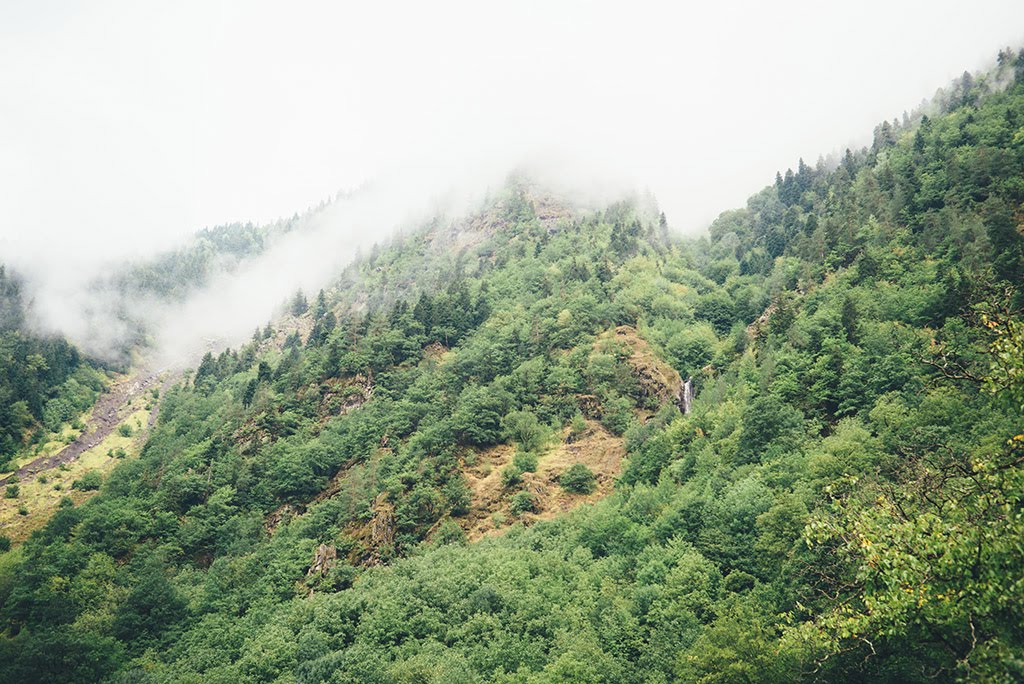

Georgia, Fannin County
00 :32 hrs
2.9 mi
146.88397 ft
Unknown
John Dick Creek is located within the Blue Ridge Wildlife Management Area and offers access to the Benton MacKaye Hiking Trail. It has pleasant scenery through a thick wooded forest. It follows a basic gravel road with some uneven terrain and small potholes.

Georgia, Union County
01 :39 hrs
9 mi
342.95502 ft
Unknown
Ivylog Gap Road is a scenic trail to explore that follows the ridge between Ivylog Mountain, Juber Knob, Lynn Knob, Anderson Knob, and Mine Mountain. The road is a maintained gravel road that can be done in either direction. There are some rocky areas and potholes but the road is suitable for passenger cars during dry conditions.

Georgia, Towns County
01 :27 hrs
8 mi
717.33105 ft
Unknown
Tray Mountain Road is a popular trail that climbs Tray Mountain to Tray Gap and then intersects with the Appalachian Trail. There are pleasant views and lots of recreation to be found. The road is a rocky gravel road with occasional ruts, potholes, and muddy sections. A 4WD is recommended. Dispersed camping is available along the way.

Georgia, Fannin County
01 :29 hrs
7.8 mi
267.27502 ft
Unknown
Rock Creek Road is the main entrance to the Blue Ridge Wildlife Area and offers access to several other trails in the area. You will also pass by the Chattahoochee Forest National Fish Hatchery, which offers excellent fishing opportunities. The road is a basic dirt road that is well maintained and suitable for passenger cars. There are also several camping areas (dispersed and designated) along the way.

Georgia, Union County
00 :39 hrs
3.6 mi
275.346 ft
Unknown
West Wolf Creek Road crawls through a scenic forest with access to hiking, and camping areas. The Road is a well-maintained gravel Forest Service Road with a few rocky sections. The road isn’t wide enough for 2 vehicles in some places but there are places to pass.

Georgia, Fannin County
00 :48 hrs
4.3 mi
43.24597 ft
Unknown
Forest Service Road 333 is a hidden gem that offers access to the Toccoa River Swinging Bridge and other hiking trails. It travels along the base of John Dick Mountain. The road is rutted and has large potholes that can get muddy. The trail will be muddy in the slightest wet conditions. A stock SUV with high clearance is recommended.

Georgia, Fannin County
01 :33 hrs
8.2 mi
355.79303 ft
Unknown
Noontootla Road is a main route through the Blue Ridge Wildlife Management Area. The trail follows along a creek for most of the way giving it some charming scenery. You can also access the Benton MacKaye Hiking Trail and there is excellent camping. The road is well maintained with a few potholes and passable in a passenger car during dry weather.

Georgia, Union County
00 :22 hrs
1.9 mi
121.51398 ft
Unknown
Canada Creek Road follows a maintained gravel road that was once popular for dirt bike riding. It has some beautiful scenery with excellent camping opportunities. It is a smooth road that is suitable for even passenger cars during dry weather.

Georgia, Towns County
03 :22 hrs
18.4 mi
723.255 ft
Unknown
Corbin Creek Road is an extension of Tray Mountain Road. You will be rewarded with excellent views and things to do. The road is a basic gravel road with a few rutted areas. It can be done in a 2WD during dry conditions and 4WD is recommended if it is wet. Dispersed camping is available along the way.

Georgia, Habersham County
00 :55 hrs
4.9 mi
190.168 ft
Unknown
Stephens Road follows the base of Red Root Mountain and offers access to camping, hunting, fishing, and hiking trails. It follows a basic gravel road with no obstacles but is steep in a few places and is single vehicle wide with overgrown brush that may cause pinstriping. During wet weather, it will get muddy.
See more adventures..
Explore complete list
Explore nearby adventures

