Best Sea Kayaking in New Orleans
Trying to find the best sea kayaking in New Orleans ? Bivy has great hiking, biking, paddling, climbing, skiing, riding and more, with hand-curated trail maps, as well as detailed driving directions.
Louisiana, New Orleans
06 :59 hrs
17.5 mi
1.1000001 ft
SK II
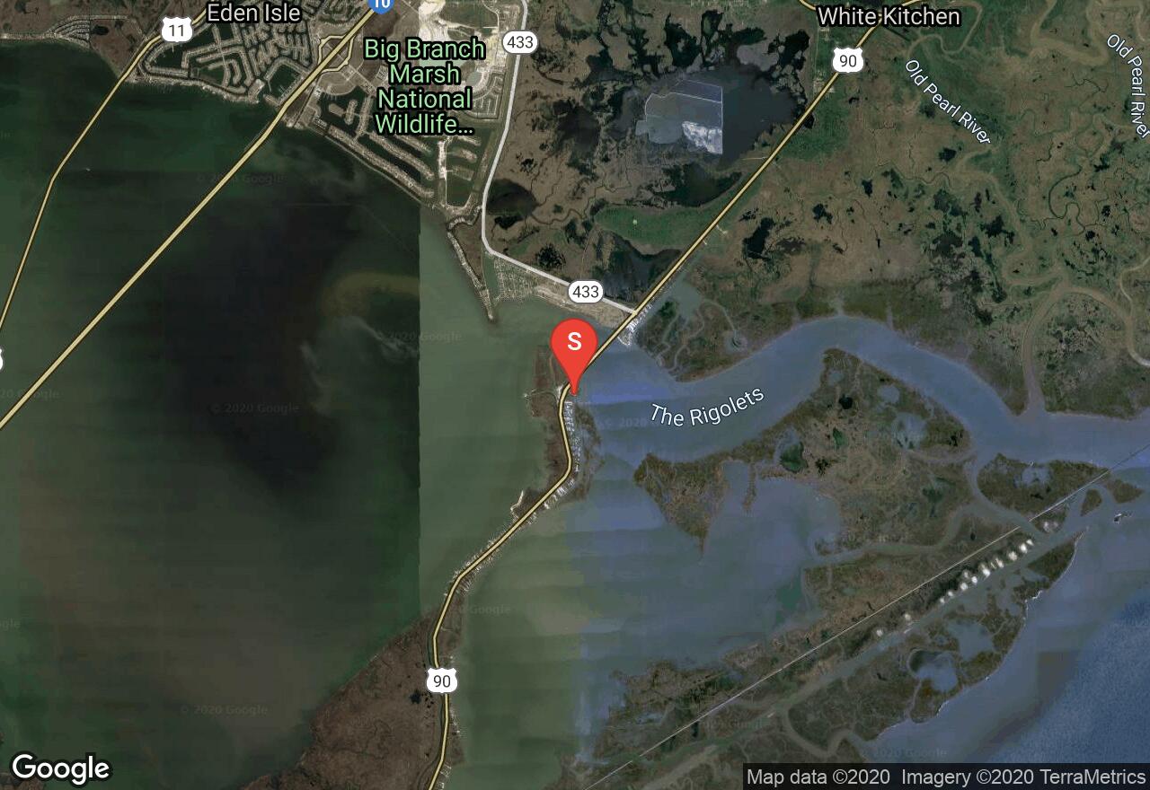
Fort Pike State Park offers visitors lots of interesting history as well as opportunity for paddling on the open waters surrounding the park. This trip starts from the launch at the state park and heads south into Lake Saint Catherine. The state park provides access to exposed open water adjacent to the Gulf of Mexico and the water can be get rough with wind, so be cautious and stay close to the shoreline. The state park offers the historic remnants to view as well as picnic sites making it a fun place to visit before or after exploring the area by water.
Mississippi, Hancock County
03 :38 hrs
9.1 mi
0.7040514 ft
SK II
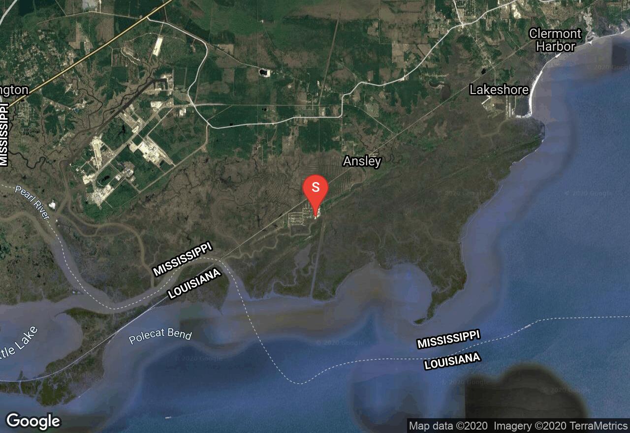
Heron Bay is a bay located just nine miles from Pearlington, in Hancock County. This is a prime fishing spot and it is very pretty. Leaving from La France Marina, you will navigate through Campbell’s Inside Bayou, Peter’s Ditch, and Redfish Bayou before entering Heron Bay. The scenery on this route is very marshy. Vast and beautiful marshes extend for miles and provide habitat for many shorebirds and waterfowl. Very pretty marsh plants and other wildlife also add to the scenery. On the return trip through the canal, take caution for motor boats and large watercraft.
Mississippi, Harrison County
07 :13 hrs
18 mi
1.2999969 ft
SK I
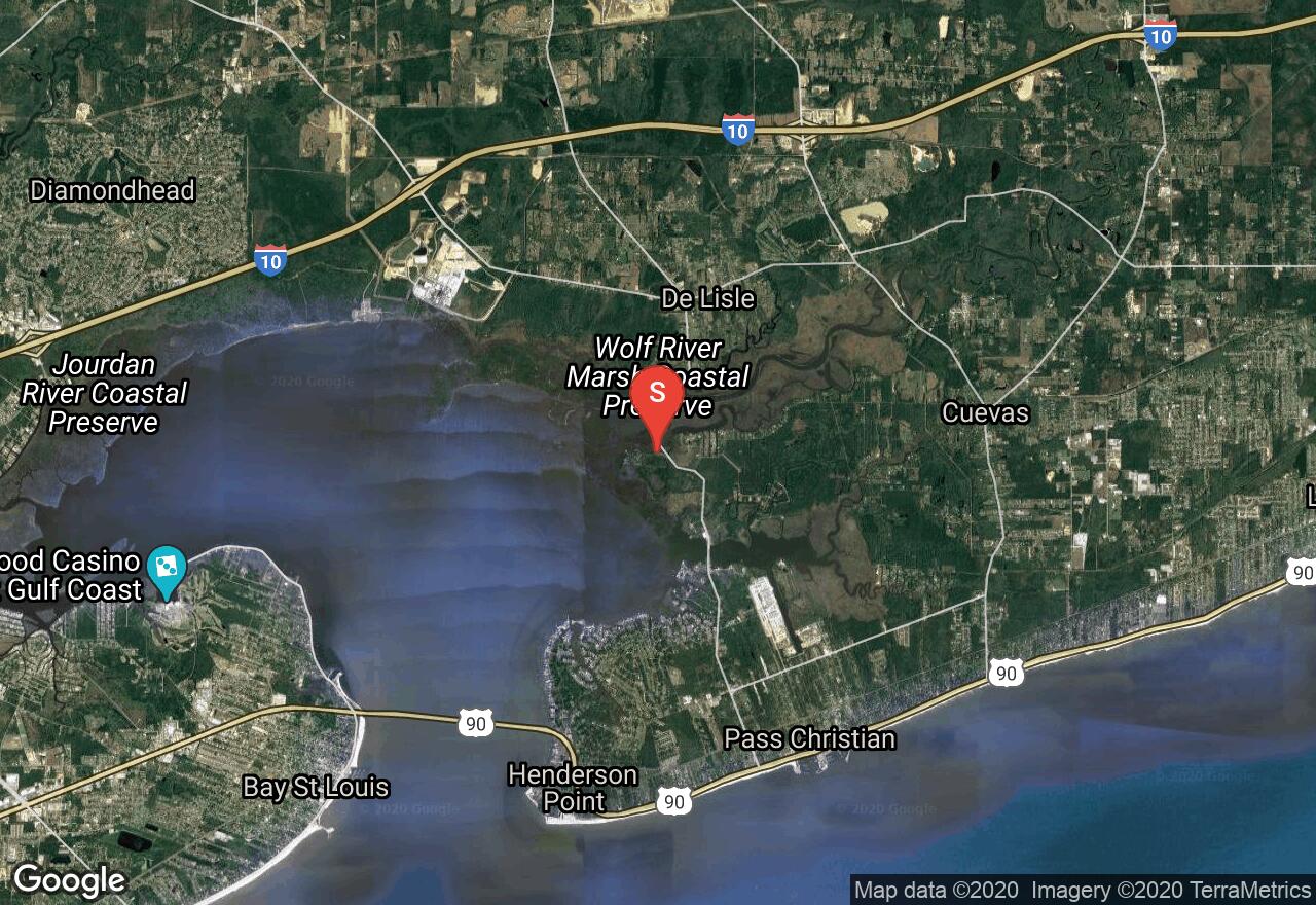
Bay St. Louis is located adjacent to the City of Bay St. Louis in Hancock County. This bay offers a wonderful diversity of scenery. There are many small rivers that are easily paddled upstream to explore the beautiful marshes. The marshes host a gorgeous array of wetland plants and provide homes to lots of wildlife. You also paddle along the shore next to the city where there are many attractive homes.
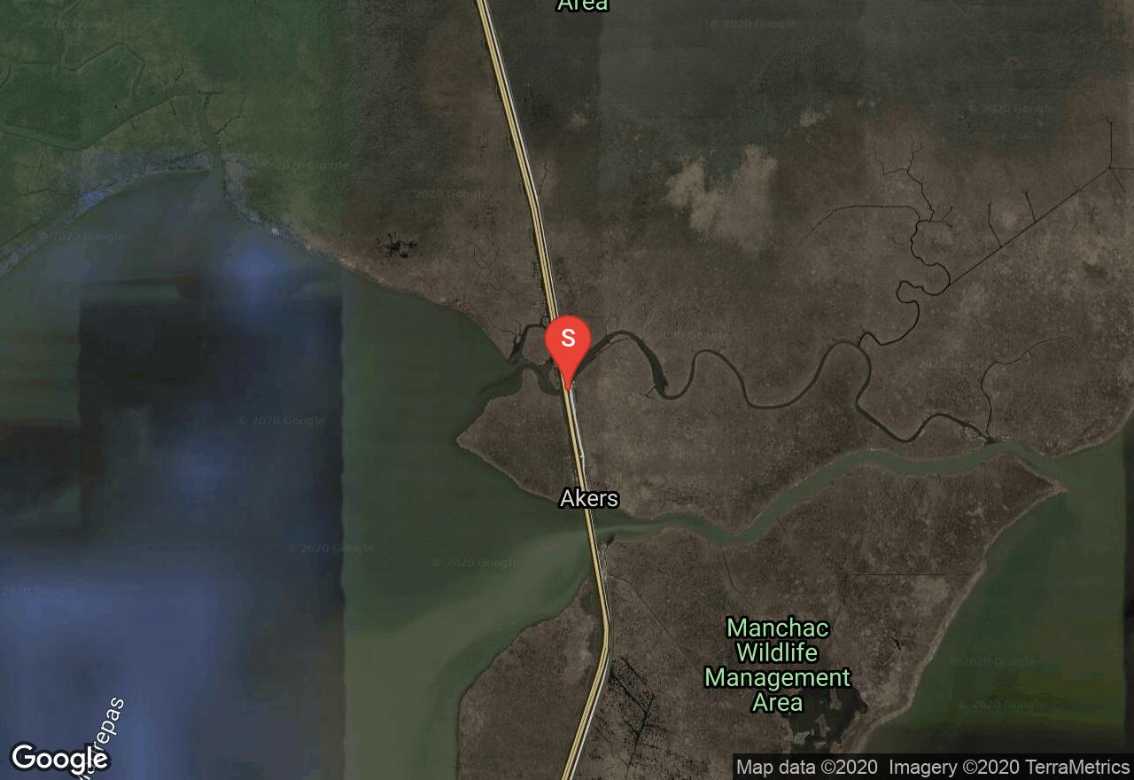
Louisiana, St. Tammany County
03 :16 hrs
7.3 mi
2.999998 ft
I
The Pearl River forms the border between Louisiana and Mississippi and offers some scenic paddling, especially the section that runs through the Pearl River Wildlife Management Area. The river widens as it enters Louisiana and splits into multiple channels. This section of river starts at Davis Landing on the most western river channel and follows the river south through swamp and marsh terrain to the take-out at Indian Village. The area is very rugged and full of wildlife, including gators.
Mississippi, Hancock County
05 :33 hrs
6.5 mi
2.3471842 ft
I
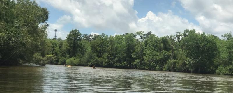
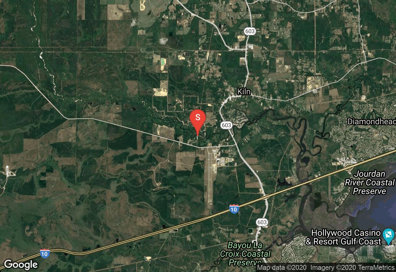
The Jourdan River is scarcely a river at all, more of an estuary of St. Louis Bay with virtually no current. McLeod Water Park is the highest public access point on the river, yet even here the Jourdan is wide and deep enough for large motorboats. By paddling and exploring upstream you can escape the motorboat traffic, find the best scenery on the river, and have the opportunity to explore many narrow side passages and oxbow lakes. You will find quiet, lonely waters ringed by gorgeous thick forest, an abundance of birdlife from ospreys to blue herons, and lots of other wildlife and woodland creatures. The river rises and falls with the tide.
Louisiana, Sun
01 :42 hrs
3.8 mi
1.796526 ft
I
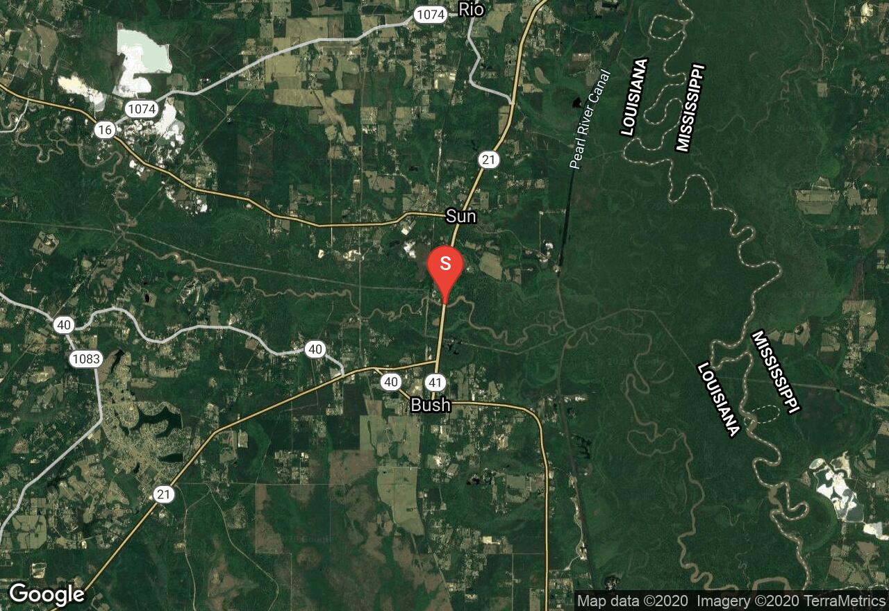
The Bogue Chitto is a calm and scenic river that starts in Mississippi and flows south into Louisiana providing paddlers miles of river for exploration. The Bogue Chitto runs through mostly wooded terrain that offers nice scenery and wildlife viewing opportunity. The river is popular for floating and is serviced by multiple rental companies. This section of the river starts at Highway 21 north of Bush and runs northeast to the take-out at Lock 3 where there is an easily accessible launch site.
Louisiana, Jefferson County
01 :29 hrs
1.7 mi
0.6609146 ft
I
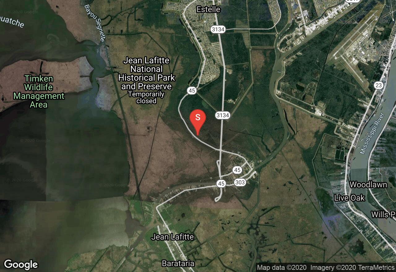
The Barataria Preserve is one of six sites that make up the interesting and scenic Jean Lafitte National Historic Park. The preserve offers paddlers lots of opportunity for recreation including multiple waterways to explore in the area of wild Louisiana wetlands. This paddling trip starts at the Pecan Grove launch and follows Bayou des Families and Bayou Coquille to the confluence with the Pipeline Canal. Water levels in the preserve as well as aquatic vegetation can effect paddling conditions so be sure to check with the park service before launching in the area.
Louisiana, Tangipahoa Parish County
04 :40 hrs
5.2 mi
0.13040048 ft
I
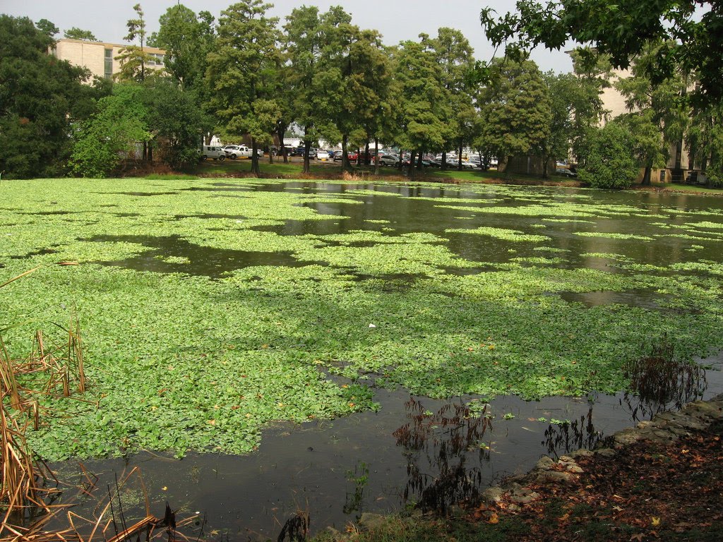
Manchac is a large lake swamp located northwest of New Orleans that provides lots of paddling destinations on its multiple lakes, rivers, and bayous. North Pass is a calm and easily accessible waterway located just south of the Joyce Wildlife Management Area that offers some nice scenery and wildlife viewing opportunity. Paddlers can explore the main waterway or venture off on the many sloughs and channels that spread through the area.
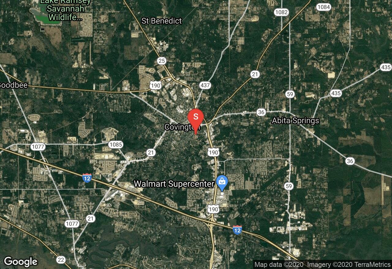
Louisiana, Covington
01 :52 hrs
2.1 mi
0.4717513 ft
I
Bogue Falaya is a tributary of the Tchefuncte River and is a fun paddling destination located in the heart of suburban development in southeastern Louisiana. This trip starts at Bogue Falaya Wayside Park in Covington and flows south towards the convergence with Tchefuncte River. The park is only open from 8 a.m. to 5 p.m. so use an alternate put-in if launching before or after this timeframe. The trip can be done as an out-and-back trip or paddlers can continue downstream to one of the multiple access sites on the Tchefuncte.
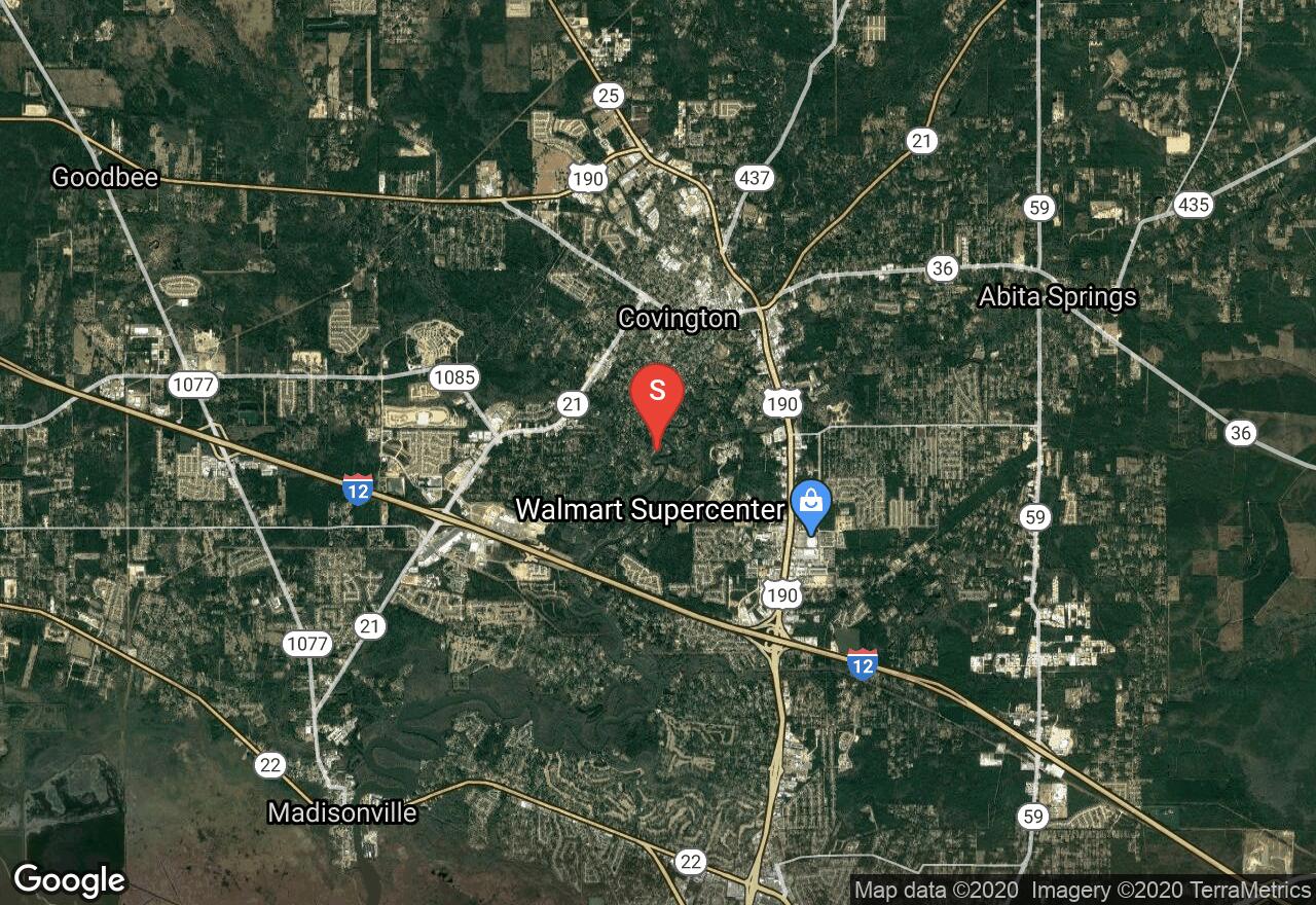
Louisiana, Covington
05 :21 hrs
11.9 mi
1.9398831 ft
I
This one-way downriver paddling trip follows the Bogue Falaya and Tchefuncte Rivers south of Covington to the mouth of Lake Pontchartrain. The scenery along the way is a mix of both residential development and undeveloped wooded terrain. The river is easy to paddle with minimal current and multiple access points. As the rivers nears the lake the terrain becomes much more swampy, providing paddlers with some additional waters that can be explored.
See more adventures..
Explore complete list
Explore nearby adventures

