Best Sea Kayaking in Texas
Trying to find the best sea kayaking in Texas? Bivy has great hiking, biking, paddling, climbing, skiing, riding and more, with hand-curated trail maps, as well as detailed driving directions.
Texas, Pasadena
05 :57 hrs
14.9 mi
3.9993708 ft
SK II
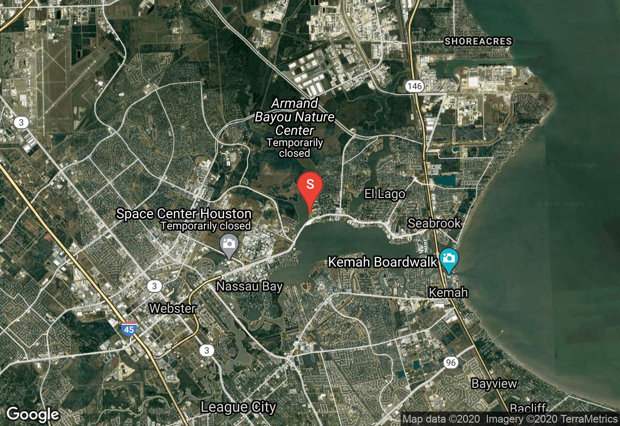
The Armand Bayou Trail is a great paddling route right in the Houston area. A good portion of the trail travels through the Armand Bayou Coastal Preserve and offers great birdwatching and wildlife viewing opportunities. There are two access points along the trail giving paddlers more options on what areas to explore and how many miles to cover.
Texas, Montgomery County
29 :47 hrs
74.5 mi
2.6103287 ft
SK I
This large lake on the north side of Houston offers all the amenities of a tourist destination. The most convenient access to the reservoir is from a boat launch on the south side, though many more access points are available. Campgrounds at the North of the lake provide the opportunity for a much longer adventure. Due to the length of the lake we classify this as a sea kayaking adventure, though canoes and kayaks are also wonderful ways to experience this Lake.
Texas, Lake Jackson
06 :00 hrs
15 mi
0.6177457 ft
SK III
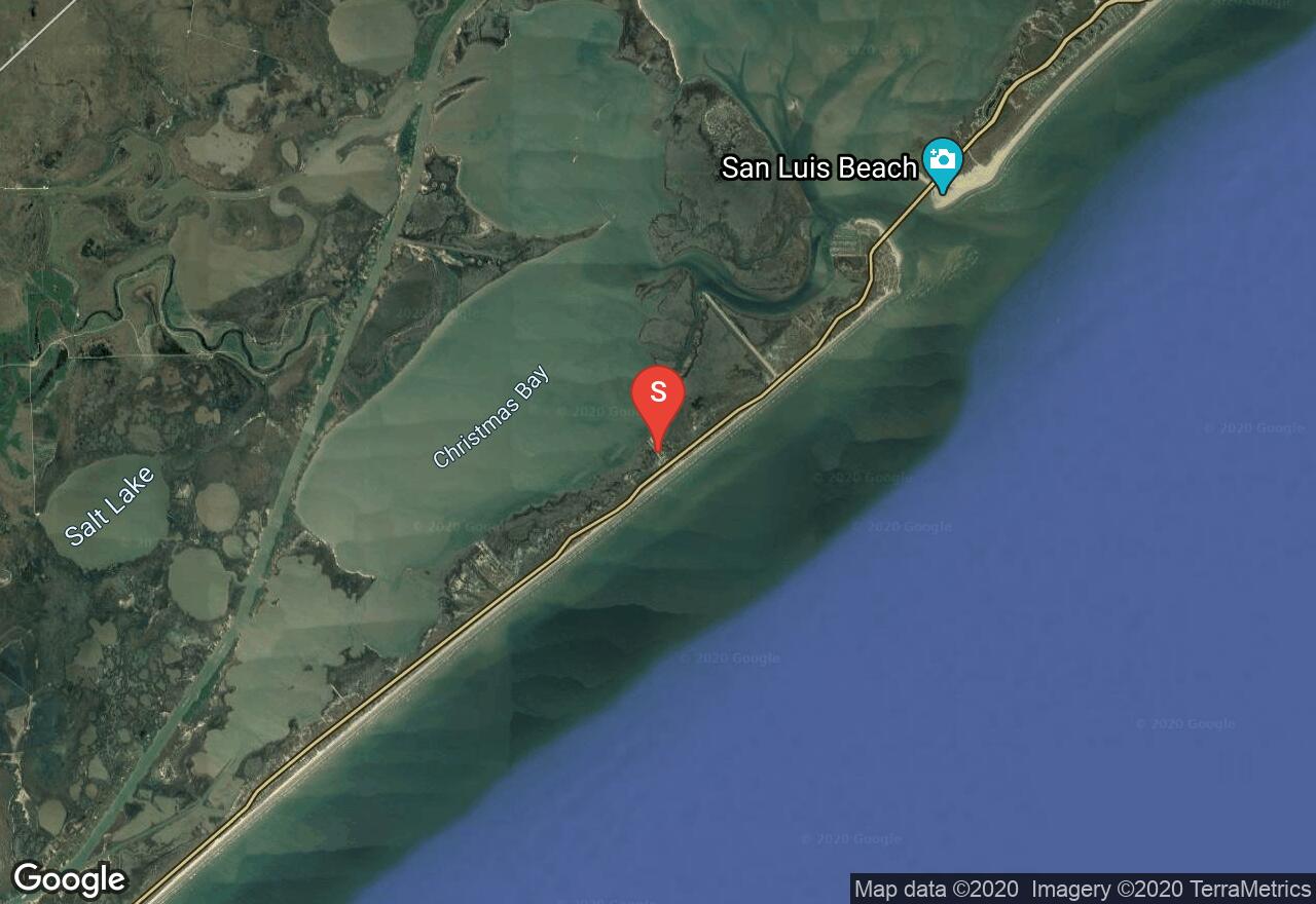
Christmas Bay is a shallow bay located on the western end of Galveston Bay complex. The route provides plenty of opportunity to see wildlife and birdlife. There are also smaller loops that can be explored and an alternate take-out spot if you are shuttling vehicles. Be sure to take sunscreen and water as there is no shade. If you are planning on wading in the water be sure to wear wading boots as there are stingrays in the area.
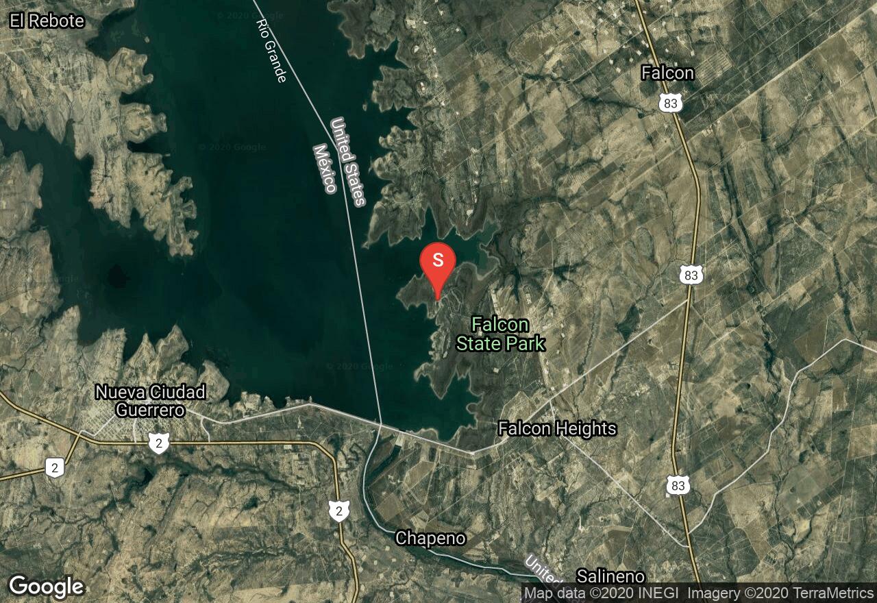
Texas, Starr County
22 :25 hrs
56 mi
0.7999878 ft
SK II
Created from a dam on the Rio Grande, this reservoir provides much opportunity for recreation. The nature of this reservoir makes for several crenellated coves and inlets which provide opportunity for exploration along coast. Be aware that all land on the western side of this reservoir is over the border in Mexico, so it is advisable that you stay close to the shore and carry ID with you.
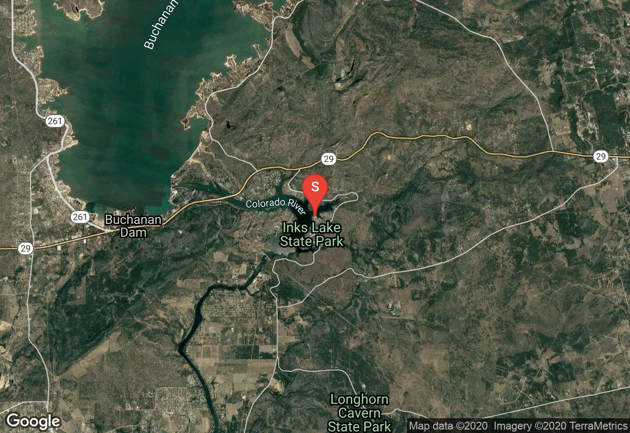
Texas, Burnet County
04 :25 hrs
11.1 mi
3.6895752 ft
SK I
This small reservoir formed in 1938 by the construction of Inks Dam on the Colorado River, is an excellent place to spend the day in the water. Much of the Lake is surrounded by Inks Lake State Park, so there are plenty of places to explore, or put ashore, particularly on the East side of Lake. This reservoir was created from a small Canyon, and as such is long and narrow, so though the total volume of the Lake is not that high, there is plenty of shoreline. If you're looking to cover a lot of distance, we recommend a sea kayak on this Lake, though canoes, kayaks, and other craft are certainly options.
, Nueces County
02 :05 hrs
5.2 mi
0.87041426 ft
SK I
The Cutters Paddling loop is one of four trails of the Lighthouse Lakes State Park area. The trail travels through channels of high seagrass and mangroves and also through some open flat areas. There are southeasterly winds that pick up at times so canoes are not recommended. Due to the amount of channels in the area getting disoriented is a possibility so it is recommended to have a map of the trail or a handheld GPS to help navigate the route. Also, paddlers have to cross a shrimping boat channel to access the put-in/take-out spot so be cautious and yield to any large boat traffic.
Texas, Nueces County
03 :03 hrs
7.6 mi
0.6455379 ft
SK II
The Redfish Loop trail is one of four trails that make up the Lighthouse Lakes Paddling Trail system. The trail leads through channels of high seagrass and mangroves and into tidal lakes. There is a shrimping boat channel that is crossed to access the put-in/take-out spot so make sure to yield to boat traffic. The area is great for birdwatching and fishing.
, Nueces County
03 :08 hrs
7.8 mi
1 ft
SK II
South Bay Loop is one of four trails of the Lighthouse Lakes State Park trail system. The trail travels through channels of high seagrasses and also through some open flat areas. There are southeasterly winds that can pick up so canoes are not recommended. Due to the amount of channels in the area getting disoriented is a possibility so it is recommended to have a map of the trail or a handheld GPS to help navigate the route. Also, paddlers have to cross a shrimping boat channel to access the put-in/take-out spot so be cautious and yield to any large boat traffic.
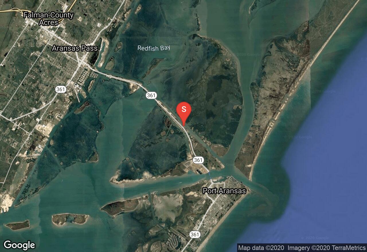
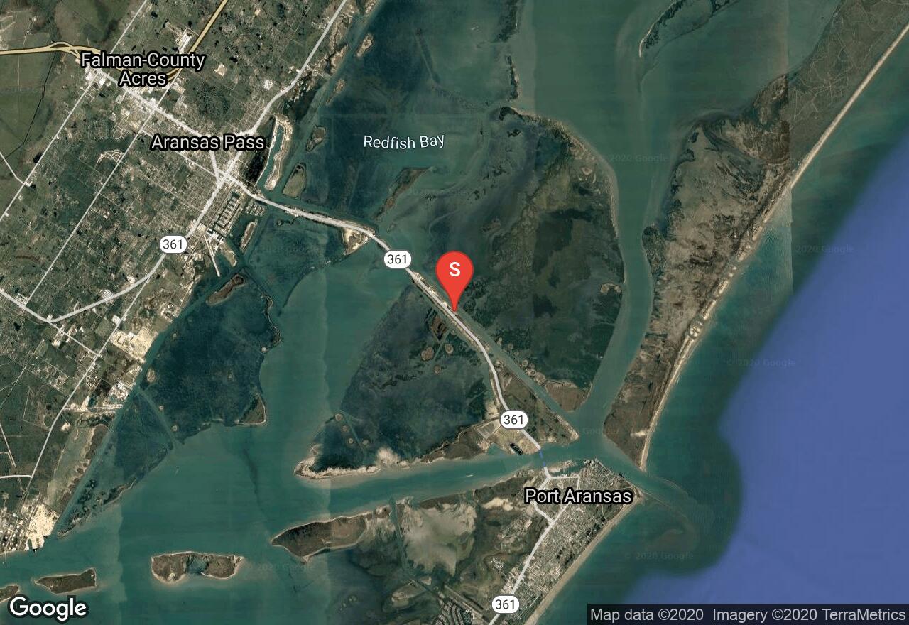
Texas, Port Aransas
05 :10 hrs
12.9 mi
0.13294089 ft
SK II
This trail is one of three trails that make up the Mustang Island Paddling Trail system. The trail leads through several islands and then out to Corpus Christi Bay and through the Atlantic cut and back. The trail can also connect to the Shamrock trail providing a take-out spot if a vehicle is left. The route goes through wetlands and also open waters along the shoreline.
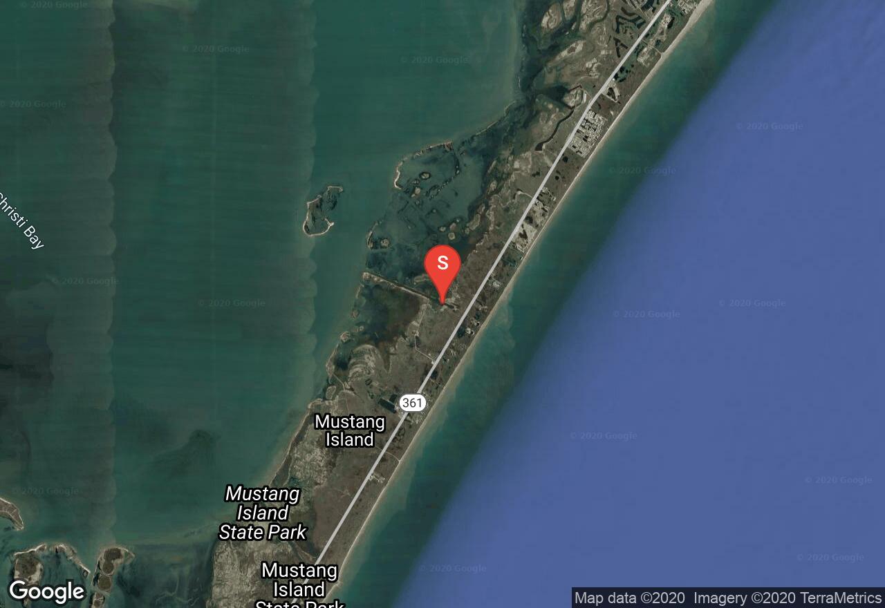
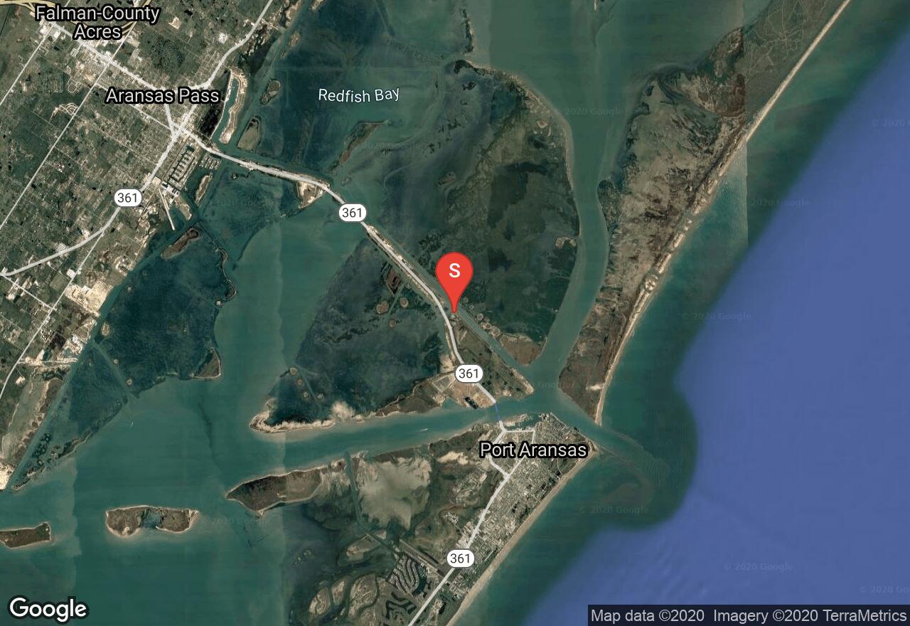
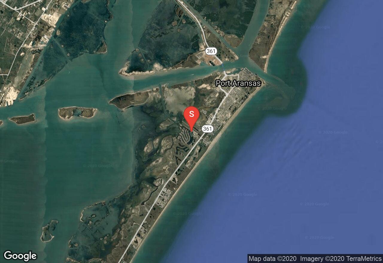
Texas, Port Aransas
02 :11 hrs
5.4 mi
0.15722738 ft
SK I
This trail is one of three trails that make up the Mustang Island Paddling Trail system. The trail is a loop and requires no shuttling of vehicles. The path will lead out to Shamrock cove and then follows the shoreline and loops back to the put-in. The shamrock trail is known for some great fishing spots.
See more adventures..
Explore complete list
Explore nearby adventures

