Best ATV in Maine
Trying to find the best ATV in Maine? Bivy has great hiking, biking, paddling, climbing, skiing, riding and more, with hand-curated trail maps, as well as detailed driving directions.
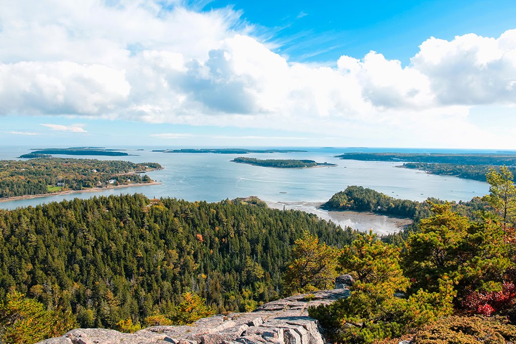

Maine, Washington County
02 :29 hrs
12.6 mi
29.946001 ft
Unknown
The Down East Sunrise Trail (DEST) follows an old railroad through mountainous scenery and a variety of wildlife. There are some unique points of interest and side trips. This is a multi-use trail that is open to ATVs, hiking, biking, and horseback riding. Please be courteous of others using the trail. Motorized users must yield to non-motorized users. This section begins at Cherryfield Crossing and has some historic points of interest along the way and passes by Harrington Crossing before ending at Columbia Falls Crossing.

Maine, Hancock County
01 :30 hrs
7.6 mi
58.686005 ft
Unknown
The Down East Sunrise Trail (DEST) follows an old railroad through mountainous scenery and a variety of wildlife. There are some unique points of interest and side trips. This is a mutli-use trail that is open to ATVs, hiking, biking, and horseback riding. Please be courteous of other using the trail. Motorized users must yield to non-motorized users. This section begins at the Trunk Lake Road trailhead and stretches 8 miles to the Unionville Crossing trailhead. There is limited parking and the trail passes through remote forestland with opporutnities to hike, swim, and camp at Donnell Pond.

Maine, Penobscot County
03 :14 hrs
16.3 mi
84.801994 ft
Unknown
The Lagrange to Medford Trail follows an old rail trail which and is now used as a multi-use trail for all types of activities including hiking, biking, horseback riding, and ATVs. The trail surface is hard gravel and explores Maine’s farmland, and forests. Motorized users must yield to non-motorized users.

Maine, Aroostook County
03 :06 hrs
15.6 mi
92.733 ft
Unknown
The Bangor and Aroostook Trail is a multi-use trail that is open year-round to several activities. The trail surface is gravel and has a variety of scenery including open fields, and deep woods. Motorized users must yield to non-motorized users. This section begins in Caribou and ends in Stockholm.

Maine, Washington County
02 :22 hrs
12 mi
28.535002 ft
Unknown
The Down East Sunrise Trail (DEST) follows an old railroad through mountainous scenery and a variety of wildlife. There are some unique points of interest and side trips. This is a multi-use trail that is open to ATVs, hiking, biking, and horseback riding. Please be courteous of others using the trail. Motorized users must yield to non-motorized users. This section begins at Columbia Falls Crossing and leads to Whitneyville Crossing.

Maine, Franklin County
00 :05 hrs
0.4 mi
- ft
Unknown
Rocky Mountain Terrain Park offers a large wooded area of trails including a rock crawling section, mud bogs, and a peewee track. Membership is required to ride and camping is available with showers and restrooms.

Maine, Hancock County
01 :46 hrs
9 mi
47.758003 ft
Unknown
The Down East Sunrise Trail (DEST) follows an old railroad through mountainous scenery and a variety of wildlife. There are some unique points of interest and side trips. This is a mutli-use trail that is open to ATVs, hiking, biking, and horseback riding. Please be courteous of other using the trail. Motorized users must yield to non-motorized users. This section stretches between Franklin Crossing to Washington Junction. Wildlife-watching in the section are abundant.

Maine, Washington County
03 :55 hrs
19.9 mi
74.490005 ft
Unknown
The Down East Sunrise Trail (DEST) follows an old railroad through mountainous scenery and a variety of wildlife. There are some unique points of interest and side trips. This is a mutli-use trail that is open to ATVs, hiking, biking, and horseback riding. Please be courteous of other using the trail. Motorized users must yield to non-motorized users. This section stretches between Cherryfield Crossing to Franklin Crossing passing by Unionville Crossing and Trunk Lake Road. There is remote forestland and access to hiking trails, and lakes.

Maine, Penobscot County
01 :07 hrs
5.6 mi
27.688004 ft
Unknown
The Sherman to Patten Trail is a multi-use trail that follows an old railroad bed along the perimeter of Thousand Acre Bog. The trail surface is hard-packed gravel and wanders through open fields in a remote landscape. Motorized users must yield to non-motorized users.

Maine, Aroostook County
03 :20 hrs
16.8 mi
39.399002 ft
Unknown
The St. John Valley Trail stretches from Fort Kent to St. Francis. You’ll travel through farmland and rolling hills along the edge of the St. John River. This is a multi-use trail and motorized users must yield to non-motorized users.
See more adventures..
Explore complete list
Explore nearby adventures

