Runtime.80ab492fe3d778817936.js in Montana
Trying to find the best in Montana? Bivy has great hiking, biking, paddling, climbing, skiing, riding and more, with hand-curated trail maps, as well as detailed driving directions.
Idaho, Fremont County
01 :41 hrs
4.2 mi
24.875488 ft
II
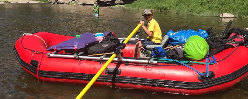
This section of the Henrys Fork starts at Island Park Dam near Box Canyon Campground. The waterway offers continuous class II rapids as it flows through the canyon within the plateau. The river is also great for fishing, and there are excellent views of the surrounding villages and mountains. The take-out is located near Last Chance and Highway 20.
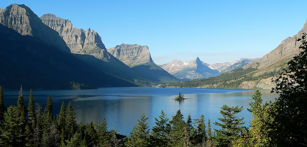
Montana, Glacier County
05 :52 hrs
5 mi
700.7062 ft
Expert
This historic tunnel was built in the 1930s by Civilian Conservation Corp for horses and early park tours, it features exceptional architecture. The beginning of this route shares the trail with the popular hike to Iceberg Lake. Just past Ptarmigan Falls, at approximately 3 miles the route forks from the Iceberg trail and begins an aggressive uphill climb through meadows to Ptarmigan Lake. From the lake it is additional 800 feet up a barren slope to the tunnel. After walking through this 250 ft. tunnel (6ft. wide by 9 ft. long) which cuts through Ptarmigan Wall, admire the burst of red rock on the other side, and the stunning views of Natoas Peak, Crosley Ridge, and the Belly Rivers as it flows into Elizabeth Lake. Depending on snowpack, the tunnel doors will open in July and close in early October so be sure to confirm the status at the ranger station before starting your adventure.
Montana, Madison County
03 :04 hrs
30.2 mi
966.31494 ft
3
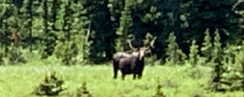
This loop ride begins on Boulder Road and rides through the small town of Pony then passes by Cataract Creek Reservoir and to the Lower Mason Lake. Views of the lake are gorgeous and there is great chance to see moose or other wildlife. Return down to Old Miners Cabin road through Mammoth.
Montana, Meagher County
24 :26 hrs
59.7 mi
286.23877 ft
II
Smith River is a pristine river that offers an excellent river trip. Best to plan on minimum of 3 days and 2 nights. It flows through a colorful canyon with plenty of wildlife, spectacular scenery and good fishing. The river requires a float permit by calling Montana Fish, and Wildlife. You must also declare your boat campsites before leaving. The permits are a first-come, first-served system. The highlight of the trip is a deep limestone canyon with towering rock formations and thick forests. Best float times are May through June before the water gets too low from irrigation. Flows can pick back up in September for a Fall trip where you might find some solitude. Be prepared for cold and rainy weather which is common even in the warm months.
Wyoming, Crook County
01 :05 hrs
2.8 mi
89.46289 ft
Moderate
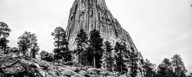
This is the longer of two loops which includes the Southside Trail and the Red Beds trail. You can also include the Valley View section which would add almost a mile. The Devils Tower is a one-of-a-kind monolithic feature that was the first to become a national monument. There is a fee charged upon entering the monument area.

Montana, Helena
00 :39 hrs
1.4 mi
84.19568 ft
Expert
The trail to Mini Machu is wide and well-maintained. The trail has a gradual ascent with views and rest points along the way. The trail becomes steeper, more narrow and more challenging as you near the base of the mountain.
Wyoming, Yellowstone National Park
00 :36 hrs
0.3 mi
105.829346 ft
Moderate
Most of this trail is a steel staircase and is quite steep down into the Grand Canyon of Yellowstone. There is a lookout point at the bottom with unmatched views of the canyon.
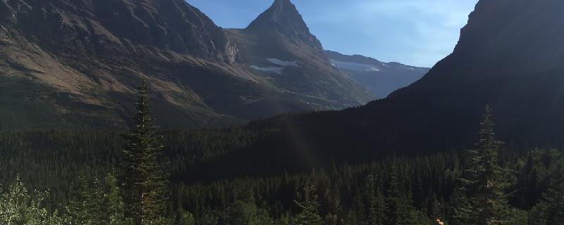
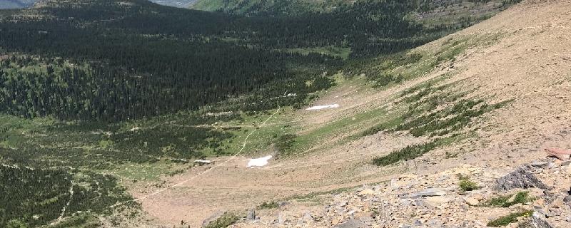
Montana, Glacier County
04 :24 hrs
4.6 mi
361.4723 ft
Expert
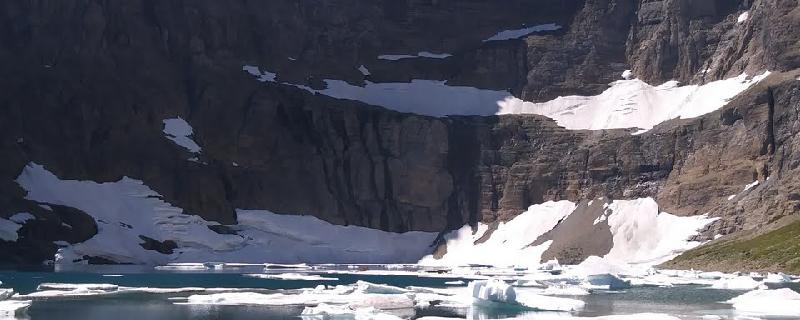
Iceberg Lake is a popular hike in Glacier National Park. After a steep beginning the rest of the hike has a comfortable, mild elevation gain. Watch closely as a junction approaches within the first mile. As with many other trails in the park, be cautious of the bears, it is common for this trail to be closed because of frequent bear activity. Near the last part of the hike watch closely for mountain goats and bighorn sheep on the grassy slopes above and to the right. There are amazing chunks of ice that float around the lake, usually until September, but the “icebergs” are larger and more scenic in July and August.
Montana, Flathead County
04 :20 hrs
11.4 mi
942.2738 ft
Expert
The Highline Trail is a one-way hike and an extremely popular hike. At every step, and every turn, you will have absolutely spectacular scenery as the Highline trail follows along the Continental Divide, also known as the Garden Wall in this area. The exceptional views, opportunities for spotting wildlife, and the wildflowers, with its exposed thousand-foot drop-offs make this a hike you’ll remember the rest of your life. En route, side trails lead to Grinnell Glacier Overlook and Swiftcurrent Lookout. At 7.6 miles you will reach the Granite Park Trail junction, to the right the Highline Trail continues on to fifty mountain campground. Head down the trail toward the Granite Park Chalet for a snack. The Granite Park Chalet was built in 1914 by the Great Northern Railway in order to provide comfortable backcountry accommodations inside the Park and is listed today as a National Historic Landmark. If you don’t want to purchase bottle water at the Chalet, (they do not provide drinking water) there is a stream you can filter water from. From the Chalet hook onto the Granite Peak trail also known as the Loop trail and travel for 4 miles till the parking lot and you can catch the hiker shuttle.
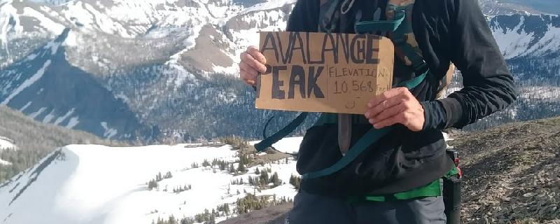
Wyoming, Yellowstone National Park
03 :58 hrs
2.3 mi
633.18823 ft
Hard
Located just inside the east entrance to Yellowstone National Park from Cody, Wyoming, avalanche peak rises above the timberline. The hike begins at picnic area on the west end of Eleanor Lake. You will likely encounter snow and wind at the higher elevations.
See more adventures..
Explore complete list
Explore nearby adventures

