Best Waterways in West Virginia
Trying to find the best waterways in West Virginia? Bivy has great hiking, biking, paddling, climbing, skiing, riding and more, with hand-curated trail maps, as well as detailed driving directions.
West Virginia, Nicholas County
03 :53 hrs
8.2 mi
101.75992 ft
V
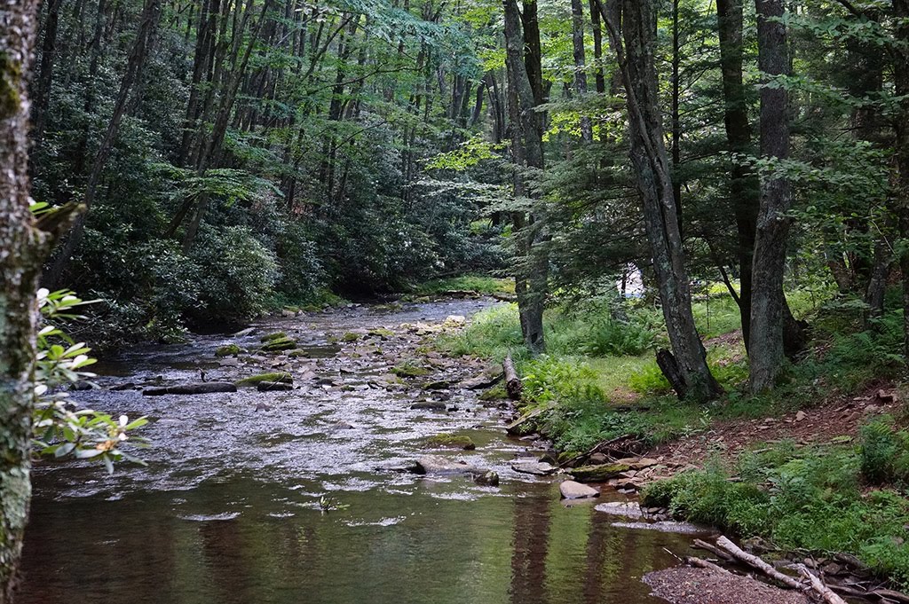
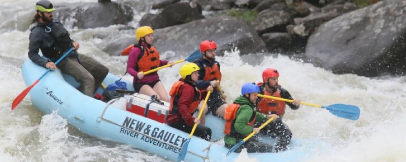
The Gauley River is recognized as one of the top ranked whitewater rivers in the world. It is 105 miles long and features over 100 rapids. The Gauley is a dam controlled watershed and scheduled fall release dates offer amazing flows for rafting. It travels through stunning wilderness scenery including canyon cliffs, waterfalls and lush foliage. This is the most difficult section of the river. Do not try this run without the skills and confidence for Class V rapids. Be extremely careful of the undercut rocks along this run. Insignificant, Pillow Rock, Lost Paddle, Iron Ring, and Sweet's Falls are world famous rapids that require extra caution.
Ohio, Tuscarawas County
02 :03 hrs
4.9 mi
8.344879 ft
I
The Tuscarawas River stretches 130 miles long through 10 counties and is the largest tributary of the Muskingum River. It offers breathtaking scenery with most of it flowing through undeveloped territory. You have opportunity to see squirrels and great blue herons. This short section of river begins at Dover Dam and flows to Dover.
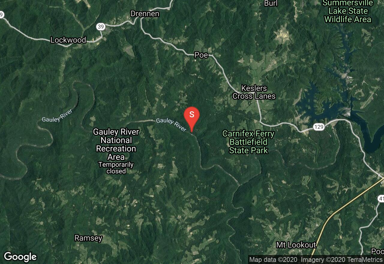
West Virginia, Nicholas County
01 :58 hrs
4.3 mi
63.463684 ft
IV
The Gauley River is recognized as one of the top ranked whitewater rivers in the world. It is 105 miles long and features over 100 rapids. The Gauley is a dam controlled watershed and scheduled fall release dates offer amazing flows for rafting. It travels through stunning wilderness scenery including canyon cliffs, waterfalls and lush foliage. This section has several class III rapids and a few that are class IV. The most difficult rapids in the run are the Woods Ferry Rapid and the Backender Rapid.
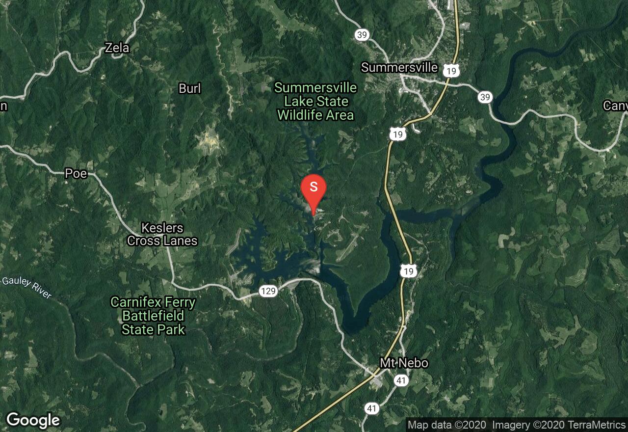
West Virginia, Nicholas County
06 :14 hrs
15.6 mi
5.7414246 ft
SK I
Summersville Lake is located on the Gauley River in Nicholas County. The 2,700 acre reservoir has a maximum depth of 327 feet, making it the largest lake in West Virginia. The lake was constructed by the United States Army Corps of Engineers for flood control. This lake has many unique coves to explore and offers 60 miles of shoreline. The Superb water quality and sheer sandstone cliffs make this lake a popular tourist destination. There is a small day use fee for boat ramp access. This access ramp is located in Long Point Area at the marina and offers boat rentals and full services.
Maryland, Garrett County
02 :18 hrs
6.5 mi
145.05103 ft
V
The Savage is probably Maryland’s most famous whitewater river and is the site of national championships in the 1972 Olympic Trials, international races, and the 1989 World Whitewater Championships. This section is very rarely runnable but is as beautiful a whitewater run as you will find in Maryland. The creek winds through a tight little gorge in complete isolation with rock cliffs and formations all around with lichens and ferns accenting. The rapids are almost continuous on this section and are formed by cobble bars, lots of ledges, and some boulders and there are many sharp turns requiring technical paddling to navigate. One difficult rapid, about four miles into the run on a straightaway is steep and clogged by jagged rocks and undercut boulders, may be carried on the right. Because the stream is so narrow, trees are an occasional problem and there is a strand of barbed wire by the camps above the take-out.
West Virginia, Preston County
06 :49 hrs
14 mi
57.427826 ft
IV
The Cheat River is 78.3 miles long and meanders through remote well kept farmlands. This stretch of the Cheat River features many difficult rapids. After passing several Class II-III rapids, there is a large boulder called Calamity Rock. Usually this boulder should be run through the right passage but at high levels its best to run along the left bank. After passing the boulder the river narrows with 3 major rapids creating crosscurrents and eddies.
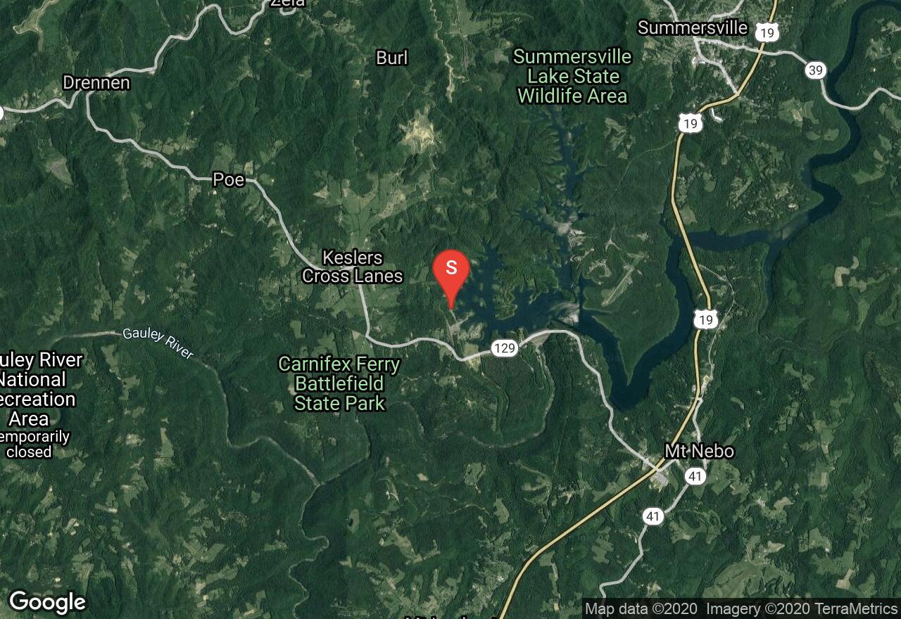
West Virginia, Nicholas County
02 :34 hrs
6.4 mi
8.918823 ft
SK I
Summersville Lake is located on the Gauley River in Nicholas County. The 2,700 acre reservoir has a maximum depth of 327 feet, making it the largest lake in West Virginia. The lake was constructed by the United States Army Corps of Engineers for flood control. This lake has many unique coves to explore and offers 60 miles of shoreline. The Superb water quality and sheer sandstone cliffs make this lake a popular tourist destination. There is a small day use fee for boat ramp access. This access ramp is located in the Battle Run Area.
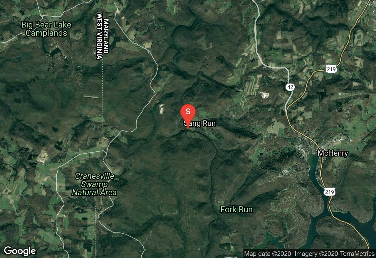
Maryland, Garrett County
03 :55 hrs
10.5 mi
176.41937 ft
V
The Youghiogheny River, called the “Yough” by most people, is a very popular river for paddlers of all skill levels and is most sought out for its whitewater challenge on this trip from Sang Run Road to Friendsville. This section is referred to as Upper Yough and has the whitewater that made this river famous, specifically its four miles of unrelenting boulder piles, ledges, blocked views, cryptic passages, menacing undercuts, and technical difficulties. After a couple miles of riffles and flat water, you will be faced with Gap Falls, a sloping five-foot ledge and from here it is all downhill through many too many rapids to describe. The rough stuff ends at Kendall and allow a soothing coast to the take out at Friendsville Community Park. Though you may not notice on your first run, this is a very beautiful section of the river with cliffs, graceful hemlocks, falls on side streams, rhododendrons, and beautifully sculpted boulders.
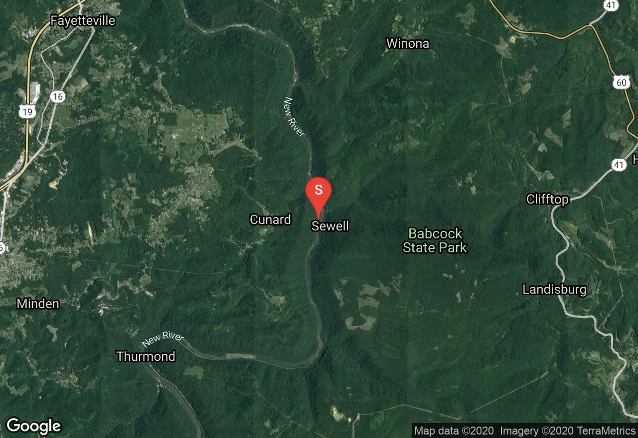
West Virginia, Fayette County
03 :22 hrs
7 mi
53.457947 ft
V
The New River is one of West Virginia’s biggest attractions. It is a high volume, powerful river and can be run over a wide range of river levels. This section is the beginning of the New River Gorge and travels through rugged mountains and cliffs that line both sides of the river. It is home to the biggest whitewater in West Virginia. There are plenty of big powerful rapids that have many complicated boulders to maneuver.
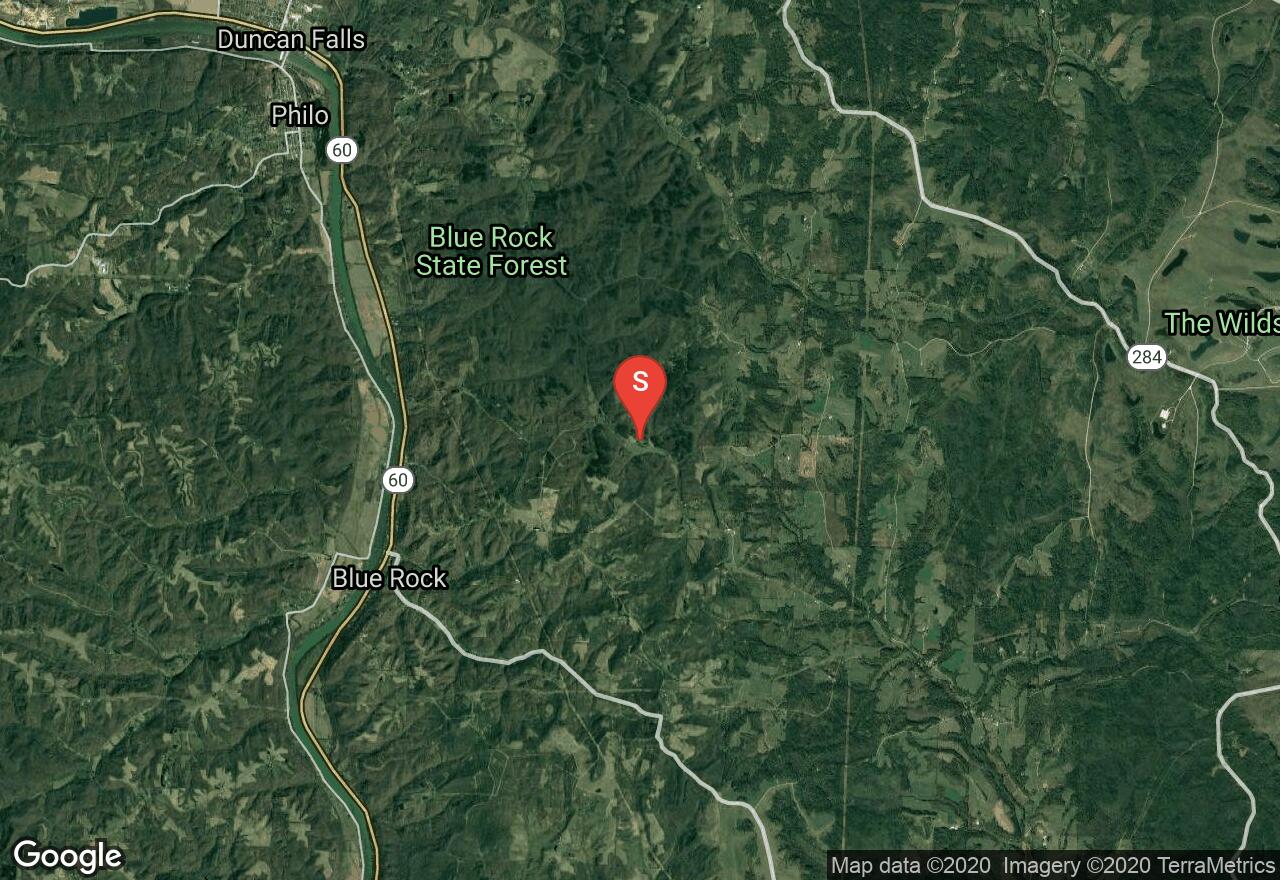
Ohio, Muskingum County
00 :23 hrs
0.9 mi
9.134262 ft
I
Cutler Lake is located in Blue Rock State Park. This lake is a peaceful and beautiful place to paddle and escape to. There are rugged hills and rich green forests that provide a scenic backdrop. Only electric and hand-propelled boats are permitted.
See more adventures..
Explore complete list
Explore nearby adventures

